


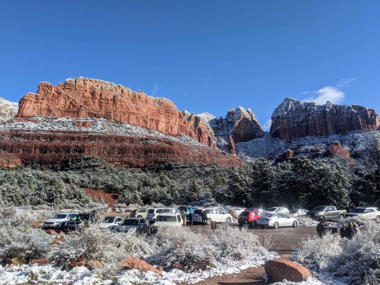
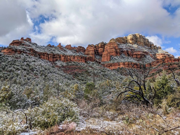
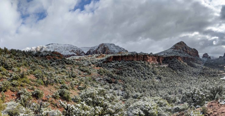
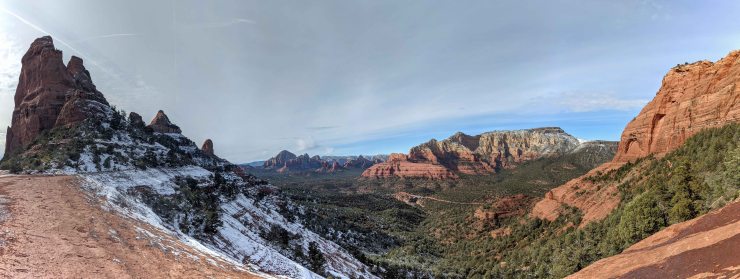
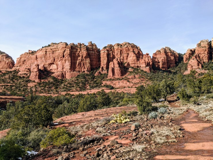
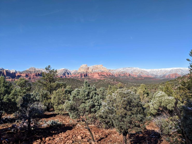
Trip overview: We went on four of the signature hikes within in Sedona, Arizona. These hikes ranged from 5 to 10 miles in length, are moderate in difficulty, and explore several of the famous rock structures surrounding Sedona: Brins Mesa, Devils Bridge, Bell Rock, Courthouse Butte, etc. Highlights include up close views of towering red rock structures, pine forests, and sweeping views of Sedona and the surrounding landscape. This trip took place in late December 2019.
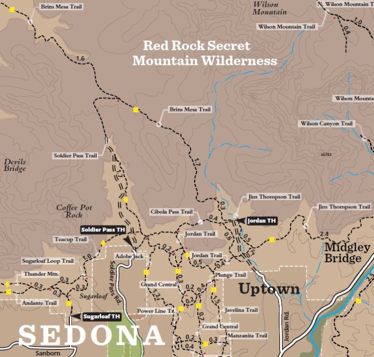
- Hiking maps of the Sedona area for (map of NE Sedona, map of NW Sedona, map of SE Sedona)
Jump to Hike 1: Brins Mesa Loop via Soldier Pass
Jump to Hike 2: Hangover and Cow Pies Loop via the Munds Wagon Trail
Jump to Hike 3: Devils Bridge via the Chuck Wagon Trail
Jump to Hike 4: Bell Rock and Courthouse Butte via the Big Park Loop
Jump to Other Highlights: Doe Mountain, Bear Mountain, Boynton Canyon, West Fork
Shop Deal of the Day at REI Outlet (up to 50% off)!
Preparations:
Click here to read more about Permits
Permits: Parking permits are required to park your vehicle at many of the trailheads in the Sedona area. The permits cost $5 for a daily pass or $15 for a week pass and can be purchased at self-service machines located at the trailheads. Beyond parking permits, no additional permits or passes are needed to hike on the trails in the Sedona area.
Click here to read more about Logistics
Logistics: It is easiest to use a personal vehicle to get around Sedona. There is not a shuttle or bus system that accesses the trailheads. Most trailheads are located within a 20 minute drive of the city center, so driving distances can be kept relatively short.
Click here to read more about Difficulty
Trail Conditions and Difficulty: There are a variety of hikes in the Sedona area so you can really choose whatever level of difficulty you desire. Most trails are less than 10 miles long and well-marked. Some routes are made up of several different shorter trails, so having a map or familiarity with the route is helpful for staying on your preferred path. Of the trails covered in this report, the Hangover and Cow Pies Loop is the only trail that would qualify as difficult. This trail has some narrow and exposed sections and requires a bit of scrambling in sections. The other trails covered are all straightforward hikes.
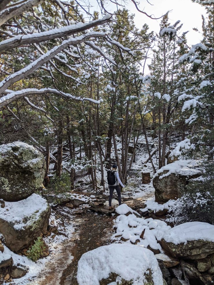
In the summer, trails will be clear but hikers should be prepared for high temperatures and lots of sun exposure. Plan to bring plenty of water as there are not potable water stations along the trails. In the winter, temperatures are cool and water is less of a worry. The primary risk in winter is ice on the trails or snow obscuring the route. When routes are icy, proceed with caution.
Supplies: Here are some suggested hiking clothes and gear (your exact choices will depend on time of year):
- a lightweight hiking rain jacket (North Face Venture 2 Jacket)
- lightweight down jacket (Patagonia 800-fill Down Jacket)
- fast drying synthetic hiking pants (prAna Zion Pants)
- a quick drying long sleeve hiking shirt (Columbia Silver Ridge L/S Shirt)
- wool outer socks (People Socks Moreno 4-pack)
- thin blister preventing base socks (WrightSock double layer Coolmesh)
- quick drying synthetic boxer briefs (ExOfficio Give-N-Go)
- hydration bladder (Osprey 3 Liter reservoir)
- small backpack (Osprey Daylite Daypack)
- trekking poles (REI Carbon Fiber trekking poles)
……….
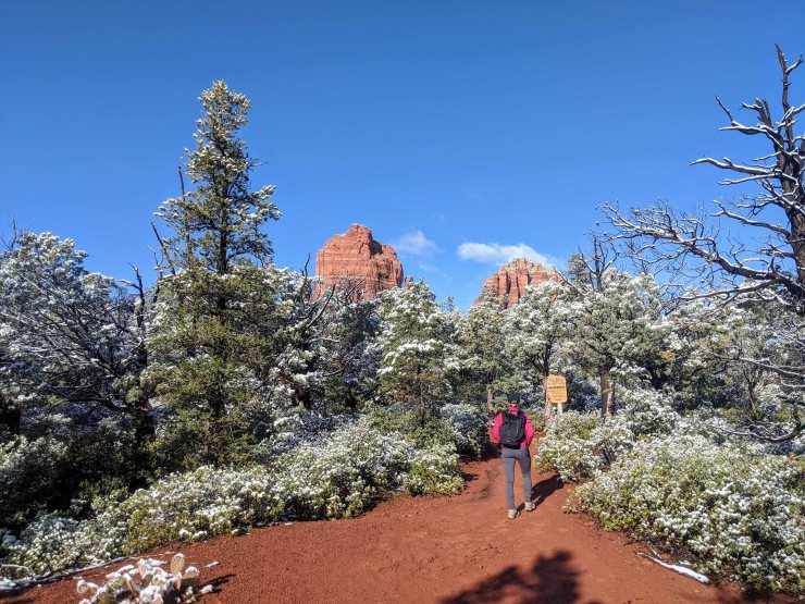
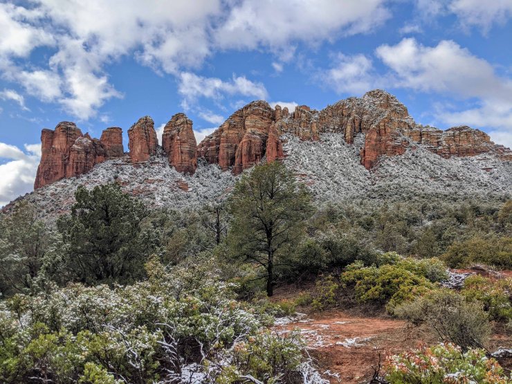
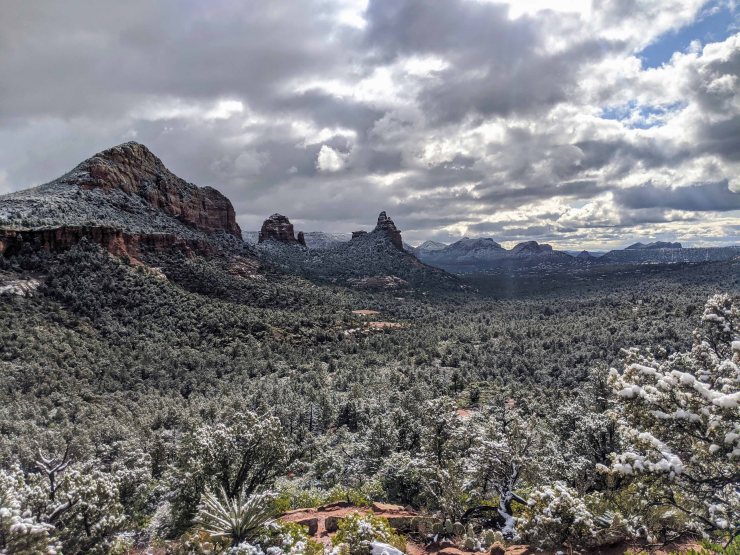
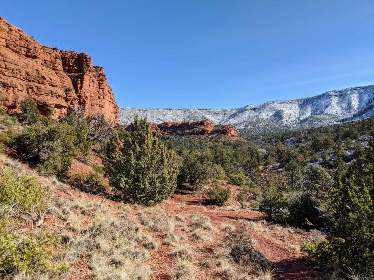
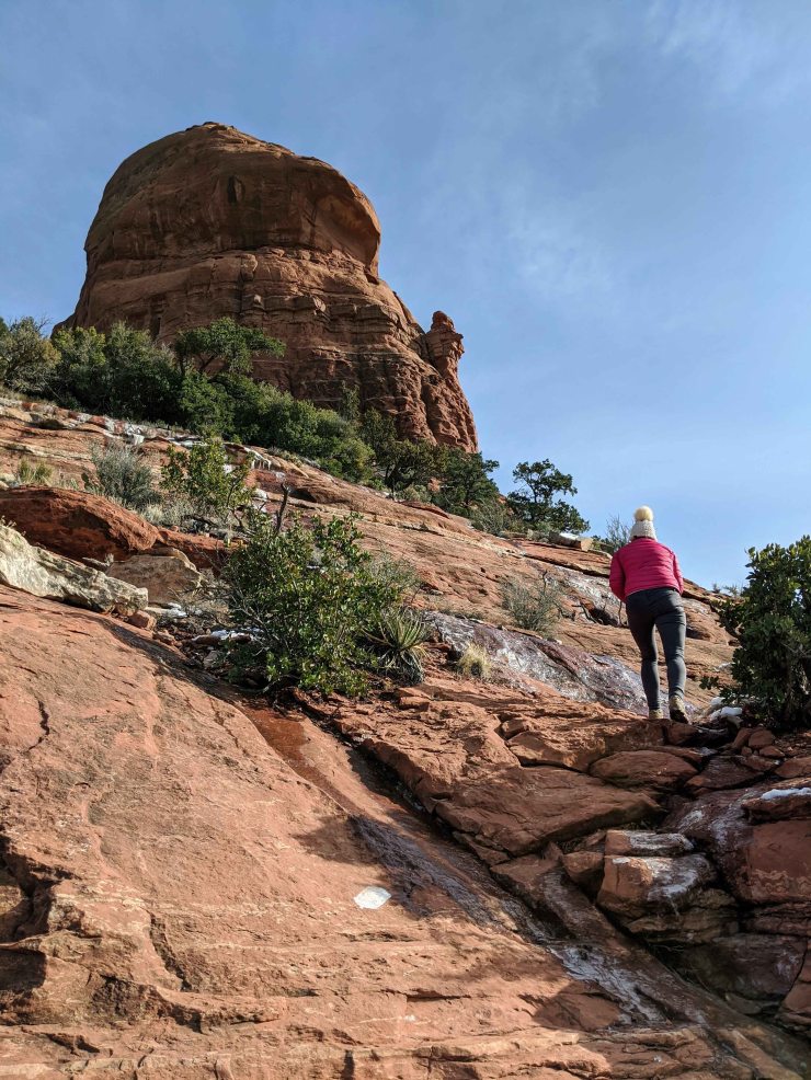
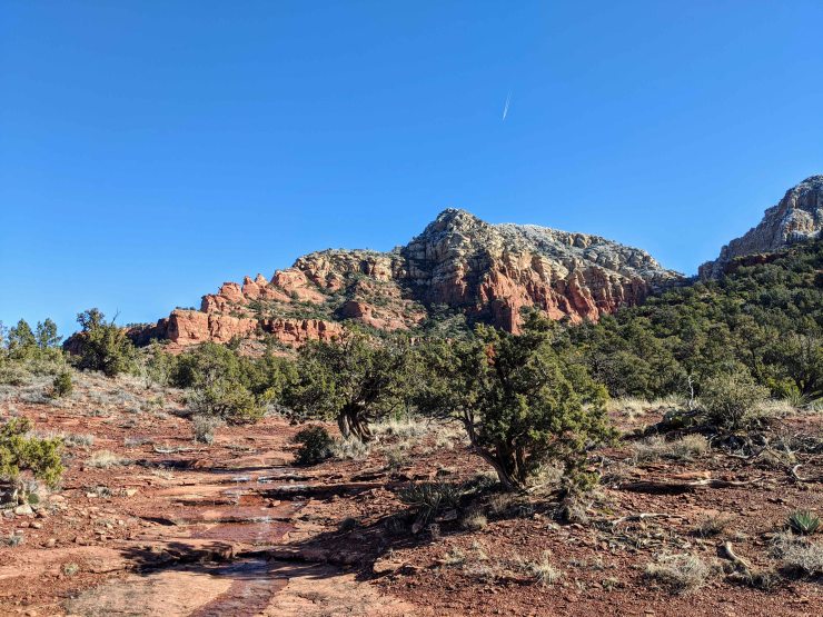
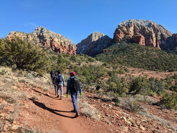
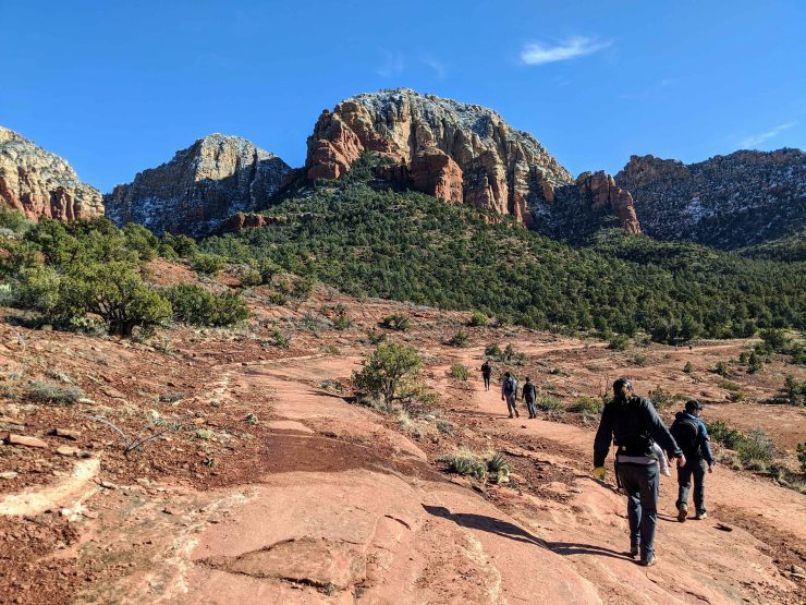
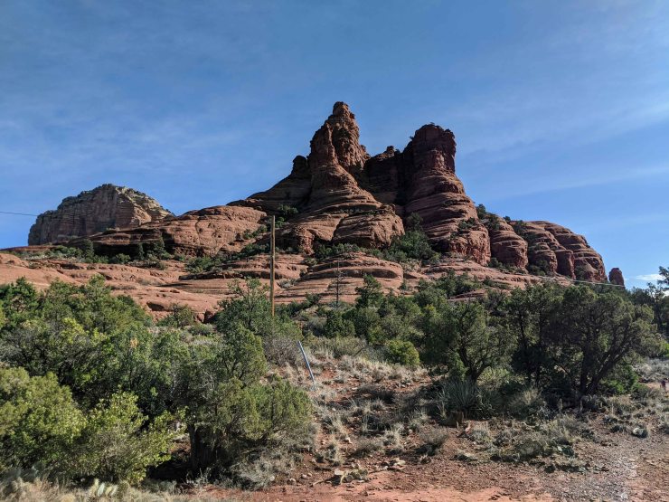
Hike 1: Brins Mesa and Soldier Pass Loop – 6 miles; +/- 800 feet
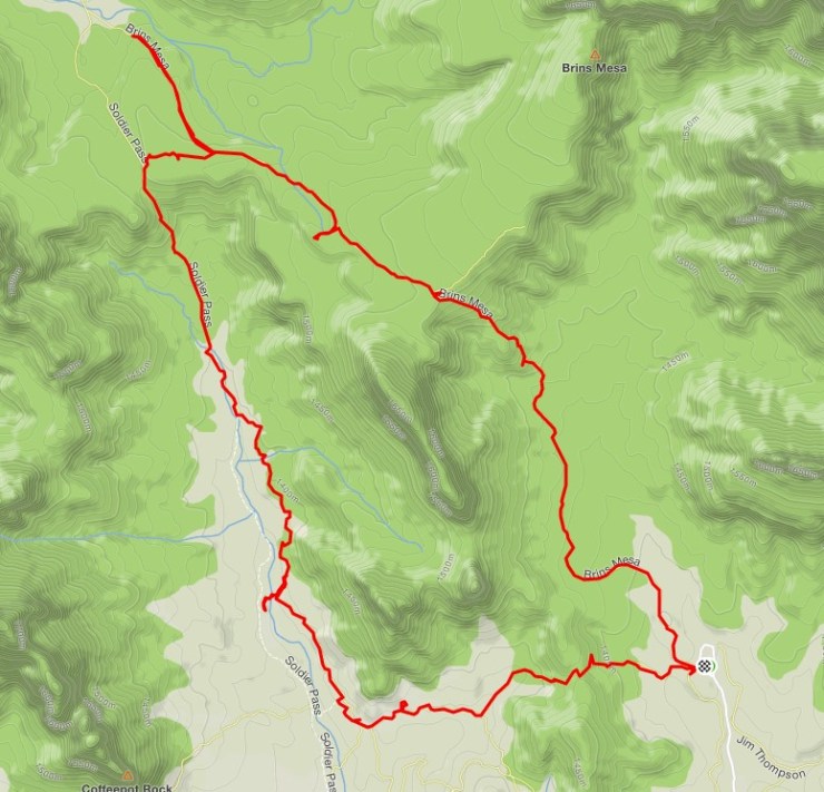
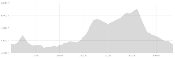
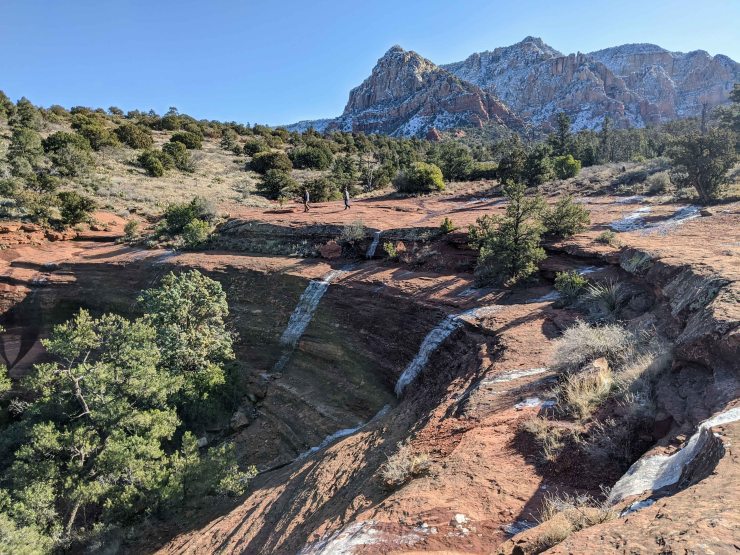
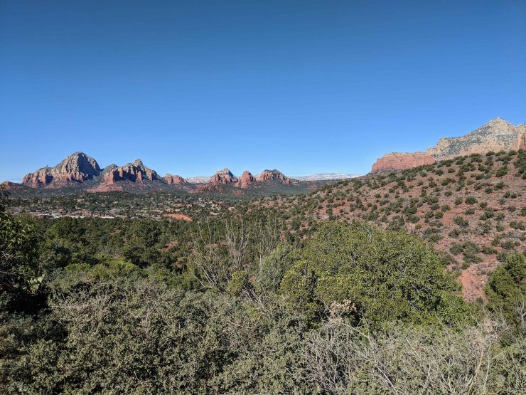
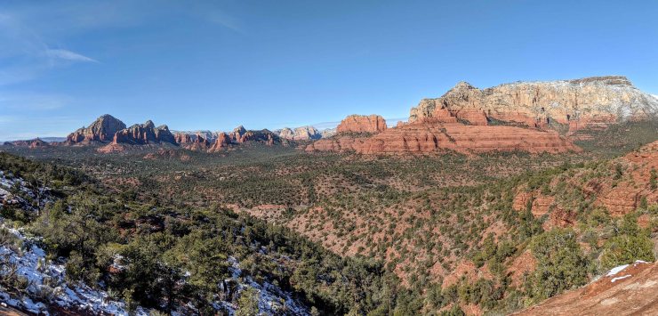
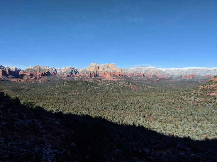
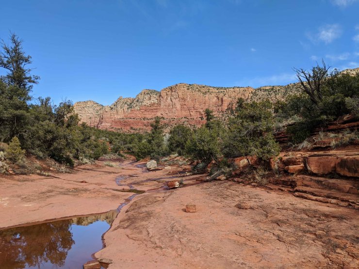
The Brins Mesa – Soldier Pass Loop is a great medium distance hike (6 miles) that provides enough climbing (800 feet) to get a great views without being overly difficult. From the top of Brins Mesa you get a very nice view of Mormon Canyon, Sedona, and the surrounding rock structures to the south. Atop Soldier Pass, you get views of the Soldier Wash and Sedona to the south and a great view of the distant canyons and rock structures to the north. This loop also takes you past the Devils Kitchen sink hole and the Seven Sacred Pools.
The easiest trailhead to park at is the Jordan Road Trailhead, which sits at the end of a dirt road outside Sedona. You do not need a 4WD vehicle to access the trailhead, but may need to drive slowly with a small sedan. From the Jordan Trailhead, we hiked the loop in a clockwise direction. You get great views hiking in either direction, so I do not believe there is a huge difference between clockwise and counter clockwise. The loop starts with a 0.6 mile hike west along the Cibola Pass Trail. You then continue west for another 0.3 miles on the Jordan Trail, which leads to a junction next to the Devils Kitchen sinkhole. You may want to take a few minutes to explore the sinkhole.
From there head north along the Soldier Pass Trail for another 0.5 miles before reaching the Seven Sacred Pools. There are several cascading pools of water here that may be flowing after a recent rain. From there, it is about another mile up hill to reach the top of Soldier Pass. At this point you take a short connector trail east until you meet the Brins Mesa Trail. Take a right turn on the Brins Mesa Trail to continue along the loop (we took a brief detour north on the Brins Mesa Trail to see if there was a viewpoint, but the view did not get better after a half mile, so we turned around).
After hiking about 0.5 miles south on the Brins Mesa Trail, there is a small rock outcrop you will find to the west. For a great view of the area, take the short side trail over to the outcrop and scramble to the top. After that, head back to the Brins Mesa Trail and continue south for another ~0.5 miles before reaching the highest point along the trail, the south end of Brins Mesa. From here you get a very nice view of Mormon Canyon and Sedona. After taking in the view, descend south off the mesa and hike until you reach the Jordan Trailhead.


……….
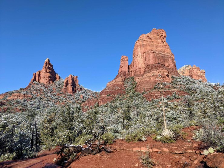
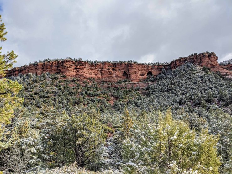
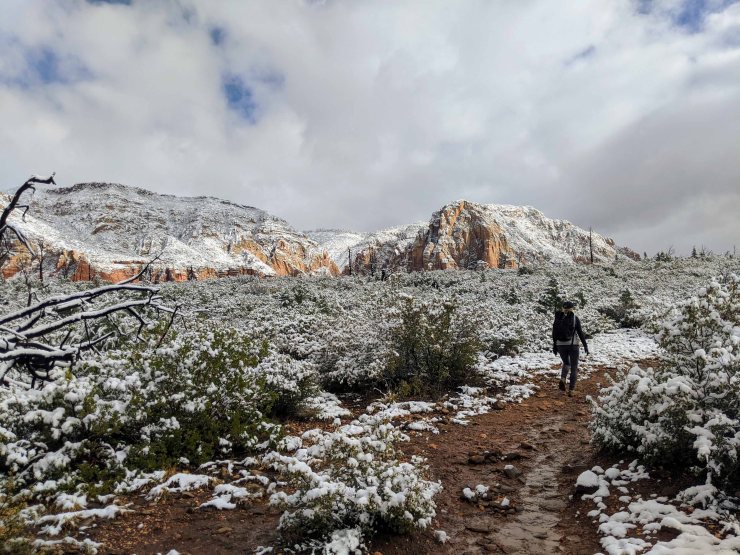
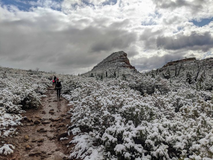
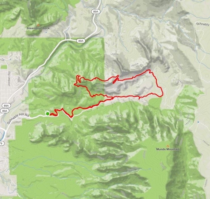
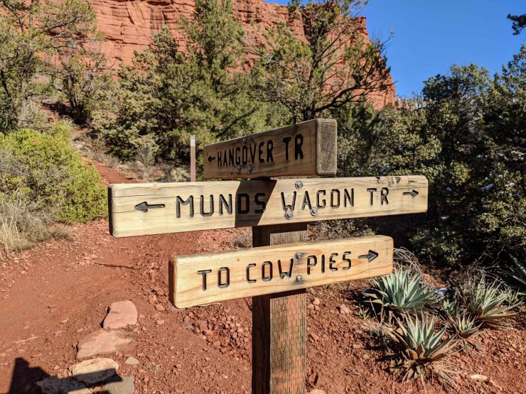
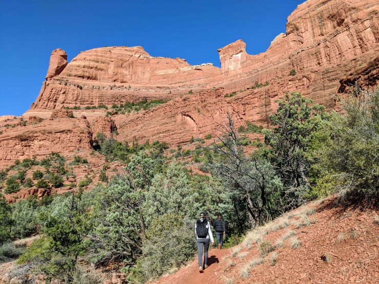
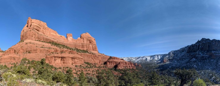
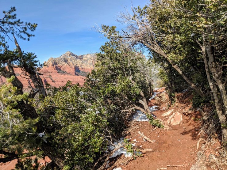
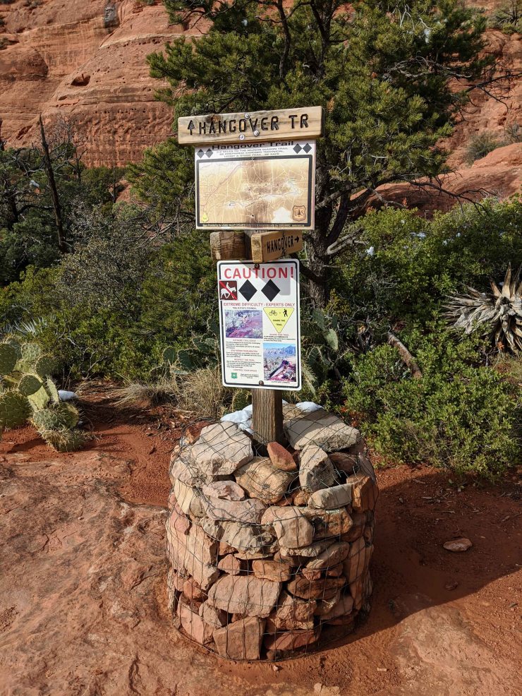
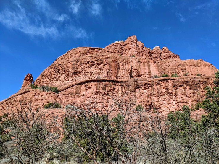
Hike 2: Hangover and Cow Pies Loop via the Munds Wagon Trail – 9.5 miles; +/- 1150 feet

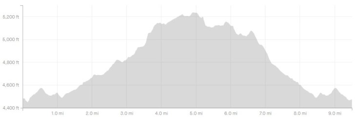
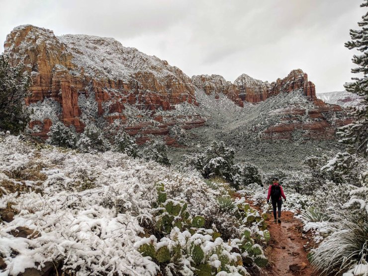
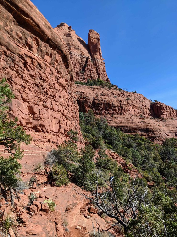
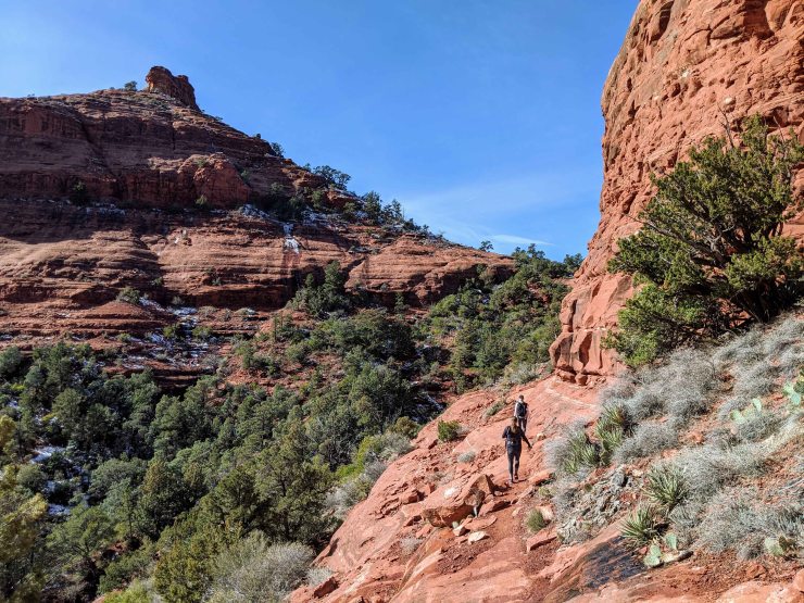
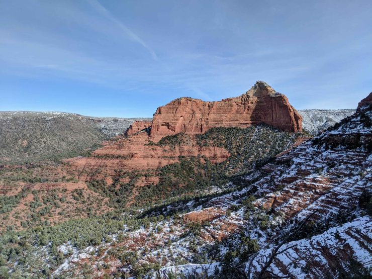
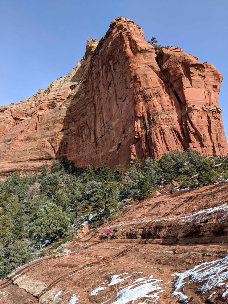
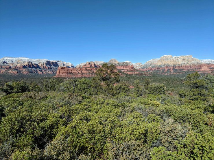
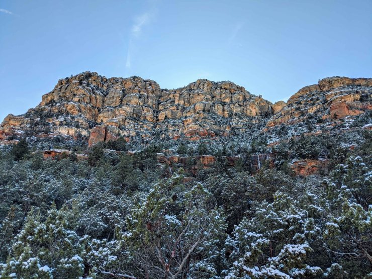
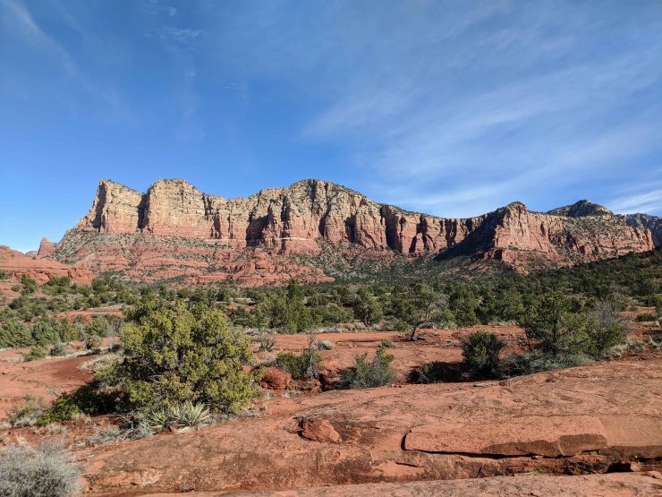
The Hangover – Cow Pies Loop was our favorite hike in Sedona, though it was also the most difficult with the winter conditions. This is a ~10 mile hike that provides spectacular views of Mormon Canyon, Sedona, and many of the prominent red rock structures north of the city.
Hiking this loop in the winter can be tricky because sections are very steep and prone to be icy. We took the trail very slow in sections and even resorted to getting down on our knees in a couple especially tricky areas. Overall the views were well worth the challenge, but be aware that completing the full loop is not for the faint of heart. Most of the obstacles are on the Hangover Trail section of the loop. The Hangover Trail requires a bit of scrambling up steep rock, but does not require any climbing. Some sections of the trail are also quite exposed with a rock wall on one side and steep drop on the other side. It is wise to have a map or GPS tracks loaded on your phone as the white track markers can be a bit hard to follow in certain sections.
We hiked the Hangover – Cow Pies Loop in the clockwise direction and were happy we did. This allowed us to climb uphill in the steepest icy section of the trail. I would advise sticking with clockwise in the winter because I think it would be harder to follow the trail in this section if you were going downhill. Some people say the views are better in the counter-clockwise direction. This may be true, but you really cannot go wrong either way.
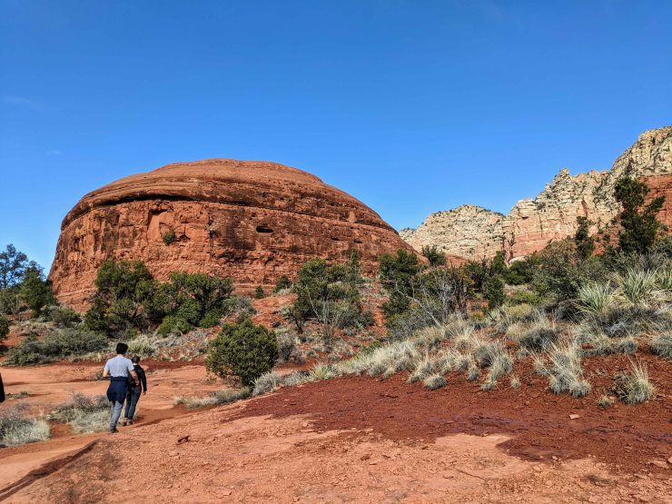
This route starts with a ~2 mile hike along the Munds Wagon Trail leading from the Huckaby Trailhead to the junction with the Hangover and Cow Pies Loop. The Munds Wagon Trail meanders next to Schnebly Hill Road (and crosses it in a couple sections) so you may see a few 4WD vehicles along the way. Despite being near the road, this trail still is quite nice and crosses a few streams and small waterfalls. At the Hangover Trail and Cow Pies Trail junction, we took the Hangover Trail west. The first ~1 miles of the Hangover Trail are standard hiking and provide some very nice views. Then you reach a saddle between two large rock domes. There is a great view of Sedona from this area. Going forward from this saddle point is where the trail gets sketchy/difficult, so this is a good turn around point for those that are afraid of heights.
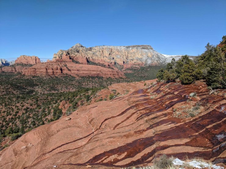
If you continue forward to complete the loop, follow the small white arrows painted on the rocks. These mark the trail and lead you on a path that skirts around the north side of the large Pointed Dome rock structure. You do some steep climbing in the first section (be sure to follow the white markers here), but then the trail levels out as it follows along a narrow ridge on the north side of the rock formation. The trail heads east towards the Flying Buttress rock structure, and you reach a saddle point at the base of this rock structure at around the 5 mile mark. This is a very nice viewpoint where you can see Mormon Canyon, Bear Wallow Canyon, and Wilson Canyon. From this point on the trail again becomes very manageable and straightforward hiking (except a few flat icy sections).
At the ~5.5 mile mark, the Hangover Trail transitions to the Cow Pies Trail. Cow Pies leads 0.5 miles south before crossing Schnebly Hill Road and intersecting the Munds Wagon Trail. At this point, you head west on the Munds Wagon Trail, which leads all the way back to the starting trailhead. The first 2 miles of the Munds Wagon Trail between Cow Pies Trail and the junction with the Hangover Trail leads through a forest and along a stream within a canyon. This section had a few very icy sections, so you need to use caution in the winter. After these 2 miles, you simply follow the Munds Wagon Trail back to the trailhead (along the trail you hiked in on).


……….
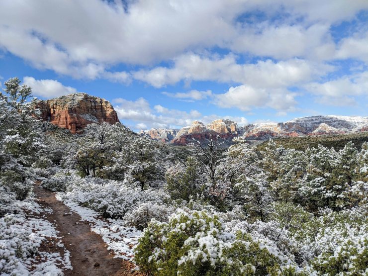
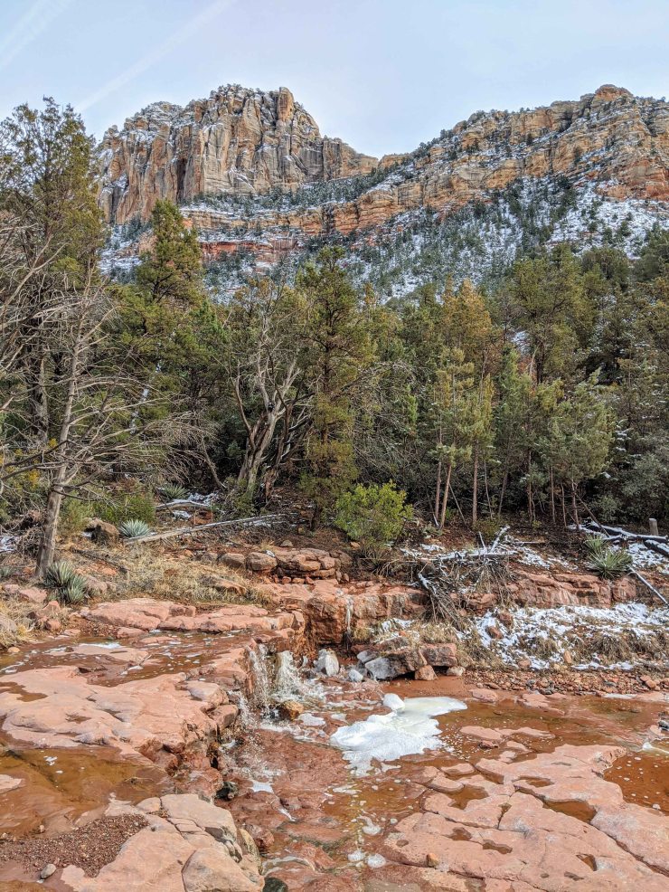
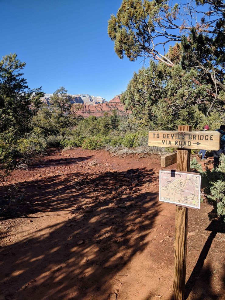
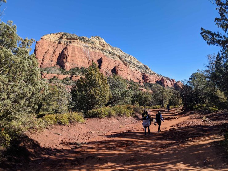
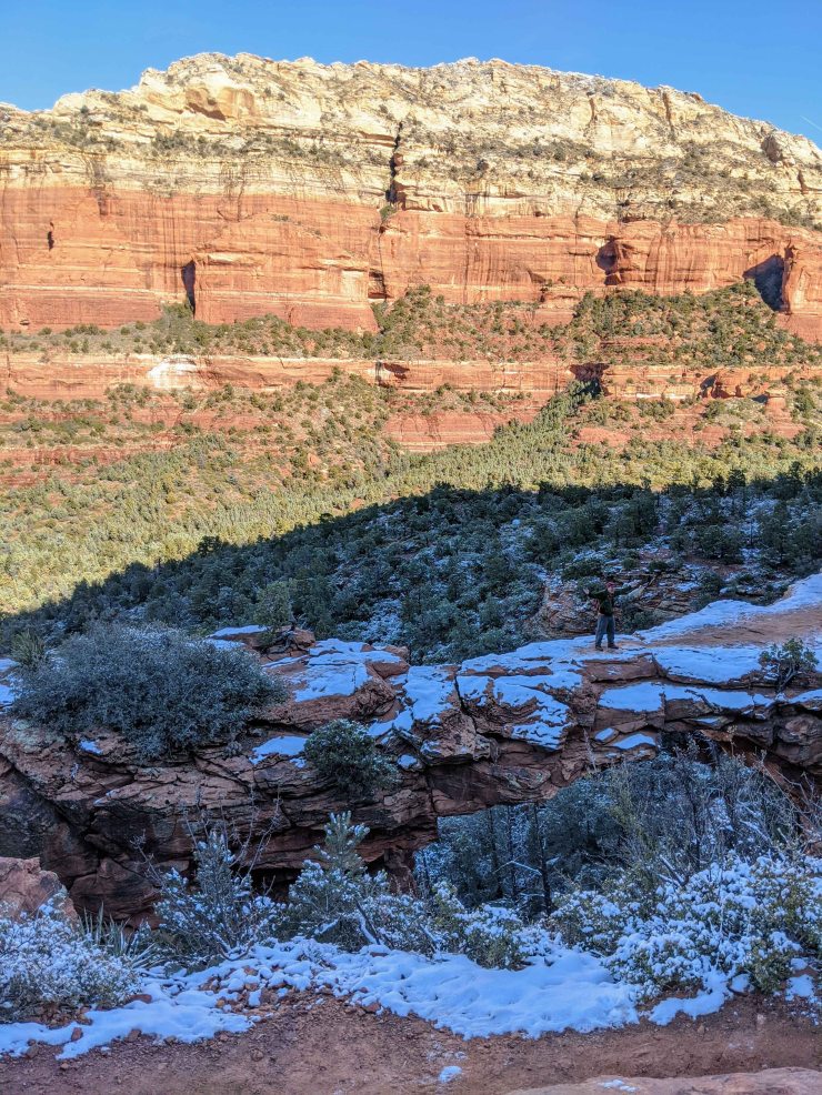
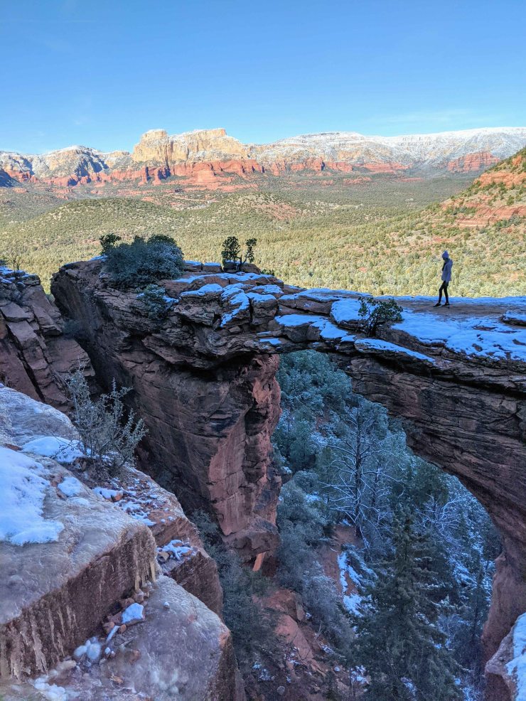
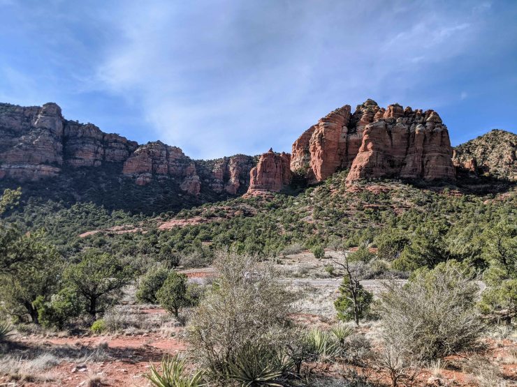
Hike 3: Devils Bridge via the Chuck Wagon Trail – 6.7 miles; +/- 800 feet
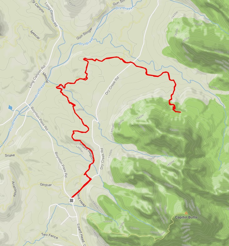
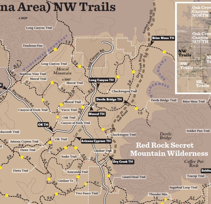
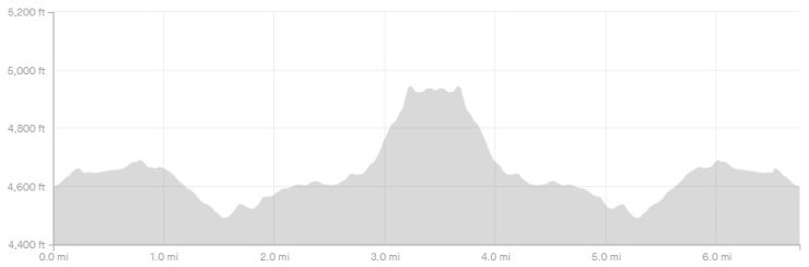
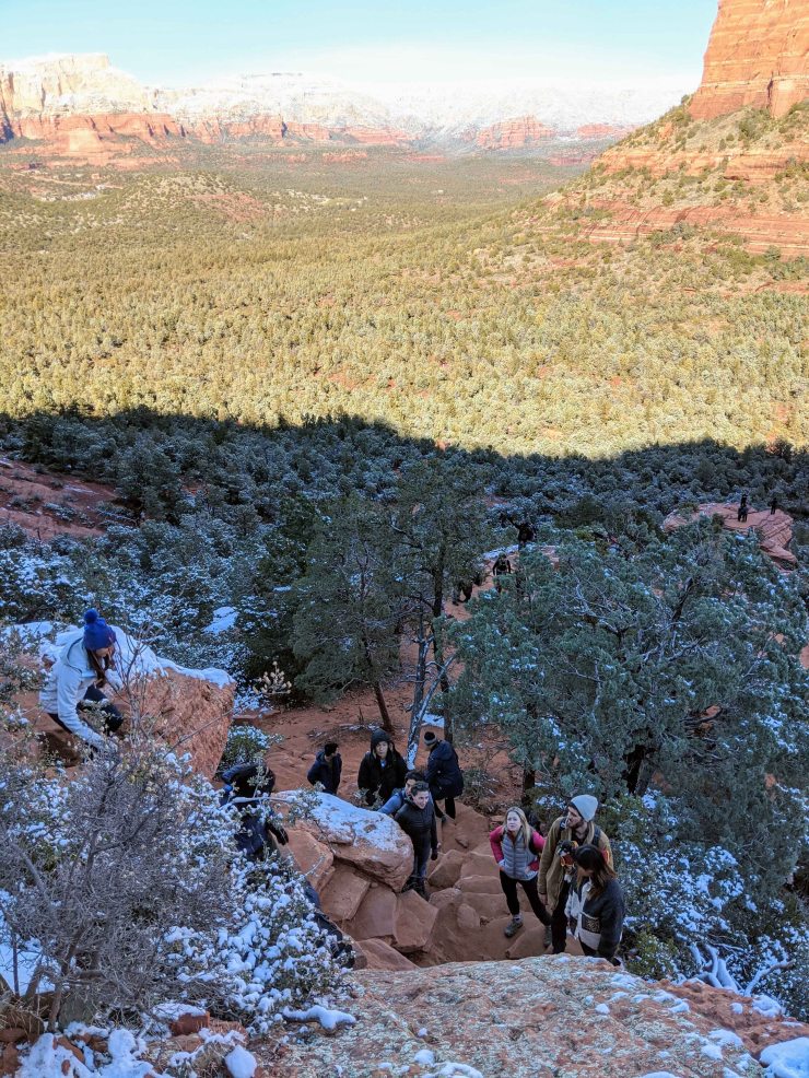
The Devils Bridge Trail is one of the most popular hikes in Sedona. In general, the rock bridge is very cool, but the trail is crowded given the popularity. There are a couple of routes to take to get to the Devils Bridge. We chose to park near the Dry Creek Trailhead so that we could stretch our legs with a 3-3.5 mile hike to the bridge. We ended up parking on the side of the road because the trailhead parking lot was full, but this was easy. From this spot, you have a nice 6-7 mile out and back hike with the Devils Bridge as a mid point.
If you have a 4WD vehicle you can drive all the way to the Devils Bridge Trailhead and hike ~1 mile to Devils Bridge. This mile of trail is the most crowded and tedious, so I would only do this if just want to see Devils Bridge and have no interest in a nice hike. There are some nice views in this last mile before Devils Bridge, but it is by no means nice hiking. There are a couple sections where we had to wait ~5 minutes for hiker traffic jams.
For our route, we hiked ~2.3 miles along the Chuck Wagon Trail from the Dry Creek Trailhead to the Devils Bridge Trailhead. We then hiked ~1 mile from the Devils Bridge Trailhead up to the bridge. We took the same route back bringing the total mileage to about 6.7 miles. There are some very nice views along the Chuck Wagon Trail and you avoid the crowds (and vehicles on the Jeep road).


……….
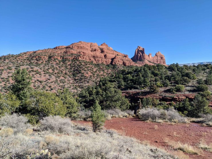
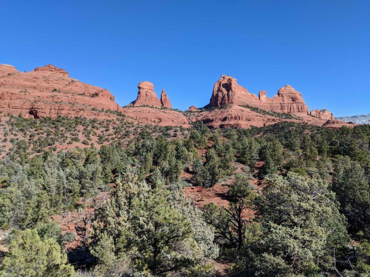
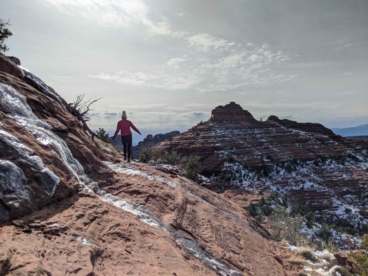
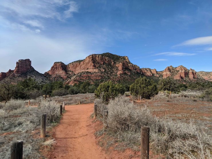
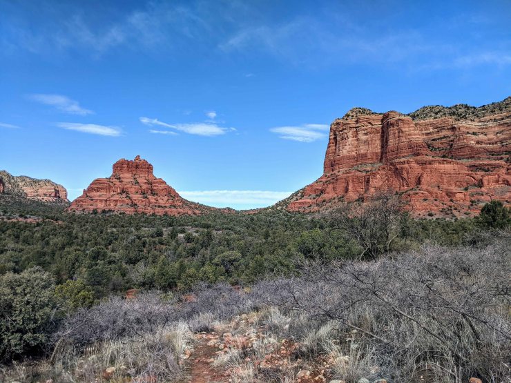
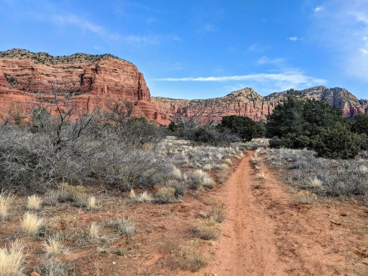
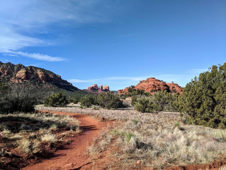
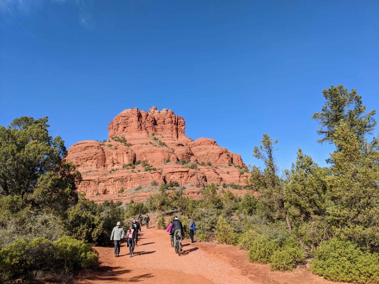
Hike 4: Bell Rock and Courthouse Butte via the Big Park Loop – 4.8 miles; +/- 475 feet

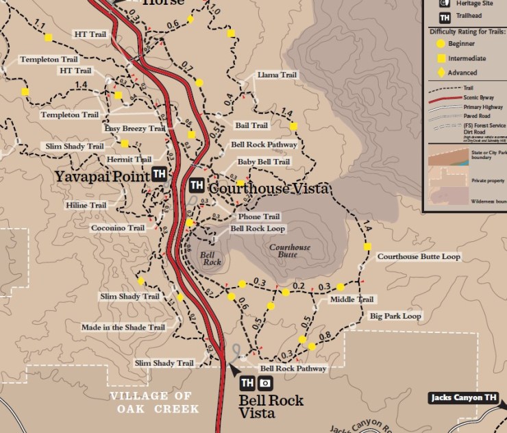

The Bell Rock and Courthouse Butte Loop hike is more of the most popular in the Sedona Area. There are generally a lot of hikers near Bell Rock because it is popular to scramble towards the top of the rock structure. To get away from the crowds a bit and still enjoy great views, take the Big Park Loop described herein. This route allows you to circumnavigate Bell Rock and Courthouse Rock. You still pass by the busy section near Bell Rock, but only ~25% of the hike will be crowded with other hikers. This hike is mostly flat and is relatively easy. To add some more difficulty you can scramble up Bell Rock. We hiked the loop counter-clockwise from the Bell Rock Vista Trailhead.


……….
Other Highlights:
Doe Mountain Trail – 1.5 mile out and back; +/- 500 feet (AllTrails Info)
A very popular trail in the Sedona Red Rocks Wilderness, the ~1.5 mile Doe Mountain Trail leads to the top of the Doe Mountain Mesa. From the top you get 360 degree views of the surrounding area. The trail is relatively steep, but quite short.
Bear Mountain Trail – 5 mile out and back; +/- 2,000 feet (AllTrails Info)
The Bear Mountain Trail is moderately difficult with a 2,000 foot climb to the summit of Bear Mountain. At the summit you are treated to views to both the west and east. You can also scramble around and find different viewpoints once the trail nears the true summit.
Boynton Canyon Trail – 6.1 mile out and back; +/- 810 feet (AllTrails Info)
This hike leads through Boynton Canyon and provides great views of the red, vertical walls on either side of the canyon. The first 2/3 of the hike are a bit underwhelming as you hike through trees. However, the trail emerges from the trees for the last mile and provides epic views.
West Fork Trail – 7.2 mile out and back; +/- 800 feet (AllTrails info)
The West Fork Trail is arguably one of the best trails in Sedona. The trail follows a river through a canyon, crossing the river several times. On a hot day, the shade in the canyon and the river make for a great hike. In the winter the trail can be tricky due to ice.
Here are some similar trip reports!
Banff National Park Hiking Highlights
Clouds Rest and the Lembert Dome – Yosemite National Park
Grand Canyon Hiking – South Kaibab and Bright Angel Trails (17 mile hike)
