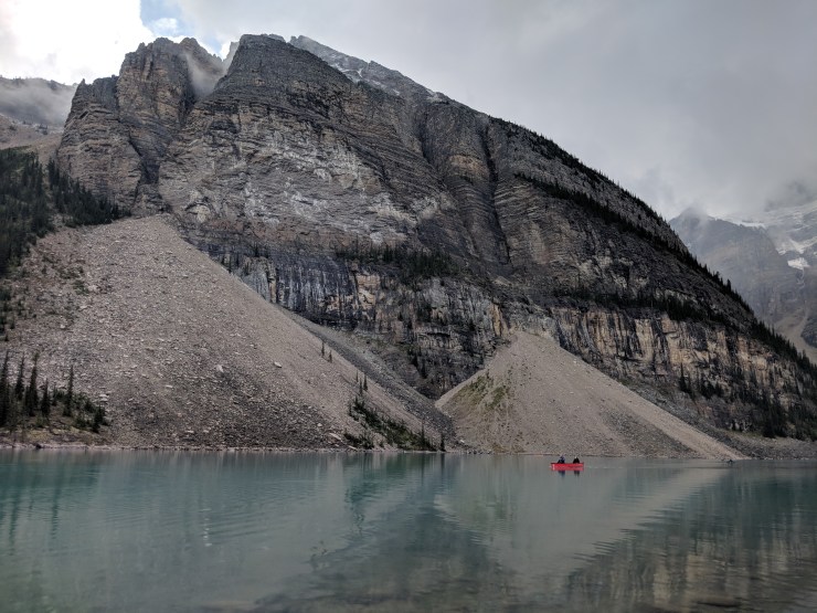
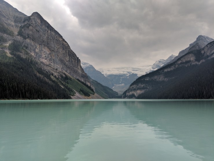
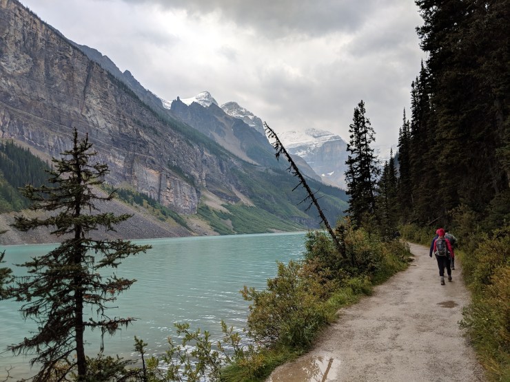
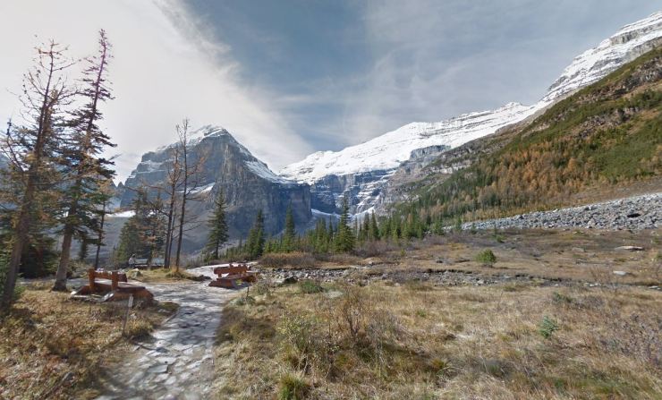
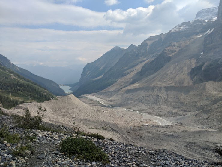
View from the shore of Lake Louise looking towards the Plain of Six Glaciers.
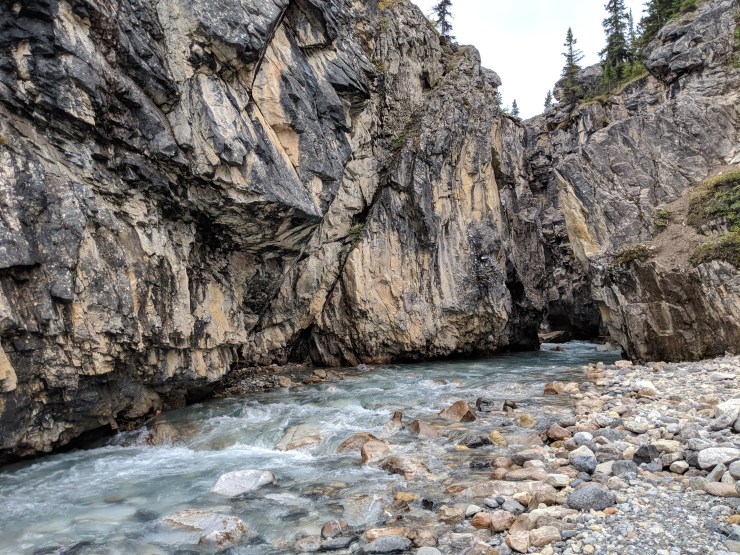
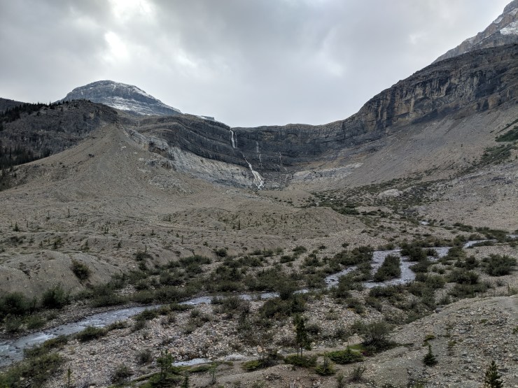
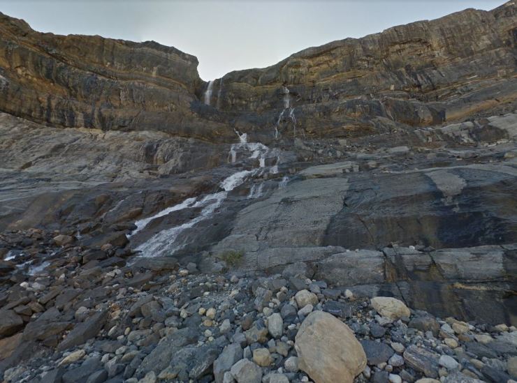
View of the canyon from atop the bridge. You can see Bow Glacier Falls in the distance.
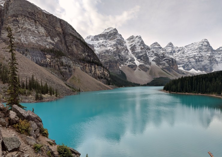
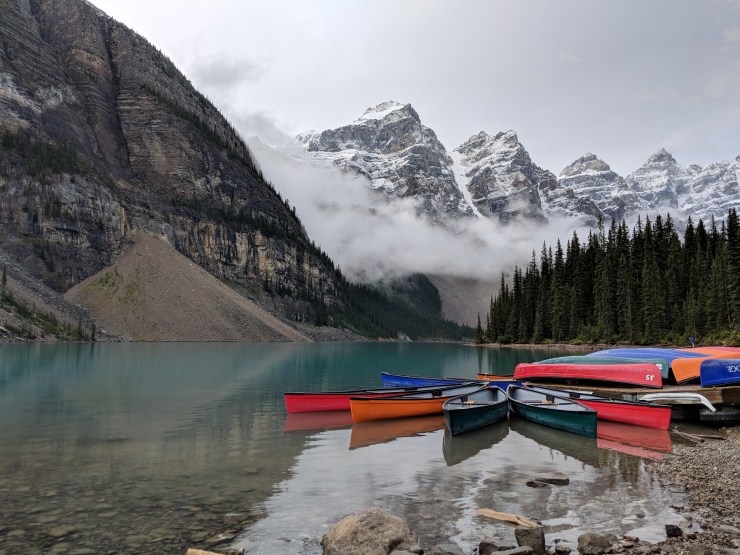
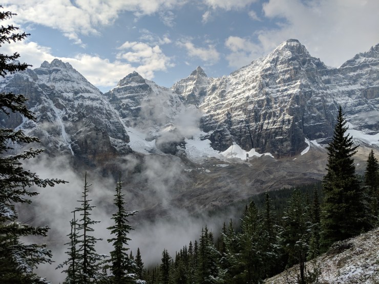
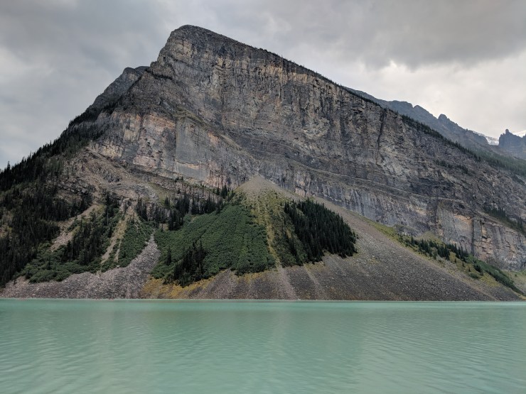
Taking in one of many beautiful views at Moraine Lake in Banff National Park (from atop of the rock pile near the lake outlet stream)
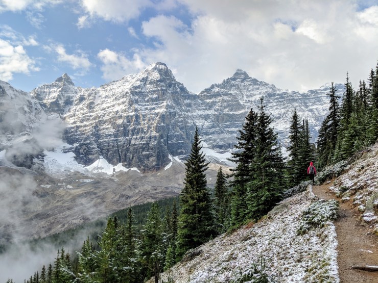
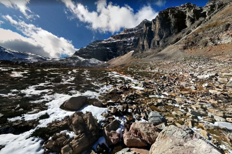
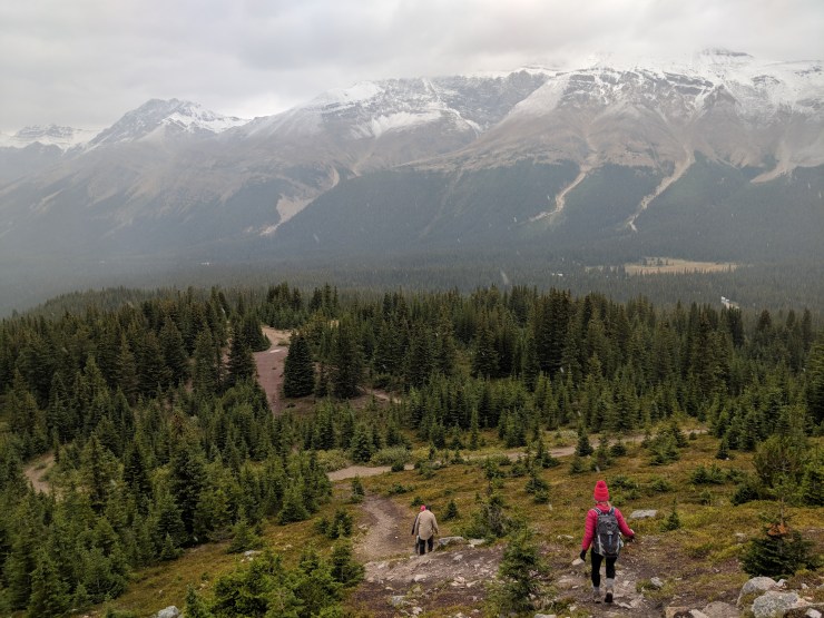
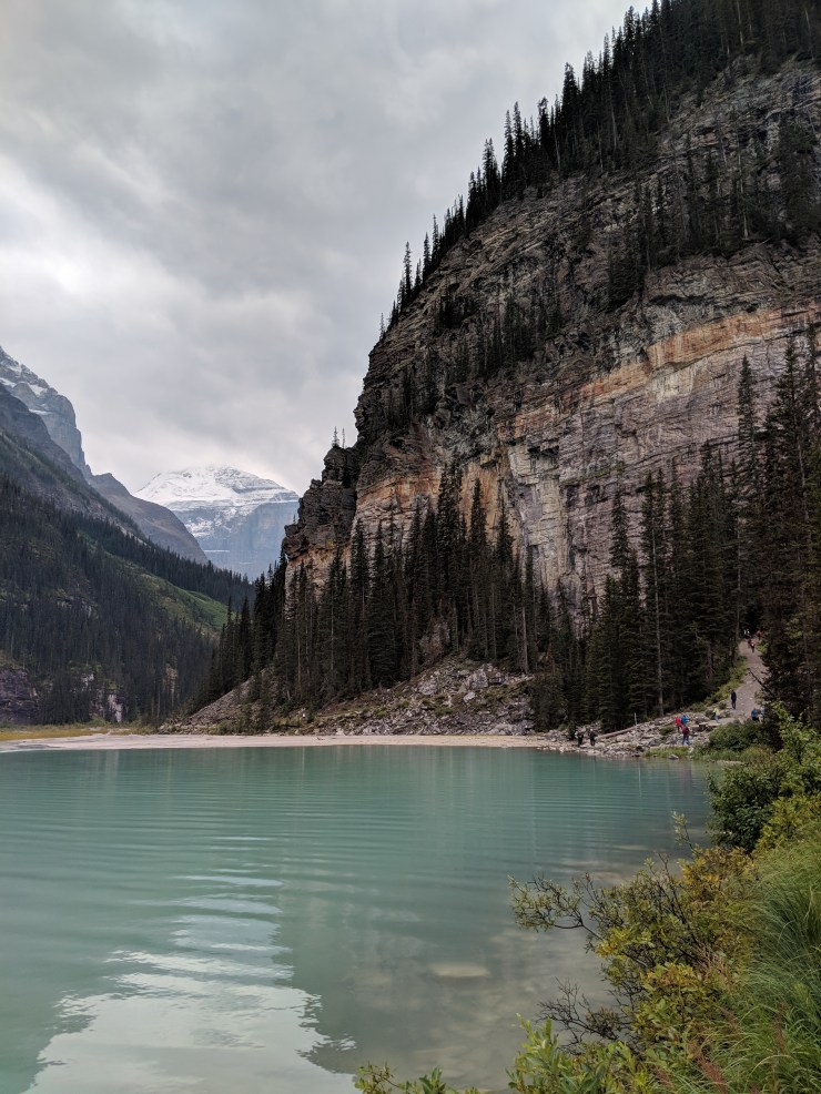
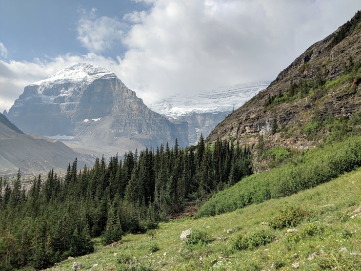
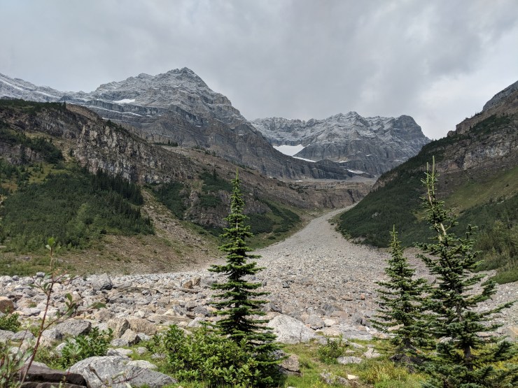
To reach the end of the Plain of Six Glaciers Trail, you follow the trail along a skinny moraine (right side of image)
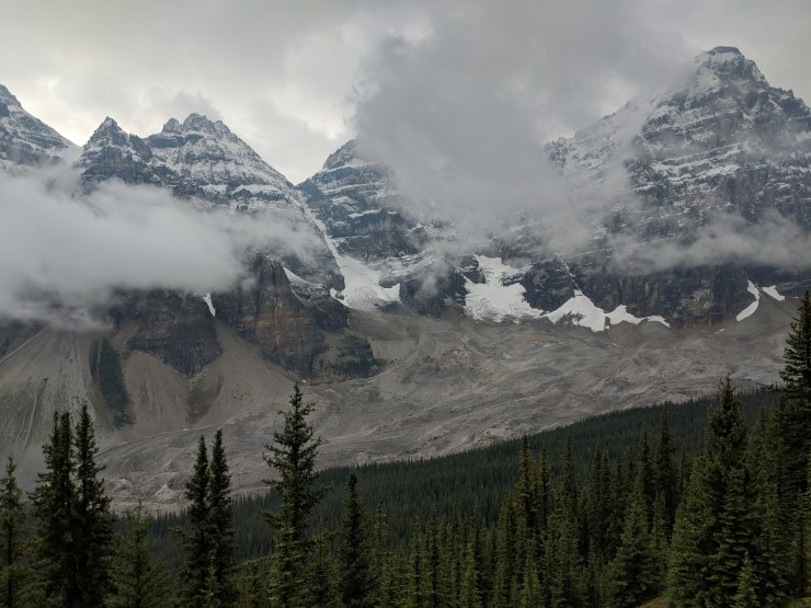
Along the Eiffel Lake Trail you get some really great views of the Ten Peaks that make up the backdrop for Moraine Lake.
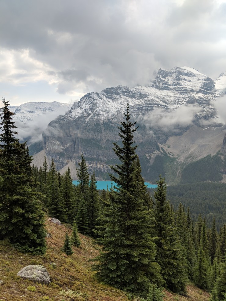
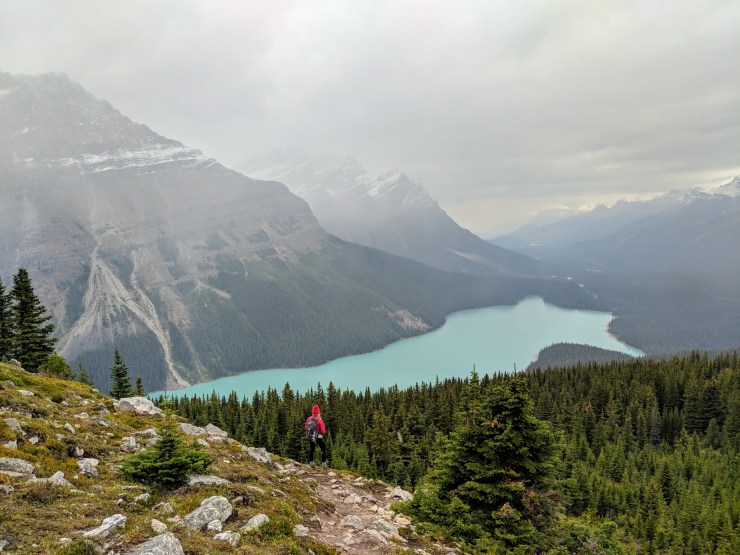
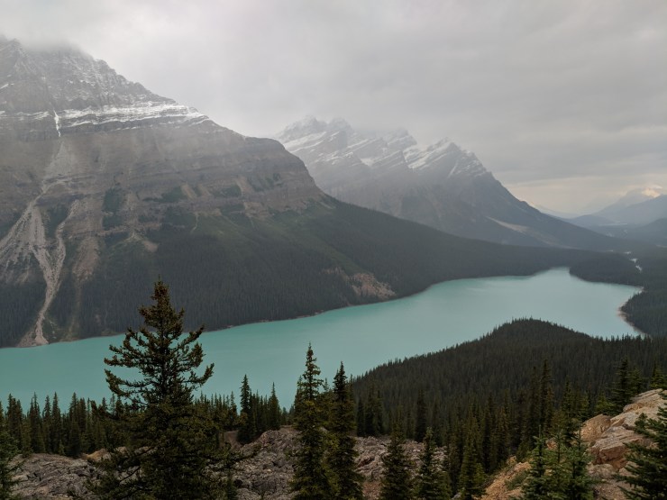
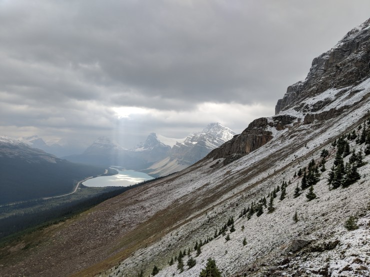
View of Peyto Lake from the upper viewpoint. At this area we saw no other hikers or tourists.
Trip overview: We went on four of the signature hikes within Banff National Park during a 6 night stay. We also went on one hike in Yoho National Park. These hikes ranged from 5 to 13 miles in length, are moderate in difficulty, and start at the signature lakes within Banff National Park: Moraine Lake, Peyto Lake, Bow Lake, and Lake Louise. Highlights include amazing glaciers, large granite peaks, turquoise blue lakes, and snow dusted forests. This trip took place in September of 2018.
Where to stay: We decided to stay within the town of Banff during this trip. Banff has many hotels and lodges that are popular for hikers. You can also camp within the national park, but competition for the camp sites can be high. Info on camping can be found here. A common alternative that is slightly more affordable is staying within the city of Canmore. Canmore is further from the hikes within the park, but has more housing options and is less touristy than Banff.
Overall we liked staying in Banff. It made the drive to the various trailheads shorter (compared to Canmore) and Banff also has some beautiful scenery. There are many good restaurants within Banff, but note that prices tend to be high and the city is full of tourists during the high season.
Permits: When entering the national park, you will need to pay an entrance fee. Day passes for a family/group are roughly $15 (USD) and yearly passes for a family/group are roughly $100 (USD). More info on fees and tariffs can be found here. Once you have paid your entrance fee, you are allowed to go on day hikes free of charge.
If you are backpacking and camping in the backcountry, you will need to secure a backcountry permit. Permits are competitive for many trails and typically can be reserved starting in January. More info on backcountry camping in Banff National Park can be found here. In addition to typical camping, there are a variety of Alpine Huts and Commercial Lodges in the park. These can make for a more relaxing trip for those who do not want to camp. Note that reservations for the huts and lodges also fills up quickly.
Supplies: If you are doing a lot of hiking on remote trails, it may be wise to invest in some bear spray to protect yourself in case you come across a grizzly bear. Banff is known to be the home of many bears, and many hikers like to carry bear spray. If you only plan to hike popular trails and have a large group (more than 4 people), bear spray is probably unnecessary. A good bug repellent is also nice to have because the mosquitoes and flies can be a nuisance in the Canadian Rockies. Finally, you will want a variety of layers to carry with you because the weather in the Banff National Park can change quite a bit over the course of a day. It is often chilly in the mornings and evenings and warm on sunny afternoons. For trail maps, I recommend Tim Jensen’s “The Best Day Hikes in the Canadian Rockies.” This book has maps, descriptions, and ratings for many of the hikes in Banff and the neighboring national parks.
Taking in one of the many beautiful views at Moraine Lake in Banff National Park (pictured: prAna Lyra down jacket)
Moraine Lake is a 1-1.5 hour long drive from the Banff City Center. The turn off for Moraine Lake is hard to miss because there are typically traffic barriers set up and a sign noting whether or not the Moraine Lake parking lot is full. When the parking lot is full, the traffic officers close the road and do not let anyone else drive up to Moraine Lake. Note that the lot fills up quickly, so you will want to arrive early (before 8am) if you plan to drive yourself. Otherwise you risk needing to wait for a car to leave the lot before you can get in. You can also park at one of the shuttle stops and take a shuttle up to Moraine Lake. This is definitely the easiest and greenest option. Just pay attention to the shuttle schedule so you do not miss the last ride back.
After the turn off for Moraine Lake, you follow a narrow winding road for ~20 minutes before reaching the parking lot. There are rest rooms and a visitors center near the parking lot. Beautiful Moraine Lake is just a short walk from the parking lot, so you do not need to move far to take in the views. For some great views, follow the short hiking path to the top of the hill near the outlet of the lake. This is a good spot to take some pictures before beginning any hikes. After that, you can find one of the maps near the lake and decide which trail you want to hike.
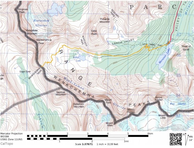
Eiffel Lake Trail to Wenkchemna Pass– 11.5 mile out and back, +/- 3,200 feet of elevation
Map of the Eiffel Lake and Wenkchemna Pass hike from Moraine Lake (orange line).
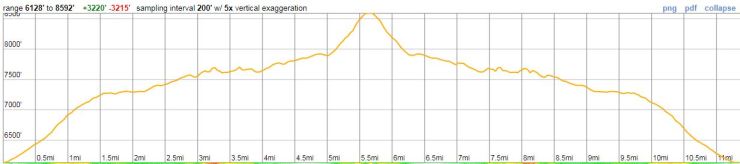
Elevation profile of the Eiffel Lake and Wenkchemna Pass hike from Moraine Lake
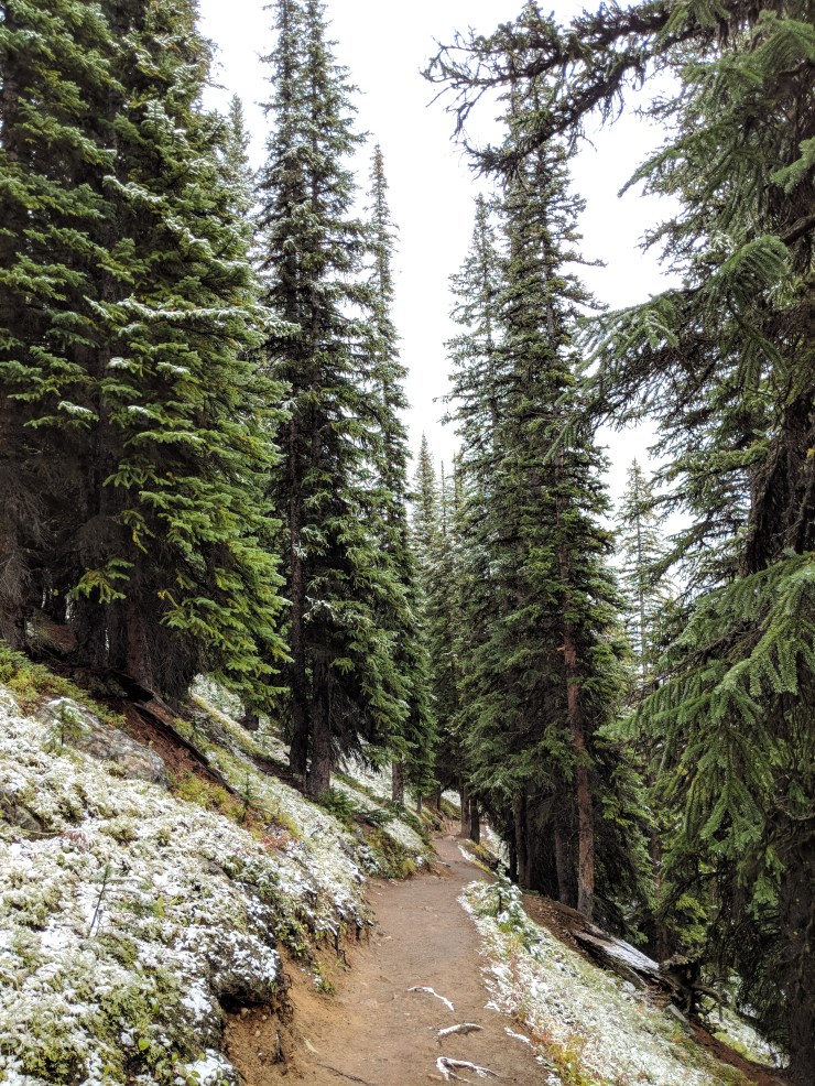
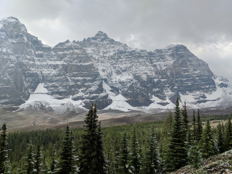
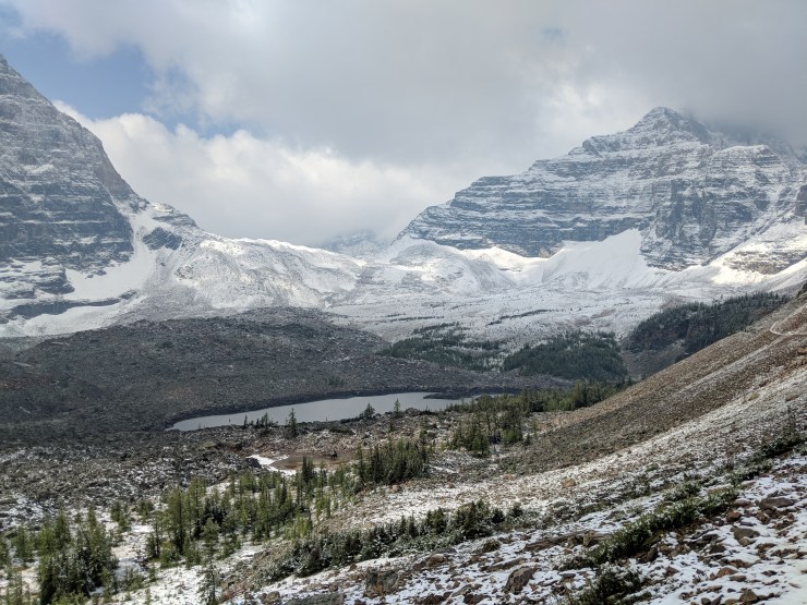
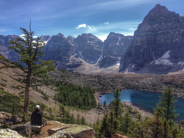
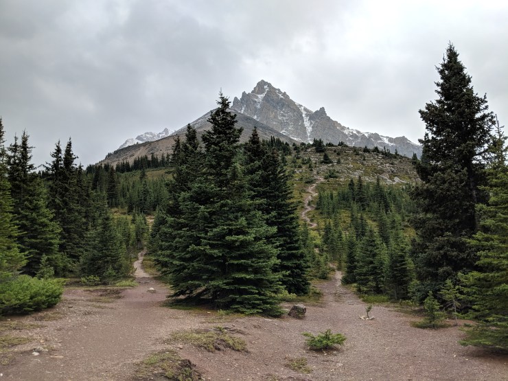
The Eiffel Lake and Wenkchemna Pass hike is an out and back hike that starts at Moraine Lake. This hike is a great option because you get great views of Moraine Lake and the Ten Peaks which frame it. Furthermore, you get to see Eiffel Lake and then some great additional views if you make it all the way to Wenkchemna Pass. The hike to Eiffel Lake is well marked and not too strenuous. The final stretch from Eiffel Lake to the pass is more strenuous and requires a little route finding and scrambling. The start of this trail is shared with the Larch Valley and Sentinel Pass Trail. After an initial climb the two trails split off from each other. We hiked the Eiffel Lake Trail on a morning in early September. It has snowed the night before, so the scenery was very beautiful!
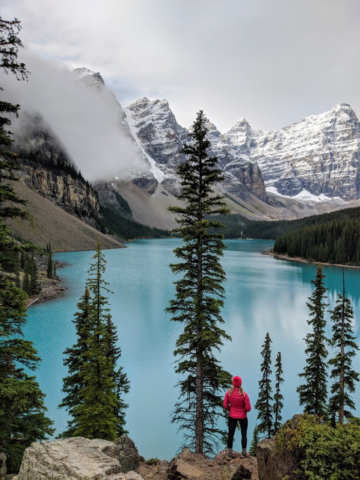
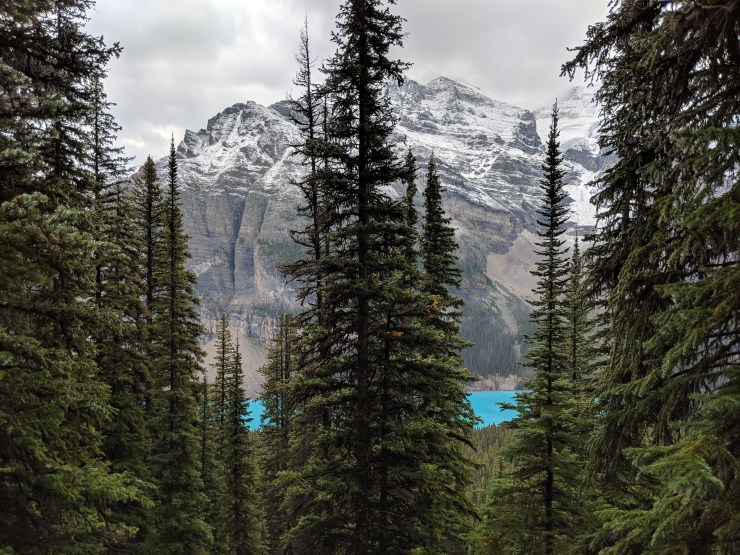
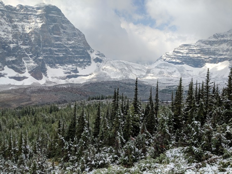
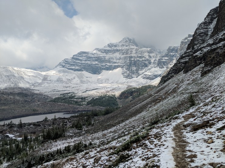
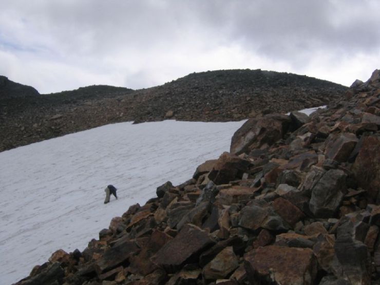
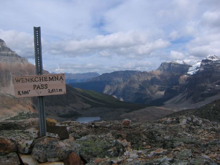
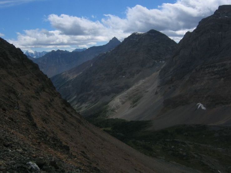
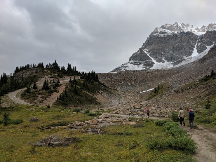
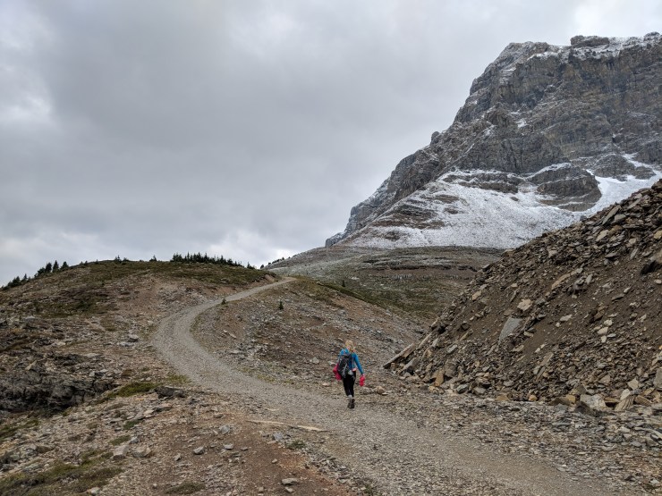
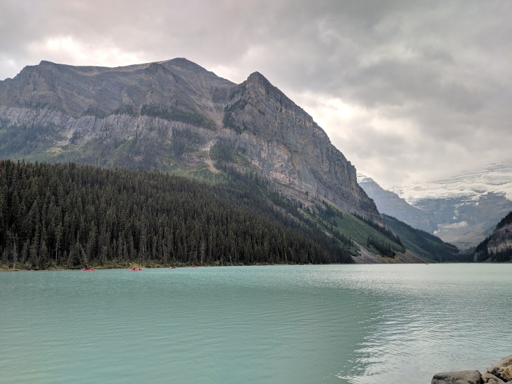
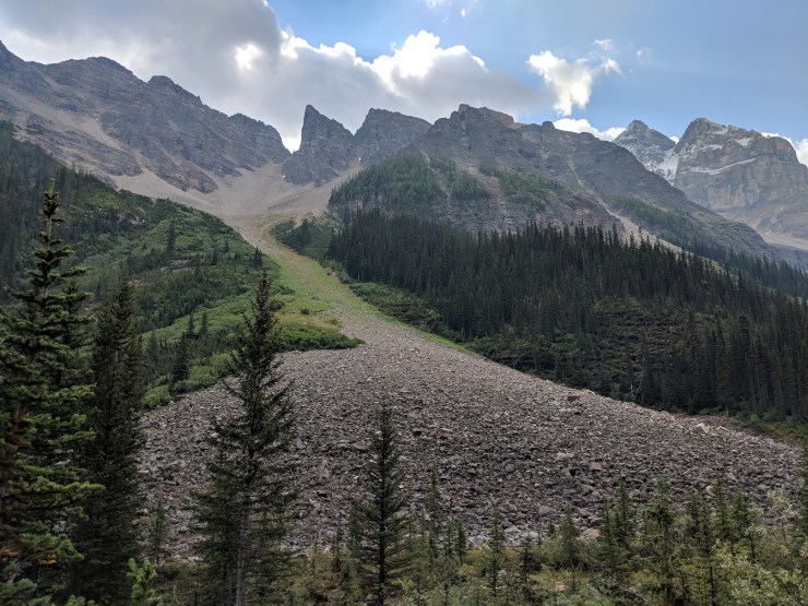
View of Moraine Lake and several of the Ten Peaks from the shore of Moraine Lake the morning we arrived.Before starting our Eiffel Lake Trail hike, we first climbed up the large hill near the outlet of the Moraine Lake. This is just a short hike and you get some great views of the lake (pictured: women’s oversized pink beanie)After taking a bunch of photos we made our way to the northwest shore of Moraine Lake. Here you find the canoe rentals and also the starting trailhead for the Eiffel Lake and Sentinel Pass Trails.A canoe on the still waters of Moraine LakeAfter checking out the lake, we then began hiking up from the shore of Moraine Lake. Follow the Larch Valley Trail, which climbs up into the forest. Eventually you reach a junction point where you can take the Eiffel Lake Trail.During the climb up through the forest, you catch glimpses of Moraine Lake’s blue water through the trees.The Larch Valley Trail starts out with a fairly steep climb up several narrow switchbacks.Around the 1.5 mile mark you reach a junction. Here you can turn off onto the Eiffel Lake Trail that leads to Wenkchemna Pass. Alternatively you can continue on the Larch Valley Trail to Sentinel Pass. Both trails have spectacular views.Along the Eiffel Lake Trail you get some really great views of the Ten Peaks that make up the backdrop for Moraine Lake.Looking back down at Moraine Lake from the Eiffel Lake Trail.Beneath the Ten Peaks you can see the Wenkchemna Glacier and its gravel and debris field.In the morning it is not uncommon for clouds to roll in and totally obscure the view. Luckily the clouds passed within a few minutes and our view was quickly restored.Another view of the large Wenkchemna Glacier and the towering peaks near Moraine Lake.View from the Eiffel Lake Trail in the section of the trail when you are above the forest.Along the Eiffel Lake Trail, looking out towards Wenkchemna Pass.The Eiffel Lake Trail skirts along a ridge above Eiffel Lake. It then heads up to Wenkchemna Pass, which often has snow on it.View of Eiffel Lake below and Wenkchemna Pass above it. At this point, we turned around and hiked back because we were short on time. The following images show what the hike looks like if you continue all the way to the pass (though the weather conditions are different than what we had)As you continue heading along the trail, head towards the group of trees near Eiffel Lake. There is a nice place to take a break and enjoy the view here (credit: Paul Labranche)As you approach the trees, you get great views of Wenkchemna Pass (pass on left) and Wenkchemna Peak (tall peak on right) (credit: Edna Winti)Hiker relaxing at a viewpoint above Eiffel Lake. From here you get a nice view of the lake and of the Ten Peaks (credit: Edna Winti)View of “trail” as it continue up to the scramble up the pass (credit: Sam Griffith).Hikers heading up towards the final climb up to Wenkchemna Pass (credit: John Serrao)Hiker climbing up a snow field to get to the top of Wenkchemna Pass. The trail becomes a bit of a scramble at this point (credit: John Serrao)View from the top of Wenkchemna Pass looking towards Moraine Lake (credit: John Serrao).View looking to the west into British Columbia and the Prospectors Valley from the top of Wenkchemna Pass (credit: John Serrao)
View of Peyto Lake from a viewpoint along the Bow Summit Lookout Trail (pictured:Osprey Tempest 20 day pack)
UPDATE: per the Parks Canada website the Peyto Lake day use is likely to be closed for much of 2019. You can check for updates on the Parks website.
“The entire day use area, including parking lots, restrooms, trails and viewing platforms, will be closed while the restrooms are replaced and the parking lots reconfigured for improved traffic flow and increased capacity. Note: This project is at a preliminary stage and construction timelines are not yet confirmed. Updates will be provided.”
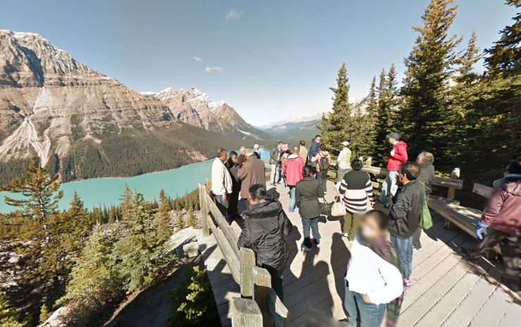
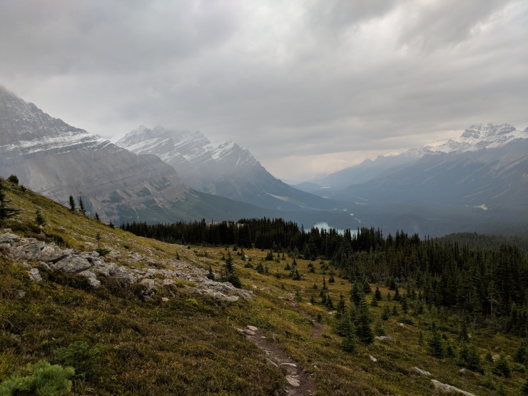
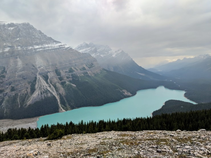
Peyto Lake is a roughly 1.5 hour drive from the town of Banff and is one of the most photogenic lakes in Banff National Park. The parking lot at the lake is right off the Icefields Parkway. From there you are just a short 0.5 mile hike from the main observation deck at Peyto Lake. The view here is great, but there is often a crowd of tourists. Better views can be attained and you can get away from the crowd by hiking further up to higher ground. One hike that is modest in length and provides views of both Peyto Lake and nearby Bow Lake is called the Bow Summit Lookout Trail. Peyto Lake and nearby Bow Lake are both beautiful and easily accessible, so they should be included on any trip to Banff National Park!
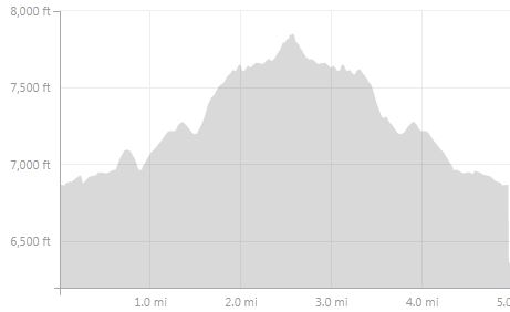
Bow Summit Lookout Trail – 4.5 mile out and back, +/- 1,200 feet elevation
Overall map of the Bow Summit Lookout hike at Peyto Lake (blue line).
Elevation profile of the Bow Summit Lookout hike at Peyto Lake
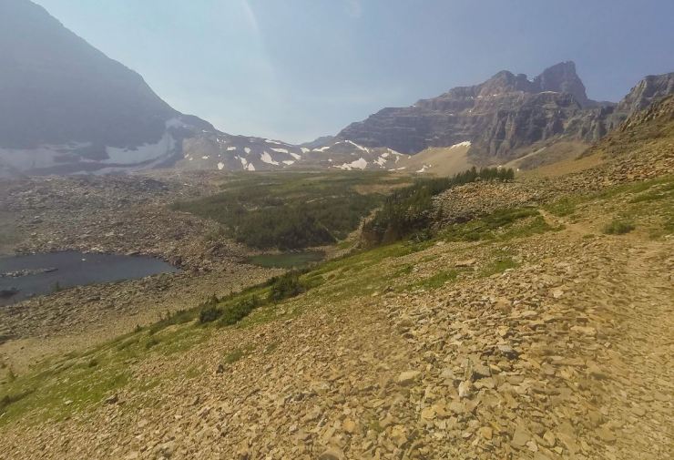
The Bow Summit Lookout hike starts and ends at the Peyto Lake parking lot. The trail leads you past a couple lookout points that provide prototypical amazing views of Peyto Lake. At the summit and turnaround point, you have a view of Bow Lake, which sits in the distance. This is a great overall hike with views that are very rewarding. One of the main advantages of doing this hike is that it gets you away from the large crowds near the Peyto Lake parking lot.
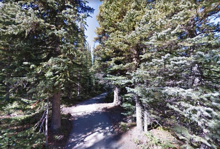
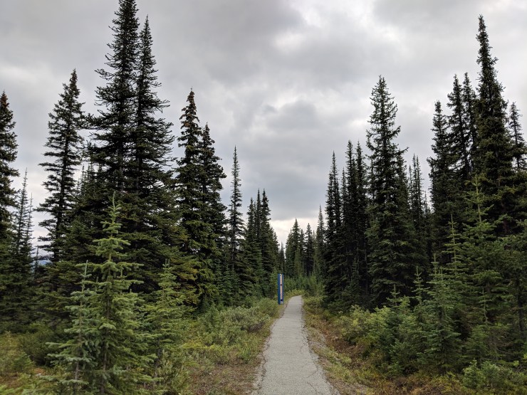
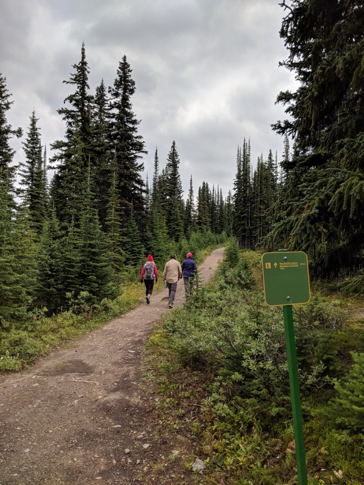
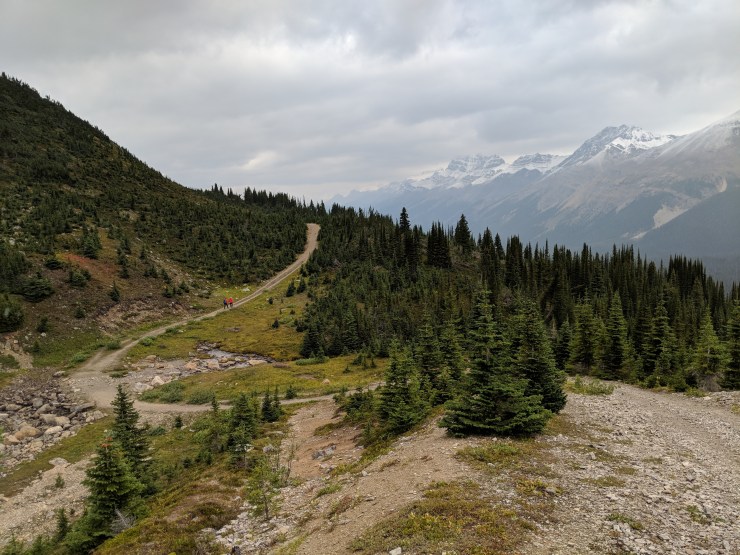
The trail from the Peyto Lake parking lot starts along a paved path through the forest. You do not really get any signs that you are only 0.5 miles from Peyto Lake. Trust that very nice views are close ahead.When you get closer to the first view point there are wood railings to that help keep tourist from straying off the paved path.The first view point/observation deck at Peyto Lake is often very popular. You can still get a nice view if you wait for a turn at the front of the railing. However, the experience is not really relaxing or enjoyable.Prototypical view you can get from the observation deck area near the Peyto Lake parking lot.We wanted to get away from the crowds, so we snapped a few pictures and then hiked on. The trail to Bow Summit Lookout is not exactly well marked at first. However, you want to hike uphill to the southeast towards Bow Lake. You do not want to hike down towards the shore of Peyto Lake (at least not if you are hiking to Bow Summit Lookout…).Not far from the first observation point, you will find the elusive trail sign marking the start of the Bow Summit Lookout trail.The trail alternates between fire roads and narrower trails. At one particular point you reach a Y junction. Take the trail to the left, which leads to fire road and then to Bow Summit Lookout. The trail to the right leads to a look out over Peyto Lake, but you can come back this way after seeing the Bow Summit Lookout area.Section of the trail on a fire road. As you get higher in elevation you will start to get some better views.View from the trail looking east across Bow Valley.Eventually, you get a view of Mount Jimmy Simpson ahead. The trail meanders up to the left of this peak.Section of the Bow Summit Lookout Trail that leads around the left side of Mount Jimmy Simpson.Another view looking out over the Bow Valley and the Icefields Parkway.A fire road leads up the final climb to near the Bow Summit Lookout (pictured: Smartwool merino 150 long-sleeve base layer)Then the fire road stops and you take a single track trail a bit further until you have a nice view of Bow Lake in the distance.View of Bow Lake from the Bow Summit Lookout.After checking out the view of Bow Lake from the summit, you then turn around and head back towards Peyto Lake.About ~0.7 miles after turning around, there is a narrow trail to the left. Take that trail and it leads downhill to a great viewpoint over Peyto Lake.View of Peyto Lake from the upper viewpoint. At this area we saw no other hikers or tourists.Panoramic view from the upper viewpoint over Peyto Lake.From this viewpoint, you then descend down and meet up the Bow Summit Lookout trail at the Y junction you previously passed.
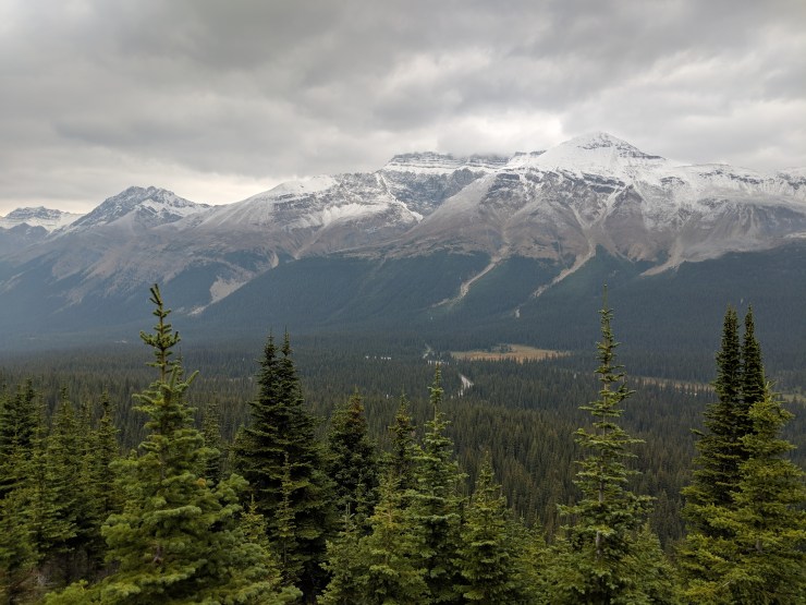
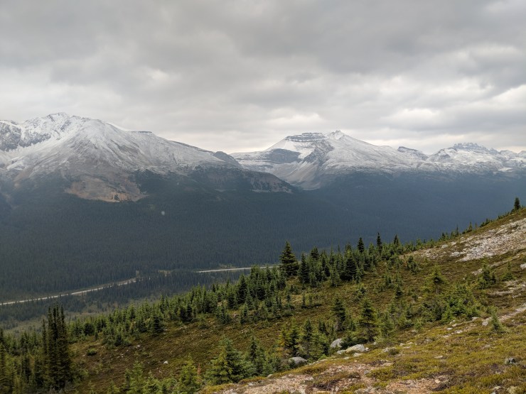
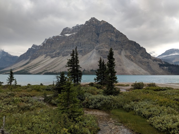
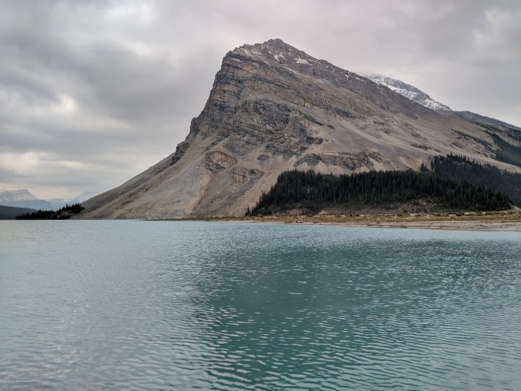
View of Bow Lake and the Crowfoot Mountain backdrop as seen from a turn on the Icefields Parkway.
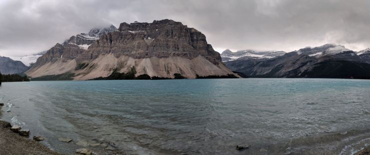
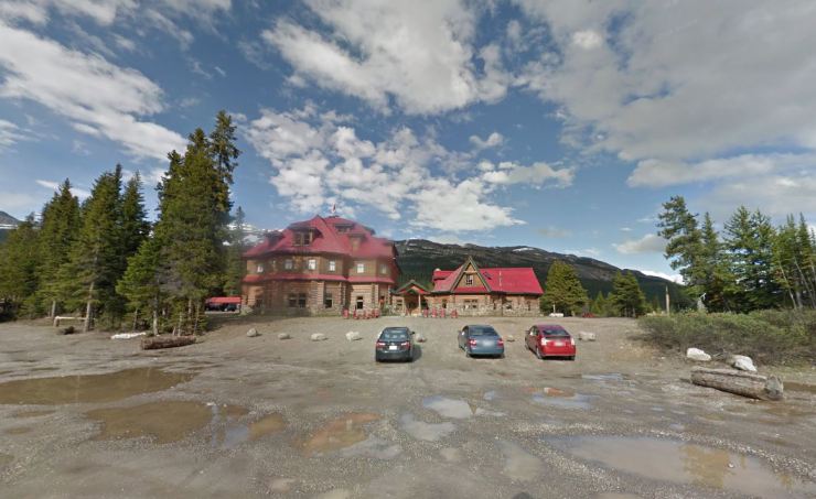
Bow Lake lies right off the Icefields Parkway and is a common stop for most visitors to Banff National Park. It is about 1 hour from the town of Banff and sits close to Peyto Lake. Bow Lake is highly photogenic with the Crowfoot Mountain forming an intimidating backdrop. Near the Bow Lake parking area you will find the Simpson’s Num-Ti-Jah Lodge, which sells beverages, snacks, and souvenirs. Near the lodge you will find the trailhead for the Bow Glacier Falls Trail, which is described below.
Bow Glacier Falls Trail – 5.5 mile out and back, +/- 800 feet of elevation
Overall map of the Bow Glacier Falls trail at Bow Lake (black line)
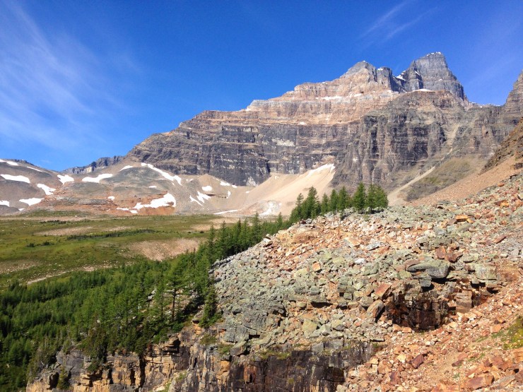
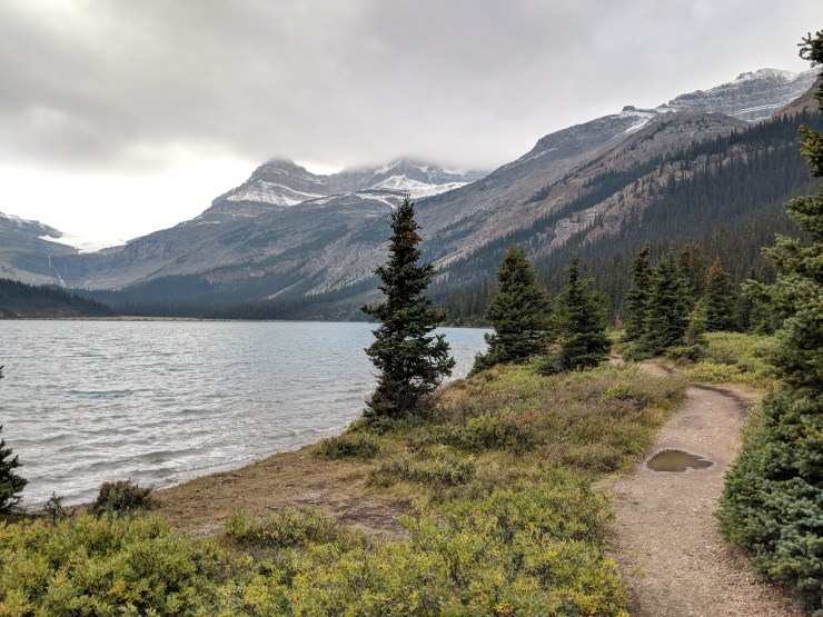
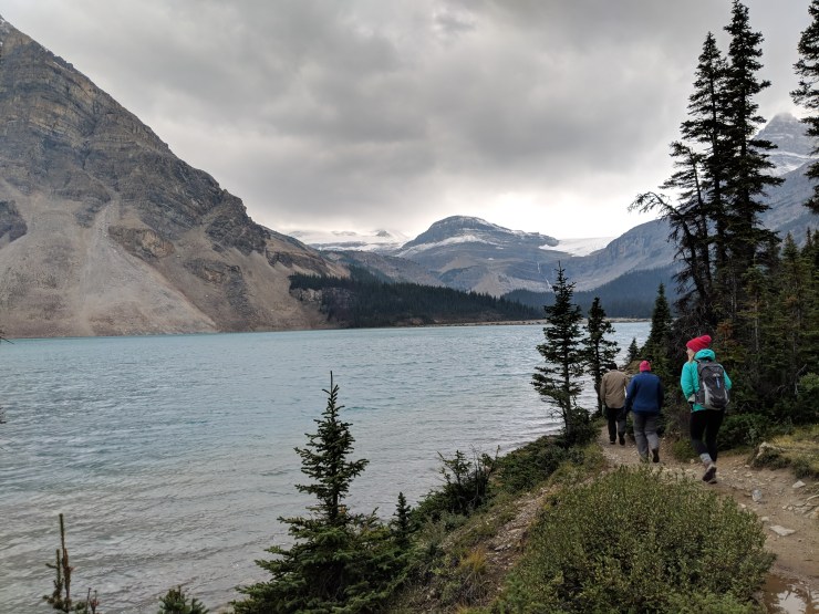
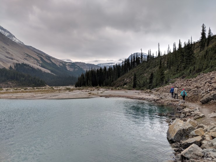
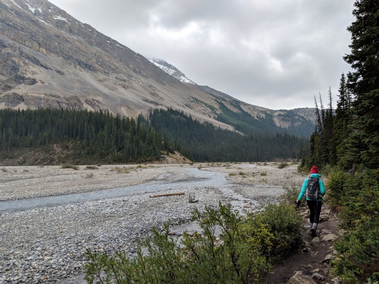
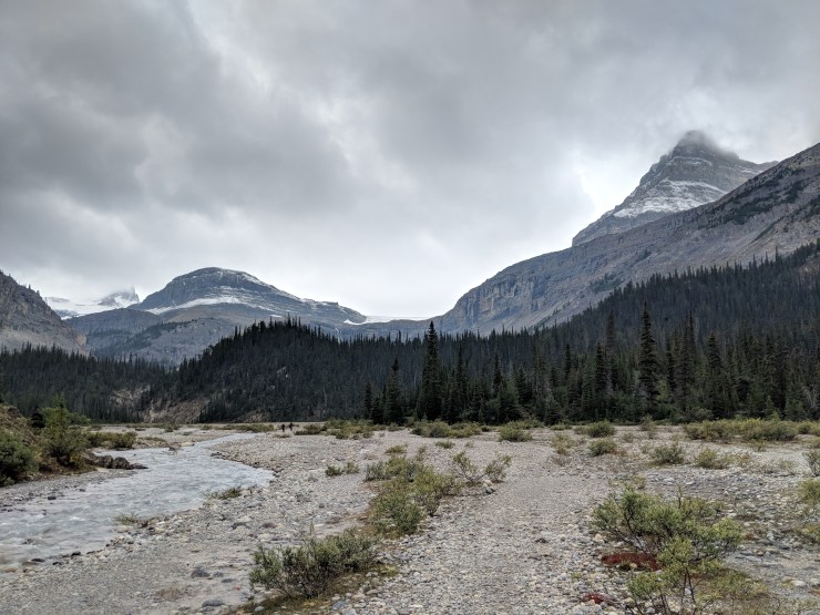
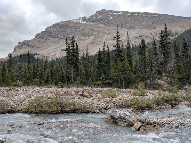
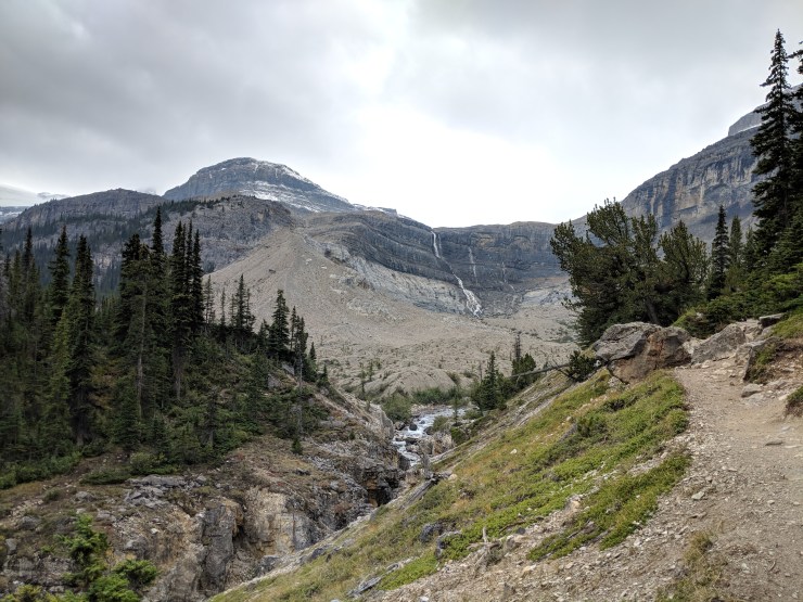
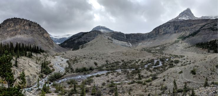
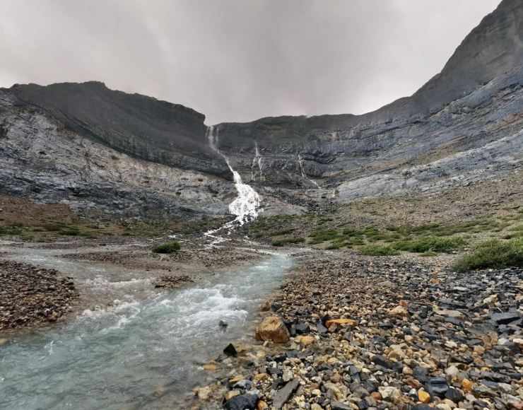
The Bow Glacier Falls hike is a very scenic 5.5 mile hike that provides views of Bow Lake and the beautiful Bow Glacier Falls. The trail meanders along the shore of Bow Lake before eventually following the river that flows between the lake and the falls. You can then hike to a great viewpoint of Bow Glacier Falls (120 meters tall).
This hike provides a great view of the water system that feeds Bow Lake. You see the Bow Glacier high above the falls. The melt from this glacier forms a tarn (not visible on this hike, but visible from nearby peaks), which is the water source for Bow Glacier Falls. The water from the falls then feeds into the stream system that flows into Bow Lake. The views along the entire trail are very nice and the hike is not overly difficult.
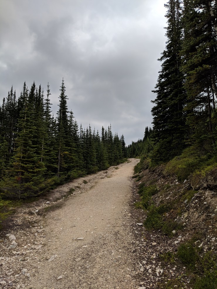
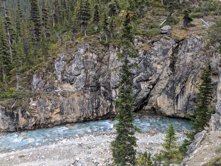
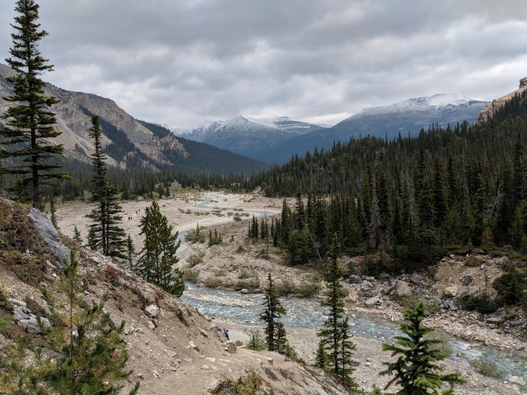
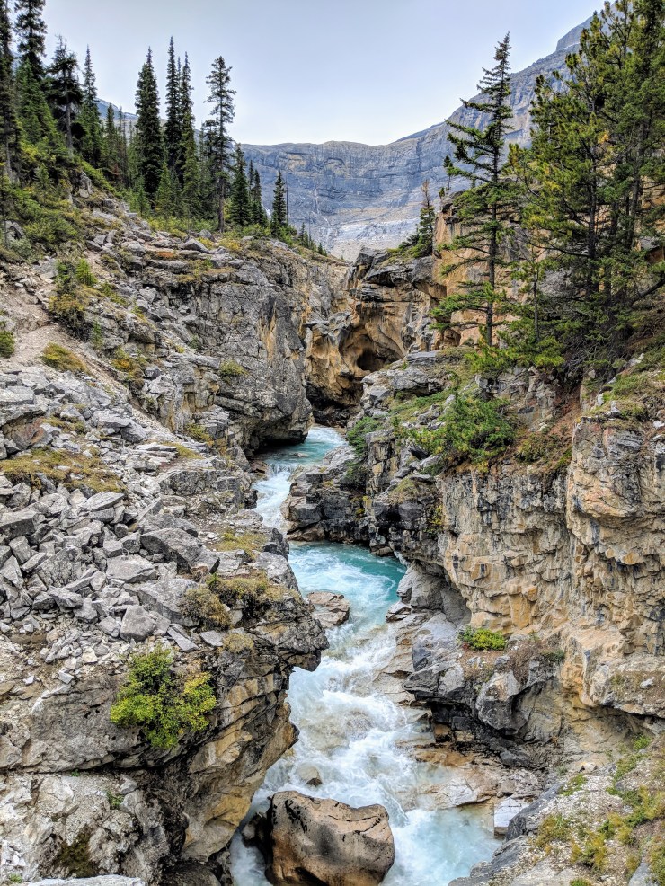
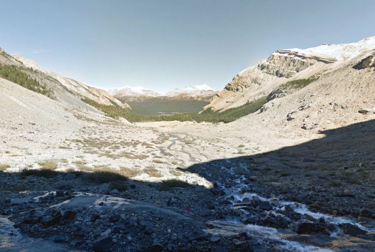
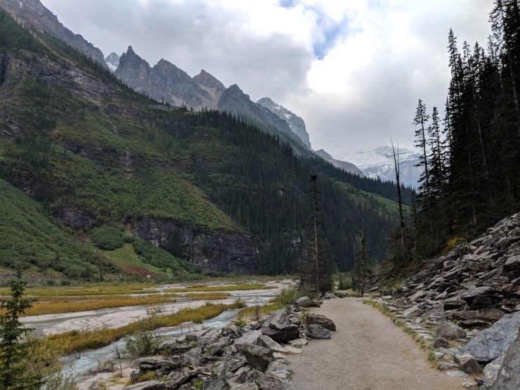
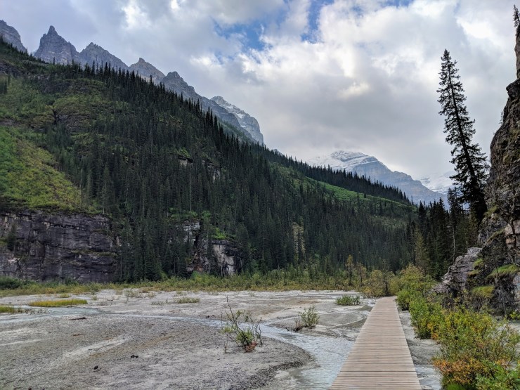
Panoramic view of Bow Lake from near the shore. The Bow Glacier Falls hike travels along the north shore of Bow Lake (right side of this picture).The trailhead for the Bow Glacier Falls hike is near the Simpson’s Num-Ti-Jah Lodge. The lodge is a short walk from the parking area at Bow Lake.The start of the Bow Glacier Falls trail heads to the north shore of Bow Lake.The views of Crowfoot Mountain and Bow Lake are spectacular.View from the north shore of Bow Lake looking south.The Bow Glacier Falls Trail meandering along the shore of Bow Lake. You can see the falls and Bow Glacier (above the falls) in the distance on the left side of the image.The first mile of the hike is along the Bow Lake shore. For most of the hike you can see Bow Glaciers Falls, which is the ultimate midway point for the hike (pictured: North Face Venture 2 rain jacket)Hiking along the Bow Glacier Falls Trail near where the trail leaves the shore of Bow Lake and begins to follow a stream.Another view of Crowfoot Mountain rising up behind Bow Lake.The Bow Glacier Falls Trail then meanders along the side of the stream that feeds into Bow Lake. The trail is pretty flat for about another mile.Looking forward towards where the trail follows the stream.The stream and trail run through a valley with mountains on either side. Thus, the views are great no matter where you look.At about the 2 mile mark, the trail begins to climb up some stairs. to the left of the stairs there are some great views of the stream cascading through a slot canyon. It is worthwhile to take a minute checking out the canyon.View of the stream as it exits the canyon. The colors here are great.The trail climbs a few hundred feet in the next quarter mile starting with the stairs, so you gets some nice views of the stream from above.View looking back towards Bow Lake after climbing up the stairs.At bit further up the trail, there is a rock bridge over the canyon. This is a trail junction that leads over to the Bow Alpine Hut. For the Bow Glacier Falls Trail, do not cross the bridge. However, the views of the canyon and stream from atop the bridge are great and are worth a quick side trip.View of the canyon from atop the bridge. You can see Bow Glacier Falls in the distance.The Bow Glacier Falls Trail continues towards the falls.The trail reaches basin area where you get a great panoramic view of Bow Glacier Falls and the surrounding mountains.The Bow Glacier Falls Trail follows the stream all the way up to the base of the falls. You can scramble as far as you would like and turn around when you are satisfied.View of Bow Glacier Falls from near the end of the Bow Glacier Falls Trail (credit: Jove Cana)Looking back towards Bow Lake from near the base of the falls.Up close view of Bow Glacier Falls. At this point you can either turn around and head back or you can explore some of the side trail that scramble up to the Bow Glacier Tarn or to the peak of Mount Jimmy Simpson!
View from the shore of Lake Louise looking towards the Plain of Six Glaciers.
Lake Louise is possibly the most photographed lake in Banff National Park, and the Plain of Six Glaciers hike is one of the more popular day hikes in the park. Despite the crowds, it is still worth a trip to see Lake Louise in person. The milky turquoise water and mountain backdrop make for a great view. Many tourists also enjoy renting canoes and exploring the lake via the water. It’s also possible to stay in the Fairmont Chateau Hotel that sits right near the shore of Lake Louise.
Plain of Six Glaciers Trail – 9 mile out and back, +/- 2,500 feet of elevation
Overall map of the Plain of Six Glaciers hike from Lake Louise (purple)
Elevation profile for the Plain of Six Glaciers hike from Lake Louise
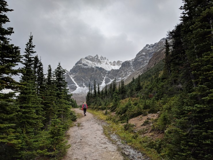
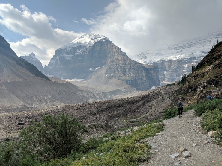
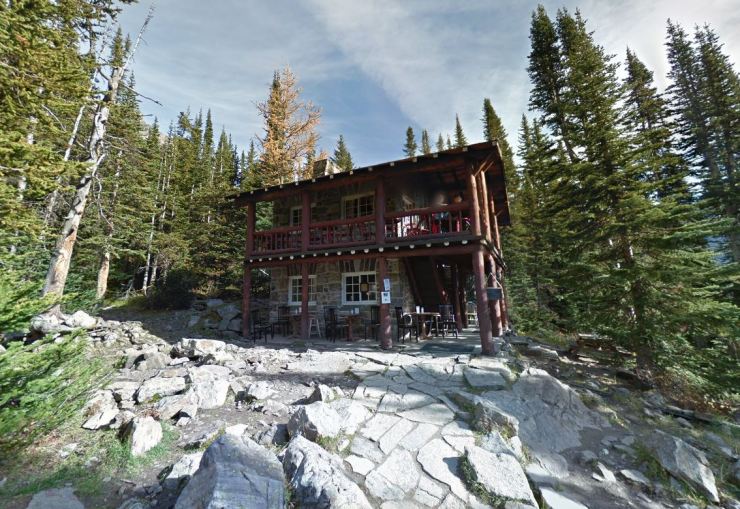
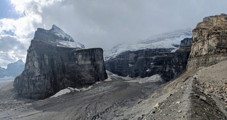
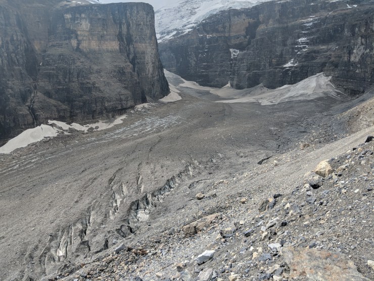
The Plain of Six Glaciers hike is the most popular hike in the Lake Louise area. When you arrive at Lake Louise you will first want to enjoy the scenery and take a few photos of the lake. Then, begin the hike as is meanders along the shore of Lake Louise. When you reach the end of the lake, the trail begins to climb up a valley that was carved out by several glaciers. Near the end of the trail, you will find a teahouse where you can grab a snack. If you continue past the teahouse, you reach the turn around point, which provides some great views of the surrounding mountains and glaciers. You can then either retrace your steps back to Lake Louise or you take the Highline Trail up to the Bee Hive to see Lake Agnes (and return to Lake Louise from there). You are likely to encounter other hikers throughout the entire hike as it is busy and popular.
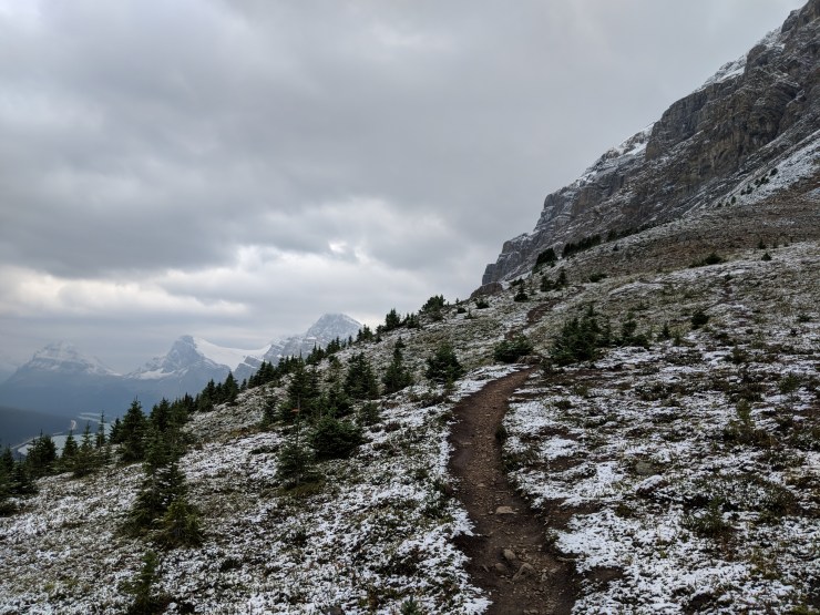
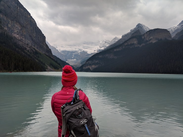
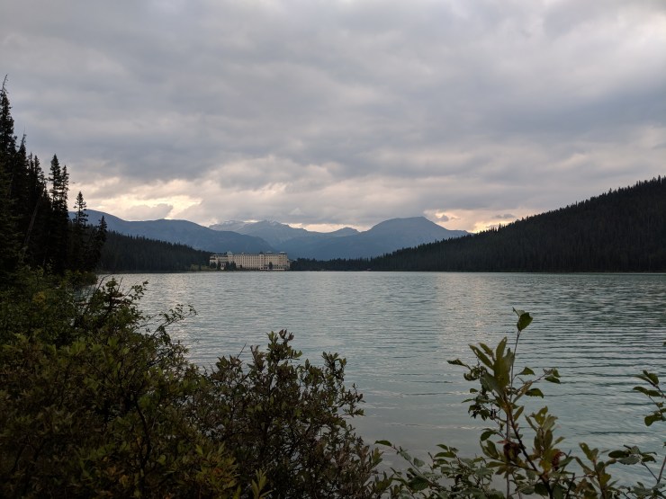
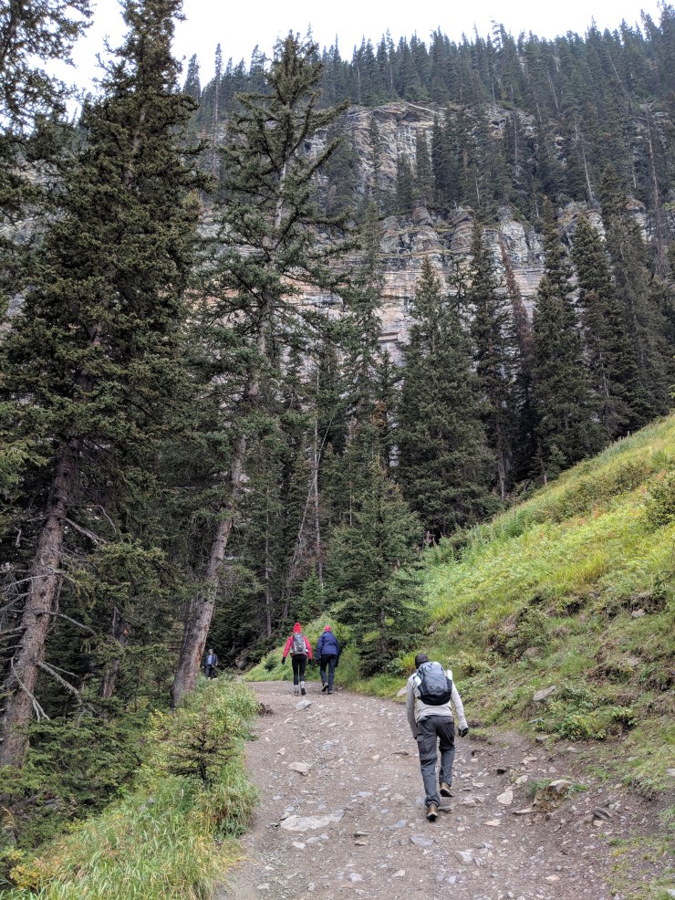
Enjoying our first view of Lake Louise upon arrival. The Plain of Six Glaciers Trail heads up into the valley in the center of the picture (pictured:Osprey Tempest 20 day pack)View of several canoes in Lake Louise. The trail follows the shore of the lake for ~1.5 miles, so you can view Lake Louise from several angles. Here we see the Fairview Mountain rising above the lake.Hiking along the beginning section of the Plain of Six Glaciers Trail.Fairview Mountain and Lake Louise.Looking back at the Fairmont Chateau hotel, which sits near the shore of Lake Louise.The Plain of Six Glaciers Trail wraps all the way around to the southwest end of Lake Louise.When you reach the end of the lake at ~1.5 miles, the trail briefly climbs.The Plain of Six Glaciers trail climbs 400-500 feet in this brief section. In this section you may see rock climbers scaling some of the vertical walls near the trail (pictured: prAna Zion convertible hiking pants)After the climb, the trail drops back down to the level of the stream.The Plain of Six Glaciers Trail then cross a boardwalk that goes over the stream that flows into Lake Louise.Looking back towards the Fairmont Chateau and Lake LouiseFrom this point, the trail steadily climbs for 2.5 miles until you reach the viewpoint. The trail goes through a valley so there are mountain views on either side.The Plain of Six Glaciers Trail as it climbs into the valley.View looking towards the Plain of Six Glaciers.Eventually the valley really opens up and get a nice view of the area previously carved out by glaciers.Around the 4 mile mark, you reach the Lake Louise Teahouse. Here you can use the restroom or buy a drink or snack.There are several chairs and tables near the teahouse where you can take a break and enjoy the view.View of the large debris field near the Lake Louise teahouse.When you are ready, the trail continues to go forward to the Plain of Six Glaciers viewpoint (pictured: Icebreaker Oasis half-zip long sleeve top)Looking back at Lake Louise from near the Plain of Six Glaciers viewpoint.To reach the end of the Plain of Six Glaciers Trail, you follow the trail along a skinny moraine (right side of image)At the viewpoint, you can see the glaciers up close. Then, you turn around and head back to the teahouse.
Honestly, we did not see much wildlife during our week in Banff. We saw some grouse and a porcupine while on the Lake Louise hike. On the other hikes we didn’t see any large mammals other than humans (no bears or moose).
Hi Joan – It will largely depend on how much hiking you plan to do at each lake. If you plan to just go to the main view points at each lake, it is very possible to see both in the same day. I would recommend visiting Moraine Lake first early in the morning because the parking lot there fills up quickly. You can reach nice viewpoints for both lakes within ~1 mile of the parking lots.
If you plan to go any hikes at either of the lakes, it would be a long day if you visit both lakes. There is a pretty long drive between the lakes, so keep that in mind. If you are a big hiker, I would recommend planning to spend more time at Moraine Lake. There are plenty of nice trails there that provide some really great views. It would be a shame to rush.


Awesome pictures looks like the wildfires didnt effect you much at all. Did you see any bears or other animals on the hikes?
LikeLike
Honestly, we did not see much wildlife during our week in Banff. We saw some grouse and a porcupine while on the Lake Louise hike. On the other hikes we didn’t see any large mammals other than humans (no bears or moose).
LikeLike
Both Moraine Lake and Peyto Lake look beautiful! Is it too much to visit both in the same day? Thanks
LikeLike
Hi Joan – It will largely depend on how much hiking you plan to do at each lake. If you plan to just go to the main view points at each lake, it is very possible to see both in the same day. I would recommend visiting Moraine Lake first early in the morning because the parking lot there fills up quickly. You can reach nice viewpoints for both lakes within ~1 mile of the parking lots.
If you plan to go any hikes at either of the lakes, it would be a long day if you visit both lakes. There is a pretty long drive between the lakes, so keep that in mind. If you are a big hiker, I would recommend planning to spend more time at Moraine Lake. There are plenty of nice trails there that provide some really great views. It would be a shame to rush.
LikeLike
Your photos are absolutely wonderful! Thank you SO much for writing this!! I cannot wait for my Banff vacation this summer.
LikeLike