


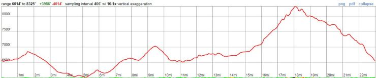
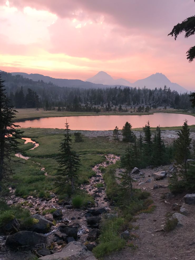
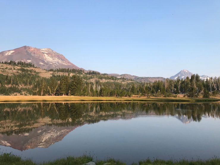
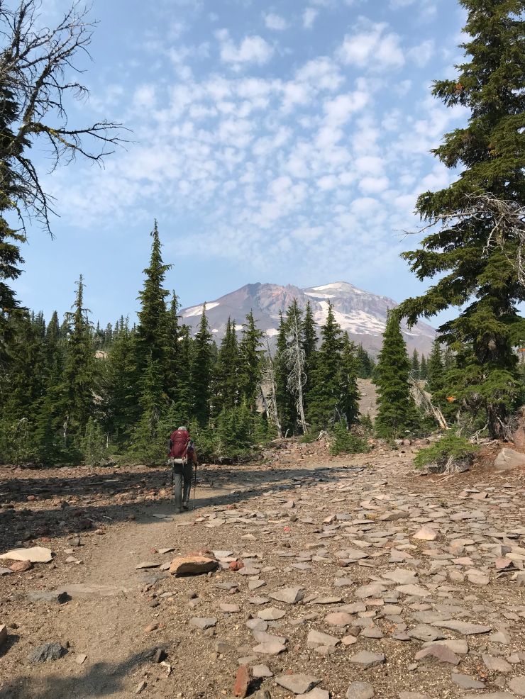
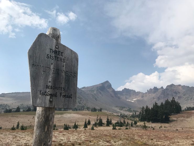
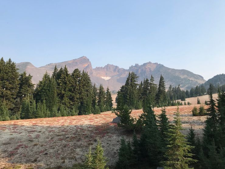
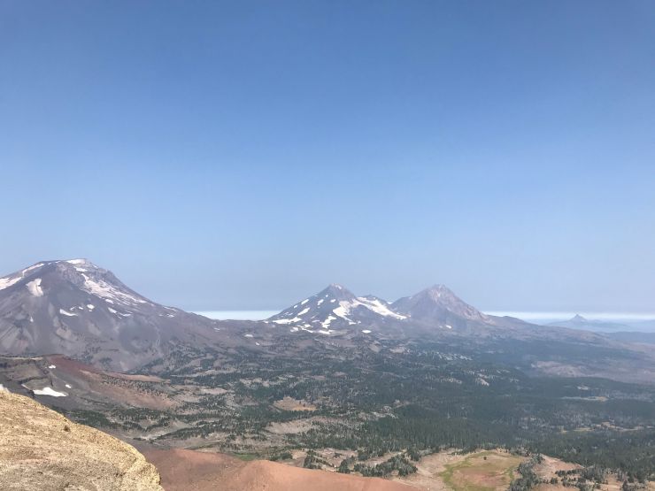
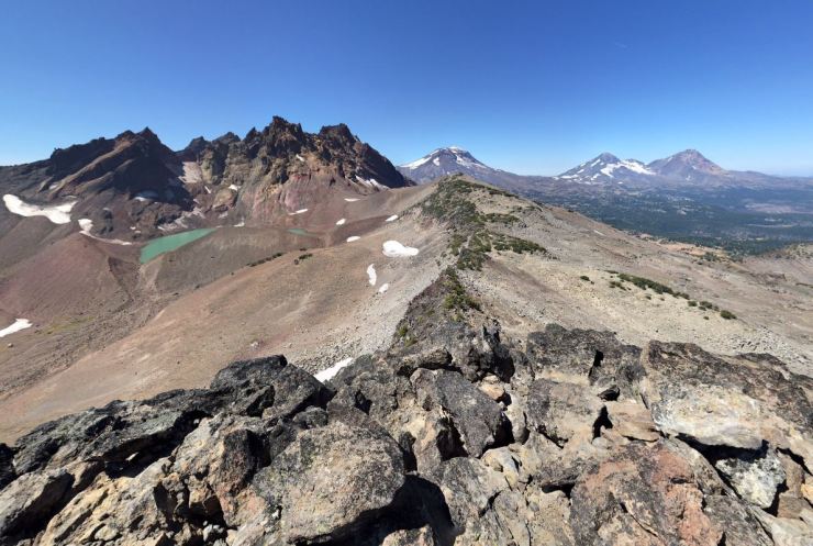
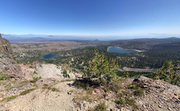
Trip Overview: The Broken Top Loop in the Three Sisters Wilderness is a ~24 mile backpacking loop that is known for providing great views of the Three Sisters (three peaks, each over 10,000 feet). This loop is one of the better known backpacking itineraries in Oregon and is typically hike over the course of two to three days. Starting at 6,500 feet of elevation, the Broken Top Loop climbs to a peak elevation of 8,350 feet and has roughly 4,200 feet of elevation change over the course of the 24 mile loop. Highlights include views of the Three Sisters, Broken Top, several lakes, volcanic features, and small glaciers. The majority of the photos in this report were taken in mid August 2018.

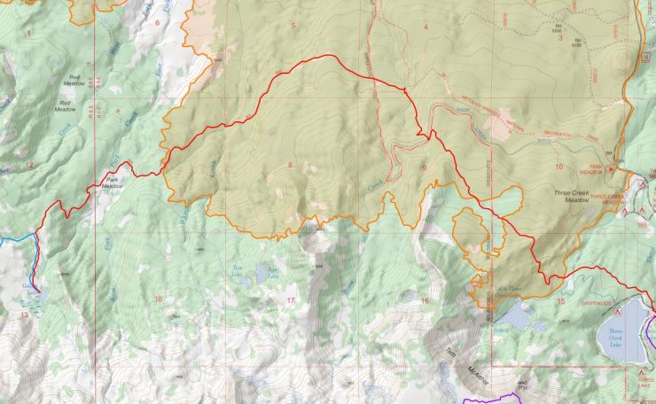
- Overall map of the Broken Top Loop in the Three Sisters Wilderness (PDF)
- Link to purchase USGS topographic map of Broken Loop area (here)
Jump to Day 1 hike – trailhead to Golden Lake
Jump to Day 2 hike – Golden Lake to Crater Creek
Jump to Day 3 hike – Crater Creek to trailhead
Shop Deal of the Day at REI Outlet (up to 50% off)!
Preparations:
Click here to read more about Permits
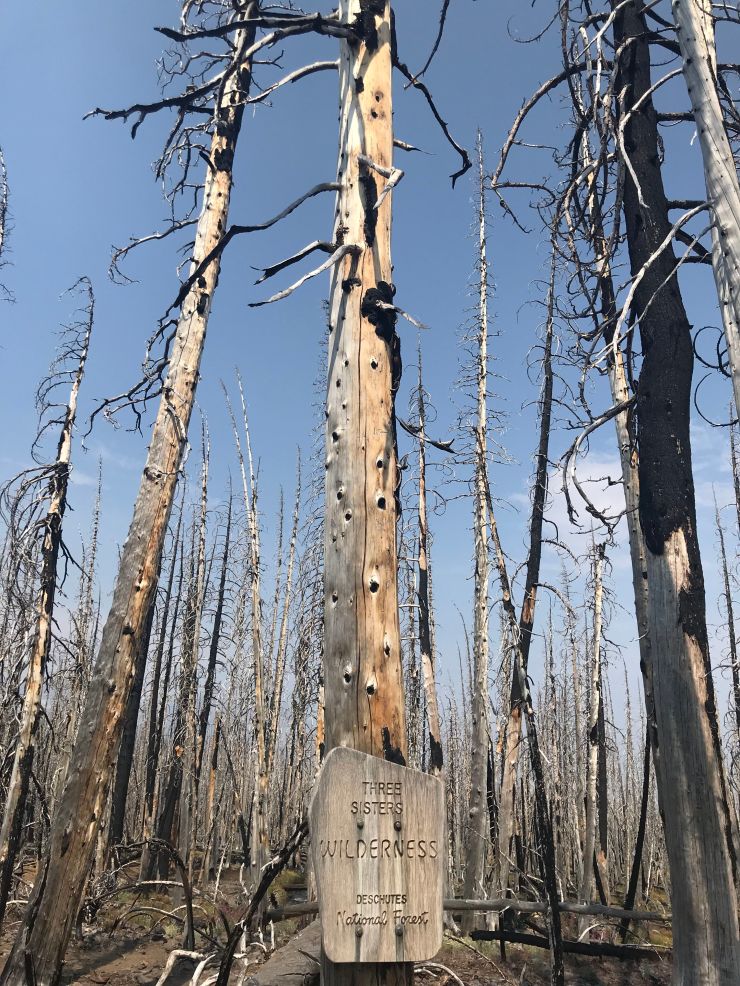
Permits: Between Memorial Day and October 31, all hikers and backpackers are required to fill out a self-issued permit at the trailhead before heading out into the Three Sisters Wilderness. You do not need to reserve a permit beforehand, you simply fill out the permit upon arrival and enter your information (for Forest Service usage data and in case a rescue is needed). More information about permits can be found on the Forest Service website.
Important regulations on this trek include fire restrictions at Green Lakes and at Golden Lake. You are also required to camp at designated sites near Green Lakes. The sites are marked by posts and are first-come, first-serve. Beyond that, standard rules and regulations for backcountry camping in Wilderness areas apply (i.e. leave no trace).
Click here to read more about Logistics
Logistics: This trek is easily start from the Tam McArthur Rim Trailhead and there is space to park your car near the trailhead. The trailhead is only about an hour away from Bend, OR. This trek only reaches ~8,500 feet in elevation at its peak, so you likely do not need to worry about acclimating to altitude. However, there are two Forest Service campsites near the trailhead if you want to camp the night before starting your trek (Three Creek Lake Campground and Driftwood Campground). Both campsite are modest in size, so consider reserving a spot ahead of time if you plan to camp.
Hikers argue about whether the Broken Top Loop is best hiked in the clockwise or counter-clockwise direction. The itinerary described in this report is for the counter-clockwise (CCW) route. The advantage of the CCW route is that you tackle the relatively easy and more boring section of the trail on the first day. This saves the best views for the last two days of the trek. If you hike clockwise, you get the best views on the first day but also must hike up a significant amount of elevation to summit Broken Hand on day one.
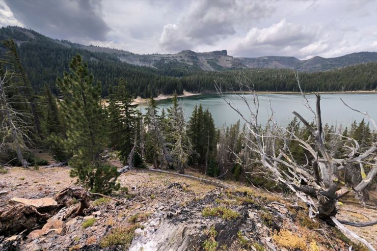
For the trek, most backpackers camp at Golden Lake, Green Lakes, and/or to the south of the unnamed lake (referred to as “No Name Lake”) between Broken Top and Broken Hand. Which campsites you choose really depends on how many days you plan to camp and whether or not you hike clockwise or CCW. There are water sources near each camp. Note that several dead elk were found near No Name Lake in the summer of 2018, so plan to properly sanitize any water taken from this lake or the creeks that flow from it (the elk could be gone by by summer 2019, but I am not sure).
Click here to read more about Difficulty and Conditions
Difficulty and Conditions: Though relatively short at ~25 miles, this itinerary is fairly tough with a good amount of elevation gain. Most hikers complete the loop in 3 days and 2 nights, though it’s possible for experienced backpackers to complete the trip in 2 days.
Most of the trails on this route are established and well marked. However, the section near near the Broken Top summit and Broken Hand is unmaintained and may be hard to follow if there is still snow on the ground. During the summer, the trail is typically well established. That said, it is wise to either bring a topographic map and be familiar with route ahead of time (the unmaintained trails will not be marked on the most maps) or use the AllTrails app or a GPS to follow the route.
Supplies: For the Broken Top Loop you should prepare for a range of temperatures. During the day it is often quite warm, but at night the temperature can drop to cooler temperatures because of the moderate elevation. There is a good amount of elevation gain along the trek, so trekking poles are great choice. If you hike early in the summer, there may still be snow in several sections of the trail. As a result, you will want waterproof hiking boots and will want to bring bug repellent to fend off the many mosquitoes that hatch after the snow starts to melt. It may also be wise to pre-treat your clothes and gear with premethrin to help keep bugs away (this helps reduce the amount of DEET you need to apply to your skin).
There are no regulations regarding bears, so you do not need to bring a bear canister or hang food on this trek. That said, it may still be wise to hang your food to avoid mice or other critters.
Below is a list of the gear that I recommend for the Broken Loop hike:
Hiking clothes
- a lightweight hiking rain jacket (North Face Venture 2 Jacket)
- fast drying synthetic hiking pants (prAna Zion Pants)
- a quick drying long sleeve hiking shirt (Columbia Silver Ridge L/S Shirt)
- wool outer socks (People Socks Moreno 4-pack)
- thin blister preventing base socks (WrightSock double layer Coolmesh)
- quick drying synthetic boxer briefs (ExOfficio Give-N-Go)
- Gore-tex hiking shoes (adidas Outdoor Terrex Fast R Gore-Tex Shoe)
Clothes for camp
- wool leggings (Minus33 Merino Wool Kancamagus Midweight Bottom)
- wool base layer shirt (Minus33 Merino Wool Chocorua Midweight Crew)
- warm wool overshirt (Pendleton Long Sleeve Classic-Fit Board Shirt)
- lightweight down jacket (Patagonia 800-fill Down Jacket)
- lightweight camp shoes (Xero Z-Trail lightweight sandal)
Hiking gear
- topographic map (Nat Geo topographic map)
- trekking poles (Black Diamond Trail Ergo Cork Trekking Poles)
- 2 liter hydration bladder (Platypus Big Zip Water Reservoir)
- 65 liter backpack (Osprey Atmos 65 Liter pack)
- water filtration system (Platypus gravity filtration system)
Camp gear
- strong tent with rain-fly (Alps Mountaineering Chaos 2 Tent)
- inflatable sleeping pad (Therm-a-Rest Trail Pro Sleeping Pad)
- sleeping bag (REI Co-op Igneo 25 Sleeping Bag)
- inflatable camping pillow (Ultralight Inflating Pillow)
- lightweight backpacking chair (Helinox Chair Zero)
- lightweight lantern (MPOWERD Luci Outdoor 2.0)
- headlamp (Black Diamond Cosmo Headlamp)
- multi-tool with knife (Gerber MDime Mini Multi-Tool)
- Ursack (Ursack Major bear bag) or bear canister (BearVault BV500)
- lightweight stove (MSR PocketRocket 2)
- lighter (BIC plastic lighters)
- 2 liter pot (GSI Outdoors Halulite Boiler Pot)
- coffee cup (GSI Outdoors Glacier Stainless Cup)
- lightweight spork (Snow Peak Titanium Spork)
- small, quick drying towel (REI mutli towel mini)
Random
- wet wipes (Stall Mates individually wrapped wipes)
- mole skin for blisters (Blister medic kit)
- lightweight trowel (GSI Sanitation Trowel)
- small amount of duct tape for gear repairs
- chapstick and sun screen
Food and drink
- a variety of my favorite dehydrated meals
- electrolyte replacement (NUUN Hydration Tablets)
- quick snacks (Clif Shot Bloks and Clif energy bars)
- instant coffee (Starbucks VIA)
- small plastic water bottles filled with whisky 🙂
……….
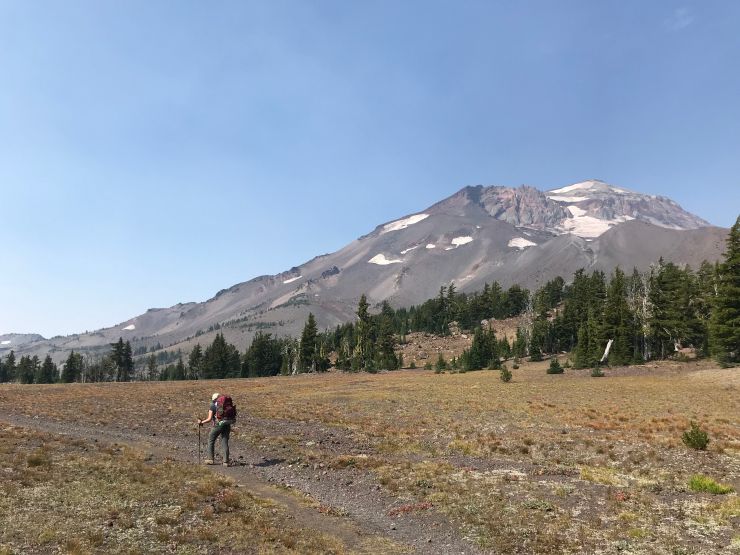
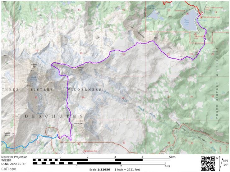
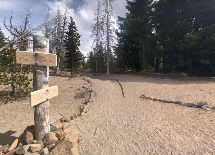
Day 1: 8 miles; +1,170 / -1,080 feet; Tam McArthur Rim Trailhead to Golden Lake
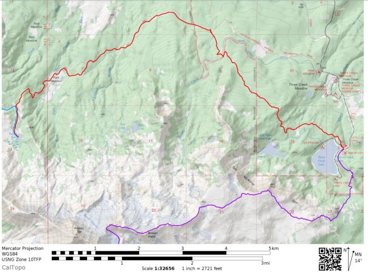
Three Sisters Wilderness Broken Top Loop Day 1 Map (PDF)

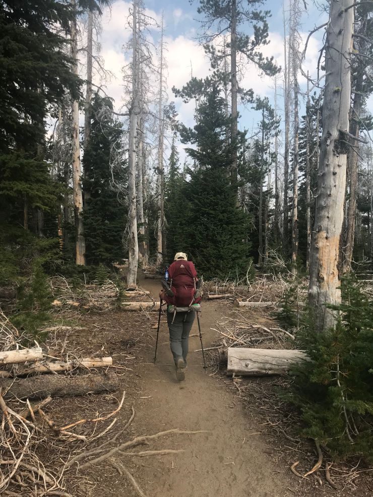
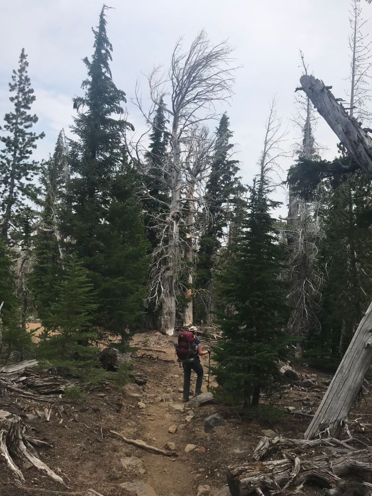
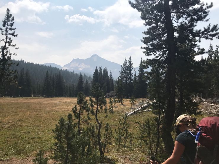
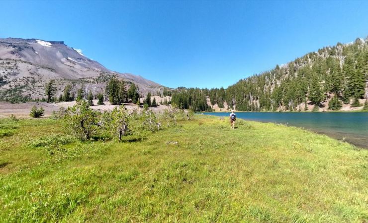
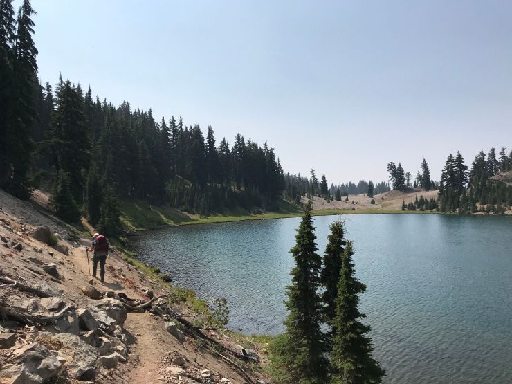
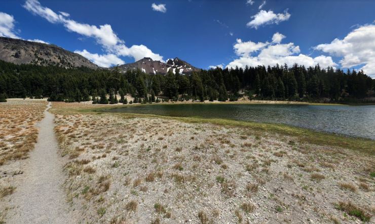
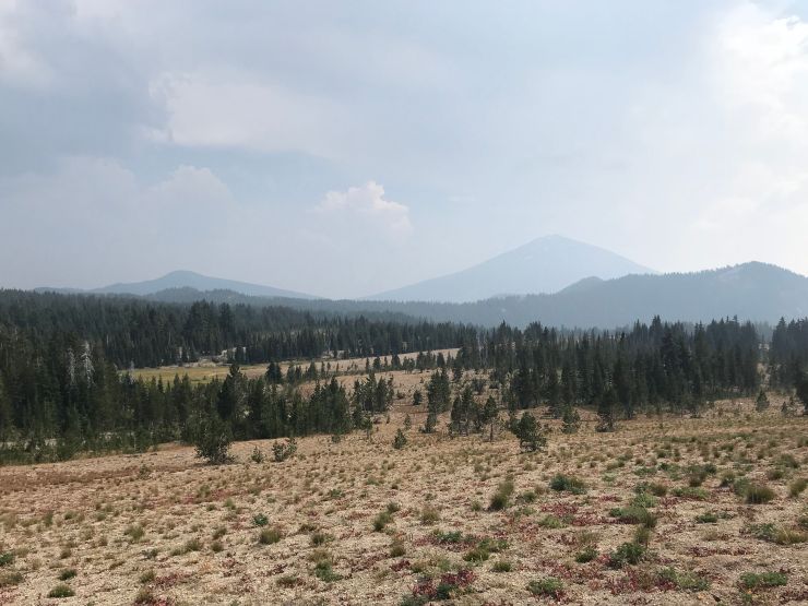
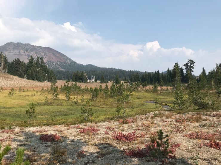
The first day of the CCW Broken Top Loop trek starts with a relatively easy hike from the Tam McArthur Trailhead to Golden Lake. After leaving the trailhead, you head to the north end of Three Creek Lake. Here you hop on the Little Three Creek Lake Trail (#4076) and hike roughly 0.7 miles before joining up with the Park Meadow Tie Trail (#4102) that heads northwest. After ~2.5 miles on trail #4102, you reach a junction and head west along the Park Meadow Trail (#4075). In roughly ~3.3 miles you reach the junction that leads to Golden Lake, which was the campsite for night 1.
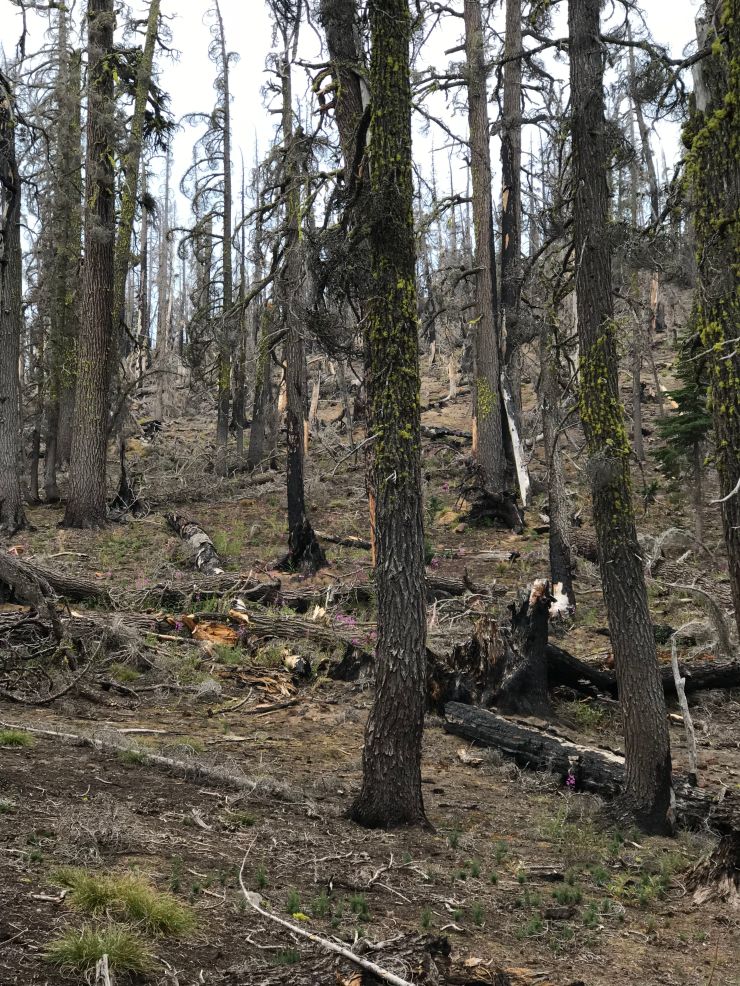
The views at the start of the trek are not spectacular as you hiked through a previous burned forest. As you get closer to Park Meadow and Golden Lake, the views get better! Golden Lake makes for a good campsite if you want to keep day relatively short. Some backpackers prefer to hike all the way to Green Lakes on the first day. You really can’t go wrong either way!


……….
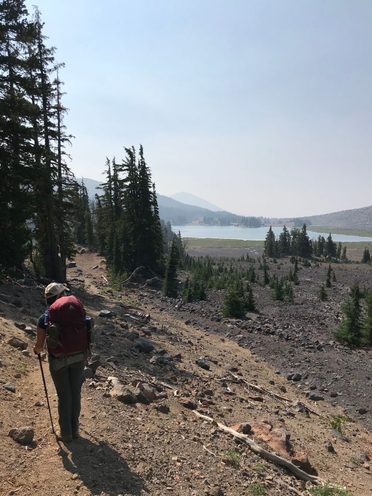
Day 2: 7.6 miles; +1,400 feet / -1,100 feet; Golden Lake to Crater Creek
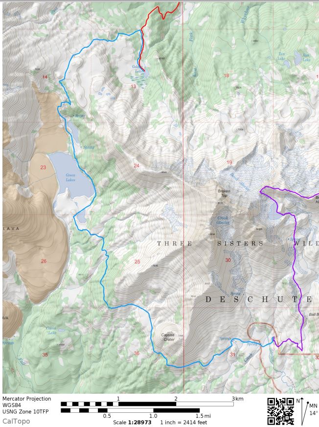
Three Sisters Wilderness Broken Top Loop Day 2 Map (PDF)

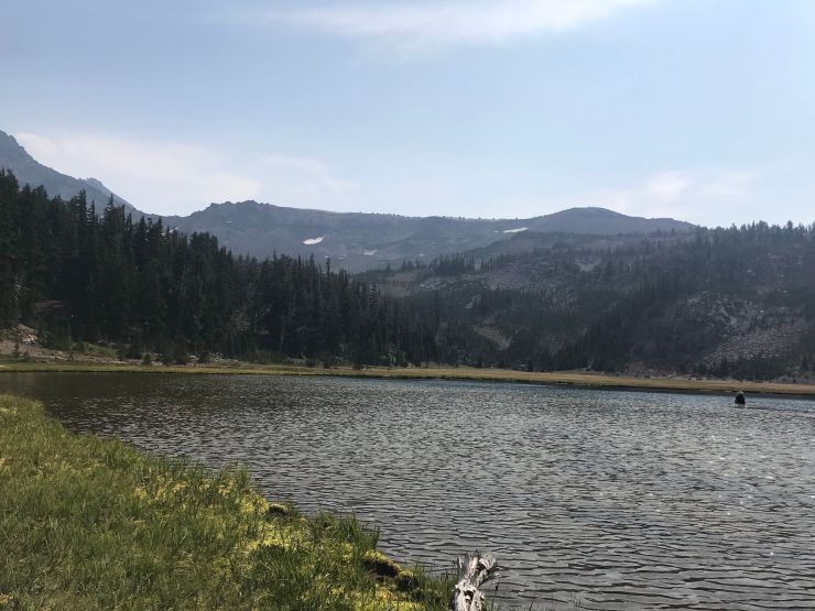
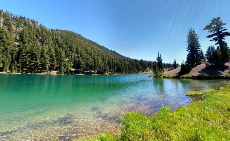
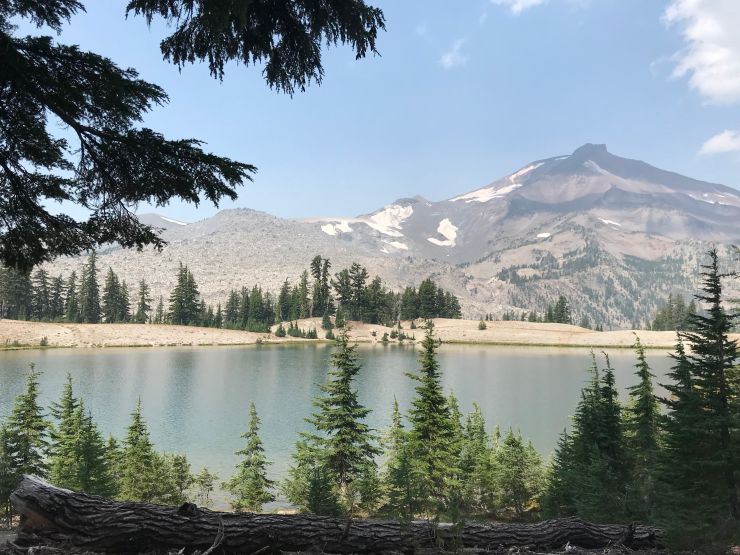
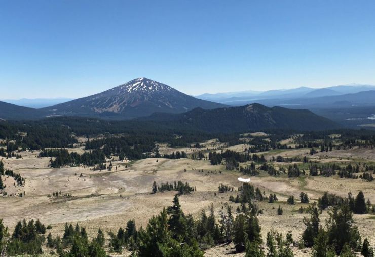
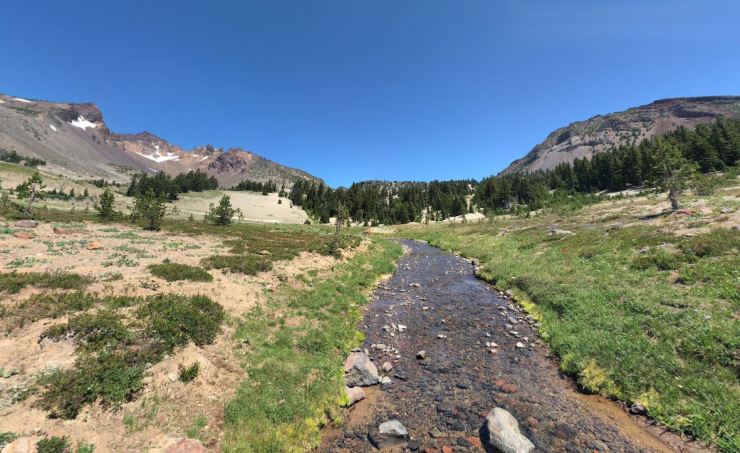
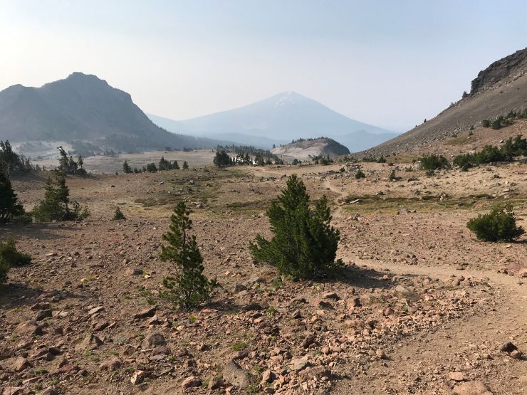
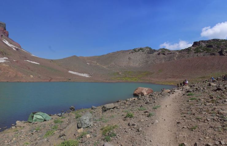
On day 2, you hike 0.5 miles out from Golden Lake and then head west along the Green Lakes Trail (#17). You can either hike through Green Lakes and camp further along the trail or you can camp at Green Lakes and have a very easy second day. If you want to push further, you continue past Green Lakes to the Broken Top Trail (#10) and can camp near one of the creeks by Balle Butte and Broken Top Trailhead. For this itinerary we camped near Crater Creek, which is about 4 miles past Green Lakes. This made the distance for each day’s hike about 8 miles. If you had extra time, you could spend a night at Green Lakes and tackle some of the side trails that lead up Broken Top and the South Sister mountains.
……….
Day 3: 7.9 miles; +1,800 feet / -2,500 feet; Crater Creek to Tam McArthur Trailhead
Three Sisters Wilderness Broken Top Loop Day 3 Map (PDF)

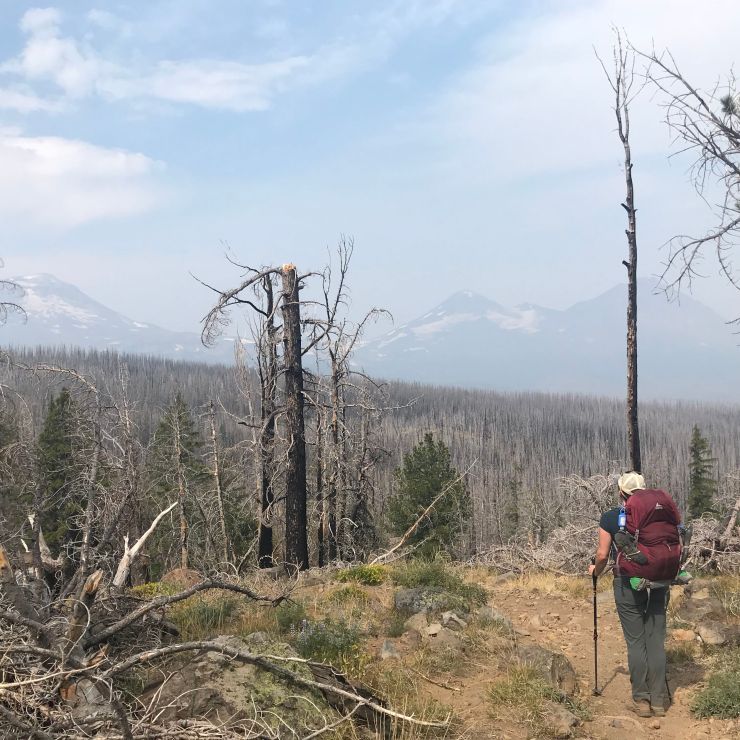
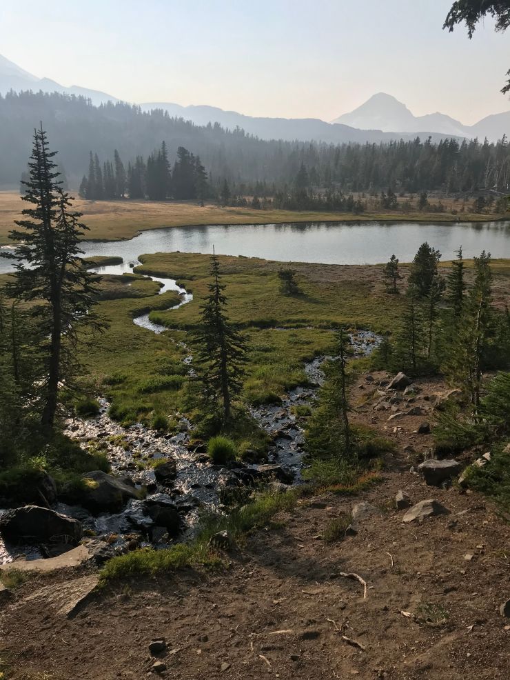
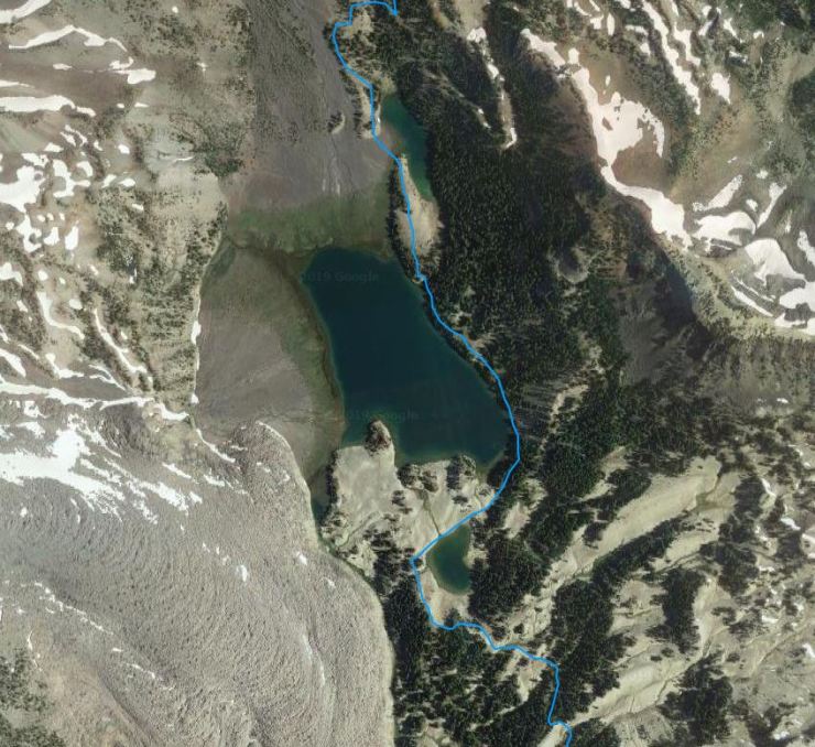
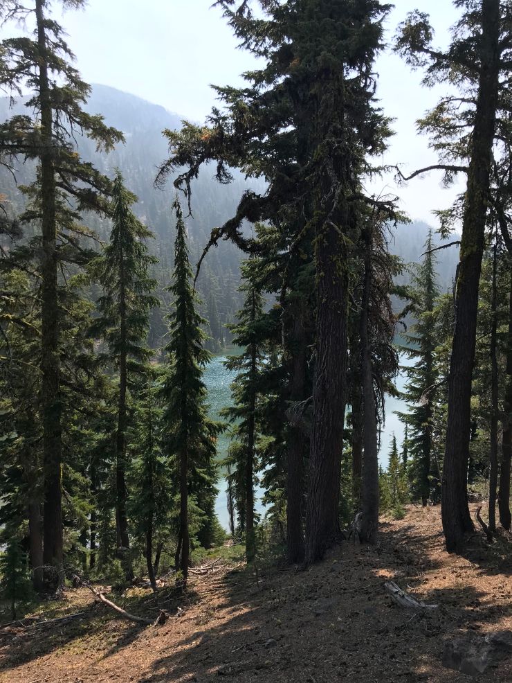
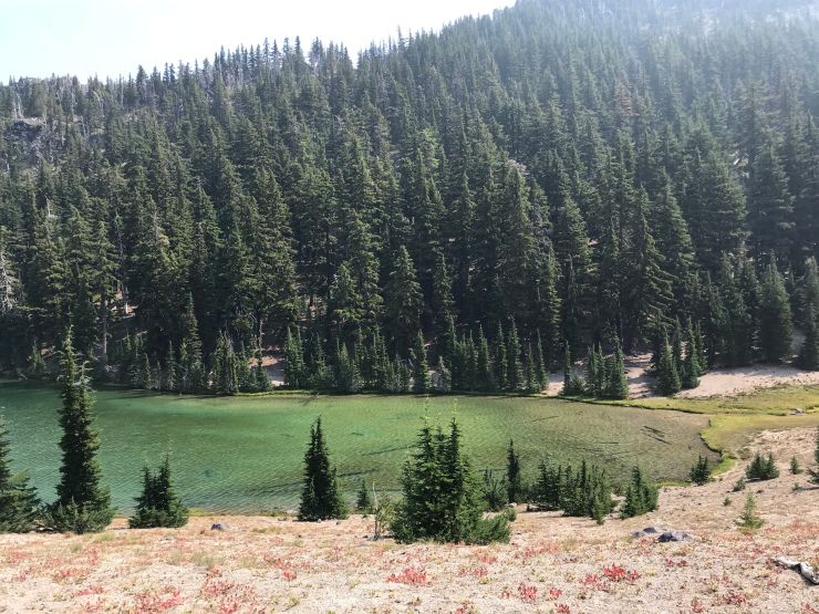
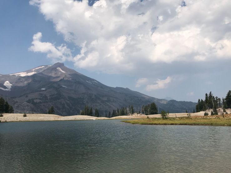
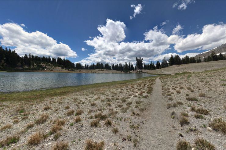
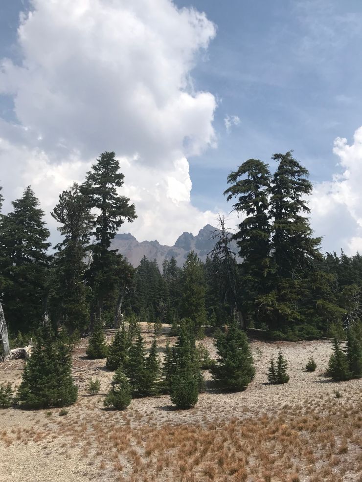
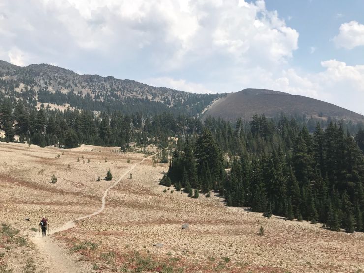
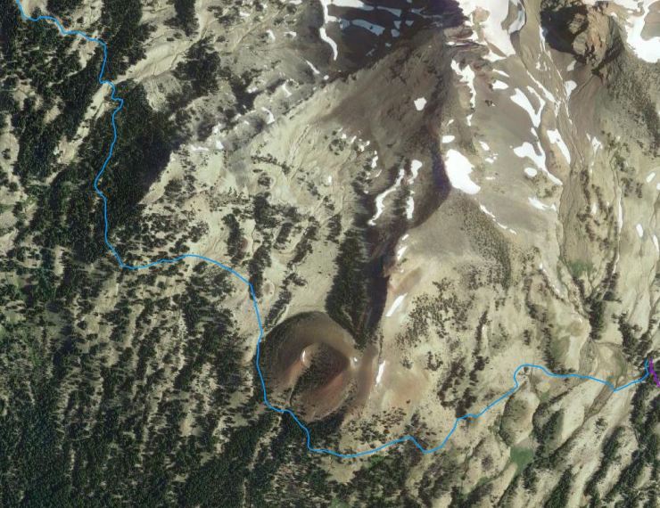
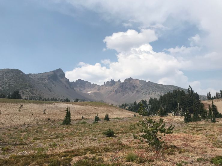
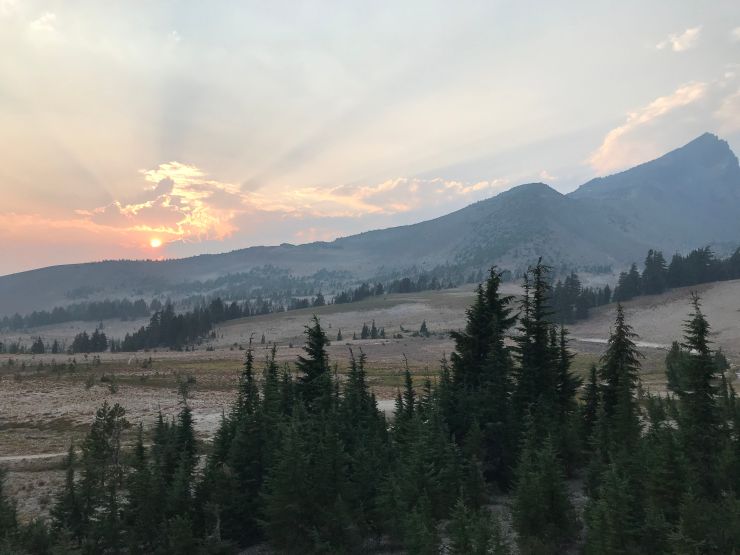
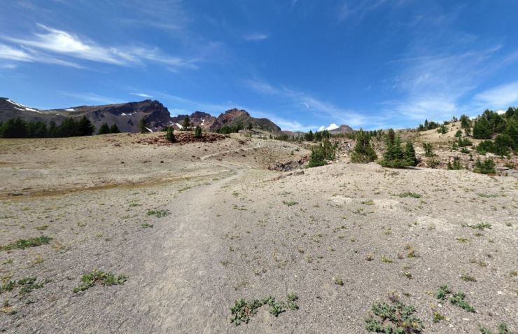
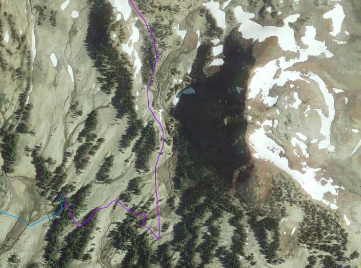
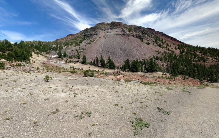
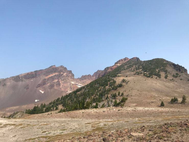
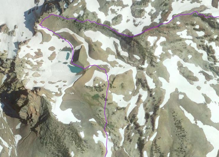
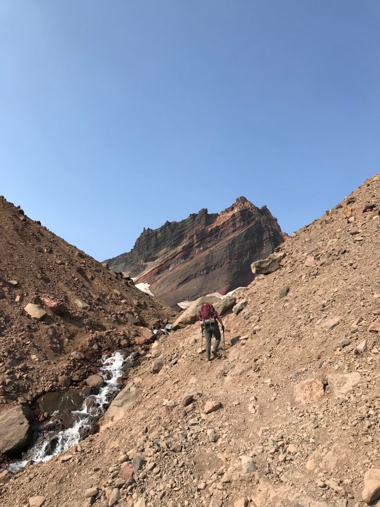
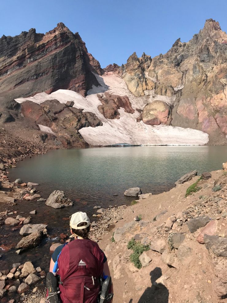
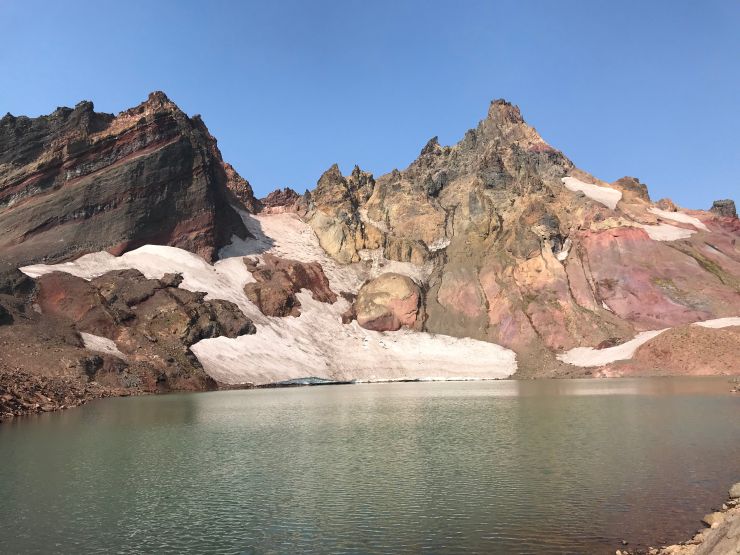
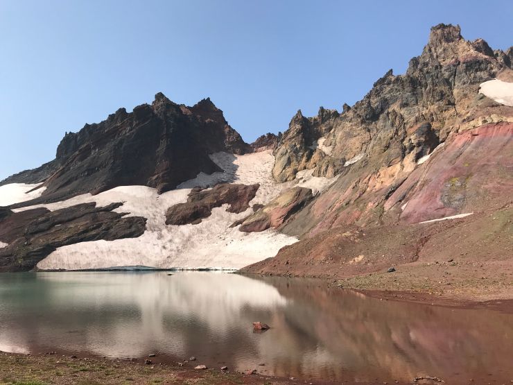
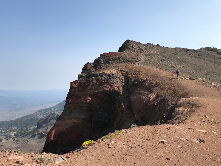
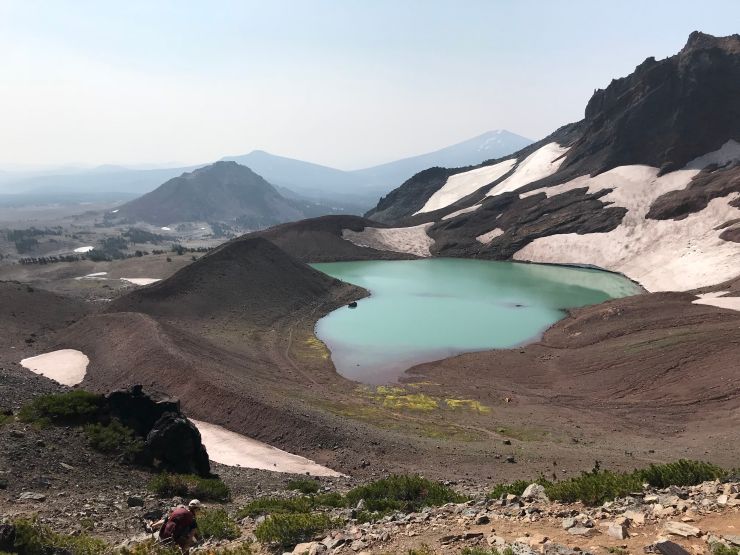
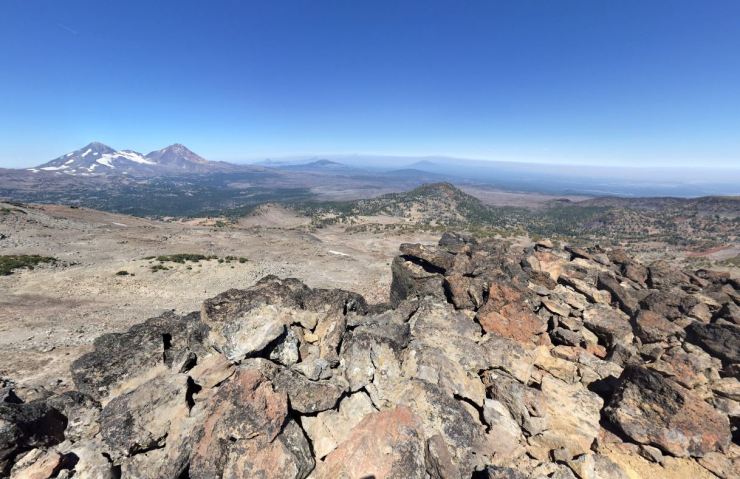
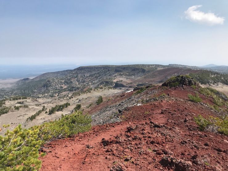
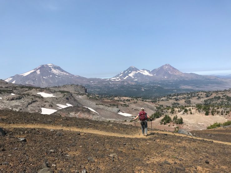
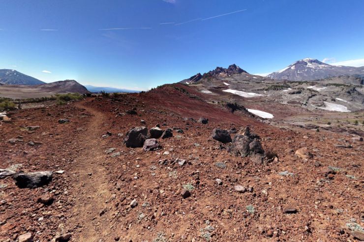
The hike on the third day is the most strenuous, but the views make up for it. The hike starts by continuing on the Broken Top Trail (#10) for another ~0.5 miles. At this point you reach a Y-junction where the trail splits in two directions. Following the trail south leads to the Broken Top Trailhead (don’t go this way) while taking a left and heading north leads to the No Name Lake and Broken Hand. You want to follow the trail north as it travels up in elevation. This section of the trail is technically not maintained and is not on the Forest Service maps, but the trail is pretty well established. Along the route, you will see the Ball Butte to your right and to your left is a small ridge line. It is just under 2 miles from the Y-junction to the No Name Lake.
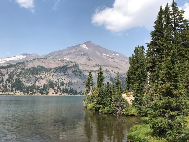
After the No Name Lake, the trail is unmaintained so you will need to pay attention to the route. The trail follows the Broken Hand ridge east towards the Tam McArthur Rim. Along the ridge you get great views of the Three Sisters. It is about a 3 mile hike from No Name Lake down to the Tam McArthur Rim. From there, you take the Tam McArthur Rim Trail (#4078) the remaining ~2.5 miles back to the trailhead.


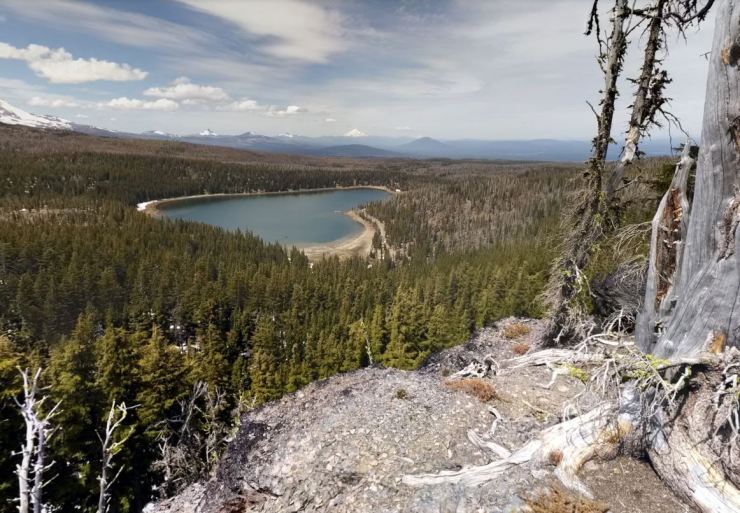
At the end, the Tam McArthur Trail reaches the trailhead this trek began at. At that point you can rinse off in the lake and then head home!
……….
Here are some related trip reports:
Trinity Alps Wilderness – Four Lakes Loop (20 mile trek)
Desolation Wilderness – Twin Lakes, Island Lake, Lake Aloha (12 mile trek)
Trinity Alps Wilderness – Emerald and Sapphire Lakes (25 mile trek)

This is a great write up! Just want to point out that you can skip the boring section between Three Creek Lake and Golden Lake. When I hiked this loop I started at the Broken Top TH. From there you hike up to No Name Lake and head off trail north towards Golden Lake. The off trail stuff between No Name and Golden Lake is not bad to navigate and the terrain and views are great. Its much better than hiking through the burned forest. From Golden Lk, you can head to Green Lakes and back to Broken Top TH like you describe.
LikeLike
That sounds like an awesome itinerary. For those with experience navigating sections of off-trail hiking, consider doing this route to shorten the trek a bit and avoid the not-super-beautiful stretch between Three Creek Lake and Golden Lake.
LikeLike
thanks for the report, gonna try to get up to bend and three sisters this summer!
LikeLike
Really great pictures. U guys ever make it to the obsidian section of the park? Looks cool but looks like there is a permit quota in place.
LikeLike
Hi Thanh – No, we did not hike on the Obsidian Trail. You are right, there is a quote in place with permitting for the Obsidian Trail. Only 30 day hikers and 40 overnight visitors are permitted into the area each day.
The trail is supposed to be awesome and pass through a good mix of terrain: lava flows, forests, alpine meadows, obsidian cliffs, etc.
Best of luck with the permits and I hope you make it there!
LikeLike
Really great pictures… I hiked a similar loop a couple years ago. Spent two nights at green lakes and used the extra day to do a day hike up towards the top of South Sister. Had some awesome views!!
LikeLike
Hi Will – Sounds like a great trip! I wish we had built in some extra time as well. The scrambles to South Sister and to Broken Top from Green Lakes both looked like fun challenges.
LikeLike
Would this loop be do-able in over the 4th July weekend 2019 (as in little snow travel and creeks that can be crossed easily)?
LikeLike
Hi Bob – Unfortunately, it’s too early to say exactly what the conditions will be up in the Three Sisters Wilderness on the 4th of July. As of the latest trail report (https://www.fs.usda.gov/Internet/FSE_DOCUMENTS/fseprd552933.pdf), there is still “deep snow” at the Tam McArthur trailhead, on Broken Top, and at Green Lakes. The snow line is fairly low at ~5,500 feet, so most of the route in the report is under snow. The incoming warm June weather should accelerate the melting, but it’s hard to say where the snow line will end up. My guess is that there will still be snow to negotiate over July 4th weekend and there still be heavy snow around Broken Top. That said, I think the best thing to do is to give the ranger station a call at the end of June to get their opinion on the situation. There are some numbers for the ranger stations at the bottom of the report I linked to above. Good luck!
LikeLike
How is this trip late September?
LikeLike
Hi Amanda – in September the trip can be great or it could be cool and snowy. I would advise being flexible and checking the weather before any trip in September. It is not uncommon for thunder storms to drop snow in the mountains then. That said, you can have really great moderate weather as well. It really just depends on the forecast before your trip!
LikeLike
My 2 boys (10yr and 12yr) and I just completed this very itinerary this past weekend. Thank you for the detailed trip report which helped greatly with planning and for reference points along the way. It was a spectacular trip with clear weather, no smoke from fires, perfect temps, incredible views and scenery, and a ton of great memories. The creeks were really flowing which was great to see, esp. near Ball Butte where we enjoyed several waterfalls. We did not see any evidence of the dead elk at No Name Lake. And there was one little sketchy part past Broken Top/No Name Lake where we lost the trail by Broken Hand and had to scamper around back to find the Rim trail. Boys found that very exciting 🙂 Nonetheless an awesome trip. Thanks again!
LikeLike
I’m glad you had a great trip!
LikeLike
Hi,
Thank you for this great write up! We are looking to do this trip soon.
I was wondering – did you notice any campsites, or places to camp, within 3-4 miles of the trailhead? We may not be able to get there until later in the day so I’m looking at options for a short first day.
Thanks!
LikeLike
A couple options:
-Near the 3 mile mark you cross Snow Creek. You can likely set up camp near the creek and have good water access. I can’t recall if there were clearly used campsites around here, but I imagine you could find a good enough spot.
-If you can make it ~6 miles, Park Meadows should have some nice areas for a campsite.
LikeLike
Your review and detained description are terrific. Planning on doing this loop in the first week of September this year and so sport the advanced recon.
LikeLike