


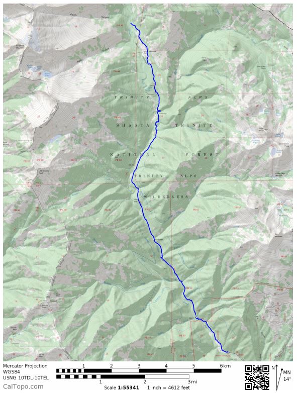
Trip overview: ~25 mile out and back (plus a 7 mile day hike) from the Stuart Fork Trailhead in the Trinity Alps Wilderness area. +/- 9,100 feet with a starting elevation of 2,900 feet and a peak elevation of 7,500 feet. Highlights include alpine lakes, meadows, and the impressive Sawtooth Ridge. We complete this trip on the July 4th weekend in 2017.

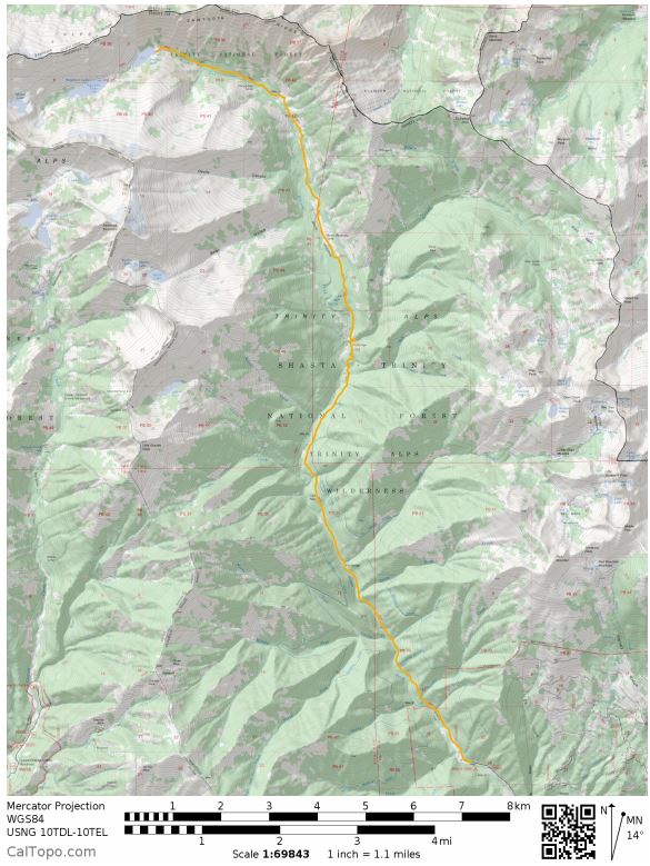
- Overall Map for the Trinity Alps – Emerald Lake trek (PDF)
- Trinity Alps Wilderness Map (link to buy)
Jump to Day 1: Stuart Fork Trailhead to Morris Meadows
Jump to Day 2: Morris Meadows to Sapphire Lake
Jump to Day 3: Sapphire Lake to Caribou Lake to Emerald Lake
Jump to Day 4: Emerald Lake to Stuart Fork Trailhead
Shop Sale & Clearance Items at REI.com (up to 50% off)!
Preparations:
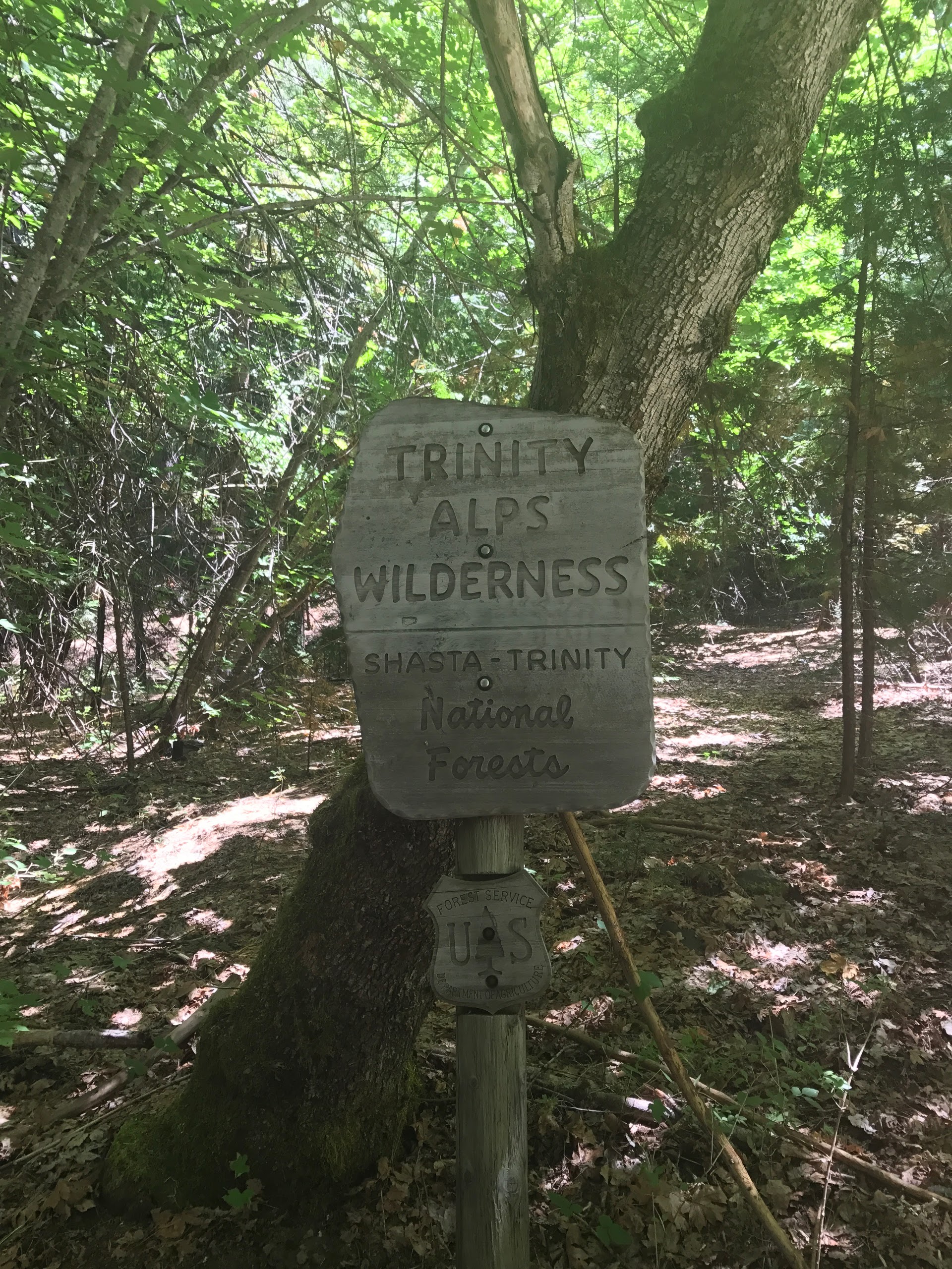
Permits: You will need a Wilderness Permit to camp in the Trinity Alps Wilderness and need a California Campfire Permit in order to have any camp fires. Luckily, there are no quotas in place limiting the number of permits, so you can backpack in the Trinity Alps without needing to reserve a permit well in advanced of your trip. Both permits are free and can be picked up at the Weaverville Ranger Station in Weaverville, CA. If you arrive when the ranger station is open, you can go inside get your permits and talk to the rangers. If you arrive when the station is closed, there is a self-service kiosk outside where you can fill out a permit and drop it in a lock-box. You can find some basic information about the wilderness and permits at the National Forest webpage for the Trinity Alps.
For information on current conditions, your best bets are to either call the ranger station (530-623-2121) or to visit the Trinity Alps Wilderness facebook page. I found the facebook page to be the most useful because many people were posting pictures and descriptions of the treks they did the previous weekend. There are only a handful of rangers covering the whole wilderness area, so they are not able to check out all the trails on a regular basis.
Logistics: Since you can grab permits at the self-service kiosk at the Weaverville Ranger Station, you do not need to worry about arriving when the ranger station is open (unless you want to ask the ranger questions). After getting your permit, you will have to drive to the trailhead because there are no shuttles or buses. Parking at some of the popular trailheads can get crowded, but if you arrive early and beat the day hikers, you should not have a problem.
Weather and Trail Conditions: The trail along Stuart Fork is well marked and maintained. Getting from Emerald Lake up to Sapphire lake requires a bit of scrambling, but there are cairns marking the route. The trail up to Caribou Lake is easy to follow, but is very overgrown in several areas.
If you are backpacking in the middle of the summer, be prepared for warm temperatures and also check that there are no forest fires in the area. It can easily get up to the 90s in the forest during the middle of the day because the Trinities are lower altitude compared to the Sierras. There can also be afternoon thunderstorms. If you go earlier in the season, be sure to check current conditions and make sure the snow has melted. Many mountain passes in the Trinity Alps were still covered in snow in July 2017.
Difficulty: Doing this trek over 4 days allowed us to take an easy pace. You could make it to Emerald/Sapphire Lakes in one day and then hike back out the next day, but having an extra day or two makes the trip very relaxing. This is a good trek if you are an experienced backpacker looking for a relaxed trip or if you are a beginner looking for a lower mileage trip to hone your skills on.
Supplies: You will need to either store your food in a bear canister (Bear Vault BV500 transparent canister) or bring supplies to hang your food at night (Liberty Mountain Ultralight Bear Bag
). Bears in the Trinity Alps are not as mischievous as the bears in Yosemite or Sequoia, but follow the rules and protect your food so the bears do not develop bad habits. I prefer the bear canister because I use it as a chair. Other people hate bear canisters because they make it more difficult to pack up your backpack.
There are a fair number of mosquitoes near the lakes, so treating your clothes and tent with permethrin repellent is a good idea. I also like to use a picaridin-based bug spray
on my exposed skin.
A non-essential but very fun supply is an inflatable boat (Intex Explorer Pro 200)or tube. It certainly adds weight to your pack, but a raft allows you to explore the whole lake and access many fishing spots that are otherwise inaccessible. Emerald and Sapphire Lake both have trout in them, so acquiring a fishing license and bringing fishing tackle is a great idea.
Below is a list of the gear I brought on this trip in the Trinity Alps:
Hiking clothes
- a lightweight hiking rain jacket (North Face Venture 2 Jacket)
- fast drying synthetic hiking pants (prAna Zion Pants)
- a quick drying long sleeve hiking shirt (Columbia Silver Ridge L/S Shirt)
- wool outer socks (People Socks Moreno 4-pack)
- thin blister preventing base socks (WrightSock double layer Coolmesh)
- quick drying synthetic boxer briefs (ExOfficio Give-N-Go)
- Gore-tex hiking shoes (adidas Outdoor Terrex Fast R Gore-Tex Shoe)
Clothes for camp
- wool leggings (Minus33 Merino Wool Kancamagus Midweight Bottom)
- wool base layer shirt (Minus33 Merino Wool Chocorua Midweight Crew)
- warm wool overshirt (Pendleton Long Sleeve Classic-Fit Board Shirt)
- lightweight down jacket (Patagonia 800-fill Down Jacket)
- lightweight camp shoes (Xero Z-Trail lightweight sandal)
Hiking gear
- trekking poles (Black Diamond Trail Ergo Cork Trekking Poles)
- 2 liter hydration bladder (Platypus Big Zip Water Reservoir)
- 65 liter backpack (Osprey Atmos 65 Liter pack)
- water filtration system (Platypus gravity filtration system)
Camp gear
- strong tent with rain-fly (Alps Mountaineering Chaos 2 Tent)
- inflatable sleeping pad (Therm-a-Rest Trail Pro Sleeping Pad)
- sleeping bag (REI Co-op Igneo 25 Sleeping Bag)
- inflatable camping pillow (Ultralight Inflating Pillow)
- lightweight backpacking chair (Helinox Chair Zero)
- lightweight lantern (MPOWERD Luci Outdoor 2.0)
- headlamp (Black Diamond Cosmo Headlamp)
- multi-tool with knife (Gerber MDime Mini Multi-Tool)
- Ursack (Ursack Major bear bag) or bear canister (BearVault BV500)
- lightweight stove (MSR PocketRocket 2)
- lighter (BIC plastic lighters)
- 2 liter pot (GSI Outdoors Halulite Boiler Pot)
- coffee cup (GSI Outdoors Glacier Stainless Cup)
- lightweight spork (Snow Peak Titanium Spork)
- small, quick drying towel (REI mutli towel mini)
Random
- wet wipes (Stall Mates individually wrapped wipes)
- mole skin for blisters (Blister medic kit)
- lightweight trowel (GSI Sanitation Trowel)
- small amount of duct tape for gear repairs
- chapstick and sun screen
Food and drink
- a variety of my favorite dehydrated meals
- electrolyte replacement (NUUN Hydration Tablets)
- quick snacks (Clif Shot Bloks and Clif energy bars)
- instant coffee (Starbucks VIA)
- small plastic water bottles filled with whisky 🙂
Day 0: On the preparation day, we drove most of the afternoon at made it to the Weaverville Ranger Station off Route 299 at around 8:00 pm. We grabbed a Wilderness Permit and a Campfire Permit and then went to our campsite at Minersville Campground on the banks of the Trinity Lake.

There are a bunch of Forest Service campgrounds in the Trinity Lake area. We chose to stay at Minersville because we were able to get a reservation online and secure our spot ahead of time. Many of the other campgrounds in the area are first come-first serve. The campground was fine enough and you could walk down to the edge of the Trinity Lake to get a nice view.
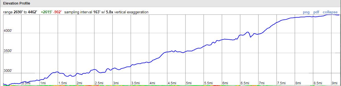
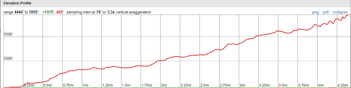
Day 1: 9.2 miles; + 2,600 feet / -900 feet; Stuart Fork Trailhead to Morris Meadows.
Map of Trinity Alps Day 1 (pdf)
On the first day we got up early, ate breakfast, and then drove to the Stuart Fork Trailhead. It is about an 8 mile drive to the trailhead and you take Route 3 towards the Trinity Alps Resort. Continue on the road for another ~2 miles after passing the Trinity Alps Resort until you reach the parking lot at the Stuart Fork Trailhead. The road is dirt for a mile or two, but was in fine shape for any normal car. There is a campground near the trailhead with a bathroom and potable water, so this is a good spot to set off from. We got ready, filled our water, and set off on the hike at about 9:30 am.
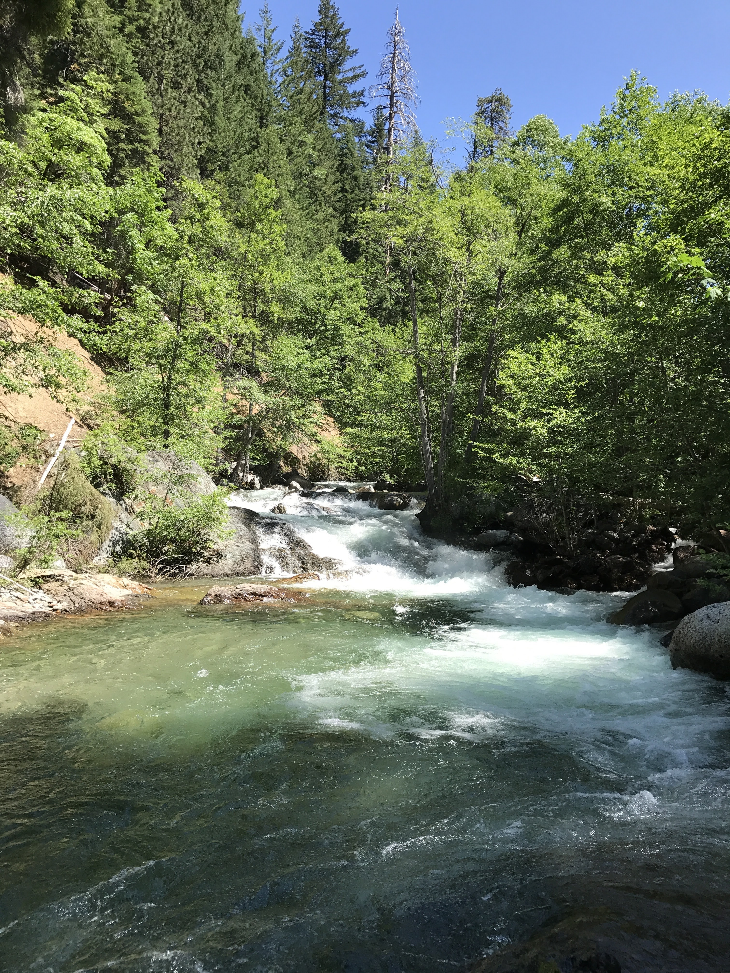
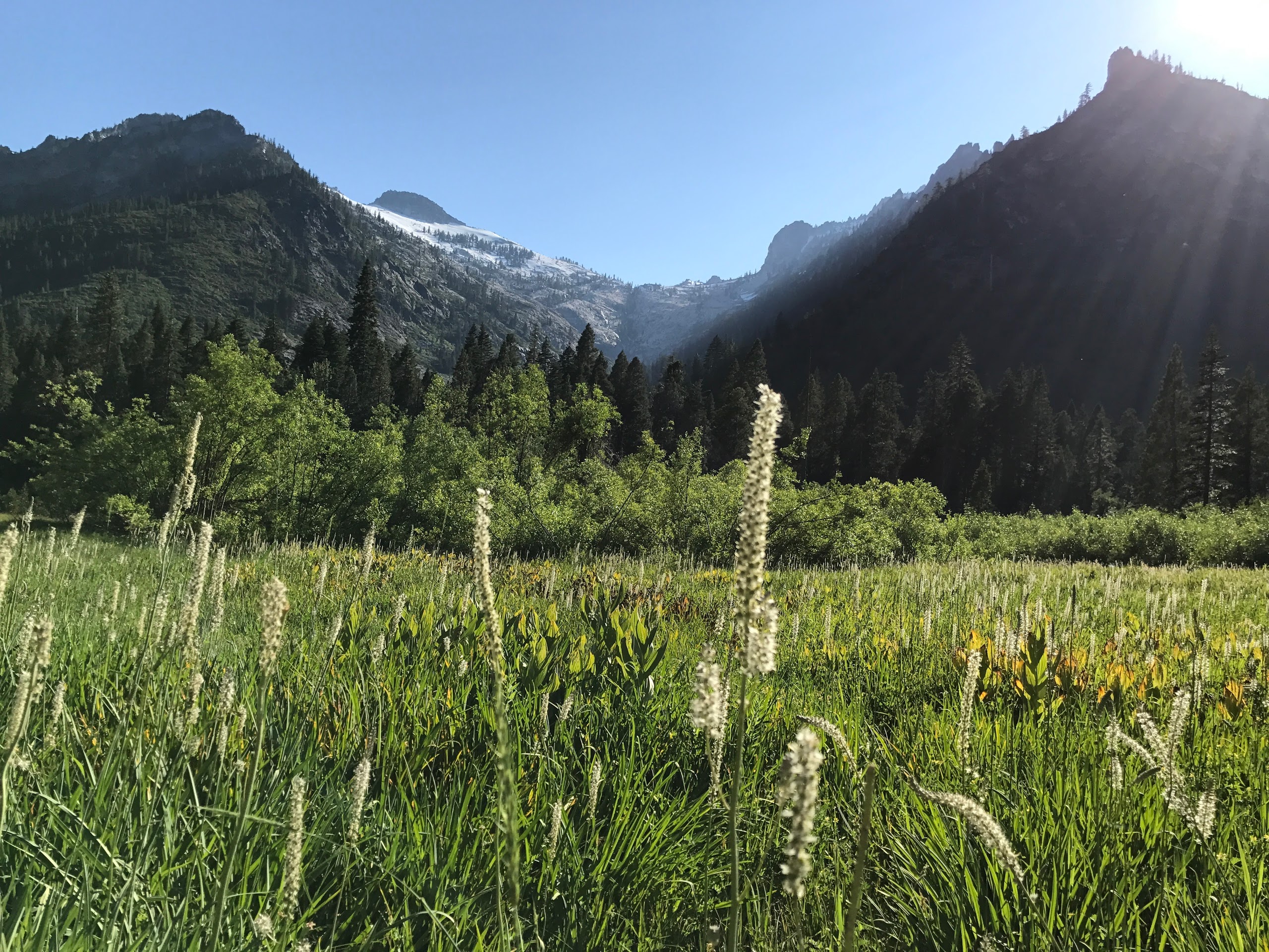
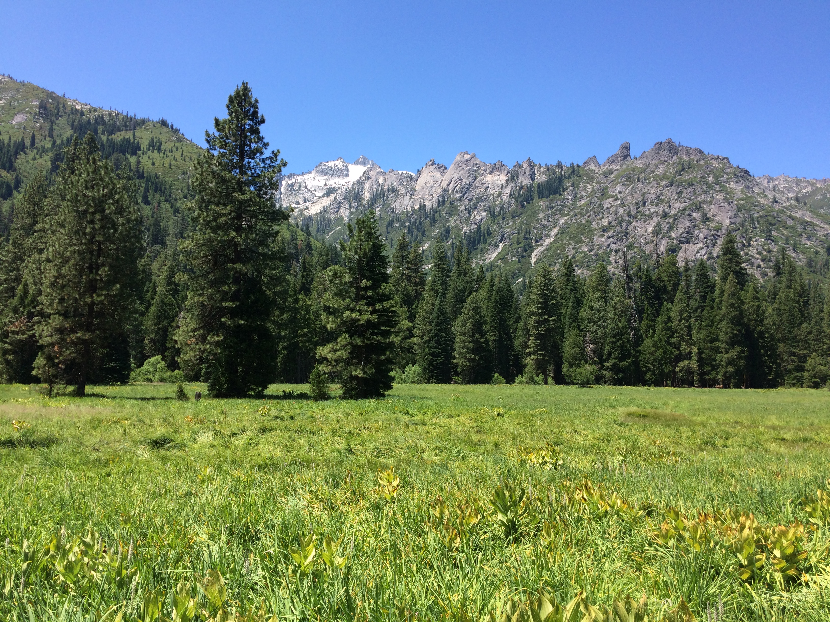
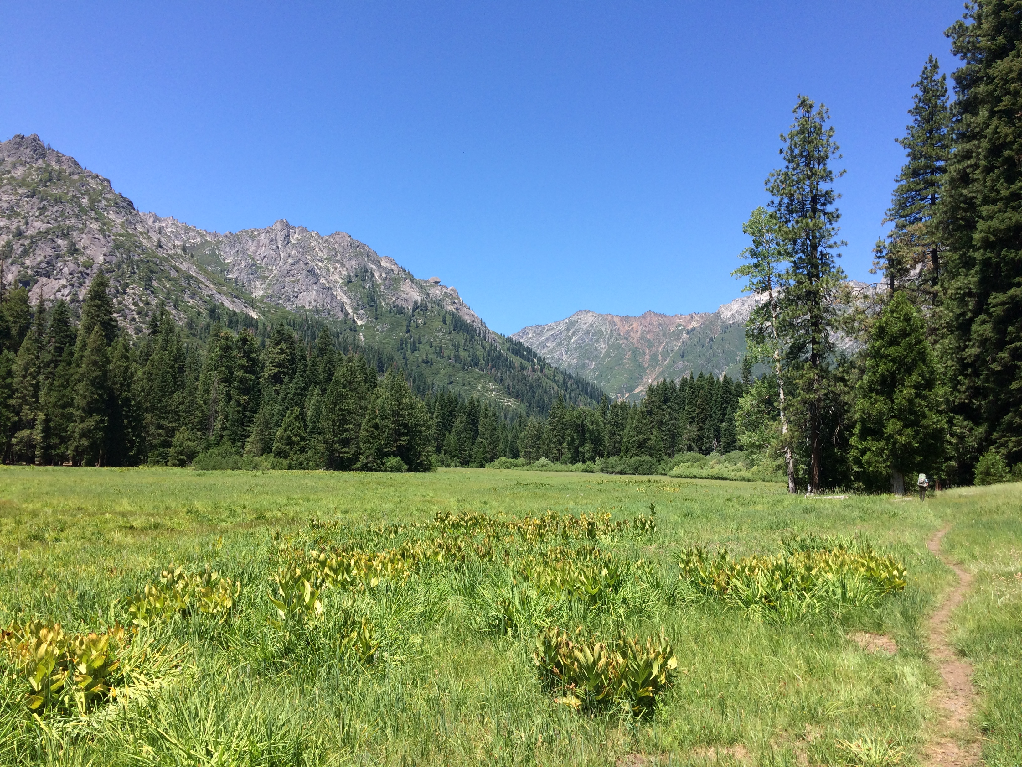
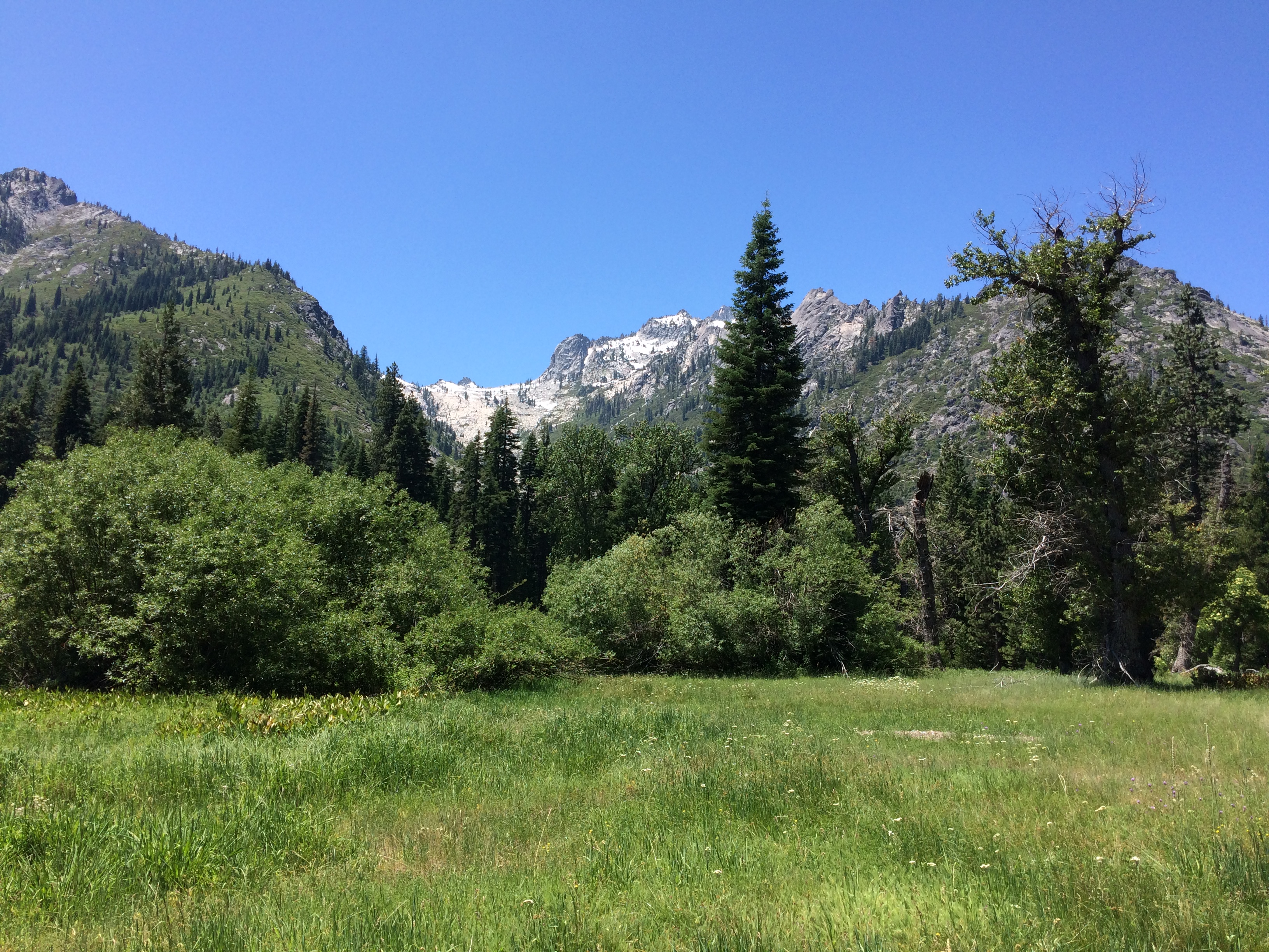
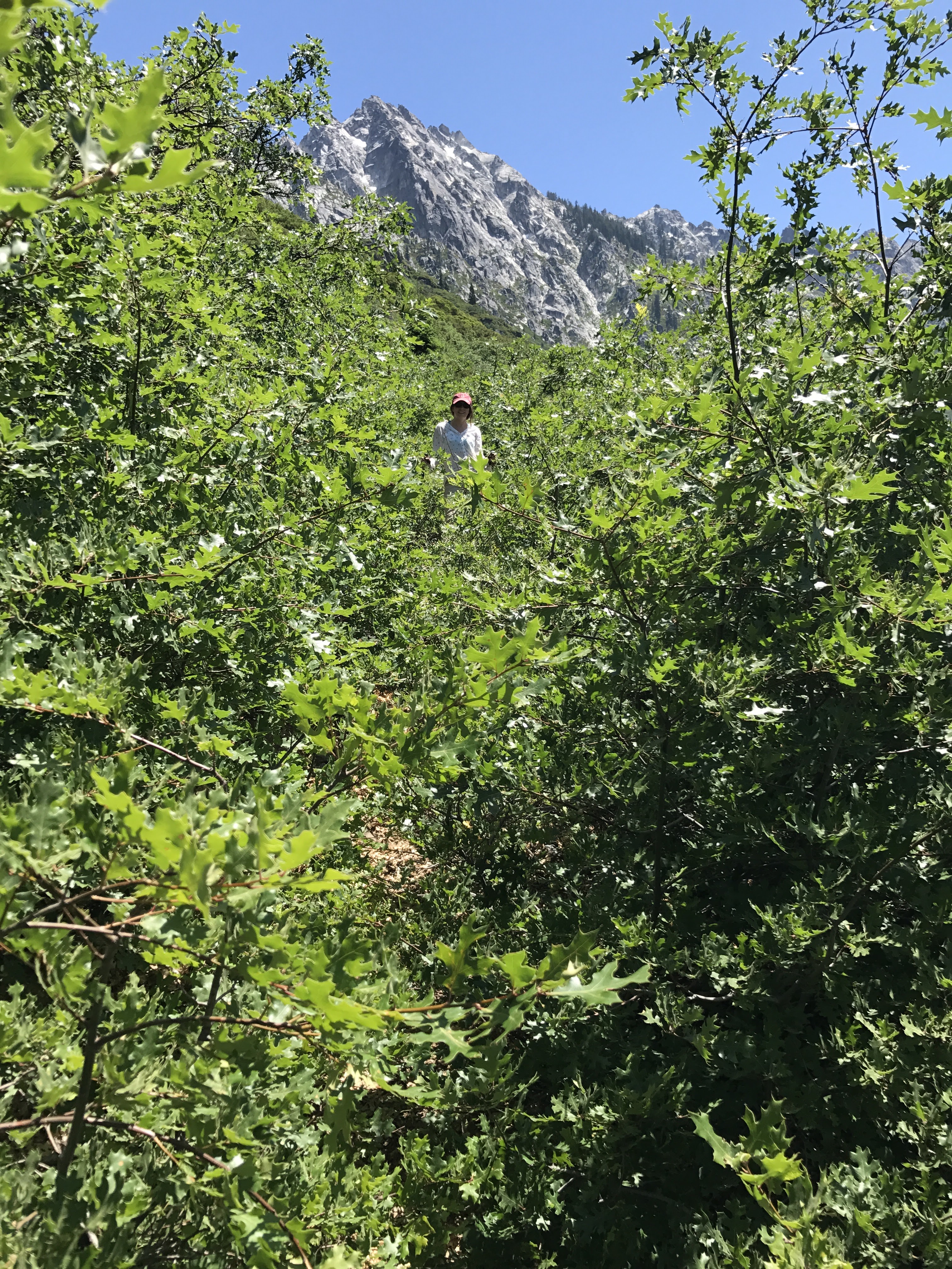
We planned to hike up to Morris Meadows and make camp for the first night. The trail follows along the Stuart Fork so water is not much of an issue along the way. There are spots to take a break and refill from the Fork every few miles if need be. Much of the first ~6 miles was pretty well covered in the forest so it was not too hot. As you approach Morris Meadows, the first thins out a bit so miles ~6 to 9 were more exposed and warm. Morris Meadows is quite large and scenic and makes for a good intermediate camping spot between Emerald Lake and the trailhead. We saw a handful of other backpackers here, but were able to secure a nice campsite near the Stuart Fork just north of the meadow. There are also campsites in the meadow if you prefer camping in the open rather than among trees.
The views along the trail on the first day are nice, but not spectacular. Much of the hike is through a forest and does not have any mountain views. Morris Meadows is nice, but this hike is really about just getting up to Emerald and Sapphire Lakes.


Day 2: 4.4 miles; +2,000 feet / -500 feet; Morris Meadows to Sapphire Lake.

Trinity Alps Backpacking Day 2 Map (PDF)
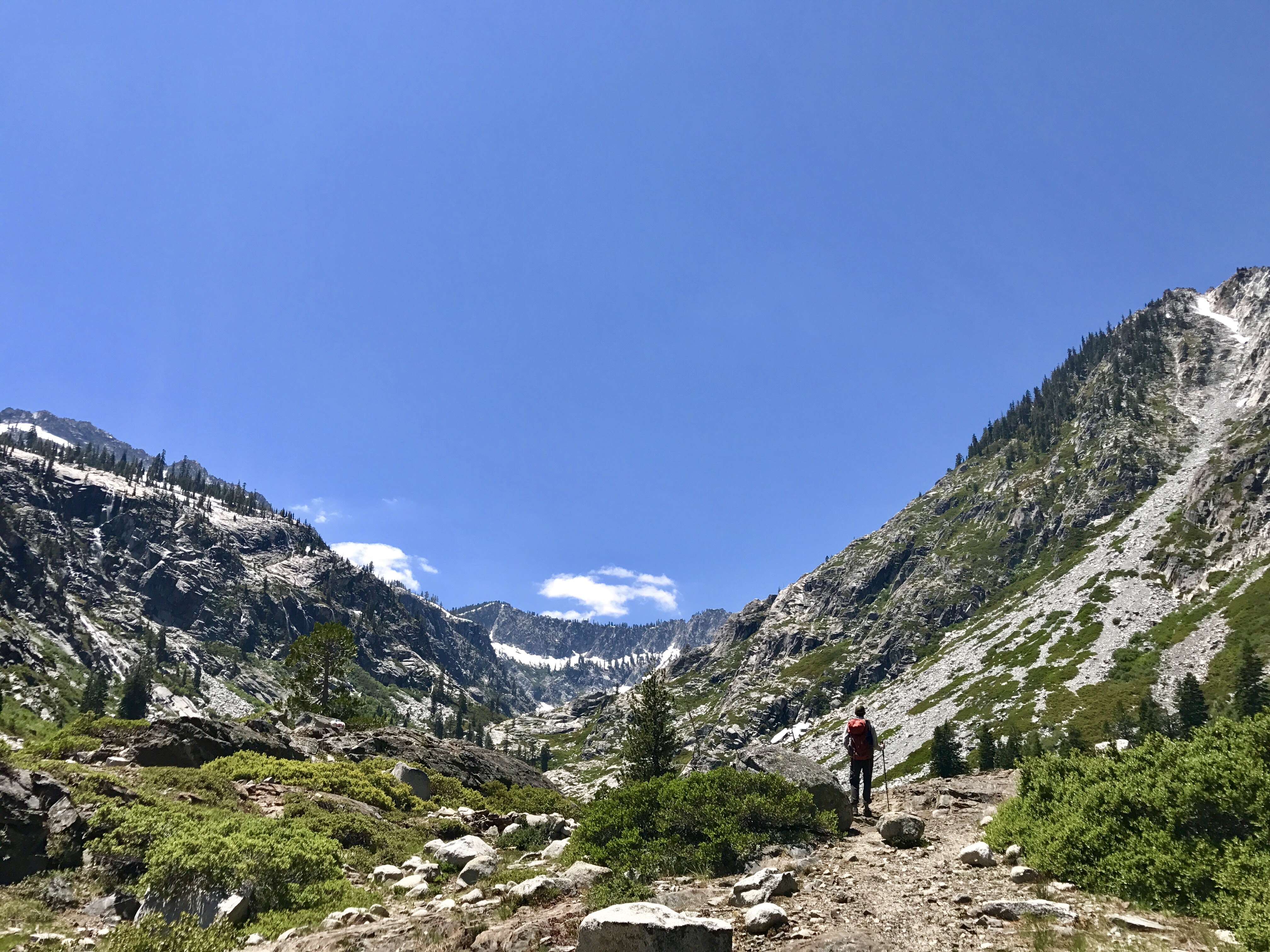
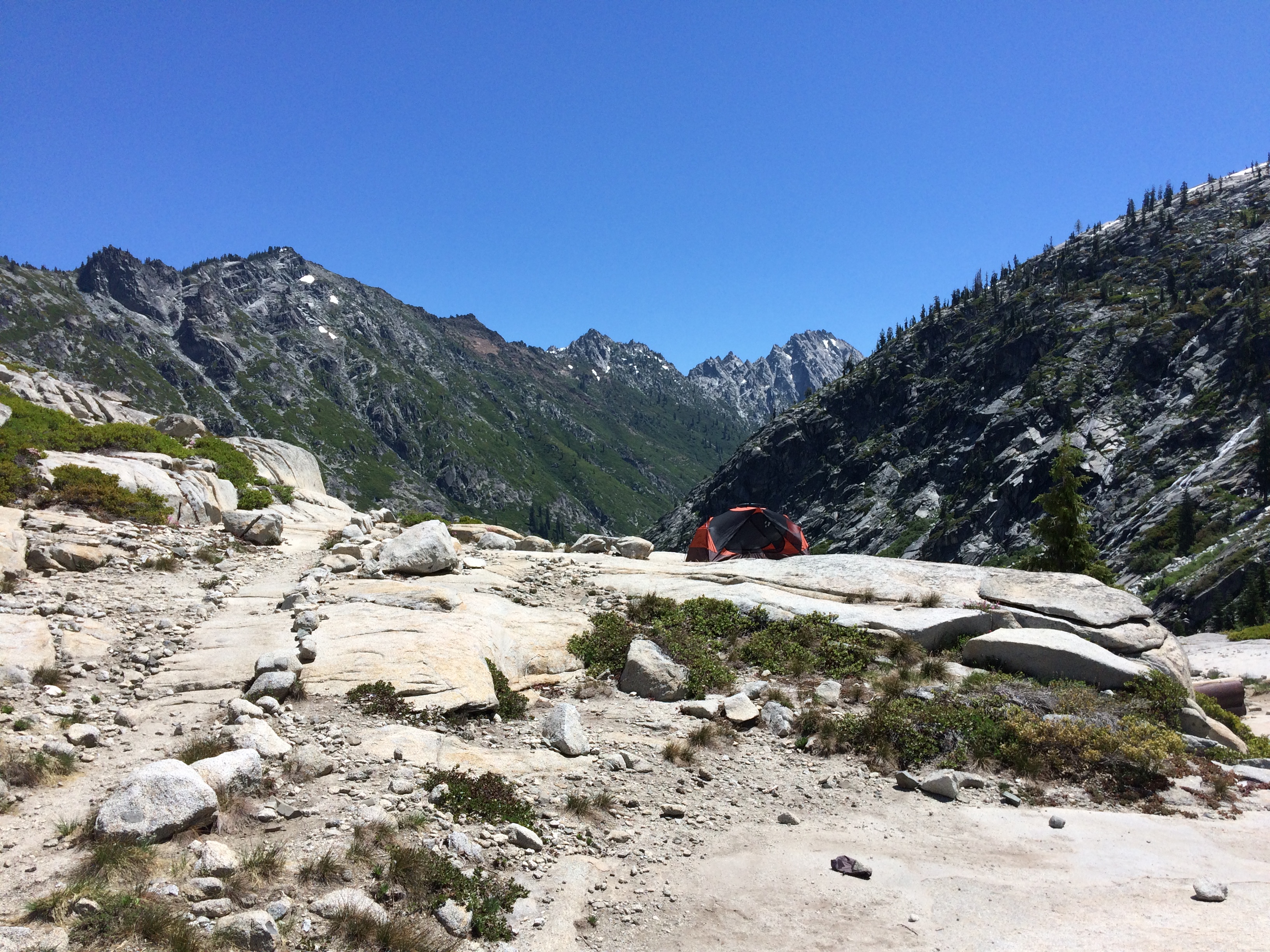
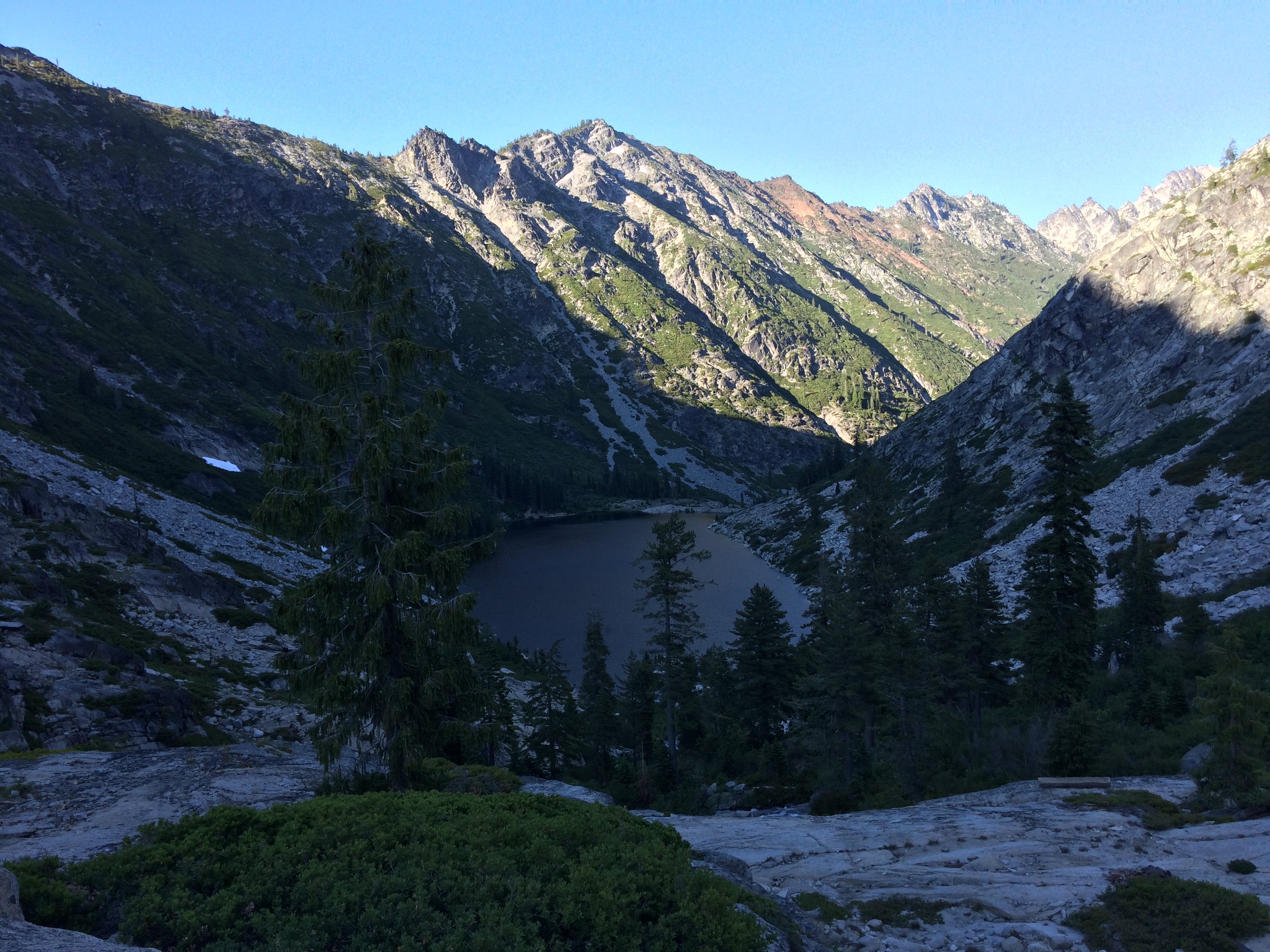
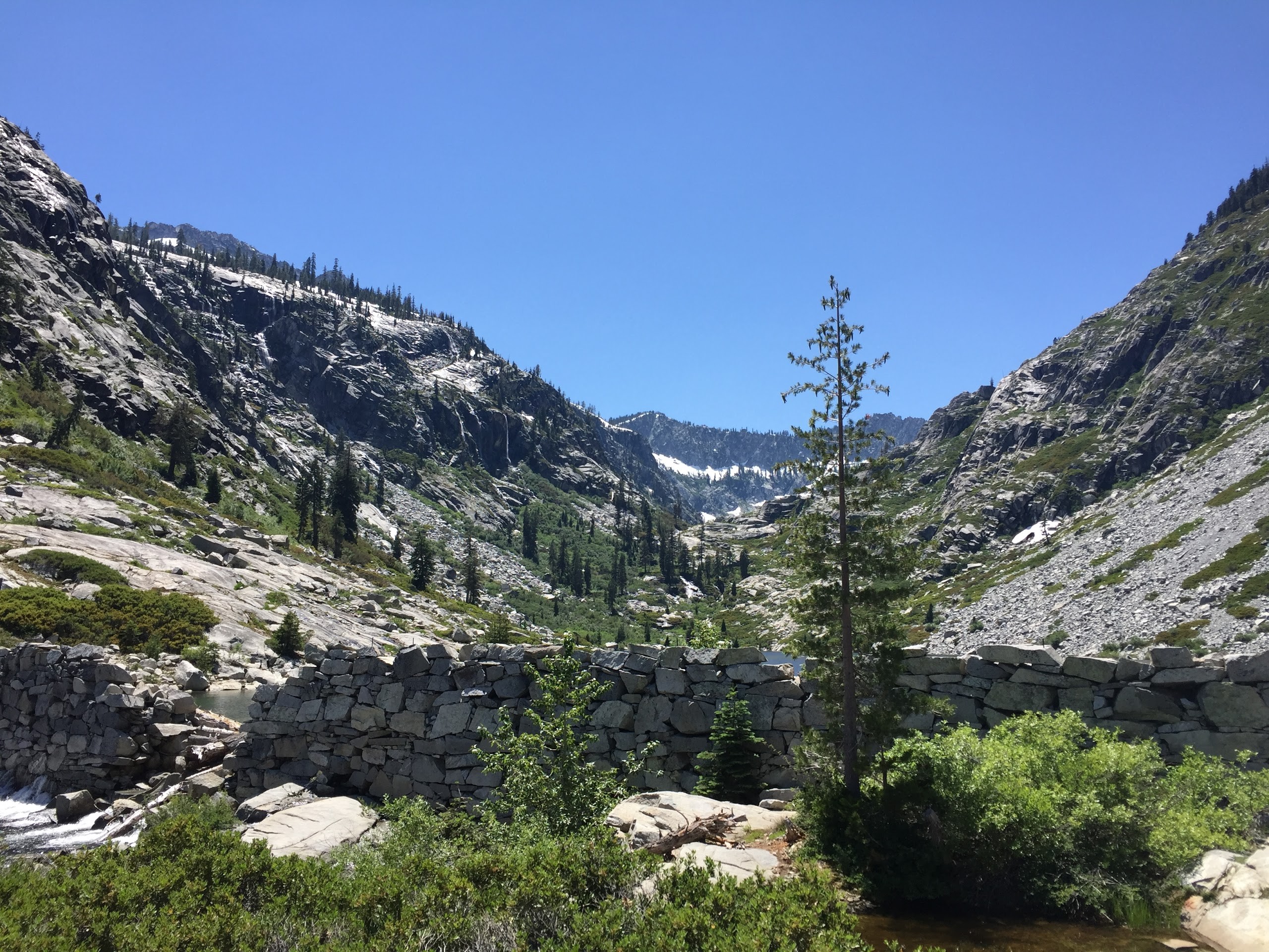
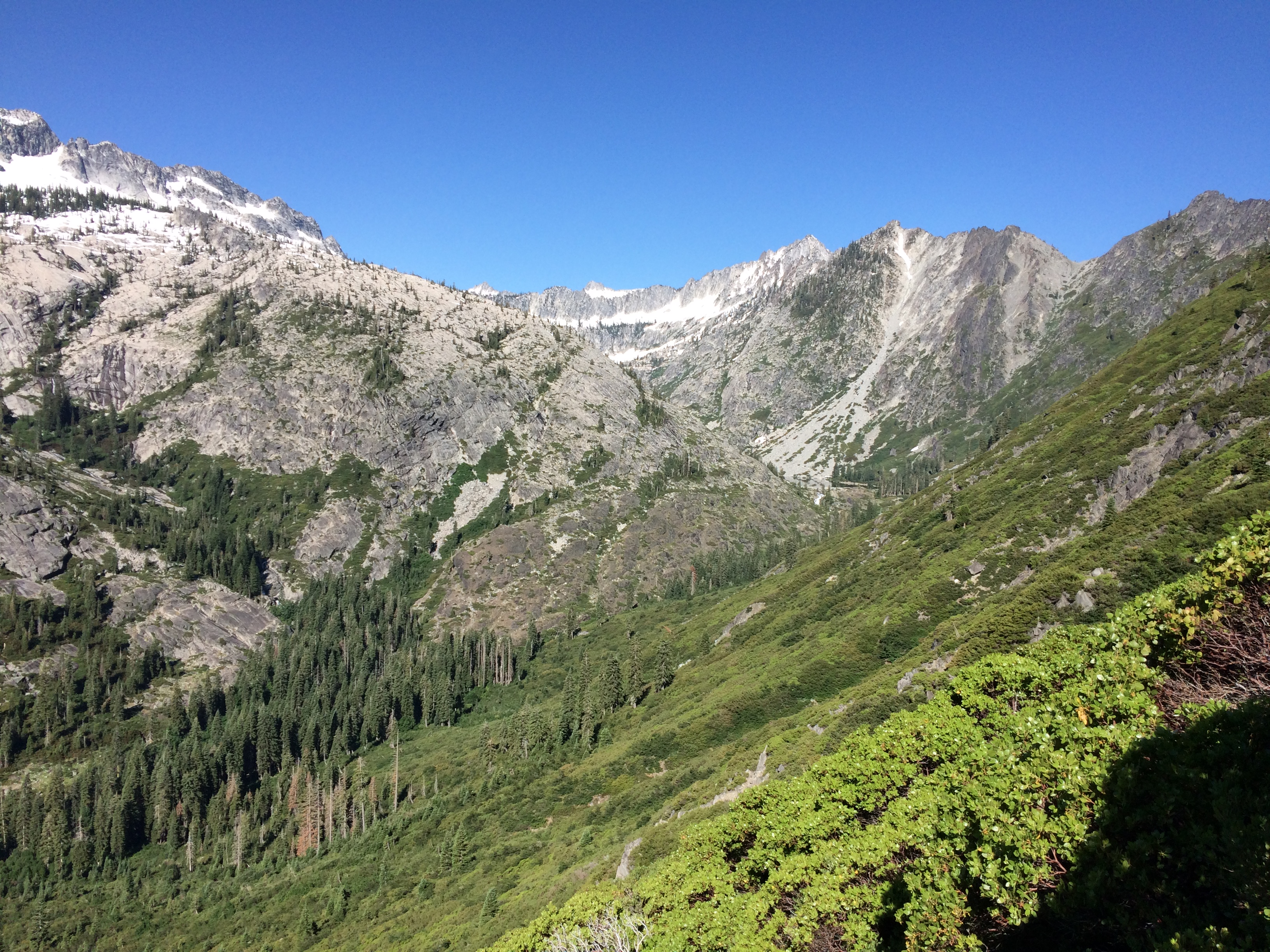
On day 2 we got up early and tried to beat the crowds to Emerald Lake. There were several groups camped at Morris Meadows so we wanted to get to the lake before other groups took the best campsites. We set off at about 7:30 am and reached Emerald Lake at about 9:30 am. Along the way several hikers recommended camping at Sapphire Lake instead of Emerald Lake because it was prettier and less busy. So, we changed our plan and decided to set up camp at Sapphire. We took a short break at the shore of Emerald Lake and took some pictures before continuing on the trail towards Sapphire. The hike up to Sapphire took an extra ~45 minutes and required some scrabbling over granite rubble. It was not too bad, but I think it discourages some people from camping up there.

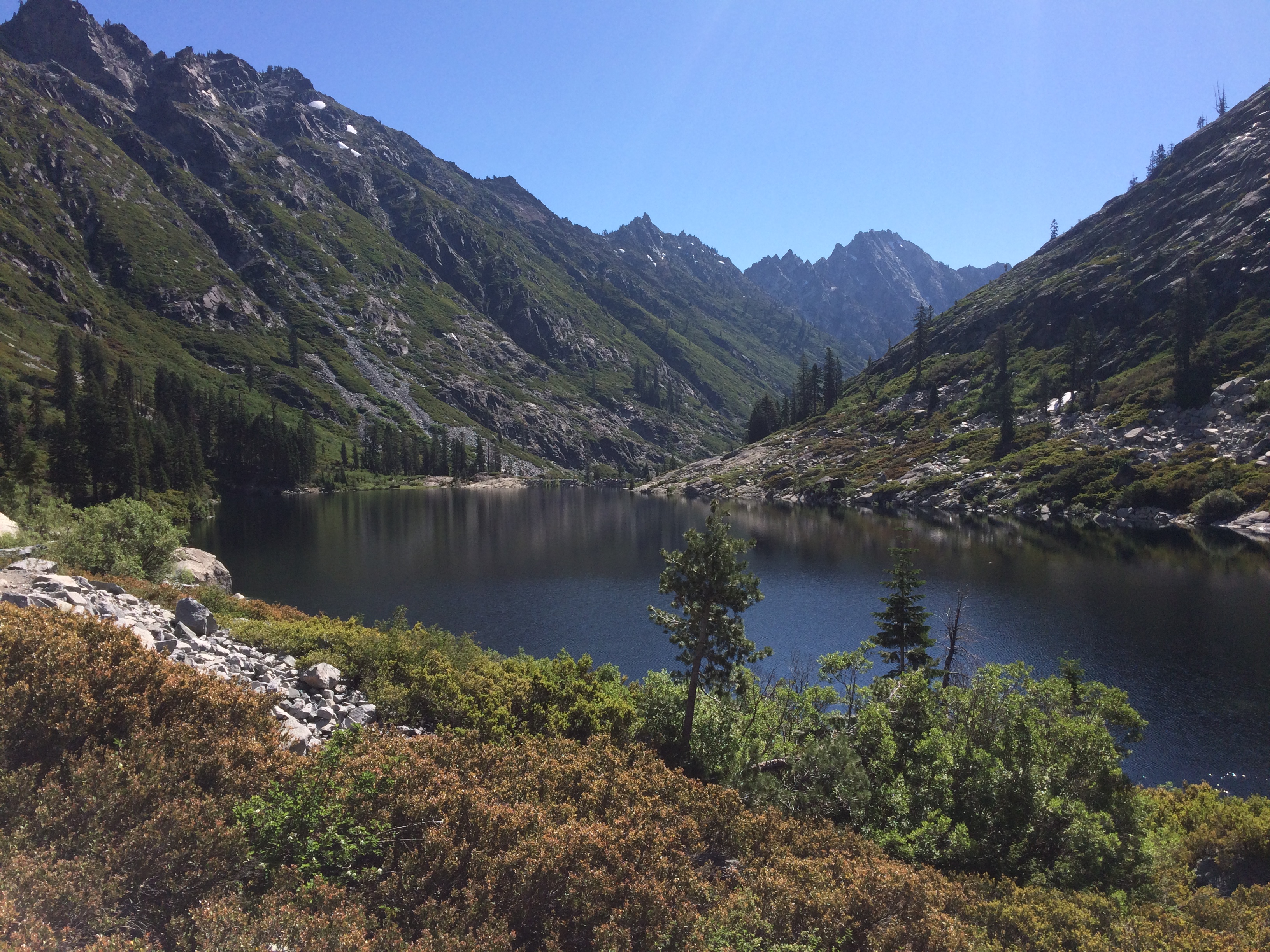


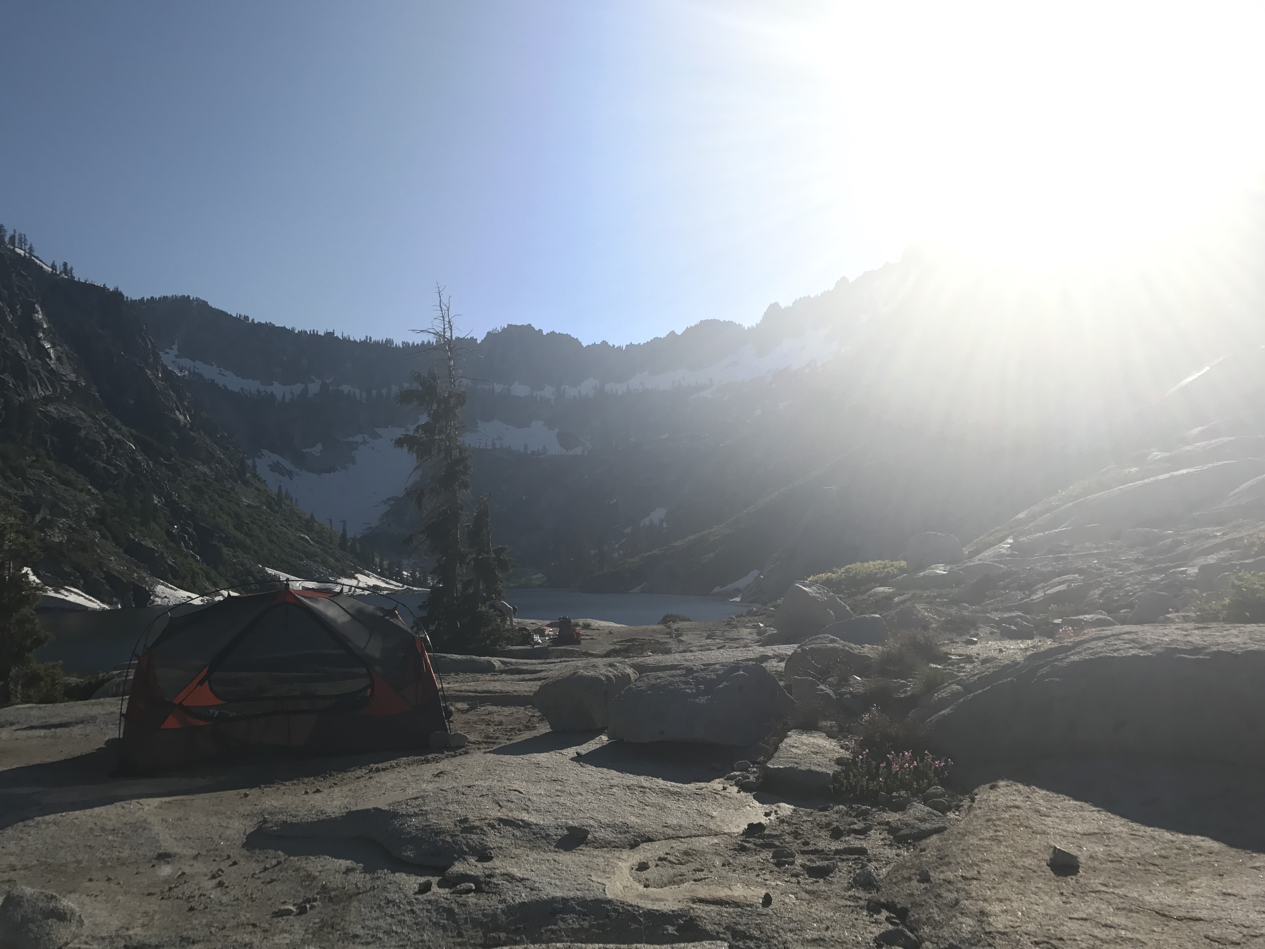
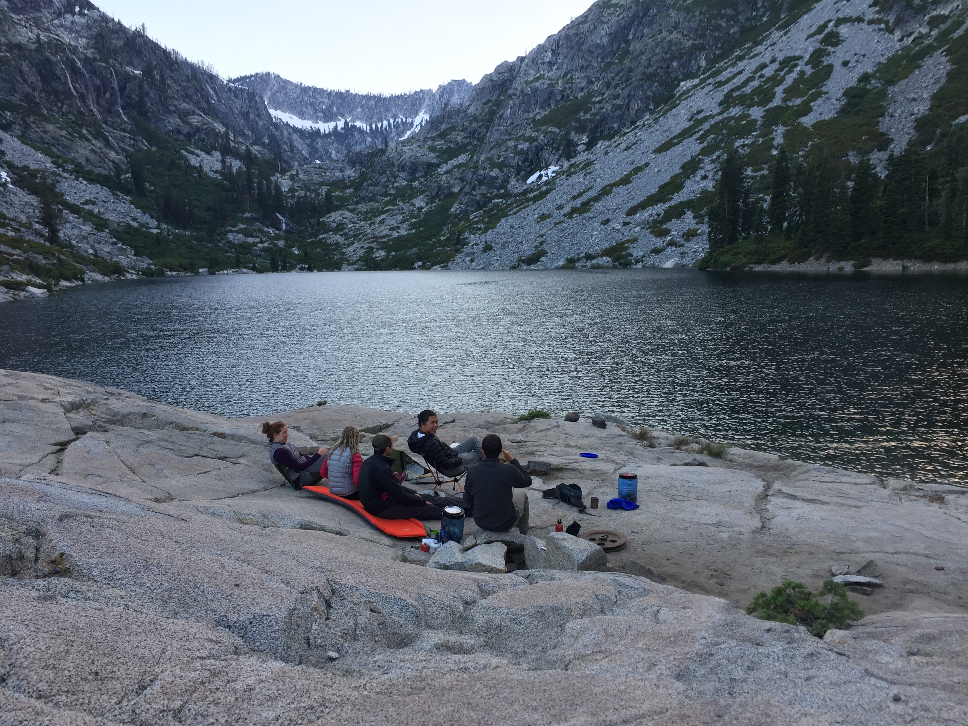
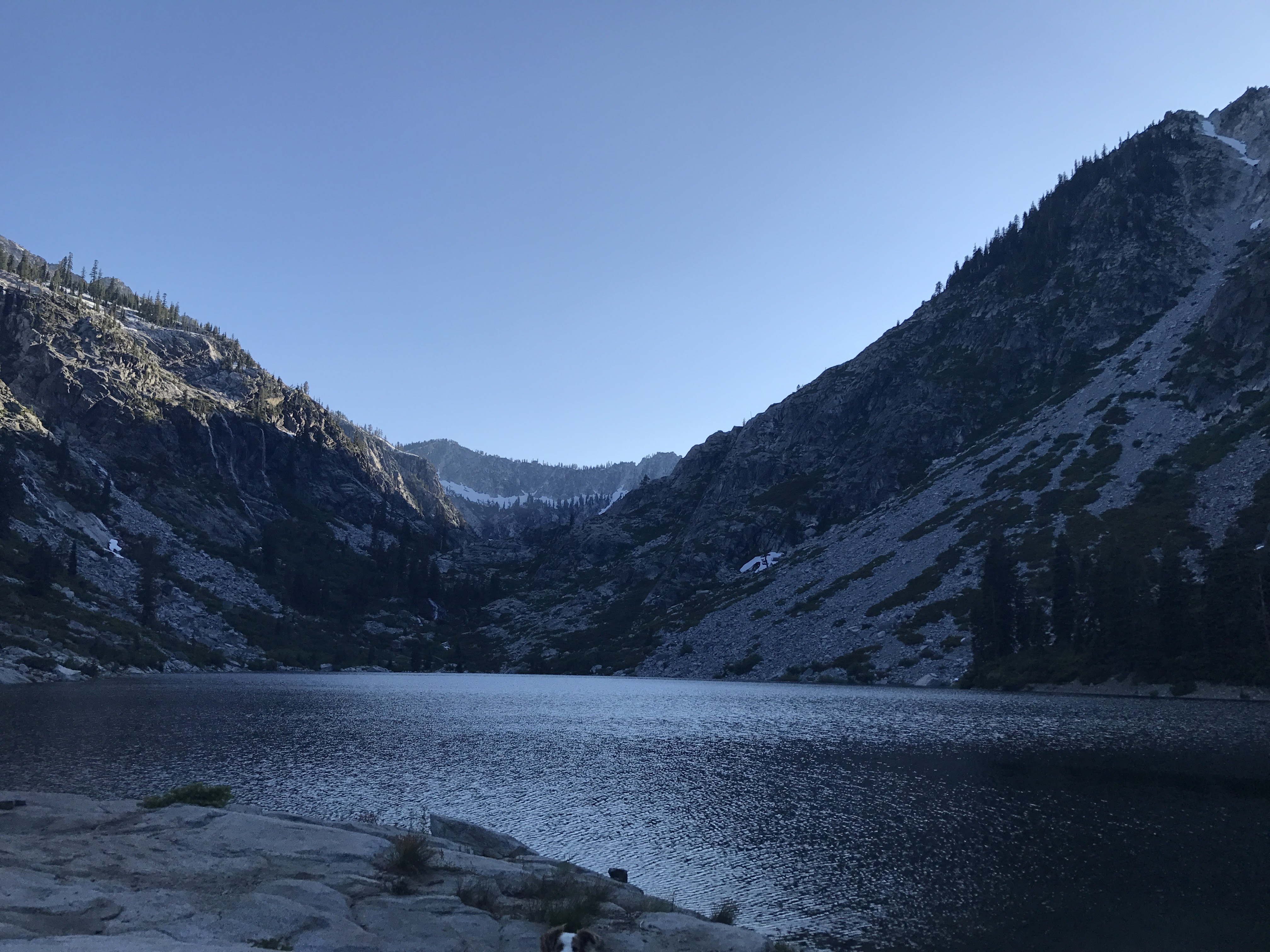
We reached Sapphire at about 10:30 am and found a nice spot to set up camp. We were the first tent up at the lake. There was a decent selection of campsites, but be prepared to set your tent up on hard ground without any tree cover. We couldn’t get any stakes in the ground, but tied the tent down with some lines and rocks. The lack of tree cover made star gazing at night spectacular. We ended up placing our tent near the tree that has the Sapphire Lake sign. This spot provides nice views of the lake.


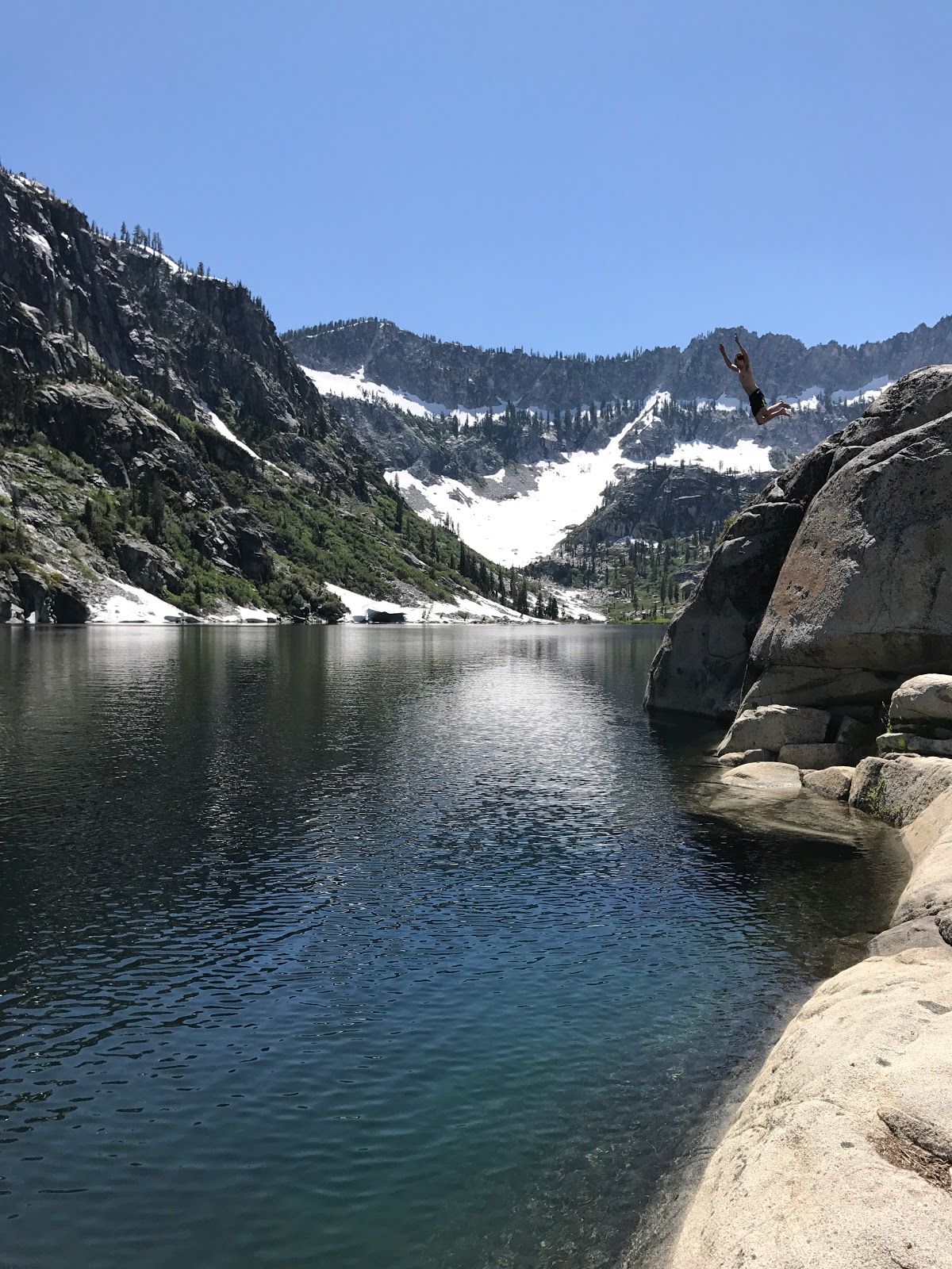
After we set up camp and inflated our Intex Explorer Inflatable Raft, we set out to relax and enjoy Sapphire Lake. A number of other hikers joined us and many people were hanging out and swimming in the lake. We took our raft out and paddled around the lake. This was great because it allowed us to reach different areas of the lake that no one else was able to get to. It is the best way to get away from the crowds and find secluded areas to relax at.


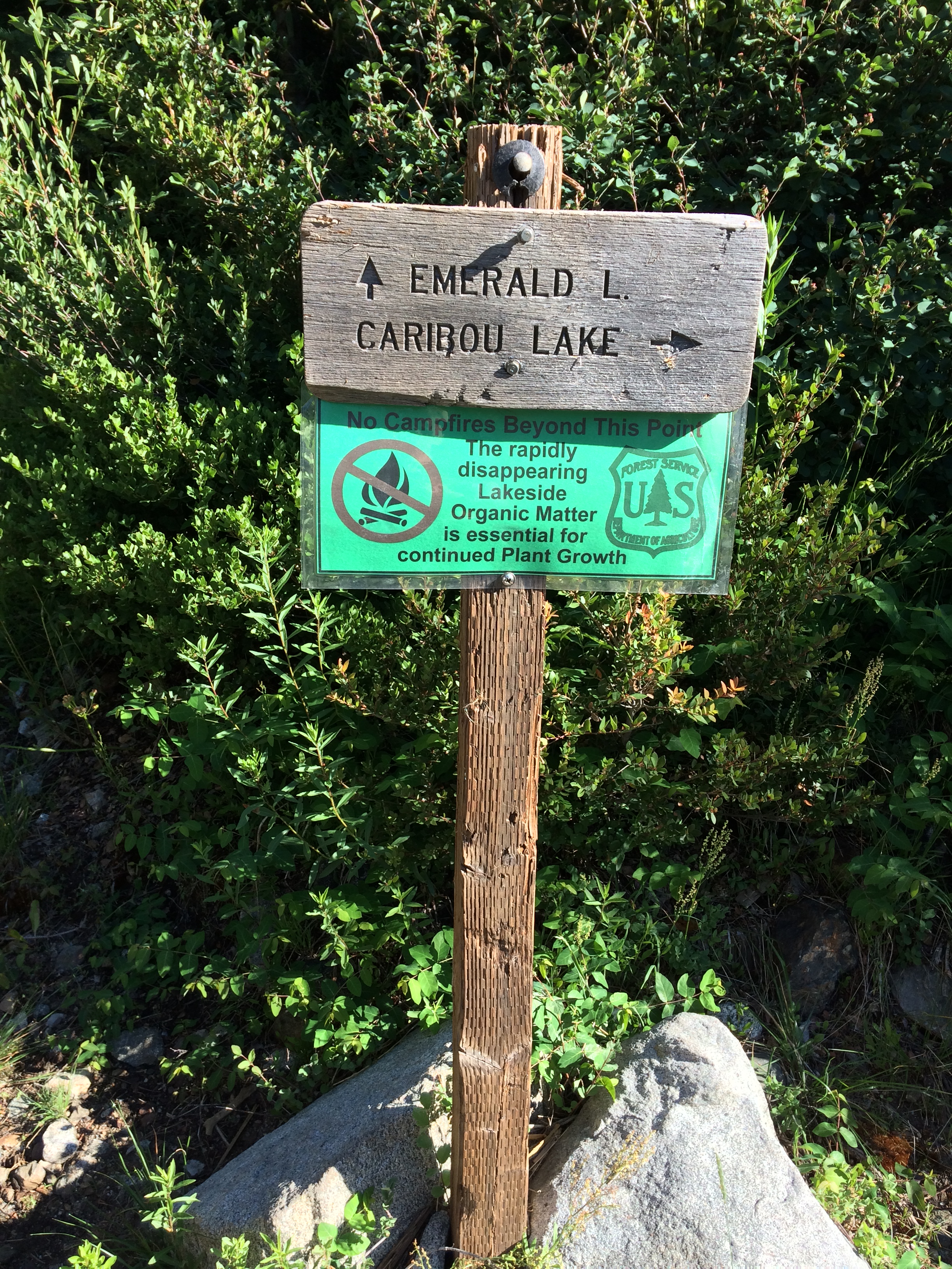
Day 3: 6.6 miles; +3,500 feet / -4,000 feet; Sapphire Lake to Caribou Lake to Emerald Lake.
Map of the Trinity Alps – Emerald Lake Day 3 Hike (pdf)

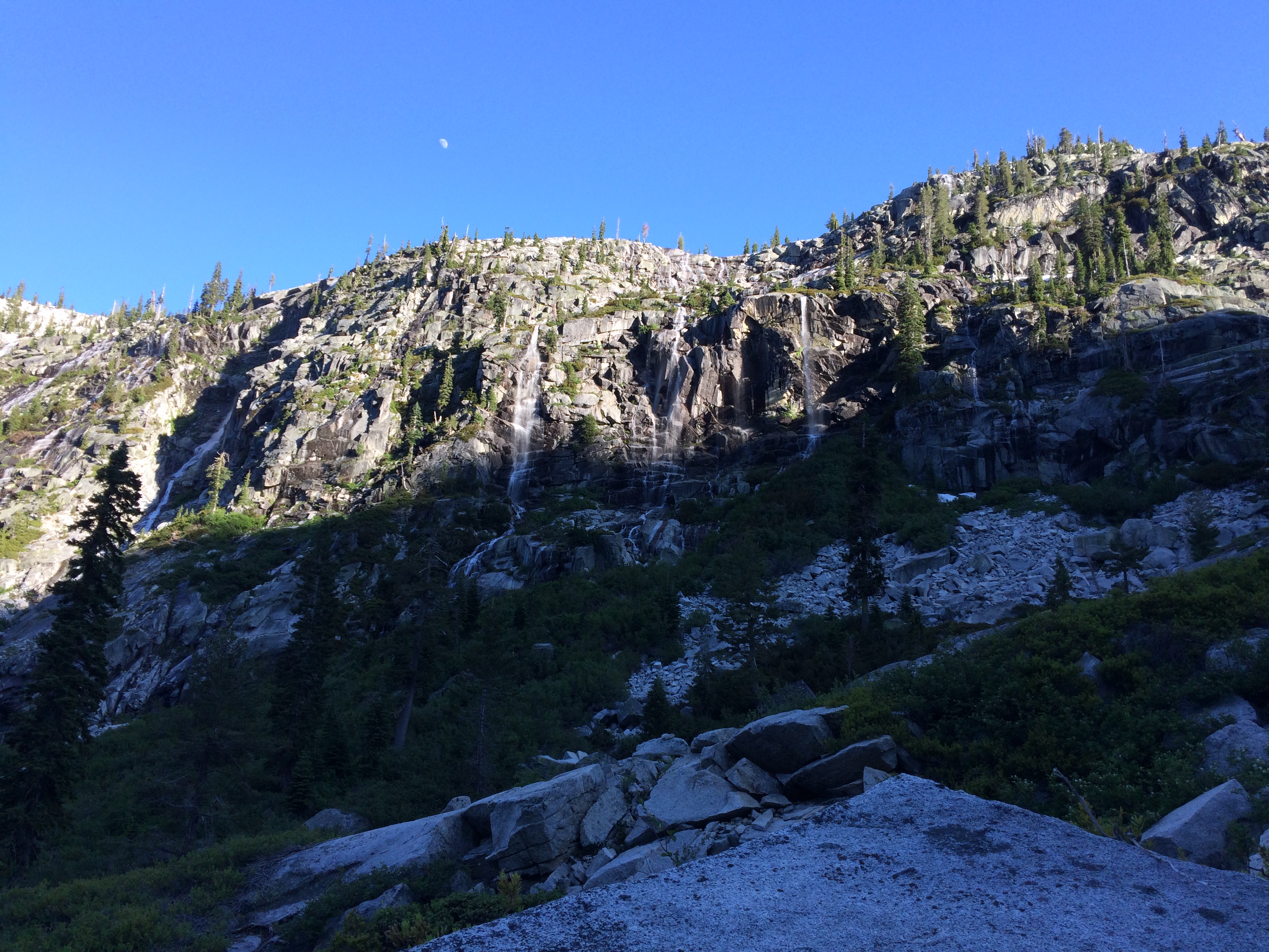
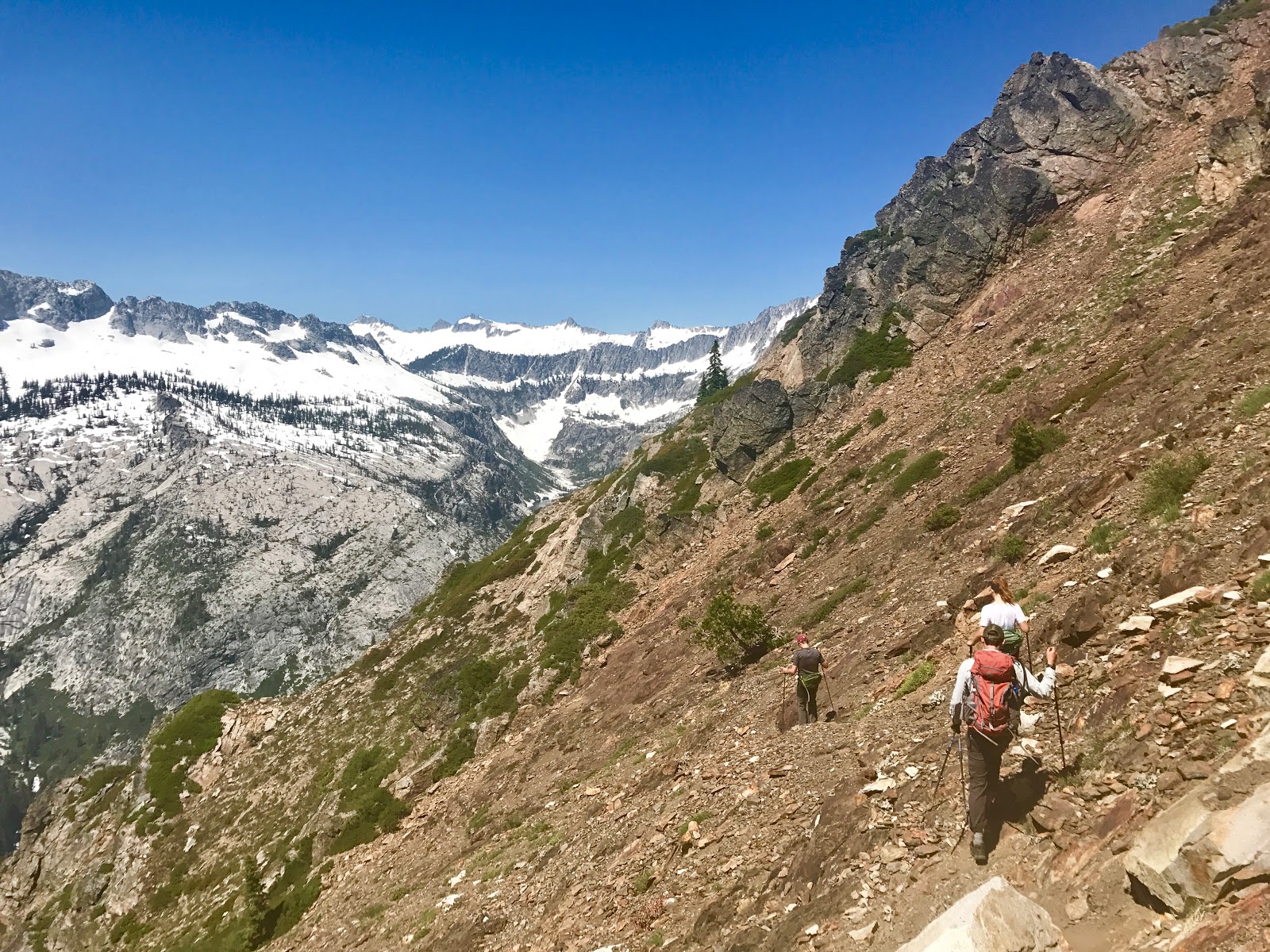
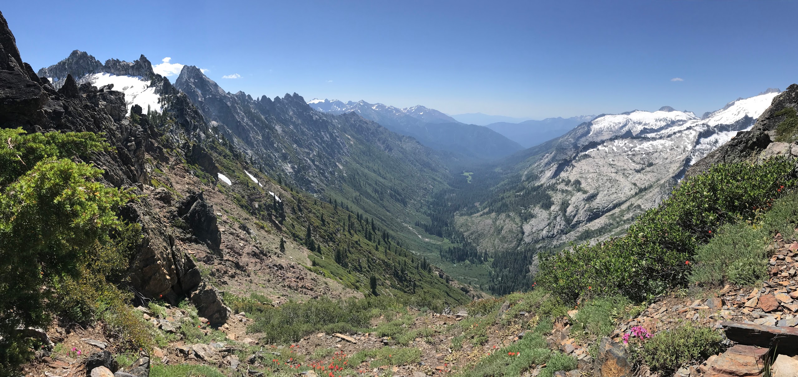
The next morning we got up early and moved our camp to Emerald Lake so that we could join up with some friends who were camping there. We scrambled back down to Emerald and had our tent set up by 8:00 am. Soon after we and our friends set off on a day hike up to the top of Sawtooth Ridge above Caribou Lake. We left early because this trail is very exposed and gets really hot during the afternoon. Be sure to bring plenty of water on this hike because there is no water once you start climbing up the ridge.
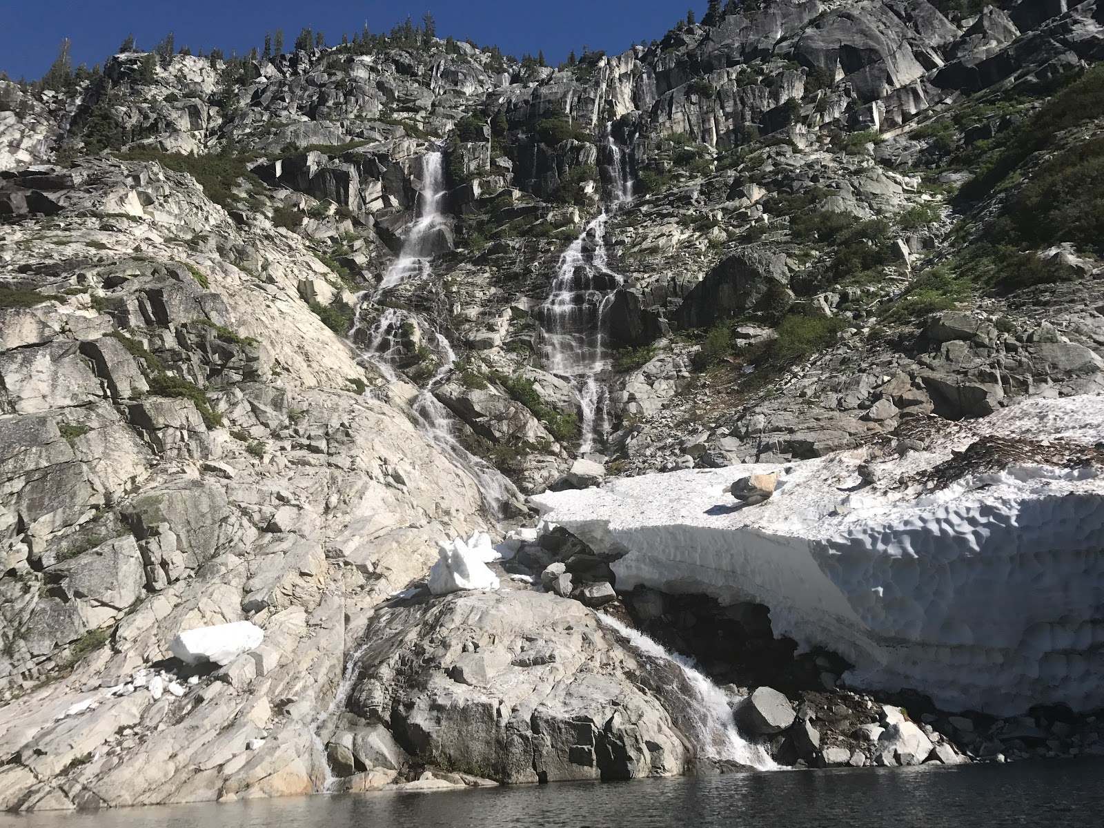
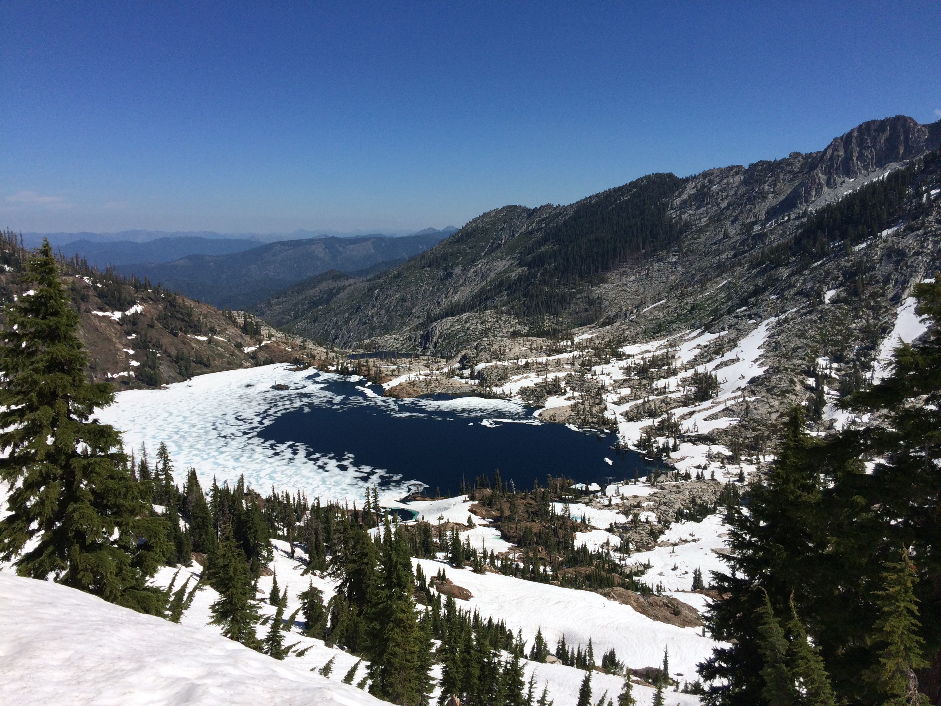
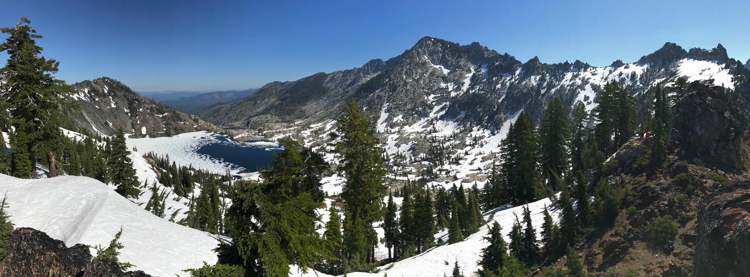
When we got to the top of the ridge we found a nice spot to sit and have lunch. The views of Caribou Lake and the surrounding area are great. The whole North side of Sawtooth Ridge was covered in snow and Caribou Lake was partially frozen. We saw a few people making the trek down the ridge to Caribou Lake, but we just hung out on the ridge and then headed back to Emerald Lake. If you head down to Caribou, you likely want an ice ax or crampons. For the hike up and down the ridge, trekking poles prove very helpful.


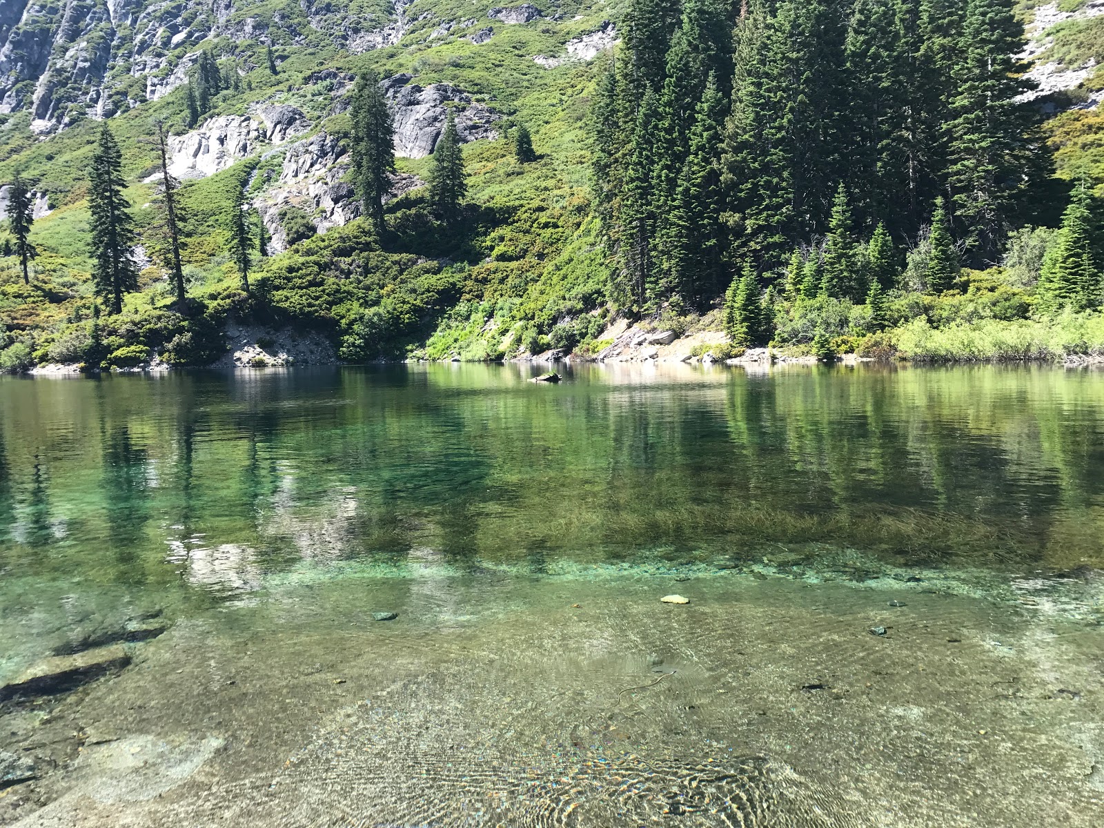
After the hike up to the top of the ridge, we hiked back to Emerald Lake to relax. We again took the raft out on the water and caught some trout with spinners. The crowds had dwindled and we largely had the lake to ourselves, which was great. There is a flat slab of granite near the edge of the lake that make for a great dinner spot.


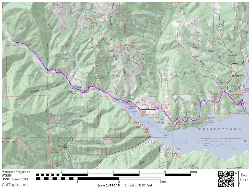
Day 4: 12.1 miles; +950 feet / -3750 feet; Emerald Lake to the Stuart Fork Trailhead.
Map of Day 4 of the Trinity Alps – Emerald Lake Trek (pdf)

On the last day, we packed up camp and then hiked the ~12 miles back to our car at the trailhead. The hike is mostly downhill and we were able to do it in ~5 hours. I didn’t take any pictures on the way out because it was the same trail we took on the way in.
After reaching our car, we dropped off our packs and walked down to the river to wash off. There was a path that led to a nice rocky beach. It was great to rinse off and cool down.
We then chugged some water to hydrate and started the drive home.
Notes: We originally planned to hike to the Four Lakes Loop via the Stoney Ridge Trail, but ultimately did this hike instead because we had heard there was still plenty of snow on the other trail. We were happy with this hike though, and Emerald and Sapphire Lakes are really nice. The trail and lakes were kind of crowded, but I imagine this was due to a combination of it being the 4th of July weekend and many of the other trails being covered in snow.
We talked to plenty of other backpackers while at the lakes and heard that Mirror Lake, which is reached via a scramble from Sapphire Lake, is really nice and secluded. We didn’t try to get there because it required scrambling over snow, but I imagine it’s a great spot in August and early September after things are all thawed. We also heard Caribou Lake is a nice place to camp and heard taking the trail to Caribou from Big Flat is nice.
Here are some related trip reports!

This is a great trip report – We did this a couple years ago in September, we were the only people there. This past weekend we hiked to Caribou from Big Flat, via the new trail, and took the old trail back part of the way. It was definitely busier, but there was plenty of room around the lake. Thanks for posting this, it was interesting to see Caribou partially frozen – there are still snow caves now.
LikeLike
Thanks! There are so many cool places to explore in the Trinity Alps. I still have to make my way to the Four Lakes Loop, Grizzly Lake, and down to the Caribou Lakes!
LikeLike
This is a GREAT report! I am doing this hike with my dog in a few weeks and i can NOT wait! Thanks for all of the information!!!
LikeLike
I hope you have a great hike! We saw a bunch of dogs on the trail when we went, so your dog should have a good time too.
LikeLike
Nice Photos and trip review. Looks the same as when I was there in 1971, including the half-frozen Caribou Lake in July. Guess I’m gettin’ old ! Happy trails.
LikeLike
Love the review. If you went again would you camp at sapphire lake or emerald lake? Just wondering what is better and why!
LikeLike
Hi Lonnie – I really thought Sapphire Lake was the most beautiful. There are fewer campsites at Sapphire, but the backdrop is awesome. You really can’t go wrong though. My main issue with Emerald Lake was just that it got a bit crowded since it’s easier to get to compared to Sapphire Lake.
LikeLike
No pictures of any wildlife or was there not any seen?
LikeLike
We did not see much wildlife on this particular trip. I think it was because it was a busy weekend on the trail with lots of other backpackers!
LikeLike
👌👌
LikeLike
We packed in there on horses when I was 16 years old in 1961. It’s good to see these pictures of the back packing trip and see that everything has remained exactly the same. It’s a phenomenal area.
LikeLike
Hey hi!
I would love to get the PDF of the overall trip, but the links appear to be broken? Can you send me a link?
LikeLike
Hi Erin – I just fixed the link to the overall PDF. You can find the download here: https://backpackersreview.files.wordpress.com/2021/05/overall_map.pdf
LikeLike