


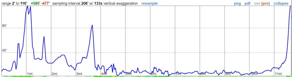
Trip Overview: This ~25 mile route offers a rare coastal wilderness experience where you travel along a beach and must keep track of the tides! The route explores one of the most undeveloped stretches of shoreline in California. Along the way, you hike on the beach, travel over grassy bluffs, and dodge sea lions and ocean waves. +/- 1,000 feet of elevation over the course of this trek with a peak elevation of only ~150 feet. Highlights include coastal views as far as the eye can see, remote beaches, and a variety of wildlife including sea lions, seals, deer, and whales. The majority of the images here are from a trip in mid May. Unless otherwise noted all photos were taken by Richard O’Neill and are reused with permission.

- Higher resolution map of the Lost Coast Trail from the BLM (PDF)
- Topographic map of King Range Wilderness for purchase (amazon link) *Note this map has mixed reviews and many prefer the BLM map above
Jump to Day 1: Mattole Beach Trailhead to Cooksie Creek
Jump to Day 2: Cooksie Creek to Big Creek
Jump to Day 3: Big Creek to Black Sands Beach Trailhead
Shop Deal of the Day at REI Outlet (up to 50% off)!
Preparations:
Click here to read more about Permits
Permits: You must obtain a wilderness permit in order to overnight camp along the Lost Coast trail in the King Range Wilderness area. The block of permits for each calendar year are released the preceding year on October 1 (e.g., 2019 permits are available October 1, 2018). Permits can be obtained on recreation.gov on a first-come, first-serve basis.
Click here to read more about Logistics
Logistics: Most backpackers prefer to tackle the Lost Coast Trail as a one way 25 mile trek. This means you must figure out a way to get between the starting and ending trailheads before/after your hike! The cheapest option is to bring two cars within your group and either leave one car at the ending trailhead or to split your group in two and organize a key exchange. However, it is a roughly 2 hour drive one way to get from the Mattole Beach Trailhead to Black Sands Beach Trailhead, so shuttling cars between the trailheads adds quite a bit of time. If you are able to spend some extra money, it can save you significant driving time to use one of the commercial shuttle companies that operate in the area. These shuttles will transfer you between trailheads for a price of ~$100 per person (Lost Coast Adventures is one operator).
In my opinion, the easiest way to tackle the Lost Coast Trail is as follows: The night before your trek you drive to the Black Sands Beach Trailhead and spend the night nearby (there are camping or hotel option is nearby Shelter Cove). Early the next morning, take a morning shuttle from Black Sands Beach up to the Mattole Beach Trailhead where you will start your trek (book this shuttle in advance). Now you can hike the Lost Coast Trail south back to Black Sands Beach where your car will be waiting for you at the end of your hike. This way you avoid needing to rush to catch a shuttle at the end of your hike.
Click here to read more about Difficulty
Trail Conditions and Difficulty: The Lost Coast Trail can be deceptively difficult for many backpackers. Although it is only 25 miles long and does not have any significant elevation gain, the footing along the trail is often challenging. Along the way you must hike over shifty sand, over boulders, and over small rocks. Expect to hike slower than your normal pace!
In terms of navigation, the route is relatively easy to follow. The trail mostly heads south along the shoreline. There are a few areas where the trail moves inland, but you always return back to the shore within a few miles.
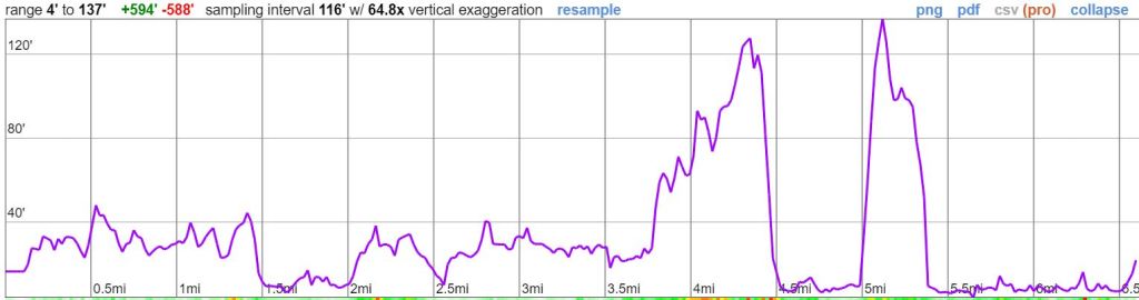
Tides: One unique facet of the Lost Coast Trail is that you must utilize a tide chart to navigate the route. Three sections of the route are impassable at high tide:
- A small section of trail near Punta Gorda
- 4 mile section of coast between Sea Lion Gulch and Randall Creek
- 4 mile section of coast between the south end of Miller Flat and Gitchell Creek

You can check the daily tide chart for the Lost Coast Trail area here at the NOAA website. Be sure to look at the dates you are planning to hike and remember that there are multiple high tides per day. It is likely that you will need to adjust your starting hike times and will need to take a few long breaks during the day to time the tides safely. Also note that planning around the tides is not just a recommendation. You literally are not able to safely hike along sections of the route when it is high tide.
Supplies: There are black bears in the King Range Wilderness, so you need to bring a hard-sided bear canister to store food and scented items. If you do not own a bear canister, there are various options for rentals in the area.
Below is a list of the gear I brought while backpacking the Lost Coast Trail:
Hiking clothes
- a lightweight hiking rain jacket (North Face Venture 2 Jacket)
- fast drying synthetic hiking pants (prAna Zion Pants)
- a quick drying long sleeve hiking shirt (Columbia Silver Ridge L/S Shirt)
- wool outer socks (People Socks Moreno 4-pack)
- thin blister preventing base socks (WrightSock double layer Coolmesh)
- quick drying synthetic boxer briefs (ExOfficio Give-N-Go)
- Gore-tex hiking shoes (adidas Outdoor Terrex Fast R Gore-Tex Shoe)
Clothes for camp
- wool leggings (Minus33 Merino Wool Kancamagus Midweight Bottom)
- wool base layer shirt (Minus33 Merino Wool Chocorua Midweight Crew)
- lightweight down jacket (Patagonia 800-fill Down Jacket)
- lightweight camp shoes (Xero Z-Trail lightweight sandal)
Hiking gear
- topographic map
- trekking poles (Black Diamond Trail Ergo Cork Trekking Poles)
- 2 liter hydration bladder (Platypus Big Zip Water Reservoir)
- 65 liter backpack (Osprey Atmos 65 Liter pack)
- water filtration system (Platypus gravity filtration system)
Camp gear
- strong tent with rain-fly (Alps Mountaineering Chaos 2 Tent)
- inflatable sleeping pad (Therm-a-Rest Trail Pro Sleeping Pad)
- sleeping bag (REI Co-op Igneo 25 Sleeping Bag)
- lightweight backpacking chair (Helinox Chair Zero)
- headlamp (Black Diamond Cosmo Headlamp)
- multi-tool with knife (Gerber MDime Mini Multi-Tool)
- bear canister (BearVault BV500)
- lightweight stove (MSR PocketRocket 2)
- lighter (BIC plastic lighters)
- 2 liter pot (GSI Outdoors Halulite Boiler Pot)
- coffee cup (GSI Outdoors Glacier Stainless Cup)
- lightweight spork (Snow Peak Titanium Spork)
- small, quick drying towel (REI mutli towel mini)
Random
- wet wipes (Stall Mates individually wrapped wipes)
- mole skin for blisters (Blister medic kit)
- small amount of duct tape for gear repairs
- chapstick and sun screen
Food and drink
- a variety of my favorite dehydrated meals
- electrolyte replacement (NUUN Hydration Tablets)
- instant coffee (Starbucks VIA)
- quick snacks (Clif Shot Bloks and Clif energy bars)
- small plastic water bottles filled with whisky 🙂
……….
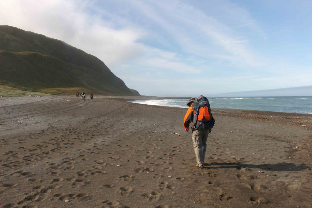
Day 1: 6.6 miles; +/- 600 feet; Mattole Beach Trailhead to Cooksie Creek

This itinerary starts the Lost Coast Trail hike at the northern Mattole Beach Trailhead. Most backpackers either take a shuttle to the trailhead or park and camp near the trailhead the night before their trek. The mileage on Day 1 is mild, so you can acclimate to hiking on the beach and account for the tides. There is a small impassable section of trail at the ~2 mile mark, so be sure to tackle this section of trail only at low tide. You also must tackle the ~2 mile section between Sea Lion Gulch and Cooksie Creek at low tide. Part of the reason why the mileage is kept low on Day 1 is because you may need to wait a couple hours in order to safely time the tides. After making camp at Cooksie Creek, you can spend the rest of the day exploring the beach.
……….
Starting the Lost Coast Trail trek from the Mattole Beach Trailhead 
Along the trail you pass several tide pools and have the opportunity to find starfish, sea urchins, and other creatures. 
Heading south along the Lost Coast Trail in the King Range Wilderness 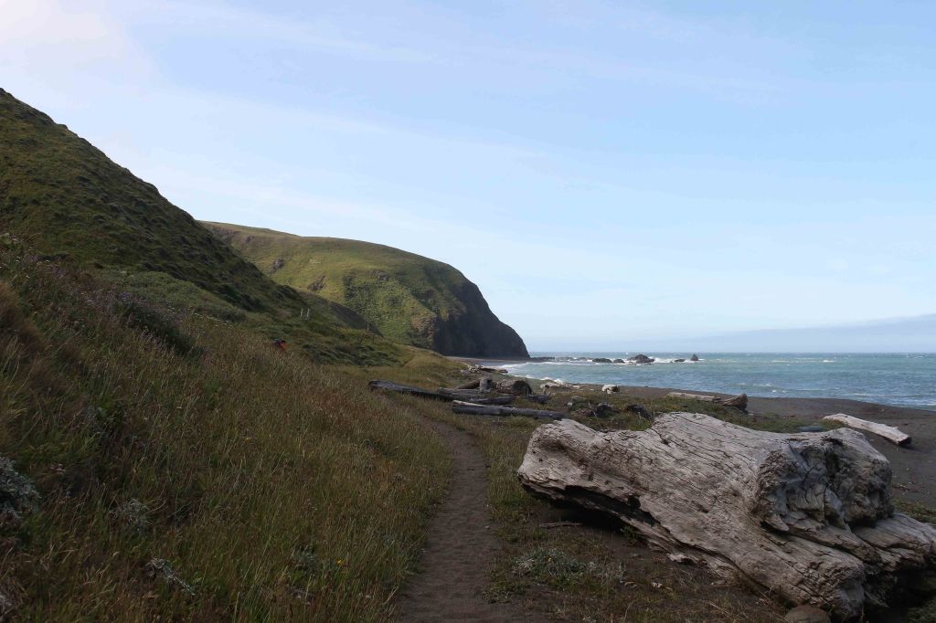
On the Lost Coast Trail between Mattole Beach and Punta Gorda 
Succulents seen along the trail 
Lost Coast Trail between Mattole Beach and Punta Gorda 
Lost Coast Trail near Punta Gorda 
Lost Coast Trail near Punta Gorda 
Lost Coast Trail near rounding Punta Gorda 
Lost Coast Trail 
Approaching the Punta Gorda Lighthouse along the Lost Cost Trail 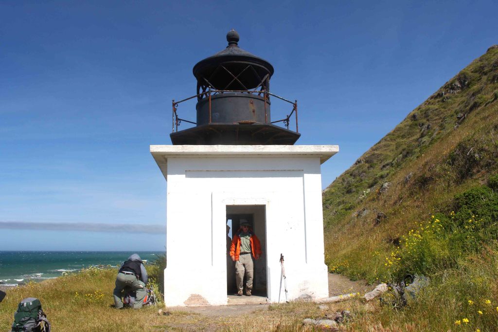
Punta Gorda Lighthouse 
View looking south at backpacking on the Lost Coast Trail as seen from inside the Punta Gorda Lighthouse 
Sea Lion hiding next to a log near the Lost Coast Trail 
Sea Lions along the Lost Coast Trail 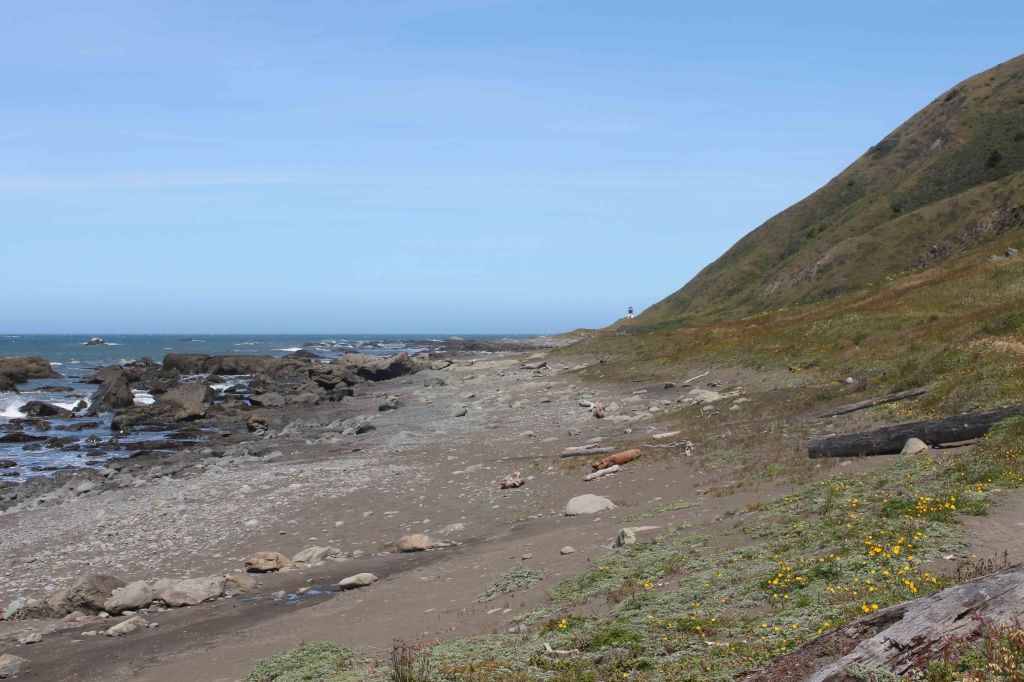
Looking back at the Punta Gorda Lighthouse 
Waterfall near Willow Creek along the Lost Coast Trail 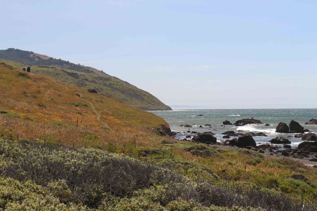
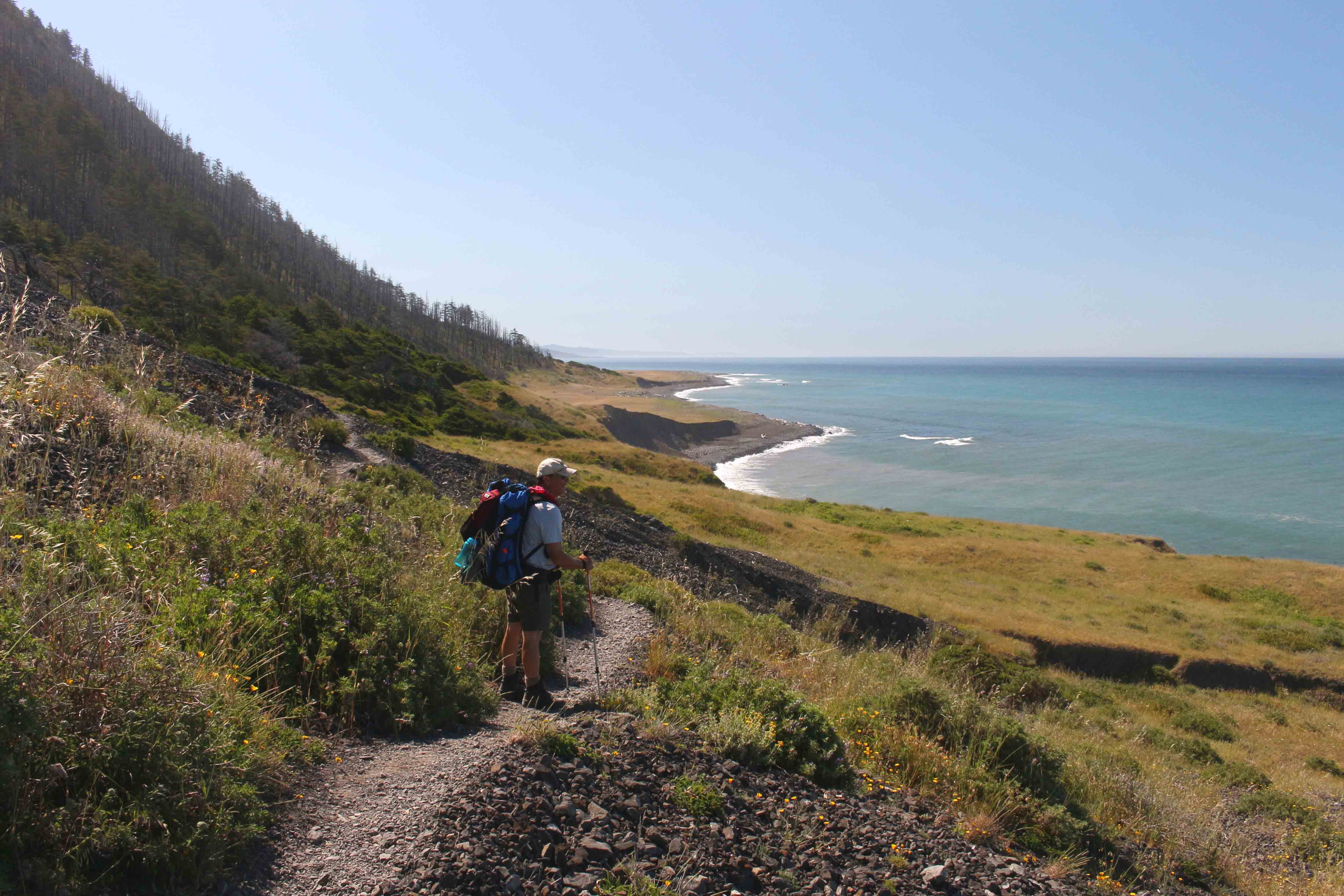
After passing Willow Creek, the Lost Coast Trail briefly climbs up to the headlands above the shore 
Hiking south on the headlands after Willow Creek, along the Lost Coast Trail 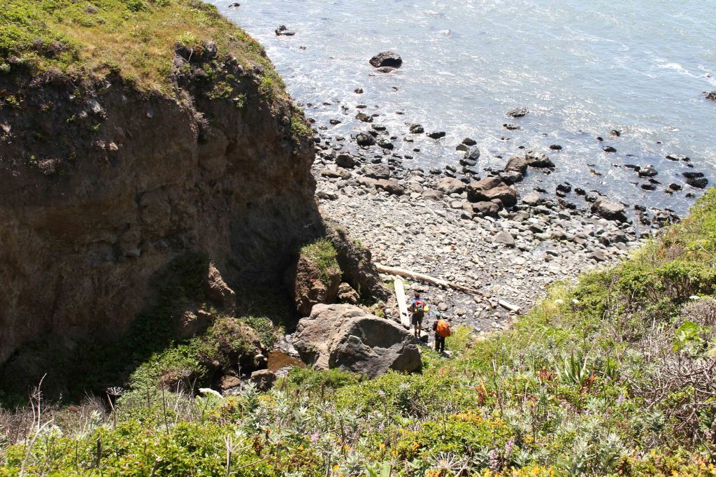
The Lost Coast Trail then drops back down to the shore at Sea Lion Gulch 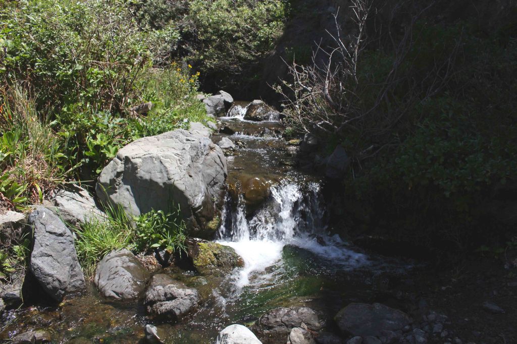
Creek at Sea Lion Gulch 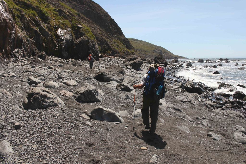
Hiking along the shore after Sea Lion Gulch, on the Lost Coast Trail 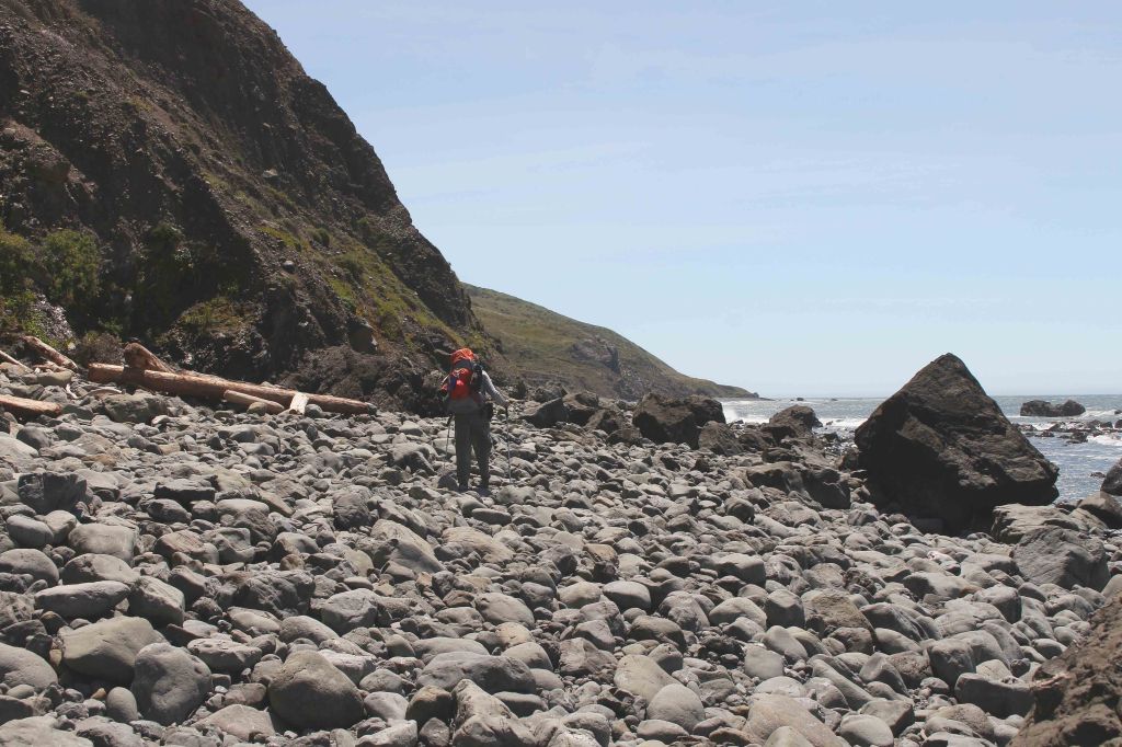
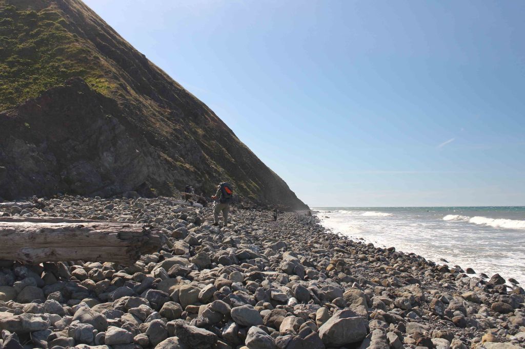
Here the Lost Coast Trail turns into a ankle twisting rock field 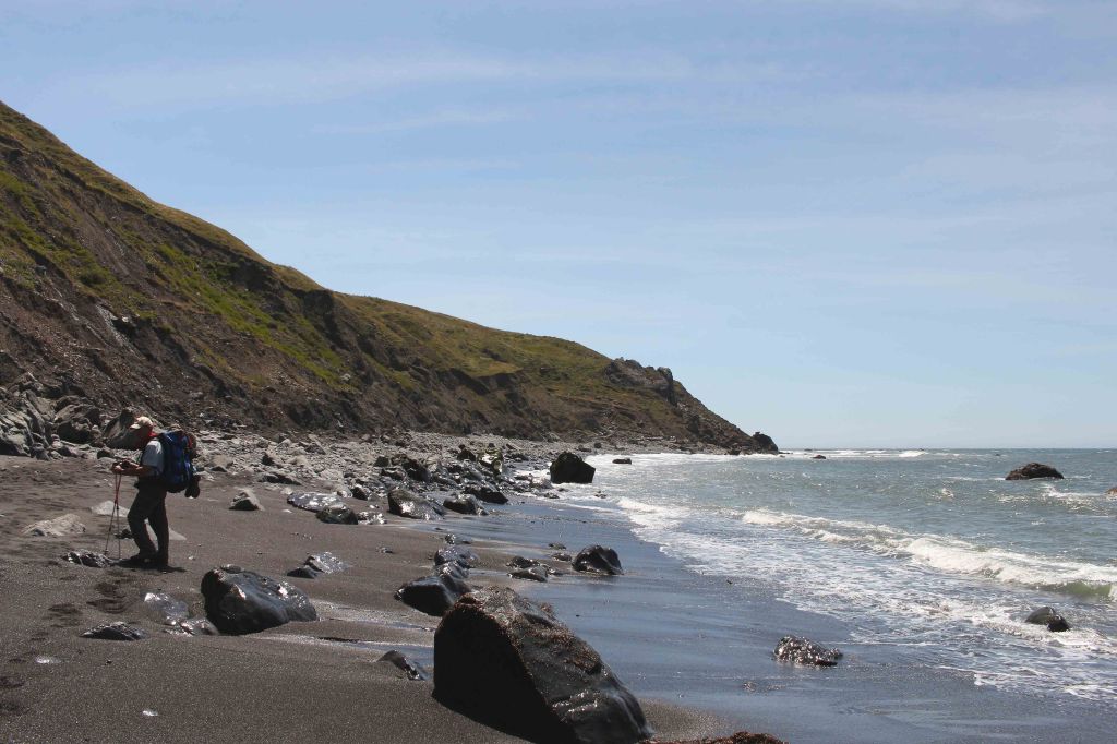
As you head south along the shore, it alternates between rocks and sand for footing 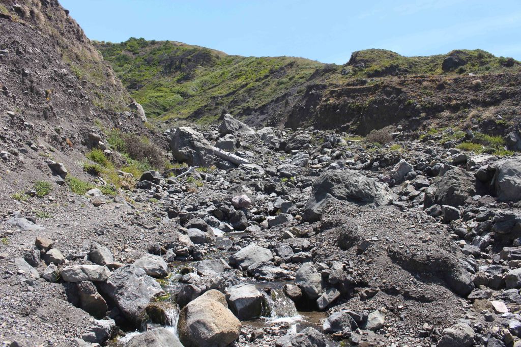
At the ~5.5 mile mark, there is a detour in the Lost Coast Trail that briefly brings you up from shore 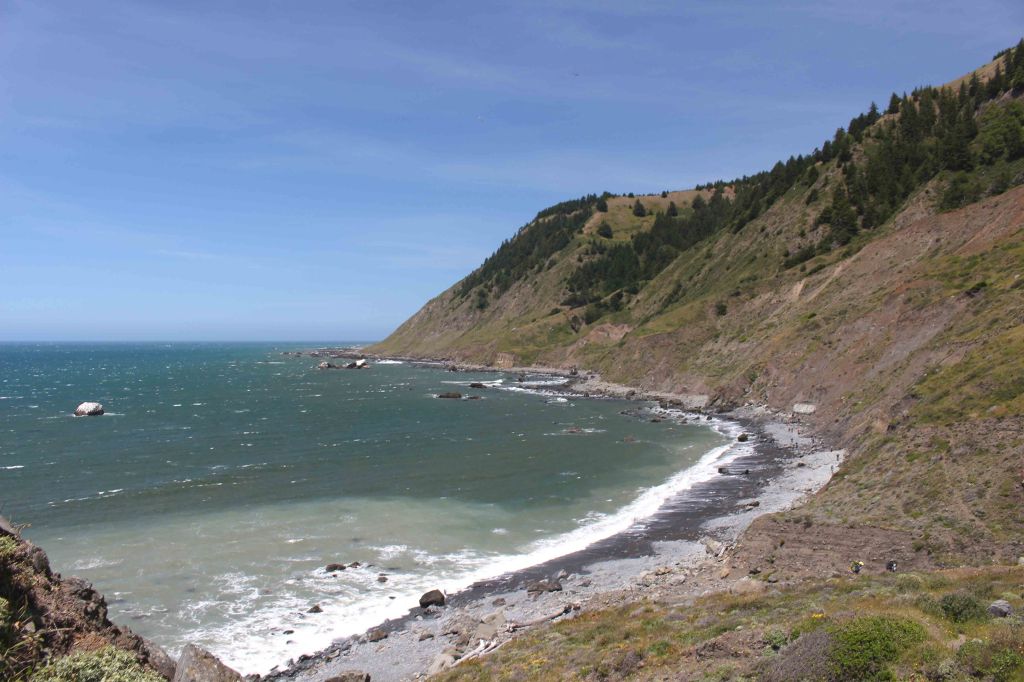
View looking north from the top of the detour area 
View looking south from the top of the brief detour on the Lost Coast Trail 
You then quickly descend back down to the shoreline 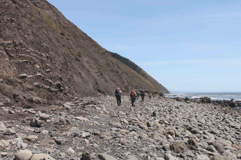
Final stretch of rocky hiking on the Lost Coast Trail before turning the corner and reaching Cooksie Creek 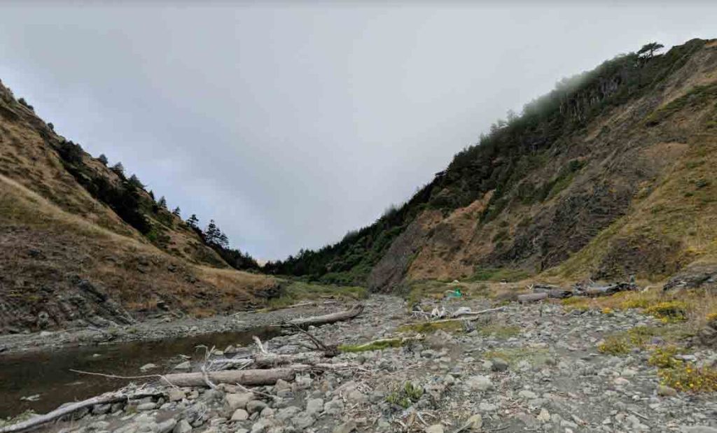
View looking up into the Cooksie Creek area. The teal tent in the center right is a popular campsite. 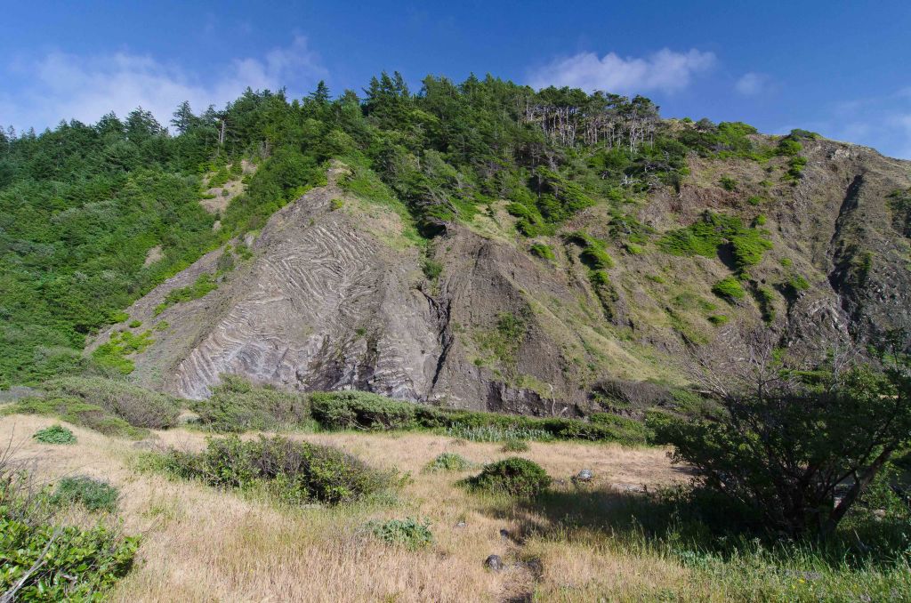
Layered rock wall seen from several campsites in the Cooksie Creek Area (credit: Daniel) 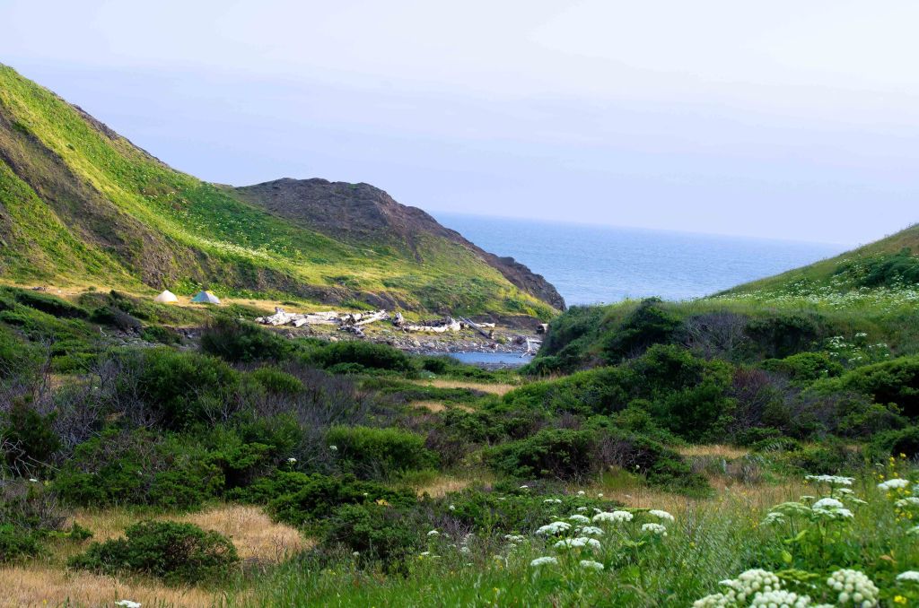
View looking at one of the popular campsites in the Cooksie Creek area of the Lost Coast Trail (credit: Daniel)
Day 2: 7.3 miles; +600 feet / -520 feet; Cooksie Creek to Big Creek

On Day 2, you travel ~7 miles from Cooksie Creek to Big Creek. The first 2 miles of hiking on this day must be tackled at low tide, so you may need to either wake up early or start late on this morning. The rest of the route to Big Creek will not have any tidal issues though and can be hiked on your own timing. In one section of this route known as the Spanish Flat, the trail climbs up to a bluff above the shore. This provides some great views and also gives you feet at break from the sand and rocks you have been hiking on.
The day 2 hike on the Lost Coast Trail starts off with rocky footing as you head south from Cooksie Creek 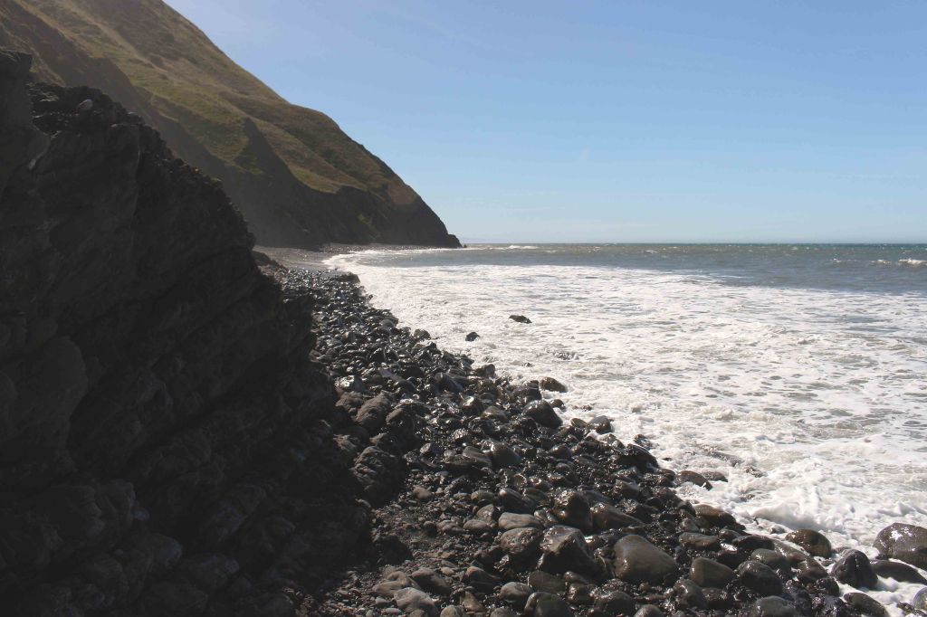
This section of the Lost Coast Trail is impassable at high tide, so you must time your hike well 
Hiking along the Lost Coast Trail between Cooksie Creek and Randall Creek 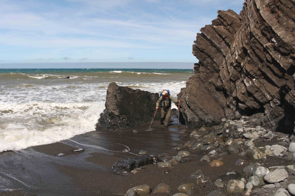
In some sections of the Lost Coast Trail you must be quick to avoid getting wet 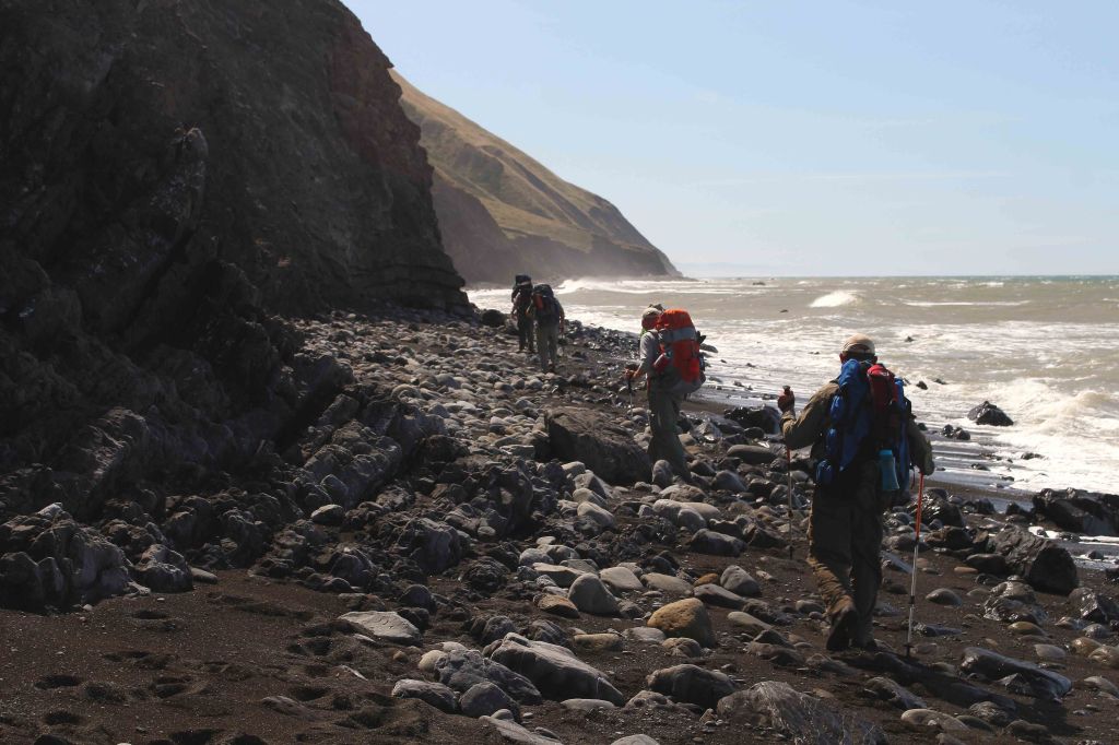
Lost Coast Trail in the King Range Wilderness 
Hiking along the Lost Coast Trail in the sandy sections can be quite tiring on your feet and knees 
View looking south on the Lost Coast Trail in the King Range Wilderness 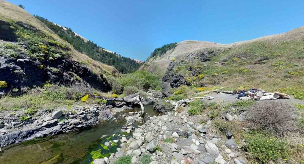
View of a nice camping area at Randall Creek 
After passing Randall Creek, the trail climbs up the headlands again. Here you feet get a break from the sand and rocks. 
Backpackers hiking along the Spanish Flats section of the Lost Coast Trail 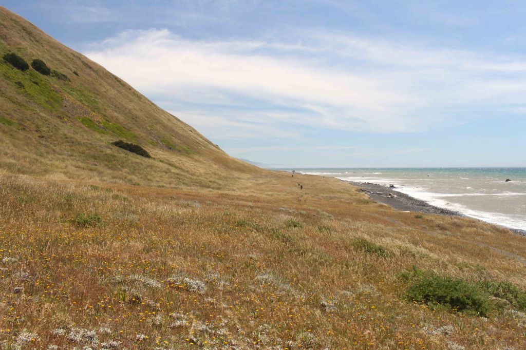
Spanish Flats section of the Lost Coast Trail 
Looking north across the Spanish Flats with many wildflowers in view 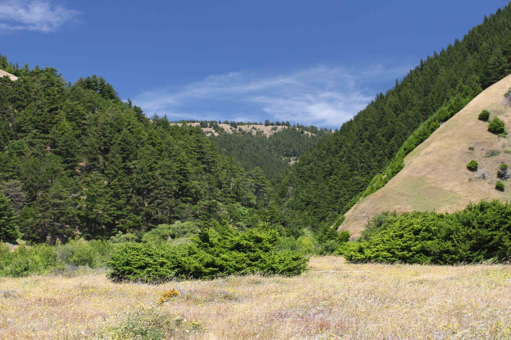
View from the Lost Coast Trail looking east towards the King Range mountains 
At the ~4 mile mark you cross over Spanish Creek, which flows across Spanish Flat down to the shore 
Along the Lost Coast Trail heading south after passing by Spanish Creek 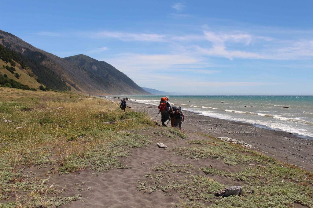
The Lost Coast Trail then briefly meets back up with the beach along shore before heading back to the headlands again 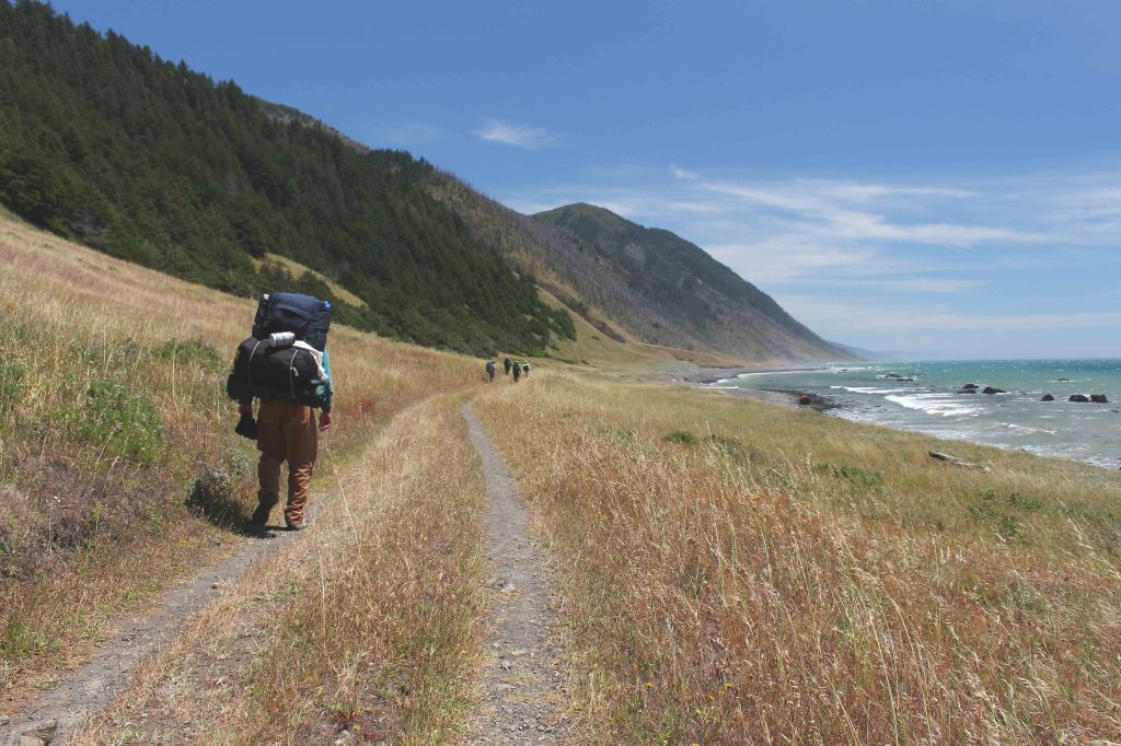
Hiking south along the Lost Coast Trail towards Kinsey Creek 
Heading south along the Lost Coast Trail 
Shortly after Kinsley Creek, the Lost Coast Trail drops back down onto the rocky shore 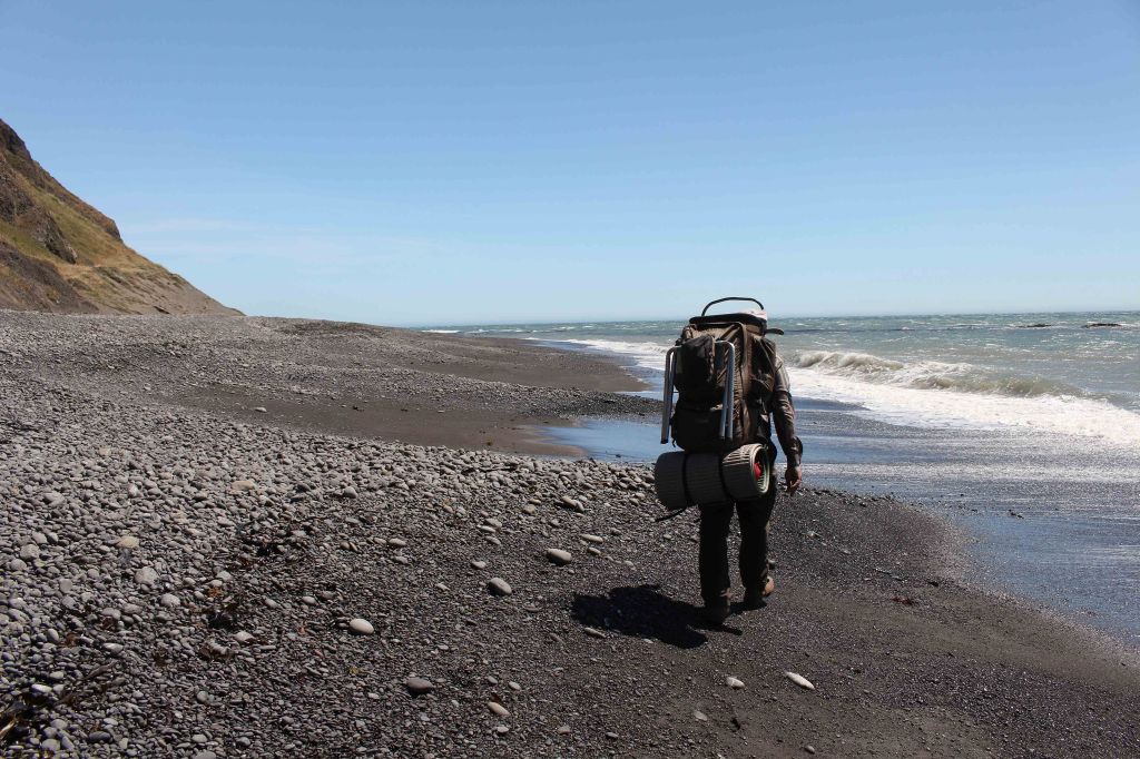
On the Lost Coast Trail as you approach the Big Creek area 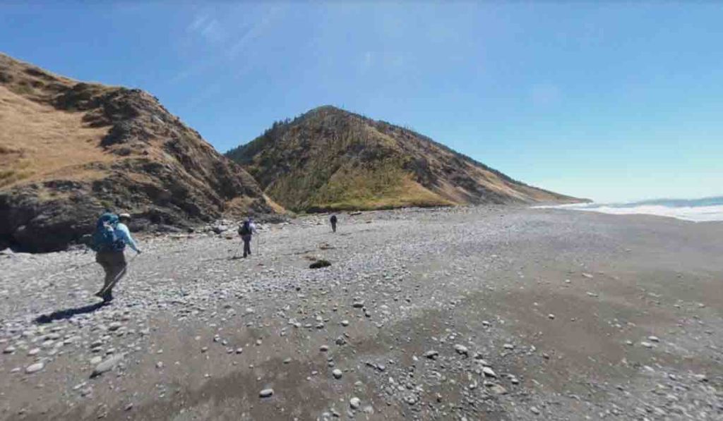
Hiking upon the Big Creek. The campsite for the second night was in the valley on the center left of this image. 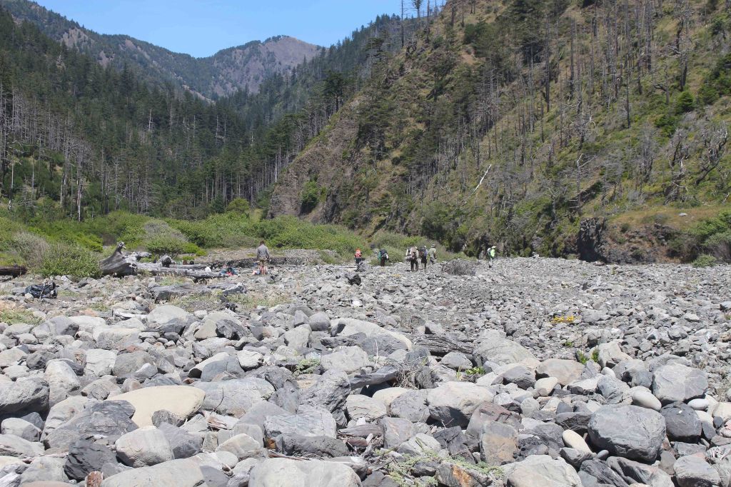
Several backpackers that have arrived at Big Creek along the Lost Coast Trail. This is a popular camping area. There is a nice campsite on the north side of the creek if you follow the creek upward for a quarter mile. 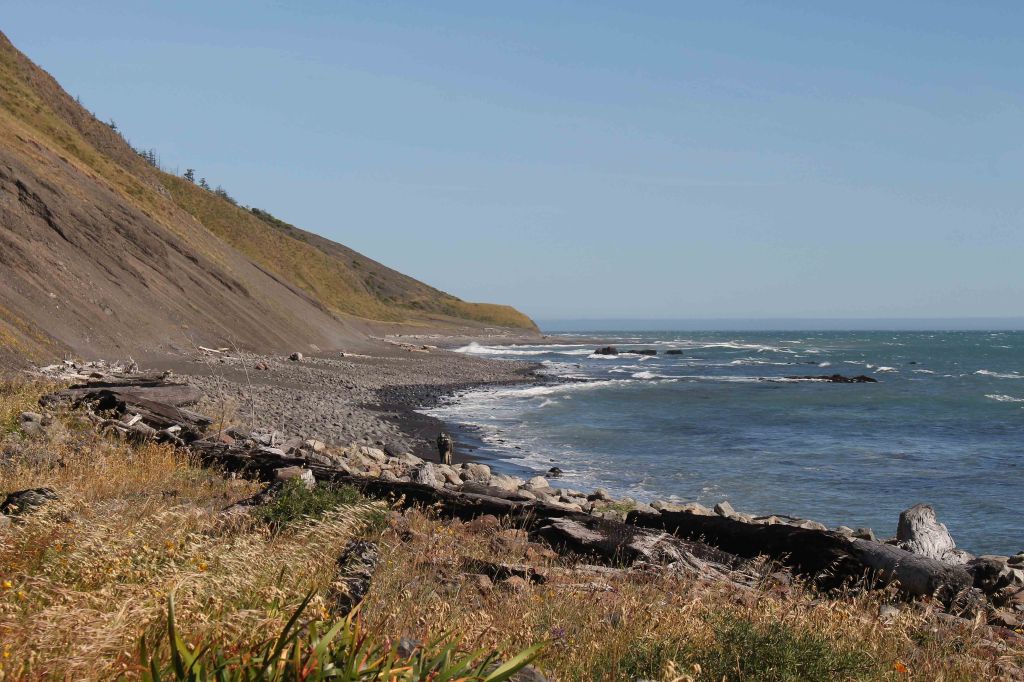
View looking south from the Big Creek area of the Lost Coast Trail
……….
Day 3: 11.7 miles; +590 feet / -480 feet; Big Creek to Black Sands Beach Trailhead

Day 3 is the longest hike of the itinerary at over 11 miles. The day starts with a modest climb up to Big Flat, a section of the trail where you hike along a Jeep Trail above the shore. You then pass by Miller Flat before dropping back down to the shore. At this point, you must navigate a ~4 mile section of trail between the south end of Miller Flat and Gitchel Creek, which is impassable at high tide. After Gitchel Creek, you are free to hike at your leisure without thinking about tides until you reach the end of the trek at Black Sands Beach.

Setting off on the Lost Coast Trail, heading south from Big Creek 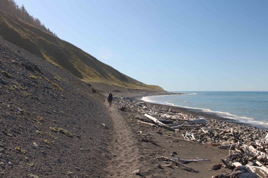
The Lost Coast Trail here is a sandy beach 
About 1 mile after Big Creek the Lost Coast Trail climbs up to the headlands again 
View looking north towards the area of the Lost Coast Trail that you have already hiked 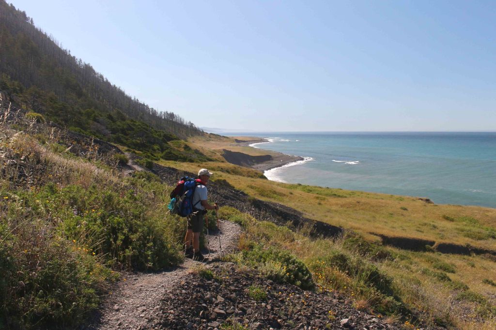
View looking south along the Lost Coast Trail 
View looking south along the Lost Coast Trail in the Big Flat area 
Hiking across the Big Flat area 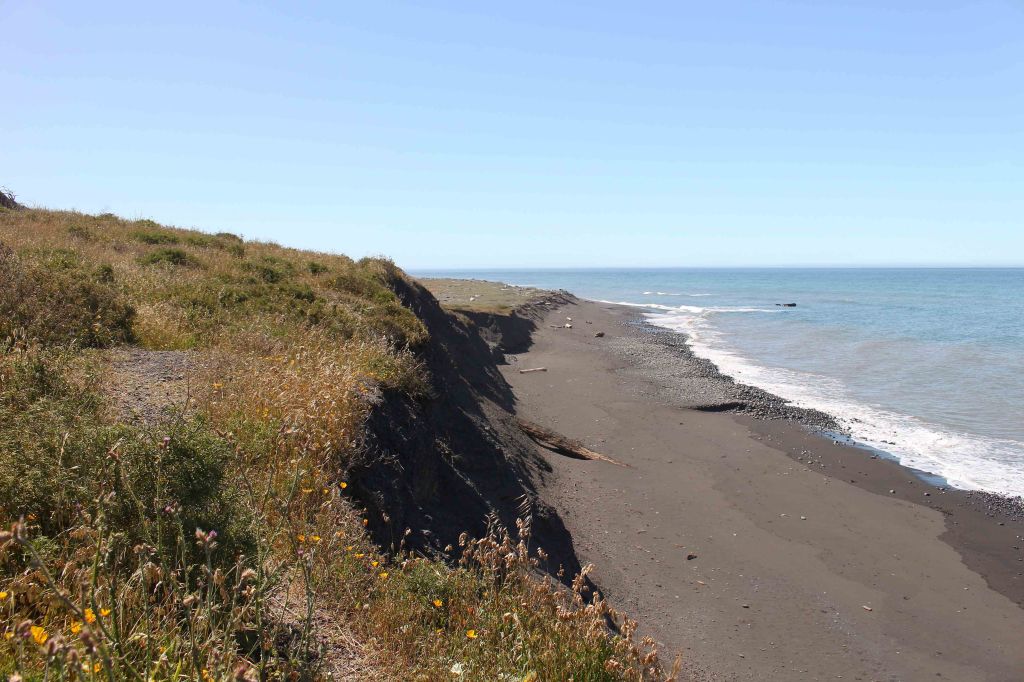
Section of the Lost Coast Trail in the Big Flat area 
Big Flat section of the Lost Coast Trail 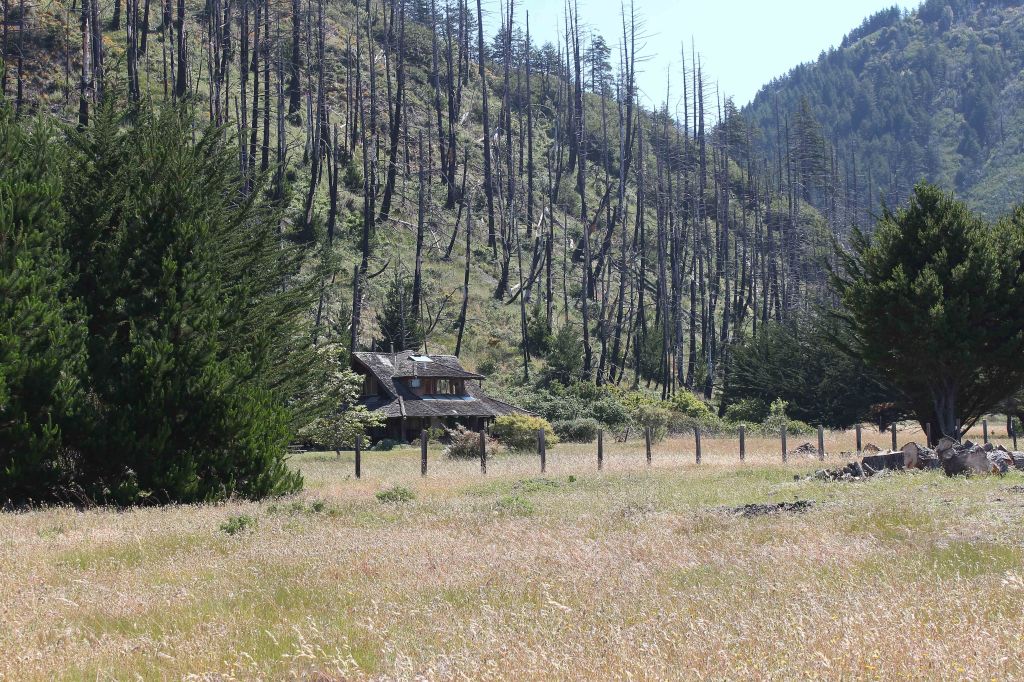
Private cabin in the Big Flat section of the Lost Coast Trail 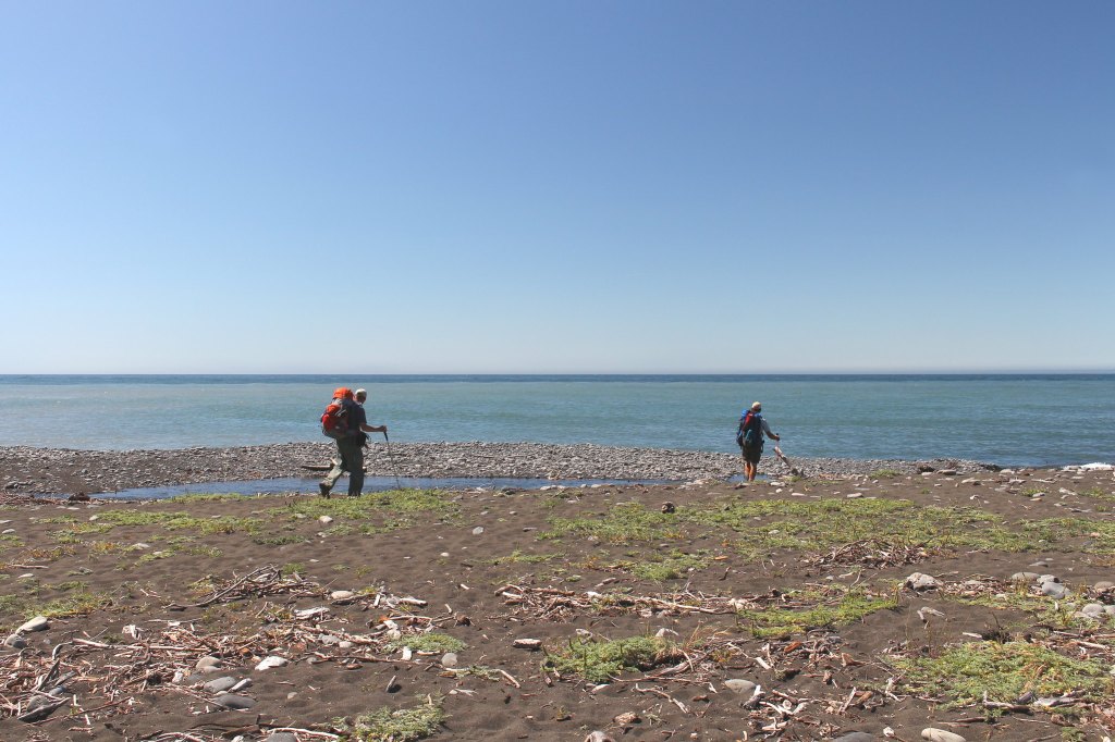
At the ~3 mile mark you pass Big Flat Creek before continuing along the Lost Coast Trail 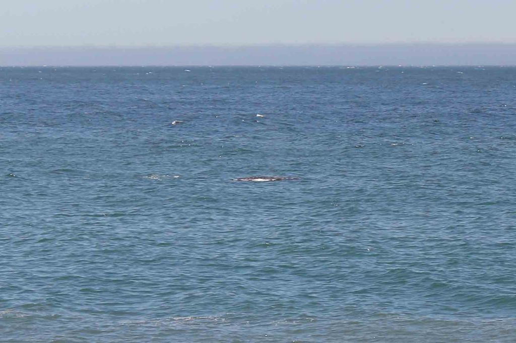
Whale seen from the Lost Coast Trail 
The Lost Coast Trail then works its way across Miller Flat before dropping back down to the shoreline 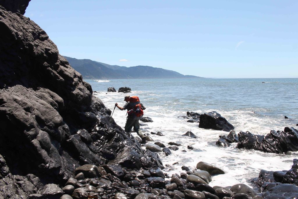
The next 4 miles of the Lost Coast Trail between Miller Flat and Gitchell Creek are impassable at high tide 
Heading south on the Lost Coast Trail between Miller Flat and Gitchell Creek 
Lost Coast Trail, King Range Wilderness 
This section of the Lost Coast Trail can be very tough on your feet with all the rocks and boulders 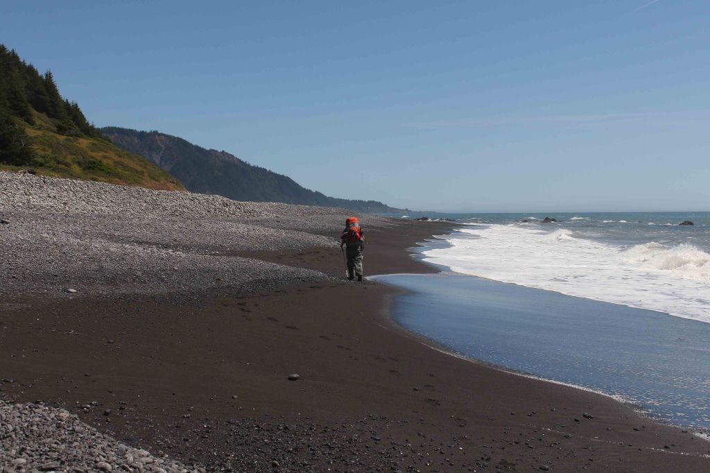
It can be a nice relief when you have a chance to hike along the packed wet sand near the water 
At the 10 mile mark, you cross Horse Mountain Creek 
View of several Lost Coast Trail backpackers taking a break at Horse Mountain Creek 
From here it is just a short hike along the beach until you reach the Black Sands Beach Trailhead 
Hiking the final stretch of the Lost Coast Trail, approaching Black Sands Beach Trailhead 
View looking north along the 25 mile route of the Lost Coast Trail 
You finish the hike with a short climb from the shore up to the Black Sands Beach Trailhead
……….
Here are some similar trip reports!
Loowit Trail – Mount St. Helens National Volcanic Monument (30 mile loop)
Four Lakes Loop – Trinity Alps Wilderness (20 mile trek)
Yosemite Highlights Loop – Yosemite National Park (40 mile loop)
Rae Lakes Loop – Kings Canyon National Park Backpacking (41 mile loop)

Do you have any recommendations for where to stay near black sands the night before taking the shuttle to matthole beach?
LikeLike
Hi Terrace – There is a privately run campsite in nearby shelter cove (https://www.sheltercoverv.net/) that is one option or there are several hotels/motels/inns in the Shelter Cove area.
LikeLike
Thank you for taking the time to compose and share your itinerary. What a lovely adventure.
Are there easily accessible water sources available?
LikeLike