


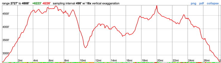
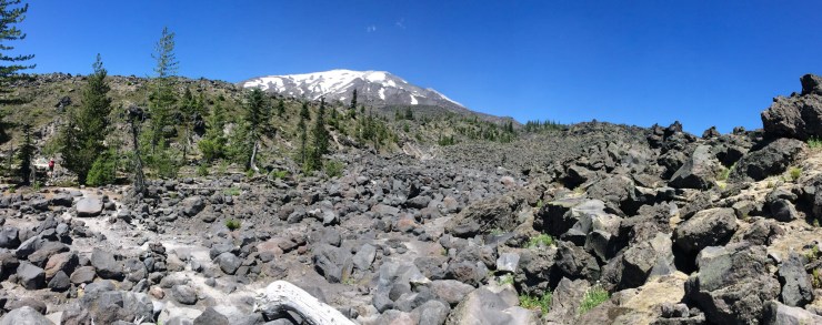
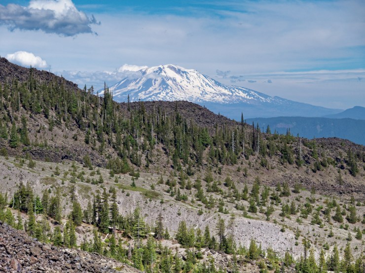
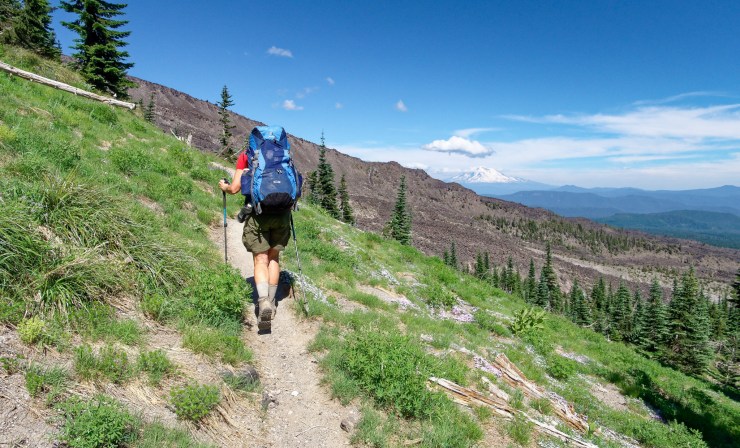
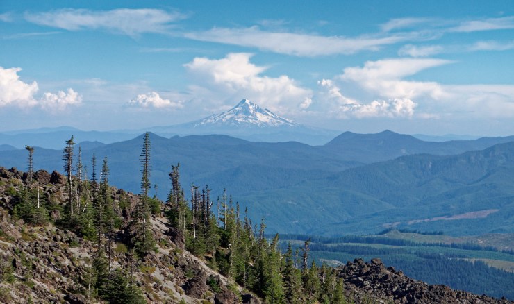
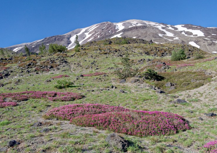
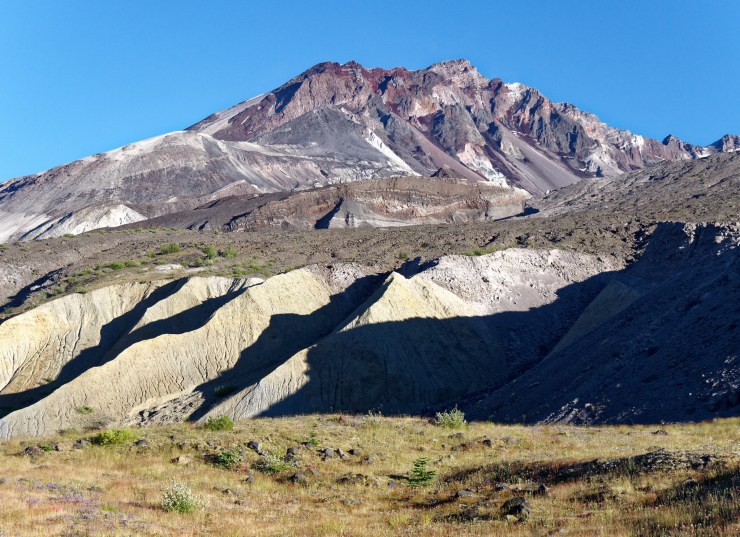
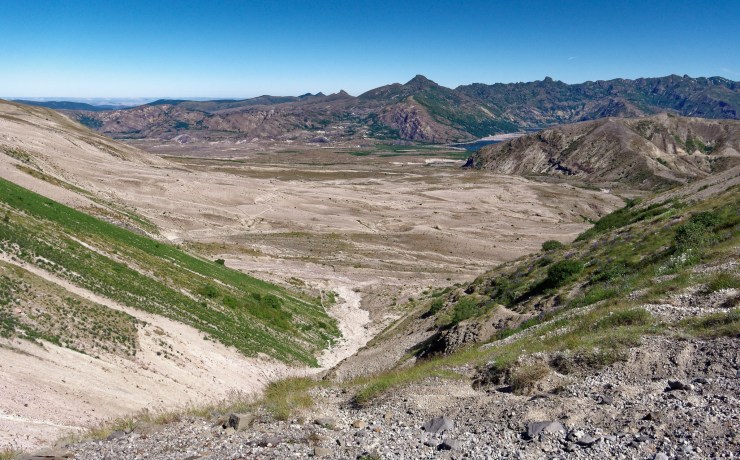
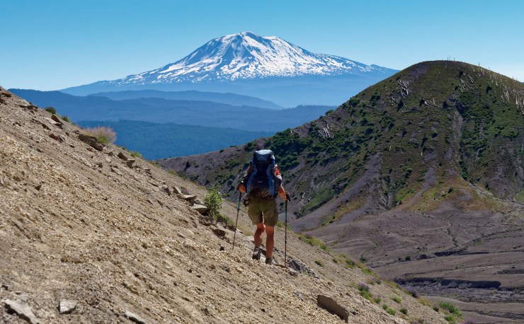
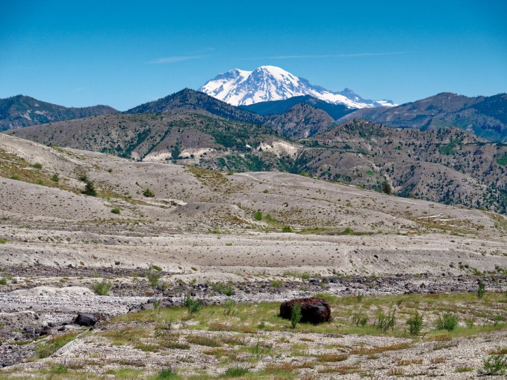
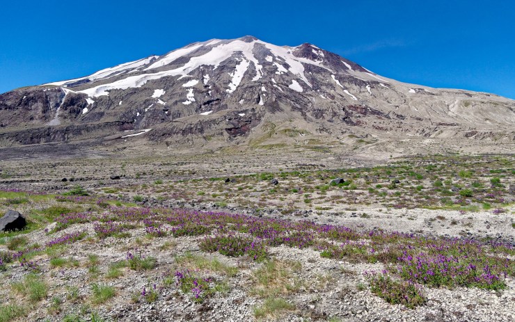
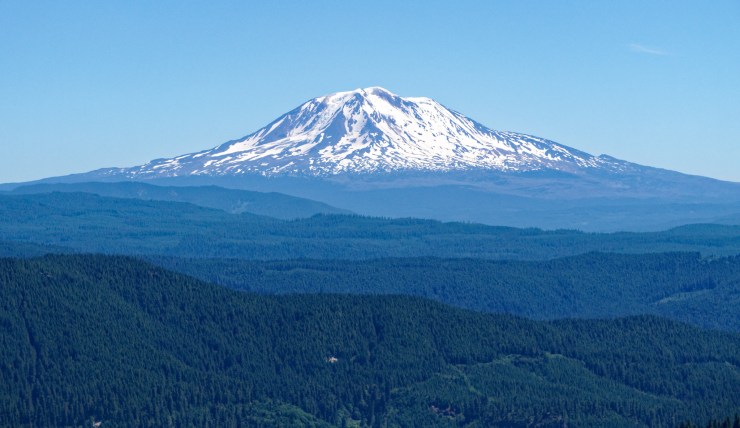
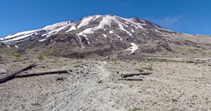
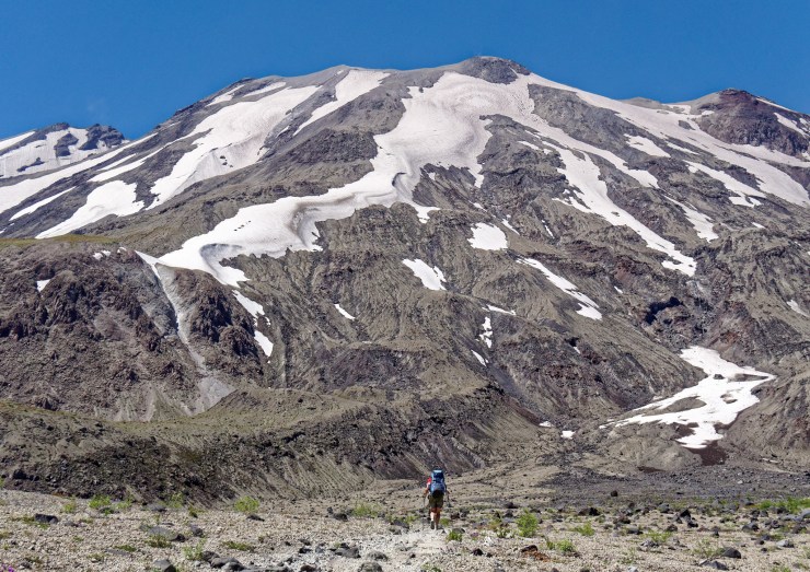
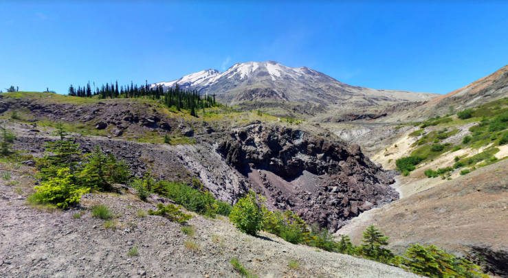
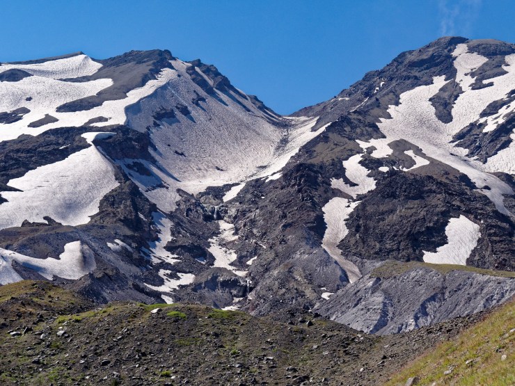
Trip Overview: The 30 mile Loowit Trail Loop is a backpacking route that circumnavigates Mount St. Helens in Washington state. This unique route provides great views of the volcanic scenery and blast zone around the most famous volcano in the continental United States. Other highlights include wildflowers, waterfalls, and epic views of Mount Rainier, Mount Adams, and Mount Hood. What truly sets this hike apart from others though is the unique landscape created by the 1980 volcanic eruption. +/- 6,500 feet of elevation across the course of this trek with a peak elevation of 4,900 feet. The majority of the images in this report are from a backpacking trip in late July of 2017.

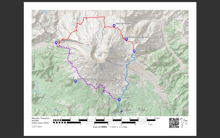
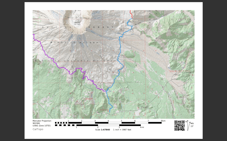
- Higher resolution version of the overall map for Loowit Trail Loop (PDF)
- Topographic map of Mount Saint Helens for purchase (amazon link)
Jump to Day 1: June Lake Trailhead to Toutle River
Jump to Day 2: Toulte River to Plains of Abraham
Jump to Day 3: Plains of Abraham to June Lake Trailhead
Shop Deal of the Day at REI Outlet (up to 50% off)!
Preparations:
Click here to read more about Permits
Permits: No passes or permits are required to hike or backpack on the Loowit Trail in the Mount St. Helens National Volcanic Monument. Depending on your chosen trailhead, there may be a $5 per vehicle per day access fee. There is no fee for parking/use at the June Lake Trailhead, which is utilized for the itinerary described in this report (more info at the USFS site).
Click here to read more about Logistics
Logistics: This is a loop hike, so no shuttles or transfers are required. The road leading to the June Lake Trailhead (Forest Road 83) is gated in the winter and early spring, so be sure to check that the road is open when trekking early in the summer. If you arriving later in the day, it is possible to camp at June Lake, which is only ~1 mile from the trailhead (must camp at 100 feet from the shore).
For the Loowit Loop, one of the main challenges is dealing with limited water availability. According to the USFS, there are only three year-round good quality water sources along the loop:
-1 mile from the Butte Camp/ Loowit Junction on the Butte Camp Trail
-1/4 mile from the Loowit Toutle Junction on the Toutle
-1/2 mile from the Windy/ Loowit Junction
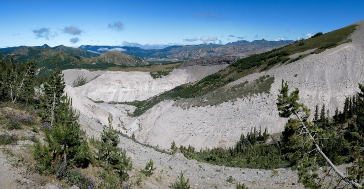
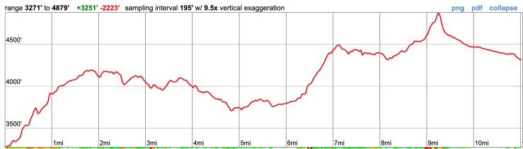
You should be able to rely upon these sources when planning your route. There are a few additional springs/creeks that are seasonal and cannot be relied upon, especially in the late summer. Thus, water availability will likely determine your campsite locations and daily mileage. Another point to note is that some streams and creeks can be very silty and muddy and difficult (or impossible) to filter. The map below shows several water sources along the Loowit Trail Loop.
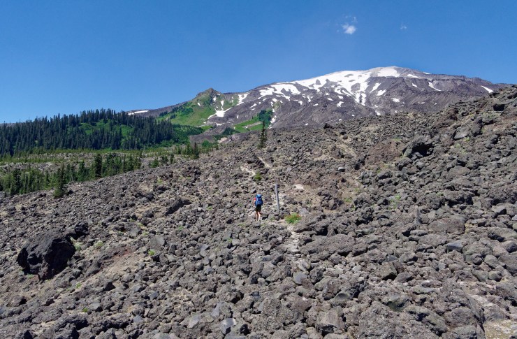
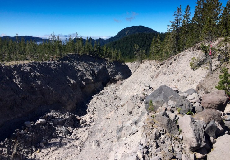
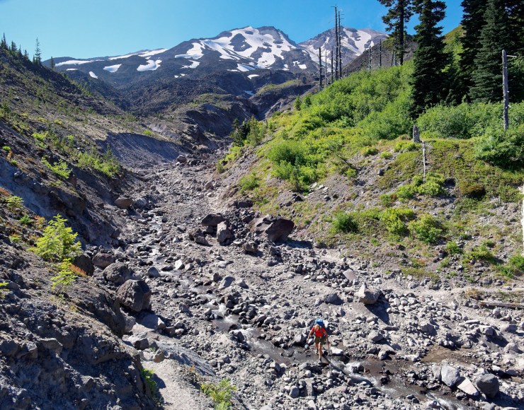
Another challenge is that camping is not allowed on the Loowit Trail between the South Fork Toutle River and Windy Pass, the ~10 mile section of trail on the north side of Mount St. Helens. Balancing this camping restriction with water availability limits the number of suitable campsites.
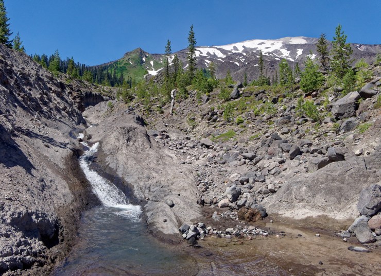
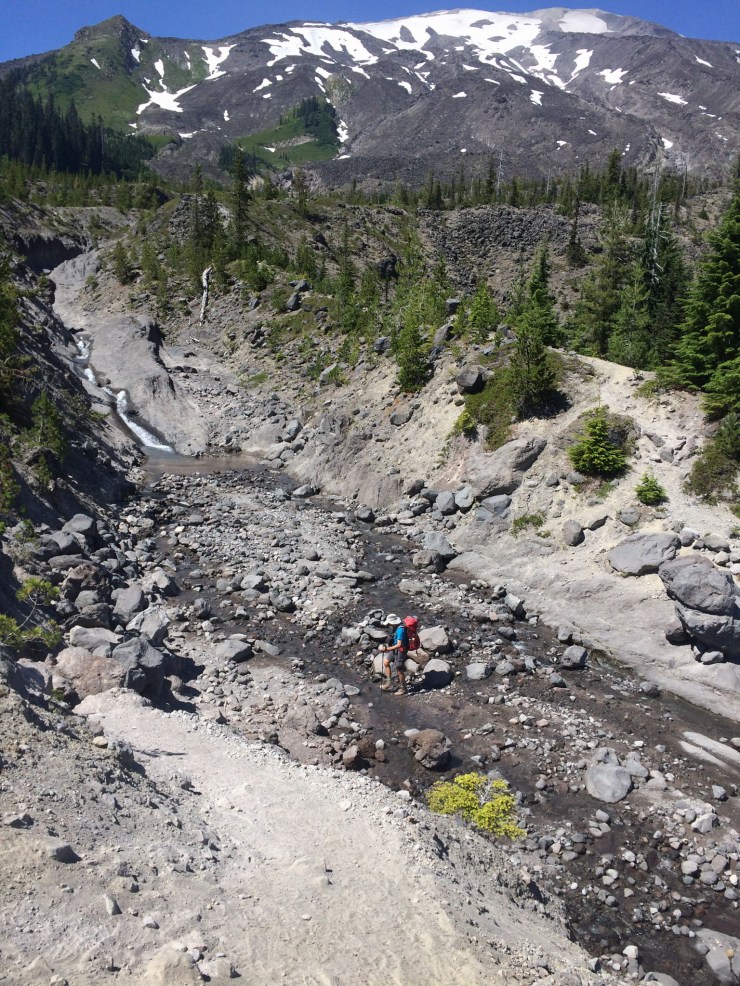
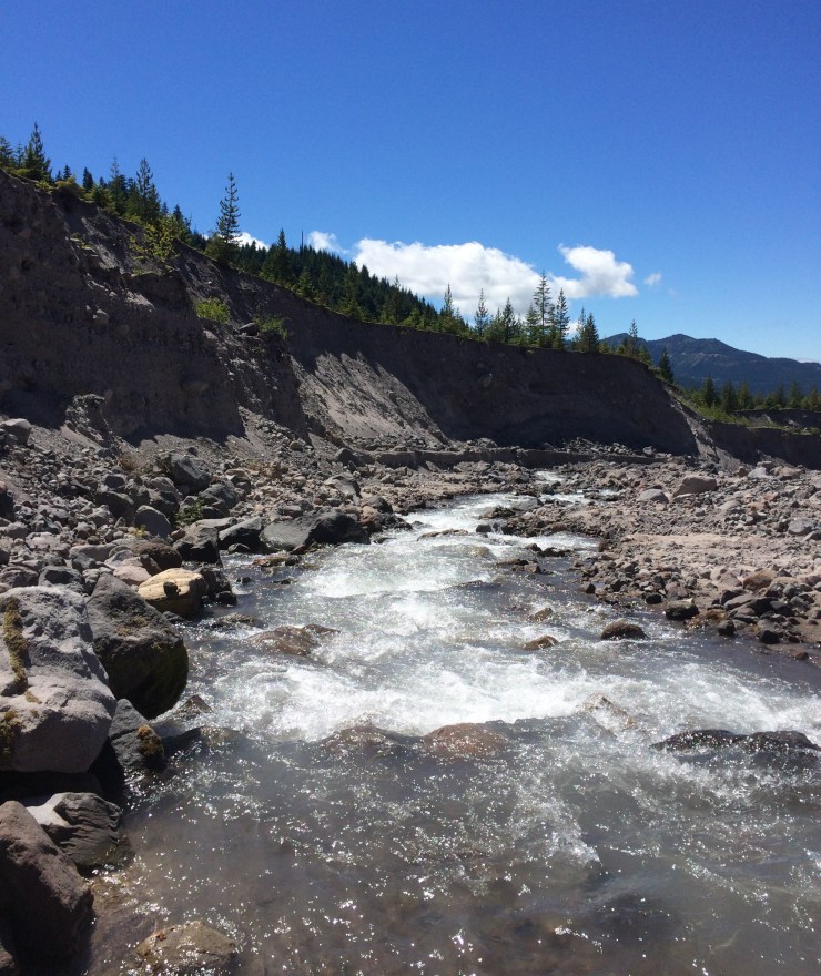
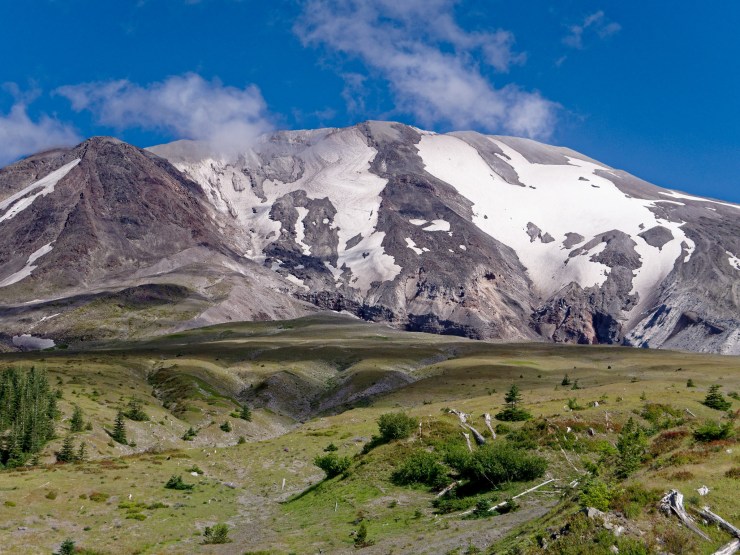
For this specific itinerary, there are reliable water sources at the start (June Lake) and end (South Fork of Toutle River) of Day 1. On Day 2, you want to make sure to fill your water because there are no reliable sources until you reach the spring located just before Windy Pass. I strongly recommend filling up your water at the spring and before continuing past Windy Pass down into the Plains of Abraham. The recommended campsite on the map for night 2 is located at the south end of the Plains of Abraham before you reach Ape Canyon (there is a seasonal spring here). However, if you come across any suitable water resource within the Plains of Abraham, it is a good idea to just set up camp nearby (to be sure you can refill water). On the last day of the trek, you hike back out to the June Lake Trailhead and there are limited water resources until you reach June Lake. The Muddy River could be used in an emergency, but is typically too silty and muddy to filter.
Given these challenges, it is smart to carry at least 3 liters of water while backpacking the Loowit Trail. You should also fill up your reservoirs whenever possible.
Click here to read more about Difficulty
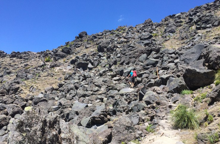
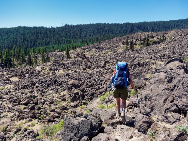
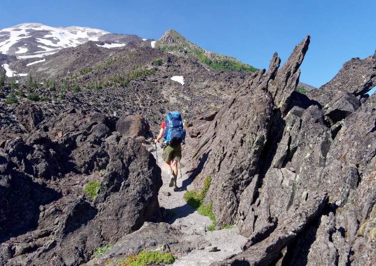
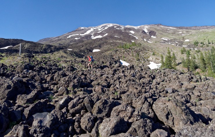
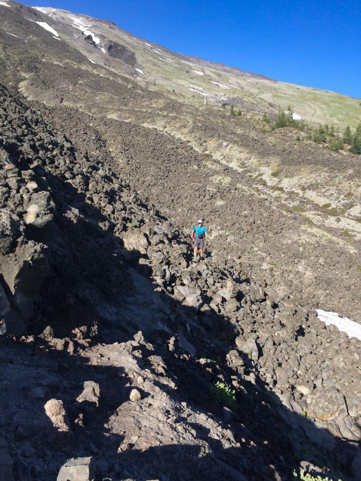
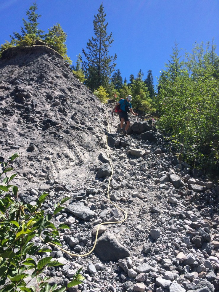
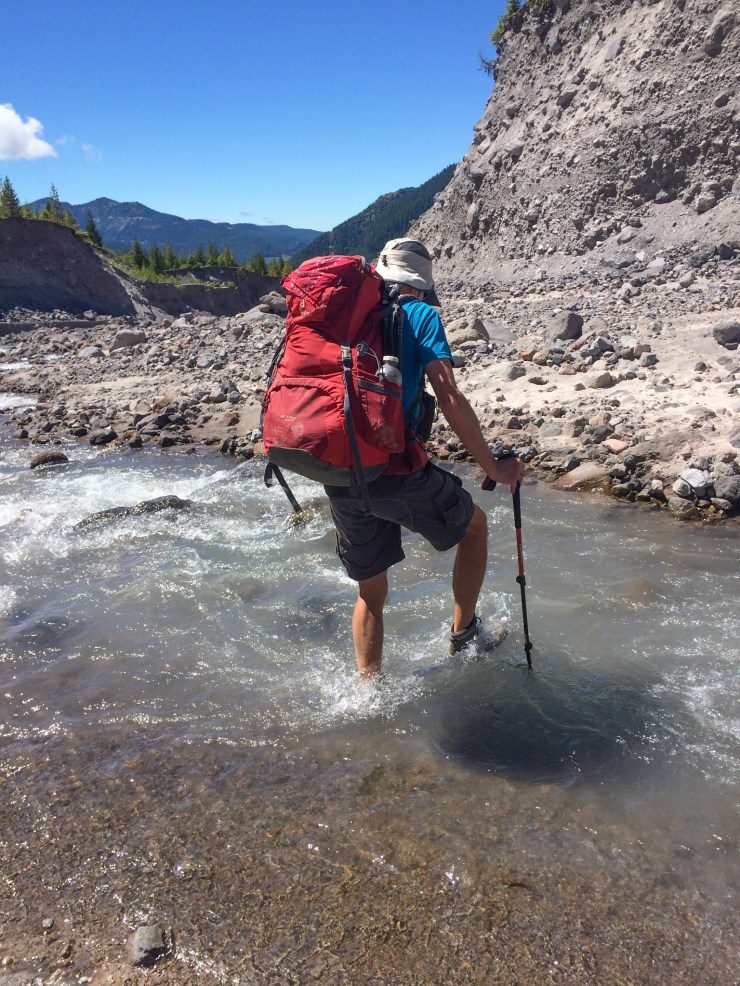
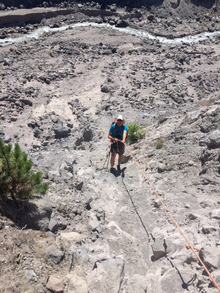
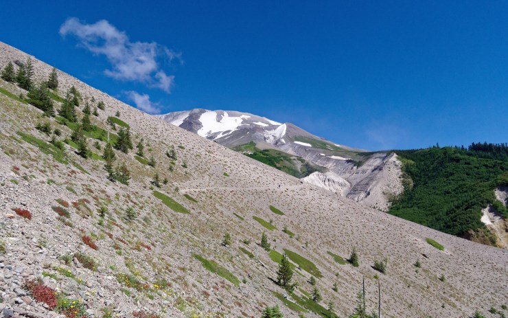
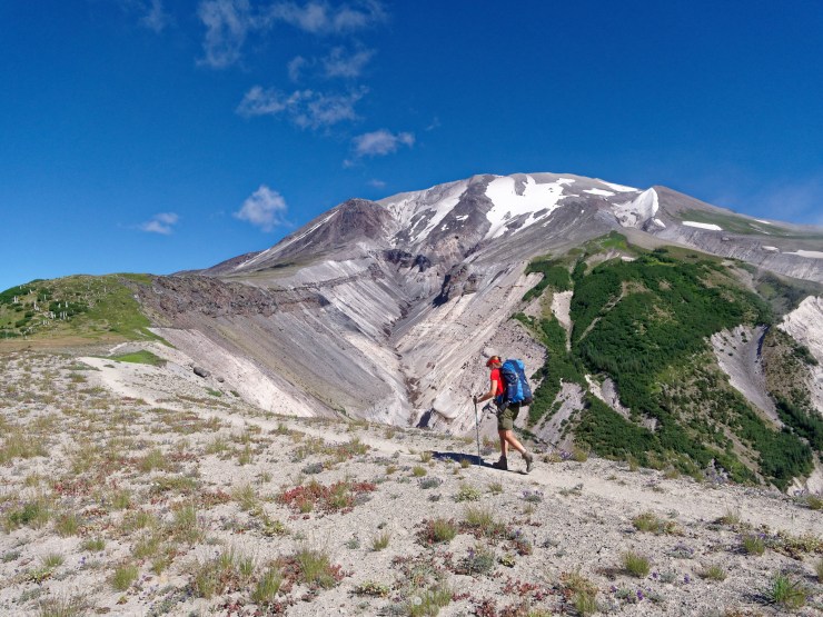
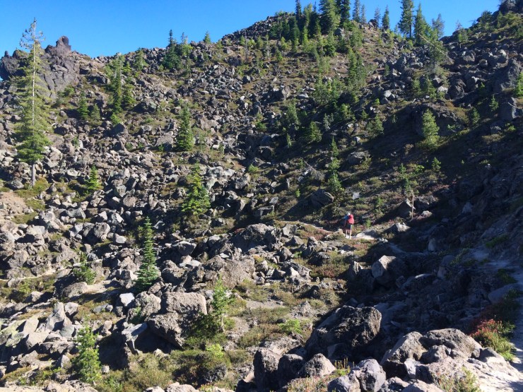
Trail Conditions and Difficulty: The Loowit Trail is a difficult backpacking route, primarily because of the water availability issues. In addition, the terrain is rough in several sections where the trail crosses lava beds and ravines. This trek is only recommended for backpackers who have prior experience and are comfortable planning their water and mileage carefully. That said, there is no technical climbing required to complete this trek and the trails are generally well established. Lastly, the trail is quite exposed to the sun and can become very hot in the summer. Be sure to know your physical limits and use sun screen!
Supplies: There is no concern for bears on the Loowit Trail, but you may encounter rodents and goats. You should store your food and gear appropriately to make the rodents and goats cannot cause problems.
For bug and mosquito protection, I recommend a picaridin based spray because it does not damage plastics and synthetic fibers like high concentration DEET sprays do. I also like to pre-treat my clothes and tent with permethrin spray repellent. The permethrin treatment stays on your clothes for up to 7 washes, so it helps reduce the amount of spray you need to put on your skin.
You likely will want trekking poles since they help when crossing the glacial ravines and when hiking on loose lava flows. As a last essential supply, you want to bring adequate sunscreen since much of the Loowit Trail is very exposed to the sun.
Below is a list of the gear recommended for backpacking the Loowit Trail:
Hiking clothes
- a lightweight hiking rain jacket (North Face Venture 2 Jacket)
- fast drying synthetic hiking pants (prAna Zion Pants)
- a quick drying long sleeve hiking shirt (Columbia Silver Ridge L/S Shirt)
- wool outer socks (People Socks Moreno 4-pack)
- thin blister preventing base socks (WrightSock double layer Coolmesh)
- quick drying synthetic boxer briefs (ExOfficio Give-N-Go)
- Gore-tex hiking shoes (adidas Outdoor Terrex Fast R Gore-Tex Shoe)
Clothes for camp
- wool leggings (Minus33 Merino Wool Kancamagus Midweight Bottom)
- wool base layer shirt (Minus33 Merino Wool Chocorua Midweight Crew)
- lightweight down jacket (Patagonia 800-fill Down Jacket)
- lightweight camp shoes (Xero Z-Trail lightweight sandal)
Hiking gear
- topographic map (Topographic map)
- trekking poles (Black Diamond Trail Ergo Cork Trekking Poles)
- 3 liter hydration bladder (Camelbak 100oz reservoir)
- 65 liter backpack (Osprey Atmos 65 Liter pack)
- water filtration system (Platypus gravity filtration system)
- Backup iodine tablets in case your filter gets clogged by silt (Potable Aqua Purification Tabs)
Camp gear
- strong tent with rain-fly (Alps Mountaineering Chaos 2 Tent)
- inflatable sleeping pad (Therm-a-Rest Trail Pro Sleeping Pad)
- sleeping bag (REI Co-op Igneo 25 Sleeping Bag)
- inflatable camping pillow (Ultralight Inflating Pillow)
- lightweight backpacking chair (Helinox Chair Zero)
- lightweight lantern (MPOWERD Luci Outdoor 2.0)
- headlamp (Black Diamond Cosmo Headlamp)
- multi-tool with knife (Gerber MDime Mini Multi-Tool)
- lightweight stove (MSR PocketRocket 2)
- lighter (BIC plastic lighters)
- 2 liter pot (GSI Outdoors Halulite Boiler Pot)
- coffee cup (GSI Outdoors Glacier Stainless Cup)
- lightweight spork (Snow Peak Titanium Spork)
- small, quick drying towel (REI mutli towel mini)
Random
- wet wipes (Stall Mates individually wrapped wipes)
- mole skin for blisters (Blister medic kit)
- lightweight trowel (GSI Sanitation Trowel)
- small amount of duct tape for gear repairs
- chapstick and sun screen
Food and drink
- a variety of my favorite dehydrated meals
- electrolyte replacement (NUUN Hydration Tablets)
- quick snacks (Clif Shot Bloks and Clif energy bars)
- instant coffee (Starbucks VIA)
- small plastic water bottles filled with whisky 🙂
……….
Day 1: 10.8 miles; +3,700 feet / -3,100 feet; June Lake Trailhead to the South Fork Toutle River
Map of the Day 1 hike on the Loowit Trail (PDF)
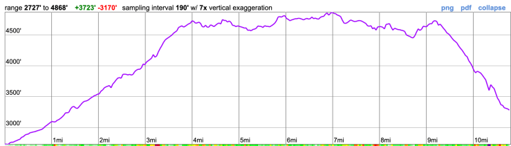
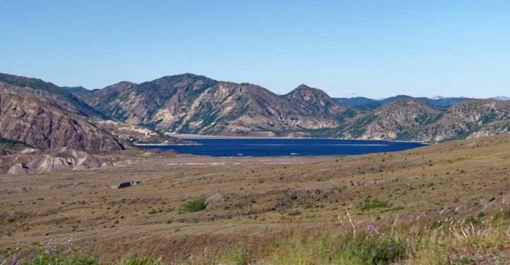
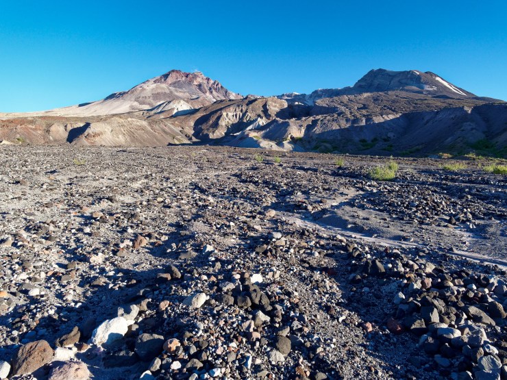
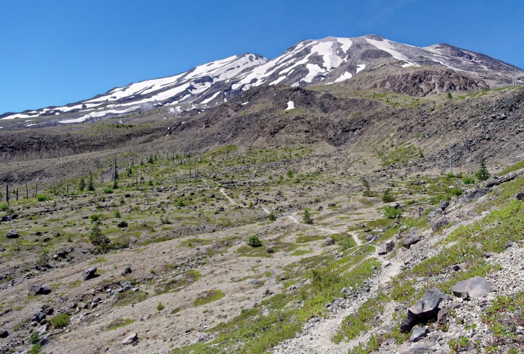
The first day hike is a relatively tough one with just over 10 miles and over 3,000 feet of elevation gain. You have opportunities to fill up your water at June Lake (~1 mile mark), the Butte Camp Trail (~7 mile mark), and at the South Fork Toutle River where you can set up camp.
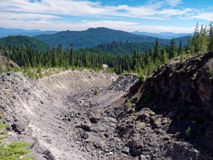
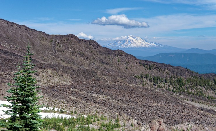
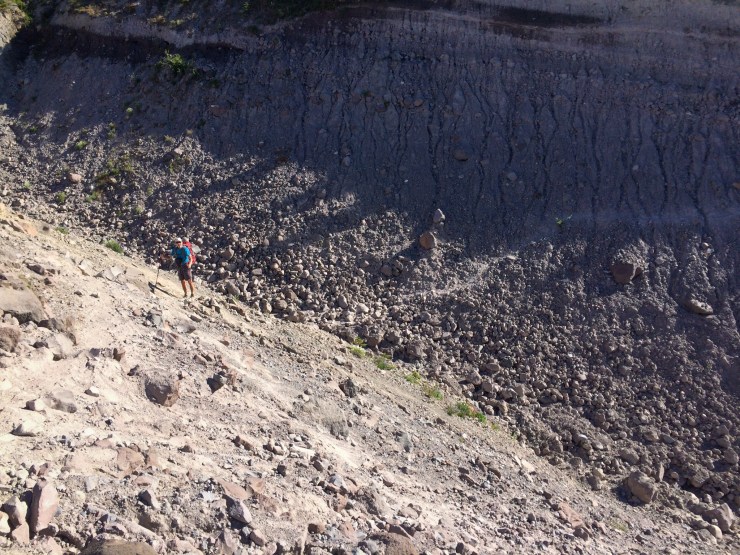
After you pass June Lake, you begin a steady ~2,000 foot climb over the course of 3 miles. The trail passes over the Swift Creek Flow Monitor Ridge and then the trail plateaus for ~5 miles as it traverses around the west side of Mount St. Helens. At the ~9 mile mark, you reach Crescent Ridge. From this point on, you descend down the ridge until you reach the river. It is most common to camp on the south side of the river.


……….
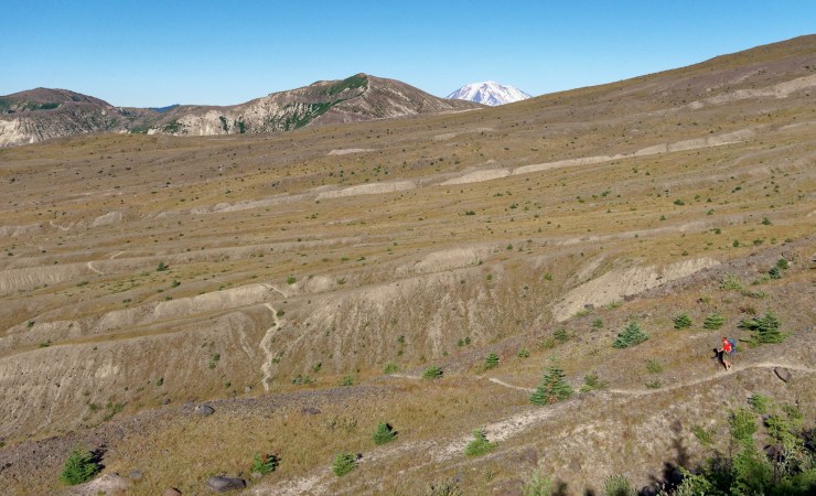
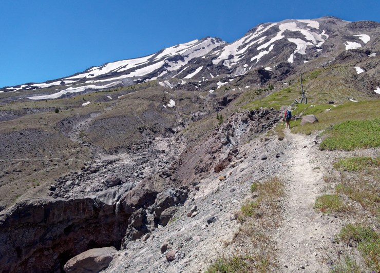
Day 2: 11 miles; +3,200 feet / -2,200 feet; Toutle River to the Plains of Abraham
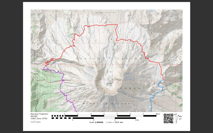
Map of the Day 2 hike on the Loowit Trail (PDF)
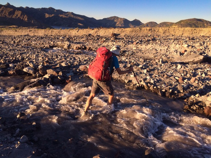
The second day hike is another tough day with 11 miles of hiking and over 3,000 feet of elevation gain. Be sure to fill up your water reservoirs and any extra bottles you have because there are no opportunities to refill until the 8 mile mark.
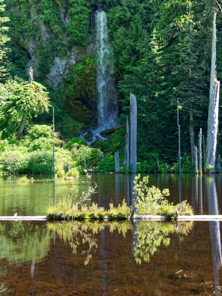
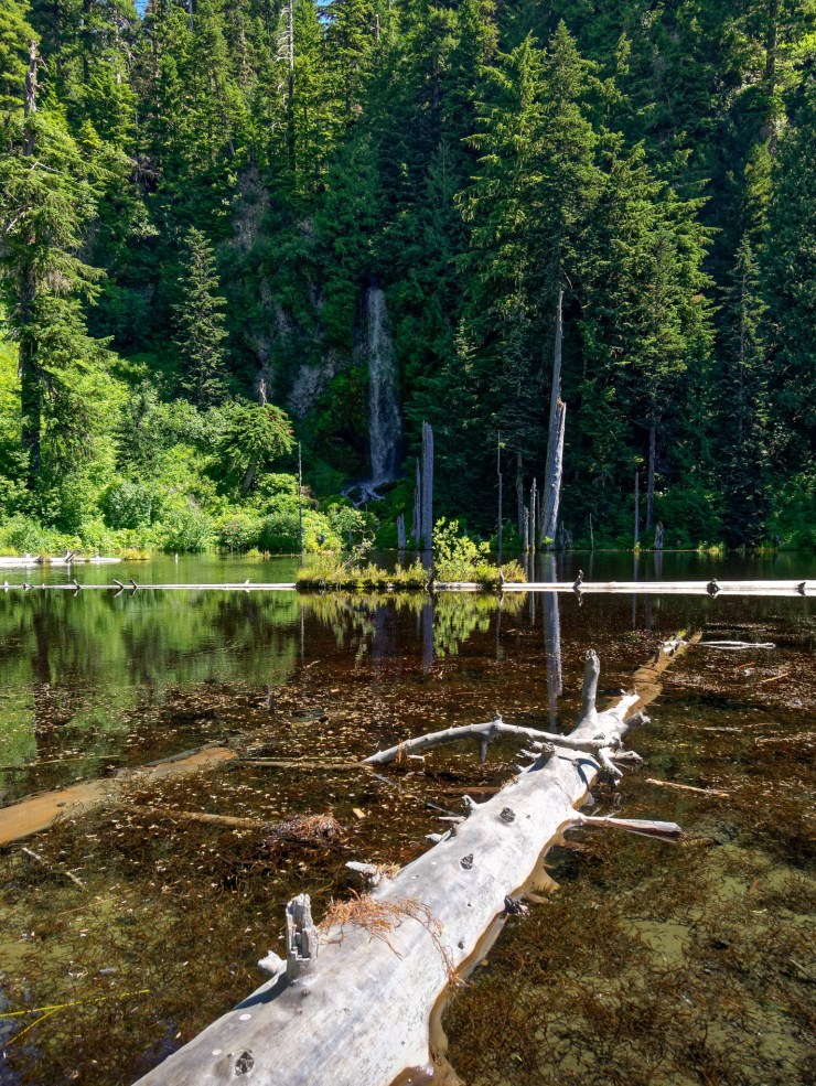
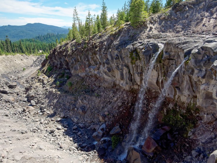
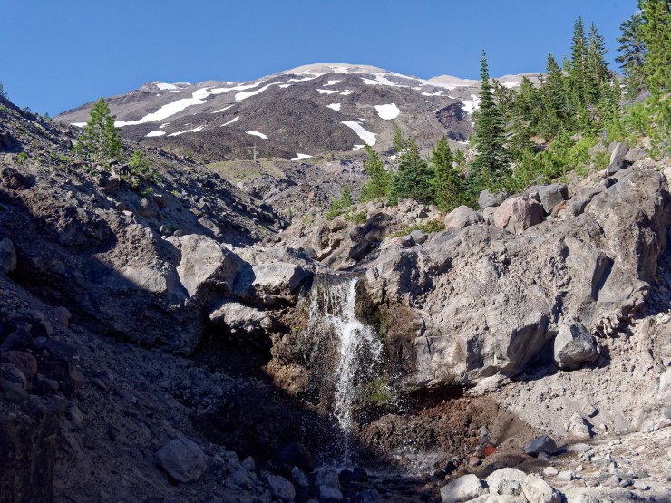
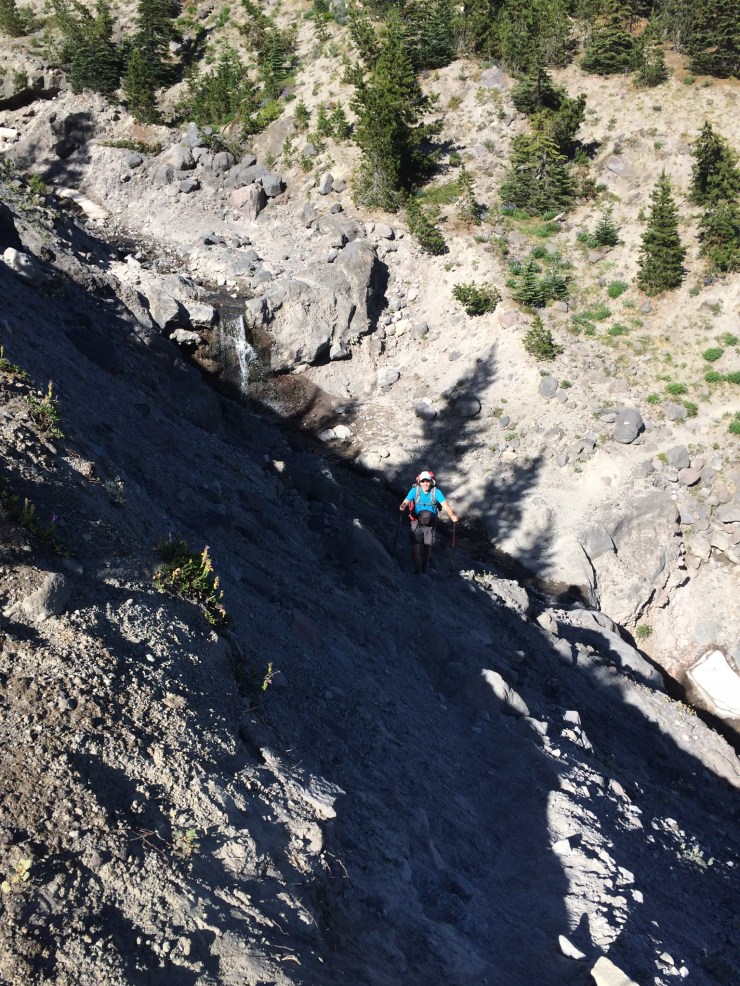
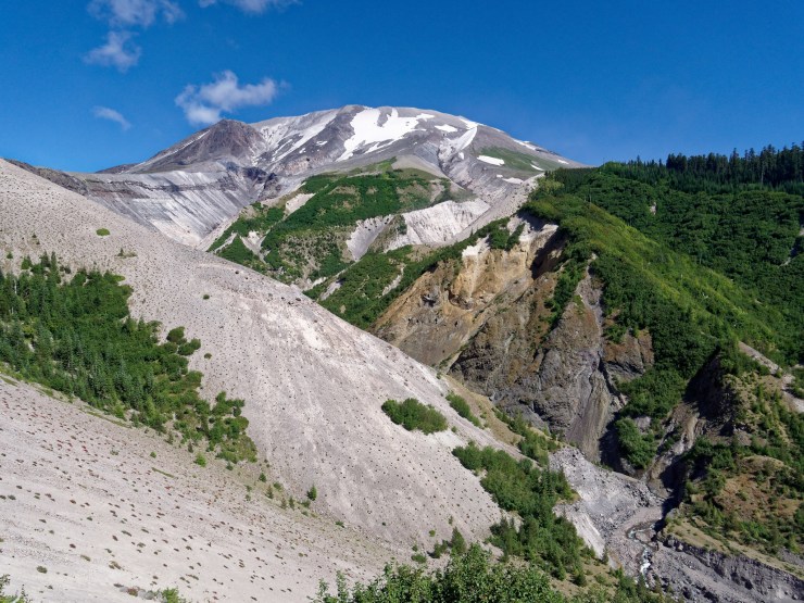
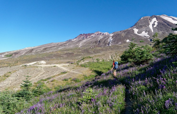
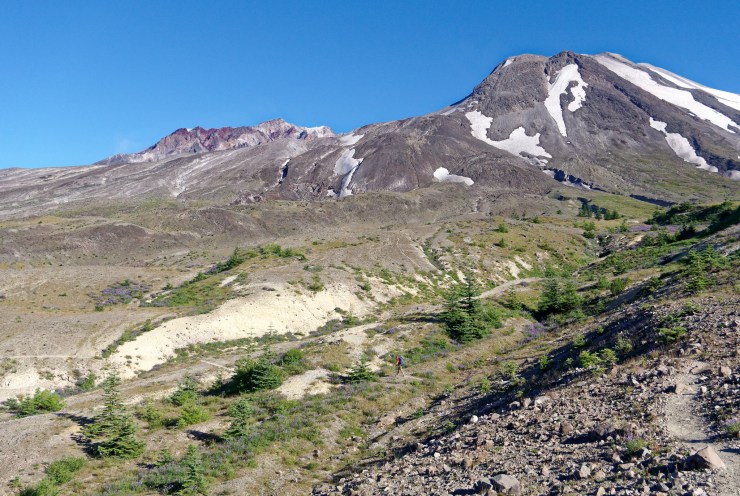
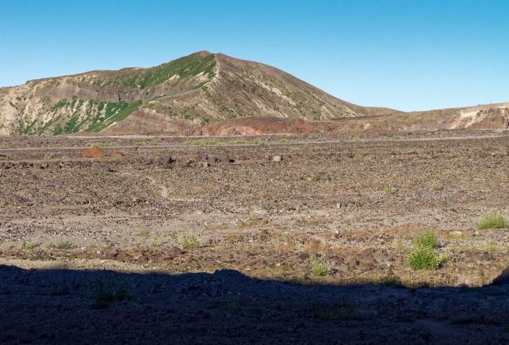
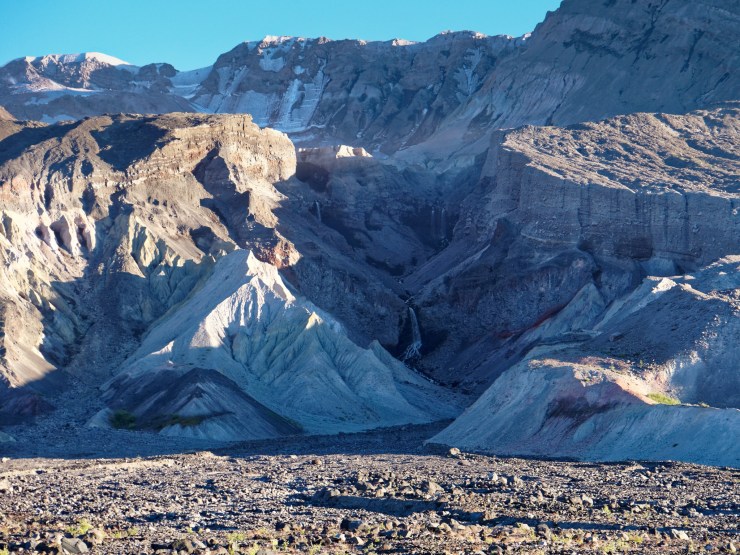
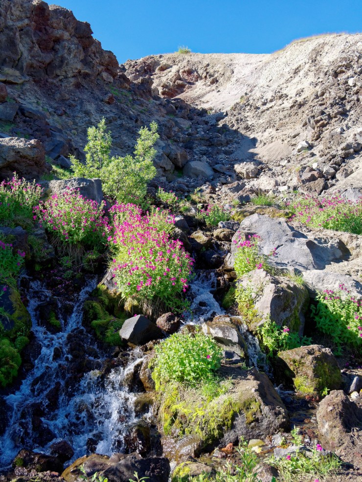
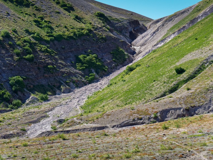
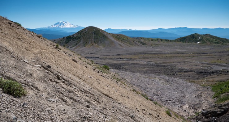
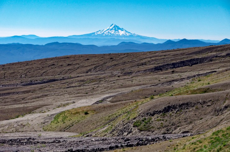
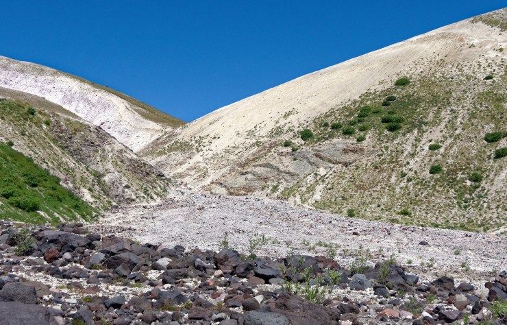
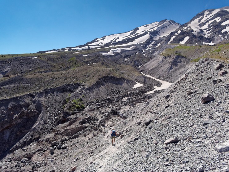
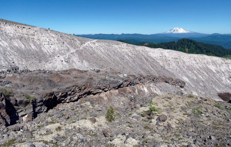
The first 1.5 miles of the hike start with a steep climb out of the South Toutle River ravine. You climb over 1,000 feet before reaching a plateau. From that point on, the Loowit Trail traverses the barren north side of Mount St. Helens. This is a restricted area where no camping is allowed. At the ~6 mile mark you pass the Sasquatch Steps. From there, you have a ~700 foot climb over the next mile. At the 7 mile mark you will catch a view of Loowit Falls and there is a side trail that you can take to get closer to the falls.
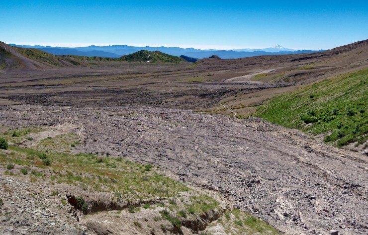
At the 8 mile mark, you reach a year round spring. Drink your water and then refill your bottles and reservoirs. From there, continue up and over Windy Pass and then descend down into the Plains of Abraham area. Once you cross over Windy Pass, you are allowed to camp anywhere near the trail. I suggest camping between the 9 and 11 mile marks, wherever you can find a suitable site and water source.


……….
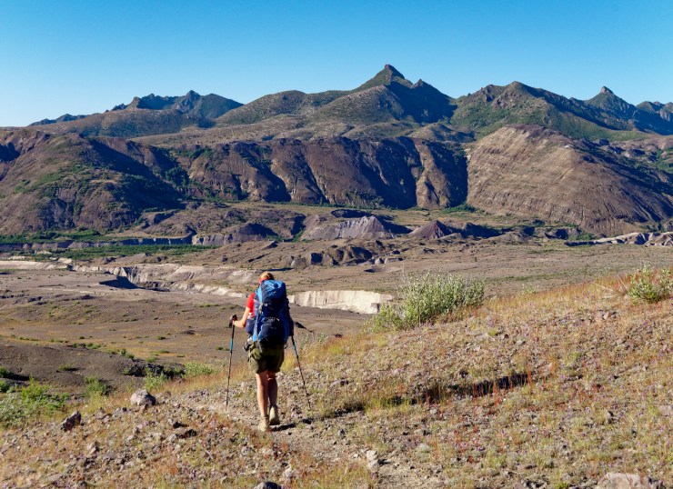
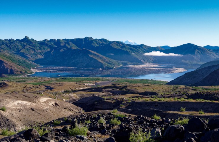
Day 3: 6.5 miles; +1,400 feet / -3,000 feet; Plains of Abraham to June Lake Trailhead
Map of the Day 3 hike on the Loowit Trail (PDF)
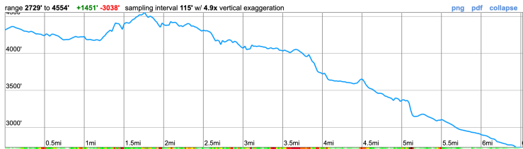
The hike on the last day is the easiest of the three. The route is largely downhill with a few modest climbs of out of ravines and over ridges. There is not likely to be much water along the route until you reach June Lake, so plan accordingly.


Here are some similar trip reports!
Timberline Trail – Mount Hood Wilderness, OR (40 mile loop)
Broken Top Loop – Three Sisters Wilderness (24 mile loop)
Spider Gap, Buck Creek Pass – Glacier Peak Wilderness (40 mile loop)
The Escalante Route – Grand Canyon National Park (32 mile trek)
