


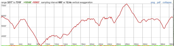
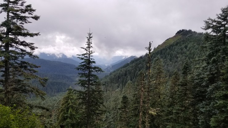
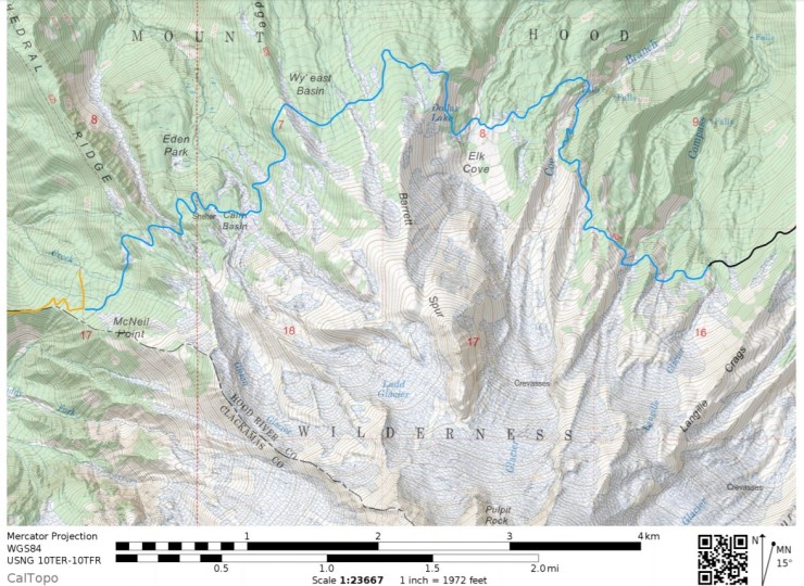
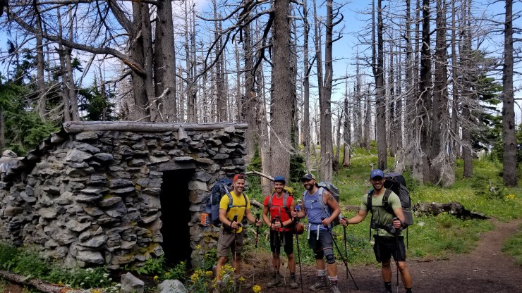
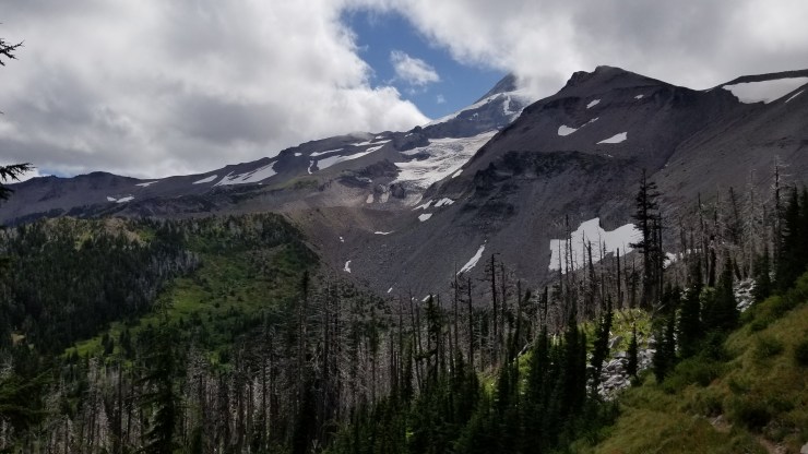
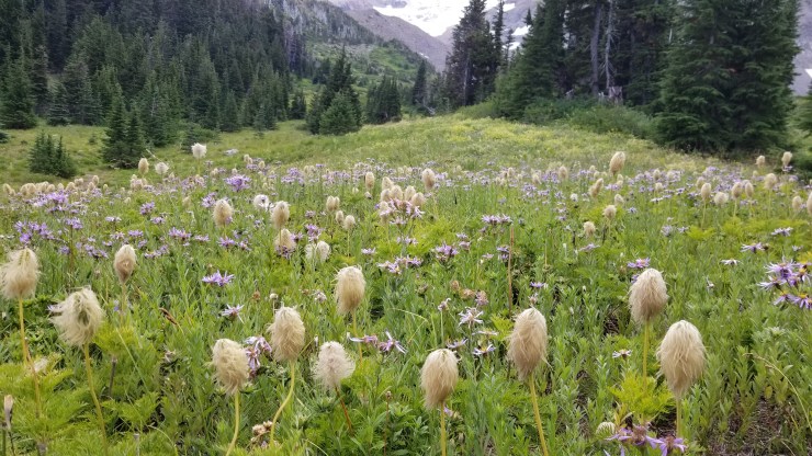
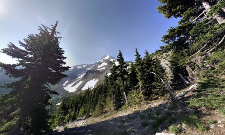
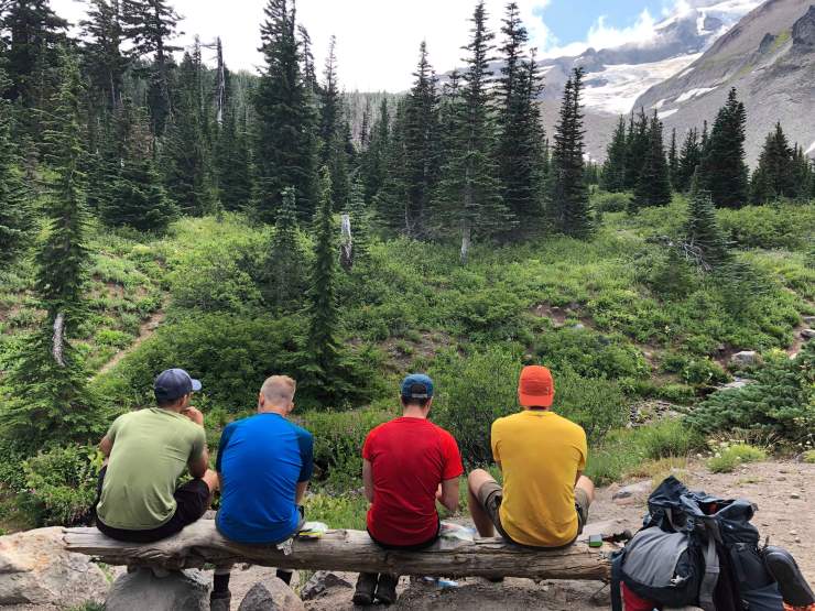
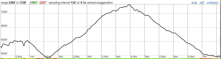
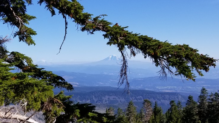
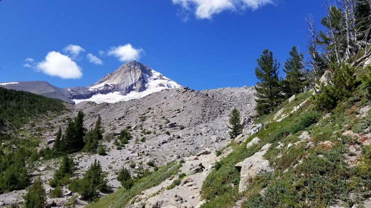
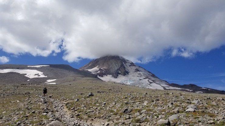
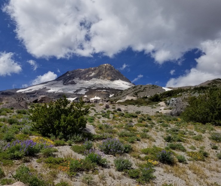
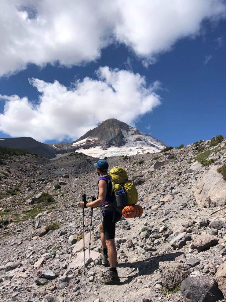
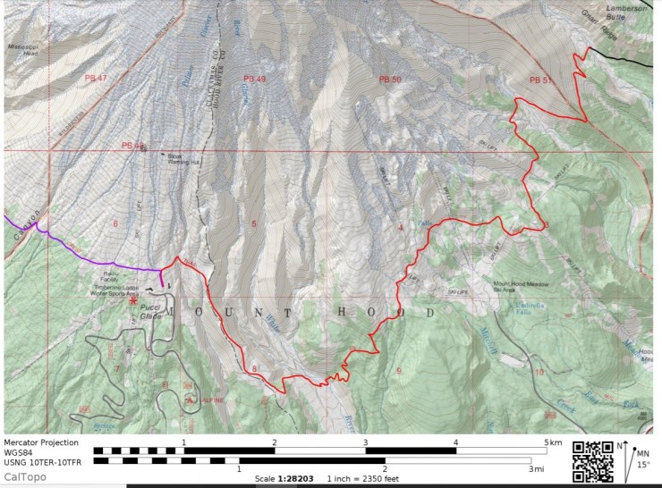
Trip Overview: The 40 mile Timberline Trail Loop in the Mount Hood Wilderness is a classic route that circumnavigates Oregon’s highest peak, Mount Hood. Located just outside of Portland, this route features alpine vistas, waterfalls, countless views of Mt. Hood, alpine meadows, and views of cascade forest. Over the course of the loop you climb roughly 10,500 feet and reach a peak elevation of 7,330 feet. The majority of the images in the report are from a trip in August of 2019.

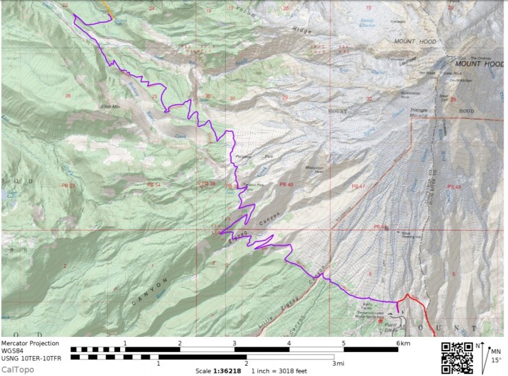
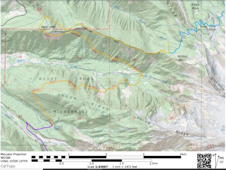
- Higher resolution version of the overall map for The Timberline Trail loop (PDF)
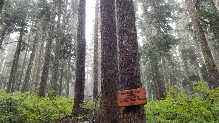
- Black and white map of the Timberline Trail from the US Forest Service (here)
Jump to Day 1: Timberline Lodge to Ramona Falls
Jump to Day 2: Ramona Falls to McGee Creek
Jump to Day 3: McGee Creek to Compass Creek
Jump to Day 4: Compass Creek to Newton Creek
Jump to Day 5: Newton Creek to Timberline Lodge
Shop Deal of the Day at REI Outlet (up to 50% off)!
Preparations:
Click here to read more about Permits
Permits: Overnight backpacking in the Mt. Hood Wilderness requires that you self-register for a permit at your entry trailhead. However, you are not required to reserve a permit ahead of time and no quotas are in place. This makes the Timberlines Trail a great option for anyone looking to find a last minute itinerary or anyone who missed out on permits for other trails with restricted access. Some trailheads in the Mt. Hood Wilderness may require day use fees, so check the posted signs when you park and follow all necessary rules and regulations.
Click here to read more about Logistics
Logistics: Many backpackers choose to hike this loop in the clockwise direction starting and ending at the Timberline Lodge. There is parking at the Lodge as well as several food and drink options. You could also stay the night at the lodge the night before or after your trek if you prefer to stay close to the trailhead to get an early start. The morning you start your trek, you can hike directly from the lodge, and since this is a loop hike, there is no need to worry about shuttles or taxis. The Timberline Lodge is about a 1-1.5 hour drive from Portland.
Click here to read more about Difficulty
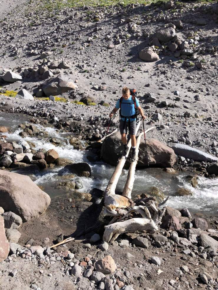
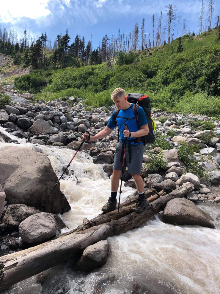
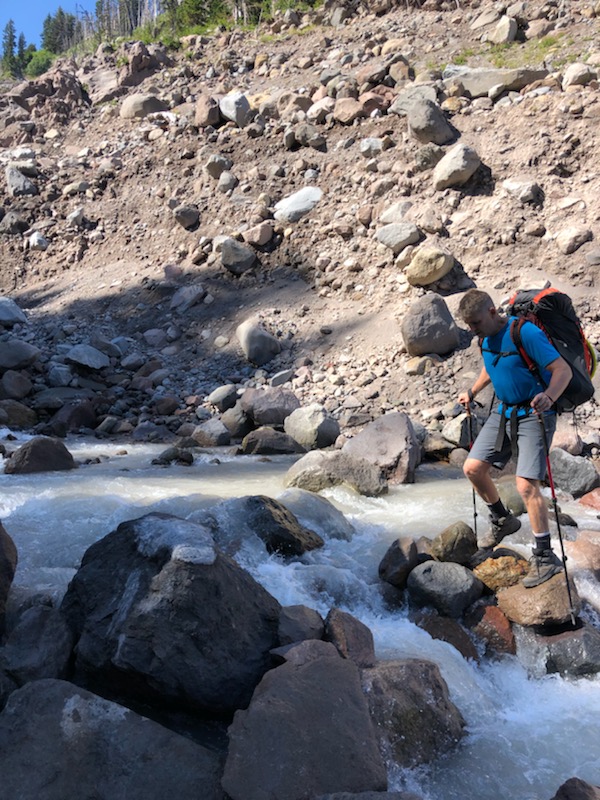
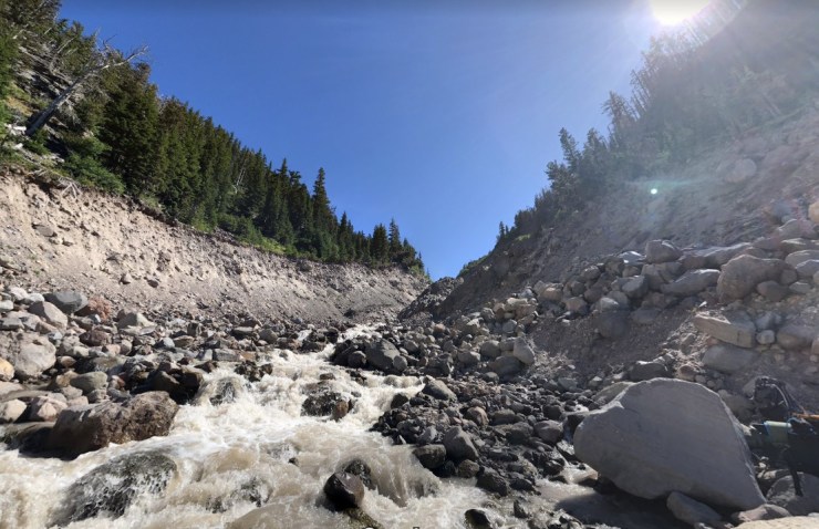
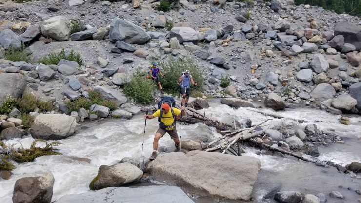
Trail Conditions and Difficulty: The Timberline Trail Loop is a moderate difficulty trek when hiked over 5 days in the prime season (July to September). Daily mileage can be kept below 10 miles and the elevation gain is evenly spread across each day. The main challenges that arise in this loop are the several creek/river crossings. There are at least 5 fast moving creek crossings that do not have bridges installed. Backpackers must carefully ford these crossings in order to complete the loop. During the summer most of these crossings are ankle-to-knee deep and can be safely crossed, but backpackers should use caution as the water can be fast moving and high during the early hiking season.
If hiked in 4 or fewer days, the mileage will make this loop difficult for hikers who are not fit. Thus, if you plan a 3 or 4 day itinerary, you should train accordingly. When hiked in late Spring (when snow can be present and creeks are likely to be flowing high) or early fall (when snow can fall), the difficulty is also increased.
Supplies: There is not much concern for bears in the Mount Hood Wilderness so there is not a requirement for bear canisters. Black bears are present in the area, but there are no regulations in place requiring specific equipment or precautions. That said, rodents and other small critters in the area are known to forage through hiker supplies. At the very least, you should hang your food in an ursack to prevent issues.
You likely will want bug spray because the mosquitoes can be out in force in certain areas where the snow has recently melted. I prefer a picaridin based spray because it does not damage plastics and synthetic fibers like high concentration DEET sprays do. I also like to pre-treat my clothes and tent with permethrin spray repellent. The permethrin treatment stays on your clothes for up to 7 washes, so it helps reduce the amount of spray you need to put on your skin.
You likely will want trekking poles since they help your knees on the steep climbs and descents and with stabilization while fording creeks.
Below is a list of the gear recommended for backpacking the Timberline Trail:
Hiking clothes
- a lightweight hiking rain jacket (North Face Venture 2 Jacket)
- fast drying synthetic hiking pants (prAna Zion Pants)
- a quick drying long sleeve hiking shirt (Columbia Silver Ridge L/S Shirt)
- wool outer socks (People Socks Moreno 4-pack)
- thin blister preventing base socks (WrightSock double layer Coolmesh)
- quick drying synthetic boxer briefs (ExOfficio Give-N-Go)
- Gore-tex hiking shoes (adidas Outdoor Terrex Fast R Gore-Tex Shoe)
Clothes for camp
- wool leggings (Minus33 Merino Wool Kancamagus Midweight Bottom)
- wool base layer shirt (Minus33 Merino Wool Chocorua Midweight Crew)
- warm wool overshirt (Pendleton Long Sleeve Classic-Fit Board Shirt)
- lightweight down jacket (Patagonia 800-fill Down Jacket)
- lightweight camp shoes (Xero Z-Trail lightweight sandal)
Hiking gear
- topographic map (Nat Geo topographic map)
- trekking poles (Black Diamond Trail Ergo Cork Trekking Poles)
- 2 liter hydration bladder (Platypus Big Zip Water Reservoir)
- 65 liter backpack (Osprey Atmos 65 Liter pack)
- water filtration system (Platypus gravity filtration system)
Camp gear
- strong tent with rain-fly (Alps Mountaineering Chaos 2 Tent)
- inflatable sleeping pad (Therm-a-Rest Trail Pro Sleeping Pad)
- sleeping bag (REI Co-op Igneo 25 Sleeping Bag)
- inflatable camping pillow (Ultralight Inflating Pillow)
- lightweight backpacking chair (Helinox Chair Zero)
- lightweight lantern (MPOWERD Luci Outdoor 2.0)
- headlamp (Black Diamond Cosmo Headlamp)
- multi-tool with knife (Gerber MDime Mini Multi-Tool)
- Ursack (Ursack Major bear bag) or bear canister (BearVault BV500)
- lightweight stove (MSR PocketRocket 2)
- lighter (BIC plastic lighters)
- 2 liter pot (GSI Outdoors Halulite Boiler Pot)
- coffee cup (GSI Outdoors Glacier Stainless Cup)
- lightweight spork (Snow Peak Titanium Spork)
- small, quick drying towel (REI mutli towel mini)
Random
- wet wipes (Stall Mates individually wrapped wipes)
- mole skin for blisters (Blister medic kit)
- lightweight trowel (GSI Sanitation Trowel)
- small amount of duct tape for gear repairs
- chapstick and sun screen
Food and drink
- a variety of my favorite dehydrated meals
- electrolyte replacement (NUUN Hydration Tablets)
- quick snacks (Clif Shot Bloks and Clif energy bars)
- instant coffee (Starbucks VIA)
- small plastic water bottles filled with whisky 🙂
……….
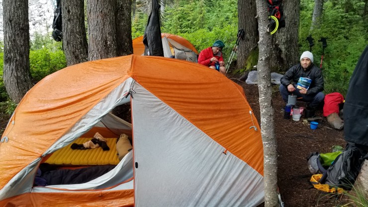
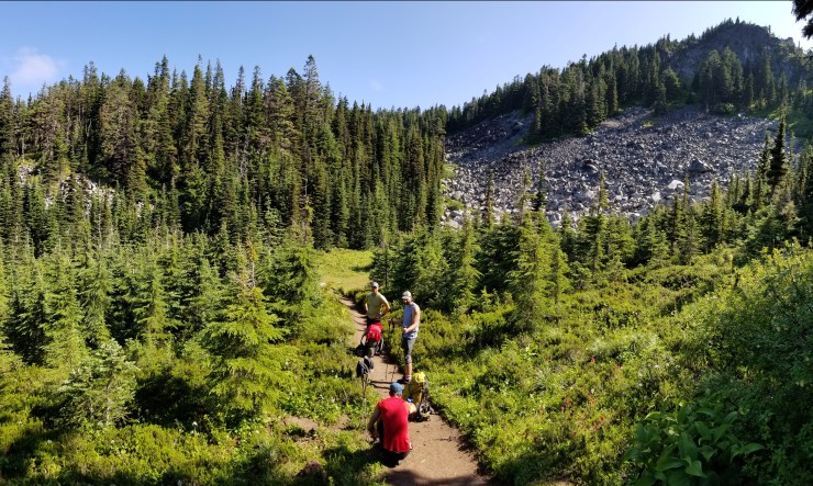
Day 1: 9.7 miles; +1,400 feet / -3,130 feet; Timberline Lodge to Ramona Falls
Map of the Day 1 hike on the Timberline Trail Loop (PDF)
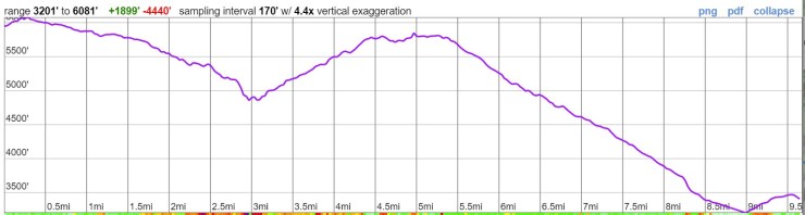
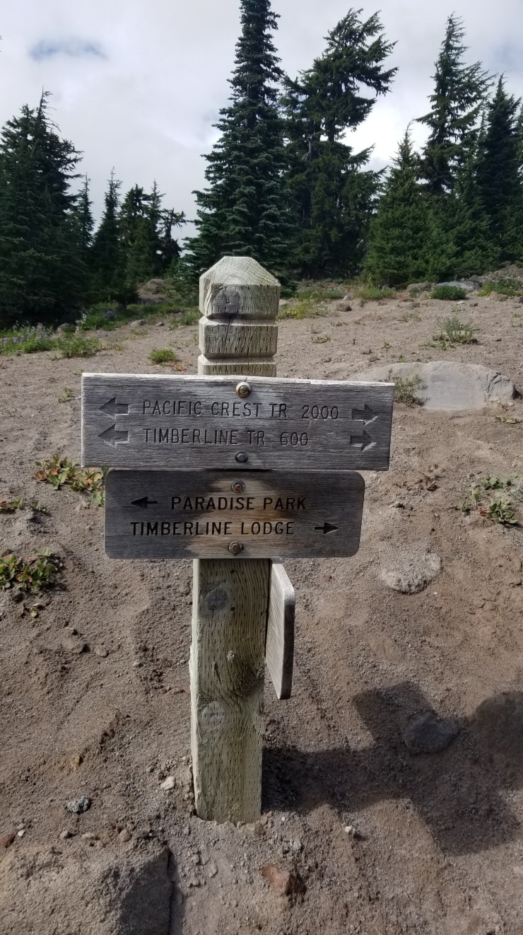
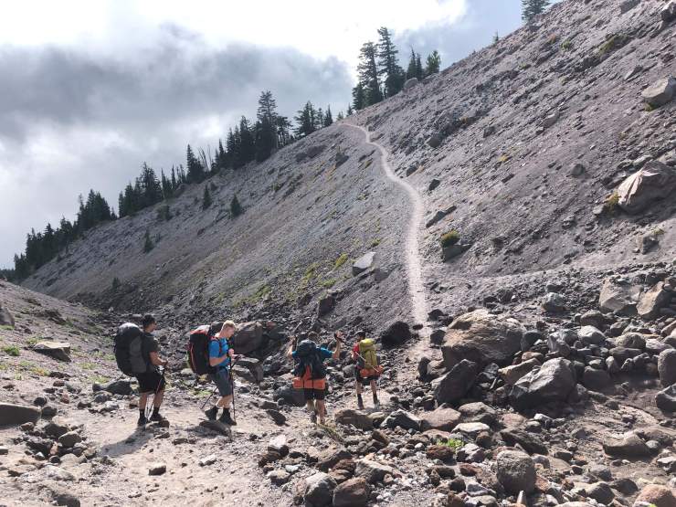
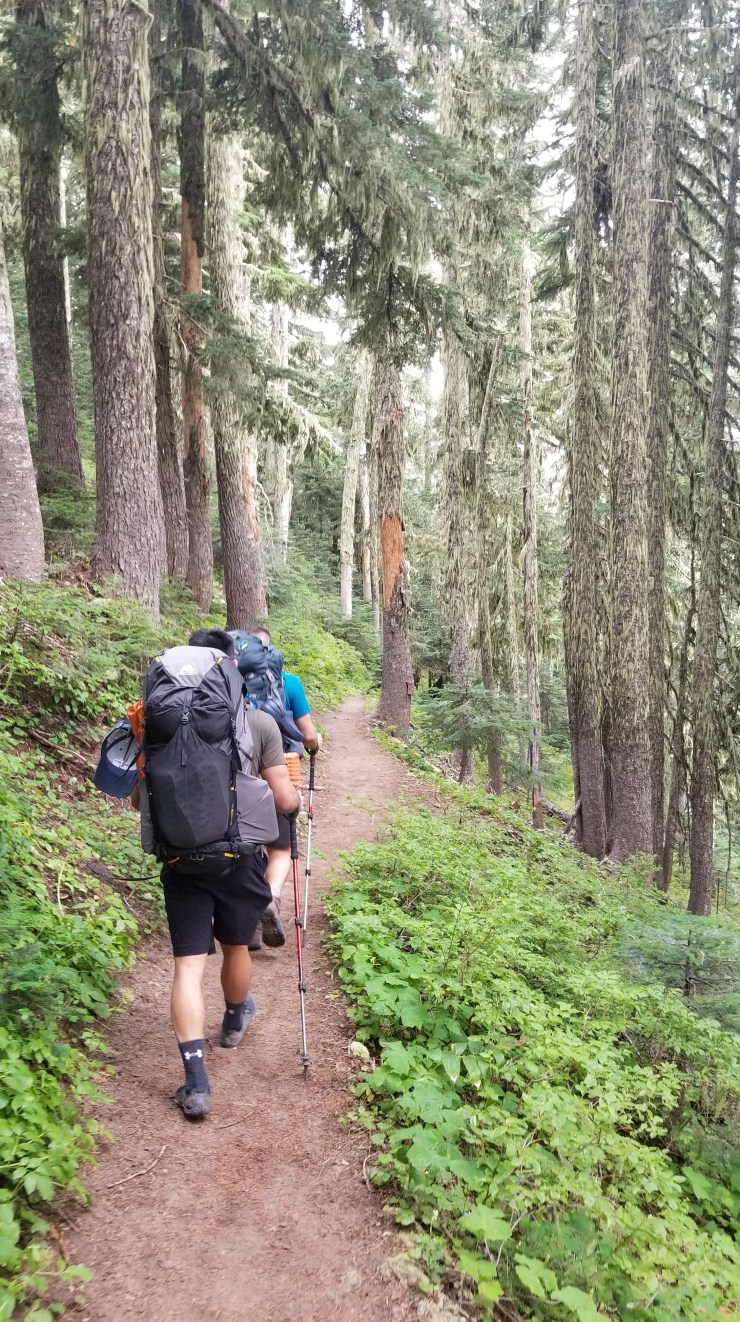
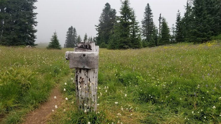
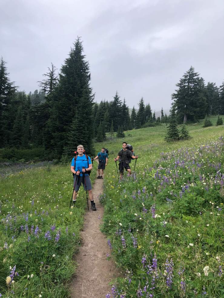
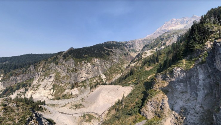
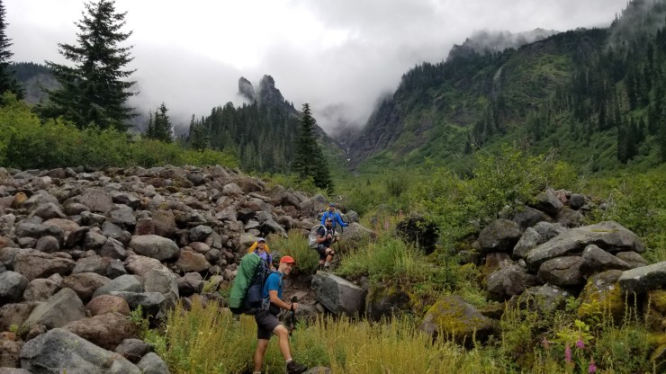
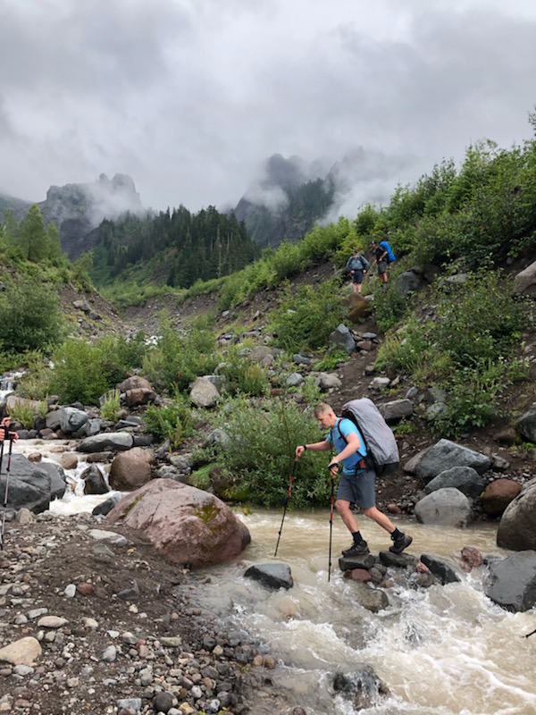
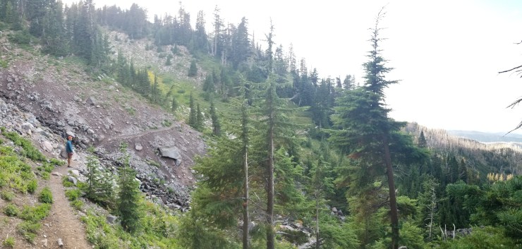
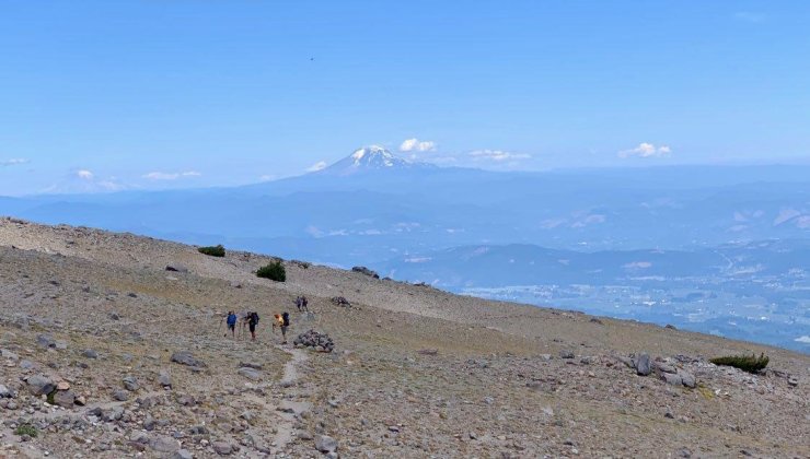
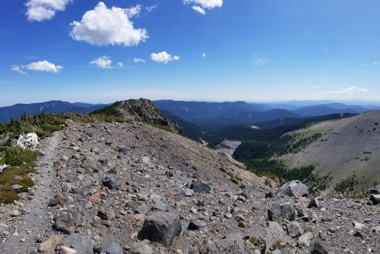
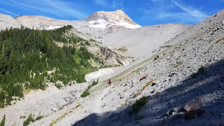
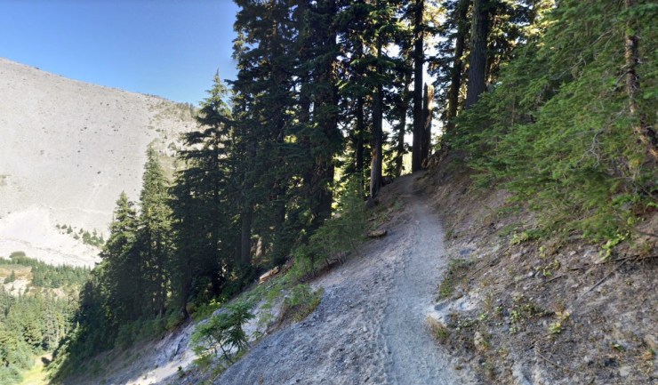
The start of this trek is mostly downhill but has one moderate ~1,000 foot climb (when exiting Zig Zag Canyon). Nearly all the hiking on Day 1 is on the Pacific Crest Trail. The PCT joins two parts of the Timberline Trail to form the full loop. Along the route from the Timberline Lodge to Ramona Falls you first pass through Little Zig Zag Canyon and the larger main Zig Zag Canyon. You will need to cross the Zig Zag River as well. After exting Zig Zag Canyon, it is advised to take the Paradise Park Trail Loop. This trail splits off from the PCT to the east and makes a detour out of the forest and into some beautiful meadows. It does not add any extra distance, so there is little to lose.
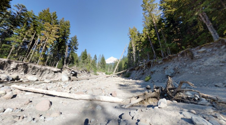
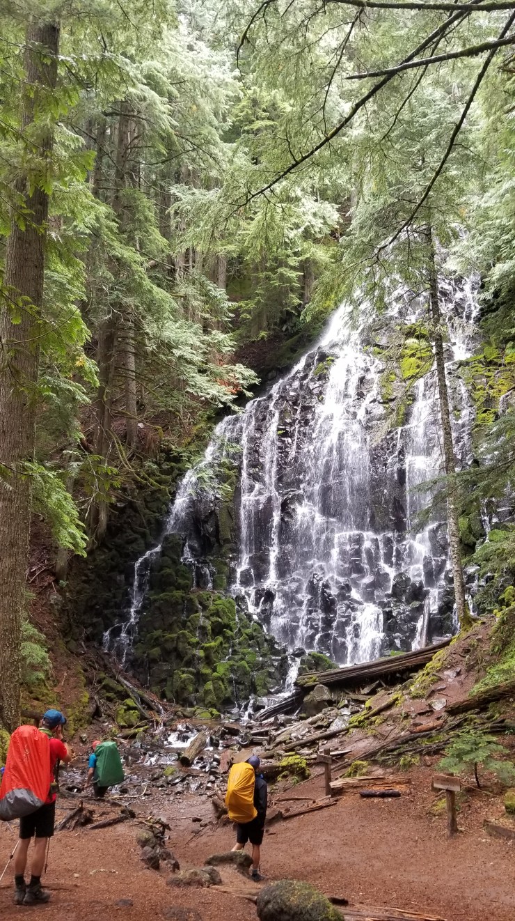
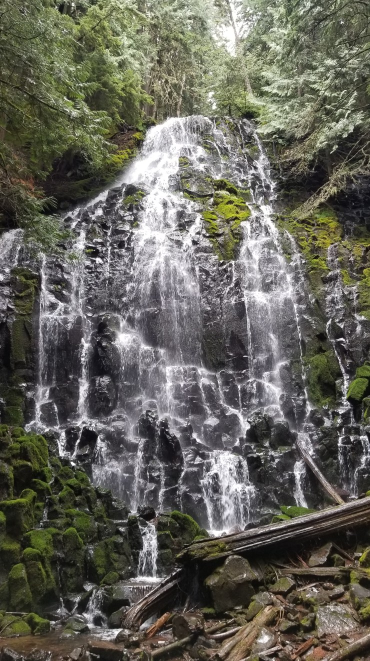
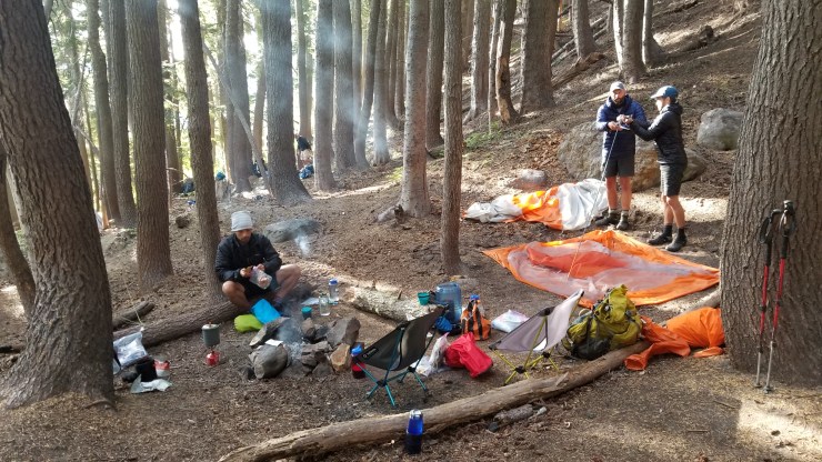
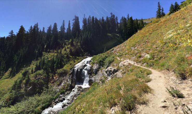
After passing through Paradise Park and fording the Lost Creek, you get back on the PCT and begin a steady 4 mile descent down to Sandy Creek. Once you ford Sandy Creek, it is less than 1 mile to Ramona Falls. Regulations require you camp at least 500 feet from the falls. There are some side trails in the area that lead to legal campsites.
……….
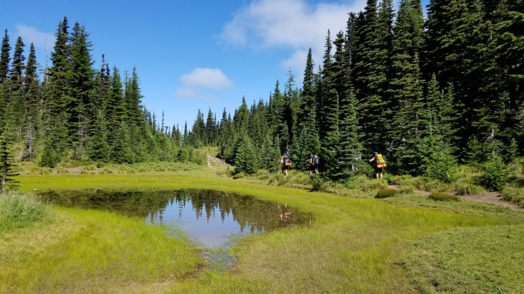
Day 2: 7.9 miles; +2,920 feet / -1,620 feet; Ramona Falls to McGee Creek
Map of the Day 2 hike on the Timberline Trail Loop (PDF)

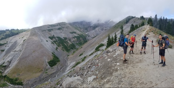
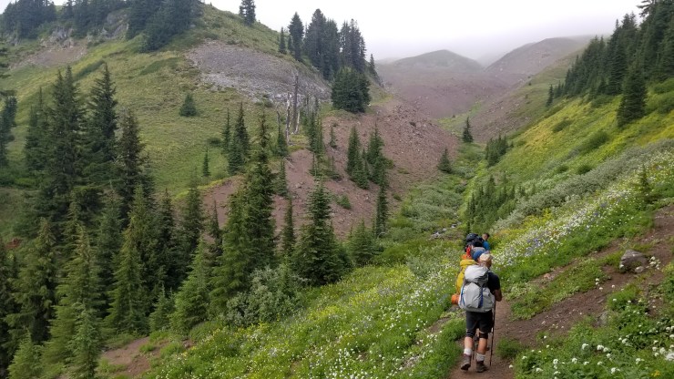
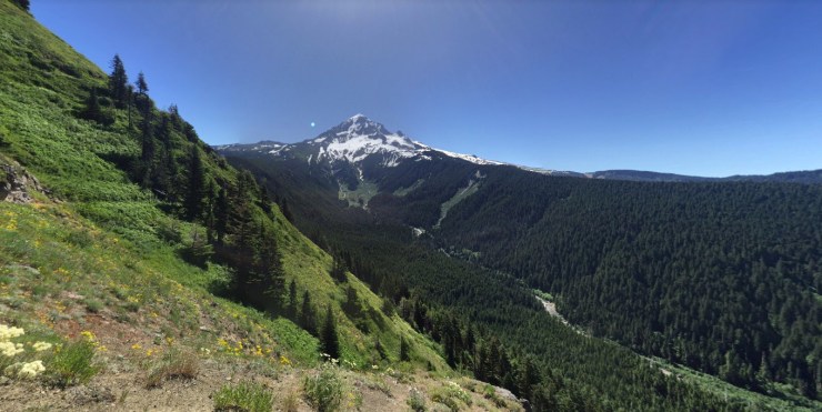
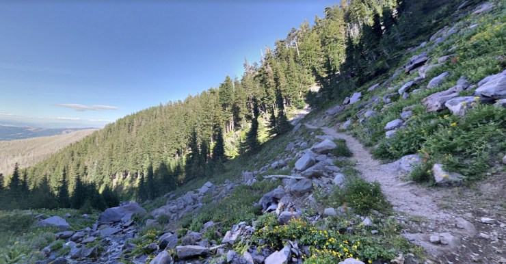
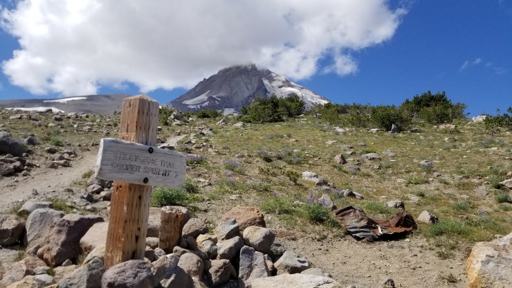
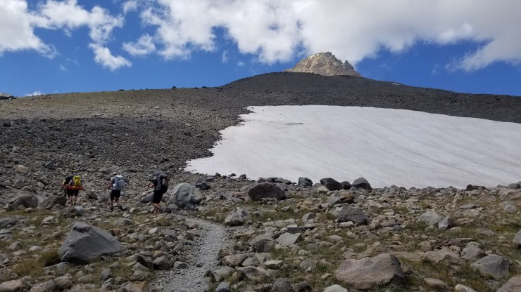
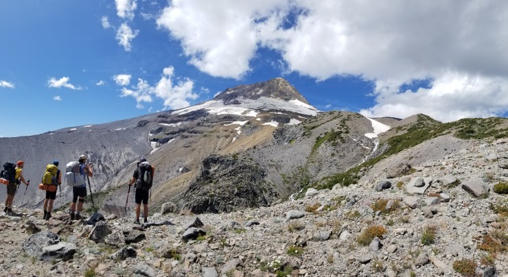
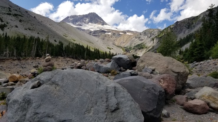
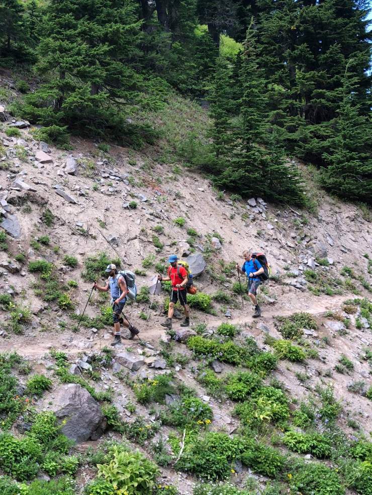
The Day 2 hike on the Timberline Trail Loop has the biggest climb of the trek. Over the course of the ~8 miles, you climb at least 3,500 feet. The day starts with climbing up and over the Yocum Ridge and then fording the Muddy Fork at the 3 mile mark. The PCT then leads along a ridge and skirts around Bald Mountain at mile 5. At this point, you transition off the PCT and start heading east on the actual Timberline Trail. The Timberline Trail leads up towards McNeil Point. At around the 7.5 mile point (near McNeil Point) there is a junction with a trail that leads north to McGee Creek. Take this trail downhill for ~0.2 miles in order to reach the campsites near the creek.
……….
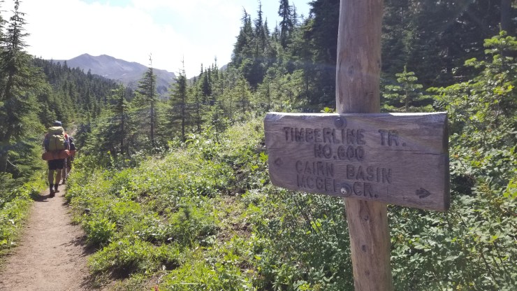
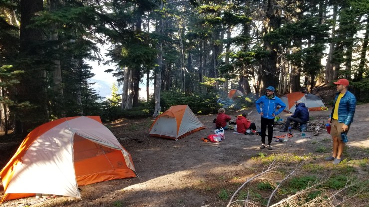
Day 3: 6.5 miles; +2,200 feet / -1,850 feet; McGee Creek to Compass Creek
Map of the Day 3 hike on the Timberline Trail Loop (PDF)
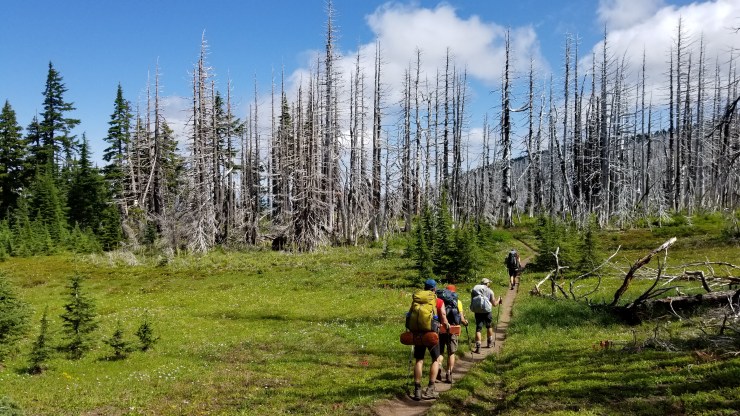
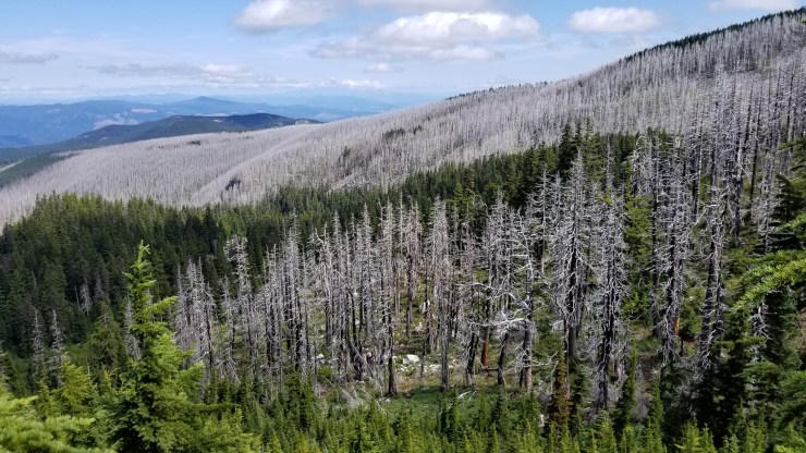
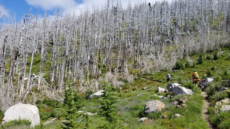
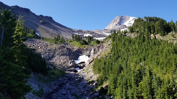
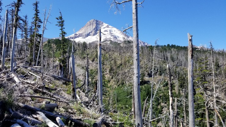
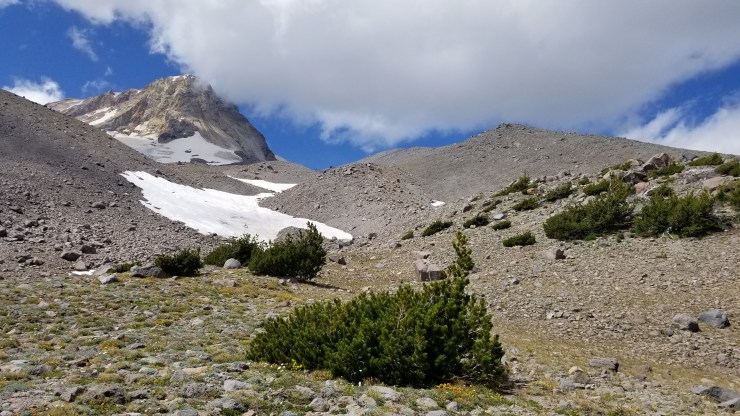
Day 3 takes you along the Timberline Trail from McGee Creek to Compass Creek. The first mile meanders in and out of the cascade forest. You then approach the Cairn Basin and the burned remnants of the 2011 Dollar Lake fire. At around the 3.5 mile mark, you descend ~800 feet through Elk Cove before reaching the Coe Branch (another creek ford). After you ford Coe, you begin a ~1,00 foot climb up to Compass Creek where you camp for the 3rd night.


……….
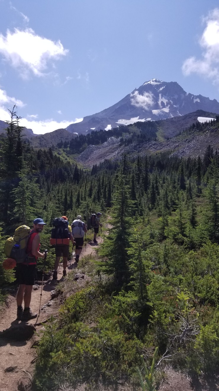
Day 4: 7.6 miles; +2,130 feet / -2,390 feet; Compass Creek to Newton Creek

Map of the Day 4 hike on the Timberline Trail Loop (PDF)
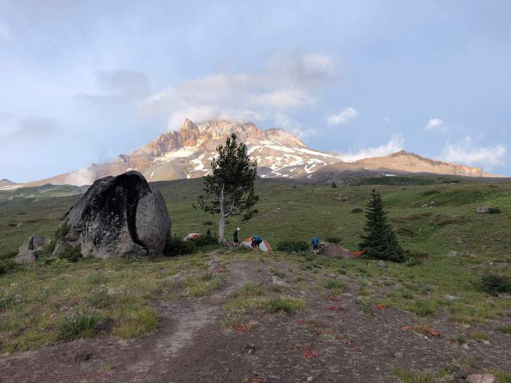
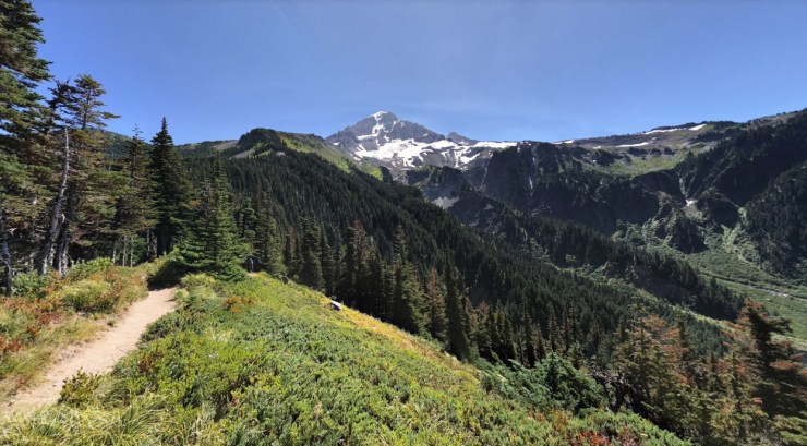
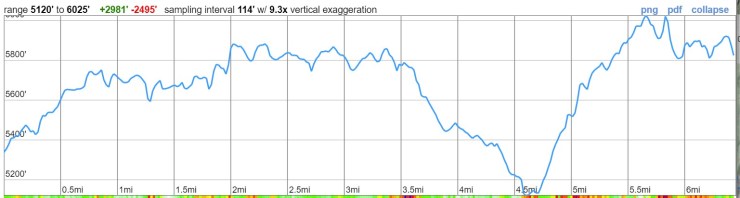
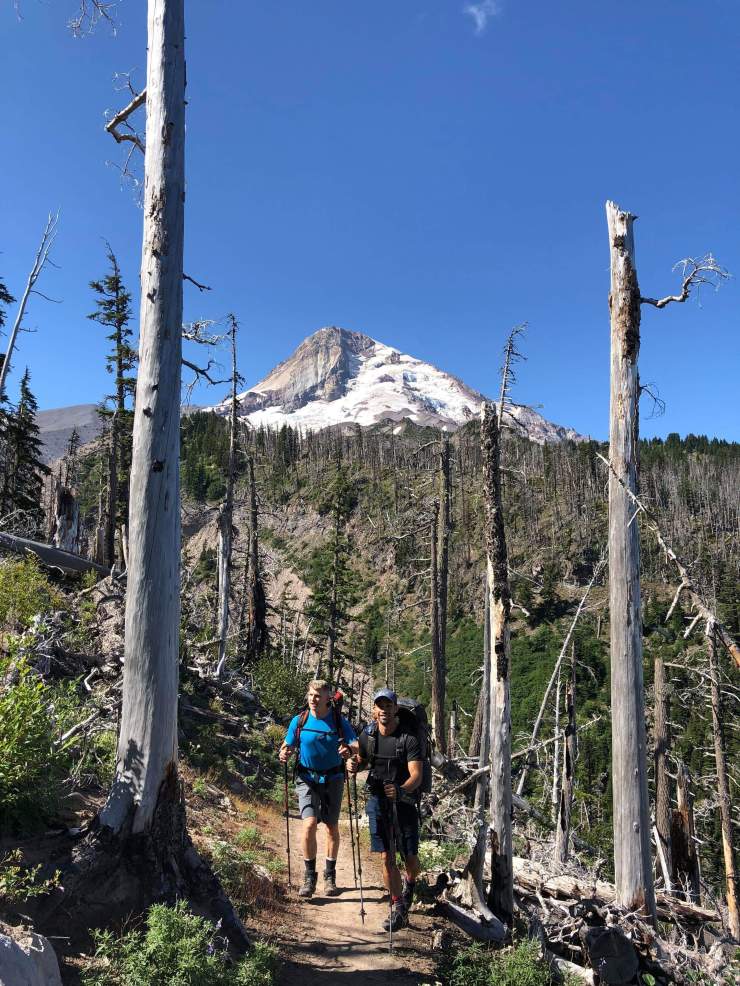
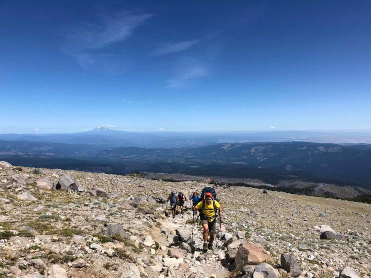
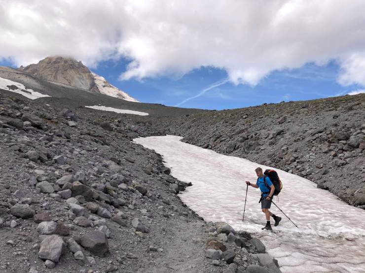
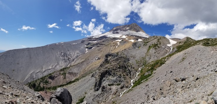
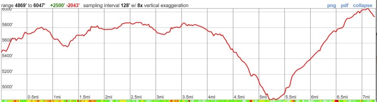
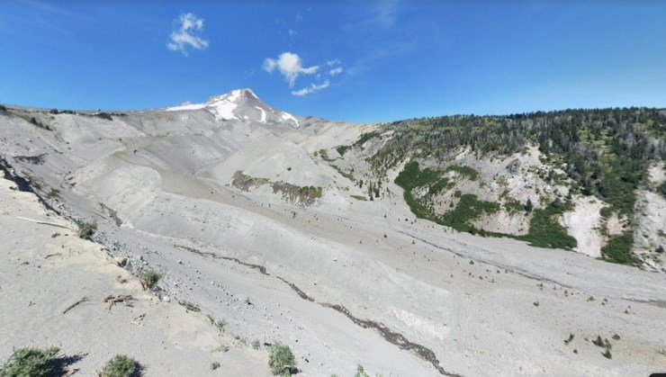
The hike on Day 4 is moderately difficult, but rewards you with some great views. The first mile is relatively flat and heads east through the forest. You then descend ~700 feet down into the Cloud Cap Saddle and the Eliot Branch. This section of the trail was constructed in the last 10 years after the previous trail through the Eliot Branch was destroyed. You ford the Eliot Branch creek and then begin a steady ~3,000 foot climb south along the east side of Mt. Hood. At the 4.5 mile mark, you reach the peak elevation of the Timberline Loop (~7,340 feet). From there it is ~3 miles downhill to Newton Creek as the Timberline Trail descends along the Gnarl Ridge. Set up camp after you ford Newton Creek.

……….
Day 5: 7.3 miles; +1,850 feet / -1,510 feet; Newton Creek to Timberline Lodge
Map of the Day 5 hike on the Timberline Trail Loop (PDF)
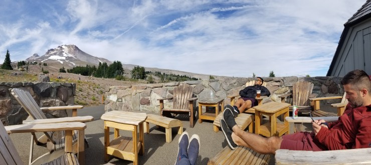
The hike on the last day of the Timberline Trail Loop is relatively tame. In the first mile, the trail gently climbs up a ridge. For the next ~3 miles, you hike across the Mt. Hood Meadows ski slope area and go in and out of the tress as you cross the different ski runs. At the 4 mile mark, you exit the ski resort area and begin a ~1,000 foot descent down towards the White River. After fording the river, it is a ~2 mile climb up 1,200 feet to reach the Timberline Lodge and finish the loop. At the lodge you can buy a beer and some food to reward yourself!
Here are some similar trip reports!
Four Pass Loop – Maroon Bells Snowmass Wilderness, CO (28 mile loop)
Broken Top Loop – Three Sisters Wilderness (24 mile loop)
Titcomb Basin – Wind River Range, WY (40 mile route)
Spider Gap, Buck Creek Pass – Glacier Peak Wilderness (40 mile loop)

Great trip guide! I’ve been thinking of trying this with my wife and niece this summer. Definitely going to give it a go once I look into permits. Do you think this route is possible to do in four days? Also, does one need to call in designated spots the entire way?
LikeLike
Hi Jeff, you can grab a permit at the trailhead when you arrive! You can camp many places along the route. There are no designated spots, though it’s best to find sites that have been used before. You can do it in four days, but you will want to be in pretty good hiking shape.
LikeLike
This looks awesome! How dry is it? Like do you need to carry enough water or is there enough sources along the trail?
LikeLike
There are a good number of creeks/streams/lakes along the trail, so you should be good to only carry 2-3L at most. Definitely bring a filter or iodine tabs to sterilize, and plan your campsites so that they are near streams (in the report I did so). Note that some of the streams can be quite silty, so they are not great to try and filter and drink. There is some good info on individual water sources at this page: https://www.oregonhikers.org/field_guide/Timberline_Trail_around_Mount_Hood_Hike
LikeLike
Thanks for the detailed info on this trip! I was wondering if you had any trouble crossing any of the rivers while traveling in the month of August as I have read that those could be challenging especially in early season. When in August was your trip? Thank you!
LikeLike
Hi Timea – The photos are from a trip that started on August 13th. The stream crossings were not that bad on this trip (you can gauge things from some of the photos). I can’t really say with any certainty how things will look this August. It will mostly depend on snow levels this winter and temperatures in the late Spring and early Summer!
LikeLike
Thank you for taking the time to put this trip report together, I have referenced it often.
LikeLike
Thanks for sharing this information. Planning and training for backpacking in September. A bit nervous with the elevation gain and the river crossings. Your detailed information is helping to calm my mind and go for it.
LikeLike
I’m having trouble finding the typical weather on the Timberline trail in September.
LikeLike
September can be really nice hiking weather. The bugs are usually gone, streams are more passable, and temps can be milder. The main risk is that it can start raining and weather can get more variable. In a drought year, you also could have some water sources dry up.
LikeLike
Thank you for creating this thorough and detailed trip report. I will be following your plan in my trip there next week. I am unsure of how cold it will get at night. The forecast in Welches is for highs in the upper 80s and lows around 60, but I assume it will be lower on both counts on the trail. Can you tell me, what time of year you were there, and what was the temp difference between day and night? Thanks!
LikeLike