


Trip Overview: This ~38 mile route traverses Lassen Volcanic National Park. Along the way you hike to the top of the Cinder Cone, pass by solidified lava flows and multicolored dunes, and walk through a large hydrothermal area. +/- 7,000 feet of elevation over the course of this trek with a peak elevation of 8,400 feet. Other highlights include volcanic peaks, meandering rivers, alpine meadows, and several lakes. The majority of the images here are from a trip in mid September.
- Higher resolution version of the overall map for the Lasssen Volcanic Loop (PDF)
- Topographic map of Lassen Volcanic National Park for purchase (amazon link)
Jump to Day 1: Kings Creek Trailhead to Rainbow Lake
Jump to Day 2: Rainbow Lake to Cinder Cone and Snag Lake
Jump to Day 3: Rainbow Lake to east of Cliff Lake
Jump to Day 4: Cliff Lake to Bumpass Hell to Kings Creek Trailhead
Shop Deal of the Day at REI Outlet (up to 50% off)!
Preparations:
Click here to read more about Permits
Permits: A free permit is required to camp in the park backcountry (outside of Lassen’s developed campgrounds). You fill out your permit at the self-registration stations within the park and must include details such as your party size, entry and exit trailheads, approximate campsite location for each night, emergency contact information, and vehicle make, model, and license number.
Click here to read more about Logistics
Logistics: To access the Kings Creek Trailhead, you will need to drive along Highway 89. This road is closed for the winter and typically opens sometime between late May and July (deepening on winter snow levels). Be sure that the road is open when you plan to take your trip. If you would like to camp the night before your trip, Lassen Volcanic National Park has several developed campground you can stay at. Some sites are available on a first-come, first-served basis and some can be reserved on recreation.gov. Reservations are advised during busy summer weekends. For this specific itinerary, you park your car and start the hike at the Kings Creek Picnic Area Trailhead.
Click here to read more about Difficulty
Trail Conditions and Difficulty: This itinerary within Lassen Volcanic National Park is of moderate difficulty. On average you will hike ~10 miles a day, but there is no particular day with extreme elevation gain. Also, on day 2 you do not need to pack up your camp and can just day hike to the Cinder Cone and back. Overall the trail is well marked. If hiking early in the season you may encounter snow on the mountain passes, so it is wise to check snow levels before setting off on your hike.
Supplies: There are active black bears in the Lassen Volcanic National Park, so you need to bring a bear canister to store food and scented items. Bear spray is not allowed so leave that at home.
You likely will want bug spray because the mosquitoes can be out in force in certain areas of the trek. I prefer a picaridin based spray because it does not damage plastics and synthetic fibers like high concentration DEET sprays can. I also like to pre-treat my clothes and tent with permethrin spray repellent. The permethrin treatment stays on your clothes for up to 7 washes, so it helps reduce the amount of spray you need to put on your skin.
Below is a list of the gear I brought on this backpacking loop in Lassen National Park:
Hiking clothes
- a lightweight hiking rain jacket (North Face Venture 2 Jacket)
- fast drying synthetic hiking pants (prAna Zion Pants)
- a quick drying long sleeve hiking shirt (Columbia Silver Ridge L/S Shirt)
- wool outer socks (People Socks Moreno 4-pack)
- thin blister preventing base socks (WrightSock double layer Coolmesh)
- quick drying synthetic boxer briefs (ExOfficio Give-N-Go)
- Gore-tex hiking shoes (adidas Outdoor Terrex Fast R Gore-Tex Shoe)
Clothes for camp
- wool leggings (Minus33 Merino Wool Kancamagus Midweight Bottom)
- wool base layer shirt (Minus33 Merino Wool Chocorua Midweight Crew)
- lightweight down jacket (Patagonia 800-fill Down Jacket)
- lightweight camp shoes (Xero Z-Trail lightweight sandal)
Hiking gear
- topographic map (Nat Geo Map)
- trekking poles (Black Diamond Trail Ergo Cork Trekking Poles)
- 2 liter hydration bladder (Platypus Big Zip Water Reservoir)
- 65 liter backpack (Osprey Atmos 65 Liter pack)
- water filtration system (Platypus gravity filtration system)
Camp gear
- strong tent with rain-fly (Alps Mountaineering Chaos 2 Tent)
- inflatable sleeping pad (Therm-a-Rest Trail Pro Sleeping Pad)
- sleeping bag (REI Co-op Igneo 25 Sleeping Bag)
- lightweight backpacking chair (Helinox Chair Zero)
- headlamp (Black Diamond Cosmo Headlamp)
- multi-tool with knife (Gerber MDime Mini Multi-Tool)
- bear canister (BearVault BV500)
- lightweight stove (MSR PocketRocket 2)
- lighter (BIC plastic lighters)
- 2 liter pot (GSI Outdoors Halulite Boiler Pot)
- coffee cup (GSI Outdoors Glacier Stainless Cup)
- lightweight spork (Snow Peak Titanium Spork)
- small, quick drying towel (REI mutli towel mini)
Random
- wet wipes (Stall Mates individually wrapped wipes)
- mole skin for blisters (Blister medic kit)
- small amount of duct tape for gear repairs
- chapstick and sun screen
Food and drink
- a variety of my favorite dehydrated meals
- electrolyte replacement (NUUN Hydration Tablets)
- instant coffee (Starbucks VIA)
- quick snacks (Clif Shot Bloks and Clif energy bars)
- small plastic water bottles filled with whisky 🙂
……….
Day 1: 10.3 miles; +1,300 feet / -2,060 feet; Kings Creek Picnic Area Trailhead to Rainbow Lake


The first day hike takes you from the Kings Creek Picnic Area Trailhead to Rainbow Lake, the campsite for the next two nights. You start with a 4.5 mile descent down to Summit Creek. Along the way you pass Kings Creek Falls and get many nice views. After the 4.5 mile mark, you begin hiking northeast along the Pacific Crest Trail. Eventually you pass by Swan and Twin Lakes and finally reach Rainbow Lake shortly after the 10 mile mark. There are several nice campsites along the shore of Rainbow Lake.

Meadow view as you start your hike in the Kings Creek area of Lassen Volcanic National Park 
View of Lassen Peak in the clouds 
Wild flowers and Kings Creek in Lassen Volcanic National Park 
One of several falls in the Kings Creek Falls area of Lassen Volcanic National Park 
One of several falls in the Kings Creek Falls area of Lassen Volcanic National Park 
View from the trail near Kings Creek Falls in Lassen Volcanic National Park 
Kings Creek Falls area 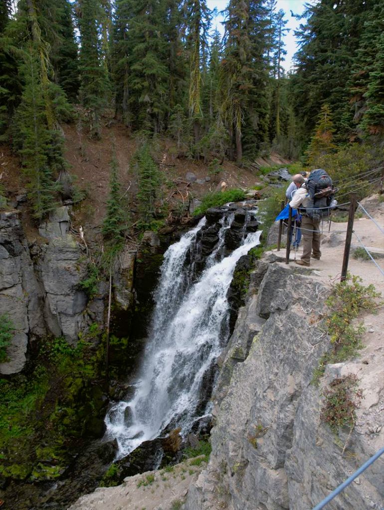
Kings Creek Falls in Lassen Volcanic National Park 
Creek crossing near the junction with the Pacific Crest Trail in Lassen Volcanic National Park 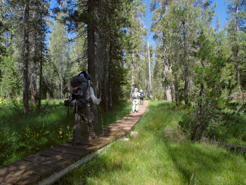
Hiking along the PCT towards Rainbow Lake 
View of one of the Twin Lakes in Lassen Volcanic National Park 
Rainbow Lake in Lassen Volcanic National Park 
Campsite along the shore of Rainbow Lake in Lassen Volcanic National Park 
Rainbow Lake at dusk, Lassen Volcanic National Park
……….
Day 2: 9.7 miles; +1,900 feet / -1,900 feet; Day Hike to Cinder Cone and Snag Lake


On Day 2, you can keep your camp intact at Rainbow Lake. Take your lighter pack with food and water and head out for a 10 mile day hike to the Cinder Cone and Snag Lake.

View of Rainbow Lake in the morning at Lassen Volcanic National Park 
Morning at Rainbow Lake 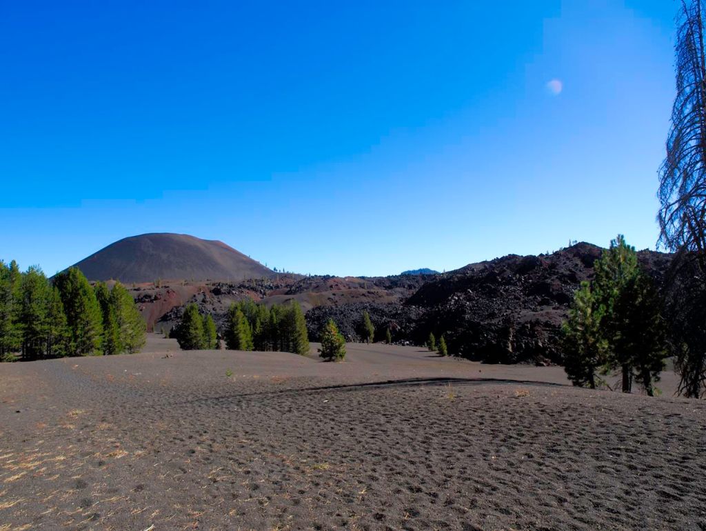
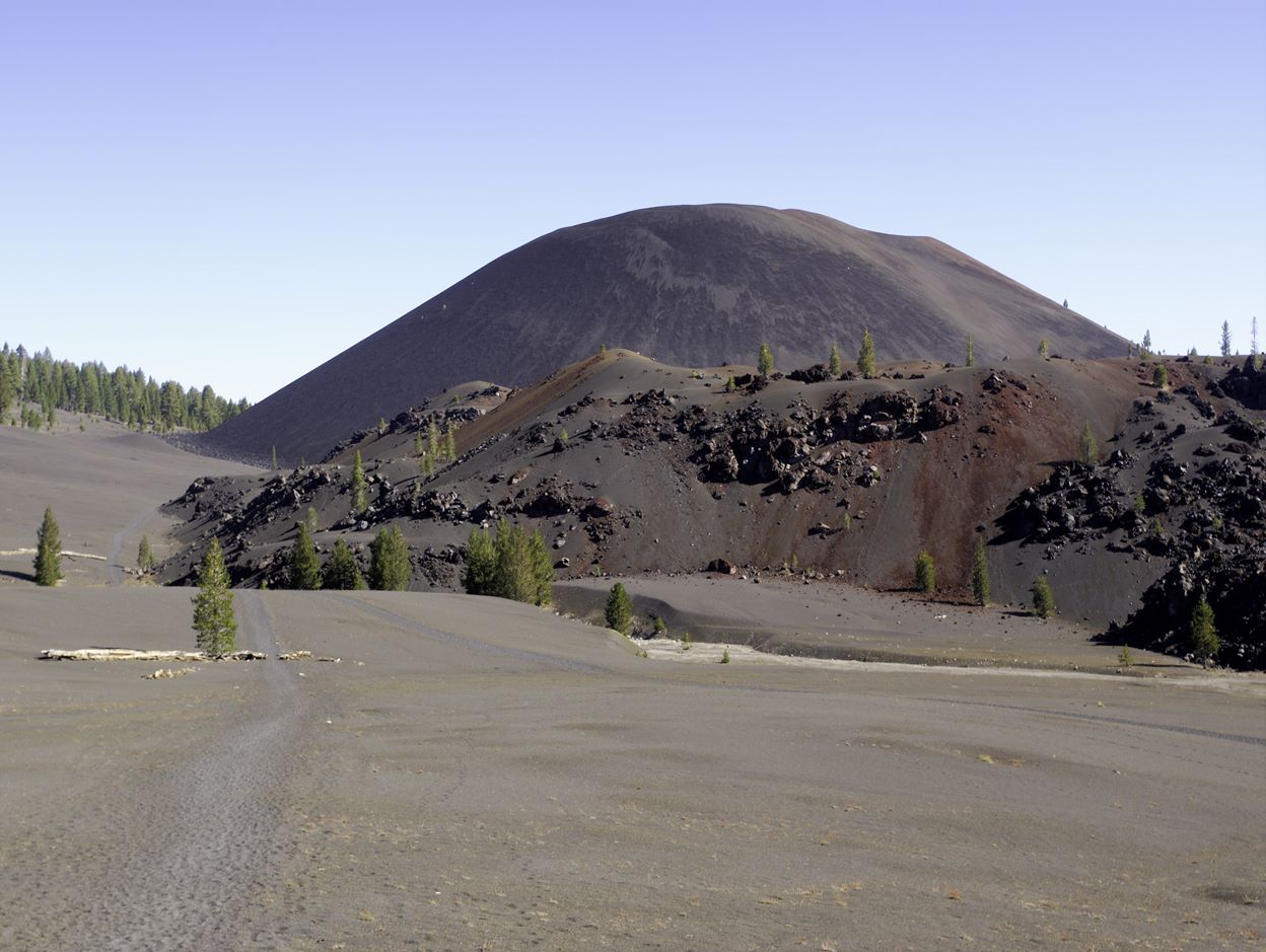
Distant view of the Cinder Cone in Lassen Volcanic National Park 
Trail leading to the Cinder Cone in Lassen Volcanic National Park 
View of Lassen Peak from near the Cinder Cone 
View of the Painted Domes with Lassen Peak in the background, in Lassen Volcanic National Park 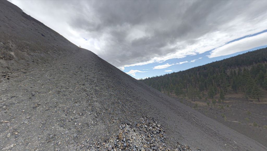
The steep, sandy ascent that leads to the top of the Cinder Cone in Lassen Volcanic National Park 
Trail along the rim of the Cinder Cone, Lassen Peak in the background 
Hiking along the Cinder Cone Rim, Lassen Volcanic National Park 
Hiking along the Cinder Cone rim, Lassen Volcanic National Park 
View from the Cinder Cone, looking out over the Painted Dunes and Fantastic Lava Beds with Snag Lake in the background 
Close up view of the multicolored Painted Dunes in Lassen Volcanic National Park 
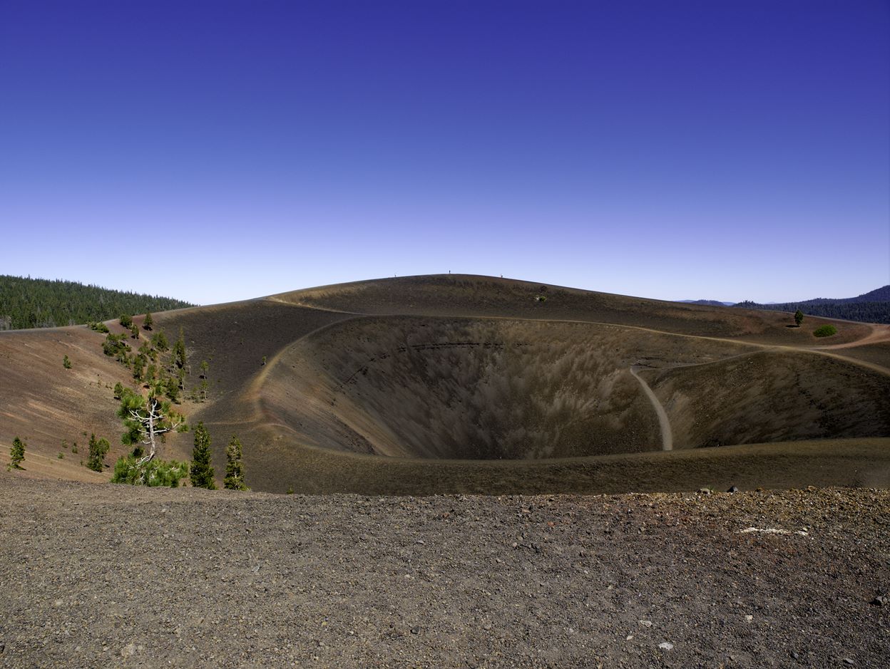
View of the trail around the circular rim of the Cinder Cone in Lassen Volcanic National Park 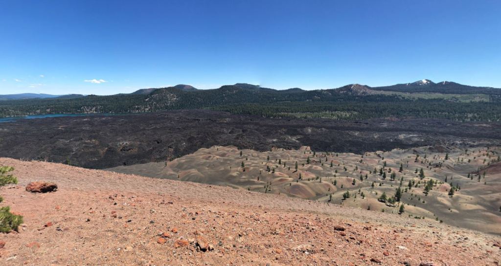
View of the Painted Dunes, Fantastic Lava Beds, and Butte Lake from atop the Cinder Cone 
Cinder Cone trail with Snag Lake in the background 
There is a spiraling trail that leads to the bottom of the Cinder Cone 
Trail leading down from the Cinder Cone towards the Painted Dunes 
The trail traverses along the Painted Dunes as it leads to Snag Lake 
The trail then heads along the edge of the Fantastic Lava Beds area 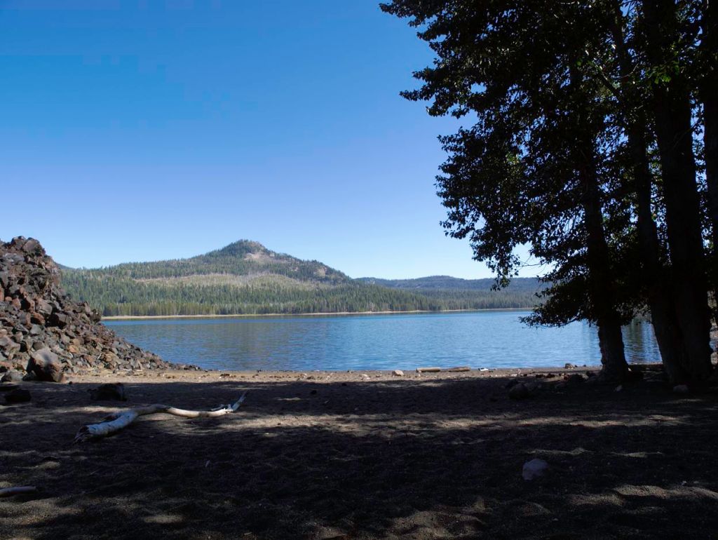
Snag Lake in Lassen Volcanic National Park 
View of the Fantastic Lava Beds from the western shore of Snag Lake 
View looking south east from the shore of Snag Lake
……….
Day 3: 7.5 miles; +1,600 feet / -1,000 feet; Rainbow Lake to east of Cliff Lake


Day 3 takes you back across Highway 89 to the Cliff Lake area. Along the way you pass several lakes including Twin Lakes, Echo Lake and Summit Lake. The trail moves in and out of the forest. After Summit Lake, you cross the highway and begin a 2 mile climb up to the meadow that sits to the east of Cliff Lake (the campsite for this night). Note that you are not allowed to camp within 0.25 miles of Cliff Lake, so make sure you stay far enough east of the lake to be within the rules. It is best to utilize the stream for water so that you do not need to hike back and forth to the lake.

View of Lower Twin Lake in Lassen Volcanic National Park 
Upper Twin Lake in Lassen Volcanic National Park 
A small lake to the west of Twin Lakes 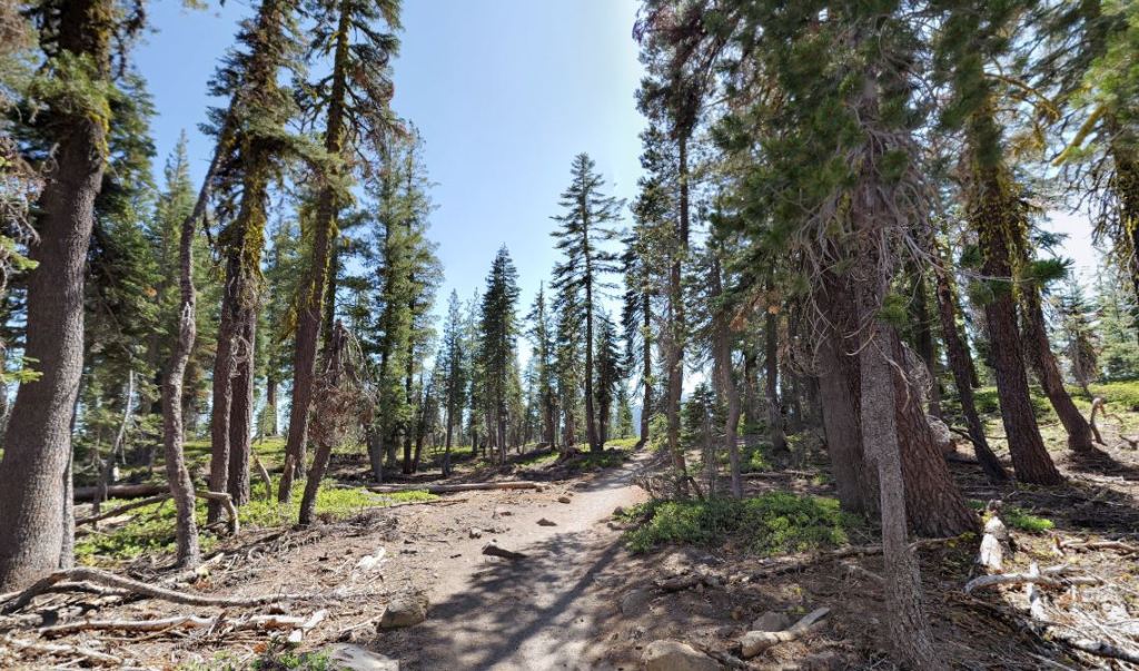
The trail traverse through a forest between Twin Lakes and Echo Lake 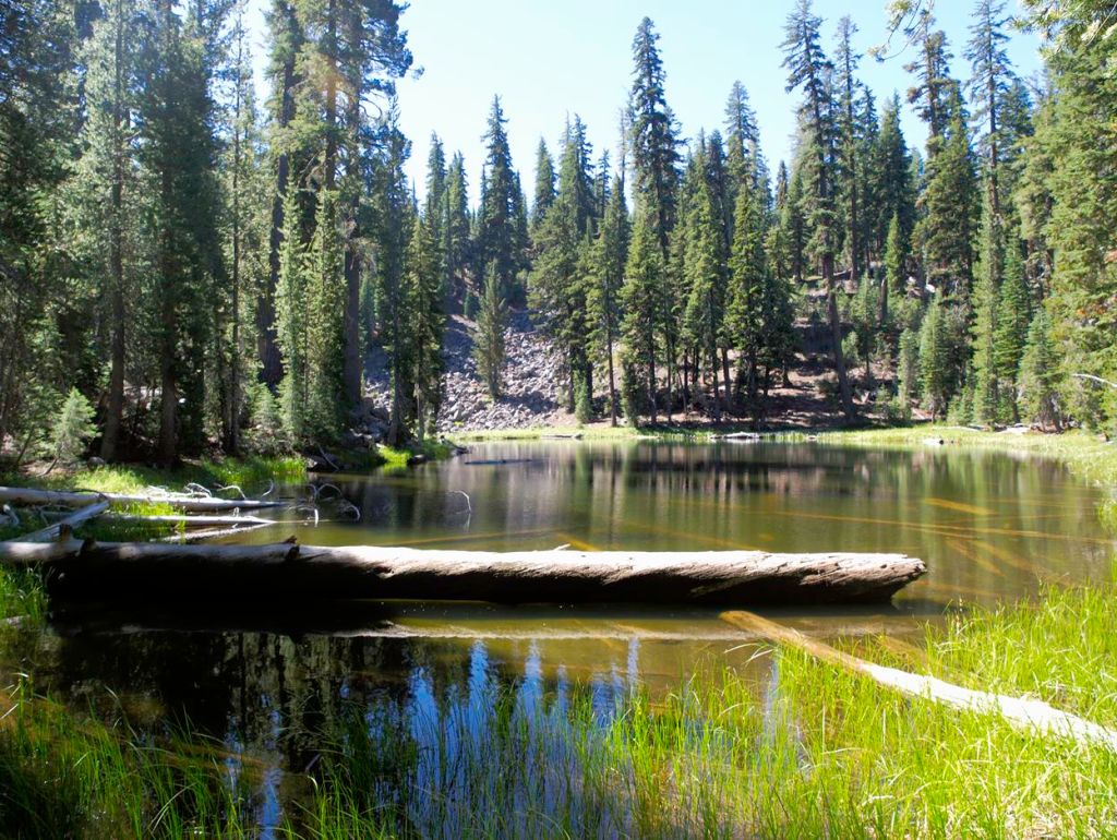
One of several small lakes/ponds you pass on the way to Echo Lake 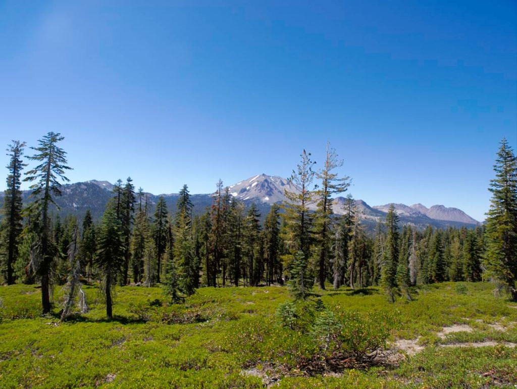
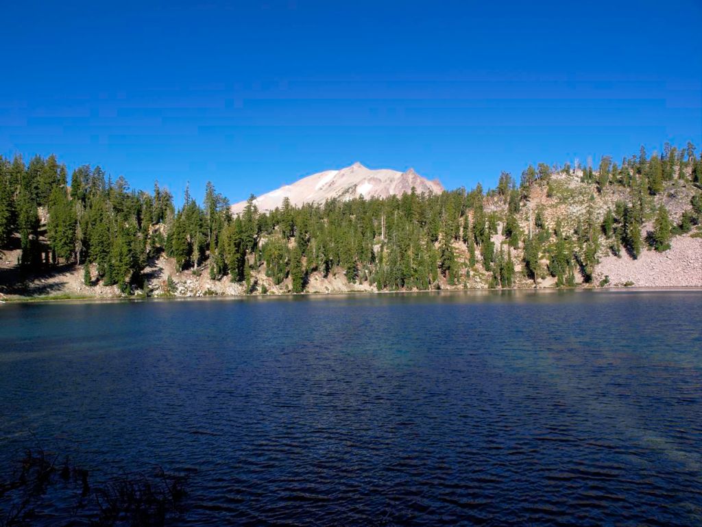
View of Lassen Peak in the distance 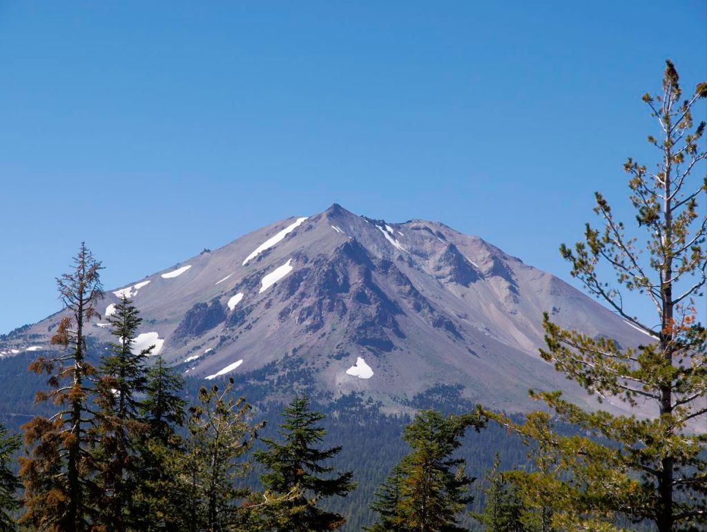
Lassen Peak 
The boardwalk at Summit Lake in Lassen Volcanic National Park 
View from the shore of Summit Lake 
After crossing Highway 89, you hike west towards Cliff Lake. Before reaching Cliff Lake you come upon a stream. You can camp in the this area, but are not allowed to camp close to Cliff Lake. 
This meadow was the campsite and sits to the east of Cliff Lake 
Visitors to the meadows east of Cliff Lake
……….
Day 4: 10.6 miles; +2,450 feet / -2,350 feet; East of Cliff Lake to Kings Creek Picnic Area TH


On the final day of this itinerary, you begin by climbing west past Cliff Lake and Shadow Lake before reaching Highway 89 again. From there you hike along the road descending for 2.5 miles until you end up back at your car in the Kings Creek Picnic Area. Leave your heavy items in your car and then set off for a day hike to the Bumpass Hell hydrothermal area. It is roughly 3 miles to hike to the west end of Bumpass Hell and then 3 miles to retrace your steps back to your car.
View of Lassen Peak from the shore of Shadow Lake 
The trail as it skirts along the shore of Shadow Lake in Lassen Volcanic National Park 
Terrace Lake in Lassen Volcanic National Park 
Lassen Peak as you cross Highway 89 on the way to the Kings Creek area 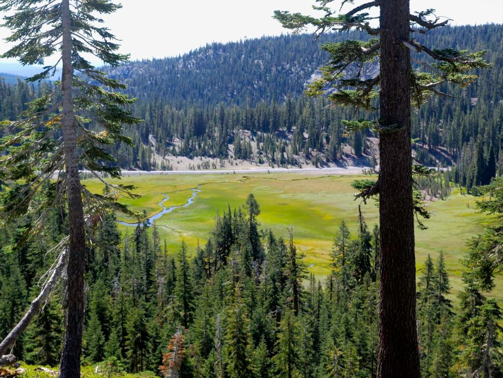
Meadow in Lassen Volcanic National Park 
Cold Boiling Lake in Lassen Volcanic National Park 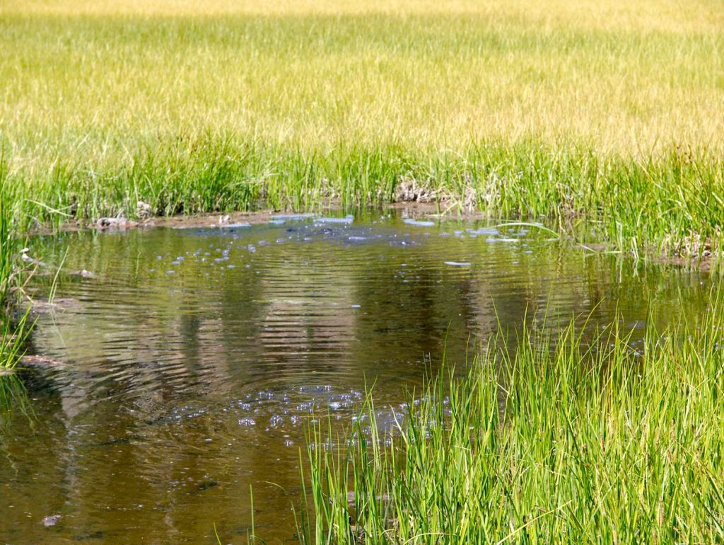
Bubbles rising from the Cold Boiling Lake in Lassen Volcanic National Park 
After passing Cold Boiling Lake, the trail skirts along a ledge as it leads towards Bumpass Hell 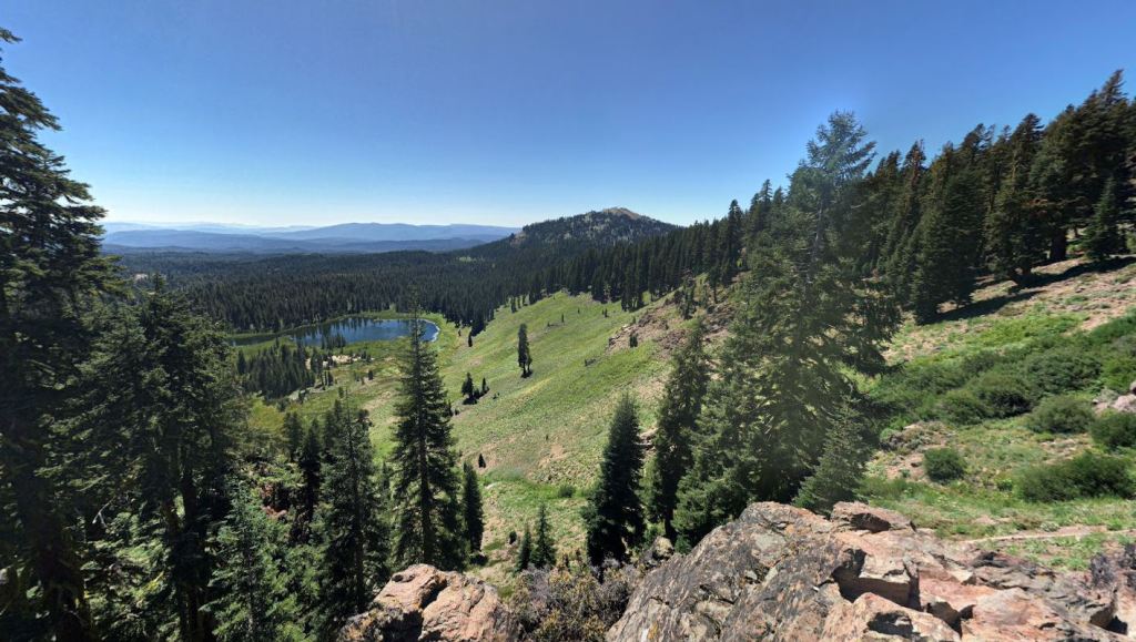
Crumbaugh Lake in the distance 
View of Crumbaugh Lake from the trail that leads to Bumpass Hell in Lassen Volcanic National Park 
Mountain view on the way to Bumpass Hell 
A small pond in the distance 
Looking east before reaching Bumpass Hell 
First view of the Bumpass Hell hydrothermal area of Lassen Volcanic National Park 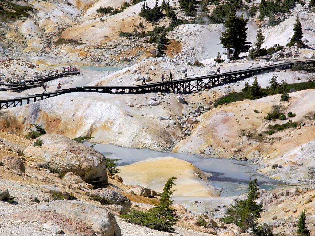
Boardwalk in Bumpass Hell area of Lassen Volcanic National Park 
Boardwalk traversing through Bumpass Hell in Lassen Volcanic National Park 
Boardwalk in the Bumpass Hell area of Lassen 
Hydrothermal feature in the Bumpass Hell area of Lassen Volcanic National Park 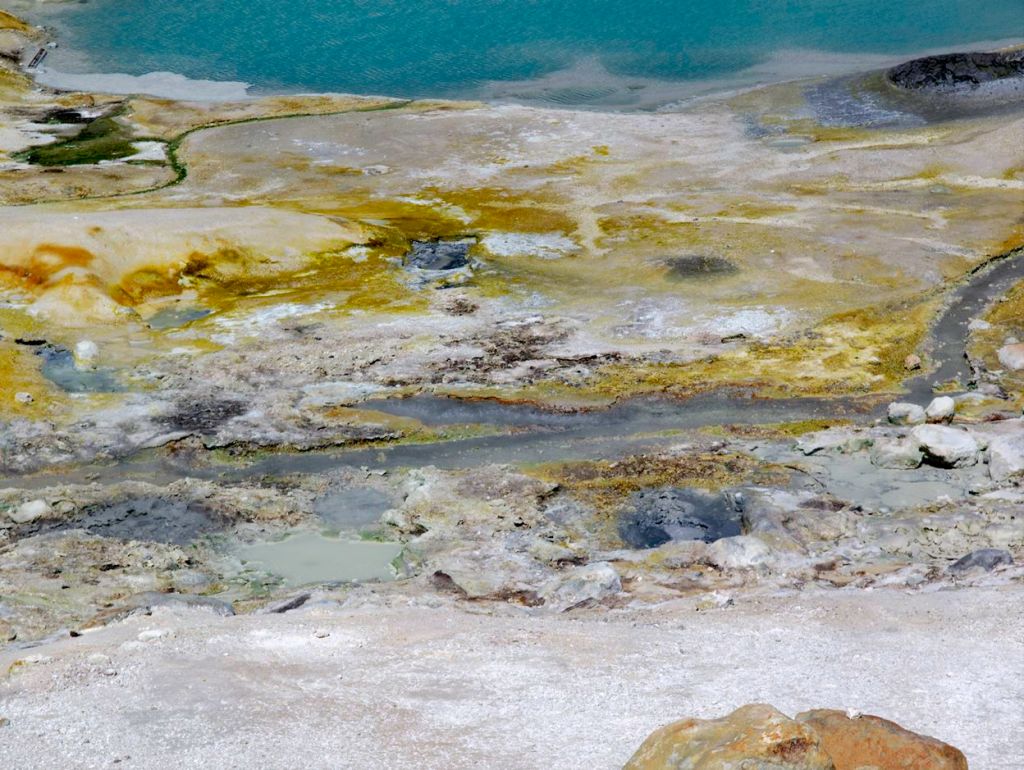
Hydrothermal feature in the Bumpass Hell area of Lassen Volcanic National Park 
Hydrothermal feature in Bumpass Hell in Lassen Volcanic National Park 
Hydrothermal feature in Bumpass Hell in Lassen Volcanic National Park 
Hydrothermal feature in Bumpass Hell in Lassen Volcanic National Park 
Hydrothermal feature in Bumpass Hell in Lassen Volcanic National Park 
A spring in the Bumpass Hell area of Lassen Volcanic National Park 
A spring in the Bumpass Hell area of Lassen Volcanic National Park 
Bumpass Hell in Lassen Volcanic National Park
……….
Here are some similar trip reports!
Loowit Trail – Mount St. Helens National Volcanic Monument (30 mile loop)
Four Lakes Loop – Trinity Alps Wilderness (20 mile trek)
Yosemite Highlights Loop – Yosemite National Park (40 mile loop)
Rae Lakes Loop – Kings Canyon National Park Backpacking (41 mile loop)

Hi do you know if lassen will be open for backpacking this year? it was closed last summer cause of bears.
LikeLike
Hi Kim – So far, all indications I can find point to Lassen Nation Park being open for backpacking and backcountry camping this year. Let’s hope it stays the case, but there is currently no mention of camping closures on the park website.
LikeLike