


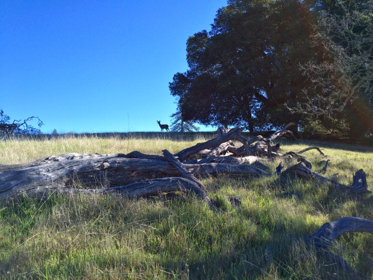
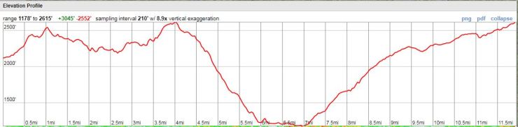
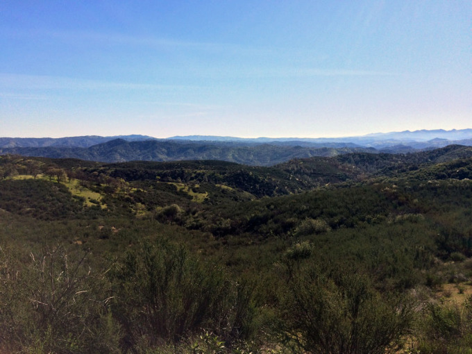
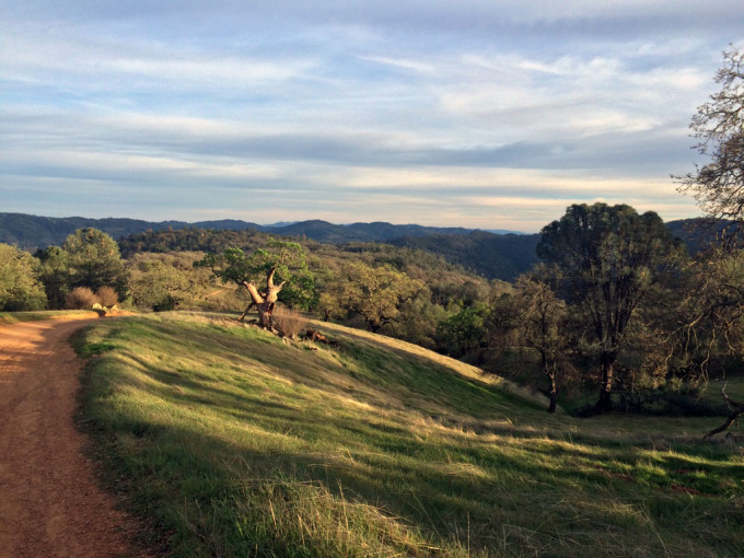
Trip Overview: ~24 mile out and back backpacking trip from the Henry Coe State Park Headquarters to Mississippi Lake and back. +/- 6,000 feet of elevation with a starting elevation of 2,600 feet and a peak elevation of 2,630 feet. Highlights include rolling hills, large oak trees, and ponds/lakes full of fish. We did this hike in 3 days and 2 nights in February of 2015.

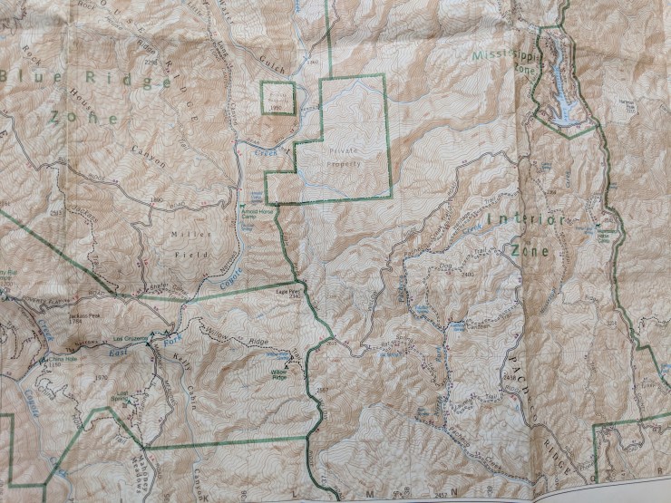
Henry Coe Park Brochure and Map
Preparations:
Permits: To backpack in Henry Coe State Park, you must obtain a permit. In the Western part of the park, backpackers must camp at the designated campsites shown in the park map above. Permits for these sites cannot be reserved ahead of time and are given out on a 1st come-1st served basis each day. In other zones of the park, backpackers can camp anywhere. Backpacking fees are $5 per night per person and parking at the Headquarters is $8 per day.
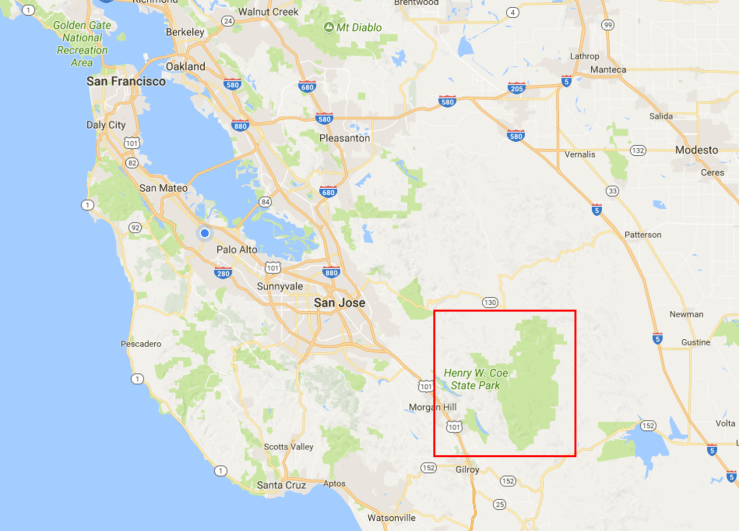
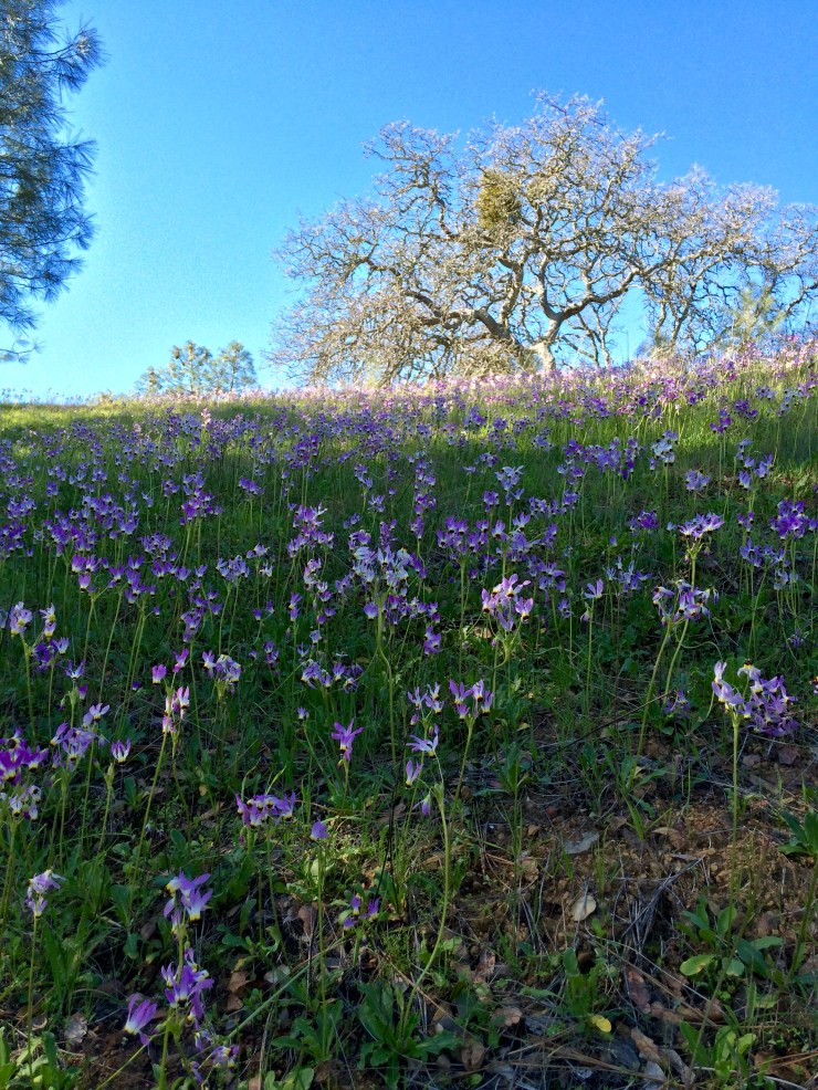
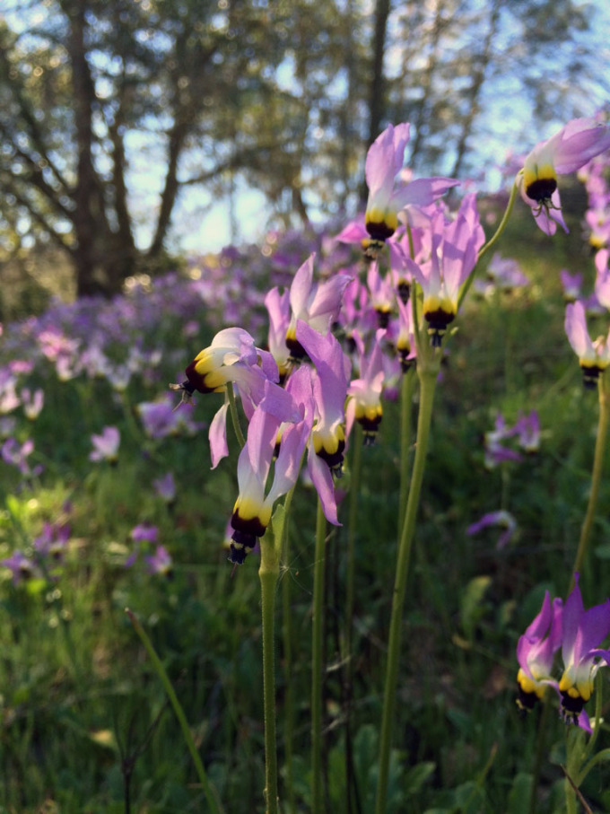
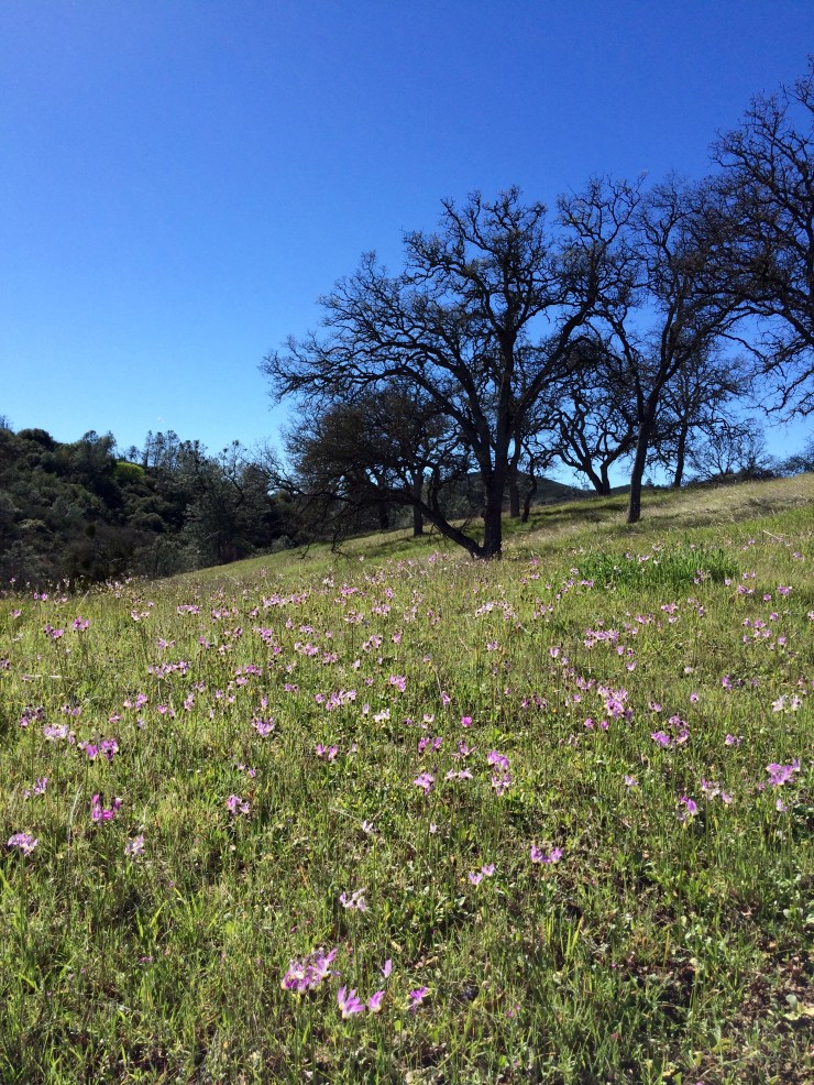
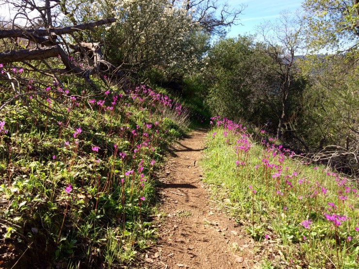
Logistics: The park rangers limit the number of backpackers in each zone and at each designated campsite, so arrive early to secure a permit if you are looking to grab a particular campsite. The park is located about 40 minutes from Morgan Hill and is within an 1.5 hour drive from many areas in the Bay Area. Henry Coe is most popular in the spring when the temperatures are cooler and the hills are green and full of wild flowers. This time of the year is when you may have competition for permits at the best campsites. In the summer, the crowds dwindle because the temperatures rise and many springs dry up.
The Headquarters/Visitor Center has bathrooms, water, and a few supplies for sale, so it makes a good starting off point. They open up at 8 am and there is typically a ranger to get current information from.
You can also enter the park at the Hunting Hollow or Dowdy Ranch entrances. The Hunting Hollow entrance has portable toilets but has no potable water. The main advantage of this entrance is that you self-register your backcounty permits and there is no quota system. However, you must have cash to put in the envelope when you drop your permit into the lock box. The Dowdy Ranch entrance is on the East side of the park. This entrance is only open Sat-Sun and thus is only useful for 1 night trips or trips that last a full week (you cannot get your car out of the parking lot during the week).
Supplies: There are no bears in Henry Coe, so you will not need to bring a bear canister on your hike. This clears up space in your pack and makes things easier!
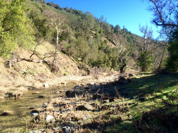
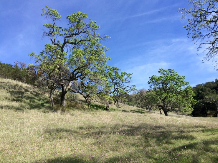
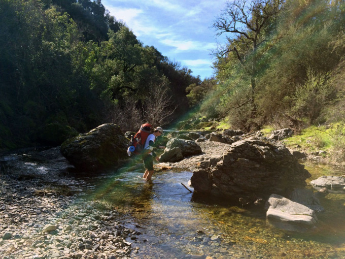
The key supplies you will need are related to heat, hydration, hills, and stream crossings. Henry Coe is a fairly low elevation park (2,000-3,000 feet) and can get extremely hot in the summer months. You should always be prepared to hike in hot temperatures and carry plenty of water. Many of the trails are very exposed as well, so protection from the sun is paramount. Additionally, trekking poles are a life saver at Henry Coe. The trails in this park are very hilly and steep, so the poles help save your knees. Lastly, you will want a pair of sandals (Xero Z-Trail lightweight sandal) or equivalent if you plan to hike along The Narrows Trail. This trail meanders back and forth across a stream over the course of a mile or so (in the summer the stream may be mostly dried out, but in the winter you may need to cross water that is waist deep). If you are visit Henry Coe State Park in the spring, winter, or fall, expect temperature to get quite chilly at night, so some warm layers for camp are needed.
Suggested hiking clothes
- a lightweight hiking rain jacket (North Face Venture 2 Jacket)
- fast drying synthetic hiking pants (prAna Zion Pants)
- a quick drying long sleeve hiking shirt (Columbia Silver Ridge L/S Shirt)
- wool outer socks (People Socks Moreno 4-pack)
- thin blister preventing base socks (WrightSock double layer Coolmesh)
- quick drying synthetic boxer briefs (ExOfficio Give-N-Go)
- light bandana for sun protection (Levi’s printed bandana)
- mesh back trucker hat (Patagonia LoPro Trucker Hat)
- adjustable fabric belt (Bison designs belt)
- Gore-tex hiking shoes (adidas Outdoor Terrex Fast R Gore-Tex Shoe)
Suggested clothes for camp
- wool leggings (Minus33 Merino Wool Kancamagus Midweight Bottom)
- wool base layer shirt (Minus33 Merino Wool Chocorua Midweight Crew)
- warm wool overshirt (Pendleton Long Sleeve Classic-Fit Board Shirt)
- lightweight down jacket (Patagonia 800-fill Down Jacket)
- lightweight camp shoes (Xero Z-Trail lightweight sandal)
Suggested hiking gear
- topographic map (purchase from park headquarters)
- trekking poles (Cascade Mountain Tech Carbon Fiber Trekking Poles)
- 3 liter hydration bladder (Camelbak Antidote Reservoir)
- 65 liter backpack (Osprey Atmos 65 Liter pack)
- water filtration system (Sawyer Squeeze water filtration system)
Camp gear
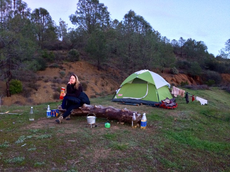
- strong tent with rain-fly (Alps Mountaineering Chaos 2 Tent)
- inflatable sleeping pad (REI Co-op AirRail 1.5 Self-Inflating Sleeping Pad)
- sleeping bag (The North Face Furnace 20 degree Sleeping Bag) or warm weather bag in summer
- lightweight backpacking chair (Therm-a-Rest trekker chair)
- lightweight lantern (MPOWERD Luci Outdoor 2.0)
- headlamp (Black Diamond Storm Headlamp)
- multi-tool with knife (Gerber MP400 compact multi-plier)
- lightweight stove (MSR PocketRocket 2)
- lighter (BIC plastic lighters)
- 2 liter pot (GSI Outdoors Halulite Boiler Pot)
- coffee cup (GSI Outdoors Glacier Stainless Cup)
- lightweight spork (Snow Peak Titanium Spork)
- small, quick drying towel (REI mutli towel lite)
Random
- wet wipes (Stall Mates individually wrapped wipes)
- mole skin for blisters (Spenco 2nd Skin Adhesive)
- small amount of duct tape for gear repairs
- chapstick and sun screen
Food and drink
- a variety of my favorite dehydrated meals
- salami and summer sausage
- electrolyte replacement (NUUN Hydration Tablets)
- quick snacks (Clif Shot Bloks and Clif energy bars)
- instant coffee (Starbucks VIA)
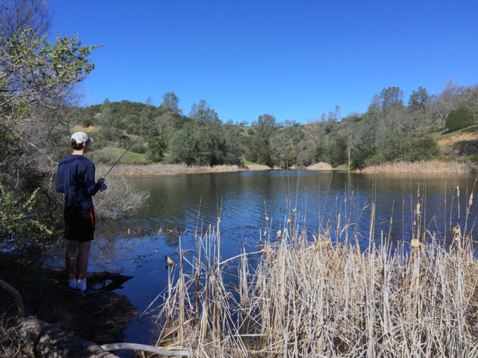
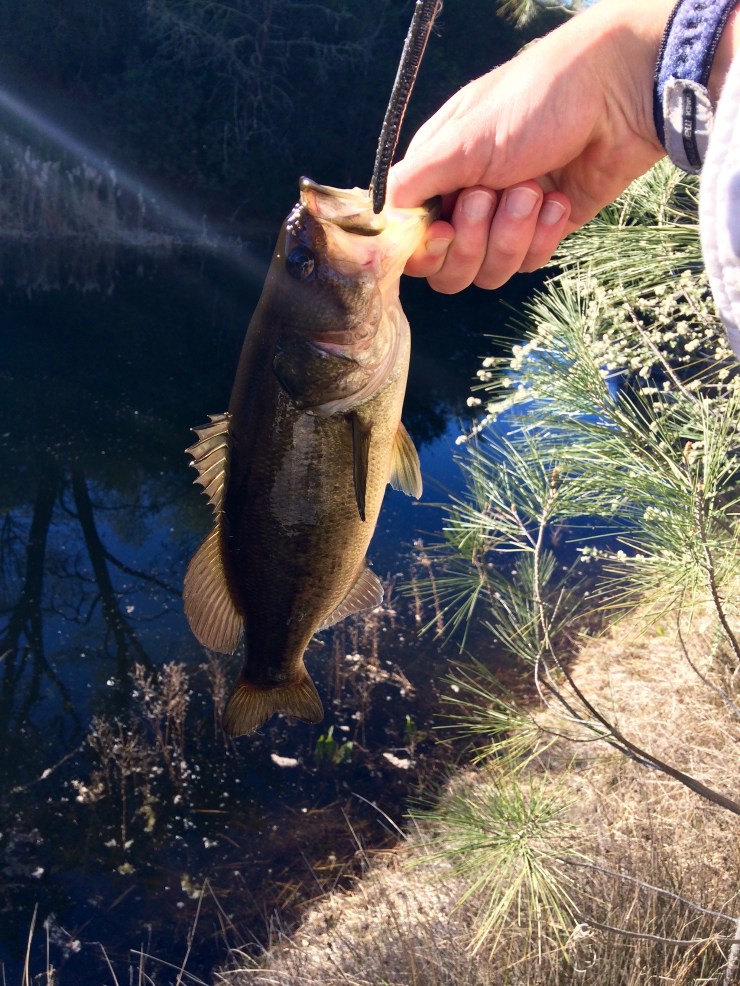
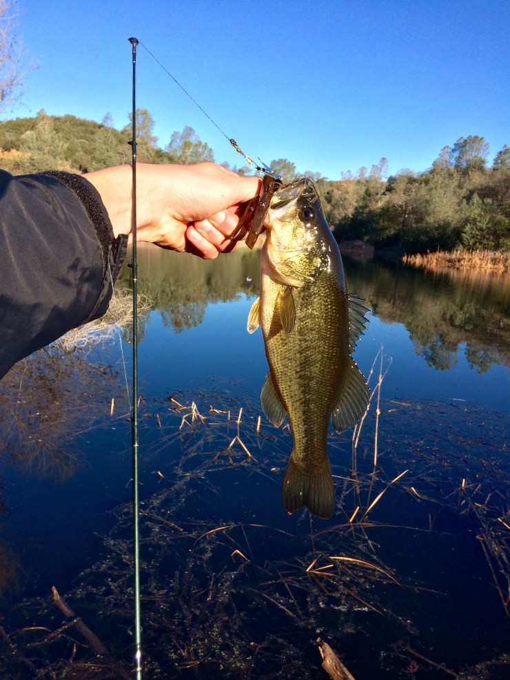
If you are in to fishing, you may also want to bring Boating and Fishing gear. Mississippi Lake has some of the best bass fishing you can find in a small-to-moderate sized lake. You likely will not catch anything bigger than ~15 inches long, but you can catch a bass on nearly every cast if you have a raft to fish from. I love throwing plastic frogs on top of the weeds and watching the bass explode through the surface of the water.
Weather and Trail Conditions: As stated above, this park can get extremely hot so plan accordingly. The temperature at night will drop down significantly though, so be prepared to sleep in moderately low temperatures (30-50 degrees depending on the season).
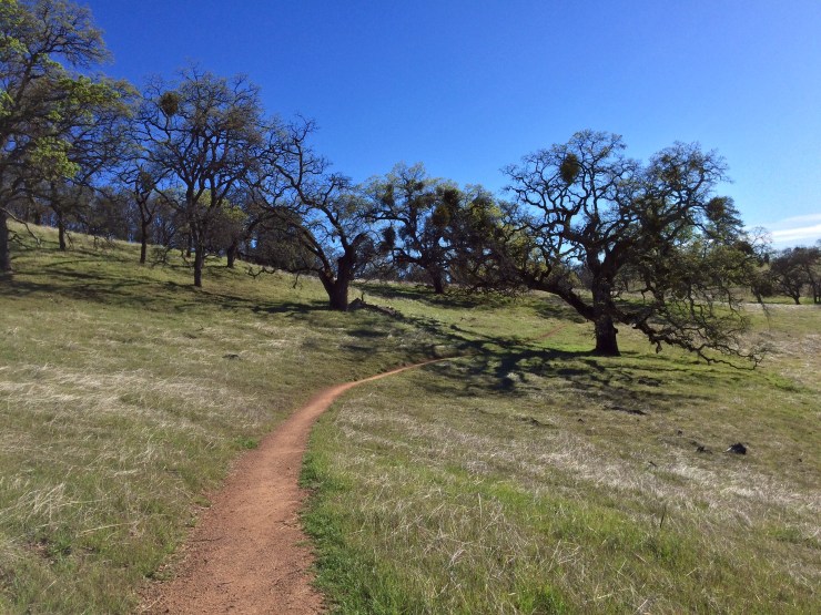
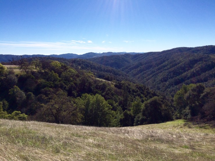
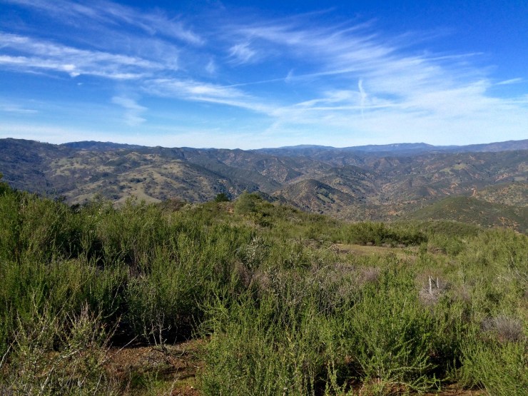
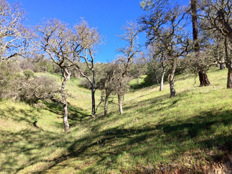
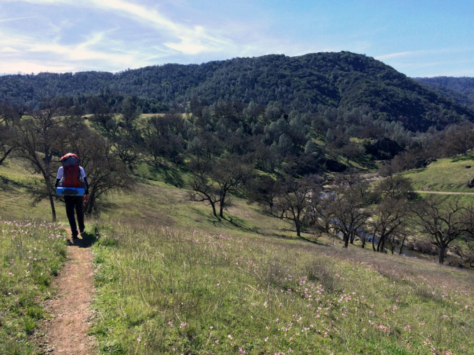
The trails are well marked and generally easy to follow. There is a great map available at the Visitor Center / Headquarters, so I highly recommend purchasing one of those. You can take multiple routes to many of the lakes in the park. When choosing your specific route, keep in mind that there are both jeep/fire roads and trails in the park. The jeep/fire roads often get places in the shortest total distance, but are extremely hilly and steep. The trails are usually longer in distance, but typically go through more scenic routes and utilize switchbacks. In general, I would recommend not taking jeep/fire roads over long distances unless you have to. Make sure to keep elevation in mind when selecting routes! Hikes at Henry Coe often end up being more difficult than anticipated because the trails are hillier than many realize.
The last things to check are the water level in the The Narrows if you plan to hike on that trail and the status of the water sources along the trails. In the Spring, the creek in The Narrows can be high and the trail may not be passable. It’s best to check with the ranger before going this route so that you do not have to backtrack if the water is too high. Additionally, in the Summer many of the springs dry up, so you will want get up to date information on where you can grab water along the trek.
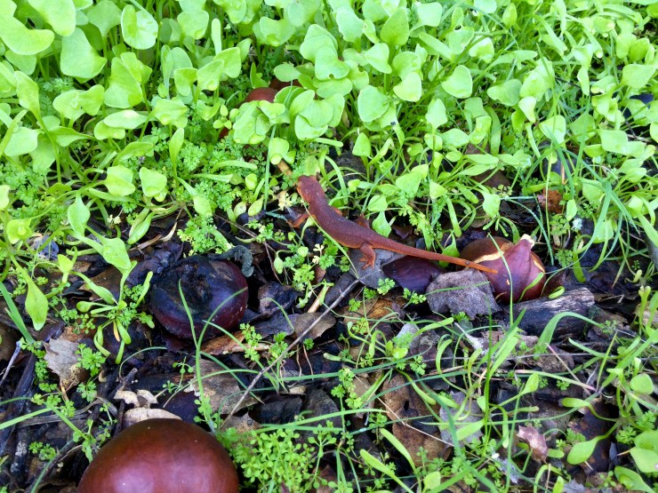
Many of the trails have poison oak, so make sure you to be aware while you are hiking. I always wear pants to avoid exposure.
Maps:
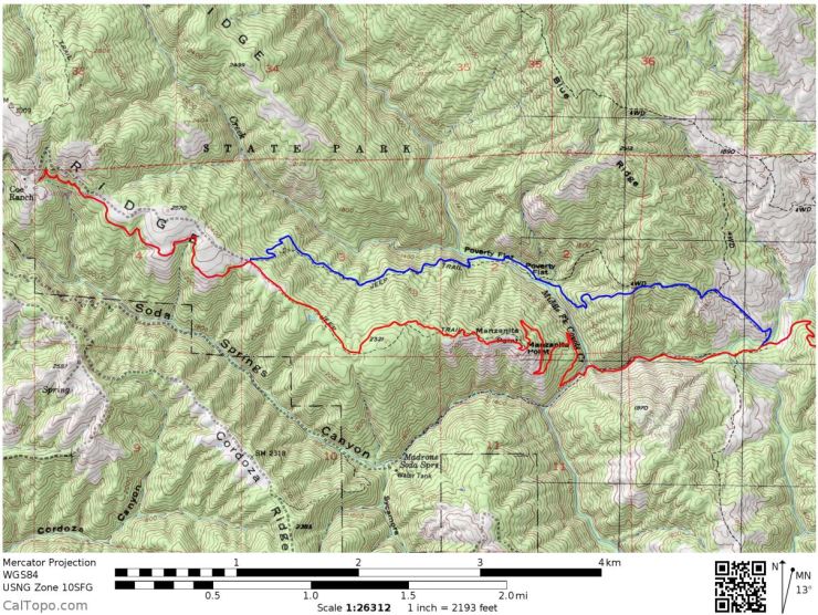
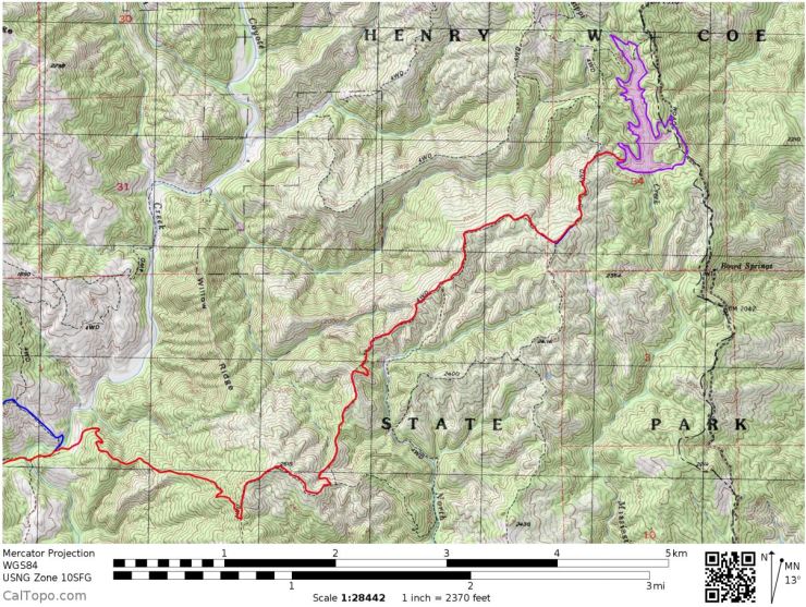
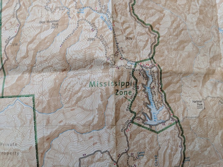
I could not find any great map sources online, so I am posting a combination of maps. The first ones are poor quality, but I was able to highlight routes on them. On the hike back from Mississippi Lake we switched up the route and went via The Narrows and the China Hole Trail rather than taking Poverty Flats Road. That is why the blue (hiking in) and red (hiking our) routes deviate in the middle.
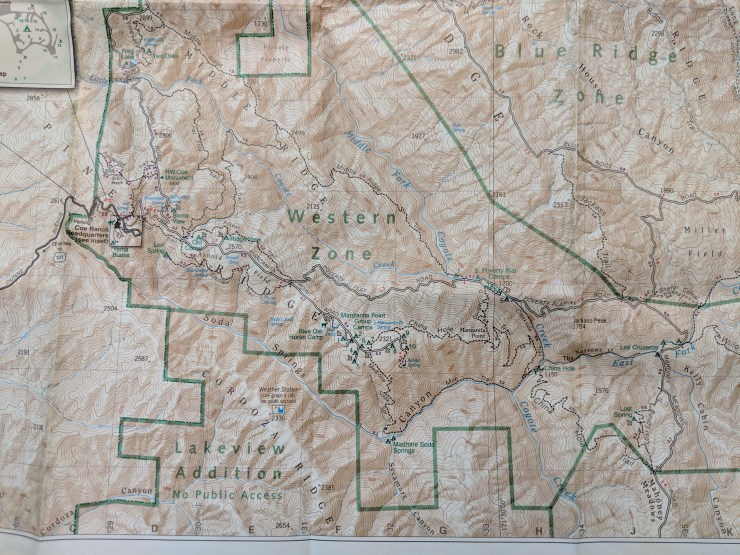
The second set of maps are photos I took of my paper map. This is the map you can buy at the Headquarter / Visitor Center and it has mileage information on it.
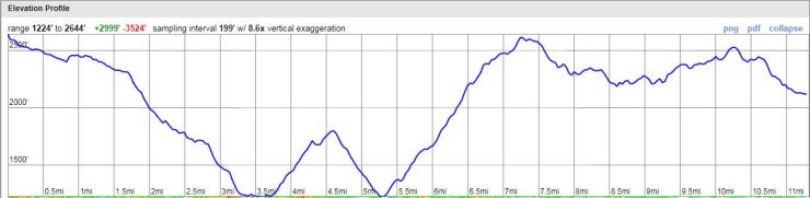
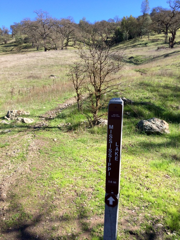
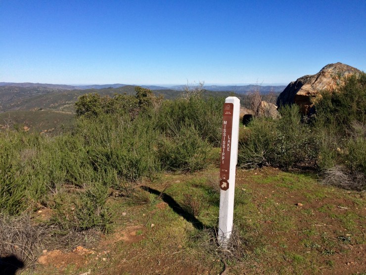
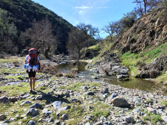
Day 1: 11.3 miles; +3,000 feet / -3,500 feet; Coe Headquarters to Mississippi Lake.
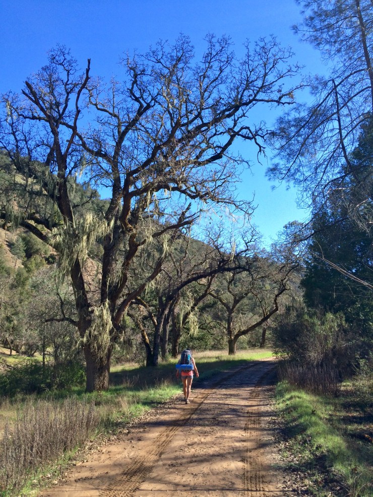
We started Day 1 by driving to Coe Headquarters and grabbing a permit. We arrived at about 8:45 am on Friday morning and were the first to request a permit for camping at Mississippi Lake. After paying, chatting with the ranger, and filling up our water, we started hiking at around 9:30 am.
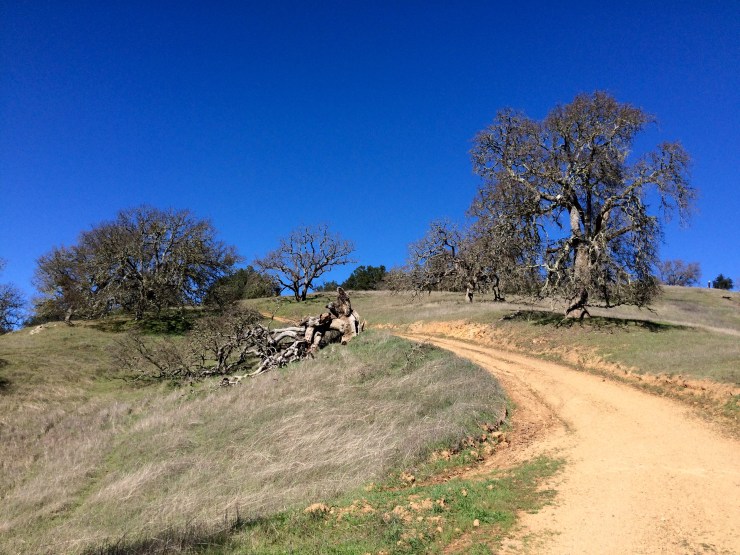
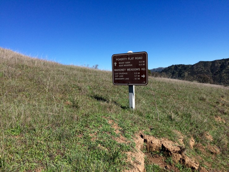
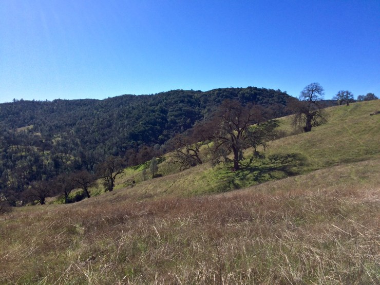
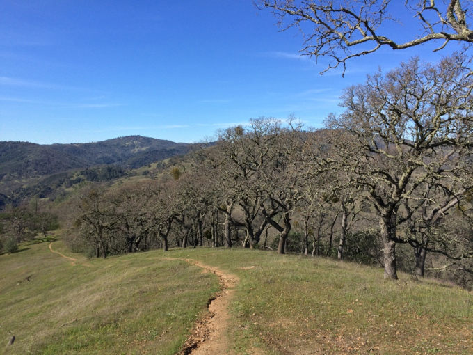
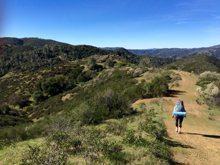
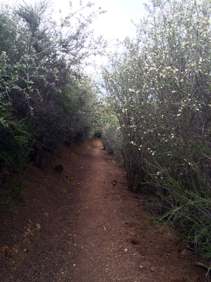
The route we took was Corral Trail to Springs Trail to Poverty Flat Road to Willow Ridge Trail to Willow Ridge Road to the Mississippi Lake Dam. We picked this route because it seemed like the shortest distance, but in hindsight I would not recommend it. Poverty Flat Road and Willow Ridge Road are both very hilly and steep and there are more interesting trails you can take instead. Instead Poverty Flat Road, you can take Manzanita Point Road to China Hole Trail to The Narrows. Instead of Willow Ridge Road the whole way, you can take Rat Spring Trail and Pacheco Creek Trail and then connect back with the road.
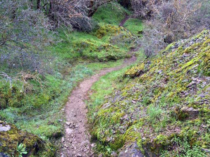
The Corral and Springs Trail are nice and largely downhill for the first 2 miles. Poverty Flat Road starts with a steep 1.5 mile descent before climbing 600 feet up over a peak and then steeply descending down to the East Fork of the Coyote Creek at The Narrows. The steep descents are very rough on the knees, which is typical of the jeep roads in the park.
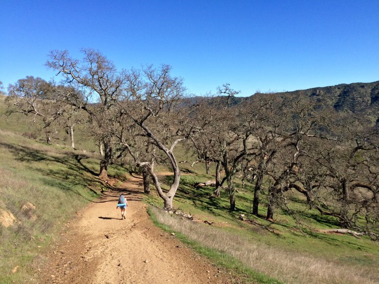
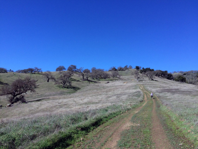
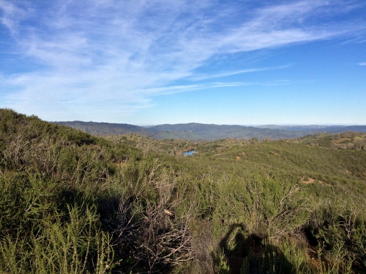
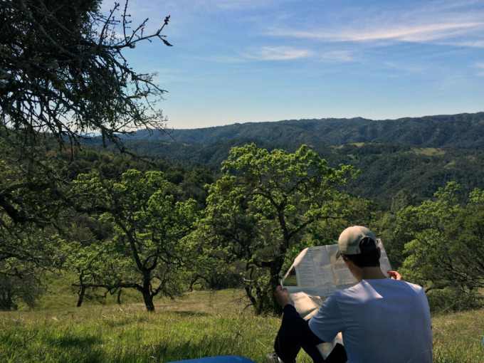
The junction at the East Fork of the Coyote River makes for a nice lunch spot and allows you to rest up a bit before heading up hill again. After resting we headed up Willow Springs Trail, which climbs 1,500 feet over the course of 1.7 miles. The climb is tough, but it is necessary to get over to Mississippi Lake. For the last 4.5 miles you follow Willow Ridge Road. The map doesn’t make this road look too bad, but in reality it is very hilly and repeatedly climbs up and down.
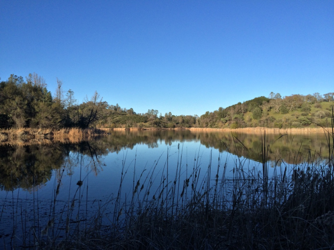
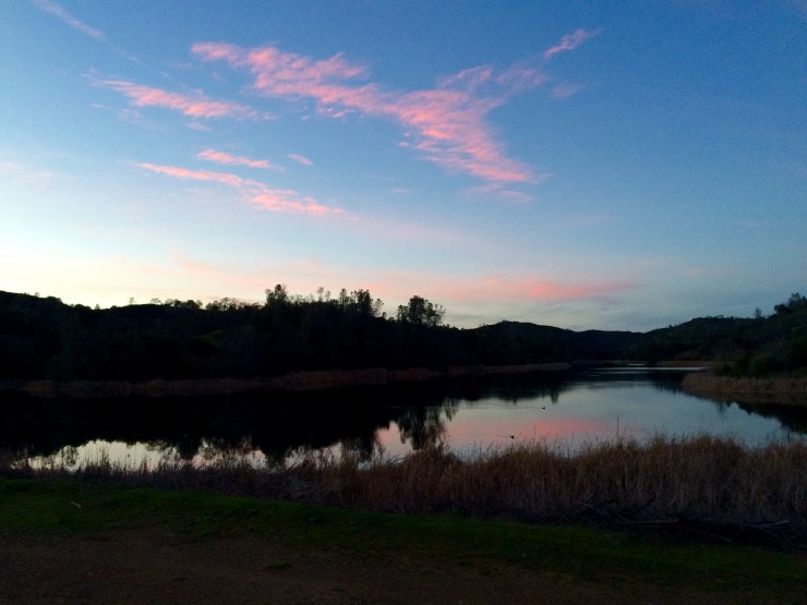
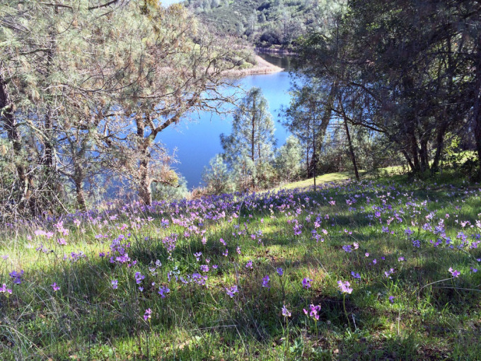
When we reached Mississippi Lake, we headed straight towards the Dam on the South side of the lake. There is a nice flat spot near the dam and there is a vault toilet nearby. There is also a nice campsite on the Northwest side of the lake, but we did not find this site until the next day.
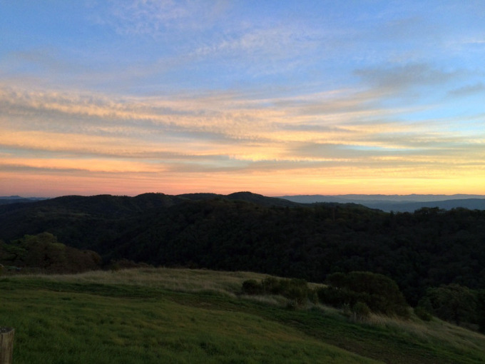
Overall this is a very tough hike. But, the lake is beautiful when you get there and you will not see too many people along the way.


Day 2: 3 miles; +/- 800 feet; Day hike and fishing around Mississippi Lake
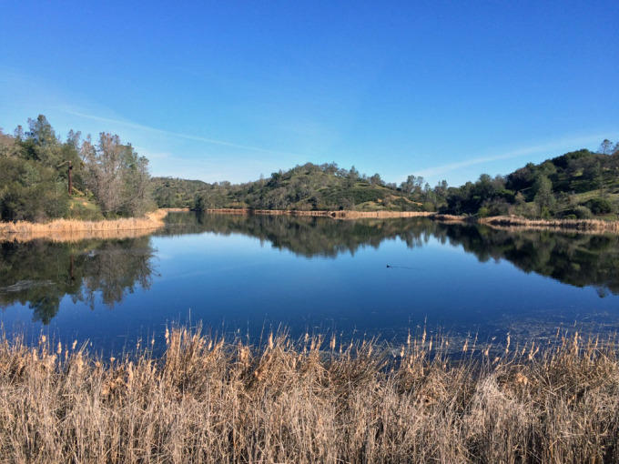
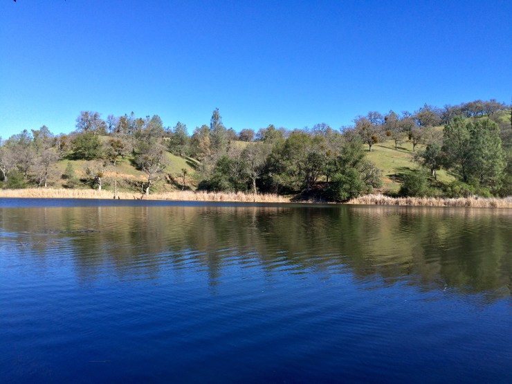
On the second day, we were pretty sore and decided to take it easy. We did a slow walk around the lake, which totaled around 3 miles. The lake is deceptively large because of all the narrow branches and inlets.
After the stroll, I got out my fishing pole and tried to catch some bass. I caught around 8 bass using plastic worms and frogs. Fishing from shore is a bit tough because weeds limit shore access in many places. The lake seem very productive though, and there is a lot of habitat for bass. Bringing a raft or float tube really would open up the fishing opportunities.
Day 3: 12 miles; +3,000 feet / -2550 feet; Mississippi Lake to Henry Coe State Park Headquarters.
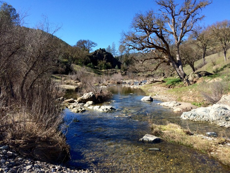
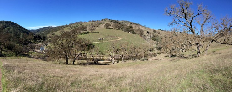
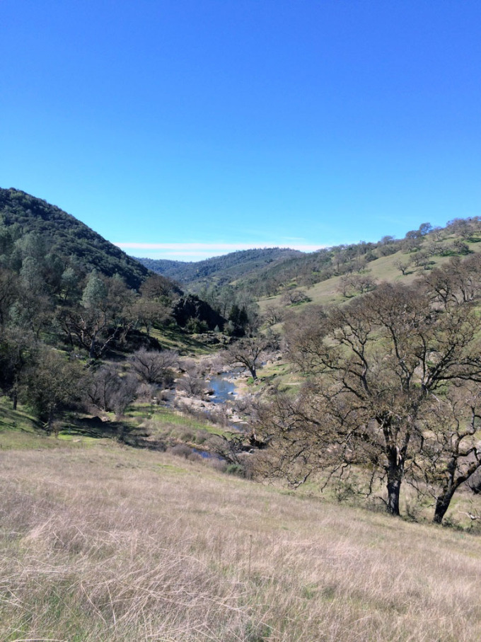
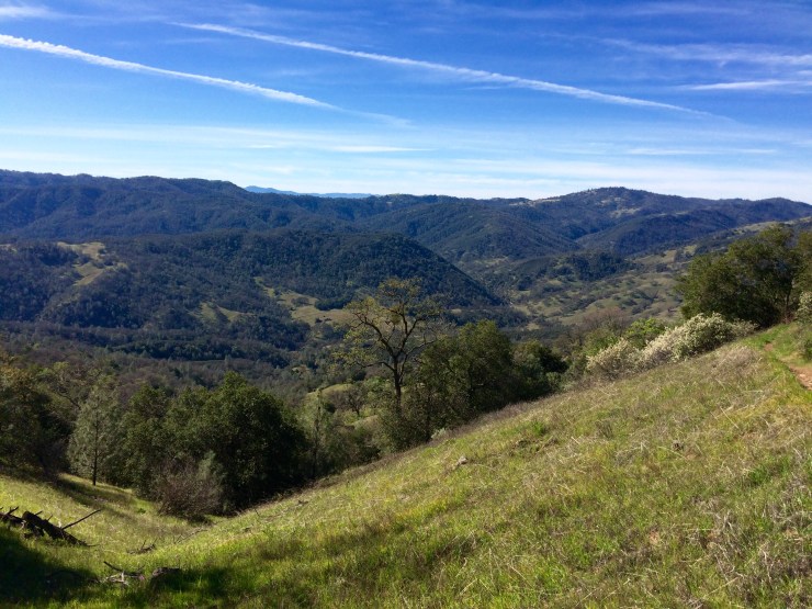
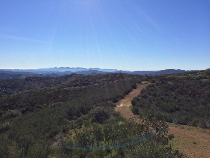
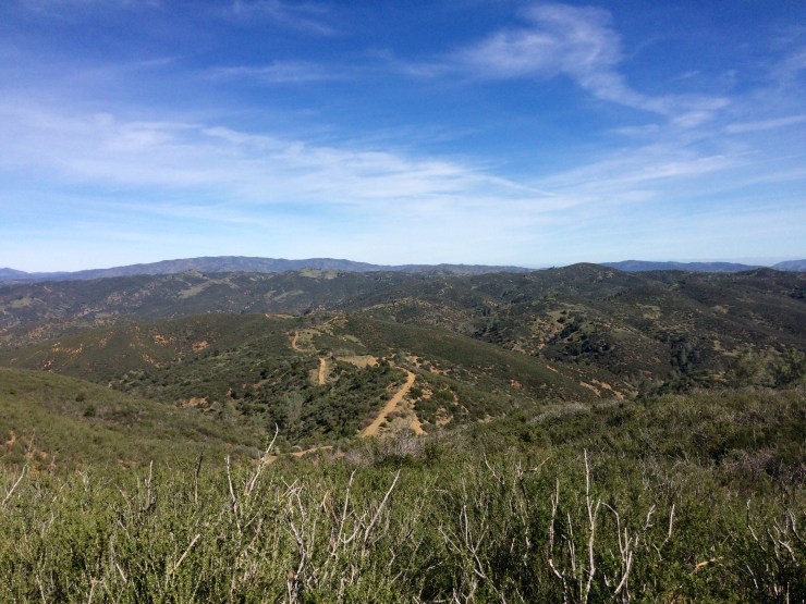
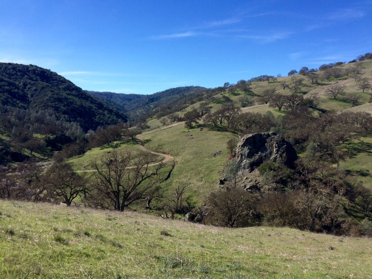
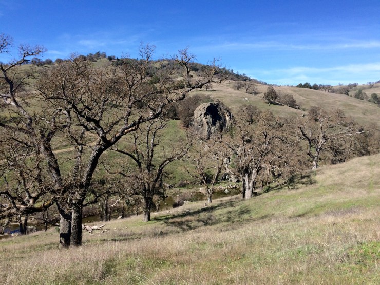
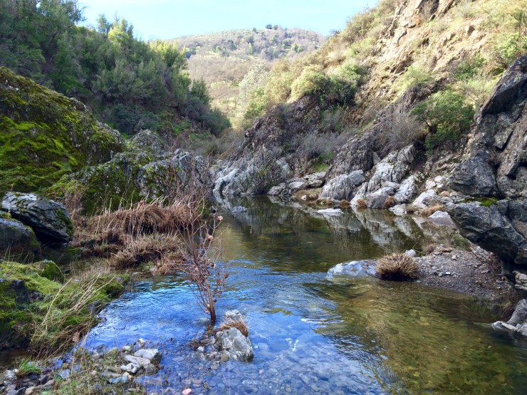
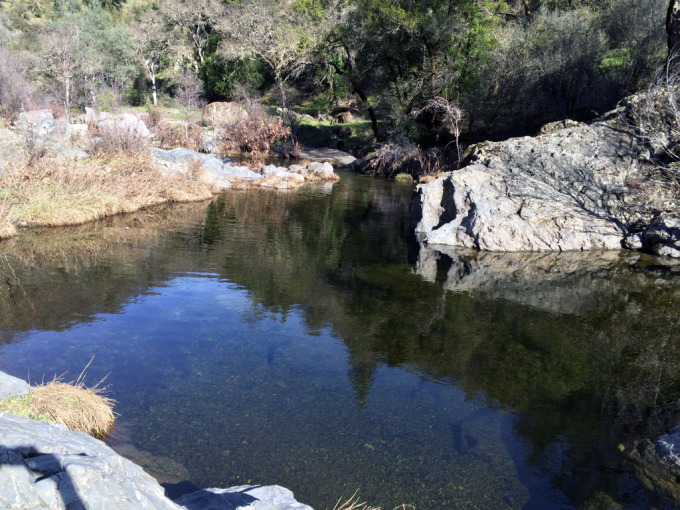
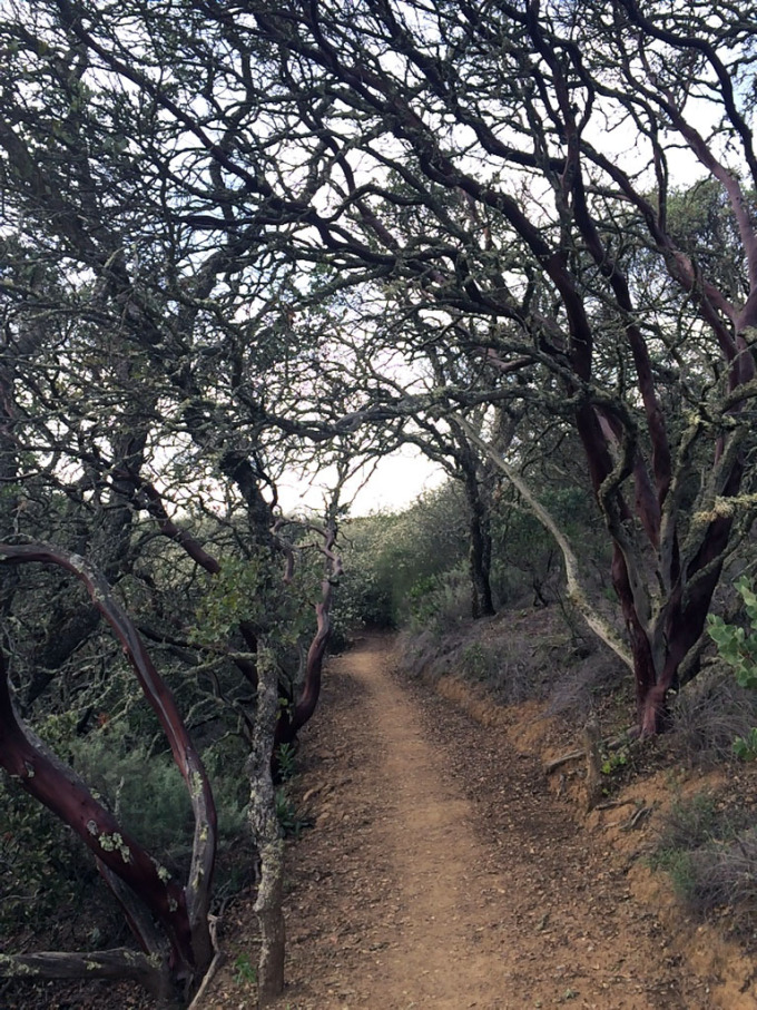
We decided to hike out using a slightly different route than we came in one. Instead of taking Poverty Flat Road, we took The Narrows and China Hole Trail to get near the Headquarters. These trails were much nicer than the road and had great views and scenery.
The Narrows is a really neat trail that meanders through the East Fork of the Coyote River. You essentially walk along the creek and find the path of least resistance since there is no formal trail. There are several great spots to take a swim or eat lunch along the way.
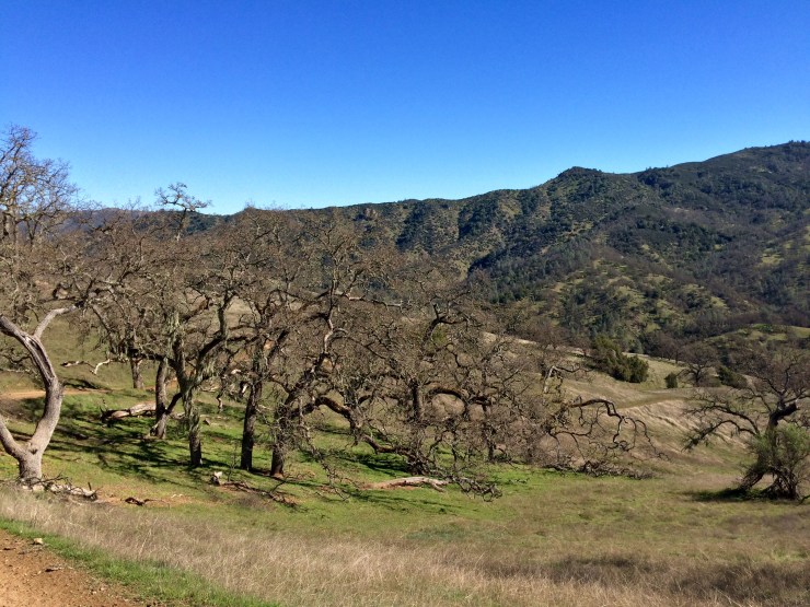
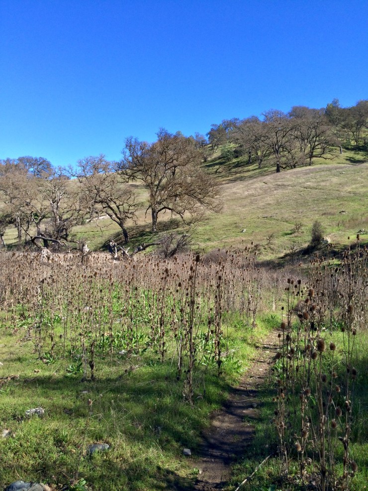
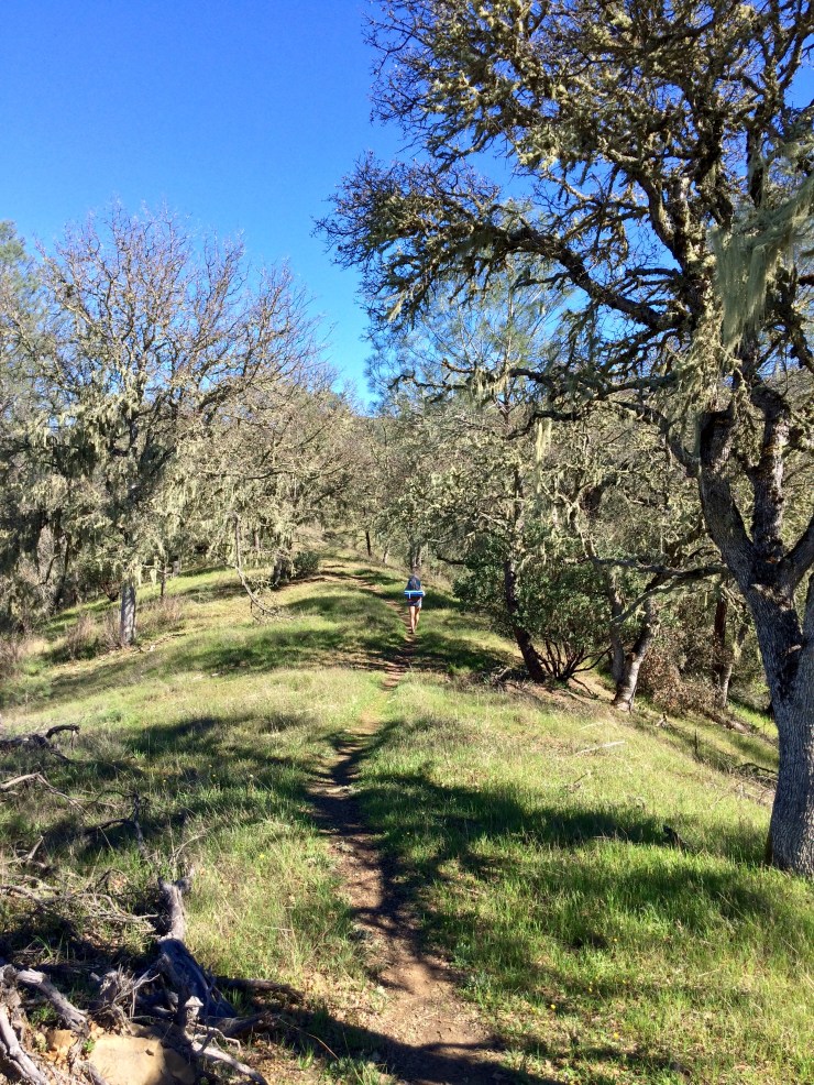
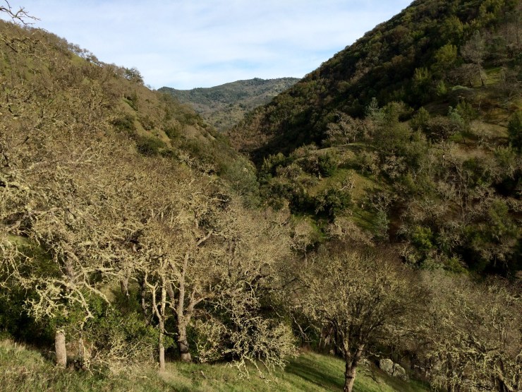
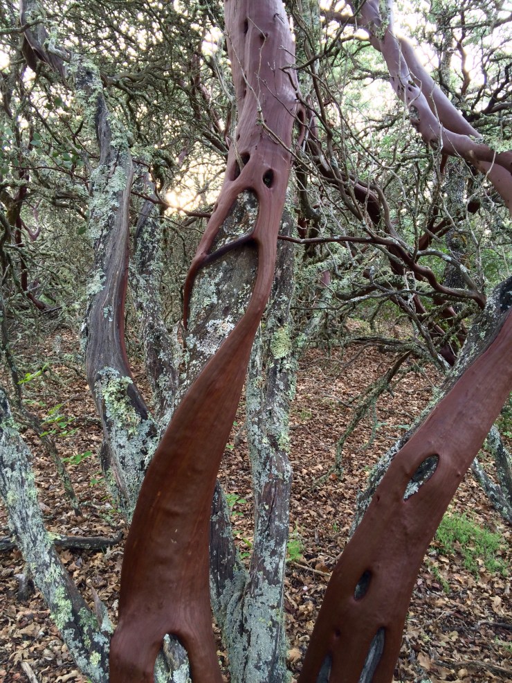
The China Hole Trail has a significant climb up to Coe Headquarters, but uses switch backs to make the trek less steep. This trail is really nice and has lots of interesting trees and plants. You also get nice views of the park when you reach the top of the trail.

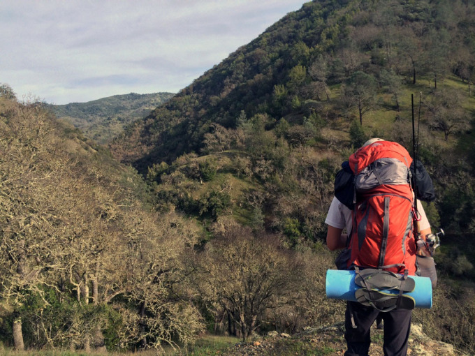
Overall we really enjoyed this trek. Besides taking trails instead of roads whenever possible, I would I also bring a raft or float tube next time. The fishing from shore is a bit tough, so a raft would make a big difference.
Here are some similar trip reports:
Henry Coe State Park Backpacking – Coit Lake

Thanks for your report. I followed this route, mostly. I took China hole on the way in but missed the narrows and climbed up and over Poverty Flat road to Los Cruzeros and the TH of Willow Ridge. WR is a grind. Just sayin. I camped just across from your campsite at Mississippi lake but set up my stove and had my breakfast and coffee from your site. I too took a stroll, but only walked about half way around the lake, from the west side and found few campsites and all were right off the road. I would definitely go back though and leave more time for scouting. I hauled it back to Manzanita Point on day 2. I found the Narrows on my return which saved me some elevation gain on Poverty Flat road. Since we just reset our clocks for daylight savings, I had about an hour of night hiking up China Hole trail. That was fun. Basically had coffee then headed to HQ from Manzanita Point on day 3. It was a quick getaway ( I needed it) and all in all a real good hike with a great payoff of a beautiful lake on the end. Unfortunately, I snapped my rod trying to yank up from a snag in the weeds (third cast…. ugh!). I know better than to use my rod to pull but I did it anyway and alas, no fish for me. Thanks again. hike on!
LikeLiked by 1 person
Awesome – I hope you had a great time. I have gone back to Mississippi Lake a few times since this trip and always try to stay at the campsite on the Northwest part of the lake (so I would recommend that one next time!). There is a nice picnic table, a shade structure, easy water access, and a toilet nearby.
Just curious, was there any water left in The Narrows or was it all dried up?
LikeLiked by 1 person
Hey there, awesome article! So inspiring. I really love going fishing (and|&) outdoor stuff. Thanks so much.
LikeLiked by 1 person
You say to avoid the jeep roads but I didnt see what route you actually recommend taking. Whats ur favorite route?
LikeLiked by 1 person
Hi Juan – My preferred route for Coe headquarters to Mississippi Lake is as follows: Corral Trail -> Springs Trail ->Manzanita Point Road -> China Hole Trail -> The Narrows -> Willow Ridge Trail ->Willow Ridge Road -> Rat Springs Trail -> Pacheco Creek Trail -> Heritage Trail -> Willow Ridge Road -> final stretch to Mississippi Lake.
On the way back, I like to take a slightly different route heading to the north towards Bear Mountain first: Mississippi Lake -> Bear Spring Trail -> Bear Mountain Road -> Narrows Trail -> The Narrows -> China Hole Trail -> Manzanita Point Road -> Springs Trail -> Corral Trail -> Coe Headquarters.
LikeLiked by 1 person
Any idea if there are still a lot of wildflowers in the park? thinking about going this weekend..
LikeLiked by 1 person
Hi KC – most of the wildflower bloom has passed. You likely will still see some flowers but things have started turning from green to yellow. Definitely still try to get out there before it gets too crazy hot!
LikeLike