


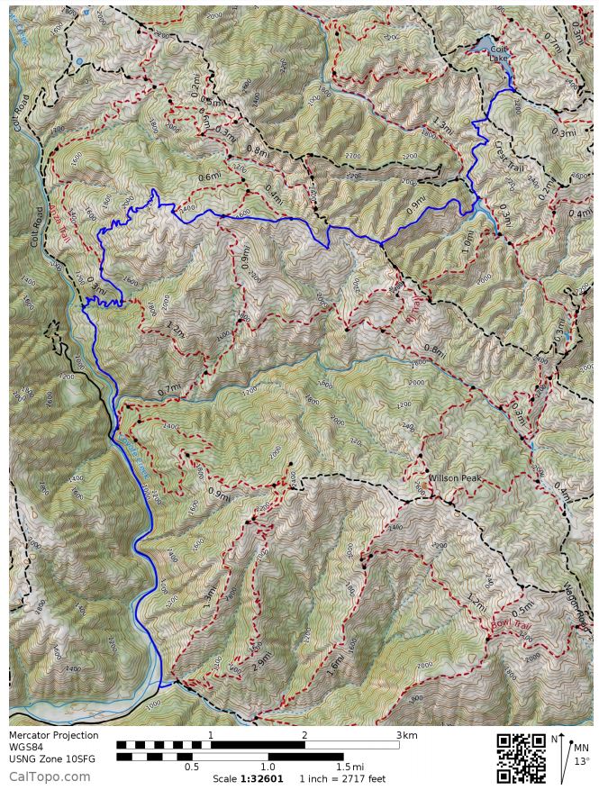
Trip Overview: 17 mile out and back backpacking trip to Coit Lake from the Hunting Hollow entrance of Henry Coe State Park in California. +/- 4,000 feet elevation with a starting elevation of 860 feet and a peak elevation of 2,680 feet. Highlights include rolling hills, large oak trees, and ponds/lakes full of fish. We did this hike in 3 days and 2 nights in August, 2017.


Preparations:
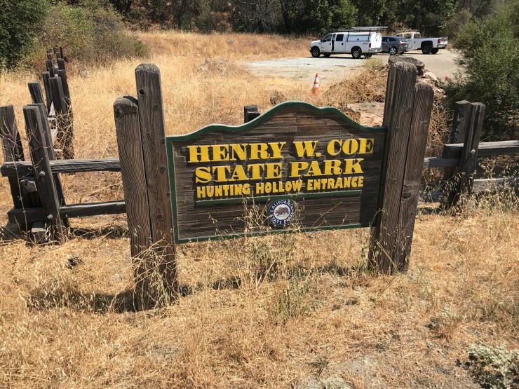
Permits and logistics: To backpack in Henry Coe State Park, you must obtain a permit. For this hike, you self-register for a permit at the Hunting Hollow Entrance before taking off on the trek. There is no quota for permits and you can camp anywhere in the wilderness.
Backpacking fees are $5 per night per person and parking at Hunting Hollow costs $6 per vehicle per day. You must pay for these fees with cash when you fill out your permit and place the envelope in the lock box at the entrance. The Hunting Hollow Entrance is not staffed and has no potable water sources, so be sure to fill up your camelbacks and bottles before arriving. There are portable toilets at the entrance though.
Supplies: There are no bears in Henry Coe, so you will not need to bring a bear canister on your hike. This clears up space in your pack and makes things easier!
The key supplies you will need are related to heat, hydration, hills, and stream crossings. Henry Coe is a fairly low elevation park (2,000-3,000 feet) and can get extremely hot in the summer months. You should always be prepared to hike in hot temperatures and carry plenty of water. Many of the trails are very exposed as well, so protection from the sun is paramount. Additionally, trekking poles are a life saver at Henry Coe. The trails in this park are very hilly and steep, so the poles help save your knees. If you are visit Henry Coe State Park in the spring, winter, or fall, expect temperature to get quite chilly at night, so some warm layers for camp are needed.
Suggested hiking clothes
- a lightweight hiking rain jacket (North Face Venture 2 Jacket)
- fast drying synthetic hiking pants (prAna Zion Pants)
- a quick drying long sleeve hiking shirt (Columbia Silver Ridge L/S Shirt)
- wool outer socks (People Socks Moreno 4-pack)
- thin blister preventing base socks (WrightSock double layer Coolmesh)
- quick drying synthetic boxer briefs (ExOfficio Give-N-Go)
- light bandana for sun protection (Levi’s printed bandana)
- mesh back trucker hat (Patagonia LoPro Trucker Hat)
- adjustable fabric belt (Bison designs belt)
- Gore-tex hiking shoes (adidas Outdoor Terrex Fast R Gore-Tex Shoe)
Suggested clothes for camp
- wool leggings (Minus33 Merino Wool Kancamagus Midweight Bottom)
- wool base layer shirt (Minus33 Merino Wool Chocorua Midweight Crew)
- warm wool overshirt (Pendleton Long Sleeve Classic-Fit Board Shirt)
- lightweight down jacket (Patagonia 800-fill Down Jacket)
- lightweight camp shoes (Xero Z-Trail lightweight sandal)
Suggested hiking gear
- topographic map (purchase from park headquarters)
- trekking poles (Cascade Mountain Tech Carbon Fiber Trekking Poles)
- 3 liter hydration bladder (Camelbak Antidote Reservoir)
- 65 liter backpack (Osprey Atmos 65 Liter pack)
- water filtration system (Sawyer Squeeze water filtration system)
Camp gear
- strong tent with rain-fly (Alps Mountaineering Chaos 2 Tent)
- inflatable sleeping pad (REI Co-op AirRail 1.5 Self-Inflating Sleeping Pad)
- sleeping bag (The North Face Furnace 20 degree Sleeping Bag) or warm weather bag in summer
- lightweight backpacking chair (Therm-a-Rest trekker chair)
- lightweight lantern (MPOWERD Luci Outdoor 2.0)
- headlamp (Black Diamond Storm Headlamp)
- multi-tool with knife (Gerber MP400 compact multi-plier)
- lightweight stove (MSR PocketRocket 2)
- lighter (BIC plastic lighters)
- 2 liter pot (GSI Outdoors Halulite Boiler Pot)
- coffee cup (GSI Outdoors Glacier Stainless Cup)
- lightweight spork (Snow Peak Titanium Spork)
- small, quick drying towel (REI mutli towel lite)
Random
- wet wipes (Stall Mates individually wrapped wipes)
- mole skin for blisters (Spenco 2nd Skin Adhesive)
- small amount of duct tape for gear repairs
- chapstick and sun screen
Food and drink
- a variety of my favorite dehydrated meals
- salami and summer sausage
- electrolyte replacement (NUUN Hydration Tablets)
- quick snacks (Clif Shot Bloks and Clif energy bars)
- instant coffee (Starbucks VIA)
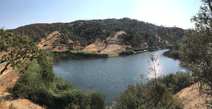
If you are in to fishing, you may also want to bring Boating and Fishing gear. Coit Lake has largemouth bass, crappie, bluegill, and sunfish. I love throwing plastic frogs on top of the weeds and watching the bass explode through the surface of the water. For this trip I brought an Intex River Run Inflatable Raft
for fishing and it worked quite well.
Weather and Trail Conditions: As stated above, this park can get extremely hot so plan accordingly. The temperature at night will drop down significantly though, so be prepared to sleep in moderately low temperatures (30-50 degrees depending on the season).
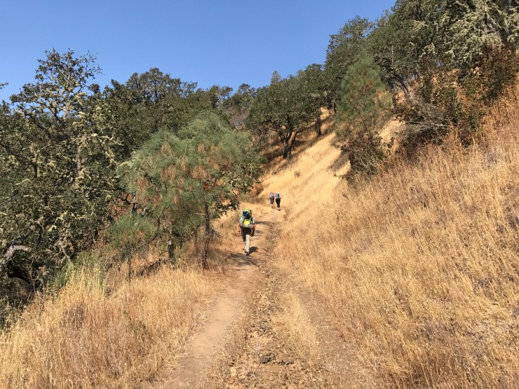
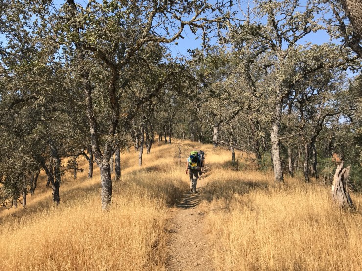
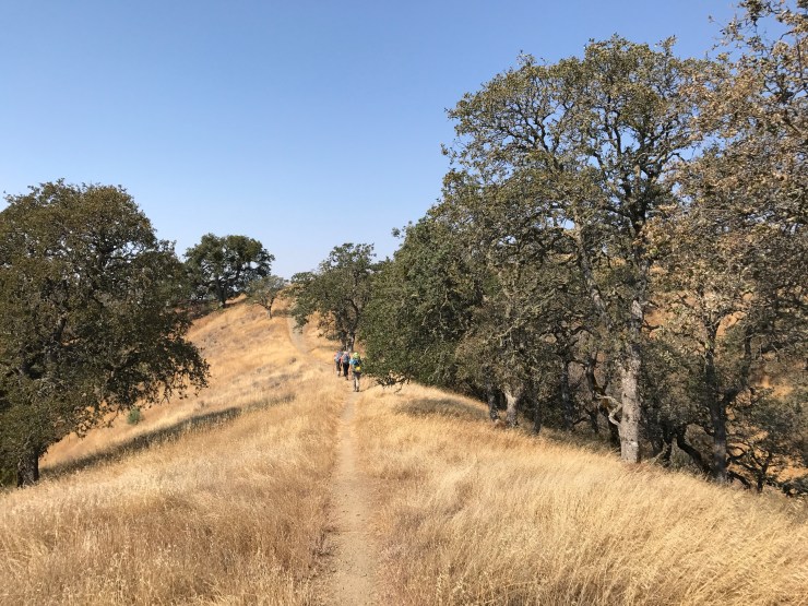
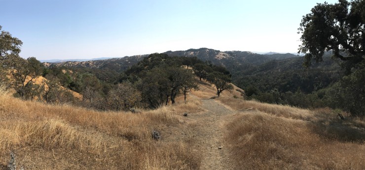
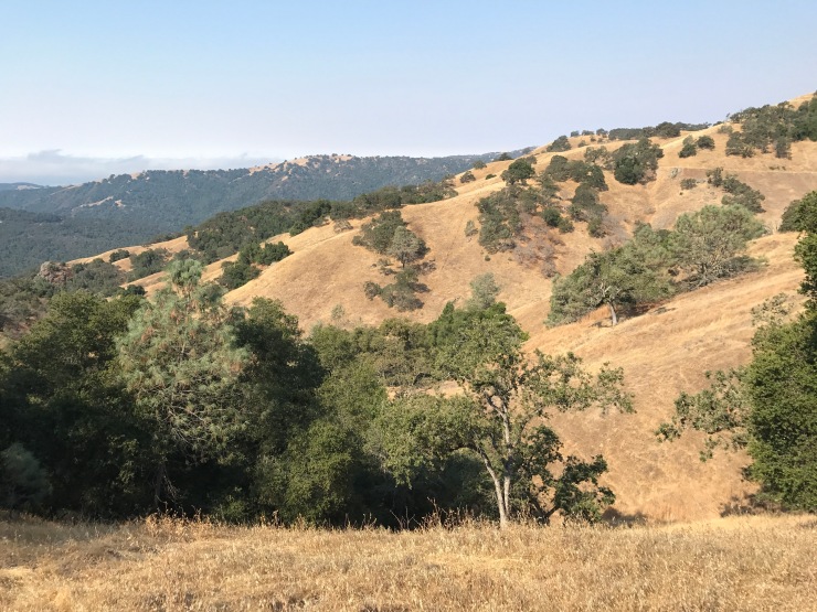
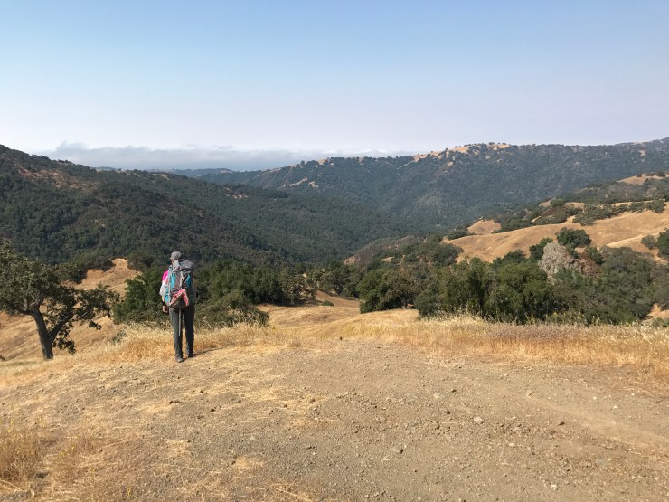
The trails are well marked and generally easy to follow. There is a great map available at the Visitor Center / Headquarters, so I highly recommend purchasing one of those. You can take multiple routes to many of the lakes in the park. When choosing your specific route, keep in mind that there are both jeep/fire roads and trails in the park. The jeep/fire roads often get places in the shortest total distance, but are extremely hilly and steep. The trails are usually longer in distance, but typically go through more scenic routes and utilize switchbacks. In general, I would recommend not taking jeep/fire roads over long distances unless you have to. Make sure to keep elevation in mind when selecting routes! Hikes at Henry Coe often end up being more difficult than anticipated because the trails are hillier than many realize.
Many of the trails have poison oak, so make sure you to be aware while you are hiking. I always wear pants to avoid exposure.
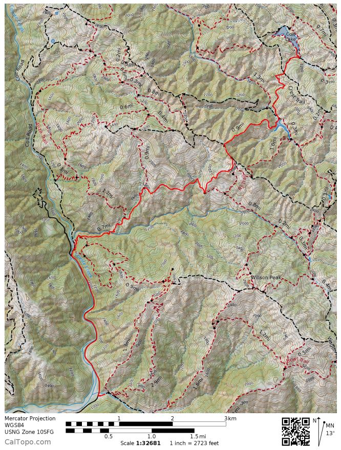
Overall Trail Map:

Day 1: 9.2 miles; +2690 feet / -1440 feet; Hunting Hollow Entrance to Coit Lake
Map of hike from Hunting Hollow to Coit Lake (pdf)

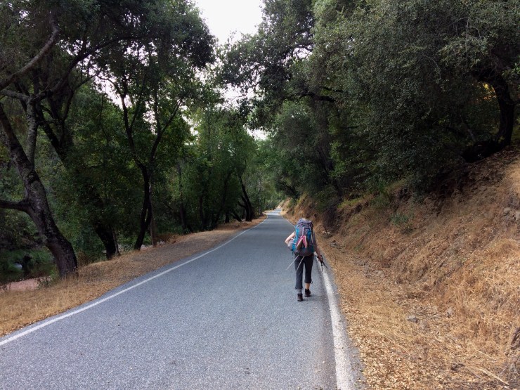
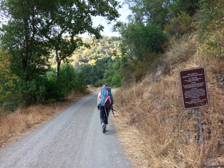
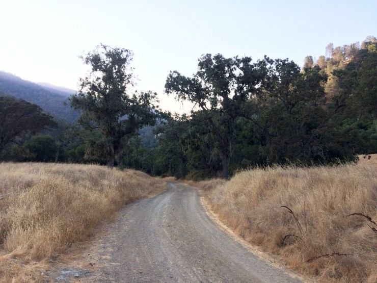
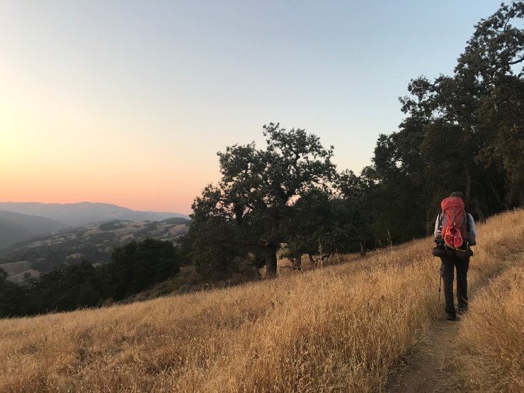
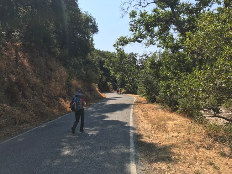
We started this trek on a Friday, but were not able to get out of work until ~2pm. So, we drove to Henry Coe State Park after work and arrived at the Hunting Hollow entrance at ~5 pm Friday night. After getting our gear ready and filling out a permit, we were on the trail at 5:30 pm. It was still pretty hot out at this hour, but we were happy to have sufficient day light to not need headlamps for the first few hours.
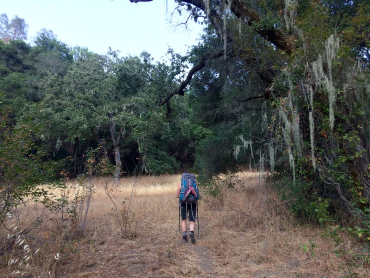
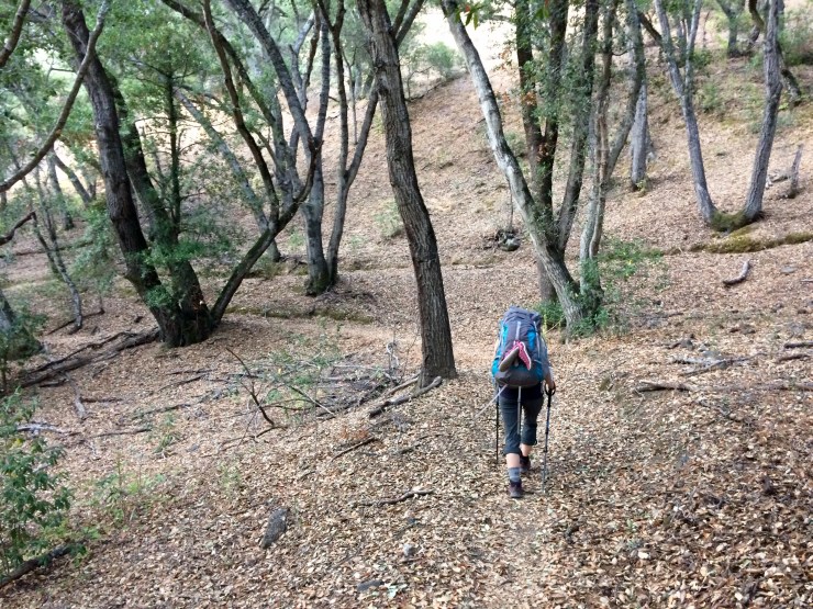
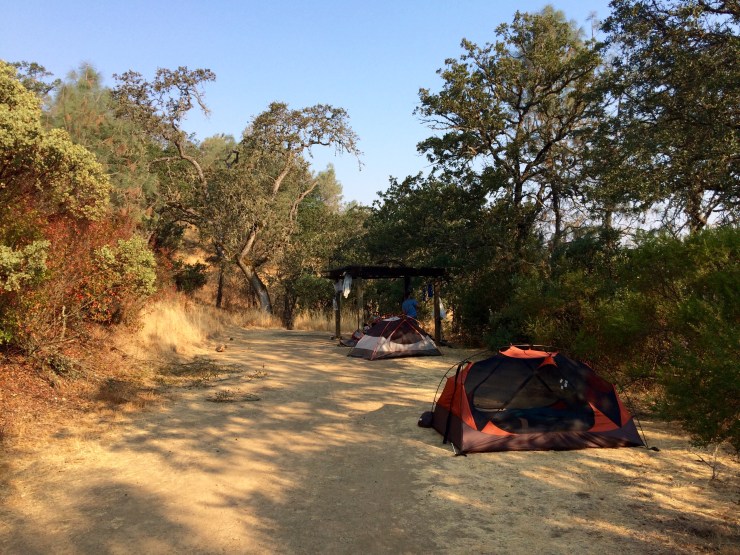
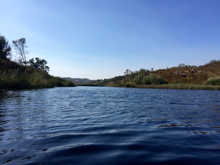
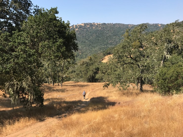
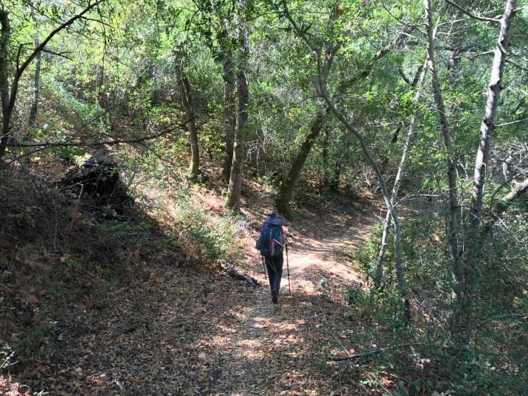
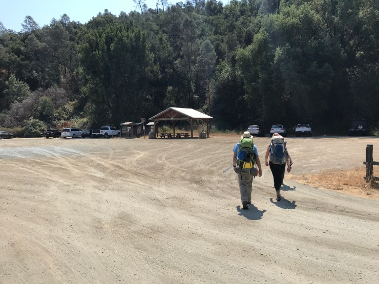
We ended up taking the route to Coit Lake that is suggested in the Henry Coe Map. From the Hunting Hollow Entrance we took: Gilroy Hot Springs Road (2 miles), Coit Road (0.9 miles), Anza Trail (0.9 miles), Jackson Trail (1.4 miles), Jackson Road (1.4 miles), Wasno Road (0.4 miles), Kelly Lake Trail (1.1 miles), and Coit Road (1.4 miles). We camped at the campsite on the Southwest side of Coit Lake where there is an established campsite with a shade structure, picnic table, and vault toilet.
This trail route starts out with a 2 mile hike along the road, which is not the most pretty. But, we were trying to get to camp quickly and figured this route would be faster than some of the other trails that have incredibly steep climbs. We ended up reaching camp at 10 pm, and needed to use headlamps for about the last two hours.
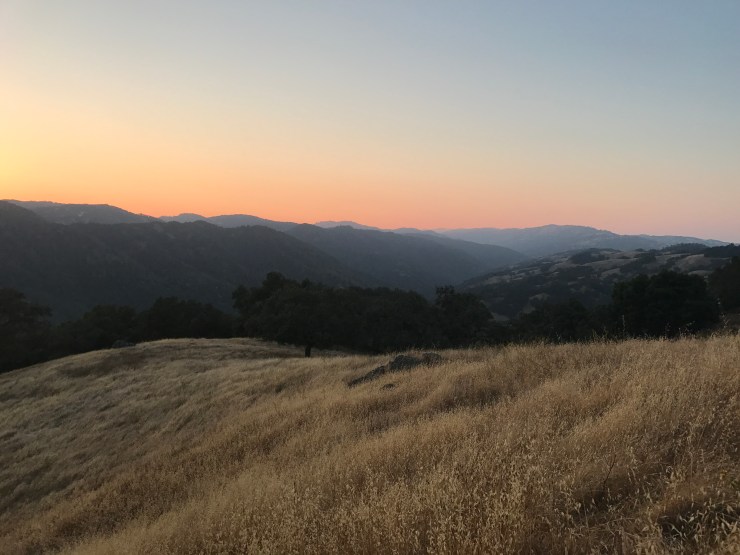
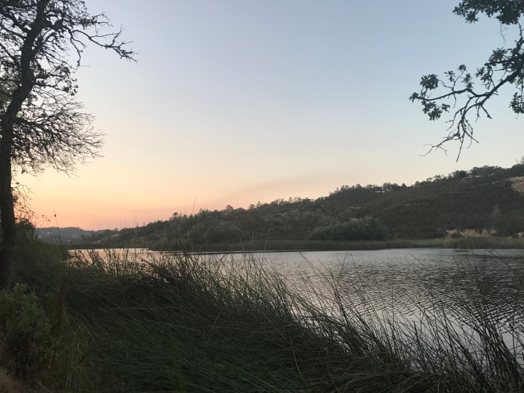
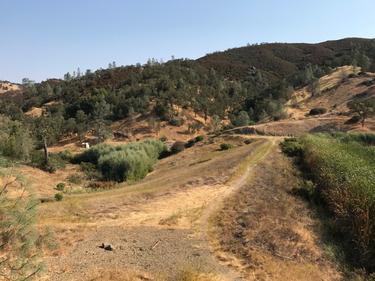
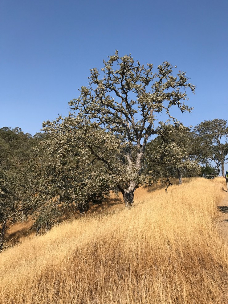
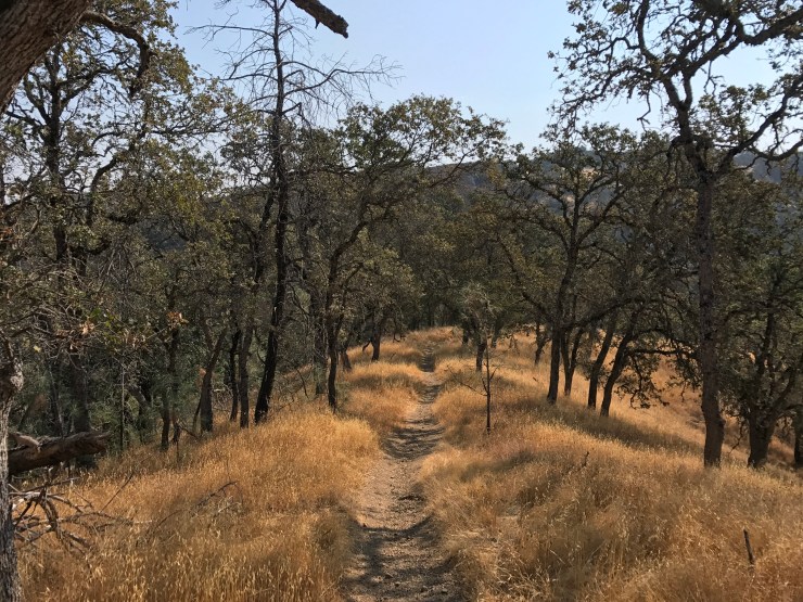
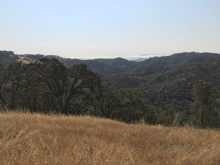
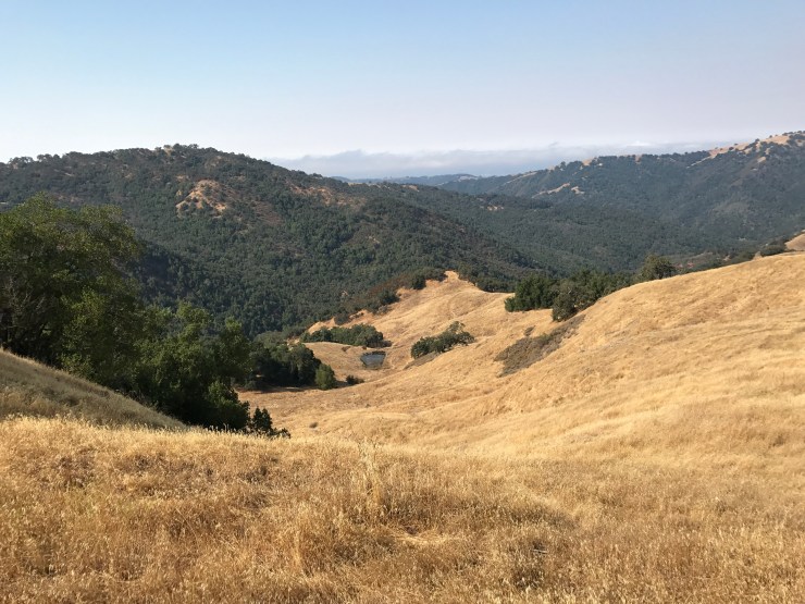
Along the way we had some nice sunset views. Given that it was August, the park was very hot and dry and the grass was golden brown. While not as beautiful as the park is in the Spring, the golden hills and green oak trees still made for nice views. Many of the streams and rivers were completely dry though, which took away some of the beauty though (but made river crossing trivial…).


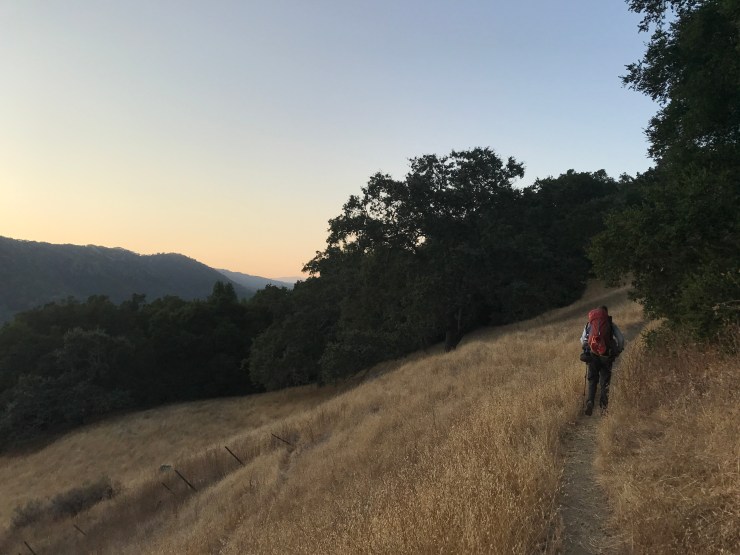

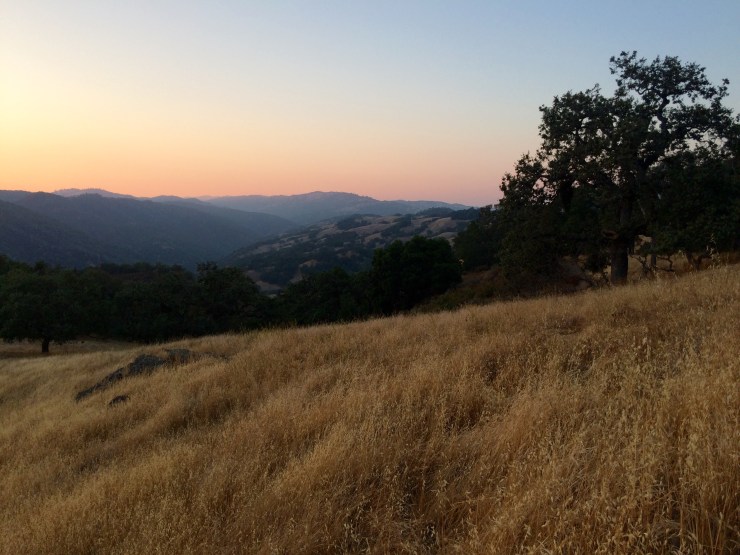

From this point on, it was too dark for photos so we put our cameras away. The views along the Jackson Trail and Jackson Road were really nice and the sunset was great. While on the Jackson Trail we did encounter a rattle snake and a wild boar though, so be a bit on alert during the hike. We also saw multiple deer along the way.
By the time we reached the Kelly Lake Trail, it was mostly dark out. It was fairly easy hiking in the dark with headlamps though. It can be a bit scary a night, but we never encountered any trouble. We pulled into camp at 10 pm and met up with two of our friends who had hiked in a few hours earlier. After a late dinner, we played some cards and then got some sleep.
Day 2: fishing day at Coit Lake with no hiking
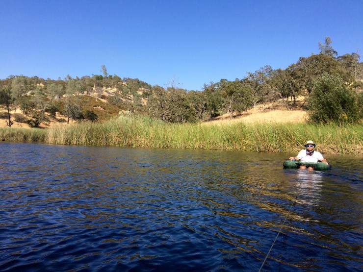
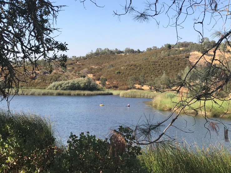
On the second day, we woke up, had breakfast, and then went out on the lake to do some fishing. I brought out a river raft to fish from and my buddy brought out his inflatable fishing float tube
, waders, and flippers. The float tube is by far superior to the raft because you can use your flippers to stay in place or move around the lake. With the raft, you are largely at the mercy of the wind unless you do a lot of paddling with your arms. Lucky, I could just tie myself to my buddy and have him pull me around.
We fished for ~4 hours in the morning/afternoon and then came back in for a 3 hour lunch break. We then went back out and fished for another 2 hours at dusk. The fishing was pretty good overall. It started out a bit slow with the first ~15 largemouth bass we caught being quite small (under 10 inches). In the end we ended up finding some bigger fish and caught 3 bass over 15 inches in length, a few good sized sunfish, and one decent sized crappie. We primarily had the best luck with weedless frogs and with a chatterbait
The chatterbait caught the biggest fish because they seemed to be hanging out a bit lower in the water.


We ended up throwing all the fish we caught back into the lake. Compared to previous fishing trips I have done at Mississippi Lake in Henry Coe, the average sized bass we caught at Coit was fairly small. However, the three big fish we did catch were as big or bigger than the biggest fish we caught at Mississippi Lake. It just seemed like we caught 10 six inch bass for every 15 inch one we caught. It was fun to catch sunfish and crappie though (we did not catch any of those at Mississippi Lake).
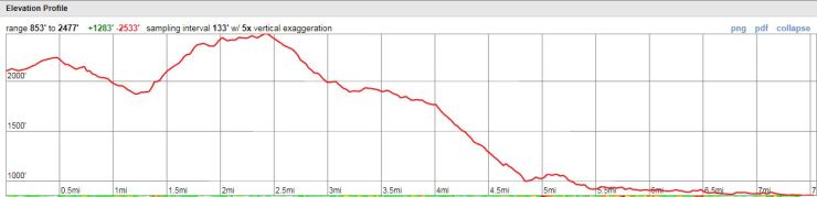
Day 3: 7.6 miles; +1280 feet / -2530 feet; Coit Lake to Hunting Hollow
Map of our hike from Coit Lake to Hunting Hollow (pdf)
The group was still a bit sore on the third day, so we decided to take the shortest and easiest route possible on the way back to Hunting Hollow. This meant we took a slightly different route than we took in, but we still hiked along Gilroy Hot Springs Road to meet up with Hunting Hollow. I would note that this is not the most beautiful route, but is the fastest route. You can take different routes and hike out from Coit Lake going on mostly single track trails but these involve more climbing.
Our route was: Coit Road (1.4 miles), Kelly Lake Trail (1.1 miles), Wasno Road (0.2 miles), Dexter Trail (0.6 miles), Grizzly Gulch Trail (2.5 miles), and Gilroy Hot Spring Road (2 miles). The route is mostly downhill, but there is a fairly steep climb between miles 1.5 and 2.5. We finished the hike in roughly 3 hours.


Here are some similar trip reports!
Henry Coe State Park Backpacking – Mississippi Lake

Hi Jon,
Great review and pics. I’m more of an angler than backpacker but would love to trek in and fish Coit. Can you tell me how good the shore access is? I’m not sure I want to carry in a raft. Also, I saw on the Coe website that the trail to Coit is 5.5 miles one way. Have you seen this trail and can it be done on a mountain bike? (Maybe the elevation change is too much?)
Would you consider Coit the best Bass lake or is Mississippi better?
Thanks!
Mke
LikeLike
Hi Mike – Shore access is not great at either Mississippi or Coit Lakes. In my experience there are typically only a few spots where the tule does not block access. It is possible to fish from shore, but I think it would be pretty frustrating if you really wanted to get some serious fishing in. I’ve camped at Mississippi Lake both with a raft and without a raft. When I brought a raft, I ended up fishing for a solid 4-5 hours and caught over 50 bass. When I was fishing from shore, I probably spent 1 hour fishing and 1 hour walking around looking for shore access (and only caught ~5 bass).
The 5.5 mile trail to Coit Lake leaves from the Dowdy Ranch Visitor Center. This entrance has special hours and you can only enter leave between 10am-6pm on Saturday/Sunday. If you wanted to do a 1 night backpacking trip you could enter the park here at 10am on Saturday and then hike out on Sunday afternoon. I have never done so myself though since I prefer to stay 2 nights camping once I get to the lake! Just be mindful of these hours if you leave from Dowdy because you don’t want your car to get stuck behind a closed gate.
As far as mountain biking goes, I have never done it myself (but it’s on my list of things to do). I have seen a couple guys riding out to Mississippi Lake on mountain bikes with saddle bags full of gear. I think it is totally possible to ride to most of the lakes, but the trails are quite steep. I imagine it would be easiest to ride on the fire roads rather than the trails (unless you are comfortable navigating switchbacks on a bike). It looks like the route from Dowdy Ranch Visitor Center to Coit Lake can be completed on only fire roads, so that could be a good option. All trails in Henry Coe are steep, so I am sure a decent portion of the ride will be climbing hills in very low gears.
For fishing, I think Mississippi Lake is a bit better. The biggest fish I caught was actually in Coit Lake, but in Mississippi Lake it seemed like you could catch a bass on nearly every cast. It’s also a bigger lake and has lots of cool inlets to float into and fish. Coit Lake is certainly not bad by any means. I just didn’t catch as many bass there. It is certainly easier to hike to Coit though, which is a big advantage. I heard from one of the Rangers that the biggest fish are actually in the ponds in the Orestimba Wilderness section of the park (Mustang Pond, Jackrabbit Lake, etc.). I haven’t made it out that far yet, but hope to do so at some point!
LikeLike