


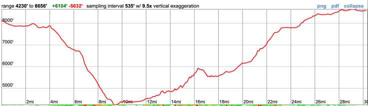
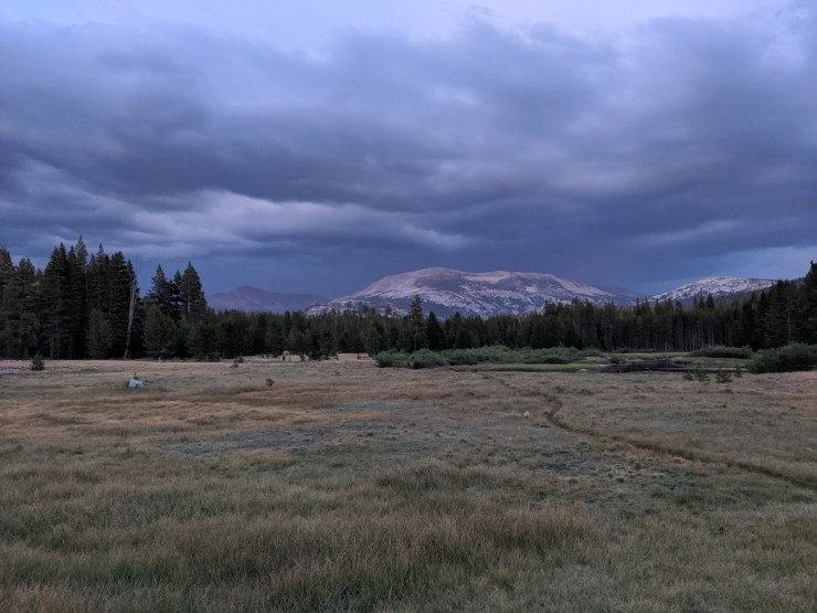
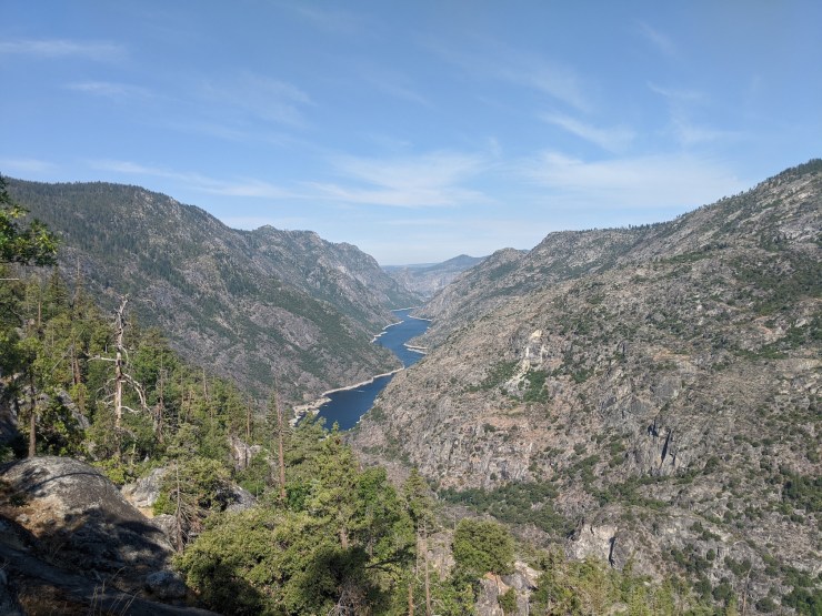
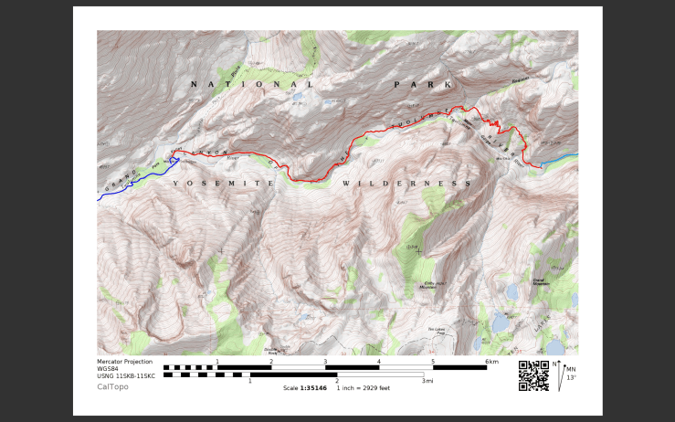
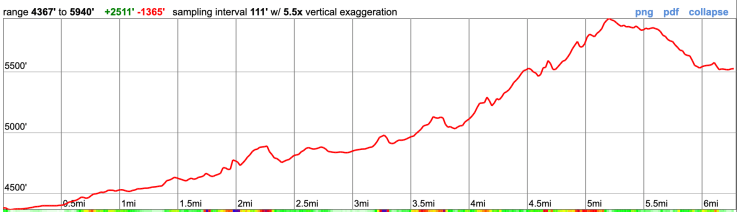
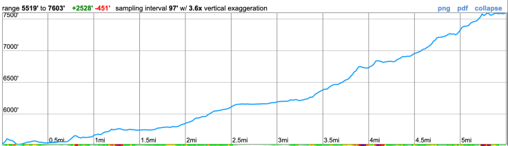
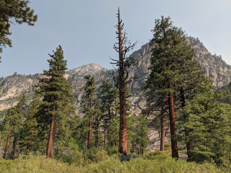
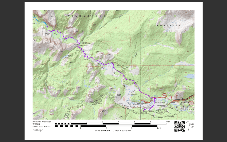
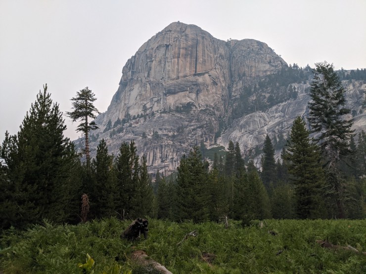
Trip Overview: The 33 mile Grand Canyon of the Tuolumne River backpacking trip is considered one of the highlights within Yosemite National Park. This route follows the Tuolumne River through a deep canyon that leads from the Hetch Hetchy Reservoir to Tuolumne Meadows. Much of the canyon is only accessible via backpacking or very long day hikes, so you are likely to get away from the crowds during this trek (a rarity in Yosemite!). +6,000 / -5,500 feet of elevation across the course of this trek with a peak elevation of 8,660 feet. Highlights include impressive granite peaks and domes, spectacular waterfalls, alpine meadows, and nonstop views of the Tuolumne River. The images in this report are from a trip in mid August 2020.

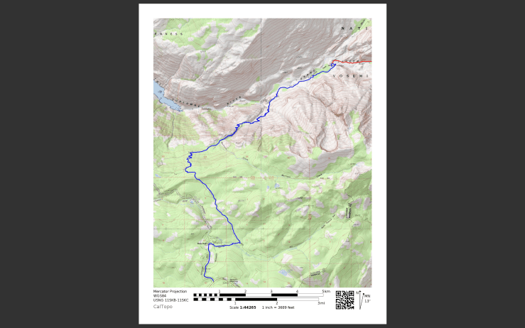
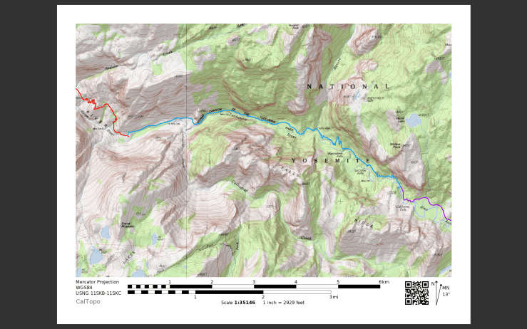
- Higher resolution version of the overall map for Grand Canyon of the Tuolumne (PDF)
- Our favorite topographic map of Yosemite National Park for purchase (Tom Harrison Yosemite High Country Map)
Jump to Day 1: White Wolf to Pate Valley
Jump to Day 2: Pate Valley to Grand Mountain
Jump to Day 3: Grand Mountain to California Falls
Jump to Day 4: California Falls to Tuolumne Meadows
Shop Deal of the Day at REI Outlet (up to 50% off)!
Preparations:
Click here to read more about Permits
Permits: Yosemite National Park is one of the most popular backpacking and hiking destinations in the United States, so permits are required year round for overnight camping and the number of permits is limited based on a quota system. You will want to secure a permit as early as possible to do this hike in June, July, or August. The peak hiking season for this trek is generally late June through early August. Hiking the Grand Canyon of the Tuolumne in June can be a challenge due to high stream crossings, but waterfalls should be near their peak flows. Hiking later in the summer provides safer stream crossings but also brings very hot temperatures and lower flow in the Tuolumne River (and thus less spectacular waterfalls).
Wilderness permit applications for any given trek start day are processed (via random lottery) starting 24 weeks before the hike start date, so you want to submit an application at least 24 weeks in advance of your hike. Permit applications can be easily submitted online (info here) and the cost is $5 per confirmed reservation plus $5 per person on the permit. You only pay the fee if you permit application is accepted and confirmed.
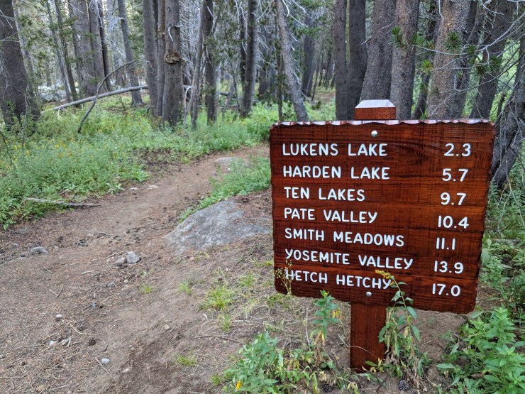
Prior to submitting an application for a permit, check the Yosemite National Park trailhead map and trailhead permit availability report (if applying fewer than 24 weeks before your start date). Note that each trailhead has a designated direction you must hike. For this specific itinerary you start at the White Wolf to Pate Valley Trailhead. Alternatively you could start at Glen Aulin and hike east to west. If hiking a full loop, you can also start at a few different trailheads along Highway 120 between White Wolf and Tuolumne Meadows (e.g. Murphy Creek, May Lake, Ten Lakes, etc). The full loop pass through Ten Lakes between White Wolf and Tuolumne.
Click here to read more about Logistics
Logistics: If you have a wilderness permit, you may camp at one of the Yosemite backpackers’ campgrounds the night before and night after your wilderness trek. For this specific itinerary, it is easiest to stay at the White Wolf or Tuolumne Meadows backpackers’ campgrounds. Backpackers must pay $6 per person to camp and you pay with exact cash at the campground. There is no overnight parking at the Backpackers Camps, so after you drop off your camping supplies you must park in legal long term spots at trailheads along highway 120. There is also parking near the Lembert Dome and along the road to Soda Springs.
The itinerary described in this report is a one way point-to-point hike, so you will either need two cars or will need to utilize the YARTS bus or the Yosemite Valley to Tuolumne Meadows Hikers Bus (or hitchhike). More info on the transit options can be found here. For our itinerary, we parked at White Wolf and began our trek from there. Upon reaching Tuolumne Meadows at the end of the our trek, we caught the YARTS bus at the Tuolumne Meadows Visitor Center and took the bus back to our car at White Wolf.
Click here to read more about Difficulty
Trail Conditions and Difficulty: Backpacking the Grand Canyon of the Tuolumne is of moderate difficulty when the 33 miles are covered in 4 (or more) days. If completing the route in 2 or 3 days, expect a more difficult hike. For an enjoyable experience, I recommend a 4 day trip. This allows you to take advantage of the many swimming and fishing holes along the Tuolumne River.
The primary challenges are the ~4,000 foot elevation different between White Wolf and Pate Valley and the high afternoon temperatures within the canyon. If hiking from White Wolf to Pate Valley in one day, expect sore knees and feet because the downhill trail is very steep (many people comment that this section is tougher than they expect). If you plan to hike more than 10 miles in a day through the canyon, I suggest leaving early in the morning. Temperatures within the Grand Canyon of the Tuolumne can get very hot during the middle of the day and some sections of the trail are very exposed to the sun.
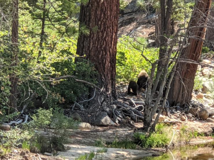
Supplies: There are very active black bears in the Yosemite National Park, so you need to bring a bear canister to store food and scented items. Bear spray is not allowed and hanging food is illegal throughout Yosemite. If you do not own a bear canister, you can rent them from the various Wilderness Centers in the park for ~$5 per week.
You likely will want bug spray because the mosquitoes can be out in force in certain areas of the trek. I prefer a picaridin based spray because it does not damage plastics and synthetic fibers like high concentration DEET sprays can. I also like to pre-treat my clothes and tent with permethrin spray repellent. The permethrin treatment stays on your clothes for up to 7 washes, so it helps reduce the amount of spray you need to put on your skin.
Below is a list of the gear I brought on this backpacking loop in Yosemite National Park:
Hiking clothes
- a lightweight hiking rain jacket (North Face Venture 2 Jacket)
- fast drying synthetic hiking pants (prAna Zion Pants)
- a quick drying long sleeve hiking shirt (Columbia Silver Ridge L/S Shirt)
- wool outer socks (People Socks Moreno 4-pack)
- thin blister preventing base socks (WrightSock double layer Coolmesh)
- quick drying synthetic boxer briefs (ExOfficio Give-N-Go)
- Gore-tex hiking shoes (adidas Outdoor Terrex Fast R Gore-Tex Shoe)
Clothes for camp
- wool leggings (Minus33 Merino Wool Kancamagus Midweight Bottom)
- wool base layer shirt (Minus33 Merino Wool Chocorua Midweight Crew)
- lightweight down jacket (Patagonia 800-fill Down Jacket)
- lightweight camp shoes (Xero Z-Trail lightweight sandal)
Hiking gear
- topographic map (Tom Harrison Yosemite High Country Map)
- trekking poles (Black Diamond Trail Ergo Cork Trekking Poles)
- 2 liter hydration bladder (Platypus Big Zip Water Reservoir)
- 65 liter backpack (Osprey Atmos 65 Liter pack)
- water filtration system (Platypus gravity filtration system)
Camp gear
- strong tent with rain-fly (Alps Mountaineering Chaos 2 Tent)
- inflatable sleeping pad (Therm-a-Rest Trail Pro Sleeping Pad)
- sleeping bag (REI Co-op Igneo 25 Sleeping Bag)
- lightweight backpacking chair (Helinox Chair Zero)
- headlamp (Black Diamond Cosmo Headlamp)
- multi-tool with knife (Gerber MDime Mini Multi-Tool)
- bear canister (BearVault BV500)
- lightweight stove (MSR PocketRocket 2)
- lighter (BIC plastic lighters)
- 2 liter pot (GSI Outdoors Halulite Boiler Pot)
- coffee cup (GSI Outdoors Glacier Stainless Cup)
- lightweight spork (Snow Peak Titanium Spork)
- small, quick drying towel (REI mutli towel mini)
Random
- wet wipes (Stall Mates individually wrapped wipes)
- mole skin for blisters (Blister medic kit)
- small amount of duct tape for gear repairs
- chapstick and sun screen
Food and drink
- a variety of my favorite dehydrated meals
- electrolyte replacement (NUUN Hydration Tablets)
- instant coffee (Starbucks VIA)
- quick snacks (Clif Shot Bloks and Clif energy bars)
- small plastic water bottles filled with whisky 🙂
……….
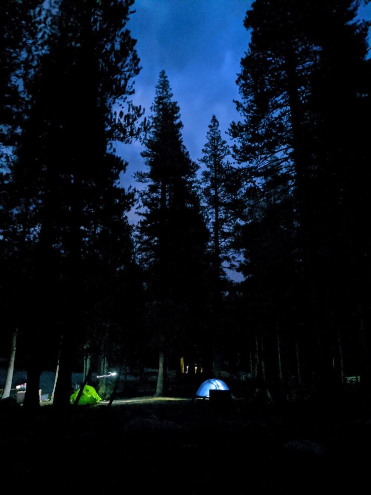
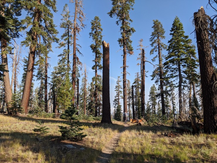
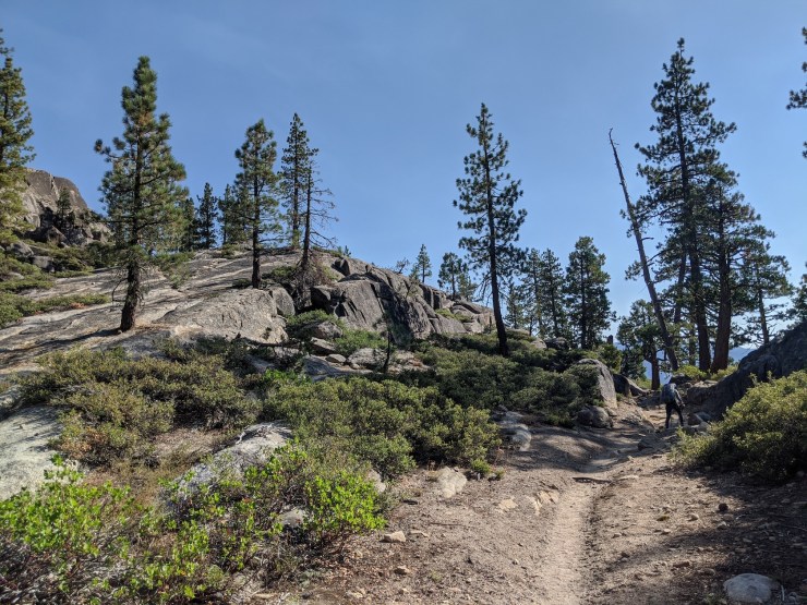
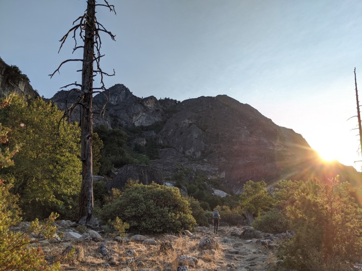
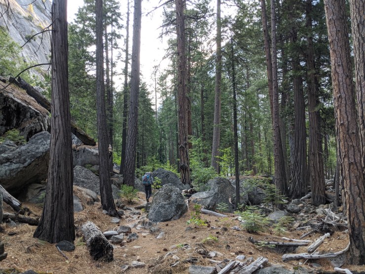
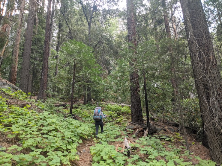
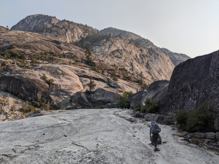
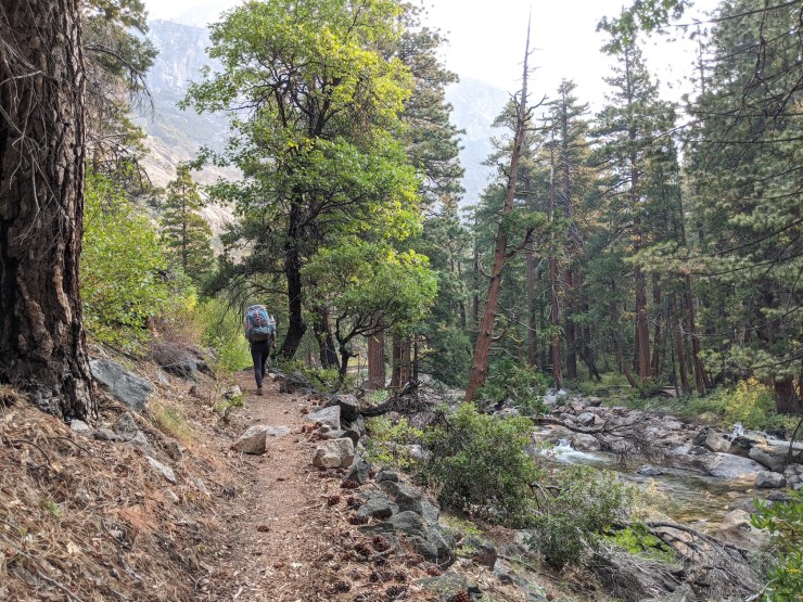
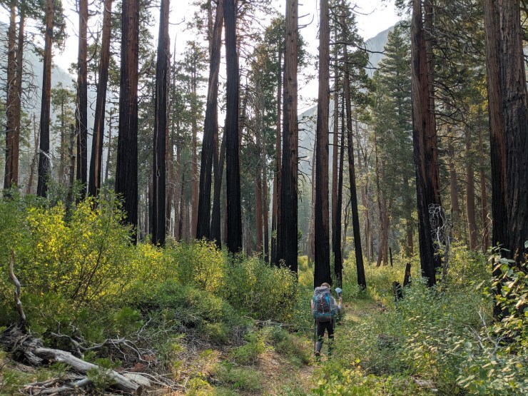
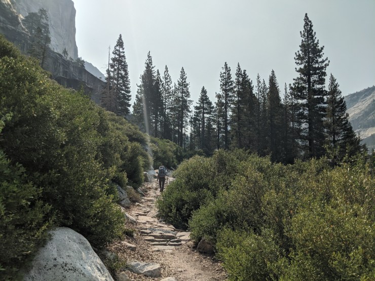
Day 1: 11.5 miles; +620 feet / -3,700 feet; White Wolf to Pate Valley
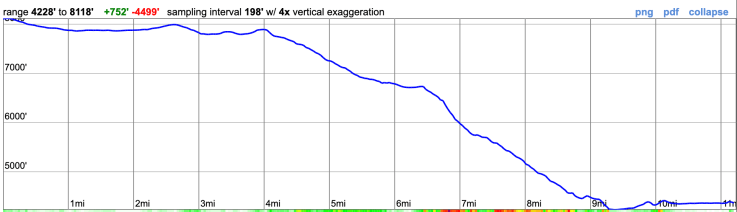
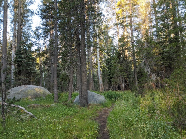
On the first day we hiked from White Wolf down to the Tuolumne River in Pate Valley. The road to the White Wolf campground was closed due to COVID-19 at the time of our hike, so we had to hike an extra ~1 mile from Highway 120 to the White Wolf Trailhead. If the White Wolf facilities are open, you can camp at the backpackers campground there and start directly at the trailhead.
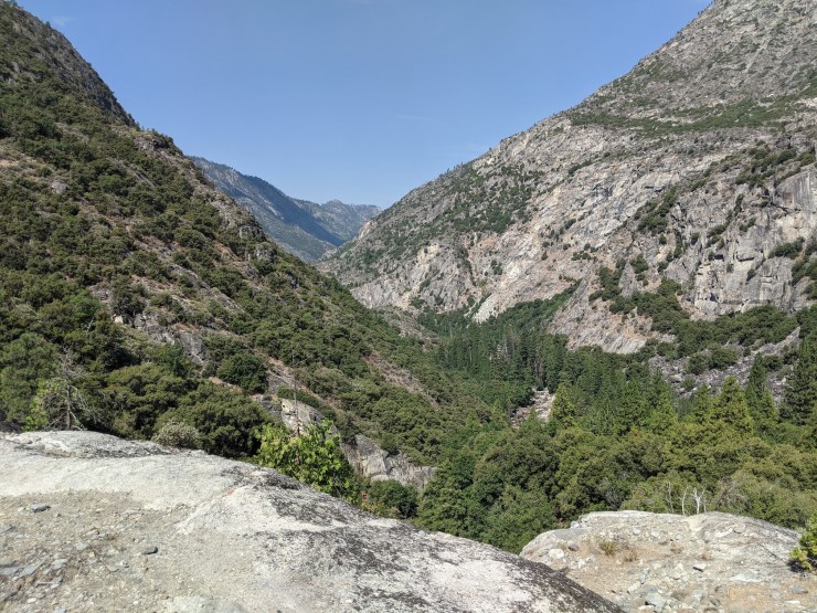
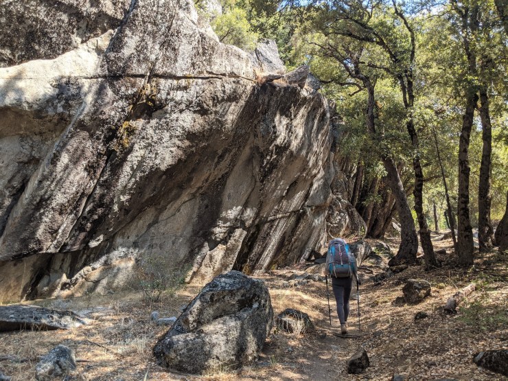
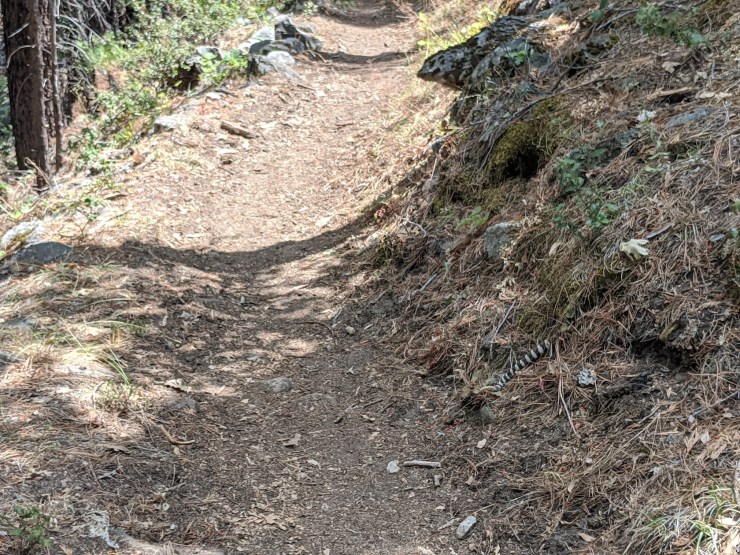
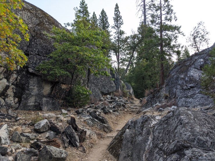
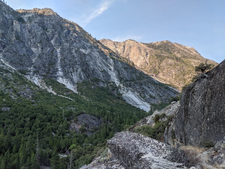
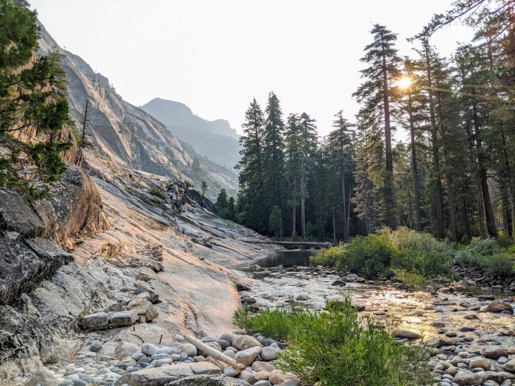
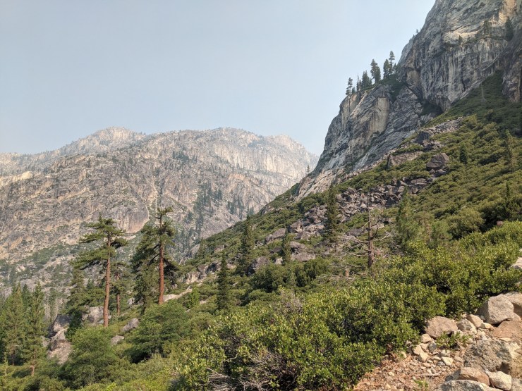
Overall this hike is fairly tough because it involves a long, steep descent. If the weather is expected to be warm, consider leaving early in the morning because much of the trail is exposed within the warm canyon. Midway through the hike you catch glimpses of the Hetch Hetchy Reservoir. You then start the steep drop into the Grand Canyon of the Tuolumne. After the descent, the trail begins to follow the Tuolumne River. Rattle snakes are quite commonly encountered in the several miles of trail before and after Pate Valley, so be aware and keep your eyes on the trail.
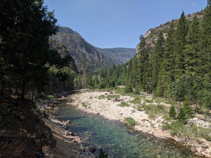
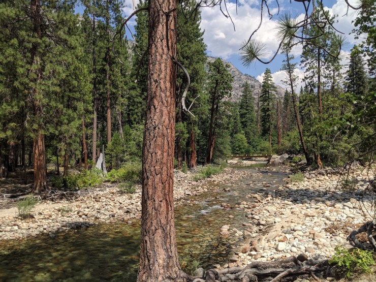
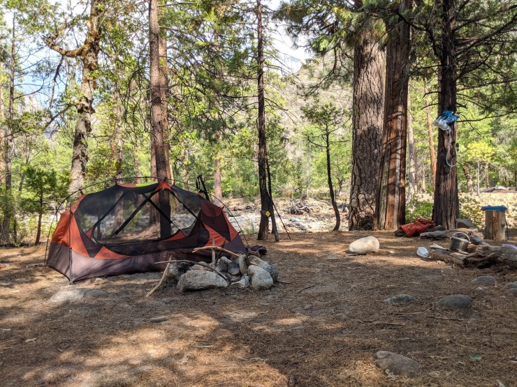
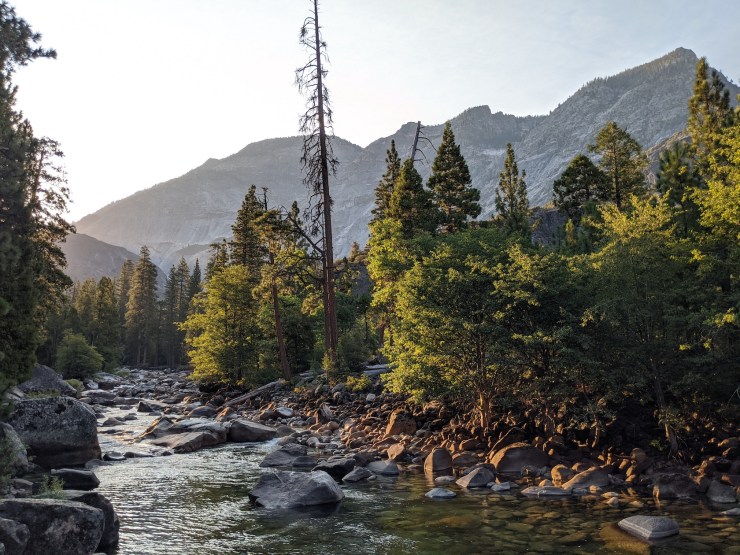
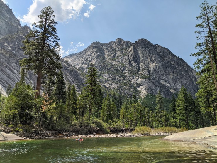
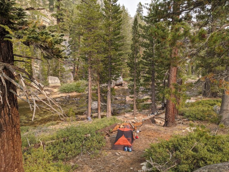
After you cross the Pate Valley bridges, there are a variety of good campsites near the Tuolumne River in Pate Valley. We camped in one site that was nearby a good swimming hole with a beach.


……….
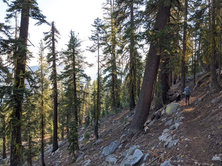
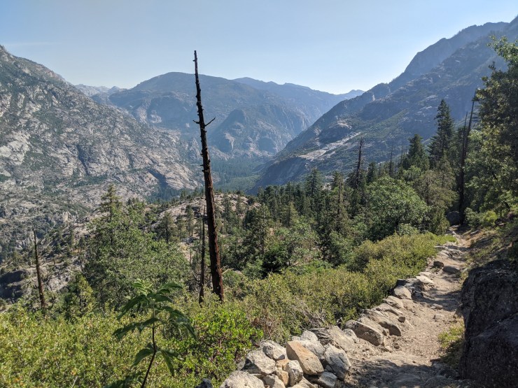
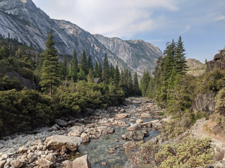
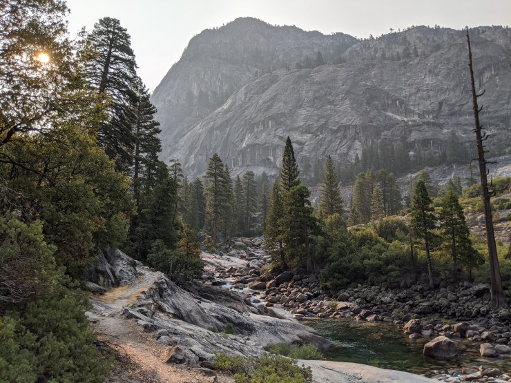
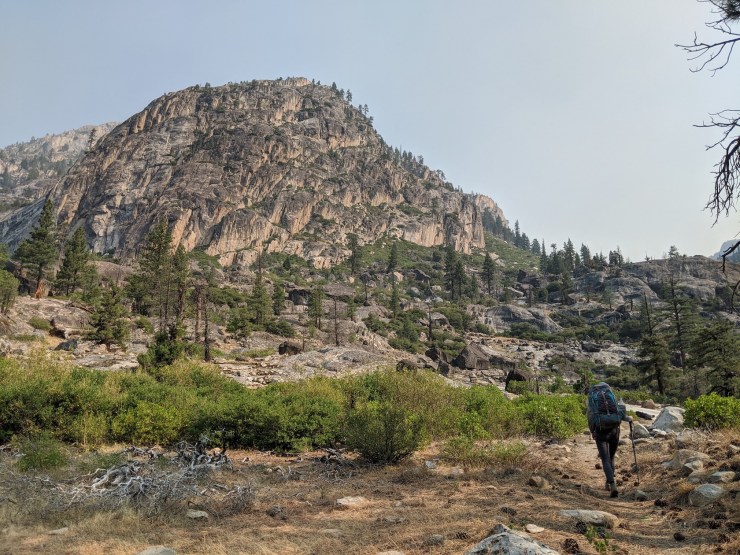
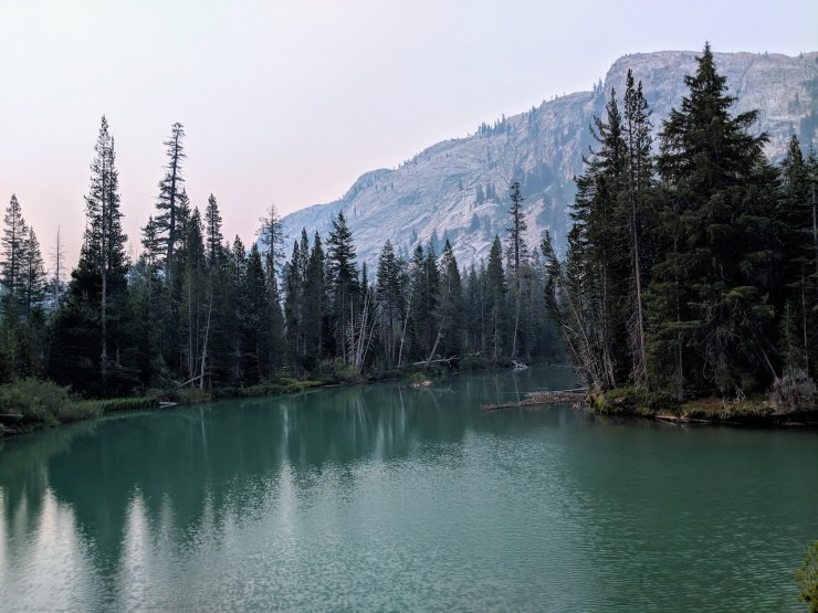
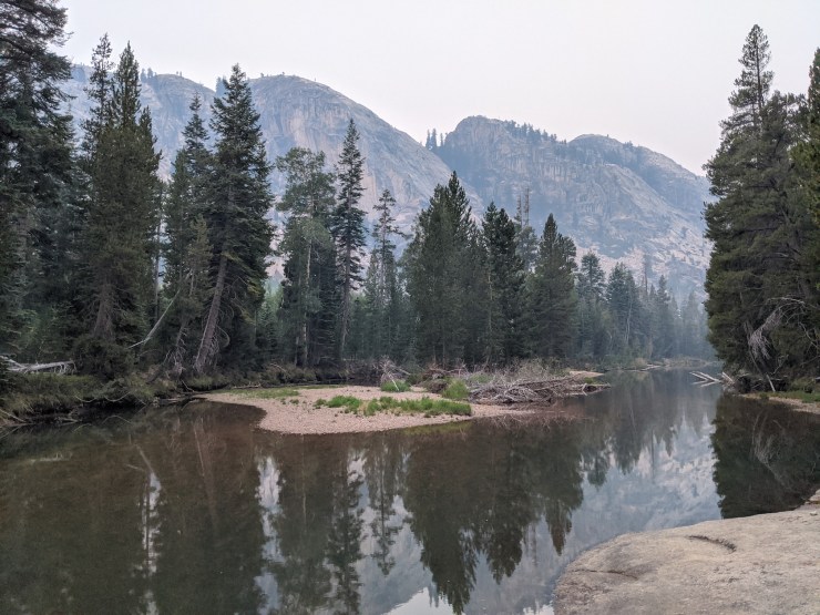
Day 2: 6.9 miles; +2,060 feet / -1,120 feet; Pate Valley to Grand Mountain
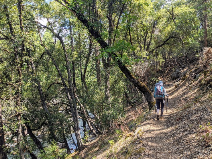
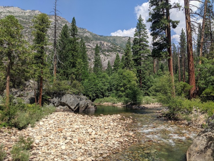
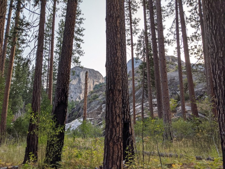
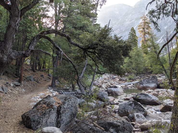
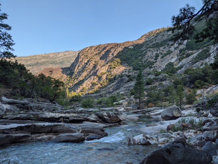
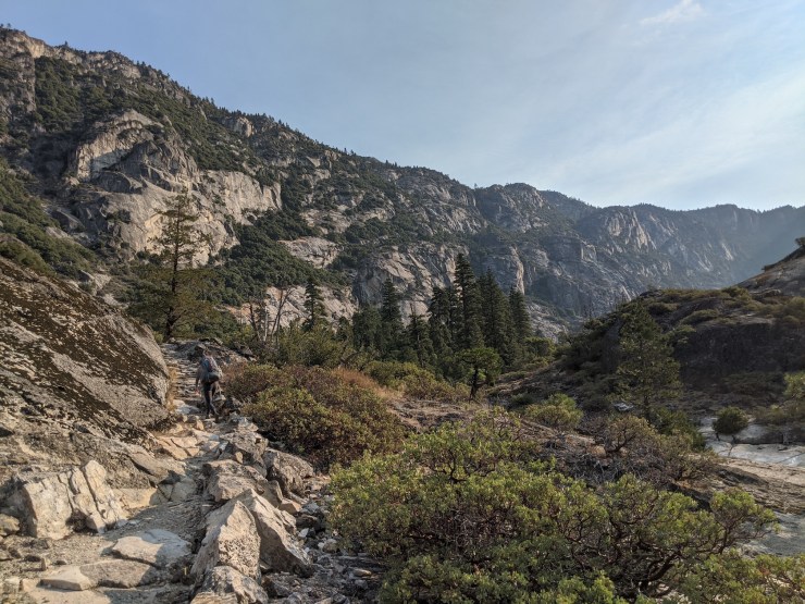
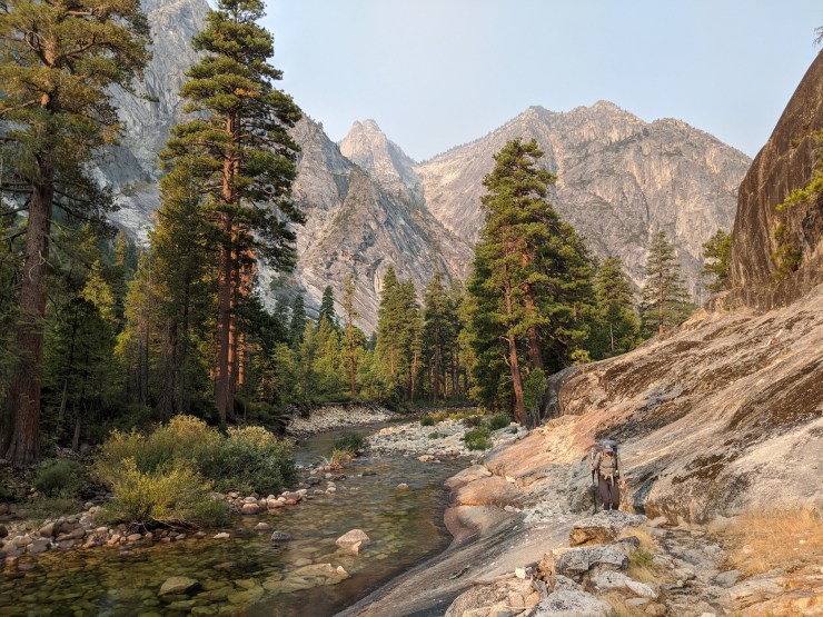
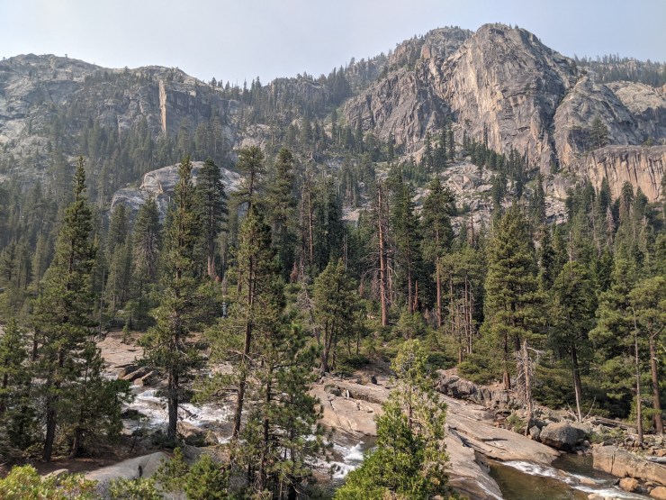
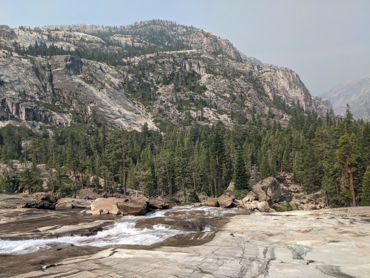
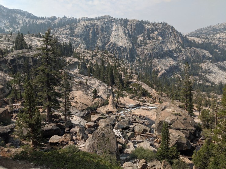
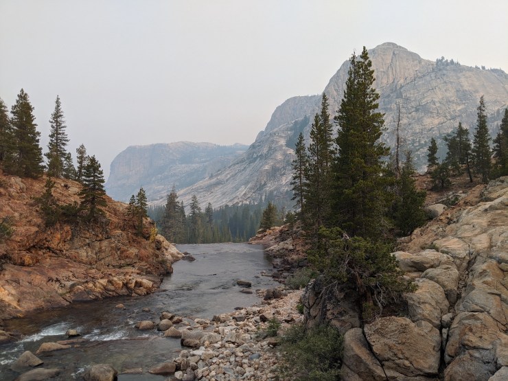
On Day 2 we began the ~20 mile route through the Grand Canyon of the Tuolumne. The trail follows the Tuolumne River as it slowly ascends up Tuolumne Meadows. This portion of the trail is the highlight of this trek and provides near constant views of the river as well as many views of towering canyon walls and countless waterfalls.
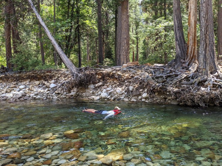
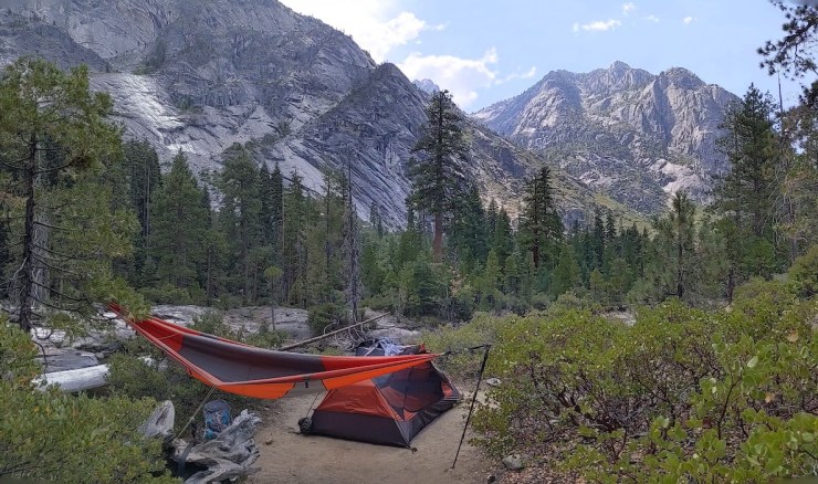
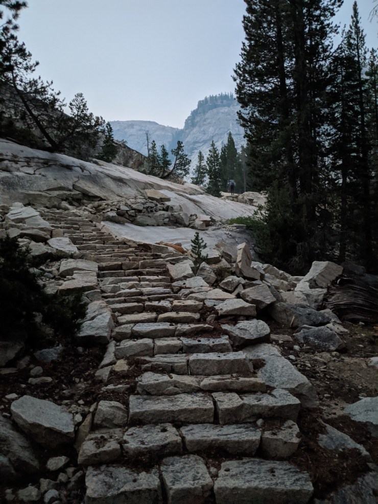
The ascend is steady but modest for the first 4 miles. In several sections, the trail skirts directly along the edge of the river. Then, the trail begins to steeply climb away from the river as it traverses around the Muir Gorge. The climb is tough as you go up many stairs and switchbacks. The climb is also very exposed to the sun, so it is best tackled early in the day. We reached the top of the climb shortly after the 5 mile mark. From there, it was a steady descent down to our eventual campsite which sat across the Tuolumne River from Grand Mountain. This campsite was exposed to the sun, but had a great view of Grand Mountain and Colby Mountain and had a scenic swimming hole nearby.


……….
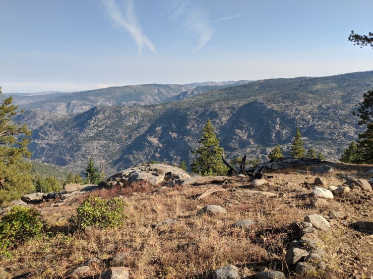
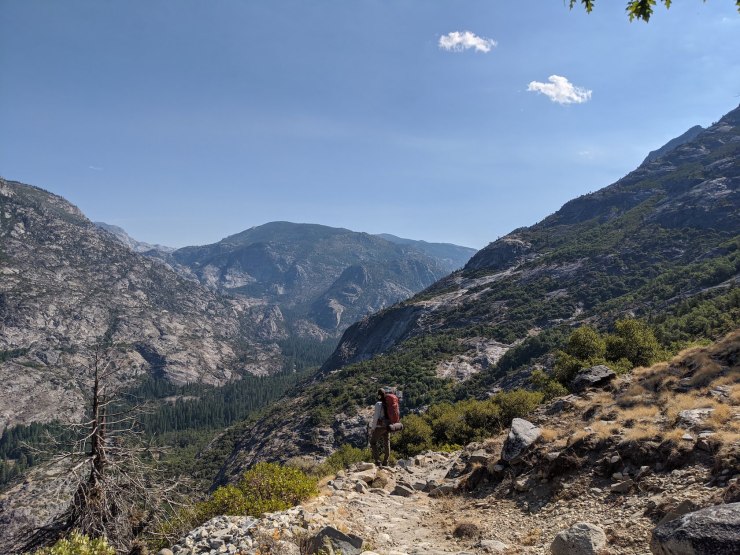
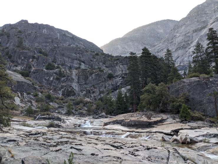
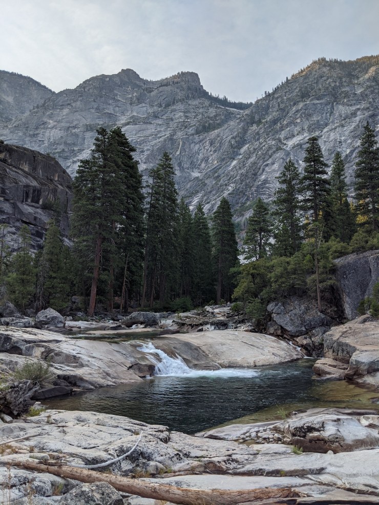
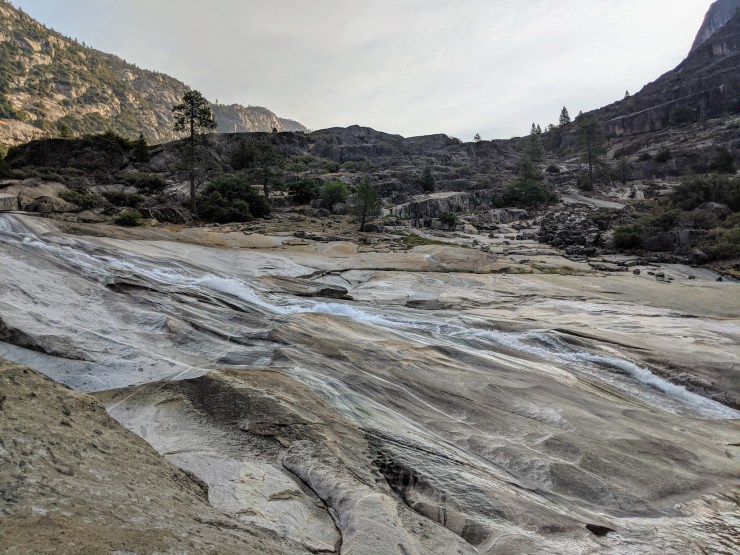
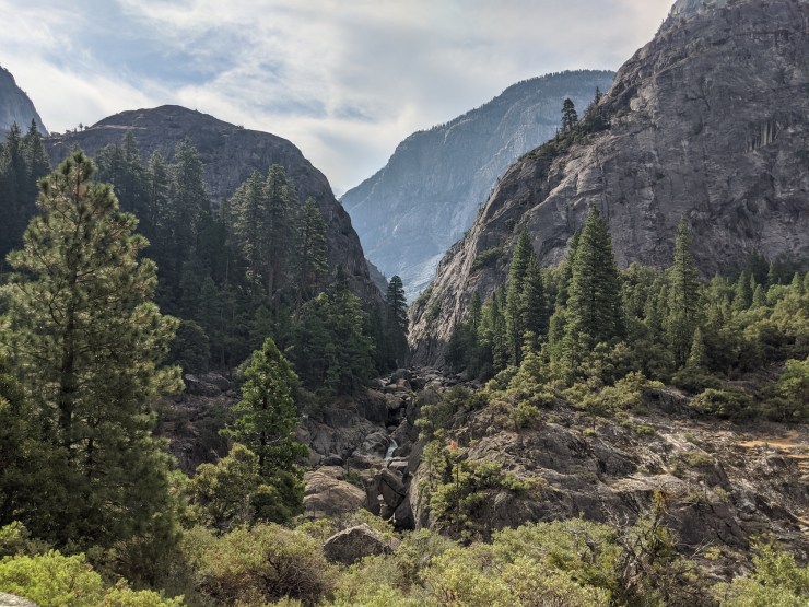
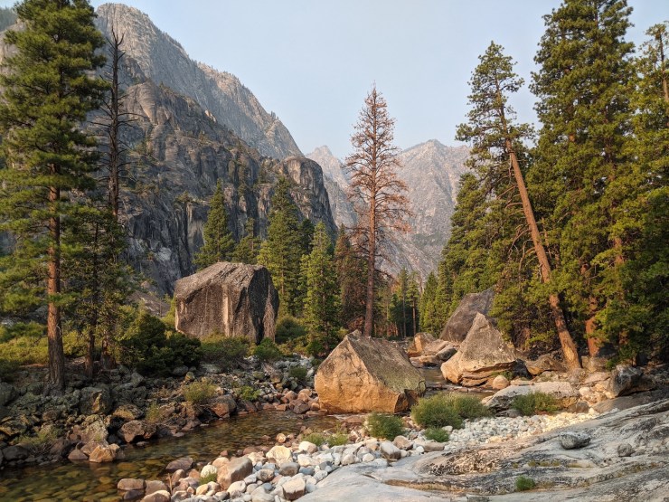
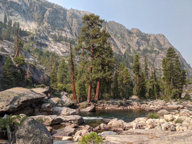
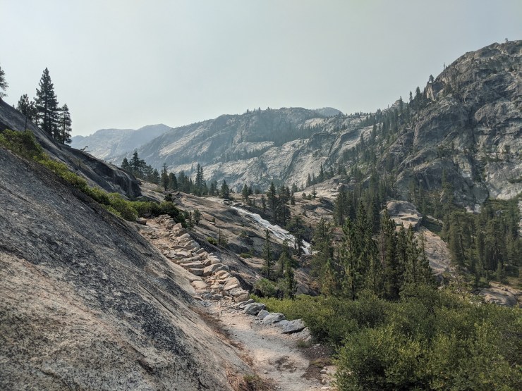
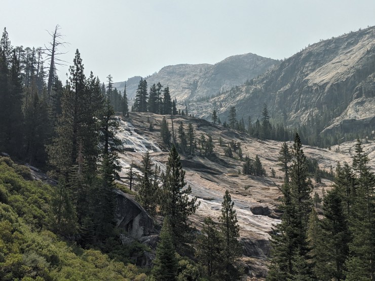
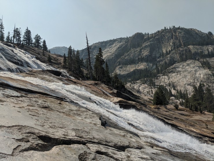
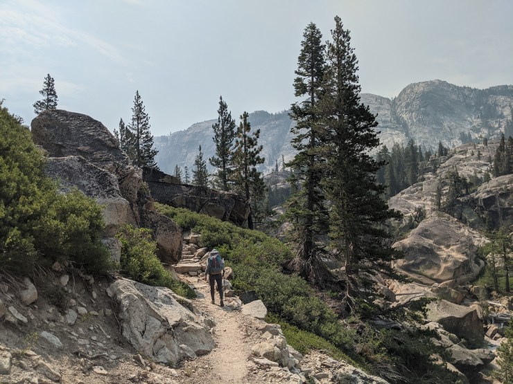
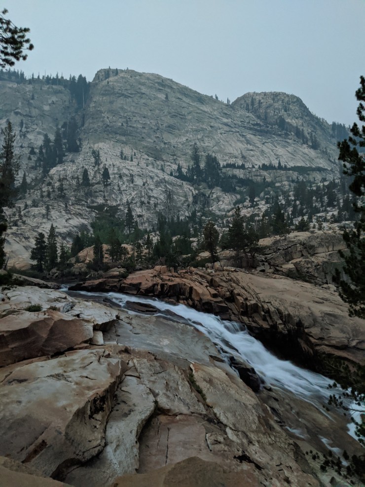
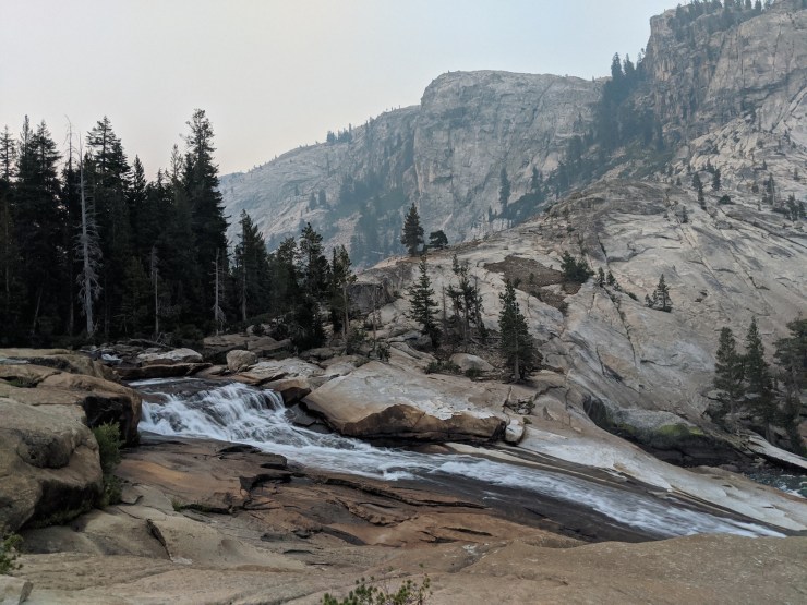
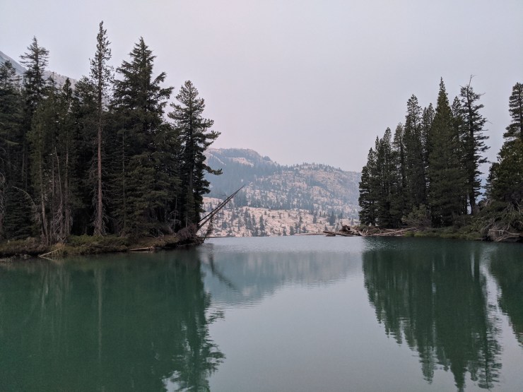
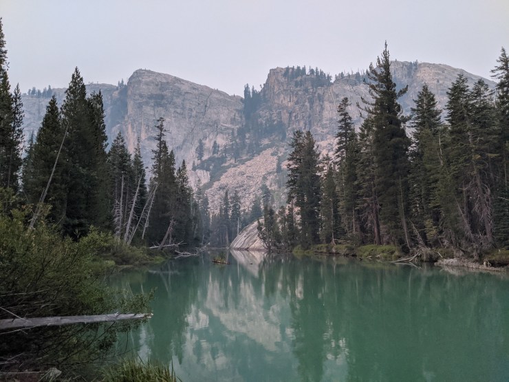
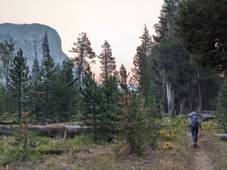
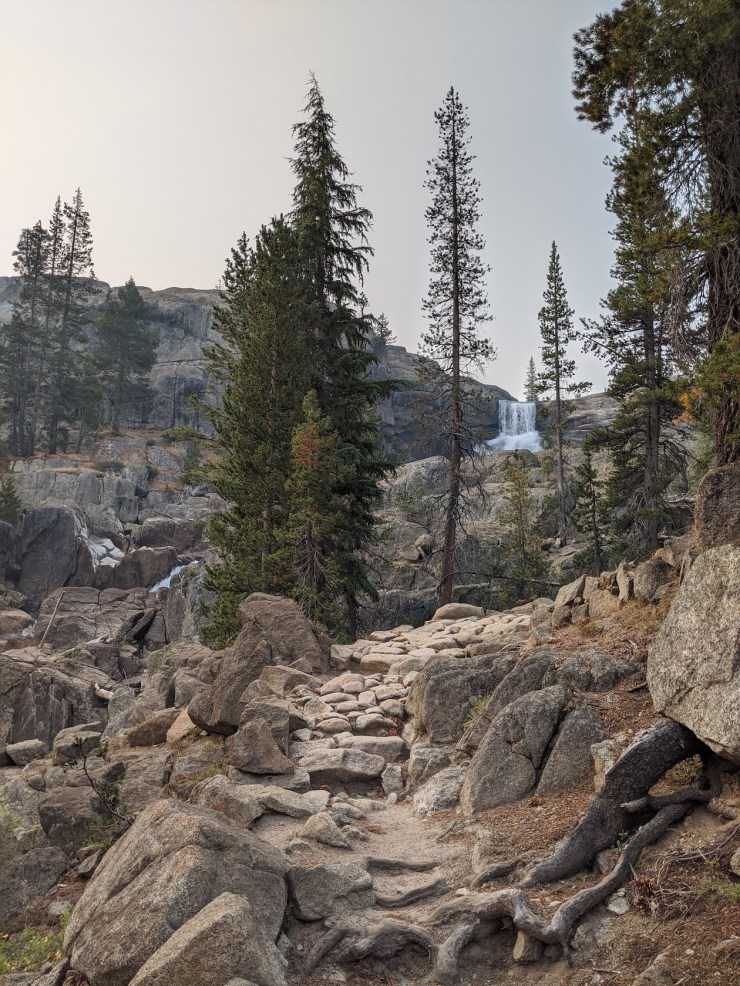
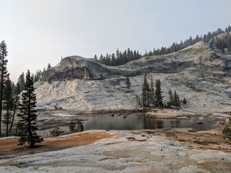
Day 3: 6 miles; +2,070 feet / -370 feet; Grand Mountain to California Falls
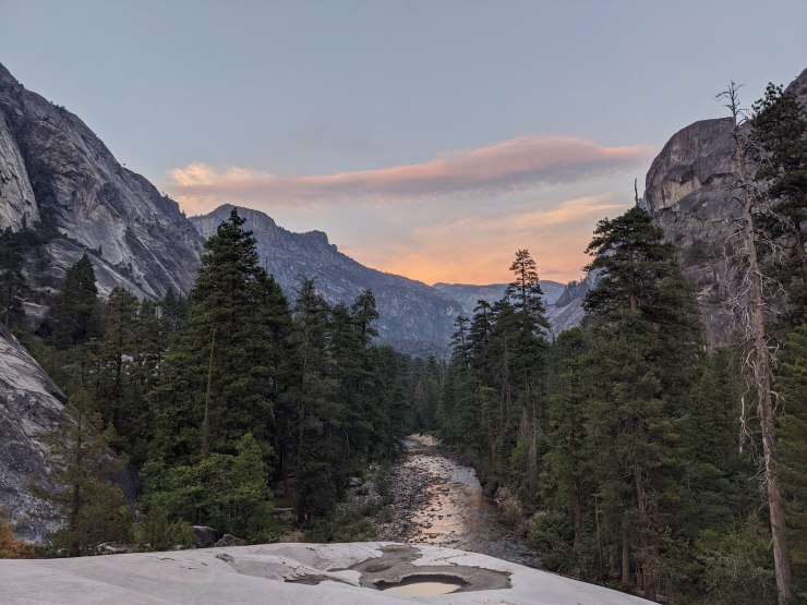
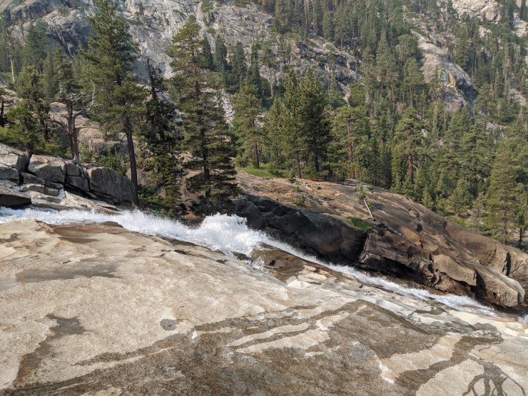
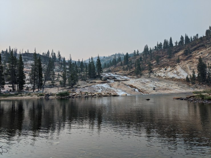
The Day 3 hike is one of the more beautiful sections of this trek. You continue hiking up the Grand Canyon of the Tuolumne and pass by two of the more impressive waterfalls along the route, Waterwheel Falls and LeConte Falls. The amount of elevation gain is similar to the Day 2 hike so it is no cake walk. However, the great views made up for the many switchbacks and stairs. After passing LeConte Falls at the 5 mile mark, we continued to climb for another 1 mile or so. At that point, we reached a larger pool of water ~0.25 miles short of California Falls. We forded the Tuolumne River and found a nice, private campsite on the south side of the river. After setting up camp, we hiked up to California Falls and relaxed in the swimming hole at the base of the falls.


……….
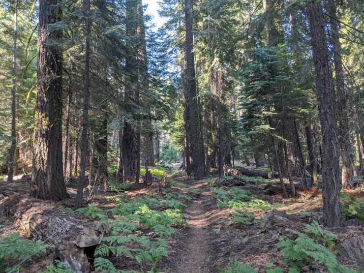
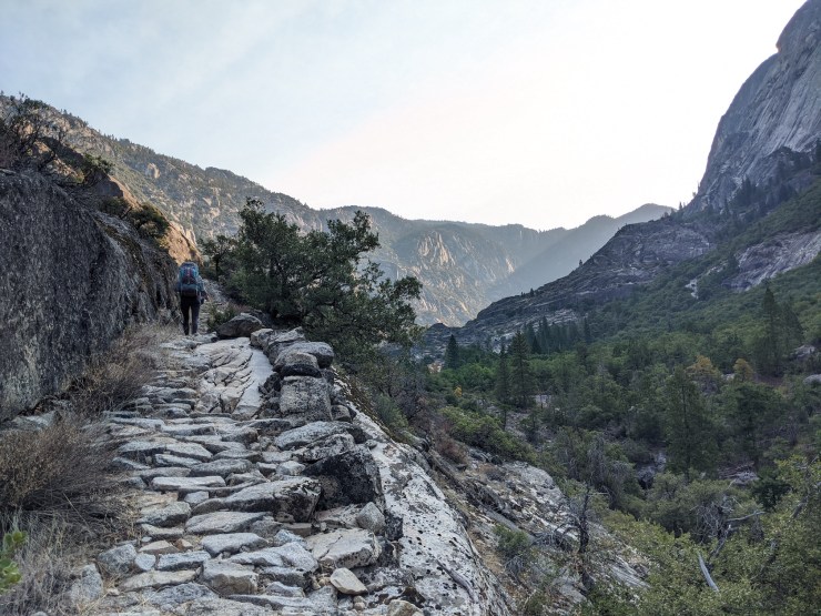
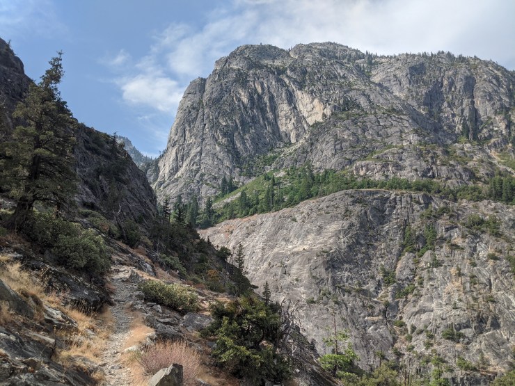
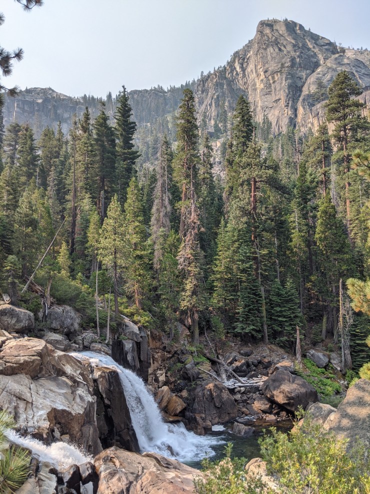
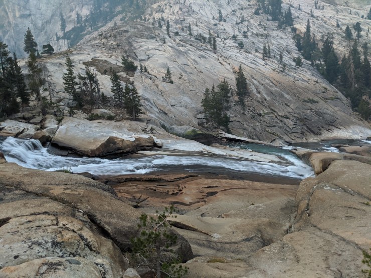
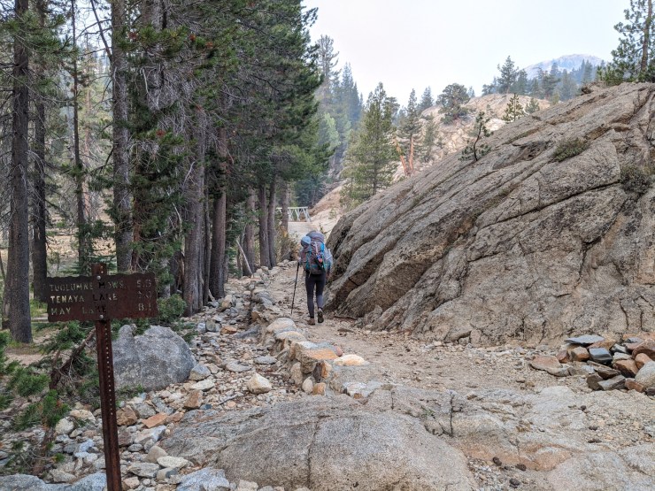
Day 4: 8 miles; +1,240 feet / -410 feet; California Falls to Tuolumne Meadows

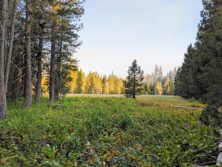
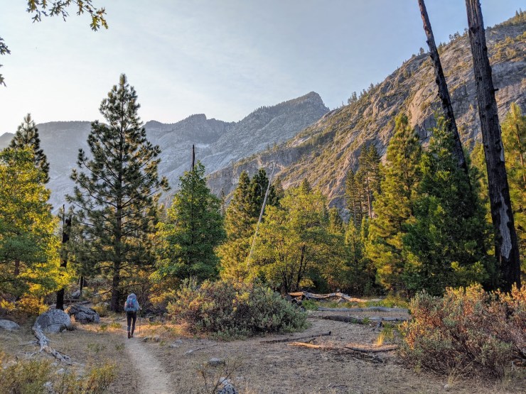
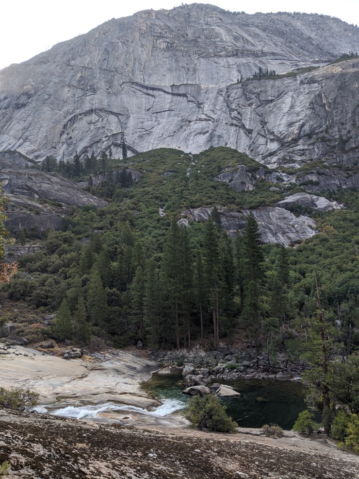
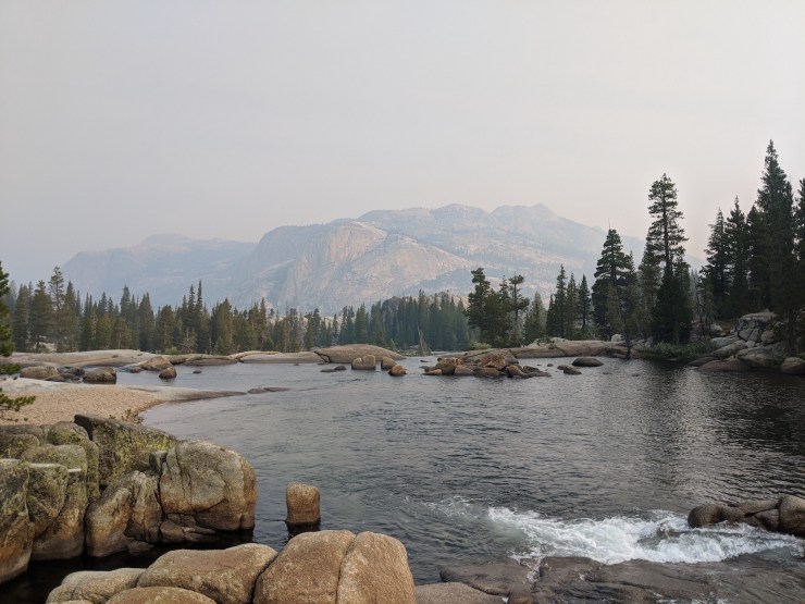
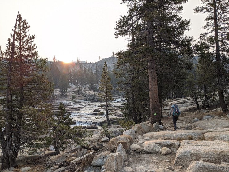
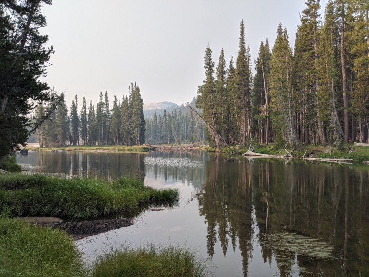
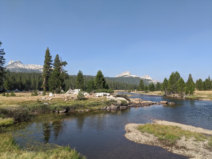
Day 4 was our last day on the trek. We had to get back to the Tuolumne Meadows Visitor Center by ~10 am in order to catch the 10:27 am YARTS shuttle back to our car at White Wolf. So, we got off to a very early start hiking in the morning (~5:45 am) and hiked the 8 miles back to the visitor center. The hike starts with a climb up over California Falls. You then enter the Glen Aulin valley/meadow and hike along flat terrain for ~1 mile. This section of trail is very serene and the slowly flowing Tuolumne River is a stark contrast to the falls and rapids elsewhere in the canyon. After Glen Aulin, the trail begins to climb again and you exit the Grand Canyon of the Tuolumne. Along the way, you pass several impressive falls (White Cascade, Tuolumne Falls, and others) and cross a footbridge bringing you to the north side of the Tuolumne River.
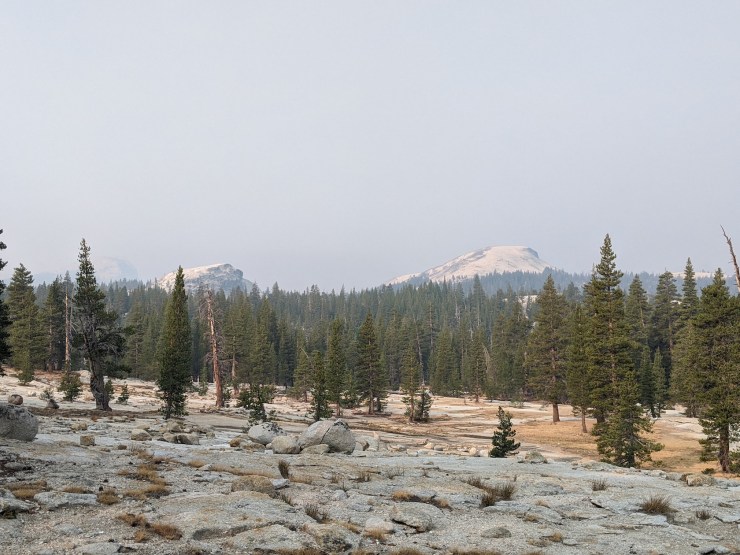
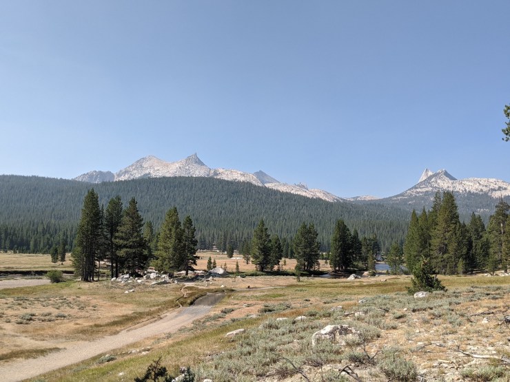
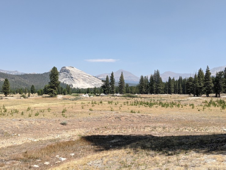
By the 4 mile mark, the trail begins to flatten out again and the river begins to wind through a meadow. You are treated to great meadow views with several domes and peaks in the distance. At ~6.5 miles you reach Soda Springs and then cross Tuolumne Meadows on your way back to the Visitor Center. From there, we caught the YARTS bus, which drove us back to our vehicle at White Wolf.


……….
Here are some similar trip reports!
Yosemite Highlights Loop – Yosemite National Park (40 mile loop)
Teton Crest Trail – Grand Teton National Park (48 mile loop)
North Circle Loop – Glacier National Park (52 mile loop)
Grand Loop – Olympic National Park (43 mile loop)

Hi, thanks so much for this detailed itinerary! I’m planning this trip for September, but the YARTS reservation site doesn’t show a “white wolf” destination. Is there another name I should be looking for?
Thanks in advance!
LikeLike
Hi Nik, we bought tickets to take us from Tuolumne Meadows to Crane Flat. Then once we boarded the bus we asked the driver to drop us off at White Wolf. He said he could do that so long as there were room for him to pull over on the side of the road. There was a large turn out not too far from White Wolf Road, so he stopped there and let us and the other hikers out.
I assume they will add the White Wolf drop off option to the YARTS site once White Wolf Road is officially opened again. It was closed to car traffic all 2020 due to COVID restrictions.
LikeLiked by 1 person
Hi, thanks so much for this detailed itinerary! I’m planning this trip for September, but the YARTS reservation site doesn’t show a “white wolf” destination. Is there another name I should be looking for?
Thanks in advance!
LikeLike
Hi, We plan to hike the canyon beginning at White Wolf but will be beginning late afternoon. Are there any campsites before reaching Pate Valley, maybe 5 to 6 miles in? Thanks!
LikeLike
There is a camping area near where the trail meets up with Morrison Creek, before the trail starts to descend down into Pate Valley (location is approximately here -> https://goo.gl/maps/5ifZZrdFHfDbtYVZA). The spot has a great view of Hetch Hetchy. The only issue is that you rely on Morrison Creek for water and this creek often stops flowing in the summer. Your best bet will be to give the Yosemite wilderness ranger a call before your trip to ask about water availability.
LikeLike
Hi..thanks for the info – really well-organized. What’re the pros of taking the route you have described down to Pate Valley on Day 1 vs. the Harden Lake one ? Thanks !
LikeLike
There’s not a big difference between the two routes. I was told that the route via Harden Lake is slightly more climbing and the views are not any better!
LikeLike
Hi, love your journey and photos. We just completed the trip (13 to 17 October 2021) we started from Tuolumne meadows and out to Tioga road past White Wolf due to resort closure. For us going from east to west was planned as the easiest for our knees due to the steep, long descent coming out of White Wolf. Your photos are so sharp and a great visual addition to the memories from our trip. What camera and lens did you use for your photos? Thank you. Paul
LikeLike
Hi Paul – I’m glad you were able to complete the trip! All the photos were taken with my fairly old cell phone. It’s a Pixel 2, but still works pretty well!
LikeLike
This has to be the definitive summary of the grand canyon of the tuolumne route. Well done! I’m curious if you encountered many other hikers. Is this a busy route? Were there other hikers camping nearby each night? Also, is it possible to camp all along the river or only at select areas due to topography, access to water, etc?
LikeLike
Hi Rob – we encountered a few groups each day. The closer to Hetch Hetchy and White Wolf you are the fewer people you will see. Near Glen Aulin and Tuolumne you start to encounter more people since day hikers can make it there. This route was not nearly as “busy” as the routes I’ve done through Yosemite Valley though. There are many established campsites that sit near the river. The first night camping in Pate Valley we could see a few other tents nearby. The other two nights we found pretty private spots along the river. Since you are hiking through a canyon, your campsite selection is limited but I felt like we passed plenty of establish camp options. These established camps are all located near river access or stream access points. In dry years, the streams near some sites may be dried up, but the river is always flowing.
LikeLike
Hi! Thank you for the detailed report. Any idea how challenging are the crossings when water levels are high? We are planning a trip mid/late June. Thank you!
LikeLike
Hi Leng – I did the hike in a dry year, so I don’t have direct knowledge of what the trail can be like with high water. That said, all the major crossings over the Tuolumne River had bridges so we never had to ford any water. Your best bet is to give the Yosemite wilderness office a call and chat with one of the rangers. They will have more direct knowledge of the likely conditions in June.
LikeLike
Hi,
Thanks for the report! Is there a reason why you didn’t take the hikers bus which depart tolumne meadow at 2pm to give you more time on the last day? Thanks!
LikeLike
Hi Ben, we just wanted to get back to our car and get on the road back home before it got later. This allowed us to get lunch on the road vs needing to pack lunch for the last day.
You could definitely take a later bus if you wanted to take it slow and enjoy the scenery!
LikeLike
Great itinerary and summary! It looks like Pate Valley may be an underappreciated destination, the valley looks idyllic based on your photos. Seems like an early morning departure from White Wolf to PV is ideal considering heat and water supply limitations, would you agree?
Also, the black/white striped snake around mile 10 on the trail is a California Kingsnake (the rattlesnake killer). I came across a lot of rattlers (western diamondbacks) following Merced River through LYV last May and one of these friendly kingsnakes appeared sunning on a rock, lackadaisical and disinterested in people.
LikeLike
Hi Chuck – Yes, it was very hot and there was not much water going from White Wolf to Pate Valley. This will be especially true if you are going later than June. Interesting about the snake. We only noticed it because we heard a rattle. But, Maybe King snakes can imitate a rattle?
LikeLike
Ooooo, I stand corrected. Definitely a rattlesnake. Maybe a western rattlesnake? They seem to have a distinct banding near the tail. Exhilarating!
LikeLike
Thank you for the comprehensive trip description. The entire route looks spectacular! Is there a way to travel east to west and continue to Hetch Hetchy and out the west end of the reservoir, instead of hiking up out of the canyon to White Wolf? It would avoid the very steep grade.
LikeLike
Hi Frank – There is not an easy or short way to do the route you suggest. Theoretically you could stop at Pate Valley and then head north up the canyon to Table Lake and Pleasant Valley. From there you can take the trail southwest down to the north shore of Hetch Hetchy and head west. You would need to check ahead of time that the trail at Rancheria Falls and Wapama Falls is passable.
Comparing the two routes, from Pate Valley to the road at White Wolf (using the normal route) is roughly 10 miles and 4,000 feet of climbing. Pate Valley to the west end of Hetch Hetchy (using the route you asked about) is 24 miles and 6,000 feet of climbing.
Hopefully that helps you!
LikeLike
Great summary, thank you! I’m curious how would rate this trip vs your Yosemite highlights loop. I’ll be doing a 4 to 5 day backpacking trip August 16 and can’t decide which to do. So many great things to see!
Thank you,
Sean
LikeLike
Hi Sean – I would say the scenery on the Yosemite Highlights Loop is the most epic as you get views of the valley from Clouds Rest and get to see Half Dome and several other famous features. The major drawback is the crowds in the valley. You will not get much solitude except for when you get back by the Merced River. The Grand Canyon of the Tuolumne is beautiful in its own right, but is not as “epic.” I imagine with the snow pack this year, the waterfalls should be great through the canyon though. The great thing about this route is that you see much fewer people (except by Glen Aulin and Tuolumne Meadows). I don’t think you can go wrong with either route. You could always apply for permits for both and then just go on whichever one you end up getting permits for!
LikeLike
Hello! I just completed this trip based on your article (and a recommendation from a friend that completed it in the past). I really appreciated your attention to details and it really helped me plan it all out. It was definitely a butt kicker of a hike, but it was an adventure I will never forget. I ended up pushing past Cal Falls and kept going to Glen Aulin for camp the last night. This was my first solo trip and I was ready to be around people that last night. Also, White Wolf campground was closed for the year, so I started my trip off hiking down from there to Harden Lake and stayed the first night there. TBH I’m glad I did that since it broke up the descent the following day a little bit.
I also chose to park at Tuolumne Meadows Visitors Center and take the YARTS to White Wolf from there so I didn’t have to deal with anything extra after the hike. For anyone reading this, I highly recommend doing it that way. The only tough part, is the last YARTS heading to WW (or Yos Valley) leaves at 10:31am. So you may have to leave early from where ever you’re driving from to make that time work out. But you’ll be thankful you did that when the hike is over.
Again, thanks for posting all the details. You helped me set up a trip of a lifetime.
LikeLike
Hey Cameron! We were thinking of doing this route around the same time this September. How were the temperatures during your trip?
LikeLike
Great informative guide! Thank you so much. My husband is not able to backpack and do the entire route (bad back and knees) but feels willing to attempt a long, single day hike in and out with plenty of breaks along the way. If we reversed the hike and left from Tolumne Meadows and strived to reach California Falls would that still give some great views? Thinking the other way would be too rigorous hiking in and out same day. Any thoughts or suggestions are appreciated.
LikeLike
The section of trail between Tuolumne Meadows and California Falls is very beautiful and has some great views. It may just be more crowded and permits could be a bit harder to secure. It’s worth exploring though!
LikeLike
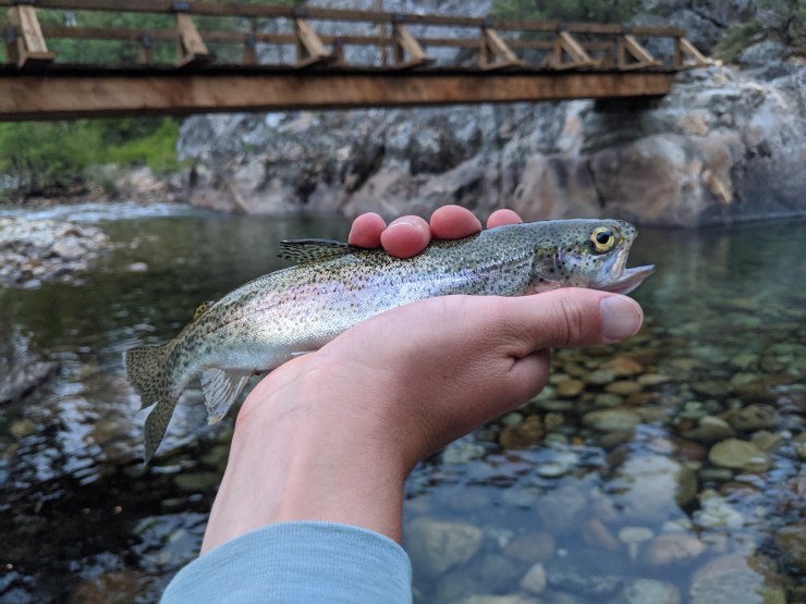
Thank you for all of your informative information. Two of us will be doing this hike in September 2025 and just yesterday I was wondering if there was any info on where to camp. You nailed it for us. We were also wondering about the fishing. Looks like there will be plenty of that too, if it is not fished out by the time we get there.
LikeLike