


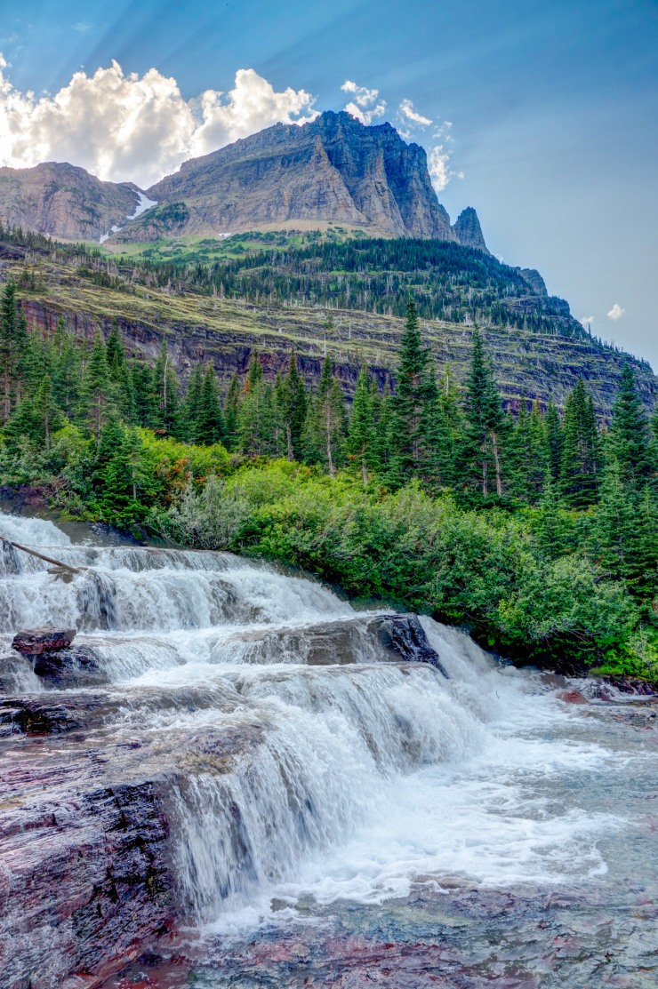
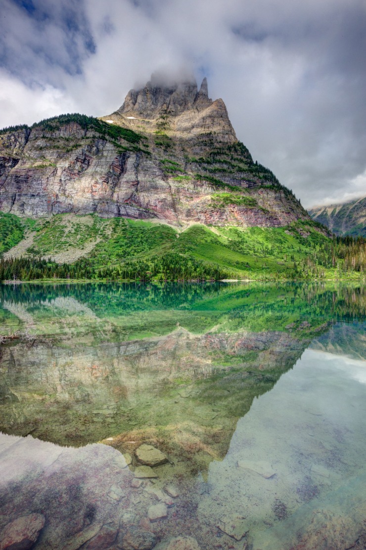
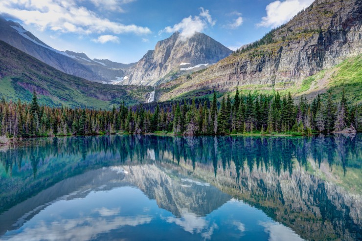
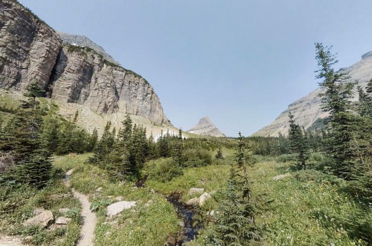
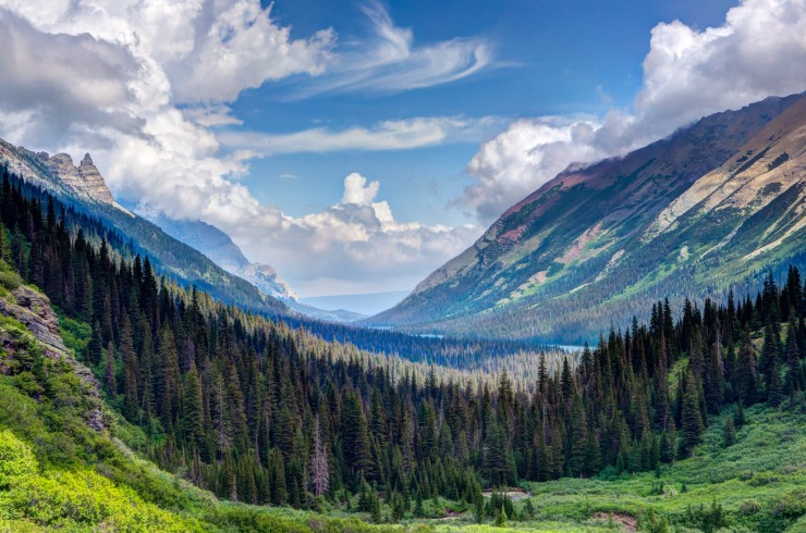
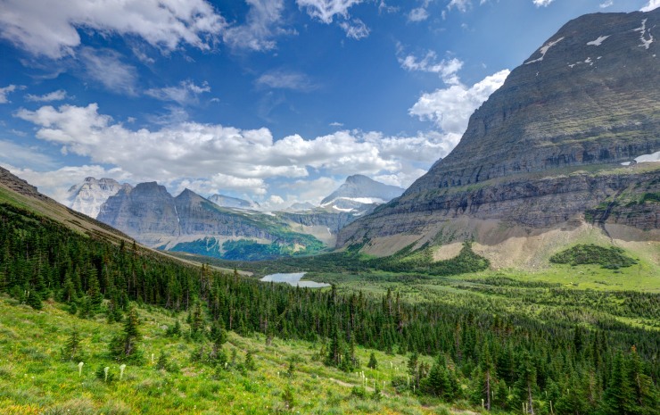
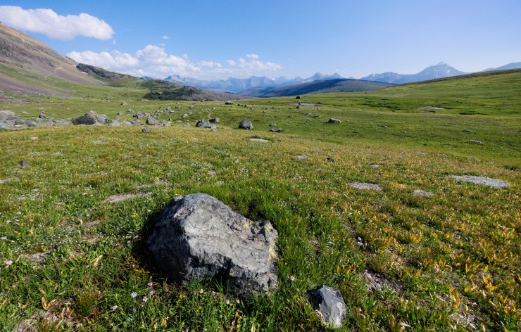
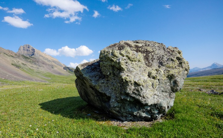
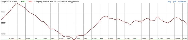
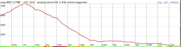
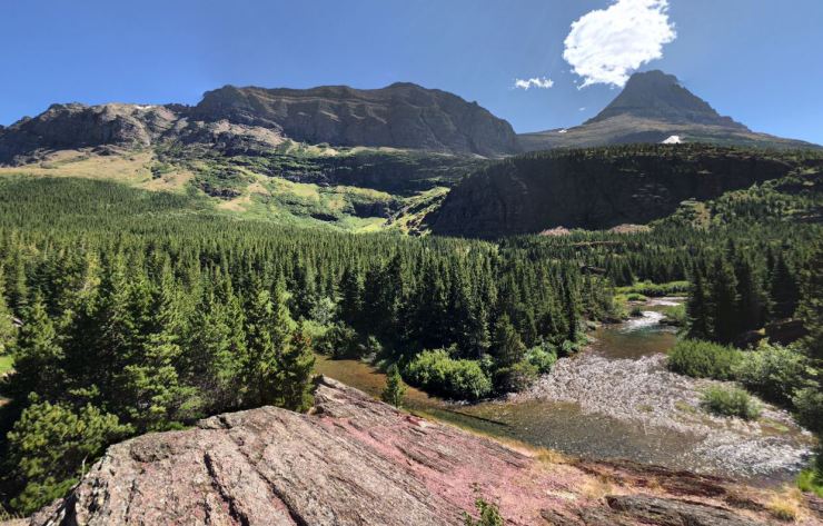
Trip Overview: The North Circle backpacking loop traverses ~52 miles within the impressive Many Glacier area of Glacier National Park. Along the route you pass through the Ptarmigan Tunnel, hike over Stoney Indian Pass and Swiftcurrent Pass, and hike along 11 miles of the famous Highline Trail, which follows the Continental Divide and provides some of the best views in Glacier National Park. The North Circle Loop has a peak elevation of 7,400 feet and you climb roughly 12,000 vertical feet over the course of the 52 mile trek. Highlights of this itinerary include massive mountains, active glaciers, wildflower blooms, alpine lakes, waterfalls, and abundant wildlife. The majority of the images in this report are from a trip in August of 2012 (captured by John Strother).

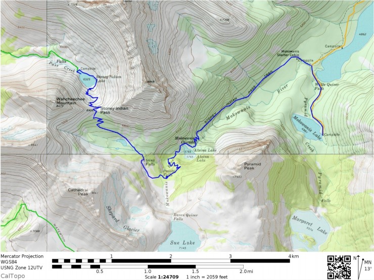
- Overall map of the Glacier North Circle Loop (PDF)
- Link to purchase topographic map of North Circle Loop area (here)
Jump to Day 1: Many Glacier to Elizabeth Lake Foot Campground
Jump to Day 2: Elizabeth Lake to Mokowanis Lake Campground
Jump to Day 3: Mokowanis Lake to Stoney Indian Lake Campground
Jump to Day 4: Stoney Indian Lake to Fifty Mountain Campground
Jump to Day 5: Fifty Mountain to Granite Park Campground
Jump to Day 6: Granite Park to Many Glacier
Shop Sale & Clearance Items at REI.com (up to 50% off)!
Preparations:
Click here to read more about Permits
Permits: Glacier National Park is one of the most popular backpacking and hiking destinations in the United States, so permits are required for overnight camping and the number of permits issued for each day is limited. You will want to secure a permit as early as possible to do this hike if going in July, August, or early September. The peak hiking season is generally mid July through early September and many trailhead quotas fill up very early for these dates.
Approximately half of the wilderness permits for each backcountry campground are available for advanced reservation and the remaining half are saved for first-come, first-serve walk ups (you may line up at the permit station starting at 4:00am the day before your hike). If you are lucky enough to get a walk up wilderness permit, you will pay $7 per person per night in camping fees. To see available walk-up availability for today check here. Note that dispersed backcountry camping is not allowed in most areas of Glacier National Park, so your permit will specify your camping location for each night of your trip.
The best way to secure a wilderness permit is to submit a wilderness permit application for the permit lottery. Advanced reservations are available for itineraries with start dates between June 15 – September 30. To be considered in the permit lottery, you must submit your permit application between 12:00am MST and 11:59pm MST on March 15 (this was the date for 2019, but it may change slightly for future years). All applications submitted within that time frame are processed in a random order. Any applications submitted after the lottery window are processed in the order they are received. Permit applications must be submitted online (info here) and there is a non-refundable $10 administrative fee and $30 fulfilled trip request fee (refunded if you do not receive a permit). Standard group sizes are limited to 1-8 campers and for advanced reservations you are limited to hiking less than 16 miles on any given day of your proposed itinerary (this distance limit does not apply to people seeking walk-up permits).
On your application you will list your proposed trip date, entry/exit trailheads, and campsites for each night. You are encouraged to submit an alternative itinerary in case your first choice is not available. For the specific itinerary described in this report, you will enter the wilderness via Iceberg/Ptarmigan (IPE) or Many Glacier Hotel (MGE), you will exit via the Swiftcurrent Parking Lot (SCE), and you will camp at Elizabeth Lake Foot (ELF), Mokowanis Lake (MOL), Stoney Indian Lake (STO), Fifty Mountain (FIF), and Granite Park (GRN). A map showing the names and locations of the backcountry campsites is found here.
If you are able to reserve a permit and pay your fee, the next step is to pick up the physical permit the day before or the morning of your hike. You can get the permit at the Apgar Backcountry Permit Center or at one of the various Glacier National Park ranger stations. These are typically open daily from late May to late September. If you are delayed and cannot pick up your permit the morning of your hike, call the ranger station and see if they can hold your permit for you. Otherwise, your permit will be released to the general public and will likely be taken by a walk-up permit seeker. It is typically wise to plan to arrive the day before your trek is schedule to start so that you have ample time to pick up your permit at the ranger station.
Click here to read more about Logistics
Logistics: To get to Glacier National Park, it is most common to drive. Visitors either road trip all the way to the park or fly into a nearby airport, rent a car, and drive to the park. Flights into Kalispell Glacier Park International Airport (FCA) or Great Falls International Airport (GTF) are typically available with one stop from most major airports. Many Glacier Campground is a ~3 hour drive from both airports. Once you are inside the park, there is a shuttle system that can be utilized.
If you would like to camp at one of the developed campsites within Glacier National Park the night before your trek, you will need to either get an advanced reservation or arrive early in the morning to try to secure a walk-up spot. There are several campgrounds in Glacier and more info on each can be found here. Many Glacier Campground is very close to the trailhead and has 41 sites available for reservation and 62 sites for first-come, first-serve campers. Info on reservations at Many Glacier Campground can be found here. Other campgrounds near the trailhead include St. Mary and Rising Sun. Note that all the campgrounds are popular in the summer, so you may need to reserve sites well (>6 months) in advance. Unfortunately this means you may need to reserve a campsite before you know whether or not you have received a wilderness permit.
Click here to read more about Weather and Trail Conditions
Weather and Trail Conditions: It is important to check the trail conditions before taking off on this trek. You can find reports on trail and wilderness conditions here. The main concerns for this itinerary are the status of the Ptarmigan Tunnel and the Ahern Drift on the Highline Trail. The Ptarmigan Tunnel doors are typically open from mid July to Late September. If you are hiking at a time when the Ptarmigan Tunnel closed, you will need to take the longer Redgap Pass Trail to Elizabeth Lake. It is not advised to attempt to climb over the Ptarmigan Wall to bypass the closed tunnel. The Ahern Drift is located south of Ahern Pass and is a steep snow drift that frequently covers a section of the Highline Trail. When this drift is large, and ice axe and snow hiking experience may be required to pass the trail. It is wise to inquire about the size of the drift before taking off on your trek.
The weather in Glacier National Park during the peak hiking season (July, August, and September) is characterized by warm days, cool nights, and occasional thunderstorms. When a storm rolls in, it is not uncommon for the temperature to drop quickly. Thus, you must be prepared for a wide range of temperatures (32-85 degrees F). Late in the season (late September-October), it is not uncommon for it to snow at high elevation. If you plan to complete the trek in late September or October, you must be prepared for rapidly changing weather and be comfortable hiking in snow. In the prime hiking season (late July through early September), the weather is typically good, but be mindful to avoid exposed, high elevation areas in the afternoon when brief storms frequently occur. Given that weather can change rapidly in the mountains, you should be prepared with different layers of clothing for different conditions.
Click here to read more about Difficulty
Difficulty: The North Circle Loop Glacier National Park is a tough overall loop with a significant amount of elevation gain. We recommend hiking the loop over 6 days as described in this itinerary. Doing so helps avoid having very long hikes over 10 miles with >4,000 feet of elevation gain. If you plan to hike this loop is 4 or 5 days, be prepared for some big climbs. The simplest way to complete the trek in 5 days is to combine days 3 and 4 of this itinerary and skip camping at Stoney Indian Lake. Since you must camp in designated sites, you will need to be flexible with your itinerary.
Supplies: In Glacier National Park, you must be prepared for a variety of conditions depending on the time of year. Up until late July, snow often remains in the high country and on mountain passes. If you are hiking this loop in June or July (before the snow fully melts) or in late September (when snow can begin to fall again), you will want to consider bringing microspikes/crampons and an ice ax. However, if the trail is clear of snow, then these are not needed.
Because of rapidly changing weather in the mountains, you will want to bring several layers so that you can easily adapt to the changing temperature and also so that you can stay dry. I also recommend having a set of wool clothes to change into at camp. Wool is great because it doesn’t pick up funky stenches as fast at cotton or synthetic clothes. It also dries out quickly so that you are able to stay warm even if all your gear gets soaked in a thunderstorm.
Other specific gear you will want for backpacking in Glacier National Park is related to bear safety. The park is inhabited by both grizzly and black bears. Thus, it is essential to store all food and scented items in a bear canister or to hang food properly at the campsites. For hanging, it is recommended to bring a weatherproof food bag and 25 feet of rope. It is also highly recommended for every member of your party to carry bear spray.
You may also want to pre-treat your clothes and tent with permethrin spray repellent. Doing so helps keep mosquitoes and other bugs away and reduces the amount of DEET or picaridin spray you need to carry. The permethrin treatment stays on your clothes for up to 7 washes.
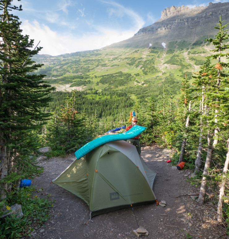
Below is a list of the gear I brought on North Circle loop in Glacier National Park:
Hiking clothes
- a lightweight hiking rain jacket (North Face Venture 2 Jacket)
- fast drying synthetic hiking pants (prAna Zion Pants)
- a quick drying long sleeve hiking shirt (Columbia Silver Ridge L/S Shirt)
- wool outer socks (People Socks Moreno 4-pack)
- thin blister preventing base socks (WrightSock double layer Coolmesh)
- quick drying synthetic boxer briefs (ExOfficio Give-N-Go)
- Gore-tex hiking shoes (adidas Outdoor Terrex Fast R Gore-Tex Shoe)
Clothes for camp
- wool leggings (Minus33 Merino Wool Kancamagus Midweight Bottom)
- wool base layer shirt (Minus33 Merino Wool Chocorua Midweight Crew)
- warm wool overshirt (Pendleton Long Sleeve Classic-Fit Board Shirt)
- lightweight down jacket (Patagonia 800-fill Down Jacket)
- lightweight camp shoes (Xero Z-Trail lightweight sandal)
Hiking gear
- topographic map (National Geographic Many Glacier Map)
- trekking poles (Black Diamond Trail Ergo Cork Trekking Poles)
- 2 liter hydration bladder (Platypus Big Zip Water Reservoir)
- 65 liter backpack (Osprey Atmos 65 Liter pack)
- water filtration system (Platypus gravity filtration system)
Camp gear
- strong tent with rain-fly (Alps Mountaineering Chaos 2 Tent)
- inflatable sleeping pad (Therm-a-Rest Trail Pro Sleeping Pad)
- sleeping bag (REI Co-op Igneo 25 Sleeping Bag)
- inflatable camping pillow (Ultralight Inflating Pillow)
- lightweight backpacking chair (Helinox Chair Zero)
- lightweight lantern (MPOWERD Luci Outdoor 2.0)
- headlamp (Black Diamond Cosmo Headlamp)
- multi-tool with knife (Gerber MDime Mini Multi-Tool)
- Ursack (Ursack Major bear bag) or bear canister (BearVault BV500)
- lightweight stove (MSR PocketRocket 2)
- lighter (BIC plastic lighters)
- 2 liter pot (GSI Outdoors Halulite Boiler Pot)
- coffee cup (GSI Outdoors Glacier Stainless Cup)
- lightweight spork (Snow Peak Titanium Spork)
- small, quick drying towel (REI mutli towel mini)
Random
- wet wipes (Stall Mates individually wrapped wipes)
- mole skin for blisters (Blister medic kit)
- lightweight trowel (GSI Sanitation Trowel)
- small amount of duct tape for gear repairs
- chapstick and sun screen
Food and drink
- a variety of my favorite dehydrated meals
- electrolyte replacement (NUUN Hydration Tablets)
- quick snacks (Clif Shot Bloks and Clif energy bars)
- instant coffee (Starbucks VIA)
- small plastic water bottles filled with whisky 🙂
……….
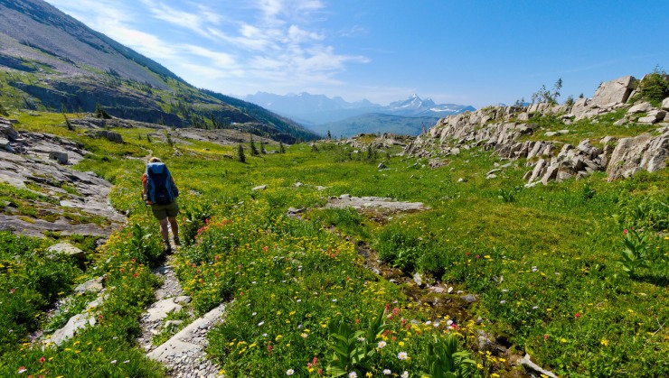
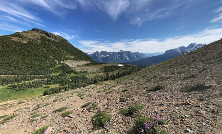
Day 1: 10 miles; +2,880 feet / -2,950 feet; Many Glacier (Iceberg-Ptarmigan Trailhead) to Elizabeth Lake Foot Campground

- Map of the Day 1 hike of the North Circle Loop in Glacier National Park (PDF)

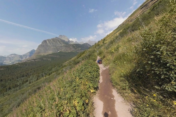
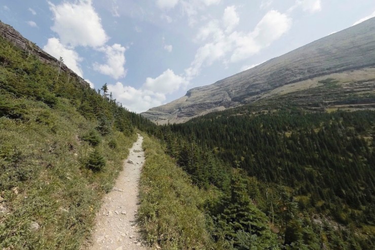
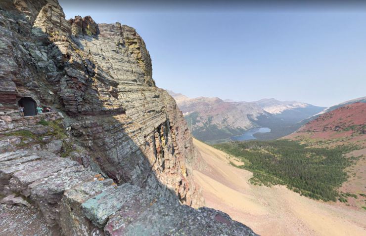
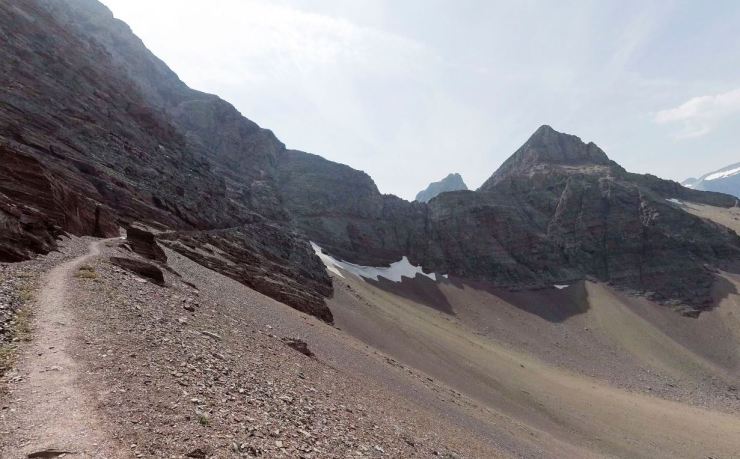
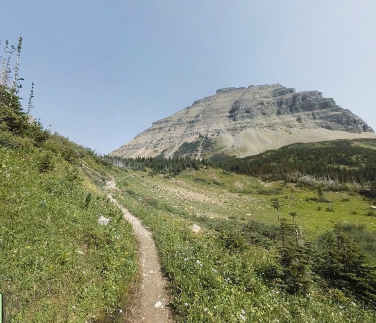
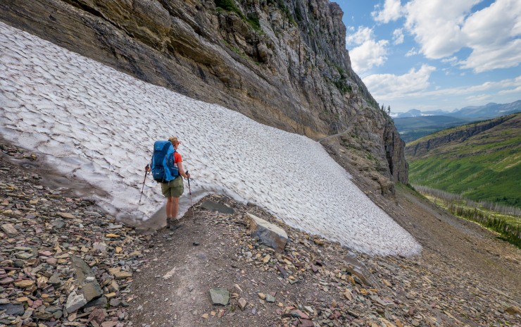
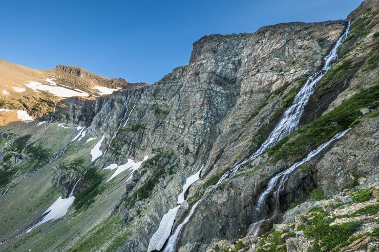
On the first day you will begin the 52 mile trek around the North Circle route. The hike starts near Many Glacier Ranger Station. If you did not pick up your wilderness permit the day before, you will need to pick one up the morning of your hike. Nearby the ranger station is the Iceberg-Ptarmigan Trailhead. The North Circle loop starts there and you begin heading north up the Ptarmigan Trail towards the Ptarmigan Tunnel. It is a roughly 5.5 mile uphill hike to the tunnel and then is another ~5 miles downhill to Elizabeth Lake. Overall this hike is quite tough, but it has some great views along the way!


……….
Day 2: 9.5 miles; +1,220 feet / -1,110 feet; Elizabeth Lake to Mokowanis Lake Campground

- Map of the Day 2 hike of the North Circle Loop in Glacier National Park (PDF)

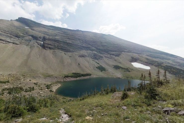
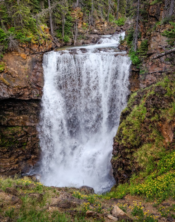
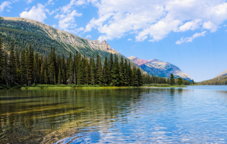
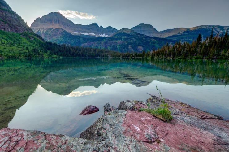
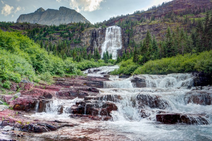
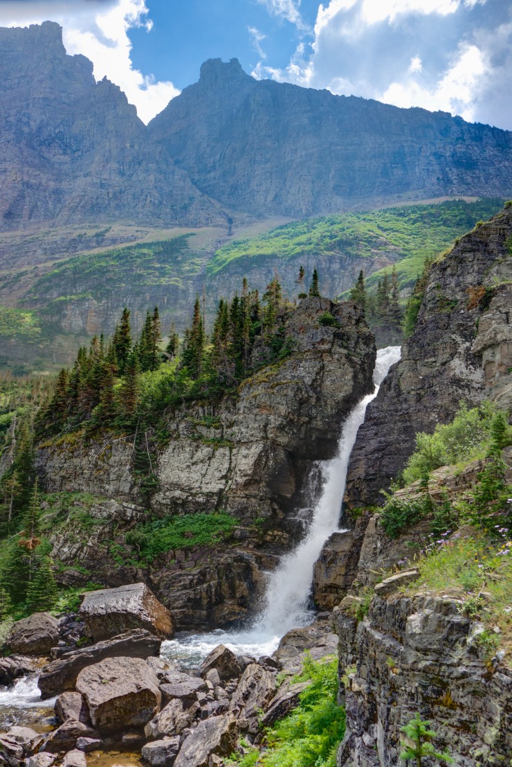
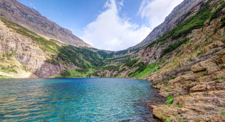
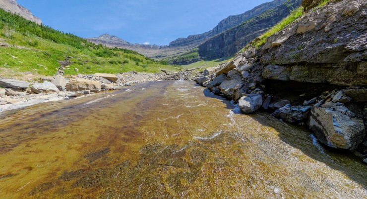
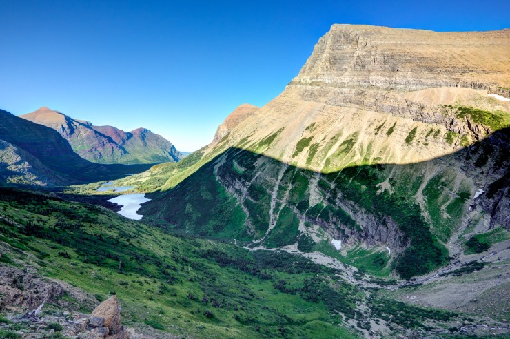
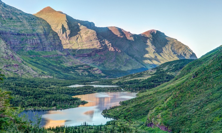
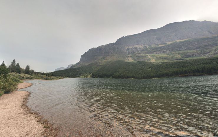
The day 2 hike is similar in length to yesterday’s hike, but is easier due to only a ~1,200 feet of climbing. This hike is very beautiful and takes you through the Belly River Valley to Cosley and Glenns Lakes. At the ~3.7 mark, you reach Cosley Lake and must ford the Mokowanis River at the lake outlet. There is a cable strung across the river that you hold to assist with the river ford. You can check the status of the trail and cable by looking at the Cosley Lake Cut-off Trail notes in the trail report here. From there you hike several miles along Cosley and Glenns lake. You then ascend up to Mokowanis Lake where you make camp for the night. Mokowanis Lake has an awesome view and makes for a great camp. If you have time after making camp, you can head off trail up to Pyramid Falls and Margaret Lake, which lie to the south of Mokowanis Lake.


……….
Day 3: 6.2 miles; +2,280 feet / -940 feet; Mokowanis Lake to Stoney Indian Lake Campground
- Map of the Day 3 hike of the North Circle Loop in Glacier National Park (PDF)
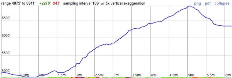
The hike on day 3 of the Glacier North Circle Loop is modest in length but involves ~2,200 feet of climbing. If you must complete the North Circle in 5 days instead of 6, then you would likely want to combine Day 3 and Day 4 into one hike (totaling ~13.8 miles and 4,600 feet of climbing). As written in this itinerary, you camp at Stoney Indian Lake Campground, which makes the hike very manageable. Since you only must hike 6.2 miles this day, you can relax in the morning and enjoy the views near Mokowanis Lake!


……….
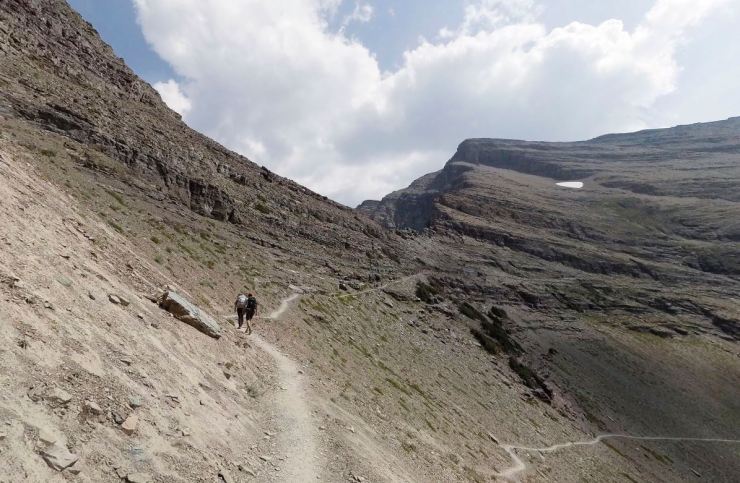
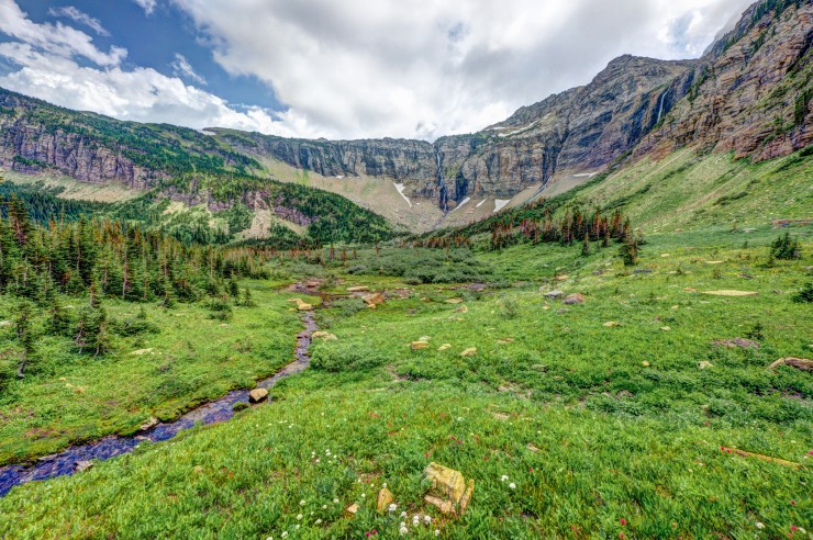
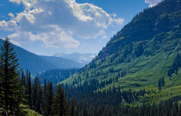
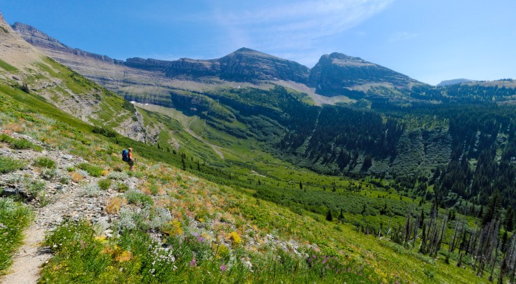
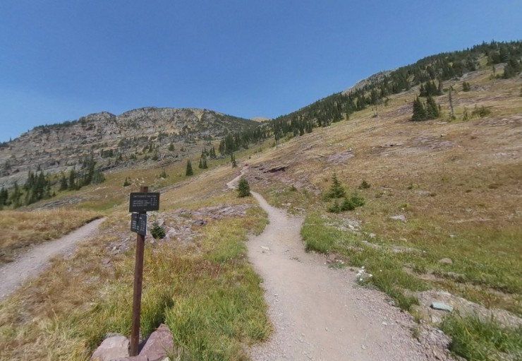
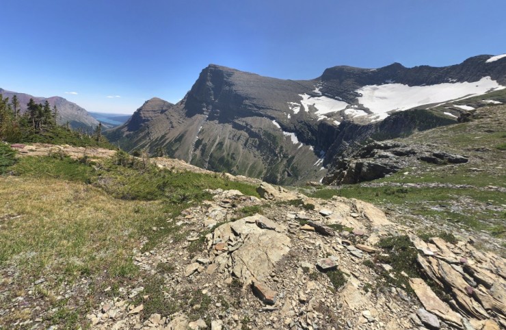
Day 4: 7.6 miles; +2,650 feet / -2,320 feet; Stoney Indian Lake to Fifty Mountain Campground

- Map of the Day 4 hike of the North Circle Loop in Glacier National Park (PDF)

The hike on the fourth day is of moderate difficulty at nearly 8 miles with ~2,600 feet of climbing. The Stoney Indian Pass Trail continues down into the Waterton Valley. From there you begin hiking on the Waterton Valley Trail as you ascend up towards the Continental Divide and the Highline Trail. The Fifty Mountain Campground sits near the junction between the Waterton Valley Trail and Highline Trail. From Fifty Mountain, you can go on a short ~2.7 mile (+1,000 feet) sidetrip to a vista point that overlooks Sue Lake. This is a worthwhile trip that can be done after setting up camp at Fifty Mountain (just be sure to properly store your food at camp before setting off).


……….
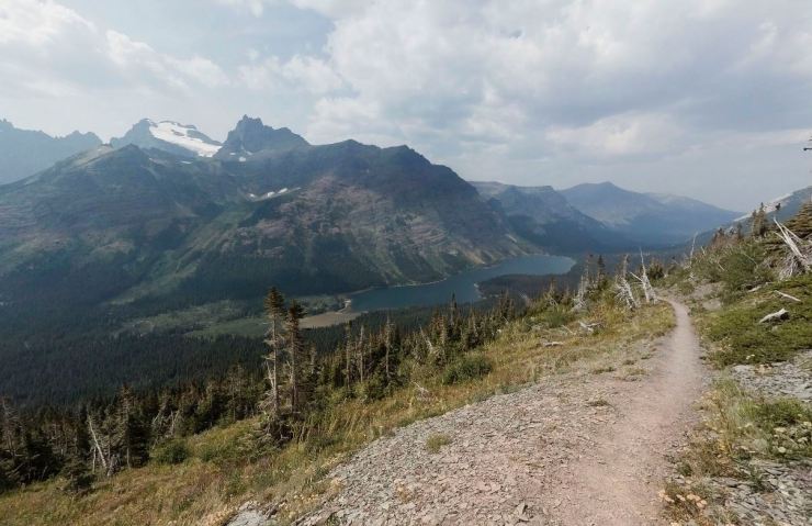
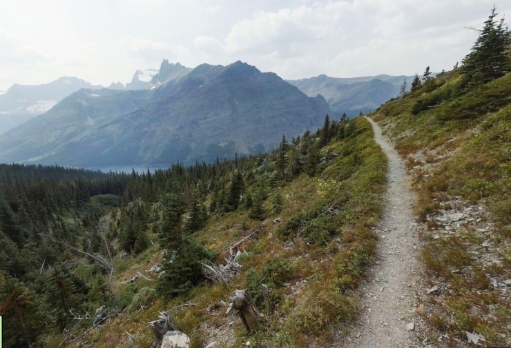
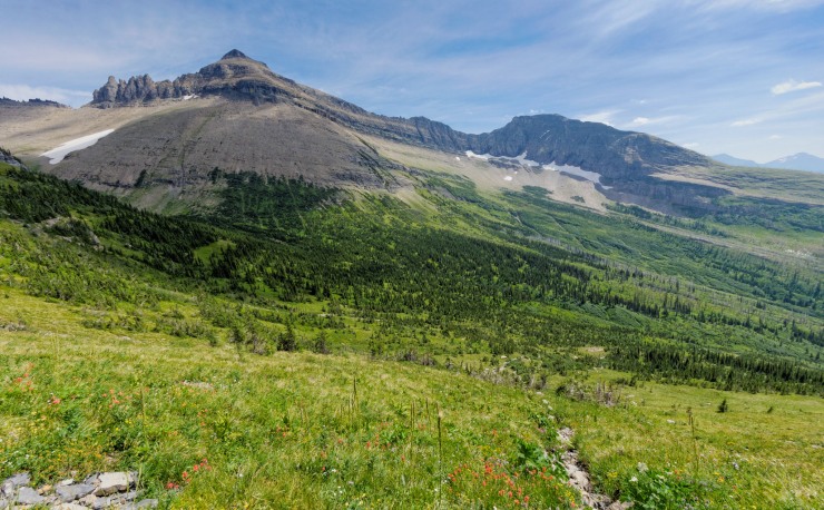
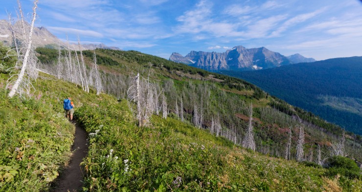
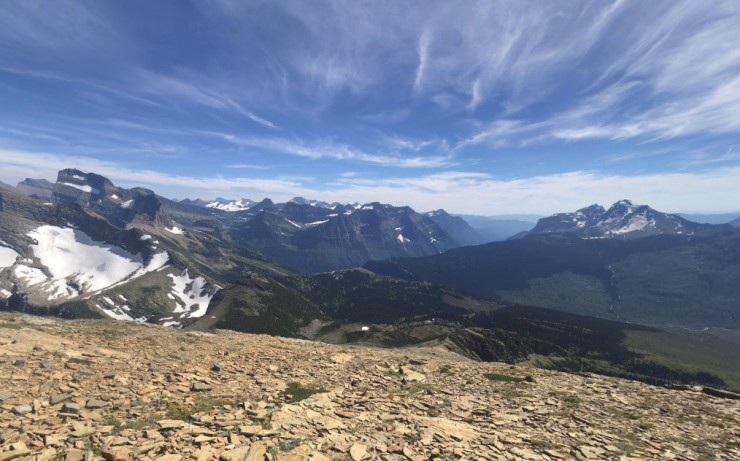
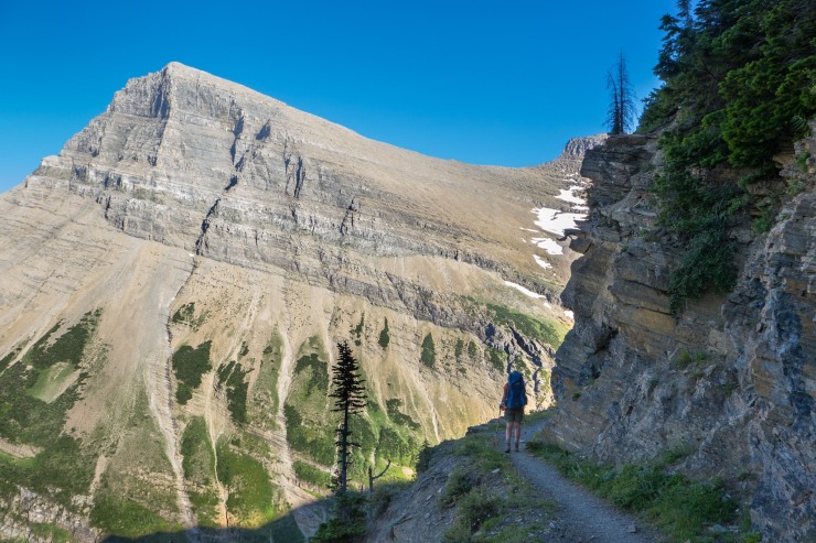
Day 5: 11.3 miles; +2,980 feet / -3,090 feet; Fifty Mountain to Granite Park Campground

- Map of the Day 5 hike of the North Circle Loop in Glacier National Park (PDF)
On Day 5, you hike along the famous Highline Trail. This is a tough hike at over 11 miles and with nearly 3,000 feet of elevation gain. The Highline Trail follows along the Continental Divide and provides great, expansive views to the west. You may encounter day hikers as you approach Granite Park at the end of the day.
Along this route, you also must negotiate the Ahern Drift, which is a steep slow drift that sits on the trail south of Ahern Pass. The drift shrinks in size throughout the summer, but can cover a large section of trail early in the hiking season. It is wise to inquire with the rangers about the status of the drift before starting your trek. If the drift is very large, an ice axe and crampons may be required to safely complete this hike. If hiking in August, the drift will likely be small enough that you can hike around it or hike directly across it.


……….
Day 6: 8 miles; +960 feet / -2,530 feet; Granite Park to Many Glacier

- Map of the Day 6 hike of the North Circle Loop in Glacier National Park (PDF)
The last hike of the North Circle Loop in Glacier National Park takes you up and over Swiftcurrent Pass and then descend back to the Many Glacier area where you started the loop. This hike is very beautiful with expansive views and several lakes. Along the route you also have the option to summit Swiftcurrent Mountain, which tops out at 8,436 feet. Doing this side trip adds 2.75 miles and 1,300 feet of elevation to the hike.


Here are some similar trip reports!
- Sequoia National Park – Mineral King Area – Sawtooth Pass and High Sierra Trail (45 mile loop)
- Rocky Mountain National Park – Continental Divide National Scenic Trail (45 mile loop)
- Rae Lakes Loop – Kings Canyon National Park Backpacking (41 mile loop)
- Teton Crest Trail – Grand Teton National Park (48 mile loop)
- Yosemite Highlights Loop – Yosemite National Park (40 mile loop)

Truly a classic rocky mountain itinerary! I hiked a similar loop in 1999 and looking through these pictures brought back some great memories. Thanks for the reminder
LikeLike
Amazing! How long did it take you?
LikeLike
Hi Matt – 6 days / 5 nights to do it at a pace with most days at 10 miles or fewer!
You can do it in 5 days with one really tough day. For anything faster than 5 days, you would need to be in really good shape!
LikeLike
Gorgeous photos….. love me some Glacier national park!
LikeLike
Your write-up is terrific! Do you think it’s likely to get a walk up permit second week of September?
LikeLiked by 1 person
Hi Amy – I think if you are at the permit station very early the day before you want to start the hike, the chances are decent! There are fewer crowds in mid September so the permit competition will be less fierce. Note that the weather can start to get a little more iffy as you get further into September though.
LikeLike
Hey, Excellent report and excellent photos! I am doing this trip at the end of August. Only difference is Glenns Lake Head (GLH) for Mokowanis Lake (MOL) campsite on the second night. Looks like we’ll want to do a sidetrip to MOL. I saw a photo of someone walking in a stream and a separate photo of covered toe sandals. Is it necessary to pack footwear for stream crossings?
LikeLike
Hi Brian – If you have the energy, a side trip to Mokowanis Lake after setting up your camp at Glenns Lake Head sounds like a good idea!
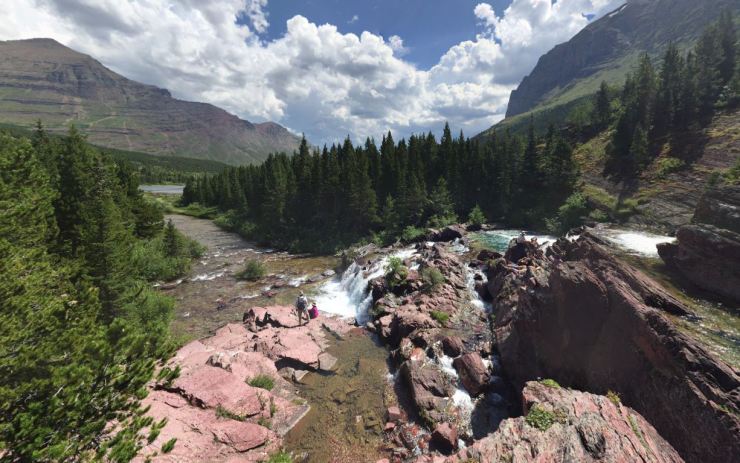
Along the trail, there are a couple stream crossings. The biggest one is where you must ford the Mokowanis River at the east outlet of Cosley Lake. This crossing is fairly wide (~100 feet) and can be a couple feet deep at the deepest point. There is a metal cable strung across the river that you use to stabilize as you cross. For this crossing you will definitely need to remove your hiking boots or they will get soaked. There is also a modest stream crossing near Stoney Indian Pass. For most of the other crossings, there were bridges.
Whether or not you bring specific shoes for the crossings or go barefoot is really a personal preference. I prefer to wear sandals while crossing because I am a bit of a baby when it comes to stepping on rocks while barefoot and like the comfort of not needing to worry about getting cut on a sharp rock. You could probably get away with going barefoot if you are pretty stable and strong though. I like teva type sandals (but not tevas because those are quite heavy) for crossing because they double as great camp shoes.
Hopefully that helps ya – have a great trip!
LikeLiked by 1 person
Hi!
I just completed the Glacier north circle loop like your trip report. I was wondering if I could get a copy of the GPS trails you used for making your maps. We did the trip in the opposite direction and would like to get the correct elevation maps based on the trails.
Thanks!
LikeLike
Hi Greg – Hope you had a great trip. You can export the clockwise route gpx track data from the map found here: https://caltopo.com/m/DGPE
To get the gpx data, you hover the cursor over the “Export” button at the top of the page and then click “Download GPX File”. You can download individual day hikes or can download them all. Note that the GPX data will not have timestamps on it though.
To just look up the elevation profile for one of the tracks, click on the data series and then click on “Terrain Statistics”.
To print out maps, hover over “Print” on the top of the page, click “Print to PDF or JPG”, resize and position the big red box to where you want the map to be, and then generate either a PDF or JPG map.
I hope that helps you out!
LikeLike
Is there a counter clockwise caltopo map. I would hate to reinvent
LikeLike
Hi! I loved reading through this and have been considering this route for years. One logistical question for you is regarding getting to/from the trailhead. We would be traveling from Eastern US and wonder what the options are and what is the best airport to fly in to. Thanks.
LikeLike
Most people either drive all the way to the park or fly into Kalispell Glacier Park International Airport (FCA) or Great Falls International Airport (GTF) and then rent a car and drive. I think the option for you will just depend on the cost of flights (and flight schedule) and the rental car!
LikeLike
Hey there! My brother and I will be hiking this route the first week of August. I was wondering if you could tell me about access to water at campsites? We’ll each be carrying 5.5L each day, but I’m curious about how heavily I’ll have to rely on a water purifier and iodine tablets.
LikeLike
Each campsite should have a water source fairly close by (either a lake, river, or stream). If you are worried about sources drying up by August, you can give the ranger station a call a week or so before your trip, to verify if any key water sources for your route are dry.
5.5L of water each is a lot of water to carry! I prefer to carry 2-3L and use a filter to purify water along the way if need be. For the North Circle route, you are unlikely to hike for more than 5 miles without passing by a water source you could fill up at.
To summarize, you should be able to use your purifier to refill water at each campsite and should have ample opportunities to refill at streams along the trail between campsites. Definitely bring a filter/purifier or iodine tablets though. There is not potable water supplied at the backcountry campsites.
LikeLike
Hey, just wanted to say thanks for posting on this blog! It’s awesome to read about these trips, and I’ve done a few of them myself since discovering the blog!
A couple of friend and I are planning on visiting Glacier National Park in September. Any recommendations for getting to the park? Are there any options to fly into the park or do you need to fly into a nearby city?
Thanks in advance.
LikeLike
Hi Ethan,
Thanks for the note. To get to Glacier National Park, it is most
common to drive. Visitors either road trip all the way to the park or
fly into a nearby airport, rent a car, and drive to the park. Flights
into Kalispell Glacier Park International Airport (FCA) or Great Falls
International Airport (GTF) are typically available with one stop from
most major airports. Many Glacier Campground is a ~3 hour drive from
both airports. Once you are inside the park, there is a shuttle system
that can be utilized.
Hope that helps
LikeLike
Thanks much for the detailed post! We’re aiming to do the same loop in a couple weeks. I’ve been planning on doing it clockwise, though – any special reason why you chose to go CCW?
LikeLike
The views should be good in either direction and the elevation is tough either way. We went CCW due to campsite availability primarily. I also was hoping we could get away from the crowds by hiking to Elizabeth Lake straight away. The section between Many Glacier and Granite Park gets a fair number of day hikers, so it would probably be a busy first day.
LikeLike
I did this loop back in 1992. Changed me forever. My kids are now old enough and we will be doing this in 2021.
LikeLike
Do you think it’s possible to do this loop in 4 days instead of 5 or 6? I was wondering about a 10 mile day to start, followed by a couple 15 mile days and then 10-12 to finish. Thoughts?
LikeLike
Hi Drew – It is definitely possible to do the loop in 4 days. Combining day 3 and 4 in my itinerary and skipping Stoney Indian Lake Camp is maybe the most obvious solution. Just be sure to be fit and in good hiking shape (used to being on your feet). Doing the loop in 4 days means every day will be at least 10 miles and have a decent amount of climbing.
LikeLike
Hey, my brother and I were planning on hiking this loop in late July. Should we be worried about the stream crossings, and snow on the steep trails. We are really eager to go, but we still want reassurance that the trail is safe.
LikeLike
Hi Cole – Unfortunately, it’s hard to say! It all depends on snow levels this winter and how fast things melt out in the Spring and early Summer. My best advice is to keep an eye on snow levels in the Spring and give the rangers a call in June to see their opinion.
LikeLike
And we were also wondering what the temperature would be like at night. We currently have 20 degree bags, do we need 0 degree bag to make the nights sleep comfortable?
LikeLike
I think 20 degree bags would be ok assuming you are sleeping in a tent. I assume you will bring some good base layer clothing because it will be chilly at dinner time, so you can also wear some of that clothing while you sleep. If you are a cold sleeper, you could opt for a 0 degree bag or could buy a sleeping bag liner to be extra safe. For a women, a lower temp bag is probably smarter since they are usually cooler at night.
LikeLike
I am a hammocker and was wondering if you thought there were enough trees in the campsites you stayed in to hang a hammock nightly? Thank you in advance for thoughts on hammock camping and for a very informative post about this trip. 🙂
LikeLike
Any chance park officials would make an exception for a group size that exceeds the normal capacity for a campsite? We’re planning a larger trip with 12ish people.
LikeLike
Hi Henry – my guess is that they will not accept any permit requests for a group larger than 12. One option would be to split up into two groups and have each group get their own permit. Technically this is not allowed though, so you would want to check-in at the ranger station separately and not tell the rangers that the two groups are in fact together.
LikeLike
Hello, great report! Thank you. Could you please note how many hours approximately you hiked each day? I’m from NH and hike in the White Mountains where I can do 10-14 mi/day depending on terrain with a pack weight of 15-20lbs. These trails are very different and I’m trying to get a better gauge how many miles I can do in a day.
LikeLike
Hi Dan – it’s hard for me to give a precise estimate since every is different. The trails in glacier are quite steep, so they can be tough. I would budget at least 30 minutes per mile plus time for your snack breaks.
LikeLike
I really want to do this loop in August but I know permits can be tough to get. I live out of state so I don’t know the area well can you suggest any almost as good back up routes to put as alternates?
Also is there any way to shorten this loop if I don’t end up with five days off?
LikeLike
Hi Jenny – There is not a great way to short this specific loop. About the only way to shorten would be to do an out and back hike rather than completing the full loop. For example you could hike to Elizabeth Lake and back or you could hike to Cosley Lake and back.
For a backup itinerary, this point-to-point hike in Glacier is also very nice. Just note that you will need to use a shuttle, have two cars, or hitchhike to travel from the starting point to the ending point. https://backpackers-review.com/trip-reports/gunsight-pass-and-lake-mcdonald-glacier-national-park/
LikeLike
Do you have any information on which permits to secure an any alternate trips as back up? I don’t know this area while and I know they are hard to get
LikeLike
Last summer my group tried for the North Circle and couldn’t get it, but got our second choice. It was INCREDIBLE. Only negative is, it’s not a loop, so we had to have our car moved or catch a ride (which is very doable). Our route was:
Start – Two Medicine
Night 1 – Morningstar Lake
Night 2 – Red Eagle Lake Foot (the Foot is much better than the Head, we got lucky)
Night 3 – Reynolds Creek
Night 4 – Lake Ellen Wilson
Exit – Sperry Trailhead by Lake McDonald.
Amazing route. Some great climbs (Pitamakin Pass, Triple Divide Pass, Gunsight Pass), waterfalls never ending, and some of the best campsites in the park. Red Eagle Foot and Lake Ellen Wilson stand out.
LikeLike
I’m thinking of doing the itinerary you describe above. The total group of 6 people (4 one-person tents and 1 two-person tent). Are there enough tent pads for the campsited listed in the article?
LikeLike
Hi Gilbert – you will want to call the ranger station to get a for sure answer, but based on the backcountry map I think you would not have enough space for 5 tents unless you are luck enough to reserve a lot of sites. The number of sites per campground is: Elizabeth Lake Foot (5 sites), Mokowanis Lake (2 sites), Stoney Indian Lake (3 sites), Fifty Mountain (5 sites), and Granite Park (4 sites). Each site is limited to 4 campers and 2 tents. Hope that helps!
LikeLike
How cold is it in this loop compared to something like the Rae lakes loop? I did all of Rae in bedrock sandals just fine in august, is the temperature comparable in the north circle loop in august? Thanks!
LikeLike
In early August, I would expect warm average temperatures (high 70s and 80s) in Glacier National Park, though temps can start to drop in late August. I think it would be somewhat similar to the Rae Lakes loop weather. The main difference is that you can likely expect more weather variability in Glacier National Park (compared to King’s Canyon). Often with California backpacking, you will not see any rain or storms. In the Rockies, you will want to bring some layers because there are frequently afternoon storms and the temperature will quickly drop when the storms rolls in.
LikeLike
Hello – thank you for providing the fantastic information. Are you aware of how much mileage and elevation gain would be added if you were to hike to the Grinnell Glacier overlook on the final day of your itinerary? Thanks again
LikeLike
It is about 2 miles and +1,000 feet of elevation one way if you start from Granite Park and hike up to the glacier overlook.
LikeLike
Would you recommend this trip for a 9 yr old and a 11 yr old with parent?
LikeLike
Hi Doug – sorry for the super late reply. I’ll be honest… this is a tough route with a lot of elevation change. If you are bringing an 9 and 11 year old, I would be sure they can do 10+ mile hikes with backpacks on without much issue. Ultimately it’s hard to say without knowing the children, but my guess is that this route would very tough for them and maybe not so much fun!
LikeLike
Hi there.
Another late question for you. Having done many Canadian Rockies backpacks we are now looking at this route in Glacier you have done. Living across the line in Canada we are wondering where to start from should we score a permit next year? Any thought’s?
Andrew.
LikeLike
Did this hike last week. Cattle Queen Creek is dry but cascade on north side of cirque is flowing. Two small creeks flowing between Cattle Queen and Granite Park. There is a small creek flowing at Granite Park on north end where trail maintenance crews are camping.
Nuisance deer at 50 Mountain that kept us up all night.
Wildfire smoke almost looked like fog at times. Otherwise, great trip.
LikeLike
Just wondering what you used for navigation? Did you take a compass?
LikeLike
I typically rely on a paper map and my phone. It’s always good to have a backup compass though!
LikeLike