


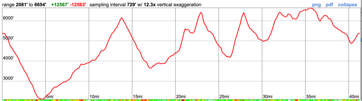
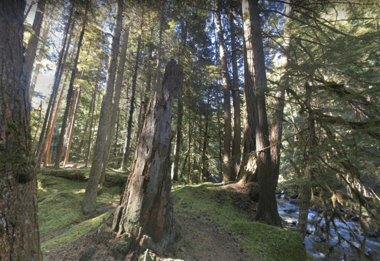
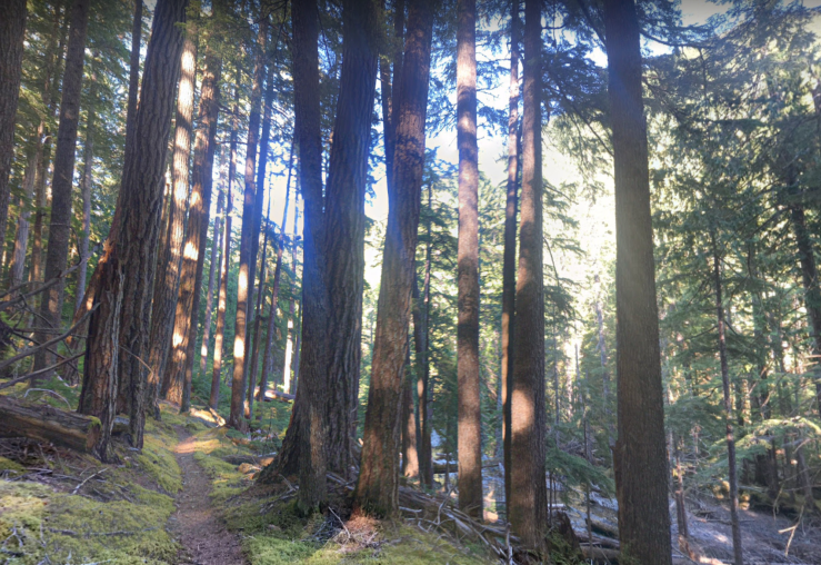
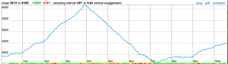
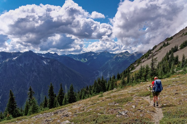
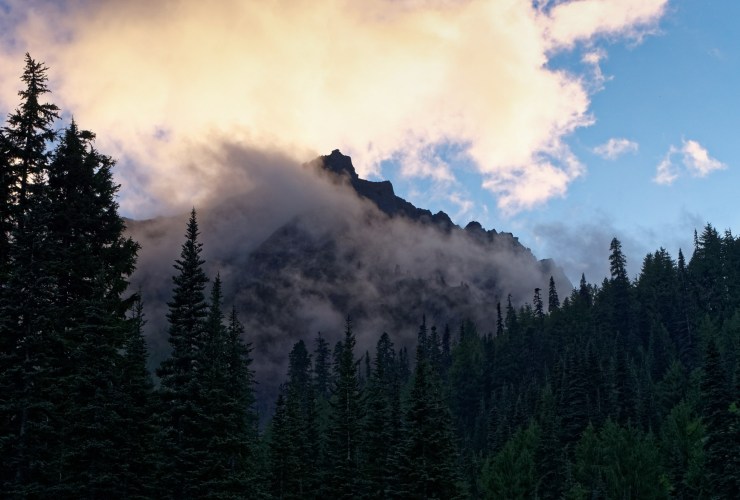
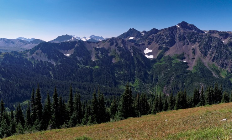
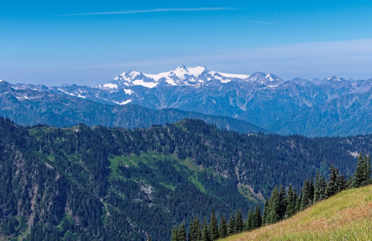
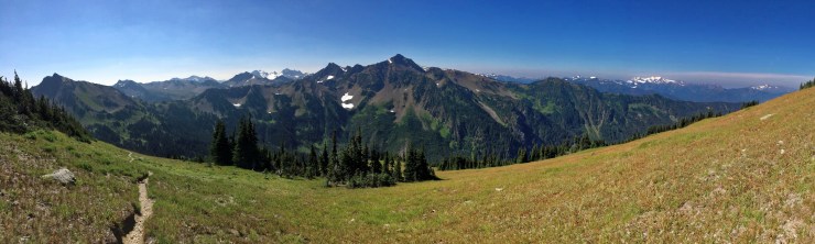
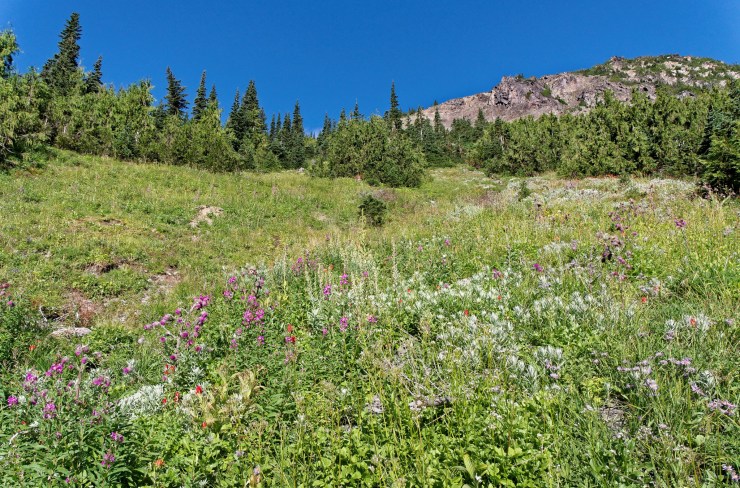
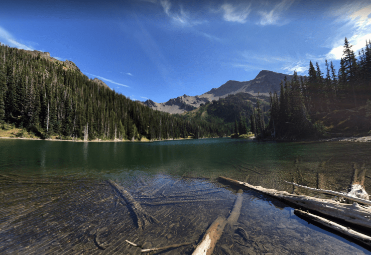
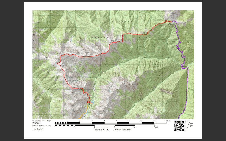
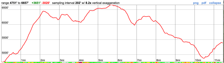
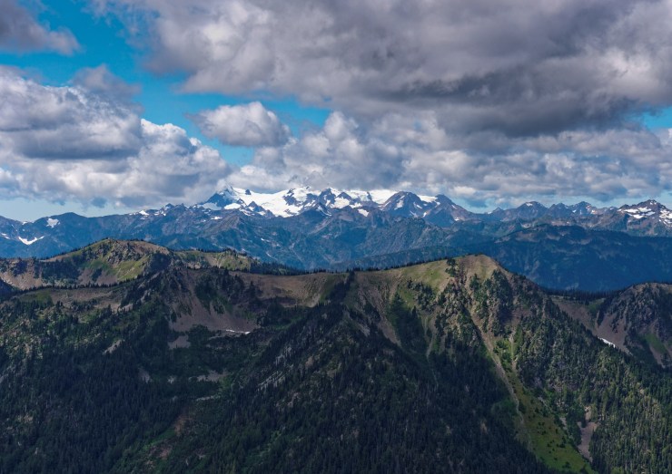
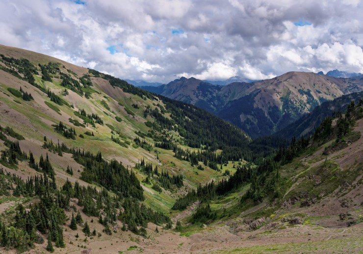
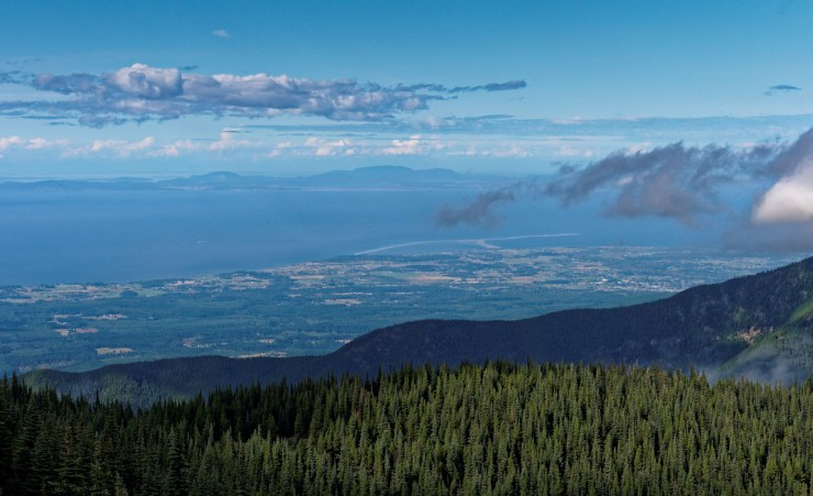
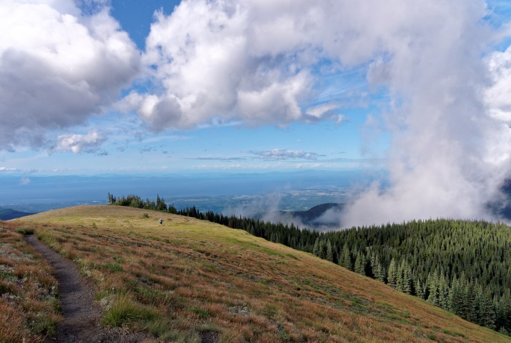
Trip Overview: The ~43 mile Grand Loop backpacking trek (aka Deer Park Loop) in Olympic National Park traverses over four mountain passes (Gray Wolf Pass, Lost Pass, Cameron Pass, and Grand Pass) and provides countless alpine views. +/- ~13,000 feet of elevation across the course of this trek with a peak elevation of 6,650 feet. Highlights include subalpine forests, glaciers and glacial-fed alpine lakes, impressive mountain peaks, and alpine meadows filled with wildflowers. This area of Olympic National Park is less crowded than several other areas, but is no less scenic. The majority of the images here are from a trip in mid August and are representative of summer conditions.

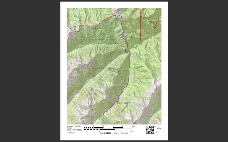
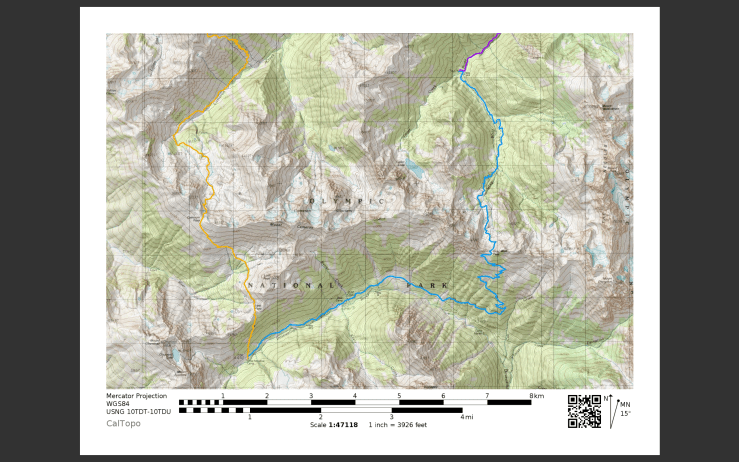
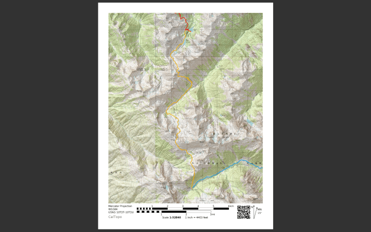
- Higher resolution version of the overall map for Grand Loop trek (PDF)
- Topographic map of Olympic National Park for purchase (amazon link)
Jump to Day 1: Deer Park Trailhead to Falls Camp
Jump to Day 2: Falls Camp to Dose Meadow Camp
Jump to Day 3: Dose Meadow to Grand Lake Camp
Jump to Day 4: Grand Lake to Deer Park Trailhead
Shop Deal of the Day at REI Outlet (up to 50% off)!
Preparations:
Click here to read more about Permits
Permits: Wilderness permits are required year round for overnight camping in Olympic National Park. Permit reservations can be made up to 6 months in advance on recreation.gov. When you book your permit, you are required to choose campsites for each night of your trip. Note that for this loop, there is no dispersed camping allowed, so you must stay at the designated campsites listed on your permit. There are quotas in place limiting the number of individuals that can stay at each wilderness camp, so plan to reserve permits in advance for be flexible with your route.
When planning your trip, you can consult this map showing the location of the various wilderness campsites. I have suggested campsites listed in this itinerary, but your ultimate itinerary will depend on permit availability.
Click here to read more about Logistics
Logistics: The 18-mile Deer Park Road, which leads to the Deer Park Trailhead is narrow and steep and the last 9 miles are gravel. Thus, the NPS notes that it is not suitable for RVs or trailers. This road is also closed from late fall until melt out in late spring, so be sure to check the status of the road if backpacking early in the year.
If you wish to camp the night before started your trek, the Deer Park Campground is located near the trailhead. This campground has 14 sites that are available on a first-come, first-served basis. There are pit toilets but no potable water available, so plan to bring water or filter/sterilize at camp. There is parking available near the campground, so you can leave your car there while on your backpacking trek.
Click here to read more about Difficulty
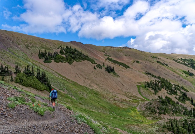
Trail Conditions and Difficulty: Backpacking along this loop is difficult given the steep trails and abundant elevation gain. Each day climbs over 2,000 feet (with one day over 4,000!), so you should be in good shape if attempting this itinerary. For an enjoyable experience, plan to spend at least 4 days hiking. That said, the trails along this loop are generally well marked and maintained so route finding is not an issue for most.
Supplies: There are black bears in Olympic National Park so backpackers are required to either use bear canisters for food storage or to properly hang their food (at least 12 feet high and 10 feet out from the nearest tree trunk). Many backpackers struggle to properly hang food, so bear canisters are preferred by park officials. If you choose to hang your food, an ursack is a good idea because it adds a second layer of protection in case a bear is able to knock your food down.
You likely will want bug spray because the mosquitoes can be out in force in certain areas of this trek (especially shortly after the snow has melted). I prefer a picaridin based spray because it does not damage plastics and synthetic fibers like high concentration DEET sprays do. I also like to pre-treat my clothes and tent with permethrin spray repellent. The permethrin treatment stays on your clothes for up to 7 washes, so it helps reduce the amount of spray you need to put on your skin.
You likely will want trekking poles since they help your knees on the steep climbs and descents and with stabilization while fording creeks.
Below is a list of the gear recommended for backpacking in Olympic National Park:
Hiking clothes
- a lightweight hiking rain jacket (North Face Venture 2 Jacket)
- fast drying synthetic hiking pants (prAna Zion Pants)
- a quick drying long sleeve hiking shirt (Columbia Silver Ridge L/S Shirt)
- wool outer socks (People Socks Moreno 4-pack)
- thin blister preventing base socks (WrightSock double layer Coolmesh)
- quick drying synthetic boxer briefs (ExOfficio Give-N-Go)
Clothes for camp
- wool leggings (Minus33 Merino Wool Kancamagus Midweight Bottom)
- wool base layer shirt (Minus33 Merino Wool Chocorua Midweight Crew)
- warm wool overshirt (Pendleton Long Sleeve Classic-Fit Board Shirt)
- lightweight down jacket (Patagonia 800-fill Down Jacket)
- lightweight camp shoes (Xero Z-Trail lightweight sandal or Teva Original)
Hiking gear
- topographic map (Nat Geo map)
- trekking poles (Black Diamond Trail Ergo Cork Trekking Poles)
- 2 liter hydration bladder (Platypus Big Zip Water Reservoir)
- 65 liter backpack (Osprey Atmos 65 Liter pack)
- water filtration system (Platypus gravity filtration system)
Camp gear
- strong tent with rain-fly (Alps Mountaineering Chaos 2 Tent)
- inflatable sleeping pad (Therm-a-Rest Trail Pro Sleeping Pad)
- sleeping bag (REI Co-op Igneo 25 Sleeping Bag)
- inflatable camping pillow (Ultralight Inflating Pillow)
- lightweight backpacking chair (Helinox Chair Zero)
- lightweight lantern (MPOWERD Luci Outdoor 2.0)
- headlamp (Black Diamond Cosmo Headlamp)
- multi-tool with knife (Gerber MDime Mini Multi-Tool)
- Ursack (Ursack Major bear bag) or bear canister (BearVault BV500)
- lightweight stove (MSR PocketRocket 2)
- lighter (BIC plastic lighters)
- 2 liter pot (GSI Outdoors Halulite Boiler Pot)
- coffee cup (GSI Outdoors Glacier Stainless Cup)
- lightweight spork (Snow Peak Titanium Spork)
- small, quick drying towel (REI mutli towel mini)
Random
- wet wipes (Stall Mates individually wrapped wipes)
- mole skin for blisters (Blister medic kit)
- lightweight trowel (GSI Sanitation Trowel)
- small amount of duct tape for gear repairs
- chapstick and sun screen
Food and drink
- a variety of my favorite dehydrated meals
- electrolyte replacement (NUUN Hydration Tablets)
- quick snacks (Clif Shot Bloks and Clif energy bars)
- instant coffee (Starbucks VIA)
- small plastic water bottles filled with whisky 🙂
……….
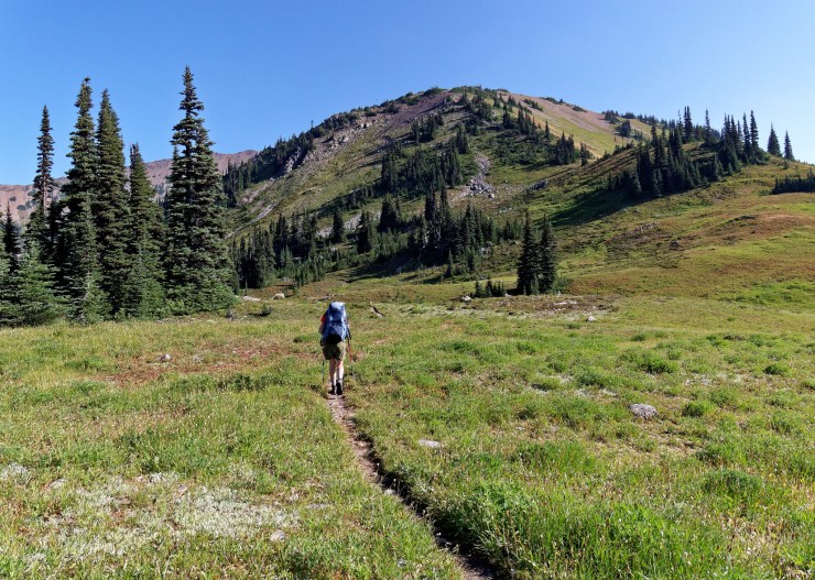
Day 1: 10 miles; +2,000 feet / -3,400 feet; Deer Park Trailhead to Falls Camp
Map of the Day 1 hike along the Grand Loop (PDF)
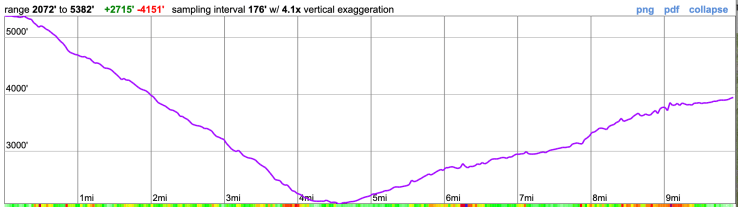
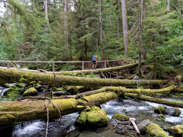
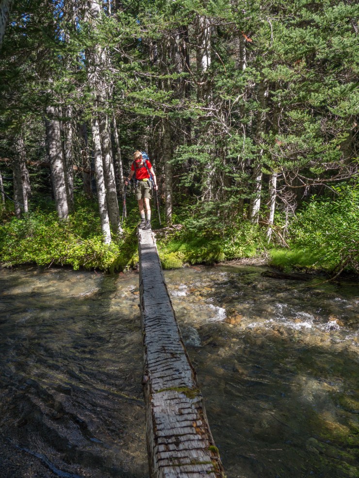
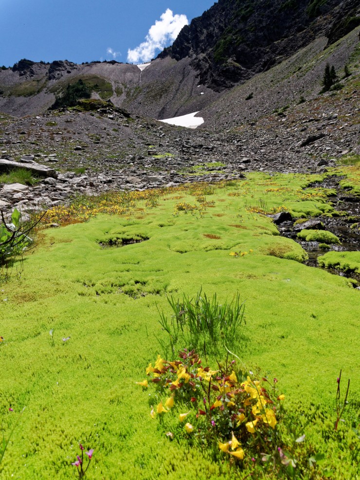
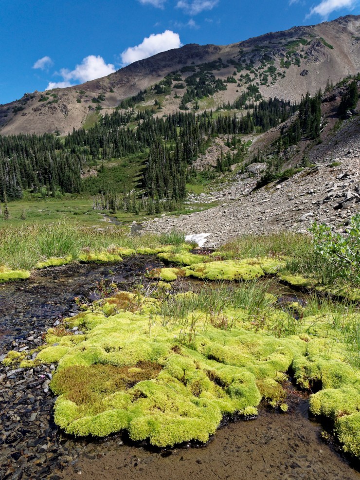
On day 1 you start with a 5 mile long and 3,000 foot descent from the Deer Park Trailhead to the intersection of Cameron Creek and the Gray Wolf River. The trail then follows the Gray Wolf River through a valley as it climbs roughly 2,000 feet in elevation over the next 5 miles. At the point you reach Falls Camp, which makes for a great first campsite. If you have extra energy after setting up camp, you can hike another 1.7 miles (one way) up to Cedar Lake for a nice view.


……….
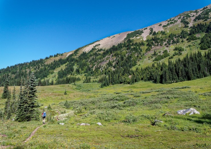
Day 2: 11 miles; +3,200 feet / -2,800 feet; Falls Camp to Dose Meadows Camp
Map of the Day 2 hike along the Grand Loop (PDF)
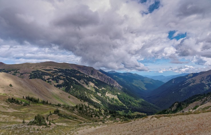
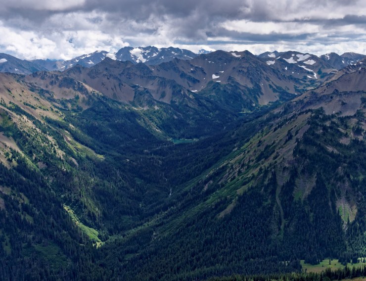
The hike on the second day takes you up over Gray Wolf Pass. In the first ~4 miles the trail climbs over 2,000 feet until you reach the top of the pass at 6,200 feet. Take in the views from the pass and rest your knees for a bit. You then begin a steep descent (into the Dosewallips River Valley) that drops nearly 2,500 feet over the next 3 miles. The trail then traverses through the valley as it follows the Dosewallips River. Along the river you will pass Bear Camp and Dose Meadows Camp, both of which make for nice campsites on your 2nd night.
……….
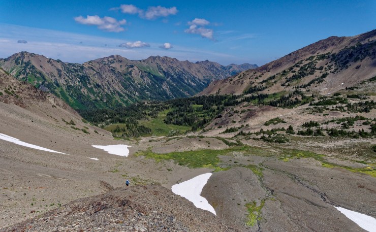
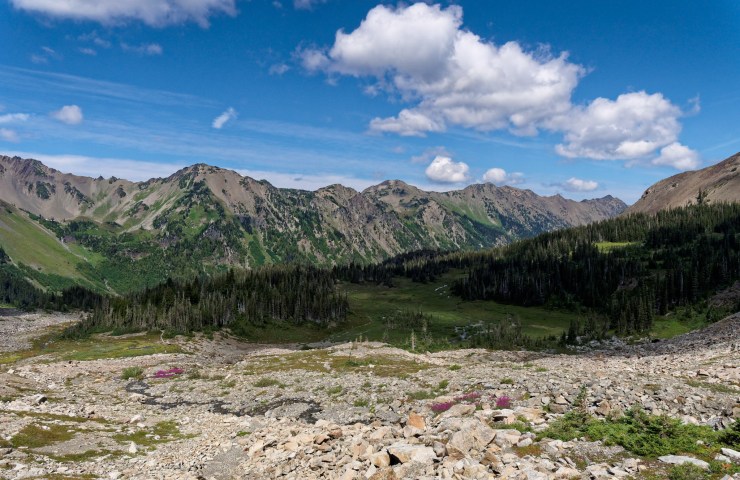
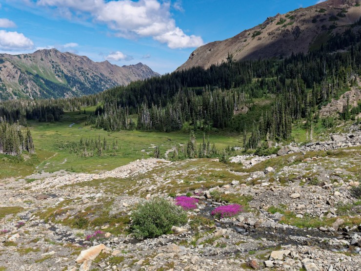
Day 3: 10.3 miles; +4,200 feet / -3,900 feet; Dose Meadow Camp to Grand Lake Camp
Map of the Day 3 hike along the Grand Loop (PDF)
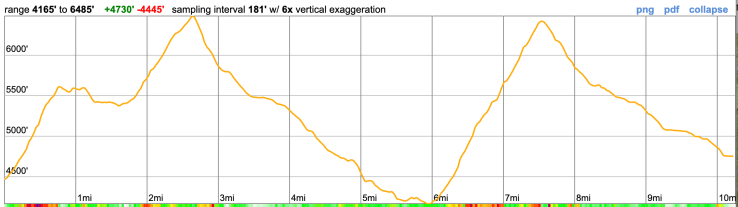
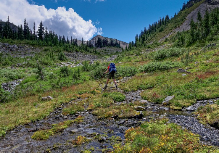
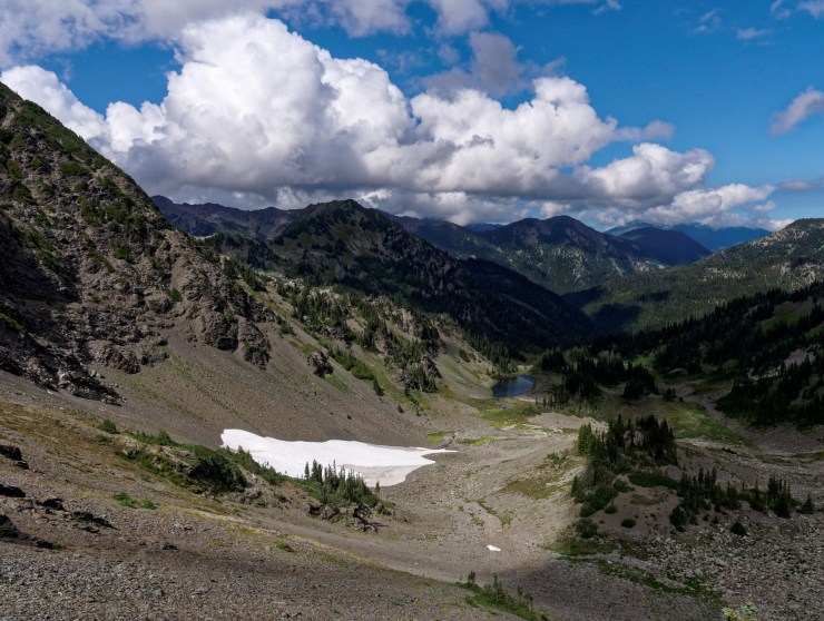
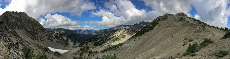
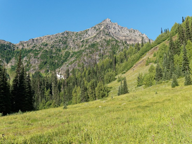
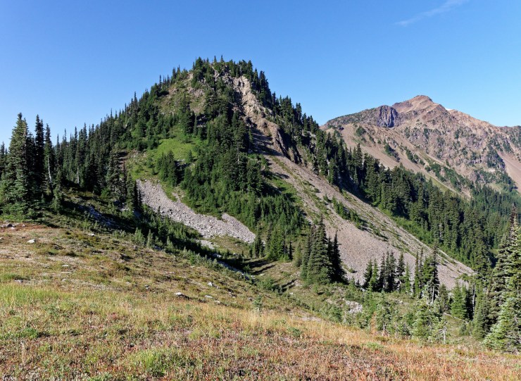
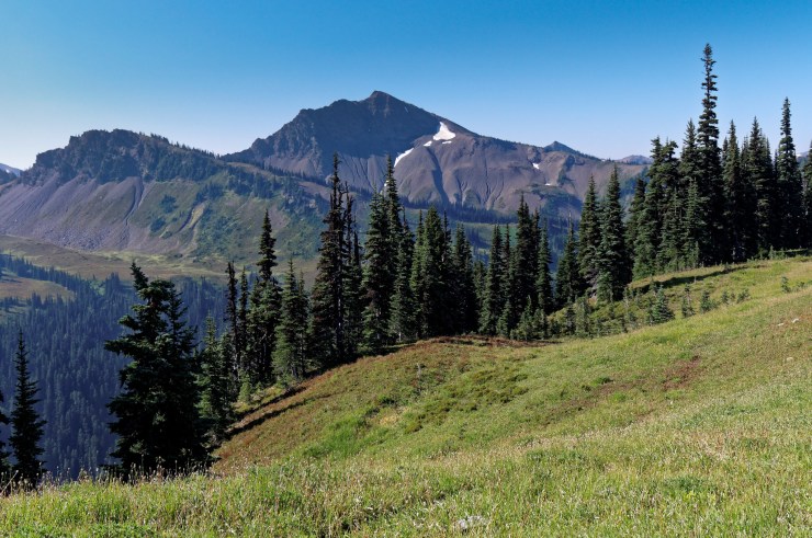
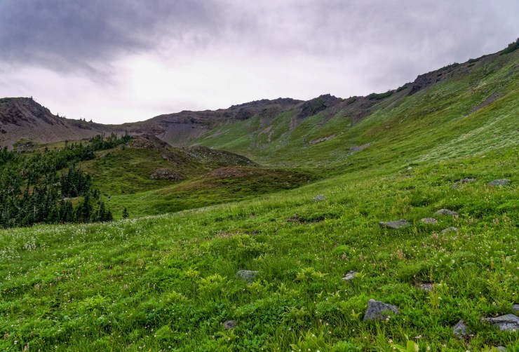
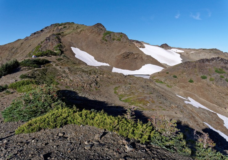
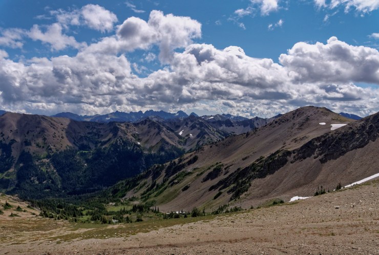
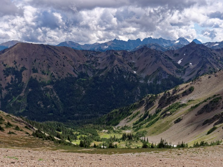
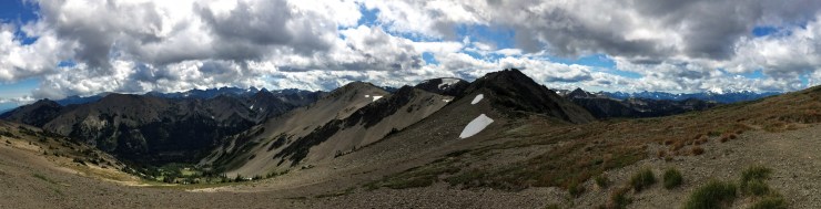
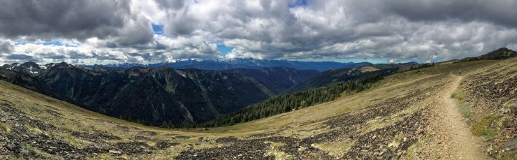
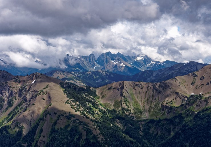
The Day 3 hike is the most difficult hike of the loop. You must hike over Lost Pass, Cameron Pass, and Grand Pass over the course of 10+ miles. From Dose Meadows, the trail immediately begins to ascend. After climbing ~1,000 feet in the first mile, you reach Lost Pass, which sits at 5,600 feet. The trail then flattens for the next mile as you traverse along the west side of Lost Peak.
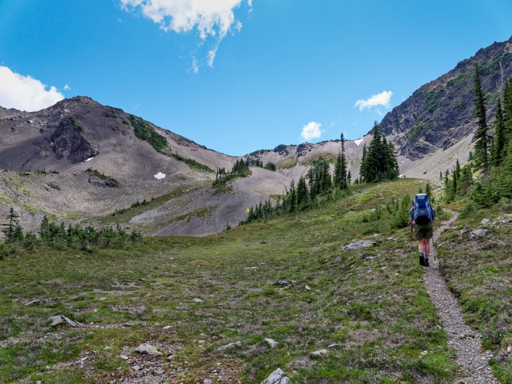
At roughly the 2 mile mark, you begin to climb again. After another 1,000 feet of climbing, you reach the top of Cameron Pass. There are some great views here, so it is a nice spot to take a break. You then descend ~2,300 feet over the next ~3 miles as the trail drops down into the Cameron Creek Basin.
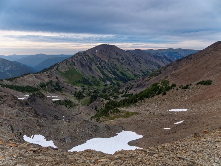
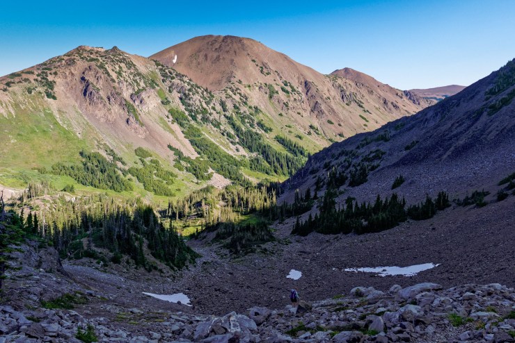
At the 6 mile mark, you start the final big climb of the day. You must climb ~2,000 feet over the next 1.5 miles in order to reach the top of Grand Pass. Again, take in the great views and then descend the final ~2.5 miles before reaching campsites at Gladys Lake, Moose Lake, and Grand Lake.


……….
Day 4: 11.4 miles; +3,200 feet / -2,500 feet; Grand Lake Camp to Deer Park Trailhead
Map of the Day 4 hike along the Grand Loop (PDF)
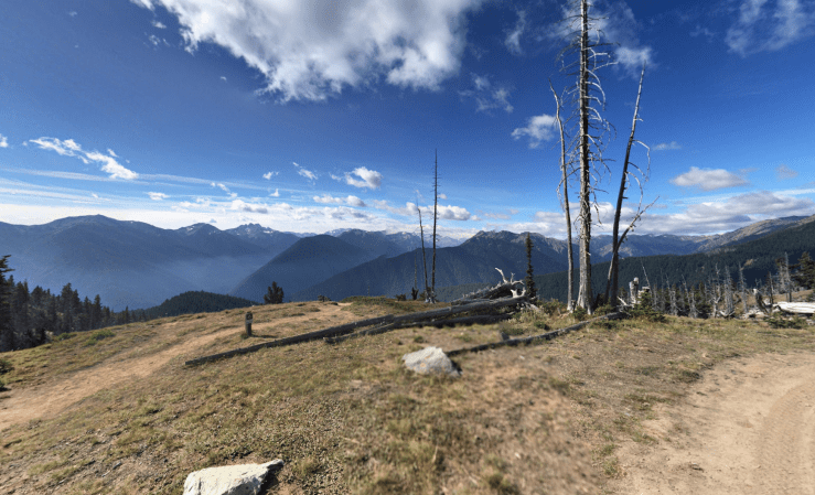
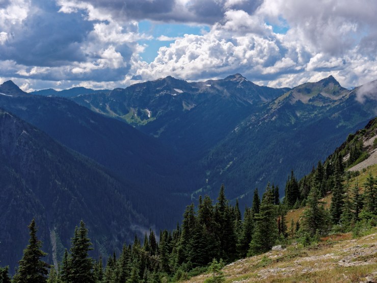
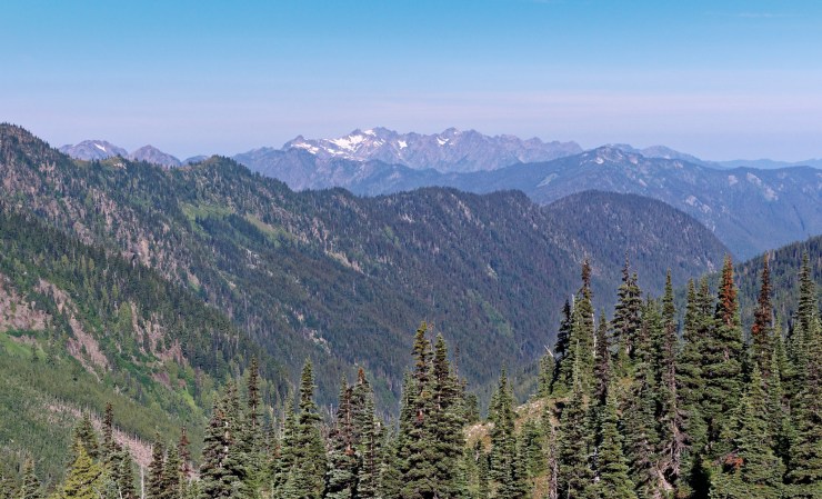
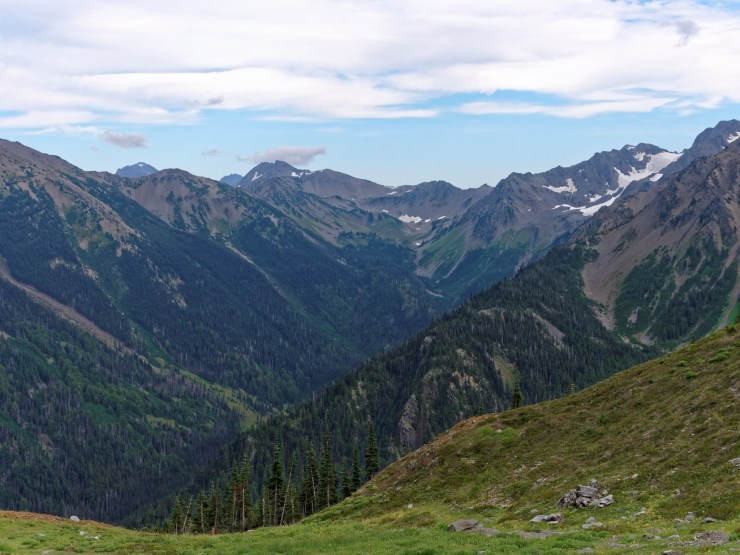
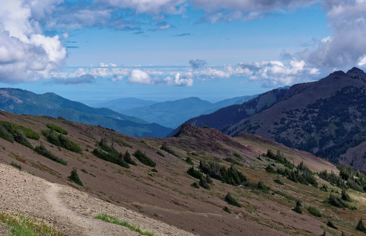
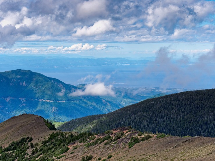
On the last day you again start out climbing… It is a ~1,500 foot climb over the first 2 miles in order to reach the top of the Hurricane Ridge. From there, the trail follows along the top of Hurricane Ridge for ~5 miles. Along the way you get nice views at Obstruction Point and you pass by Elk Mountain and Maiden Peak. From Maiden Peak it is then just another 4 miles, mostly downhill, back to the Deer Park campground.
……….
Here are some similar trip reports!
North Circle Loop – Glacier National Park (52 mile loop)
Yosemite Highlights Loop – Yosemite National Park (40 mile loop)
Teton Crest Trail – Grand Teton National Park (48 mile loop)

Nice trip report! I hiked all of this solo in the mid 1980’s across the span of 2 trips: one from Staircase to Hurricane Ridge, and another from Deer park to Deer Park via Graywolf Basin, with a side trip to Cedar Lake. I’m too old and injured now, but thank you for reliving these routes for me.
LikeLike
Thank you for the awesome trip report, photos and description. We are planning to hike this route next week and it was inspiring to read your report! Thank you
LikeLike
Excellent trip report. Looking forward to seeing the area soon. Thanks for compiling such a vivid record of your trip.
LikeLike
Decided last minute to do a trip in the Olympics instead of the Cascades due to fire. This made choosing one really easy. Thanks for the excellent documentation.
LikeLike
Love this report! I just finished this exact loop thanks to your description. I’d like to call out a couple things from my hike 9/21/2022 to 9/24/2022. I camped at Falls, Bear, and Gladys Lake. There was no sign for Falls Camp. So make sure you know what you are looking for (open rocky area to your left as you walk along the trail). The trail after Falls Camp has a lot of fallen trees and for a somewhat newbie it was a little challenging to pick back up at times. Something to be aware of. Also…cannot stress enough the challenge of day 3. Rocked me. Getting over Grand Pass was grueling. Especially after the two other passes of the day. For anyone else doing this trip, I would consider spreading it out over one more day if time permits. I found myself at camp near dusk everyday but that’s definitely related to my hiking pace. All in all, it was an incredible trip, and I’m thankful for the thorough guide on this website! Thank you!
LikeLike