


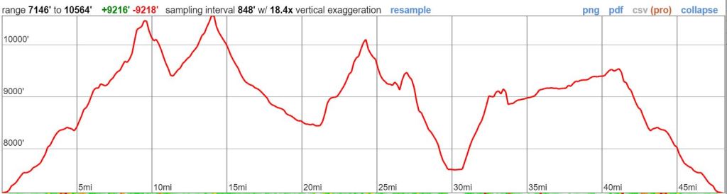
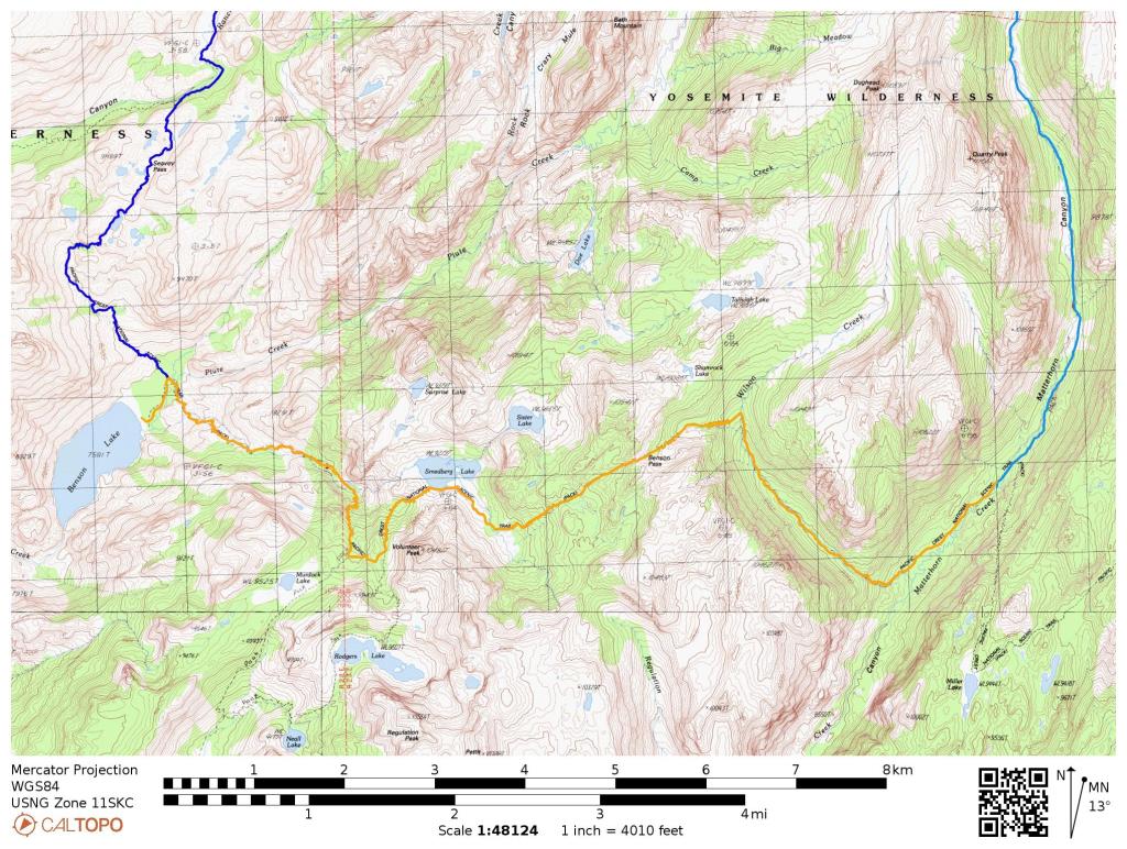
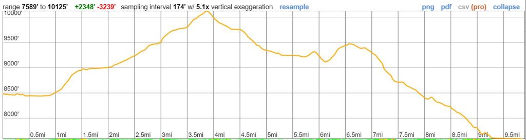
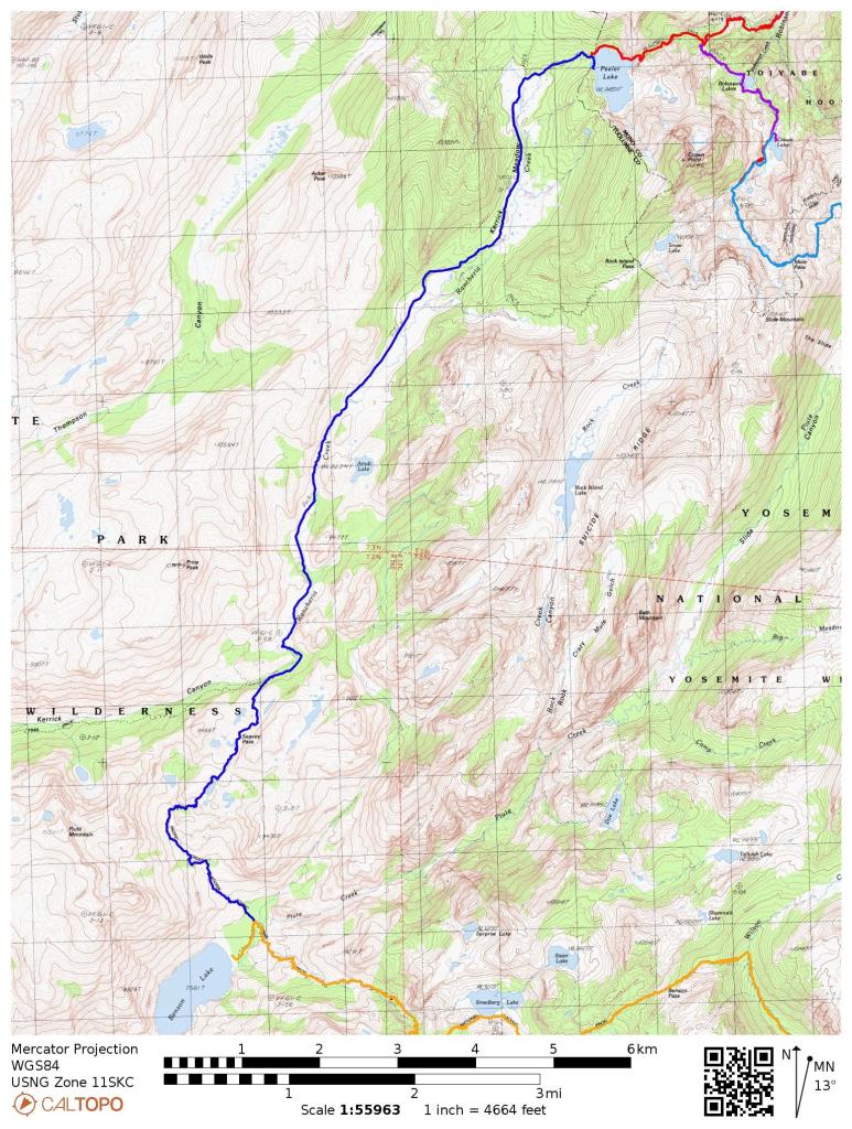
Trip Overview: This ~50 mile loop traverses through a very scenic area in the northern section of Yosemite National Park. The highlight of the trip is a stay at Benson Lake, which features a large natural sand beach and mountain views. +/- 10,000 feet of elevation across the course of this trek with a peak elevation of 10,560 feet. Other highlights include glacial-fed alpine lakes, impressive granite peaks, meandering rivers, and alpine meadows. The majority of the images here are from a trip in late July.
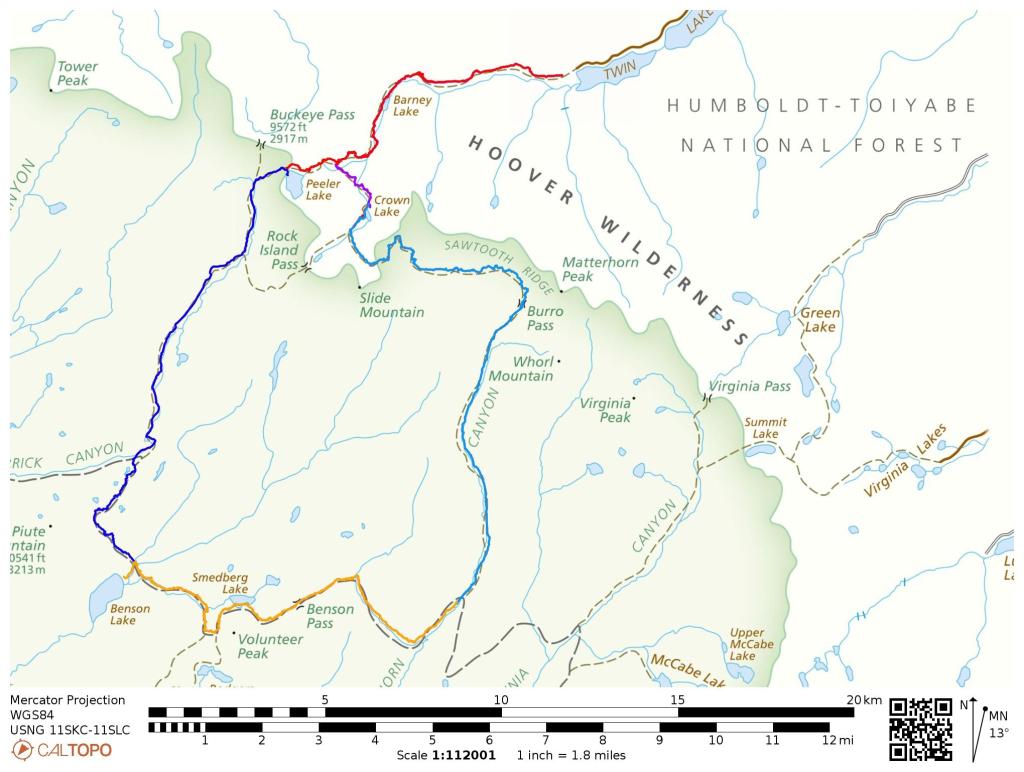
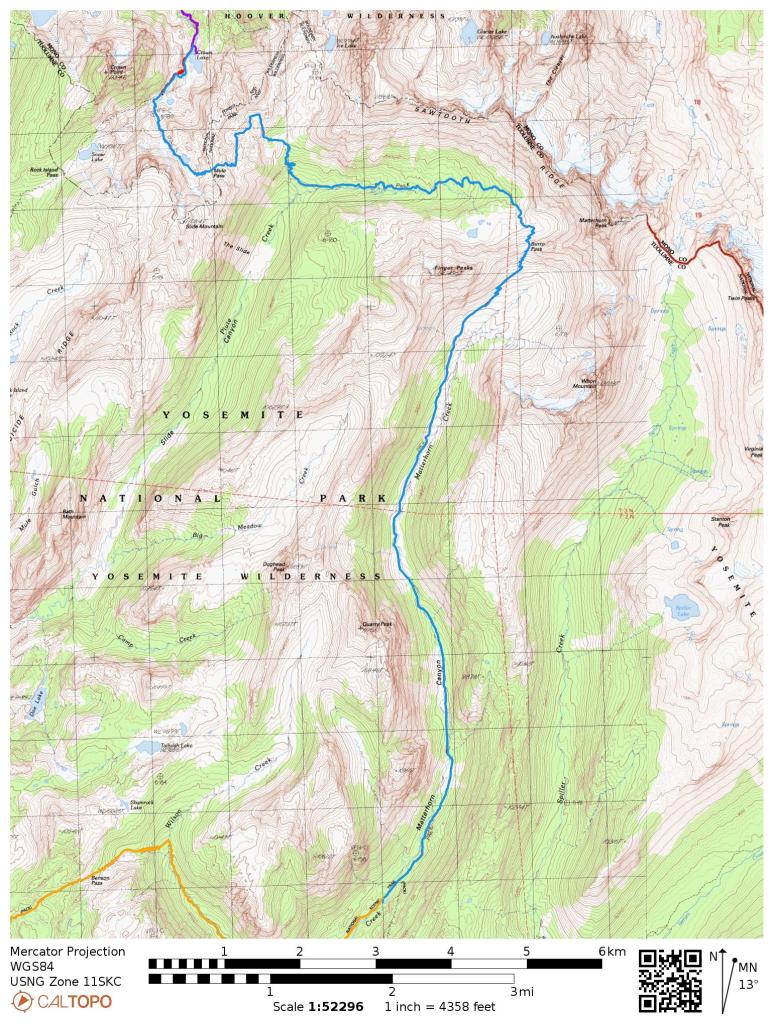
- Higher resolution version of the overall map for the Benson Lake Loop (PDF)
- Topographic map of Northern Yosemite and Hoover Wilderness for purchase (amazon link)
Jump to Day 1: Robison Creek Trailhead to Crown Lake
Jump to Day 2: Crown Lake to the Matterhorn Canyon
Jump to Day 3: Matterhorn Canyon to Benson Lake
Jump to Day 4: Benson Lake to Peeler Lake
Jump to Day 5: Peeler Lake to Robinson Creek Trailhead
Shop Deal of the Day at REI Outlet (up to 50% off)!
Preparations:
Click here to read more about Permits
Permits: Though the majority of this trek is within Yosemite National Park, the itinerary starts and ends at the Robinson Creek Trailhead in the Hoover Wilderness. Thus, you need to secure a Humboldt-Toiyabe National Forest Wilderness Permit for your trip. You do not, however, need to secure any additional permits for Yosemite National Park. From the last Friday in June through September 15, wilderness permits are limited by a trailhead quota. Each year quota season permits become available for advanced reservations six months in advance of your trip start day. During the quota season, up to one half of the wilderness permits for each trailhead are available on a first-come, first-served basis at the Bridgeport Ranger Station. On your permit, you only need to specify your start date and party size. Permits can be reserved at recreation.gov and for this specific itinerary you are starting the trek at the Robinson Creek Trailhead.
Click here to read more about Logistics
Logistics: Most backpackers choose to spend the night before their trek at Annett’s Mono Village. Here you can camp for a fee and can park your vehicle for the duration of your trek for a modest fee. There are over 250 campsites and they are available on a first-come, first-serve basis. The Robinson Creek Trailhead is located very close to the campground, so you can easily start the Benson Loop trek from here.
Click here to read more about Difficulty
Trail Conditions and Difficulty: The Benson Lake Loop itinerary is an ambition ~50 mile route with significant amounts of elevation gain. Be sure to plan a reasonable itinerary that does not cover too much distance in any given day. Our 5 day/4 night itinerary keeps the daily mileage at ~10 mile per day and should be reasonable for experiences hikers and backpackers. If you plan to finish the loop in fewer days, you should be in excellent shape or should be prepared for some pain and soreness! Overall the trail is well marked. If hiking early in the season you may encounter snow on the mountain passes, so it is wise to check snow levels before setting off on your hike.
Supplies: There are very active black bears in the Yosemite National Park, so you need to bring a bear canister to store food and scented items. Bear spray is not allowed and hanging food is illegal throughout Yosemite. If you do not own a bear canister, you can rent them from the various Wilderness Centers in the park for ~$5 per week.
You likely will want bug spray because the mosquitoes can be out in force in certain areas of the trek. I prefer a picaridin based spray because it does not damage plastics and synthetic fibers like high concentration DEET sprays can. I also like to pre-treat my clothes and tent with permethrin spray repellent. The permethrin treatment stays on your clothes for up to 7 washes, so it helps reduce the amount of spray you need to put on your skin.
Below is a list of the gear I brought on this backpacking loop in Yosemite National Park:
Hiking clothes
- a lightweight hiking rain jacket (North Face Venture 2 Jacket)
- fast drying synthetic hiking pants (prAna Zion Pants)
- a quick drying long sleeve hiking shirt (Columbia Silver Ridge L/S Shirt)
- wool outer socks (People Socks Moreno 4-pack)
- thin blister preventing base socks (WrightSock double layer Coolmesh)
- quick drying synthetic boxer briefs (ExOfficio Give-N-Go)
- Gore-tex hiking shoes (adidas Outdoor Terrex Fast R Gore-Tex Shoe)
Clothes for camp
- wool leggings (Minus33 Merino Wool Kancamagus Midweight Bottom)
- wool base layer shirt (Minus33 Merino Wool Chocorua Midweight Crew)
- lightweight down jacket (Patagonia 800-fill Down Jacket)
- lightweight camp shoes (Xero Z-Trail lightweight sandal)
Hiking gear
- topographic map (Tom Harrison Yosemite Hoover Wilderness Map)
- trekking poles (Black Diamond Trail Ergo Cork Trekking Poles)
- 2 liter hydration bladder (Platypus Big Zip Water Reservoir)
- 65 liter backpack (Osprey Atmos 65 Liter pack)
- water filtration system (Platypus gravity filtration system)
Camp gear
- strong tent with rain-fly (Alps Mountaineering Chaos 2 Tent)
- inflatable sleeping pad (Therm-a-Rest Trail Pro Sleeping Pad)
- sleeping bag (REI Co-op Igneo 25 Sleeping Bag)
- lightweight backpacking chair (Helinox Chair Zero)
- headlamp (Black Diamond Cosmo Headlamp)
- multi-tool with knife (Gerber MDime Mini Multi-Tool)
- bear canister (BearVault BV500)
- lightweight stove (MSR PocketRocket 2)
- lighter (BIC plastic lighters)
- 2 liter pot (GSI Outdoors Halulite Boiler Pot)
- coffee cup (GSI Outdoors Glacier Stainless Cup)
- lightweight spork (Snow Peak Titanium Spork)
- small, quick drying towel (REI mutli towel mini)
Random
- wet wipes (Stall Mates individually wrapped wipes)
- mole skin for blisters (Blister medic kit)
- small amount of duct tape for gear repairs
- chapstick and sun screen
Food and drink
- a variety of my favorite dehydrated meals
- electrolyte replacement (NUUN Hydration Tablets)
- instant coffee (Starbucks VIA)
- quick snacks (Clif Shot Bloks and Clif energy bars)
- small plastic water bottles filled with whisky 🙂
……….
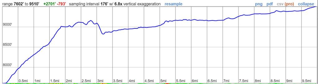
Day 1: 7.7 miles; +2,800 feet / -480 feet; Robinson Creek Trailhead to Crown Lake
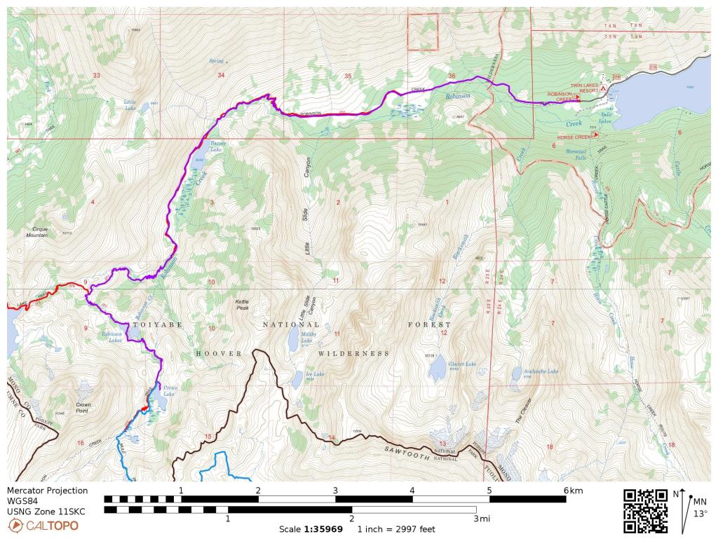

The first starts with a westward hike along the Robinson Creek Trail. The trail steadily climbs in elevation over the course of the entire hike, so expect little to no downhill hiking. Near the 6 mile mark, you reach a junction with the Peeler Lake Trail. Here you take a left and continue hiking south towards Robinson Lakes and Crown Lake. After passing by the beautifully-colored Robinson Lakes you eventually will reach Crown Lake, the camp destination for the first night. There is a great campsite located on the northeast corner of the Crown Lake.
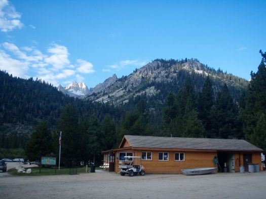
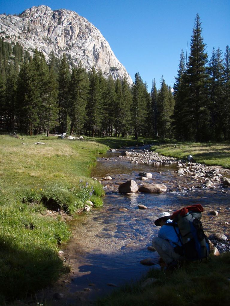
Mountain view from Annett’s Mono Village near the Robinson Creek Trailhead, the start of the Benson Lake Loop in Yosemite National Park 
View along the Robinson Creek Trail in Yosemite National Park 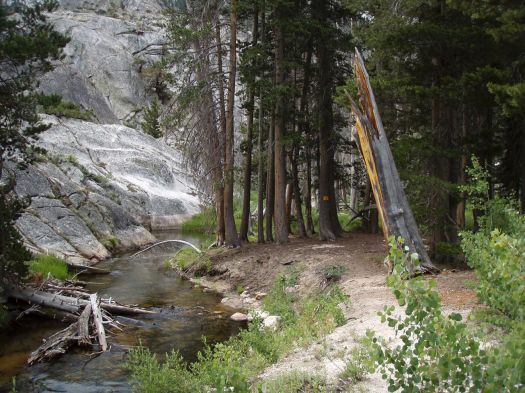
View along the Robinson Creek Trail in Yosemite National Park 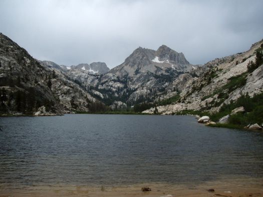
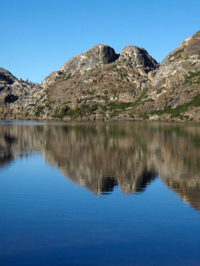
Barney Lake in Yosemite National Park, seen along the Benson Lake Loop 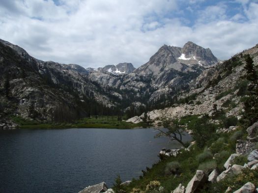
Barney Lake in Yosemite National Park, seen along the Benson Lake Loop 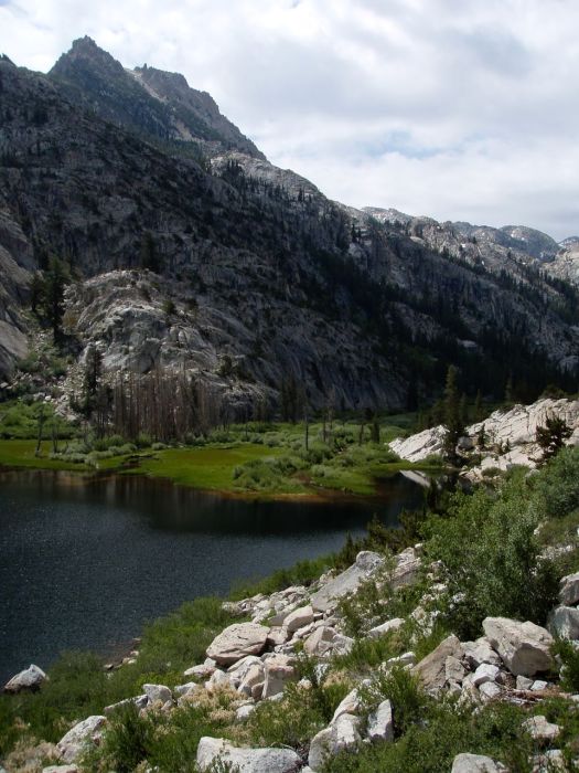
Marsh at the end of Barney Lake in Yosemite National Park 
Marsh and meandering Robinson Creek at the south end of Barney Lake, in Yosemite National Park. 
The trail continues to follow Robinson Creek as you hike beyond Barney Lake, in Yosemite National Park 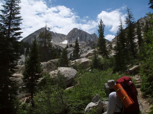
The trail leads up many switchbacks as you head towards Robinson Lakes, in Yosemite National Park 
The first of the Robinson Lakes in Yosemite National Park 
Robinson Lakes in Yosemite National Park, along the Benson Lake Loop 
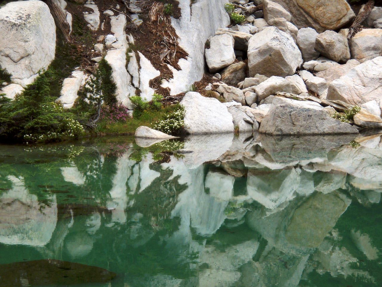
Reflections in one of the Robinson Lakes in Yosemite National Park 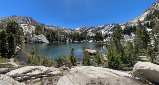
The largest of the Robinson Lakes in Yosemite National Park 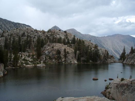
Crown Lake in Yosemite National Park, along the Benson Lake Loop 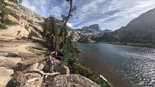
Campsite location at Crown Lake, along the northeast shore – in Yosemite National Park 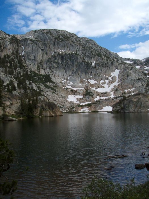
View from the shore of Crown Lake in Yosemite National Park 
Crown Lake with a view of Crown Point in the background, Yosemite National Park
……….
Day 2: 12.7 miles; +2,500 feet / -3,240 feet; Crown Lake to the Matterhorn Canyon

The Day 2 hike is arguably the toughest hike of this trek at nearly 13 miles with 2,500 feet of climbing. Along the way you climb over Mule Pass and Burro Pass before gradually descending into the Matterhorn Canyon. The trail follows the meandering Matterhorn Creek as you hiking through the canyon. You can camp anywhere within Matterhorn Canyon. For this itinerary we specify a camping area near the trail junction with the Pacific Crest Trail.
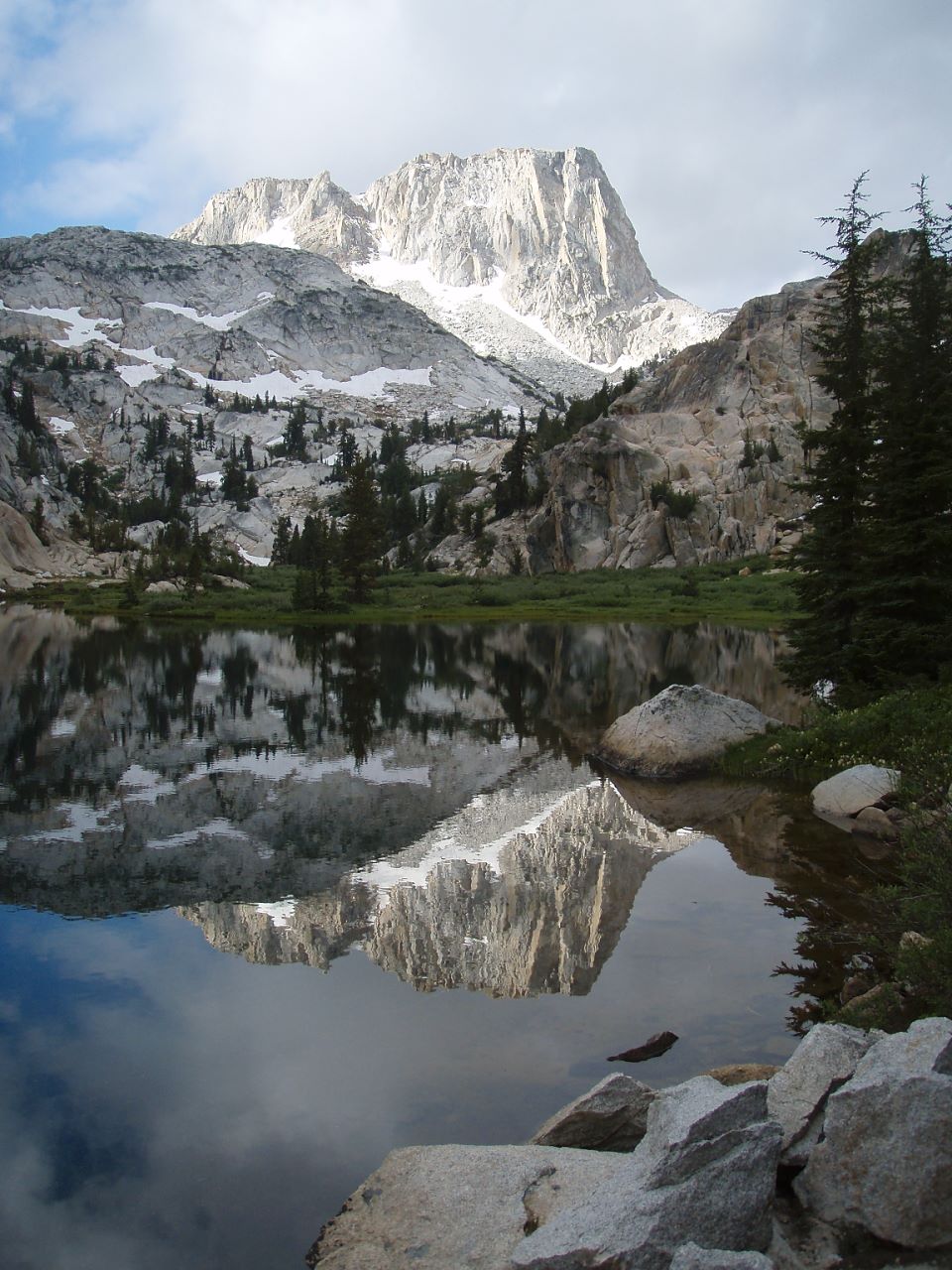
Reflections in still water at Crown Lake in Yosemite National Park 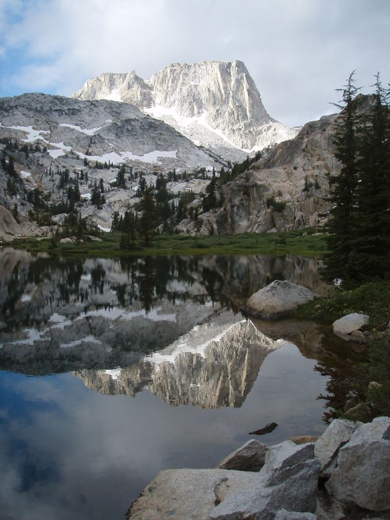
Reflections of Crown Point in the water of Crown Lake in Yosemite National Park 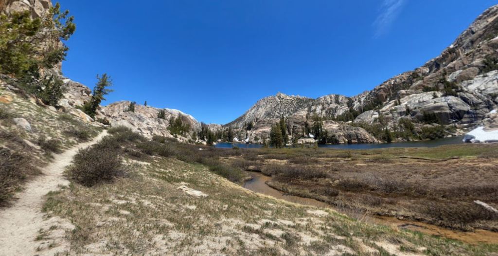
Looking back towards Crown Lake as you hike south to Mule Pass 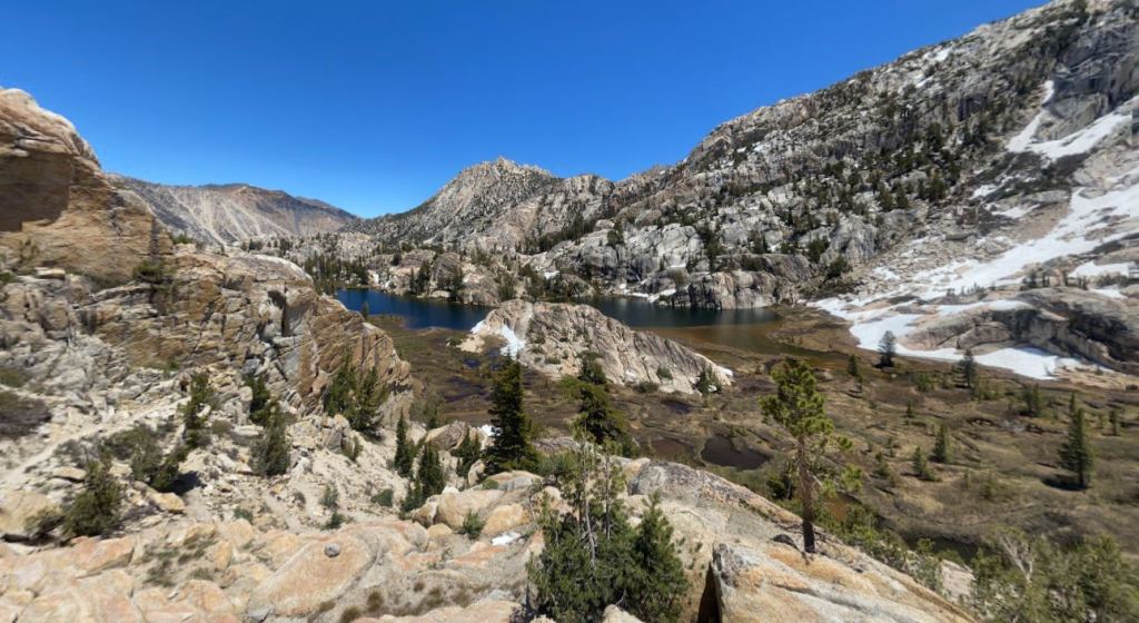
View of Crown Lake in the distance, in Yosemite National Park 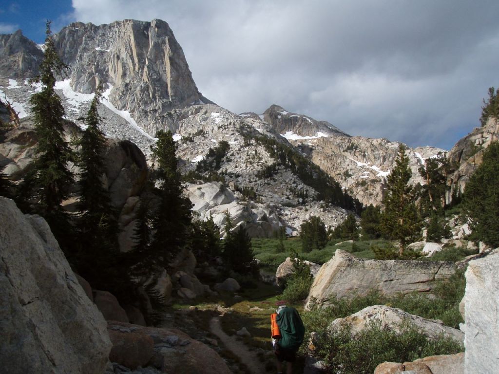
Near the Mule Pass Train junction in Yosemite National Park, Crown Point in the background 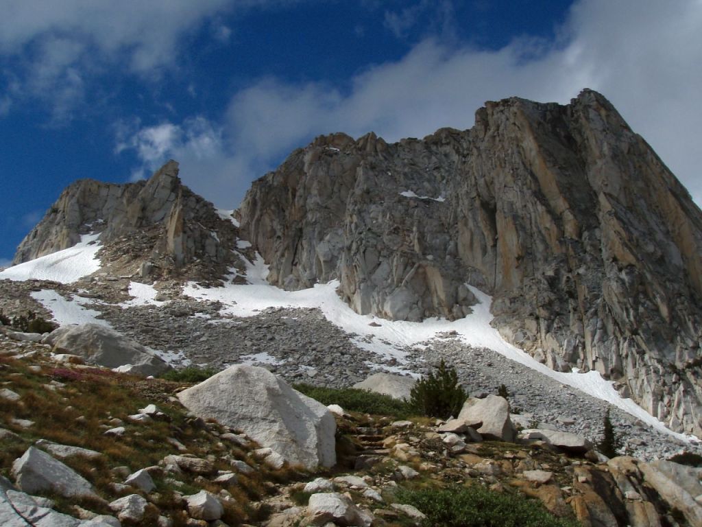
View along the Mule Pass Trail in Yosemite National Park 
Lake 10,300 along the Mule Pass Trail in Yosemite National Park 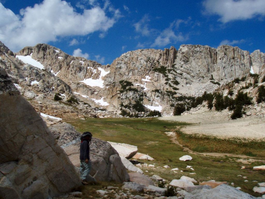
Approaching Mule Pass in Yosemite National Park 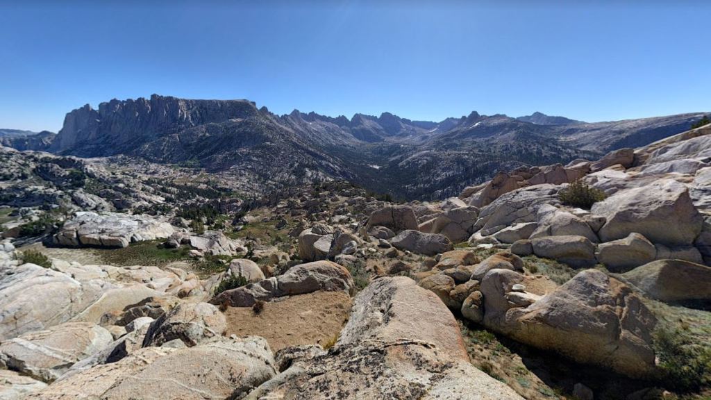
View from atop Mule Pass in Yosemite National Park, along the Benson Lake Loop 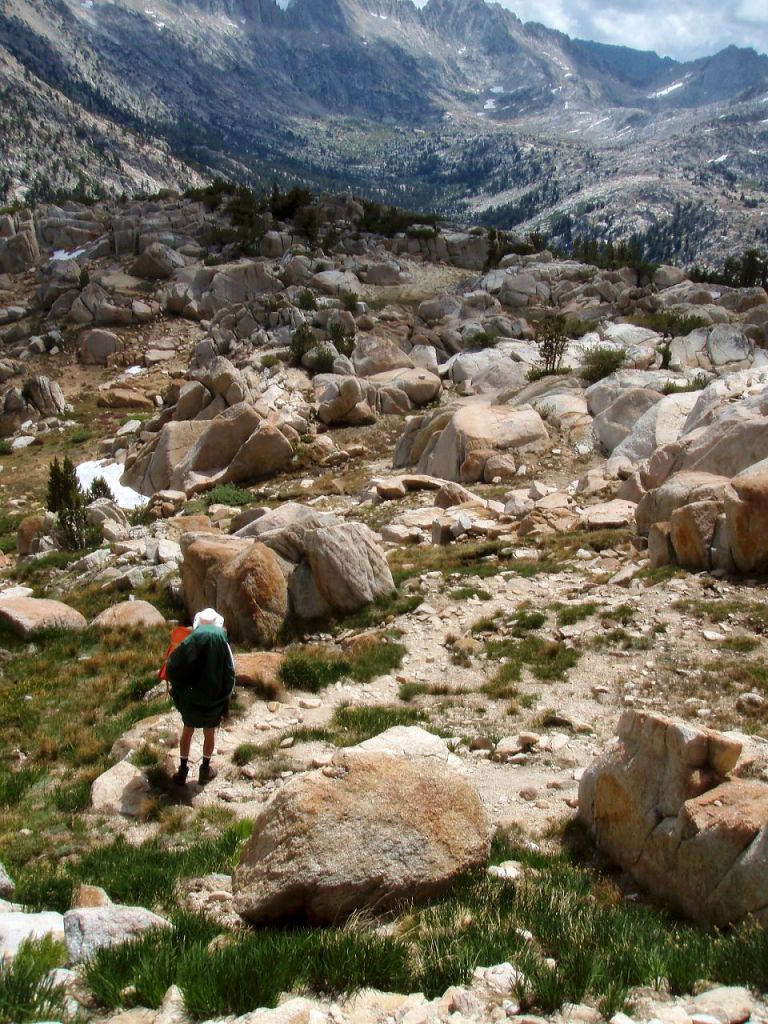
Descending from Mule Pass along the Benson Lake Loop in Yosemite National Park 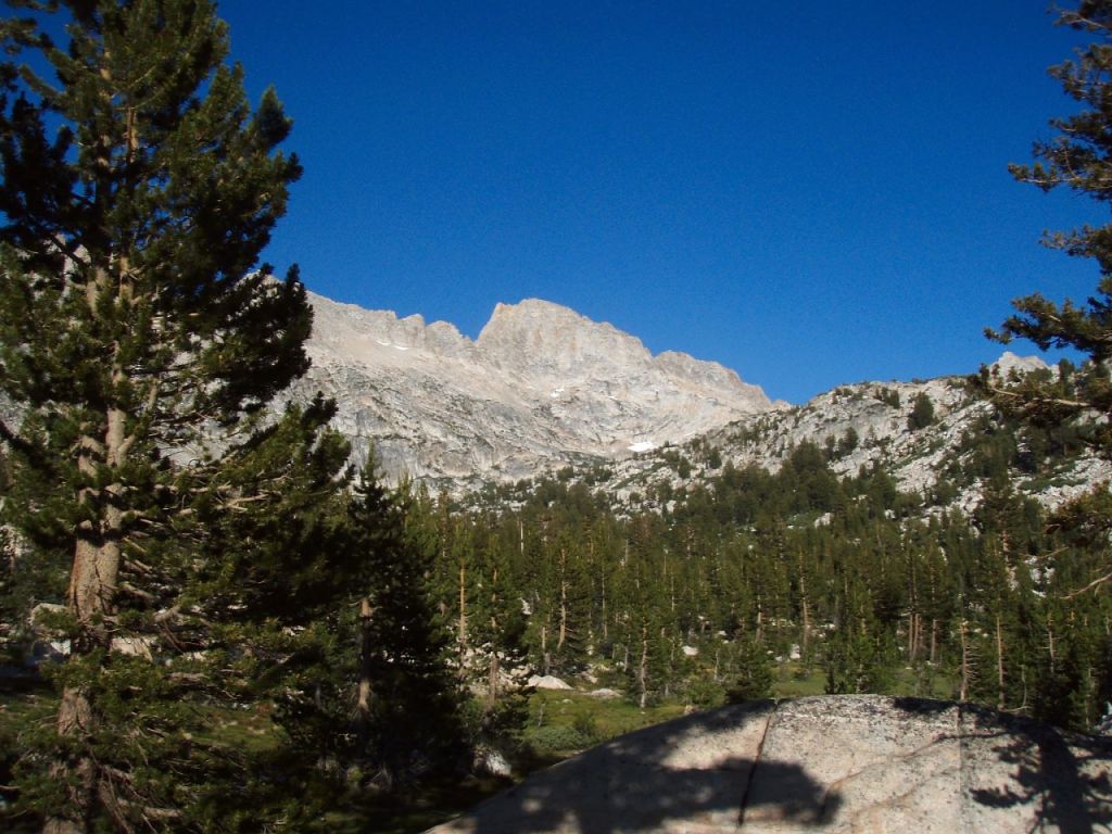
View of the Sawtooth Ridge in Yosemite National Park 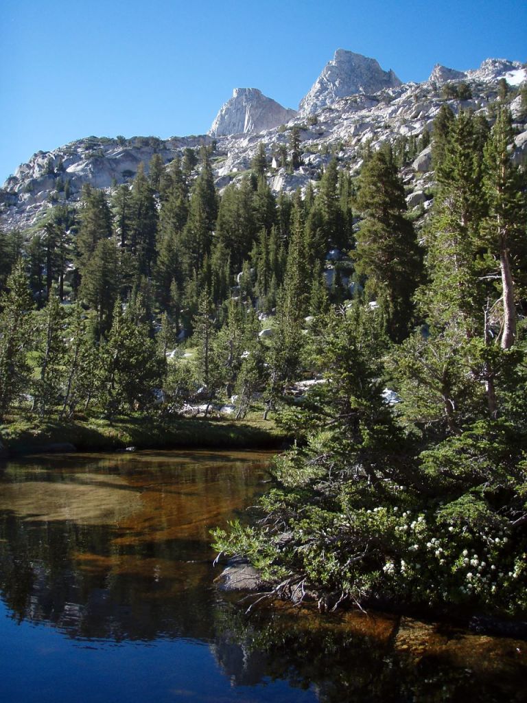
Piute Creek and the Sawtooth Ridge in Yosemite National Park 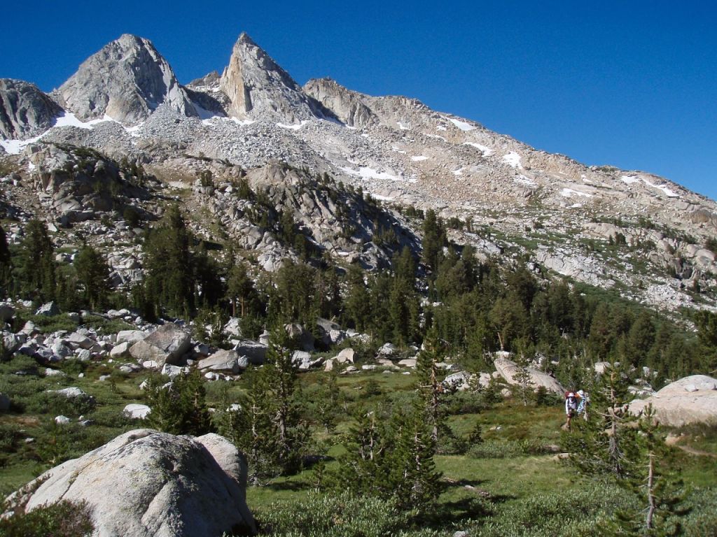
Hiking beneath the Sawtooth Ridge in Yosemite National Park 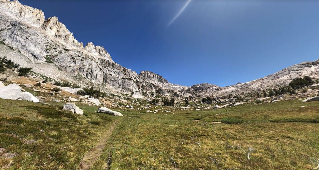
Hiking towards Matterhorn Peak and Burro Pass in Yosemite National Park 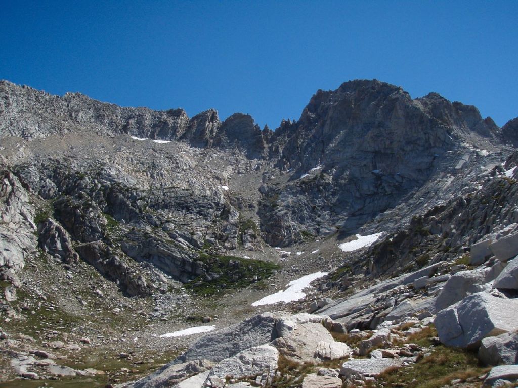
View of Matterhorn Peak as you hike up to Burro Pass 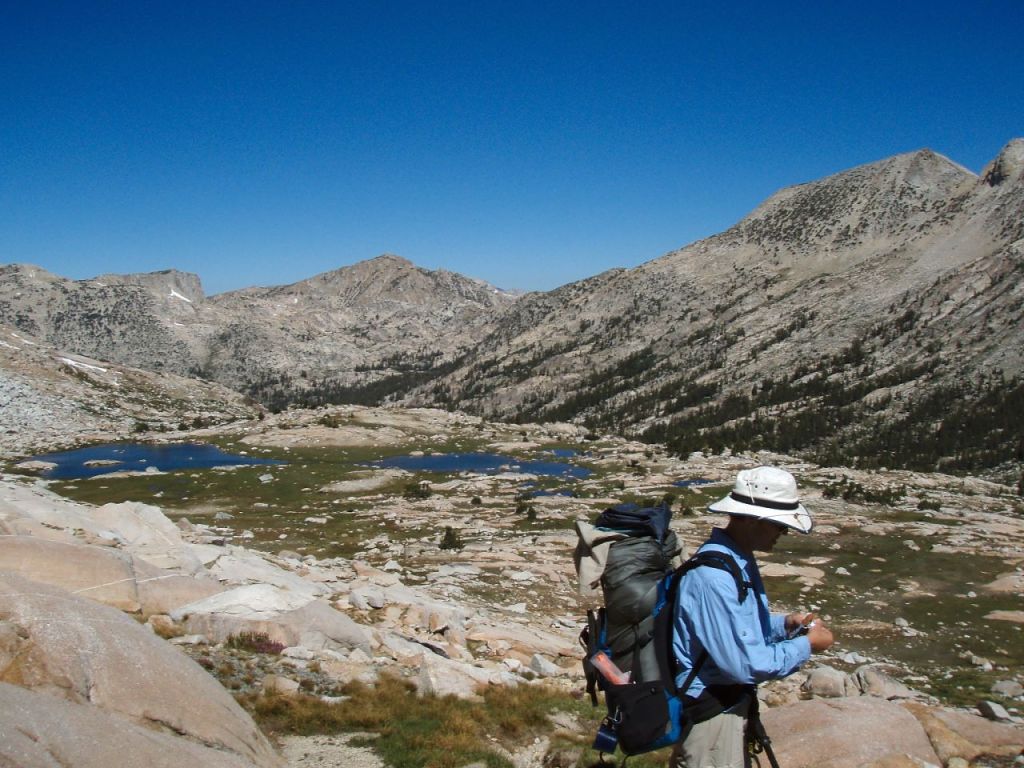
View looking west from the top of Burro Pass in Yosemite National Park 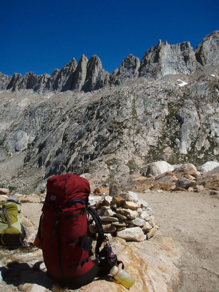
View of the Sawtooth Ridge from atop Burro Pass in Yosemite National Park 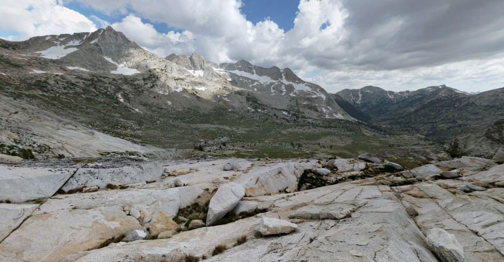
View looking south from atop Burro Pass in Yosemite National Park 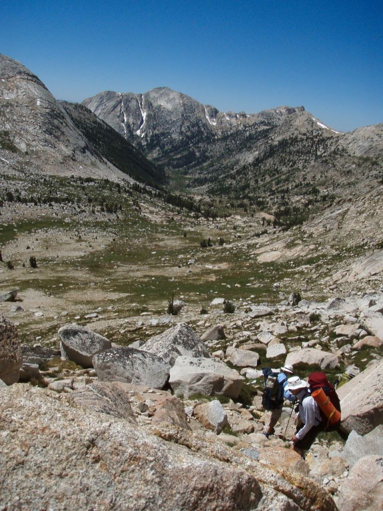
Descending from Burro Pass and beginning the hike into the Matterhorn Canyon, in Yosemite National Park 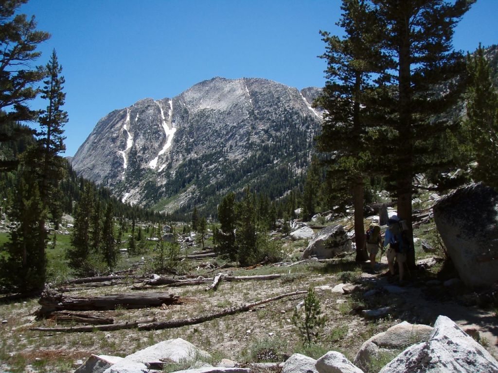
Hiking along the trail in Matterhorn Canyon in Yosemite National Park, along the Benson Lake Loop 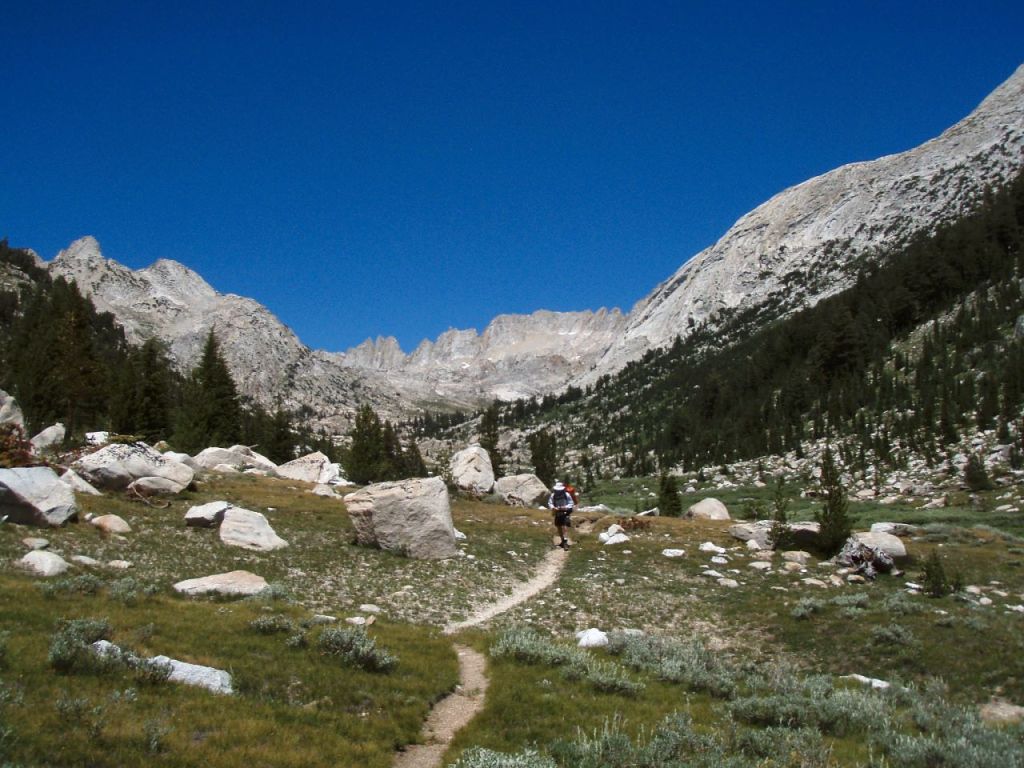
Matterhorn Canyon in Yosemite National Park, along the Benson Lake Loop
……….
Day 3: 9.9 miles; +2,350 feet / -3,240 feet; Matterhorn Canyon to Benson Lake
Day 3 takes you to the highlight destination of this backpacking loop, Benson Lake and its sand beach. For the first 4 miles of the hike you climb up to Benson Pass. From there you hike down past Smedberg Lake (a great lunch spot at the ~5.5 mile mark), and eventually reach the turnoff for Benson Lake. The turnoff will lead to the beach on the northeast shore of Benson Lake. Most backpackers choose to camp along the beach on this shore, so you shouldn’t have to hike far to find a nice campsite.
Hiking along the PCT near Wilson Creek in Yosemite National Park 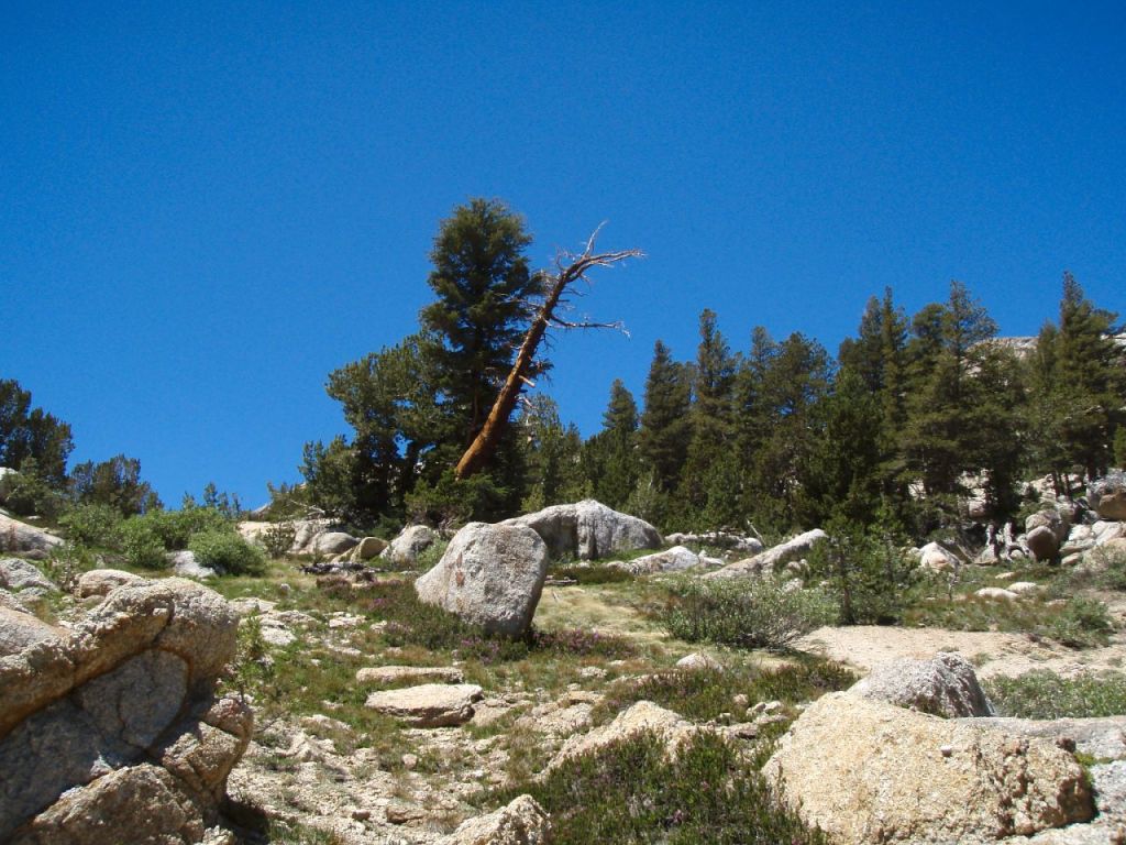
Beginning the ascent to Benson Pass in Yosemite National Park 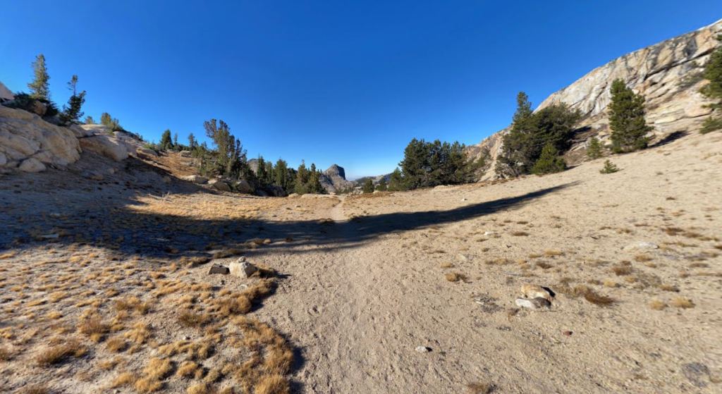
Atop Benson Pass in Yosemite National Park, along the Benson Lake Loop 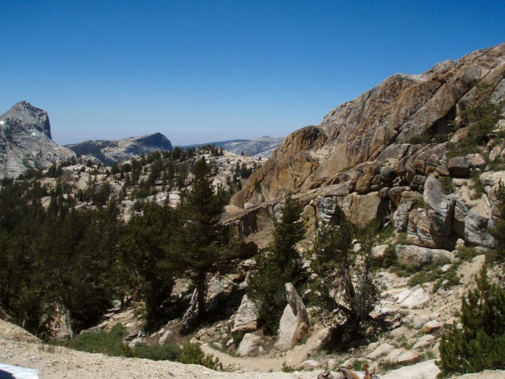
Descending from Benson Pass towards Smedberg Lake in Yosemite National Park 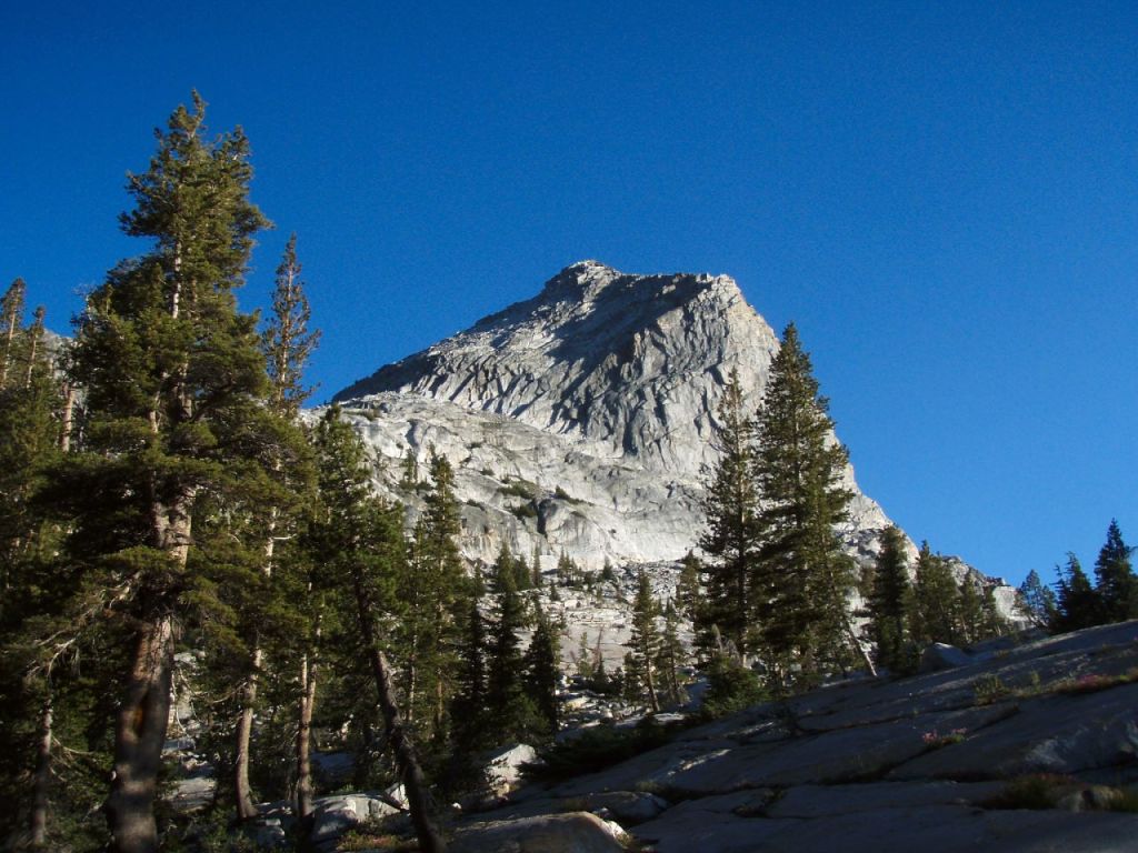
Volunteer Peak in Yosemite National Park 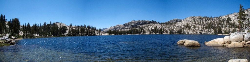
Pano of Smedberg Lake in Yosemite National Park 
On the PCT as you pass Smedberg Lake in Yosemite National Park, along the Benson Lake Loop 
Regulation Peak in Yosemite National Park 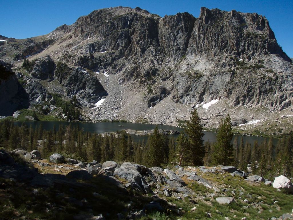
Regulation Peak and Rodgers Lake in Yosemite National Park. This is a short side trip from Smedberg Lake. 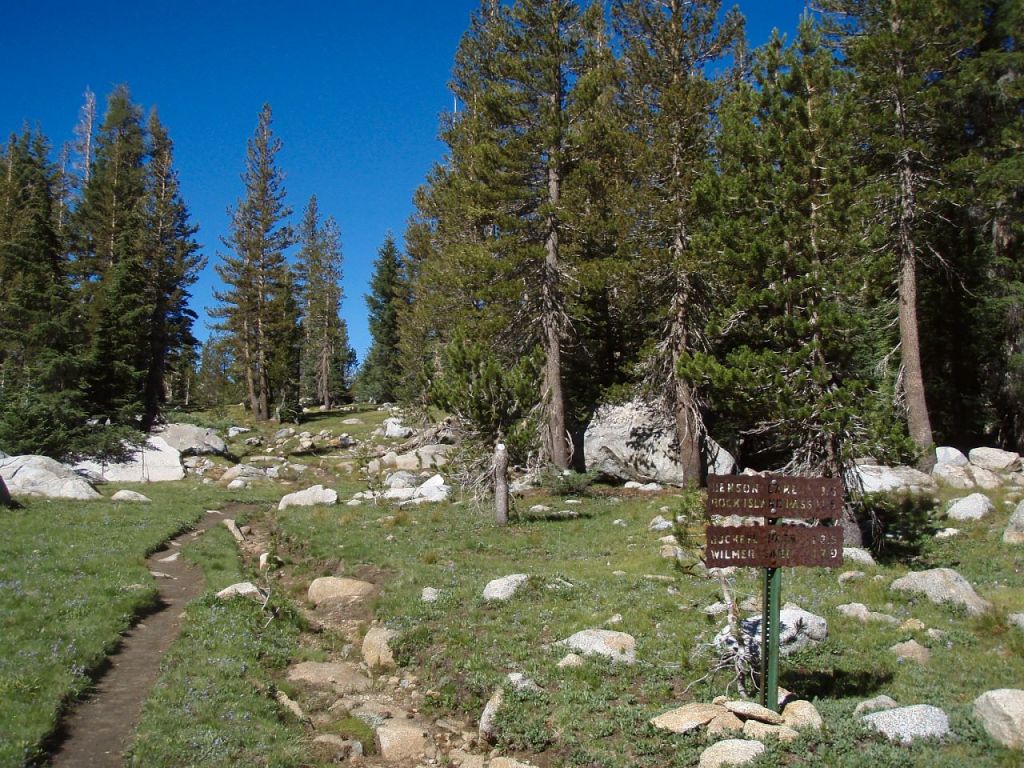
Along the PCT as it heads to Benson Lake in Yosemite National Park 
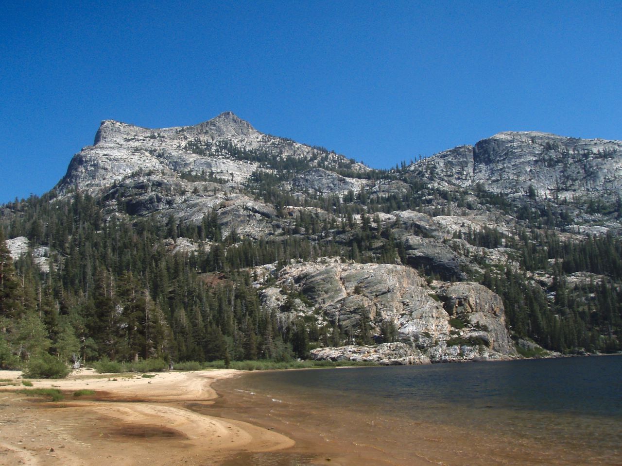
View from the beach at Benson Lake in Yosemite National Park 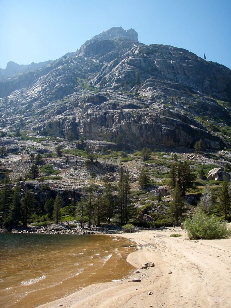
View from the beach at Benson Lake in Yosemite National Park 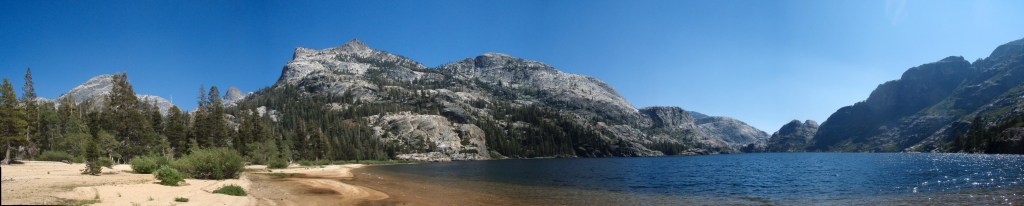
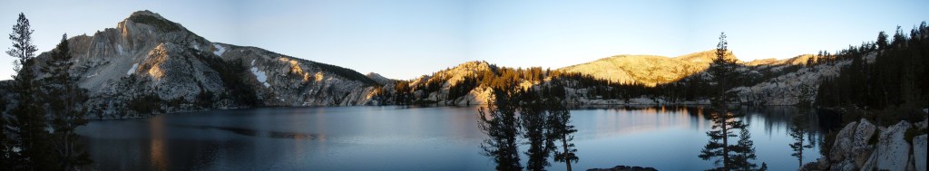
Panoramic view of Benson Lake in Yosemite National Park 
View looking across Benson Lake in Yosemite National Park 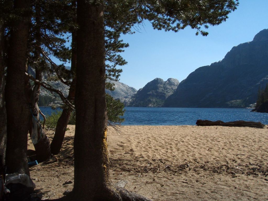
View of Benson Lake from one of many beach campsites, in Yosemite National Park 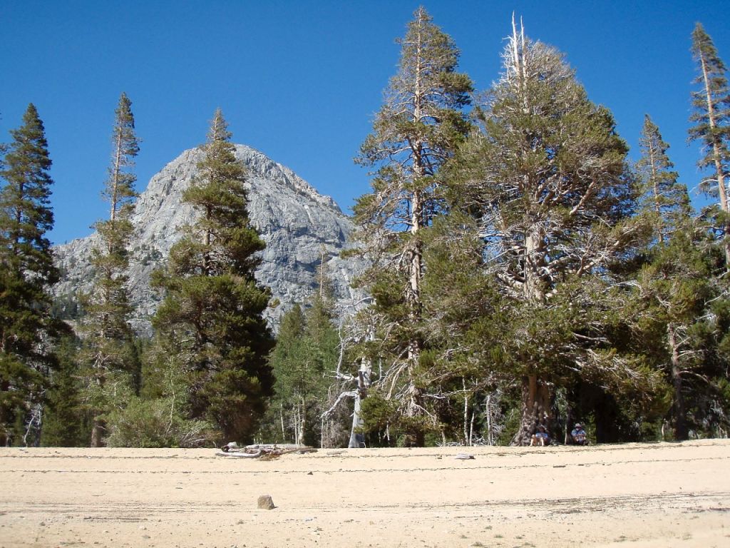
Backpacking relaxing in the shade at the Benson Lake beach in Yosemite National Park
……….
Day 4: 10 miles; +2,700 feet / -790 feet; Benson Lake to Peeler Lake
On this hike you travel from Benson Lake up to Peeler Lake, which will be the last stop before reaching the Robinson Creek Trailhead. There is a tough climb up to Seavey Pass in the first 3 miles of the hike and then the trail gradually climbs until you reach Peeler Lake.
Morning reflections in the water at Benson Lake in Yosemite National Park 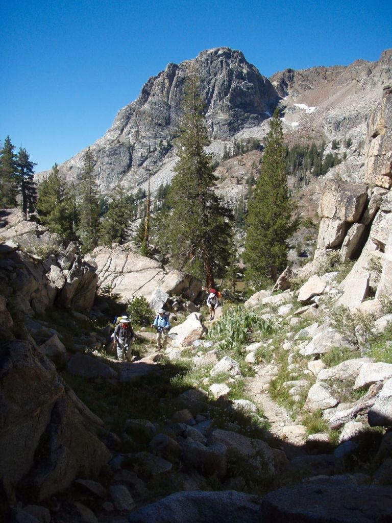
Climbing up the PCT towards Seavey Pass in Yosemite National Park 
Unnamed lake along the PCT as you approach Seavey Pass 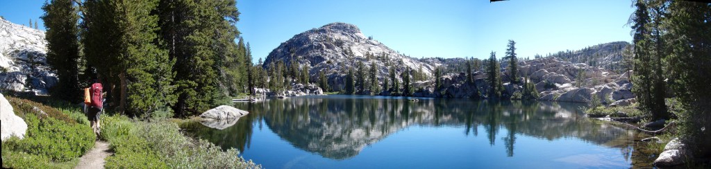
Hiking along the PCT towards Seavey Pass 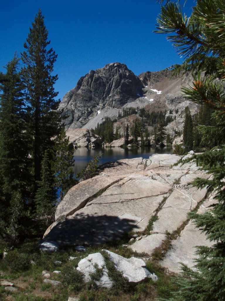
Piute Mountain seen from the PCT in Yosemite National Park 
PCT as it approaches Seavey Pass in Yosemite National Park 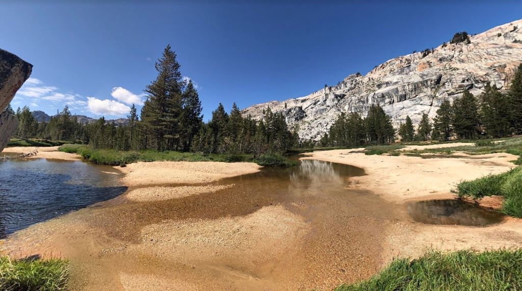
A sandbar along the Rancheria Creek in Yosemite National Park, between Seavey Pass and Kerrick Meadow 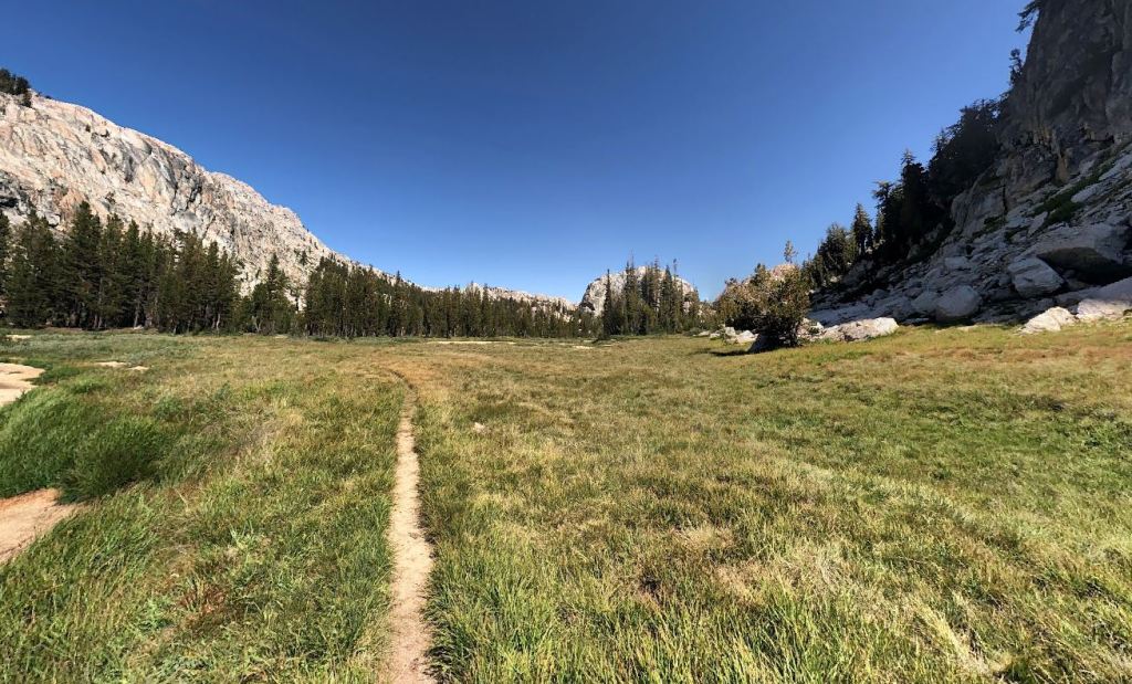
Hiking north towards Kerrick Meadow in Yosemite National Park, along the Benson Lake Loop 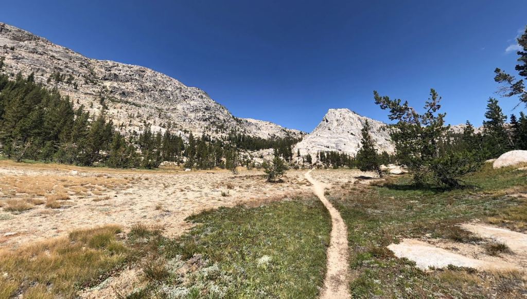
Hiking north towards Kerrick Meadows following Rancheria through a large valley 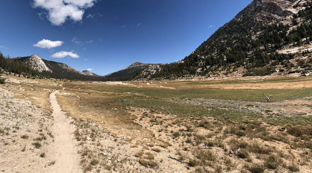
Hiking through the Rancheria Creek Valley in Yosemite National Park 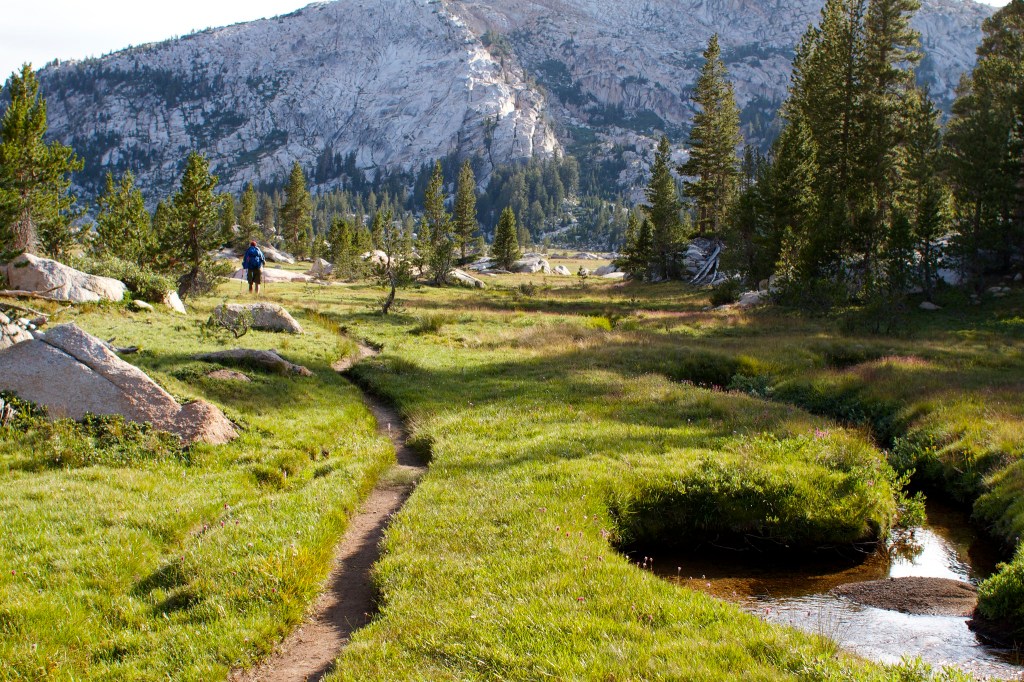
Kerrick Meadow in Yosemite National Park, along the Benson Lake Loop 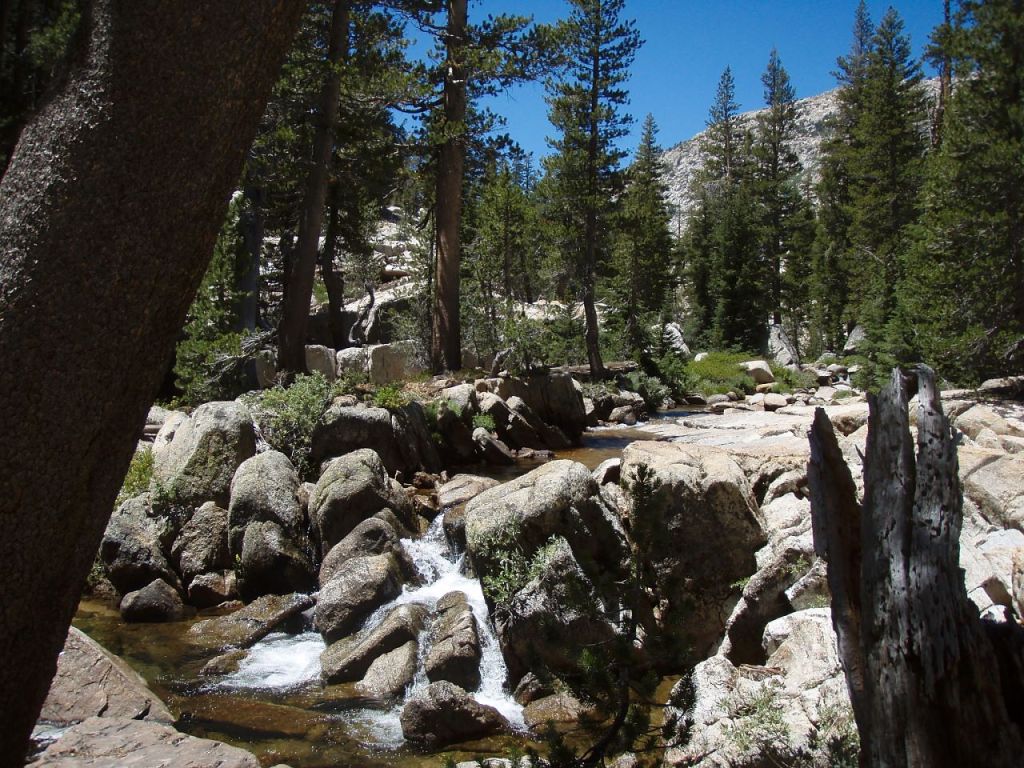
One of several small cascades in Racheria Creek as you approach Peeler Lake 
Rancheria Creek in Yosemite National Park 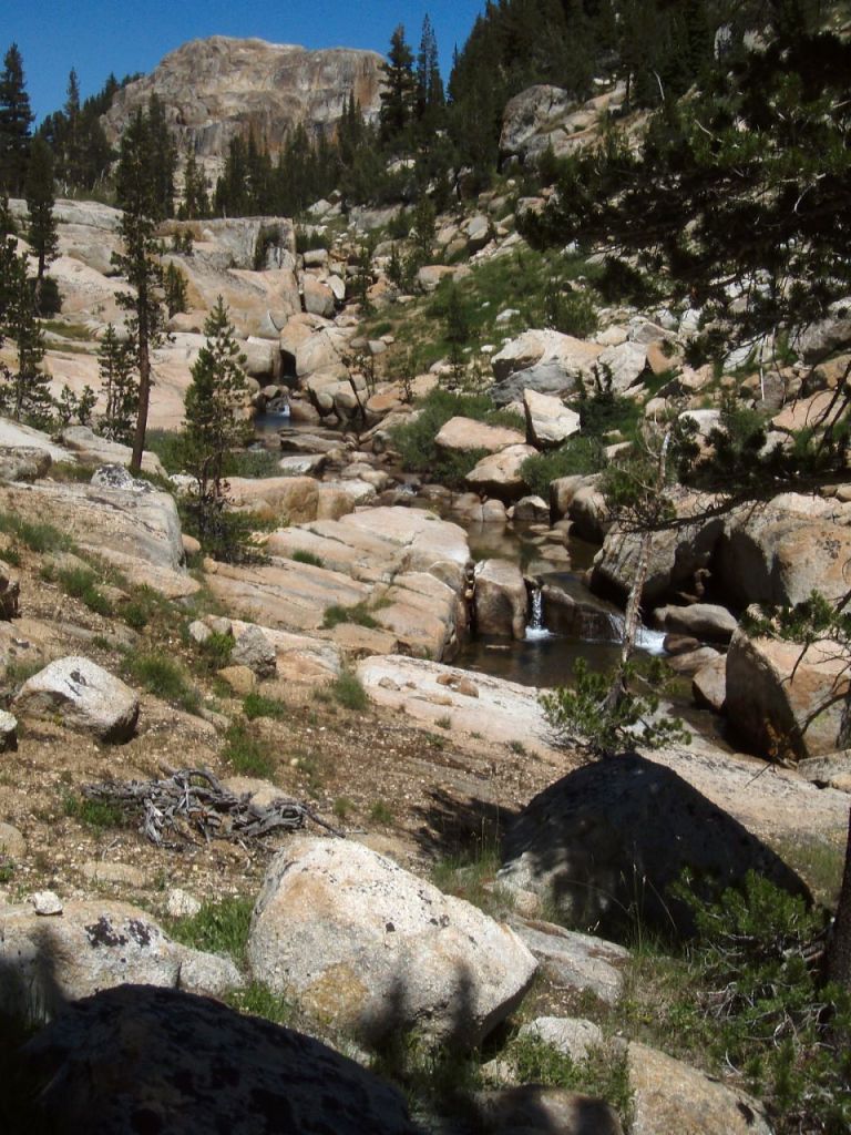
Rancheria Creek in Yosemite National Park 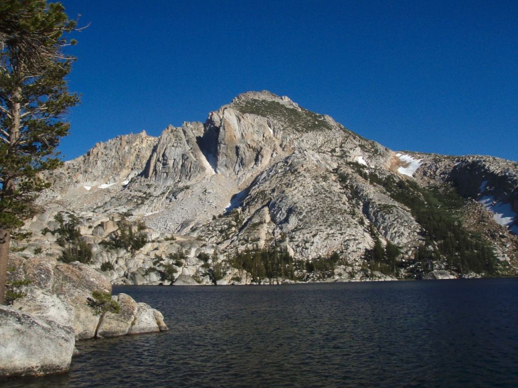
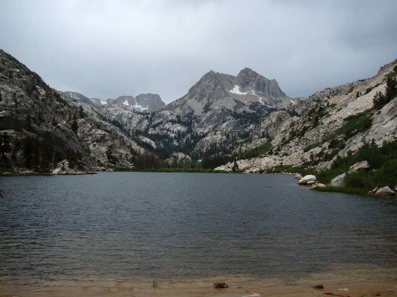
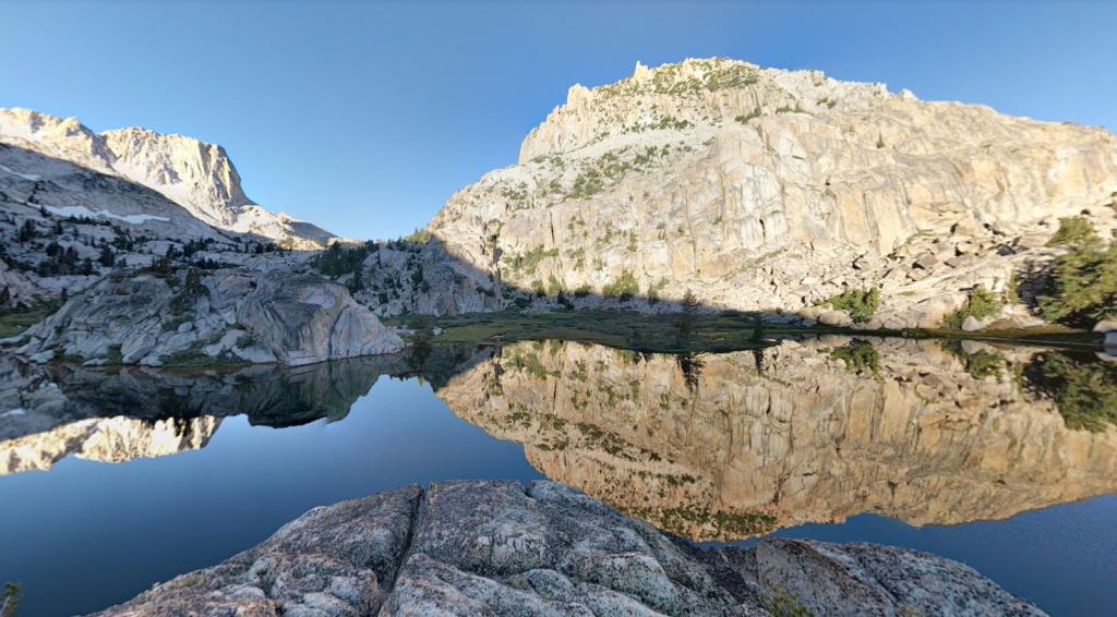
Peeler Lake with Crown Point in the background, Yosemite National Park 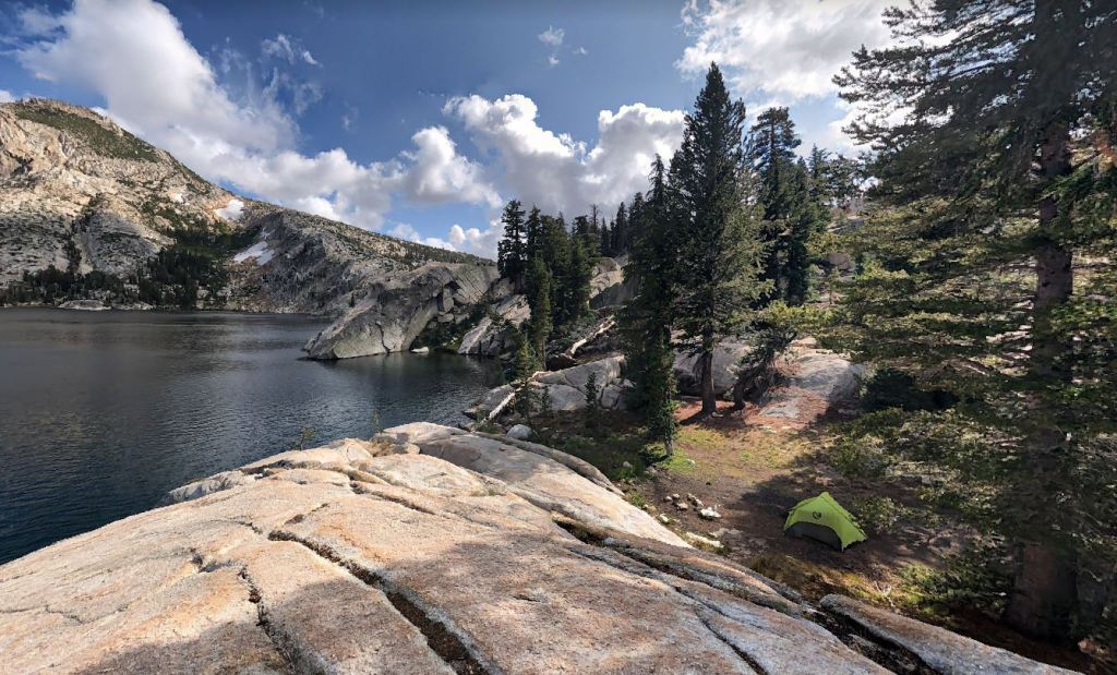
Beautiful campsite on the northwest shore of Peeler Lake, in Yosemite National Park 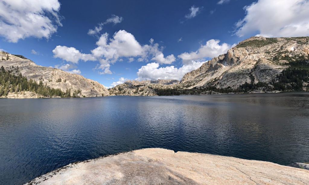
View of Peeler Lake looking east from near the campsite 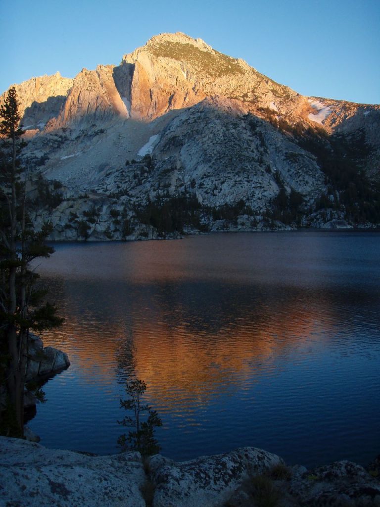
Crown Point and Peeler lake at sunset, in Yosemite National Park
……….
Day 5: 7.6 miles; +610 feet / -2,980 feet; Peeler Lake to Robinson Creek Trailhead
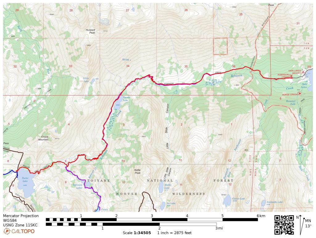
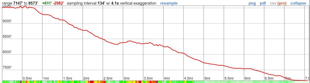
On the last day you hike out to the Robinson Creek Trailhead. This is a relatively modest hike compared to the previous days at less than 10 miles and with less than 1,000 feet of elevation gain. After hiking east along the Peeler Lake Trail for ~1.5 miles, you reach a junction with the Robinson Creek Trail. From this point on you retrace the path you hiked on the first day until you end up back at the Robinson Creek Trailhead.
Some backpackers may choose to combine this hike with the previous day’s hike to make for a big 17 mile last day. This allows for an extra night of camping at the beach on Benson Lake (or allows you to cut one day off the itinerary).
Sunrise over Peeler Lake in Yosemite National Park 
A small cascade in Robinson Creek as you descend from Peeler Lake towards Barney Lake, in Yosemite National Park 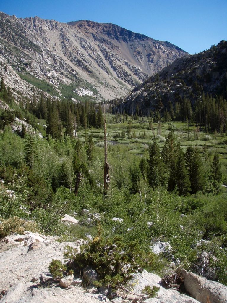
Approaching the marsh and meandering Robinson Creek at the outlet of Barney Lake, in Yosemite National Park 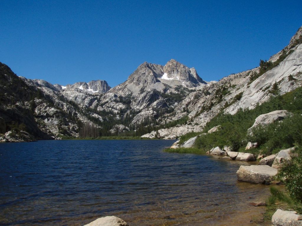
Barney Lake in Yosemite National Park 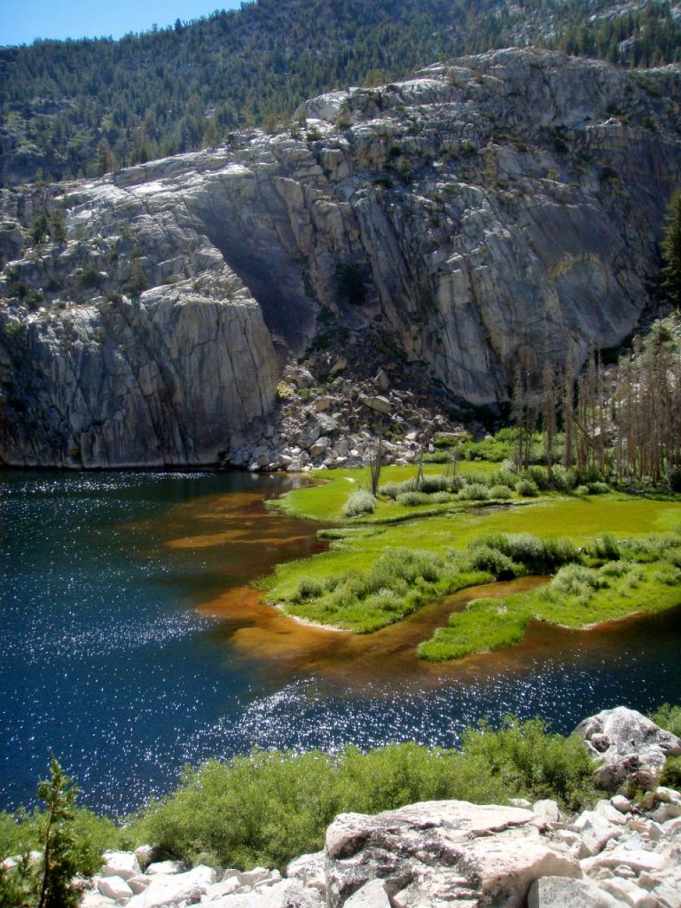
Vivid colors at Barney Lake 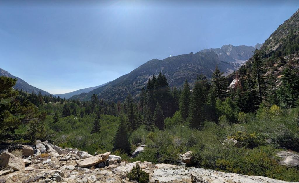
View as you continue hiking east towards Twin Lakes and the Robinson Creek Trailhead
Here are some similar trip reports!
Four Pass Loop – Maroon Bells Snowmass Wilderness, CO (28 mile loop)
Grand Canyon of the Tuolumne River – Yosemite National Park (33 mile point-to-point)
Yosemite Highlights Loop – Yosemite National Park (40 mile loop)
Rae Lakes Loop – Kings Canyon National Park Backpacking (41 mile loop)

Just want to say that I hiked this loop 2 years ago. Benson lake is awesome and we had a great time swimming. watch out for the skeeters tho, they swarm like crazy
LikeLike
Hi Bobby – thanks for the info! We had some bug issues in July, but treating our clothes with permethrin before the trip and using serious DEET lotion helped a ton. The Benson Lake area can definitely be buggy in the early season though.
LikeLike
HI again, we were planning on doing both of your Desolation Wilderness routes in later September, after returning from the two Wind River Range routes, in which we exchanged comments on a few days ago.
Most of the Desolation Wilderness is now closed until Sept. 30 due to nearby fire activity so I rebooked us to do the Benson Lake Loop instead. Thanks again for all of the great trip plans.
I have one question please. We are considering breaking it into 6 days so as to avoid the long 12.7 mile day from Crown Lake to where Matterhorn Canyon intersects the PCT as described in your Day 2. I’m thinking of camping about 4 miles earlier in Matterhorn Canyon; then going to Smedberg Lake; then a short day to Benson Lake. In order words turn your Days 2 and 3 into three days.
Do you please know anything about availability of water and suitable camp locations farther back up Matterhorn Canyon towards Burro Pass? I’m thinking of maybe near Quartz Peak or a bit closer back up towards Burro Pass. Thus cutting about 4 miles off your 12.7 mile day out of Crown Lake.
I’ve read mixed information on this. Some sources suggest the canyon is steeper farther up without any real flat spots. Other sources seem to indicate others have camped up Matterhorn Canyon closer to Burro Pass with no problem.
I’m curious if you have any insight on this. Thanks again for all of the great information. I would be happy to provide you with feedback on gear or any backpacking routes anytime I could contribute to your web site.
Thanks.
LikeLike
Hi Jim – If I recall correctly, the trail is fairly steep downhill for 1-2 miles after Burro Pass. I would plan to hike through this section before setting up camp. After about the 8.5 mile mark on my route for that day the trail begins to flatten out a bit. I’d start looking for camping there as the trail is both less steep and closer to Matterhorn Creek.
As far as water availability, you best bet is to call up the Yosemite Ranger Station and ask about the flow of Matterhorn Creek. Given we are in a drought and it’s getting later in the summer, I really have no idea if it’s flowing or dry. Best of luck with your trips!
LikeLike
Hi. Thanks. I was just this minute texting my girlfriend that my only concern about that trip is water in Matterhorn Creek. Then I saw your response. I will of course talk to the rangers and adjust our plan as necessary.
From a few of your posts, I’m inferring you are from the Bay Area. The routes in Henry Coe State Park were the tip off. I grew up in San Jose.
Thanks again. We do your two Wind River Range routes starting next Tuesday. Then the Benson Lake Loop starting Sept. 19. I’ll give you any relevant feedback from those trips.
LikeLike
Do you happen to have this route saved in the gaia app that you could share?
LikeLike
Do you happen to have this route saved in the Gaia app?
LikeLike