


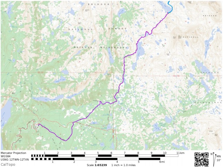
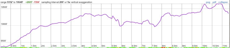
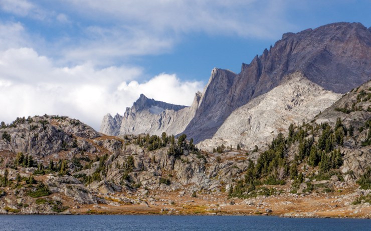
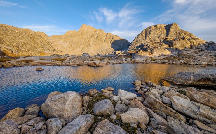
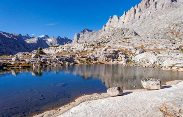
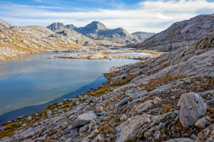
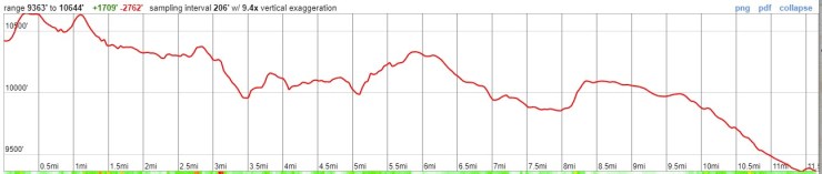
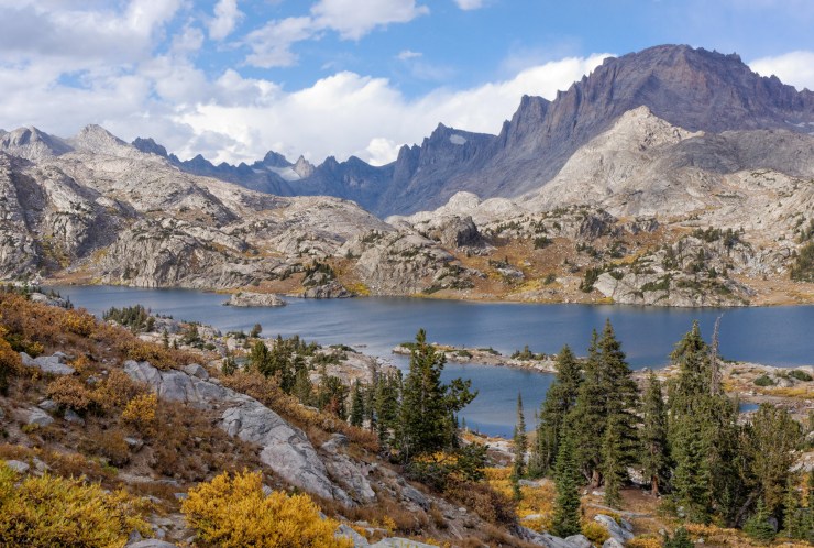
Trip Overview: The ~40 mile Titcomb Basin and Indian Basin backpacking trek goes through the spectacular and popular Wind River Range in the Bridger Wilderness area of Wyoming. +/ -7,500 feet of elevation across the course of this trek with a peak elevation of 12,145 feet (top of Indian Pass). Highlights include steep glacier cut valleys, glacial-fed alpine lakes, impressive granite peaks, and spectacular views. The beauty of this area makes it one of the more popular backpacking destinations in Wyoming, but the scenery makes up for any crowds you may encounter. Along this route you will explore both the Titcomb and Indian Basins from a basecamp set up at Island Lake.

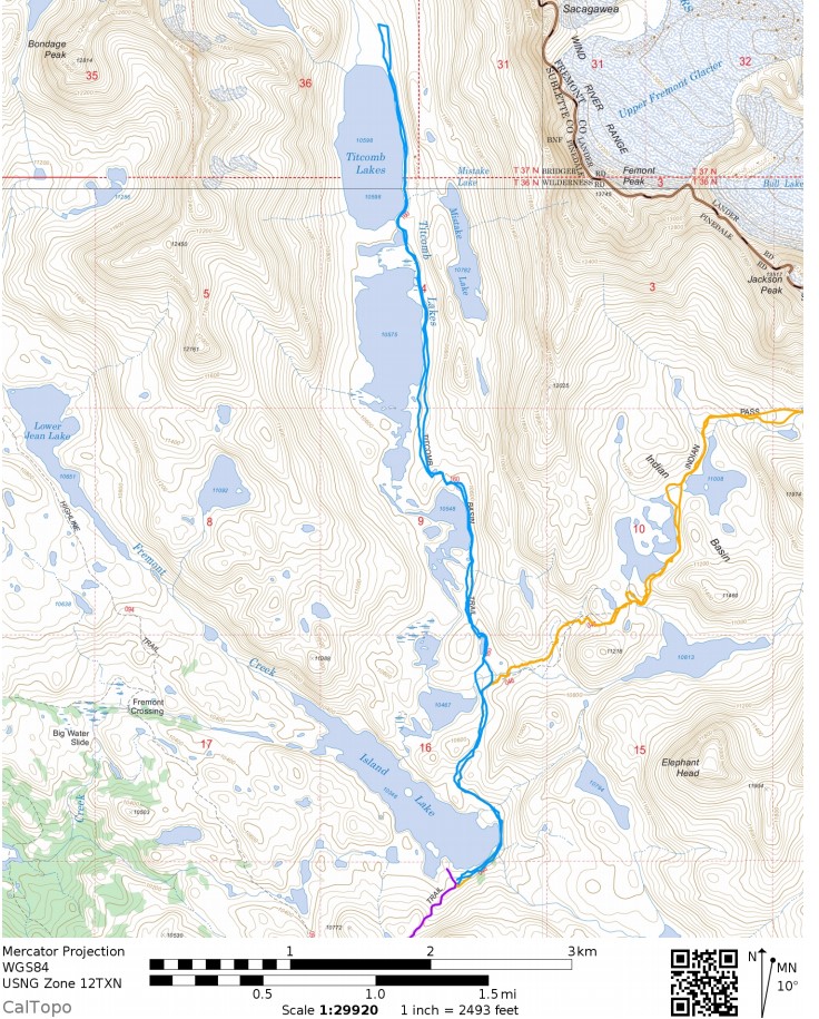
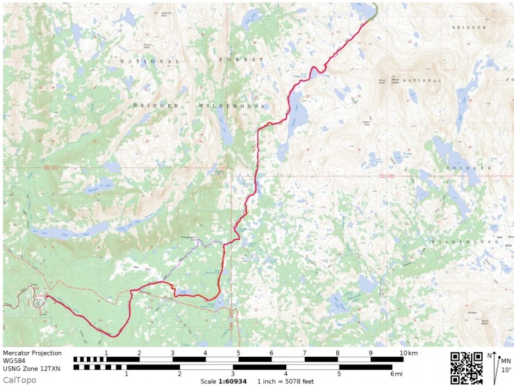
- Higher resolution version of the overall map for Titcomb Basin trek (PDF)
- Topographic map of Wind River Range for purchase (amazon link)
Jump to Day 1: Elkhart Park Trailhead to Island
Jump to Day 2: Explore the Indian Basin
Jump to Day 3: Explore the Titcomb Basin
Jump to Day 4: Island Lake to Elkhart Park Trailhead
Shop Deal of the Day at REI Outlet (up to 50% off)!
Preparations:
Click here to read more about Permits
Permits: No permits are needed to backpack in the Wind River Range. Both the Popo Agie and Bridger Wilderness areas allow groups under 15 people to backpack with no permits or fees. There are a few regulations that backpackers must follow in these areas though. There is no camping allowed within 200 feet of lake shores or within 100 feet of creeks or streams. In the Bridger Wilderness area, campfires are only allowed below the tree line and cutting or removing standing wood is not allowed. Beyond these regulation, you should follow other general rules such as staying on trail, packing out all trash, and properly storing food (either in a bear canister or by properly hanging).
Click here to read more about Logistics
Logistics: The Titcomb Basin trek starts and end at the Elkhart Park Trailhead. At the trailhead there are vault toilets and parking, but no potable water source (plan to arrive with a filled camelbak or filter water along the trail). You must drive to the trailhead or arrange for a private shuttle. The trailhead is about 2 hours drive from Jackson, Wyoming.
If you plan to camp the night before leaving on the trek (a good idea to help acclimate to the elevation), the Trails End Campground near the trailhead is a great option. Sites are available on a first-come, first-serve basis and it only costs $12 per night. There are vault toilets, but no potable water here. Note that there are only 8 sites at the campground, so it’s possible the campground could be full and you may need to make friends and pitch your tent close to someone else.
Click here to read more about Difficulty
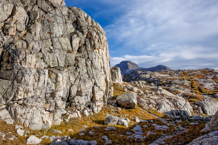
Trail Conditions and Difficulty: Many of the trails in the Wind River Range have a good amount of elevation change and traverse high elevation mountain passes. This entire loop sits above 9,000 feet and much of the mileage is above 10,000 feet. Backpackers should spend a day or two acclimating to the thin air, should be in good cardiovascular shape, and should know the signs for altitude sickness.
Given this route is quite popular, the trails are typically well marked. That said, backpackers should be prepared with a map and compass because storms can drop snow in the high elevation Wind River Range many months of the year. The best time of the year to backpack this route is typically mid-July to mid-September. During this time frame you are least likely to encounter snow on the trail. Note that the weather is unpredictable in the mountains and afternoon thunderstorms are common. Backpackers should be prepared for varying weather and should avoid hiking on high elevation exposed trails in the afternoon when storms are likely.
Supplies: In the Winds, you must be prepared for a variety of conditions depending on the time of year. Up until late July / early August, snow may remain in the high country and on mountain passes. If you are hiking the trail in June or July (before the snow fully melts) or in late September / October (when snow can begin to fall again), you will want to consider bringing microspikes/crampons and an ice ax. If the trail is clear of snow, then these are not needed.
Because of rapidly changing weather in the mountains, you will want to bring several layers so that you can easily adapt to the changing temperature and also so that you can stay dry. I also recommend having a set of wool clothes to change into at camp. Wool is great because it doesn’t pick up funky stenches as fast at cotton or synthetic clothes. It also dries out quickly so that you are able to stay warm even if all your gear gets soaked in a thunderstorm.
Other specific gear you will want for backpacking in the Titcomb is related to bear safety. This wilderness area is inhabited by both grizzly and black bears. Thus, it is important to store all food and scented items in either a bear canister or properly hung using a rope and ursack. It is also recommended to carry bear spray. Given the popularity of this route, an encounter with a grizzly is unlikely, but it is best to be prepared.
You may also want to pre-treat your clothes and tent with permethrin spray repellent. Mosquitoes can be an issue in late July and early August after the snow melts. The permethrin treatment stays on your clothes for up to 7 washes, so it helps reduce the amount of DEET spray you need to put on your skin.
Below is a list of the gear recommended for backpacking in the Wind River Range:
Hiking clothes
- a lightweight hiking rain jacket (North Face Venture 2 Jacket)
- fast drying synthetic hiking pants (prAna Zion Pants)
- a quick drying long sleeve hiking shirt (Columbia Silver Ridge L/S Shirt)
- wool outer socks (People Socks Moreno 4-pack)
- thin blister preventing base socks (WrightSock double layer Coolmesh)
- quick drying synthetic boxer briefs (ExOfficio Give-N-Go)
- Gore-tex hiking shoes (adidas Outdoor Terrex Fast R Gore-Tex Shoe)
Clothes for camp
- wool leggings (Minus33 Merino Wool Kancamagus Midweight Bottom)
- wool base layer shirt (Minus33 Merino Wool Chocorua Midweight Crew)
- warm wool overshirt (Pendleton Long Sleeve Classic-Fit Board Shirt)
- lightweight down jacket (Patagonia 800-fill Down Jacket)
- lightweight camp shoes (Xero Z-Trail lightweight sandal)
Hiking gear
- topographic map (South Wind River map)
- trekking poles (Black Diamond Trail Ergo Cork Trekking Poles)
- 2 liter hydration bladder (Platypus Big Zip Water Reservoir)
- 65 liter backpack (Osprey Atmos 65 Liter pack)
- water filtration system (Platypus gravity filtration system)
Camp gear
- strong tent with rain-fly (Alps Mountaineering Chaos 2 Tent)
- inflatable sleeping pad (Therm-a-Rest Trail Pro Sleeping Pad)
- sleeping bag (REI Co-op Igneo 25 Sleeping Bag)
- inflatable camping pillow (Ultralight Inflating Pillow)
- lightweight backpacking chair (Helinox Chair Zero)
- lightweight lantern (MPOWERD Luci Outdoor 2.0)
- headlamp (Black Diamond Cosmo Headlamp)
- multi-tool with knife (Gerber MDime Mini Multi-Tool)
- Ursack (Ursack Major bear bag) or bear canister (BearVault BV500)
- lightweight stove (MSR PocketRocket 2)
- lighter (BIC plastic lighters)
- 2 liter pot (GSI Outdoors Halulite Boiler Pot)
- coffee cup (GSI Outdoors Glacier Stainless Cup)
- lightweight spork (Snow Peak Titanium Spork)
- small, quick drying towel (REI mutli towel mini)
Random
- wet wipes (Stall Mates individually wrapped wipes)
- mole skin for blisters (Blister medic kit)
- lightweight trowel (GSI Sanitation Trowel)
- small amount of duct tape for gear repairs
- chapstick and sun screen
Food and drink
- a variety of my favorite dehydrated meals
- electrolyte replacement (NUUN Hydration Tablets)
- quick snacks (Clif Shot Bloks and Clif energy bars)
- instant coffee (Starbucks VIA)
- small plastic water bottles filled with whisky 🙂
……….
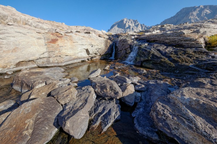
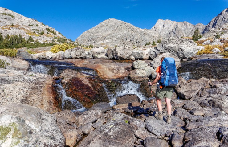
Day 1: 11.5 miles; +2,600 feet / -1,600 feet; Elkhart Park Trailhead to Island Lake.
Map of the Day 1 hike for the Titcomb Basin Trek (PDF)
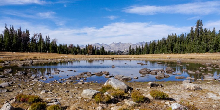
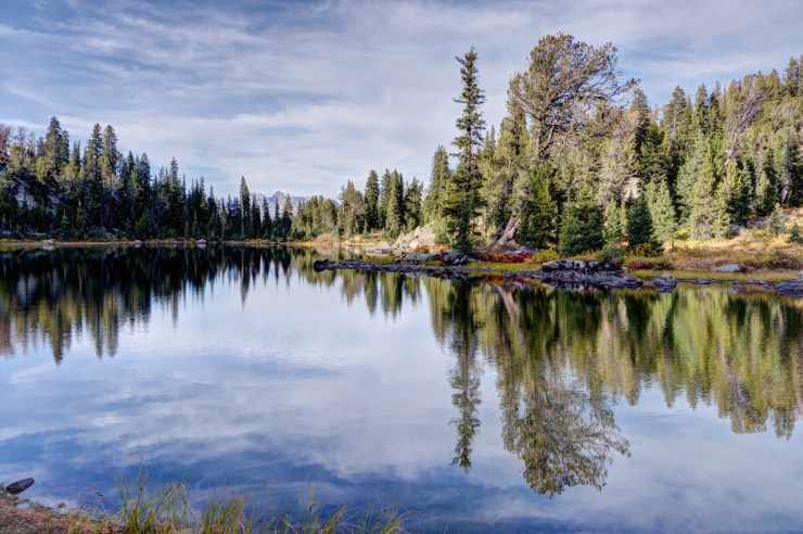
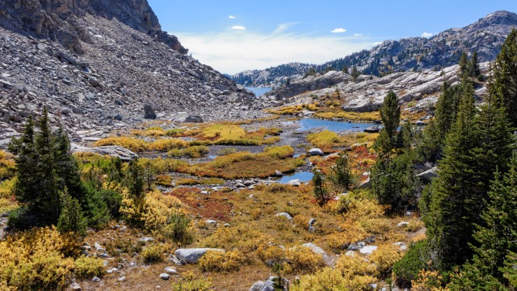
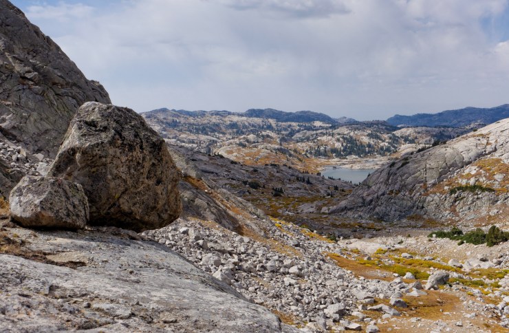
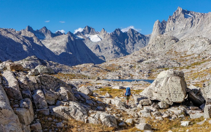
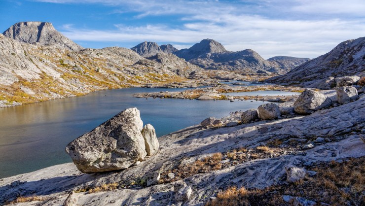
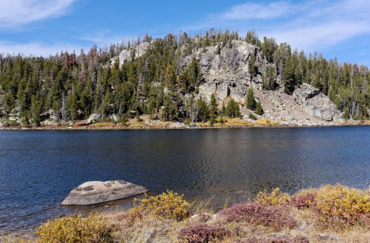
The first day of the trek starts with a 11-12 mile trek from the trailhead in Elkhart Part to Island Lake, which will be the basecamp for the next three nights. The hike on Day 1 is fairly long and involves ~2,600 feet of climbing, so plan to leave early and give yourself time. By hiking all the way to Island Lake on Day 1, you then do not need to move camp again until you head back to the trailhead!
The trek starts out by following Pole Creek for ~1.5 miles through a forested area. The trail steadily climbs at the beginning. Near the 2.5 mile mark, the trees start to thin as you continue to gradually climb. There is a Y-junction at the ~3 mile mark. Turning left takes you to Photographer’s Point (at the 4.3 mile mark), which is an excellent viewpoint looking down into a canyon. Going right at the junction instead would take you past Miller Lake, Middle Lake, and Upper Sweeney Lake. In this itinerary, you hike towards Photographer’s Point on the way to Island Lake and take the route by the lakes on the last day. After Photographer’s Point, you follow the Seneca Lake Trail all the way to Seneca Lake. Once you pass Seneca Lake and Little Seneca Lake, you take the Indian Pass Trail to Island Lake.


……….
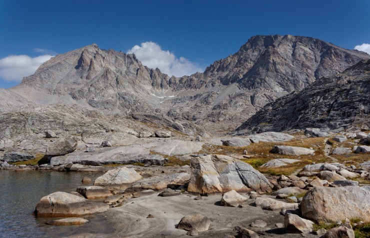
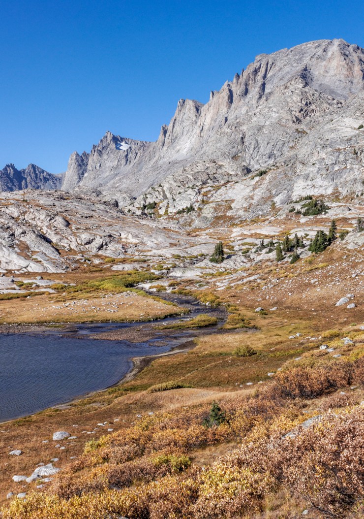
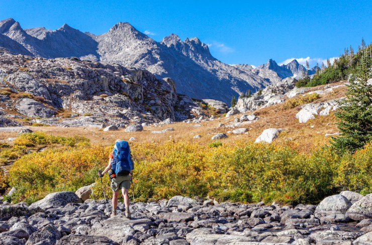
Day 2: 8.8 miles; +2,350 feet / -2,350 feet; Explore the Indian Basin and Indian Pass
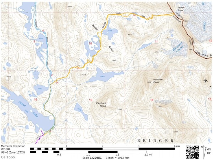
Map of the Day 2 hike of the Titcomb Basin Trek (PDF)

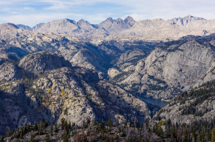
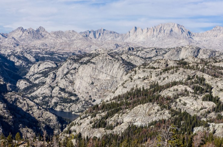
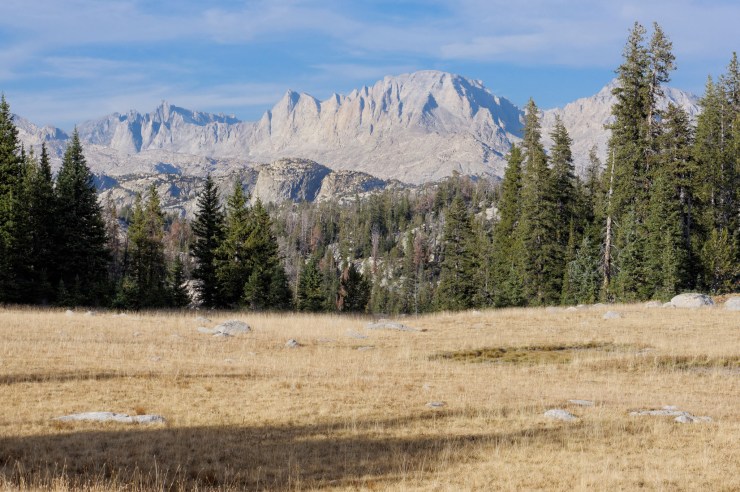
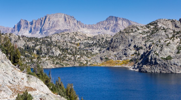
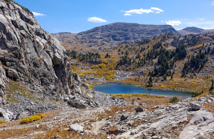
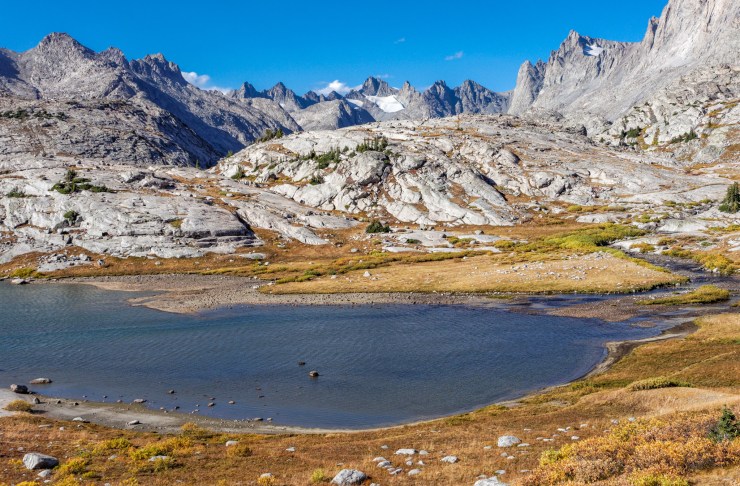
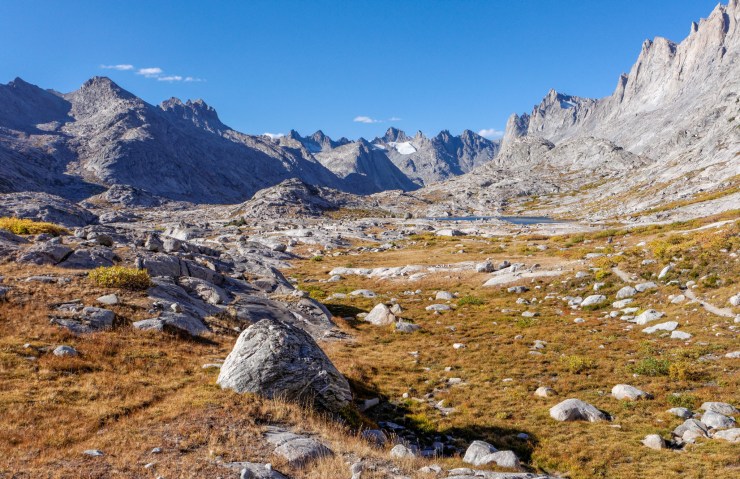
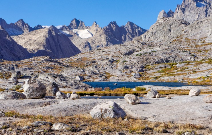
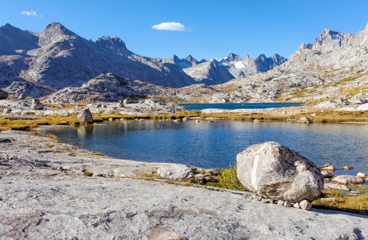
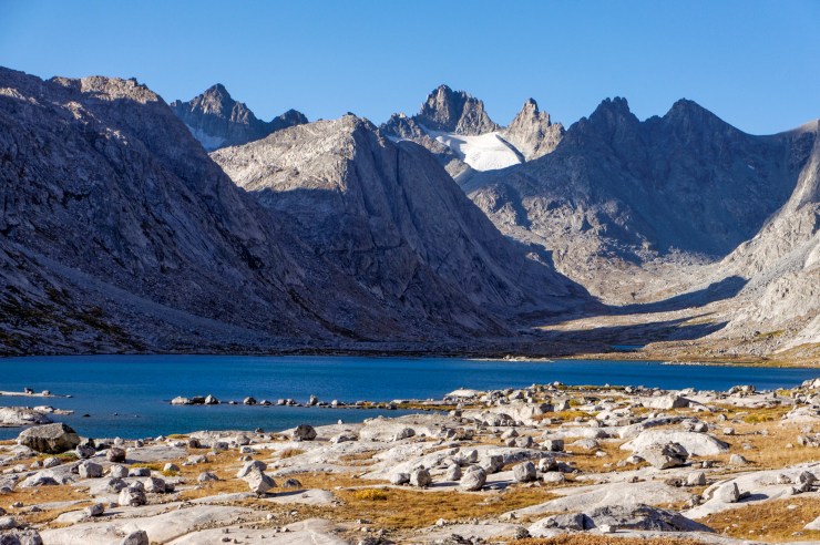
On day 2 of this trek, you head off to explore the Indian Basin and climb to the top of Indian Pass. Leave your camp at Island Lake and only take a day pack along the hike. The Indian Pass Trail leads north towards Lake 10,467. At the ~1 mile mark there is a junction. The trail to the east (Indian Pass Trail) leads to the Indian Basin and the trail to the north (Titcomb Basin Trail) leads to the Titcomb Basin. On this day, you continue on the Indian Pass Trail and head east to the Indian Basin and Indian Pass. The hike to the top of the pass and back is roughly 9 miles long. Along the way you can explore the several lakes in the Indian Basin and can view the Harrower Glacier and Knife Point Glacier from the top of Indian Pass.


For a nice selection of photos showing views from the top of Indian Pass, check out this page from HikingWalking.com.
……….
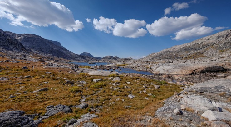
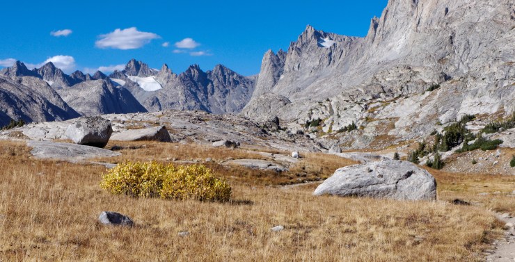
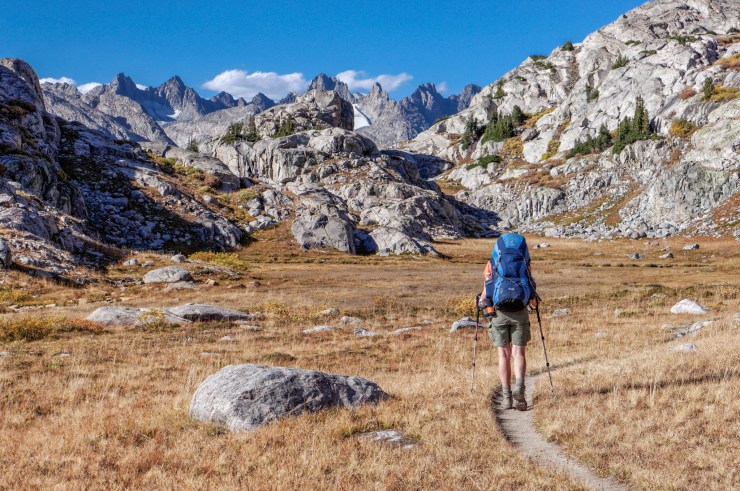
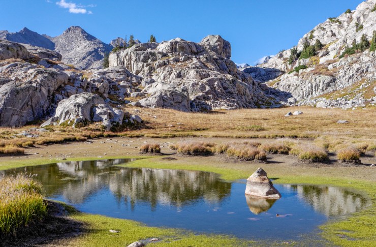
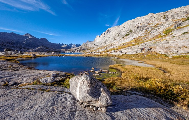
Day 3: 8.8 miles; +880 feet / -880 feet; Explore the Titcomb Basin
Map of the Day 3 hike of the Titcomb Basin Trek (PDF)

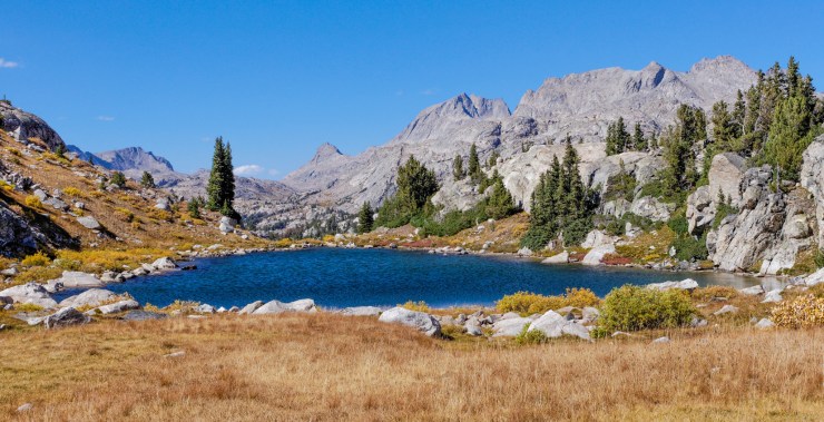
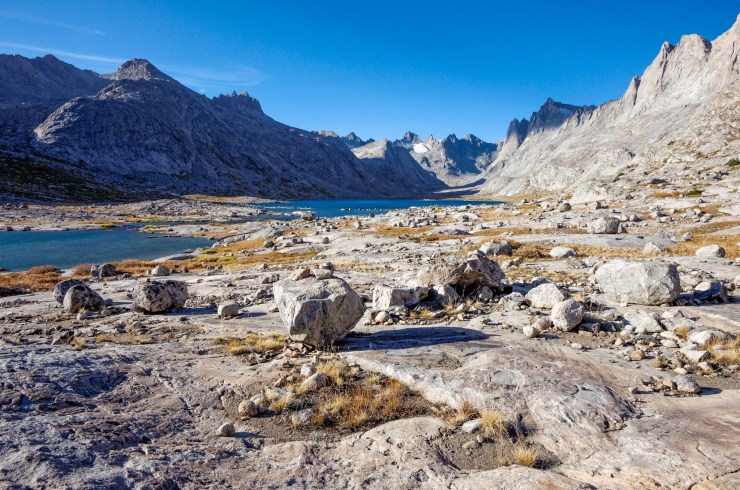
On day 3, explore the Titcomb Basin, which has some of the best views in the Wind River Range. Again leave camp at Island Lake and take the Indian Pass Trail north. At the 1 mile junction, head north on the Titcomb Basin Trail. This trail leads into the Titcomb Basin. It is roughly 9 miles round trip to the north tip of the Upper Titcomb Lake and back to Island Lake. Once in the Titcomb Basin, you can explore the area and take possible side trips to Summer Ice Lake and or Mistake Lake.

……….
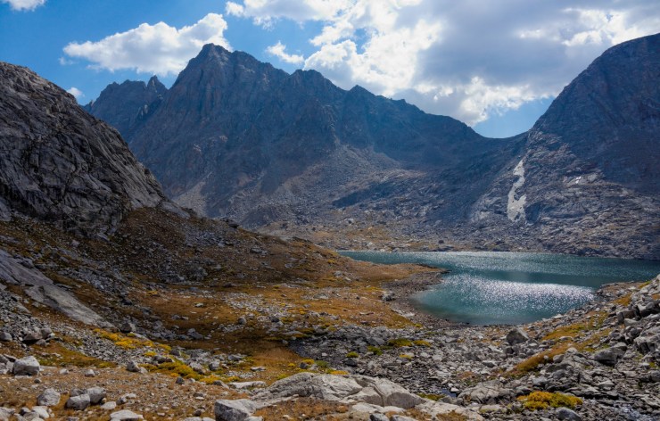
Day 4: 11.7 miles; +1,700 feet / -2,760 feet; Island Lake to Elkhart Park Trailhead
Map of the Day 4 hike of the Titcomb Basin Trek (PDF)
On the last day you hike out to the Elkhart Park Trailhead via the Indian Pass Trail and Seneca Lake Trails that you hiked in on. The only major difference will be taking the Sweeney Creek Trail at the ~6 mile mark instead of hiking by Photographer’s Point again. You do not have to take this route, but it allows you to see a few more lakes on your way out.

Here are some similar trip reports!
Cirque of the Towers Loop – Wind River Range, WY (45 mile loop)
Four Pass Loop – Maroon Bells Snowmass Wilderness, CO (28 mile loop)
North Circle Loop – Glacier National Park (52 mile loop)
Teton Crest Trail – Grand Teton National Park (48 mile loop)

Backpacked in Wind twice and heading back at 72 years old this summer! What time of year were the photos taken?
LikeLike
Hi Holger – These photos were all taken in mid September.
LikeLike
I am very excited about this trip and the location. However I only have a ranges of 5-7 miles (stamina, altitude). Is feasible add a couple days and do fewer miles? Are there plenty of campsite opportunities to support this? I appreciate the excellent documentation on your entire website, its a great service to other hikers.
LikeLike
Great description of the perfect trip.
I plan on doing it solo next Labor Day!Photos are very professional.
LikeLike
Will be our 2nd trip to the Winds in 2 years…the cirque last year and this one in Aug. renting llamas again to help us bring the kiddos!
LikeLike
Hi! I’ve really enjoyed your site – super informative and extremely helpful! My husband and I are trying to plan a backcountry trip this upcoming September ( Sep 23-Oct. 1st). I wanted to ask your opinion about hiking the Titcomb Basin, Wind Rivers during our suggested time? Would it be too risky with the weather?
Thanks again for all the great work on here! It’s been really helpful finding trips we want to do. (We’ve hiked a few already and loved each! )
LikeLike
I’m glad you found the site helpful! Weather in late September can be great or not so great… Unfortunately it is hard to predict. The photos on the site for the Wind River Range are from early to mid September so good weather can be found in the fall. However, you can encounter large temperature drops and snow fall once late September and October roll around.
Is it too risky to head out on a 40 mile loop in late September? It really depends. If you are cautious and keep a careful eye on the weather before leaving and bring the appropriate gear, I think it can be totally fine (or even great since crowds are often gone by late September). For example, you should make sure to bring your rain fly, warm clothing, and an appropriate sleeping bag (and maybe a GPS and map in case the trail gets lightly covered with snow and is hard to follow). It’ll be different then prime summer backpacking where you can leave the rain fly and cool weather gear at home. If the weather forecast looks sketchy before you leave, maybe consider choosing a route that doesn’t go up >10,000 feet. Basically, just make sure you are prepared and know the limits of your skill level and equipment.
LikeLike
Thanks for this great write up! I am looking at doing either the Titcomb Basin or Crique route around June 9-12, 2021. Do you think the routes will be open? We will certainly prepare with warm weather gear, but would love some options of lower level routes if the snowcover is still too deep to pass. Really appreciate any advice!
LikeLike
Hi Amy – I believe it’s most likely that the Titcomb Basin route would be tough to pull off in mid June this year. That is area is just so high in elevation that it often doesn’t melt out until July.
LikeLike
Any restrictions with leaving your stuff at island lake for the day 2 and 3 hikes? How busy do you think this would be end of August during the week?
LikeLike
Hi Greg – sorry for the late reply! I do not believe there are any restrictions about leaving some supplies at Island Lake while you day hike or explore elsewhere. That said, you would not want to leave any food or scented items unless they were properly stored in a bear canister. The last you want is a bear to tear open your tent and eat your supplies.
The Wind River Range can get pretty busy during peak season and is not limited by any permit quotas. End of August is probably not too bad since summer break is over and kids are back in school. That said, Island Lake is one of the more popular camping spots in the Winds. I imagine you would have a great trip at the end of August assuming the weather cooperated.
LikeLike