Iceline Trail and Takakkaw Falls – Yoho National Park (13 mile loop)

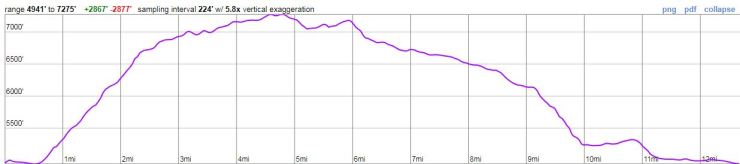
Trip overview – The Iceline Trail is one of the signature day hikes within Yoho National Park. It is typically hiked as a loop/circuit including Takakkaw Falls, the Iceline Trail, Little Yoho Valley, and Laughing Falls. The full circuit from the Takakkaw Falls parking lot is roughly 13 miles in length with a starting elevation of 4,950 feet, a peak elevation of 7,300 feet, and an overall elevation gain of ~3,000 feet. Highlights include great views of several glaciers, expansive views of Yoho Valley and Little Yoho Valley, and multiple waterfalls. We completed this hike in September of 2018.

Shop Sale & Clearance Items at REI.com (up to 50% off)!


Preparations:

Where to stay: For our trip to Yoho and Banff National Parks, we decided to stay in the town of Banff. This meant we had a ~1.5 hour drive to the trailhead from our hotel. This drive was a bit long, but very beautiful. We only spent one day in Yoho National Park, so this made sense for us. If you plan to spend multiple days exploring Yoho National Park, you may want to stay closer or within Yoho NP. There are many camping options in the park or you could stay in Field, B.C. or in one of the many vacation rentals around the park. More info on accommodations can be found at the Yoho National Park website.

Permits: You will need to pay an entrance fee upon entering the National Parks in the vicinity of Banff and Yoho. More info on the fees can be found here. If you purchase a park pass upon entry to Banff National Park, that pass will allow you into Yoho National Park as well. Beyond the entrance fee, you do not need to obtain any permit to day hike within Yoho National Park (except for Lake O’hara, more info here). If you are backpacking, however, you do need to get a backcountry permit. Permits can be reserved online at the national park website.

Supplies: If you are doing a lot of hiking on remote trails, it may be wise to invest in some bear spray to protect yourself in case you come across a grizzly bear. If you only plan to hike popular trails and have a large group (more than 4 people), bear spray is probably unnecessary. A good bug repellent is also nice to have because the mosquitoes and flies can be a nuisance in the Canadian Rockies. Finally, you will want a variety of layers to carry with you because the weather in the Yoho National Park can change quite a bit over the course of a day. It can also be quite chilly and windy in sections of the Iceline Trail that are above the treeline. For trail maps, I recommend Tim Jensen’s “The Best Day Hikes in the Canadian Rockies.” This book has maps, descriptions, and rating for many of the hikes in Yoho and the neighboring national parks.

Here are some suggested hiking clothes and gear that are good for the Iceline Trail hike (I recommend bring a small backpack to carry some layers):

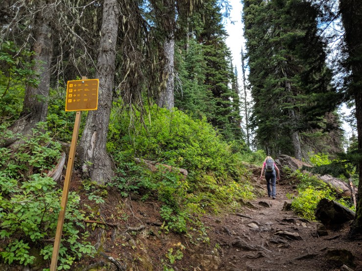
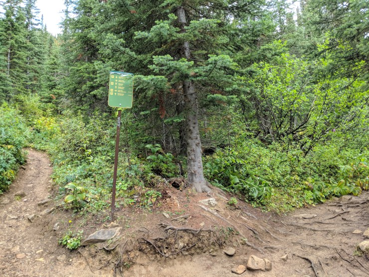
Trail Conditions and Difficulty: The trail are along this circuit are generally well marked. I do advise bringing a map or studying a map before hiking though. While there are trail signs marking the different trails, there are not explicit directions showing how to get back to the Takakkaw Falls parking lot. With a map, it is easy to figure out the correct the route.

The Iceline Trail is an overall tough day hike. There is a sustained climb over several miles culminating at the Iceline Summit, so hikers should be in good shape and be prepare to hike for at least 5 hours. During the normal hiking season, no special equipment or extensive route finding is required for this hike though.

view-from-iceline-summit-looking-towards-little-yoho-valley
View from the Iceline Summit looking North towards Little Yoho Valley.


Iceline Trail Hike Details: 13 miles; +/- 3,100 feet of elevation; Start at the Takakkaw Falls parking lot, Yoho Valley Trail to Iceline Trail to Little Yoho Valley Trail to Yoho Valley Trail.

Yoho-national-park-iceline-trail-map
Overall map of the Iceline Trail loop in Yoho National Park (purple line). This trek start and ends at the Takakkaw Falls parking lot.

PDF version of the map of the Iceline Trail in Yoho National Park

Yoho-iceline-trail-elevation-profile
Approximate elevation profile of the Iceline Hike in Yoho National Park

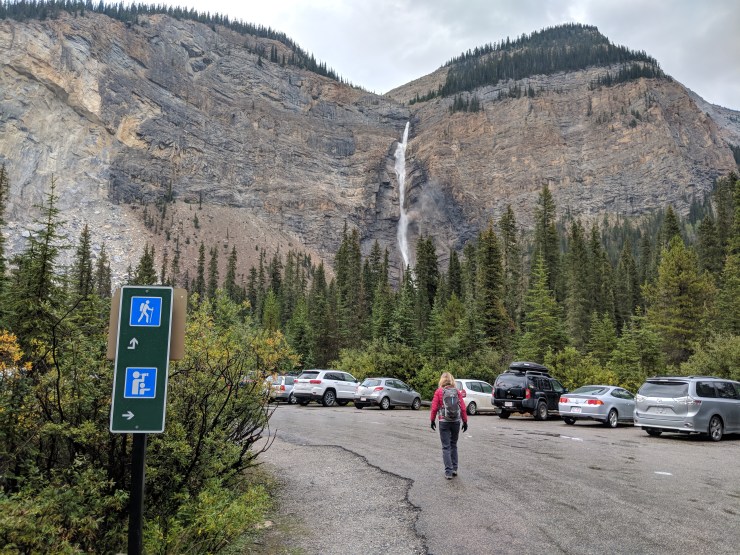
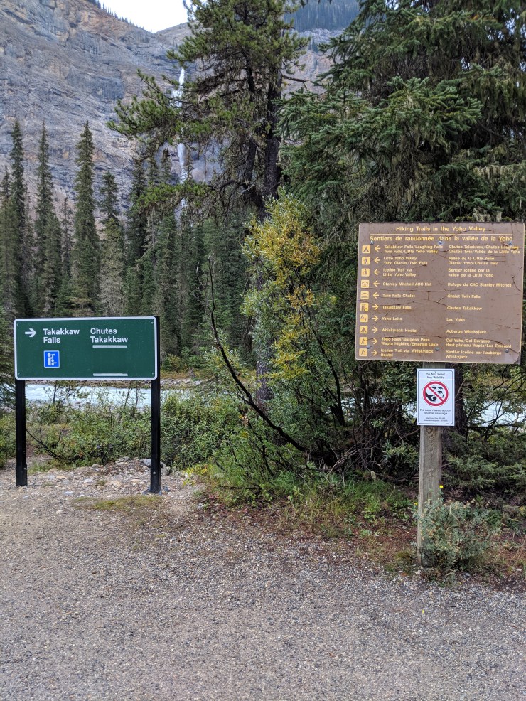
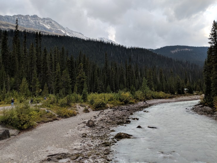
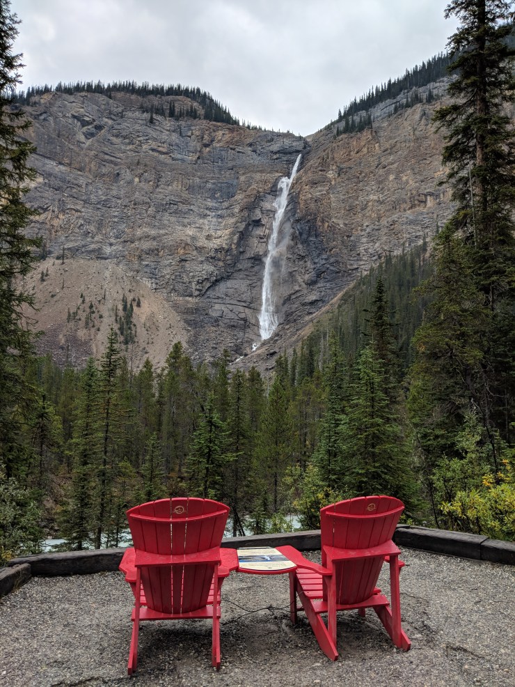
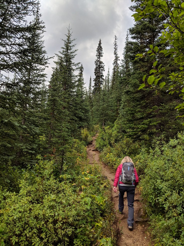
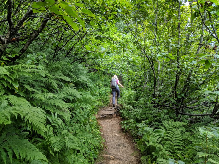
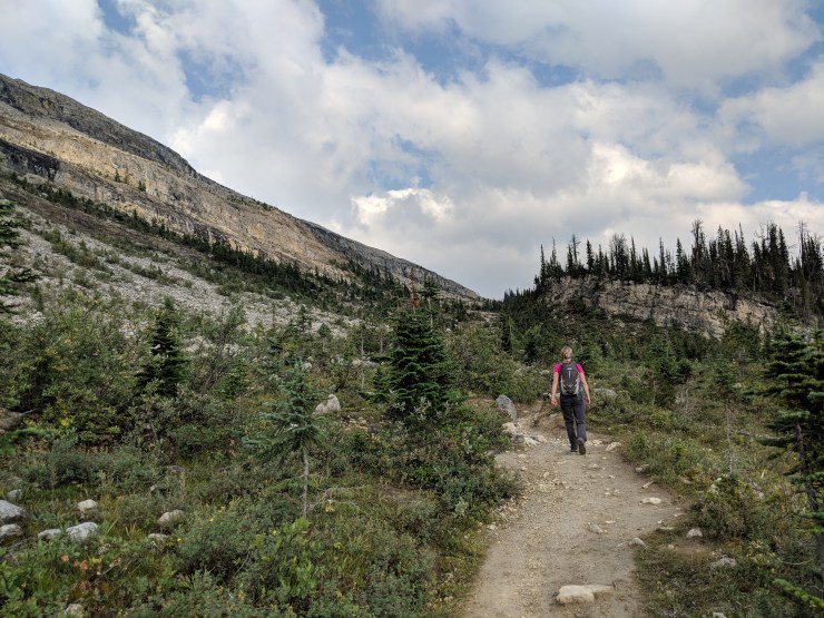
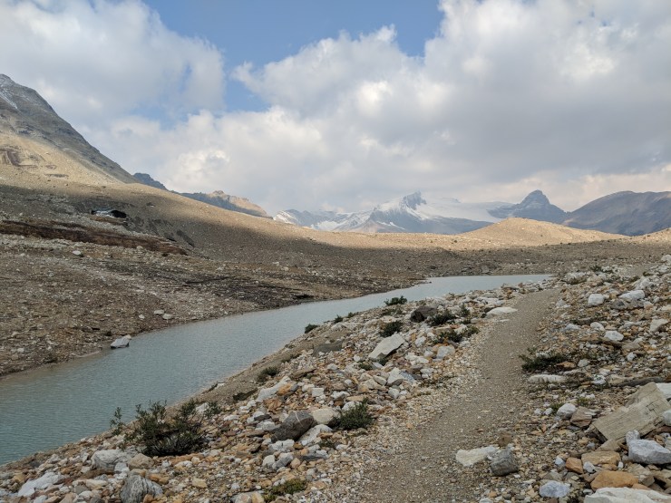
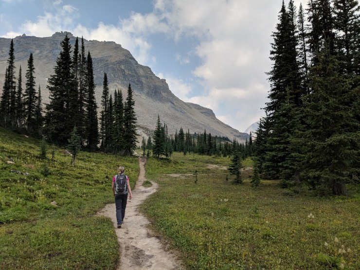
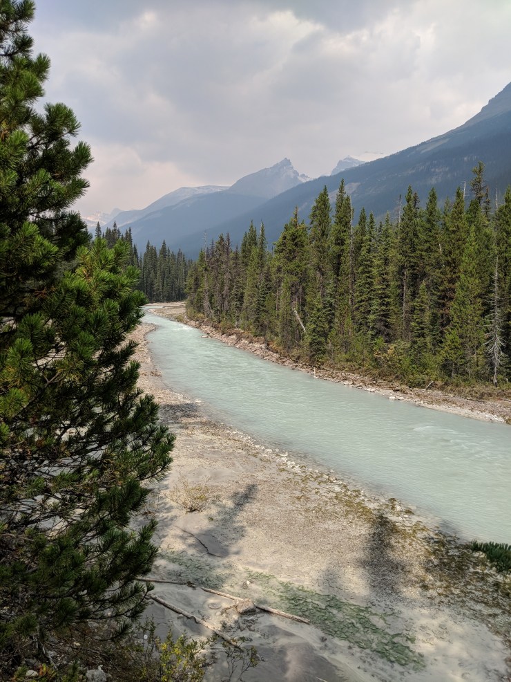
After driving along the Trans-Canada Highway, you take the winding Yoho Valley Road to the Takakkaw Falls parking area. After parking, begin the Iceline hike by hiking towards Takakkaw Falls. Along this first section of the trail, which follows the Yoho River, you get some nice views of the falls up close. You also get nice views of the mountains on either side of Yoho Valley. At the start, follow signs for Iceline via Whiskyjack along the Yoho Valley Trail.

Yoho-iceline-trail-takakkaw-falls-parking
Beginning the hike to the Iceline Trail from the Takakkaw Falls parking area. The hike starts along the Yoho Valley Trail.
Yoho-iceline-trail-sign-trailhead
Sign at the trailhead near the Takakkaw Falls parking area. Follow the arrow to Iceline Trail via the Whiskyjack Hostel.
Yoho-iceline-trail-takakkaw-falls-yoho-river
During the first portion of the hike you get great views of Takakkaw Falls and the Yoho River.
Yoho-iceline-trail-yoho-river-trail
View of the Yoho Valley Trail which travels along the shore of the Yoho River. This section of the trail will be popular given the proximity to the parking lot and Takakkaw Falls.
Yoho-iceline-trail-takakkaw-falls-red-chairs
View of Takakkaw Falls and two of the red chairs set up by the national park service.
Yoho-iceline-trail-view-takakkaw-falls
Another great view of the Yoho River and Takakkaw Falls. Shortly after this point the trail turns away from the river and heads towards the hostel.

After roughly 0.25 miles, the trail turns away from the Yoho River and heads towards the Whiskey Jack Hostel. The trail crosses Yoho Valley Road before you reach the Hostel. You reach the hostel at about the 0.6 mile mark.

Yoho-iceline-trail-yoho-river-trail-towards-hostel
Hiking along the Yoho Valley Trail towards the Yoho Valley Road and the Whiskyjack Hostel (pictured: Osprey women’s Tempest 20 day pack)
Yoho-iceline-trail-back-towards-takakkaw-falls
View looking back towards Takakkaw Falls from near where you cross Yoho Valley Road.
Yoho-iceline-trail-crossing-road-to-hostel
Hiking towards the Whiskyjack hostel. The Iceline Trail is straight ahead, but is up above the treeline (pictured: prAna Halle Pants)
Yoho-iceline-trail-trailhead-whiskyjack-hostel
Trailhead near the Whiskyjack Hostel. Here you continue onto the Yoho Lake Trail towards the Iceline Trail.

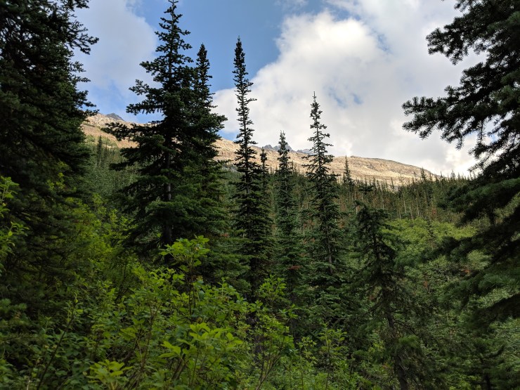
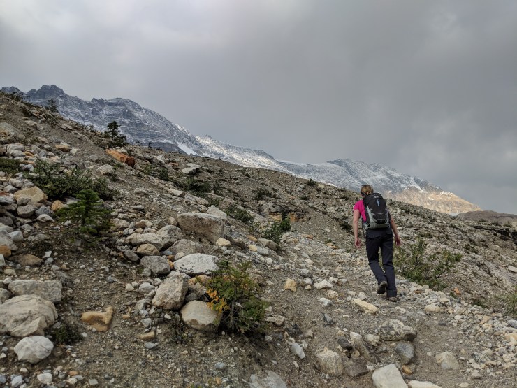
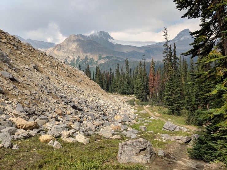
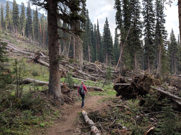
At this point, the trail begins to climb up towards the Iceline Trail. The climb starts with a ~1 mile and +2,000 feet steep climb through the forest. At this point you are hiking on the Yoho Lake Trail and heading towards the junction with the Iceline Trail. Along the way you will see a junctions for trails to Hidden Lakes and then to Yoho Lakes. After you pass the junction where the Yoho Lake Trail splits off from the Iceline Trail, you are on the Iceline Trail and will follow this for several miles.

Hiking-on-yoho-lake-trail-towards-iceline-trail
The steep climb up to the Iceline Trail begins shortly after the Whiskyjack Hostel.
view-takakkaw-falls-from-yoho-lake-trail
Although the climb is tough, you can take breaks and enjoy the great views of Takakkaw Falls across the Yoho Valley.
yoho-lake-trail-climb-through-forest
The climb continues up through the forest.
yoho-lake-trail-junction-hidden-lakes
Along the way you reach a junction for Hidden Lakes. Follow the sign towards the Iceline Trail.
yoho-lake-trail-junction-with-emerald-lake-and-yoho-lake-turn-off
Shortly after, you reach a second junction that leads to Yoho and Emerald Lake. Again, follow arrows for the Iceline Trail.

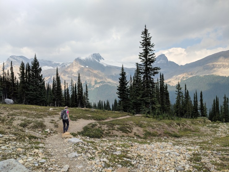
The Iceline starts off still in the forest and then around the 1.7 mile mark, emerges above the tree line. Soon you reach a junction with the trail that heads to Yoho and Emerald Lake. Continue to follow the Iceline Trail here.

hiking-through-forest-on-iceline-trail
The start of the Iceline Trail continues climbing through the forest.
view-of-takakkaw-falls-from-start-of-iceline-trail
As the trail gets higher in the elevation the views of Yoho Valley get better and better.
view-looking-up-to-rock-shelf-that-iceline-trail-traverses
Here is a glimpse of the rock wall that the Iceline Trail traverses once you get above the treeline.
iceline-trail-getting-close-to-treeline
As the Iceline Trail gets higher in elevation the trees get smaller.
iceline-trail-view-of-yoho-valley-takakkaw-falls
View of Takakkaw Falls and the icefield above it.
iceline-trail-above-treeline
Hiking along the Iceline Trail as it start to emerge above the treeline.
iceline-trail-junction-to-emerald-and-yoho-lake
Junction with a trail that heads to Yoho and Emerald Lake.

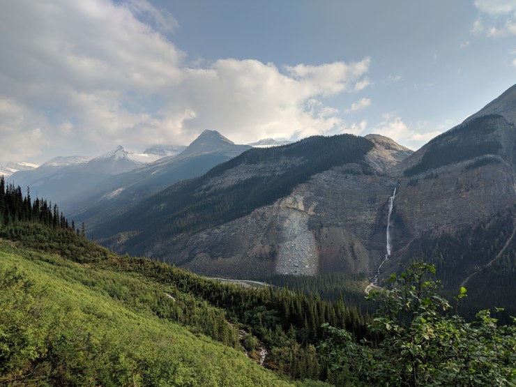
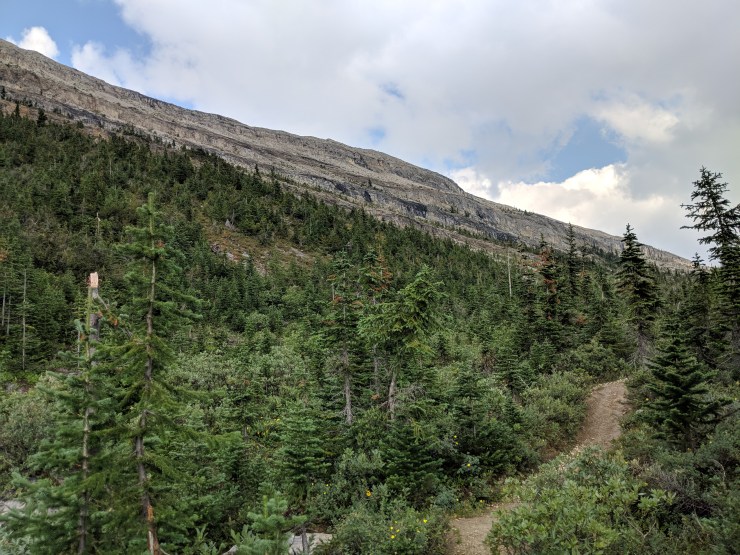
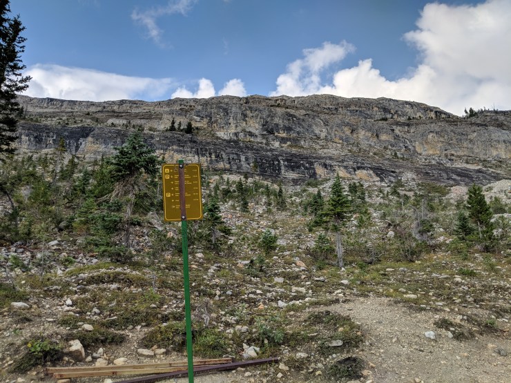
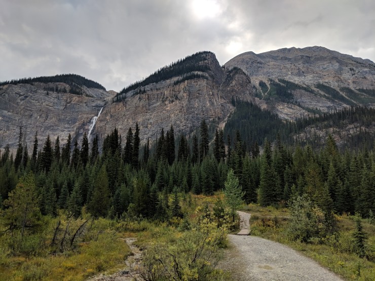
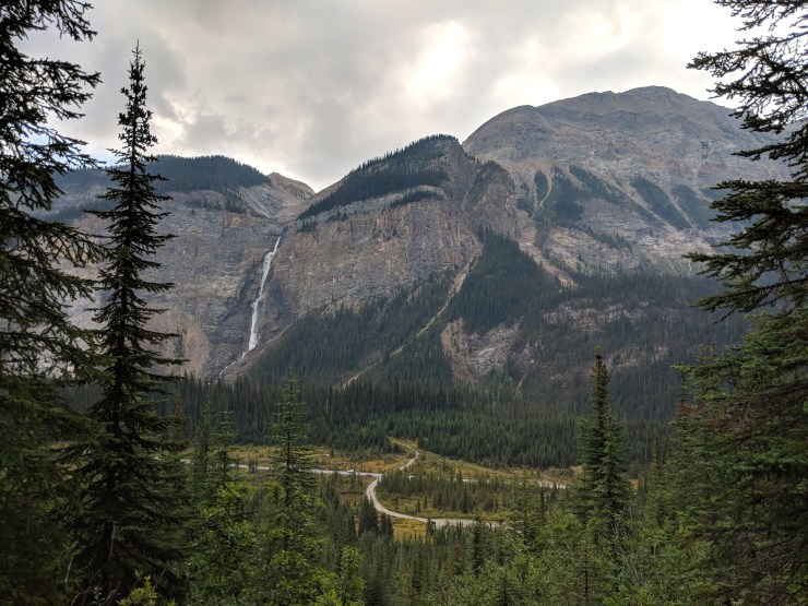
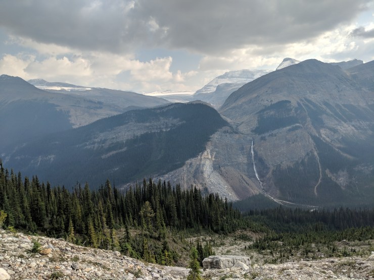
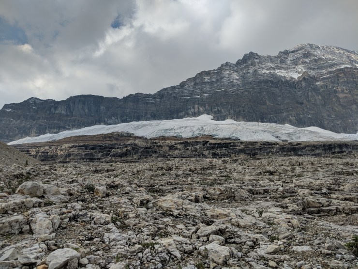
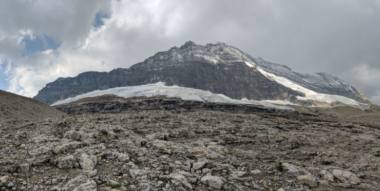
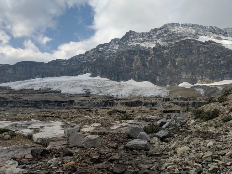
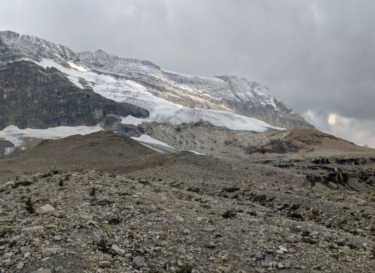
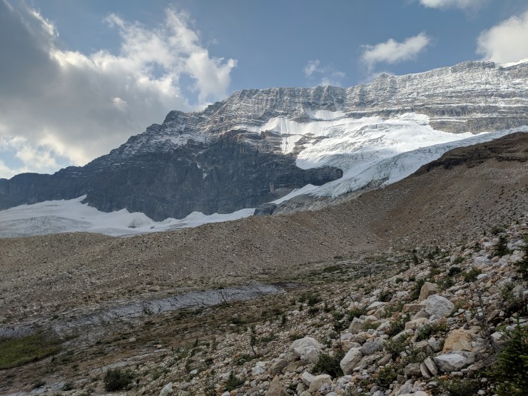
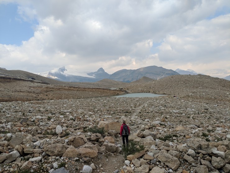
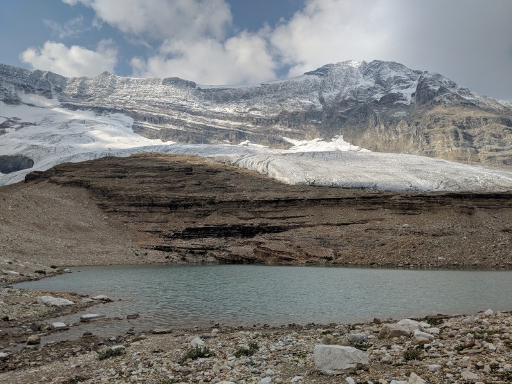
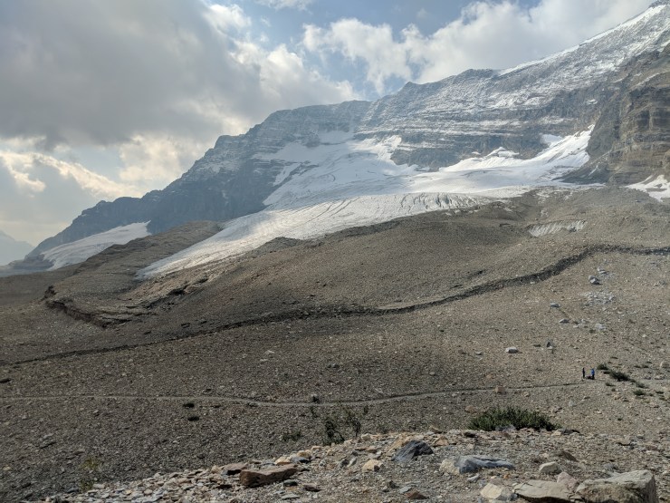
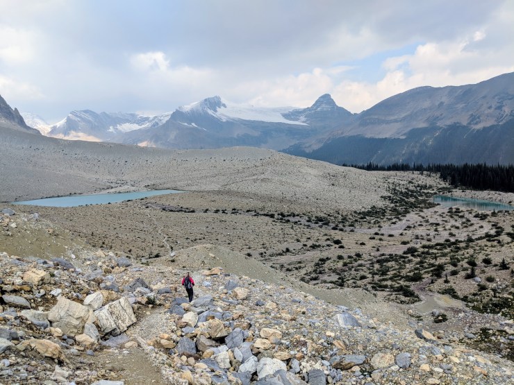
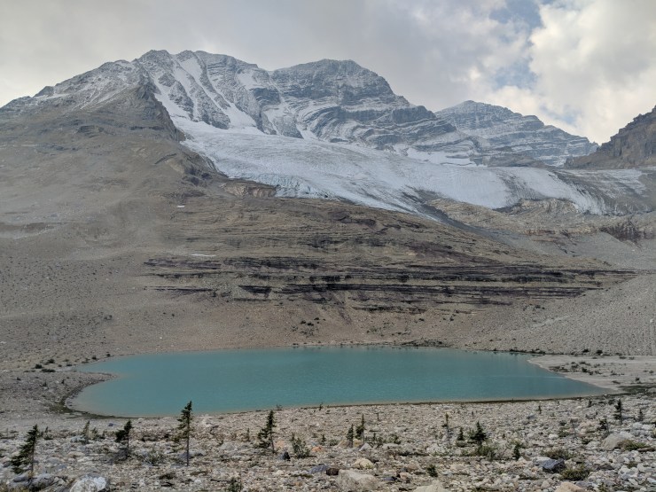
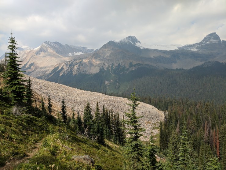
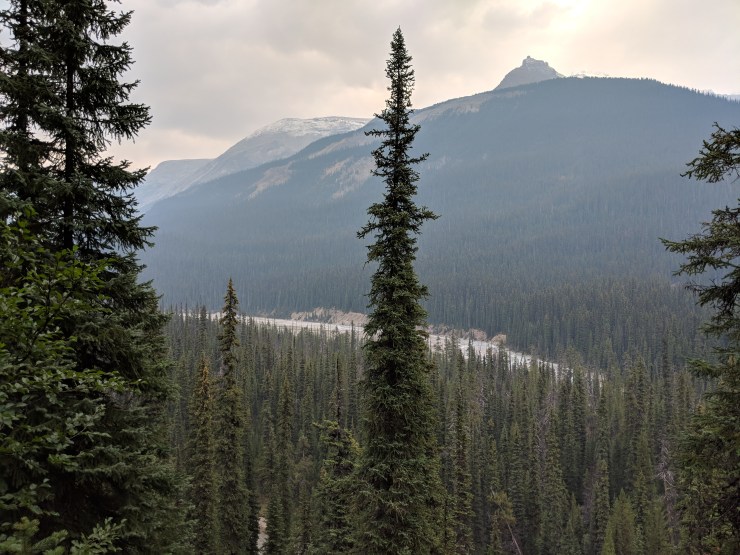
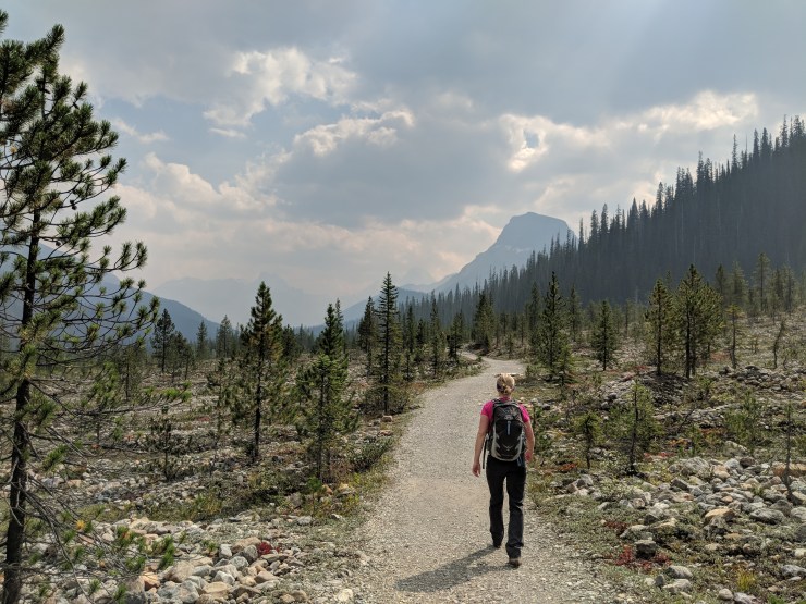
At this point the views really start to open up and you get great views of Takakkaw Falls and the Daly Glacier to the East and the Emerald Glacier to the West. The next ~2.5 miles of the Iceline Trail are above the tree line and provide really expansive views of the Yoho Valley and the nearby glaciers. There are also several glacial lakes that the trail passes. The trail continues to climb until about the 5 mile mark where you take a short side trip up a hill to the top of the Iceline Summit.

daly-glacier-and-icefield-from-iceline-trail
View from the Iceline Trail looking towards the Daly Glacier and the Icefield.
takakkaw-falls-daly-glacier-from-iceline-trail
Another view of Takakkaw Falls and the Yoho Valley.
iceline-trail-with-mount-balfour-in-background
The Iceline Trail continues to climb and you get nice views of the mountains across the Yoho Valley.
iceline-trail-climb-up-to-emerald-glacier
There is a final steep climb that leads up to the great glacier views.
iceline-trail-emerald-glacier-first-view
Taking in the first view of the Emerald Glacier on the Iceline Trail.
iceline-trail-first-close-view-emerald-glacier
Picture of the Emerald Glacier and the rock steps below it.
iceline-trail-panoramic-view-emerald-glacier
Panoramic view of the Emerald Glacier as seen from the Iceline Trail.
iceline-trail-emerald-glacier
Another view of the Emerald Glacier and the interesting rock steps beneath it.
iceline-trail-emerald-glacier-and-moraine
The Iceline Trail traverses along side the glacier, so you get great views the whole way.
iceline-trail-expansive-view-leaving-emerald-glacier
The trail then briefly heads back into the open area as you traverse over a couple moraines.
iceline-trail-lake-below-emerald-glacier
You then come across a lake and waterfall beneath the Emerald Glacier.
iceline-trail-waterfall-near-emerald-glacier
The Iceline Trail then leads up and over the ridge behind the waterfall.
iceline-trail-lake-under-emerald-glacier
On the other side of the ridge, you find another lake made of Emerald Glacier melt.

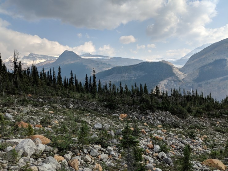
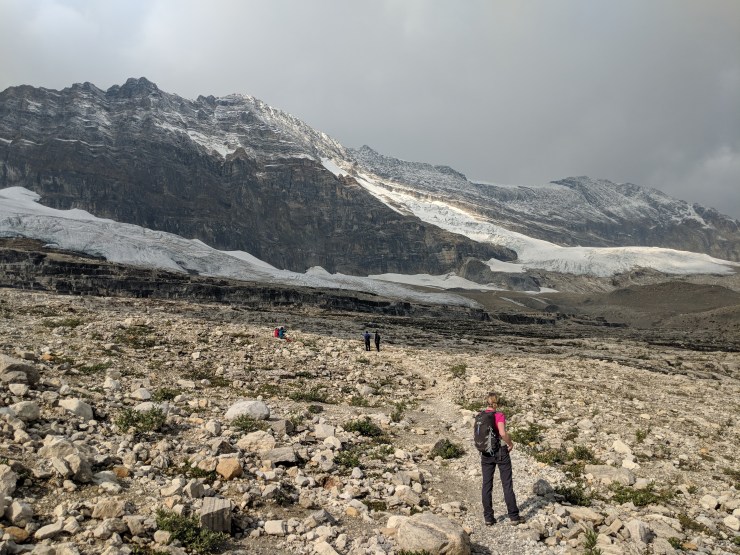
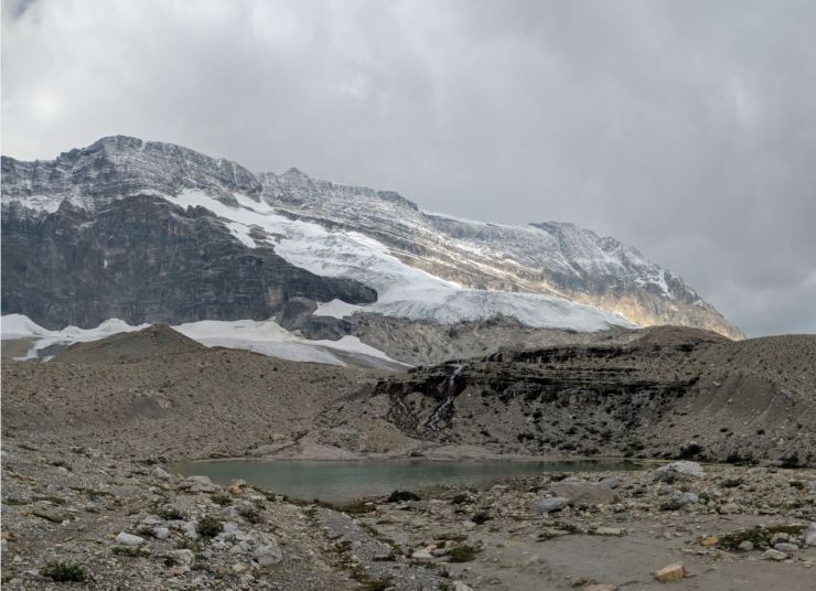
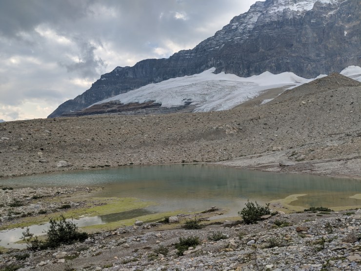
After the first set of lakes, you hike another 15-20 minutes before reaching two more lakes. There is also a junction here with a trail to Celeste Lake. Stay on the Iceline Trail. From here you get a good glimpse of The Vice President, a peak in the President Range.

iceline-trail-hiker-view
The Iceline Trail then meanders through the rock field towards another set of glacial lakes.
iceline-trail-looking-towards-celeste-lake
You get some great views looking down towards the area where Lake Celeste resides.
hiker-along-iceline-trail-yoho
This area has some large glacial moraines that the Iceline Trail travels up and over.
iceline-trail-looking-back-at-emerald-glacier
Along the Iceline Trail looking back towards one section of the Emerald Glacier.
iceline-trail-hiking-towards-lake-beneath-vice-president
The Iceline Trail then reaches another set of lakes near the junction with the Lake Celeste Trail.
iceline-trail-vice-president-glacier-and-lake
View of the lake and the Vice President mountain behind it.
iceline-trail-long-lake-vice-president
The Iceline Trail follows along the shore of a long, narrow lake.

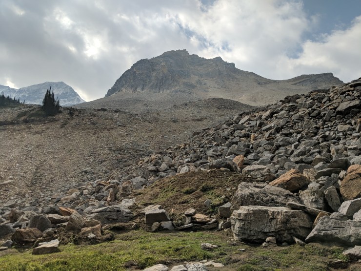
Shortly after leaving this area you will see the Iceline Summit and that side trail that leads up to. Take a quick trip to the summit and enjoy the view. From there, head back down to the Iceline Trail and continue on towards Little Yoho Valley.

iceline-trail-hiking-towards-iceline-summit
Hiking towards the Iceline Summit. The summit is the small peak in the sun in the center of this picture.
view-from-iceline-summit-looking-towards-little-yoho-valley
View from the Iceline Summit looking North towards Little Yoho Valley. The Iceline Trail heads this way and pass the lake on the left.
view-from-summit-looking-back-at-emerald-glacier
View from the Iceline Summit looking South back at the Emerald Glacier.
iceline-trail-descending-down-from-iceline-summit
Descending from the Iceline Summit and hiking towards two more lakes along the trail (pictured: prAna Lyra down jacket).

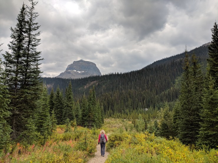
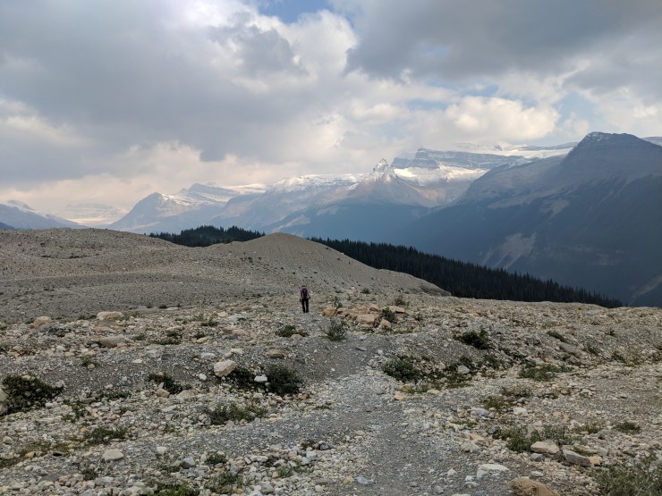
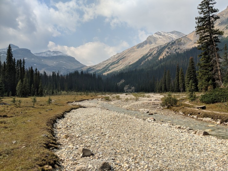
After descending from the Iceline Summit, the trail continues above the tree line for another mile or so. The views are great as you head towards the Little Yoho Valley. The trail then descends into the trees again as it heads down towards the Little Yoho River. During the descent you get some great views of the mountains to the North.

iceline-trail-the-secretary-treasurer-peak-and-glacier
Glacial lake along the Iceline Trail. This lake sits in front of the Secretary-Treasurer sub peak.
iceline-trail-approaching-descent-to-little-yoho-valley
View from the Iceline Trail as it approaches the forest again.
iceline-trail-back-into-the-forest
The Iceline Trail then begins the descent through the forest down towards the Little Yoho River.
Iceline-trail-hiking-towards-little-yoho-valley
Along the way, there are great views of the mountains on the other side of Little Yoho Valley (pictured: Patagonia down sweater vest)
iceline-trail-looking-towards-mount-mcarthur
View looking across Little Yoho Valley.
iceline-looking-back-towards-vice-president
Looking back the Vice President mountain as the Iceline Trail traverse around a scree pile.
iceline-trail-along-scree-pile-to-little-yoho-valley
The Iceline Trail as it heads down towards the Little Yoho River.

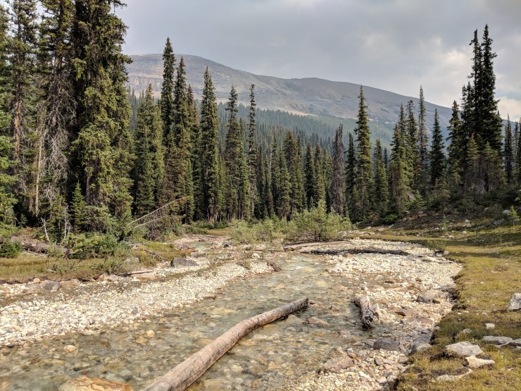
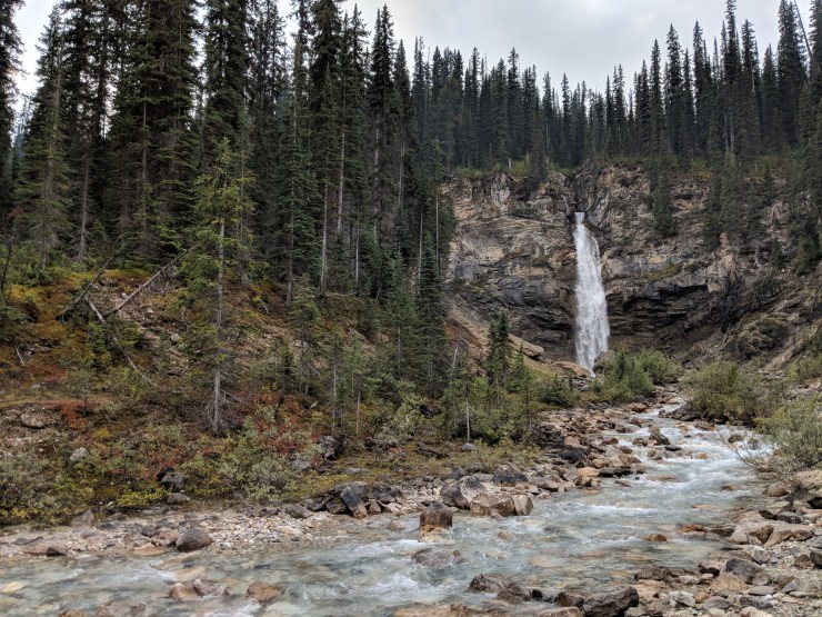
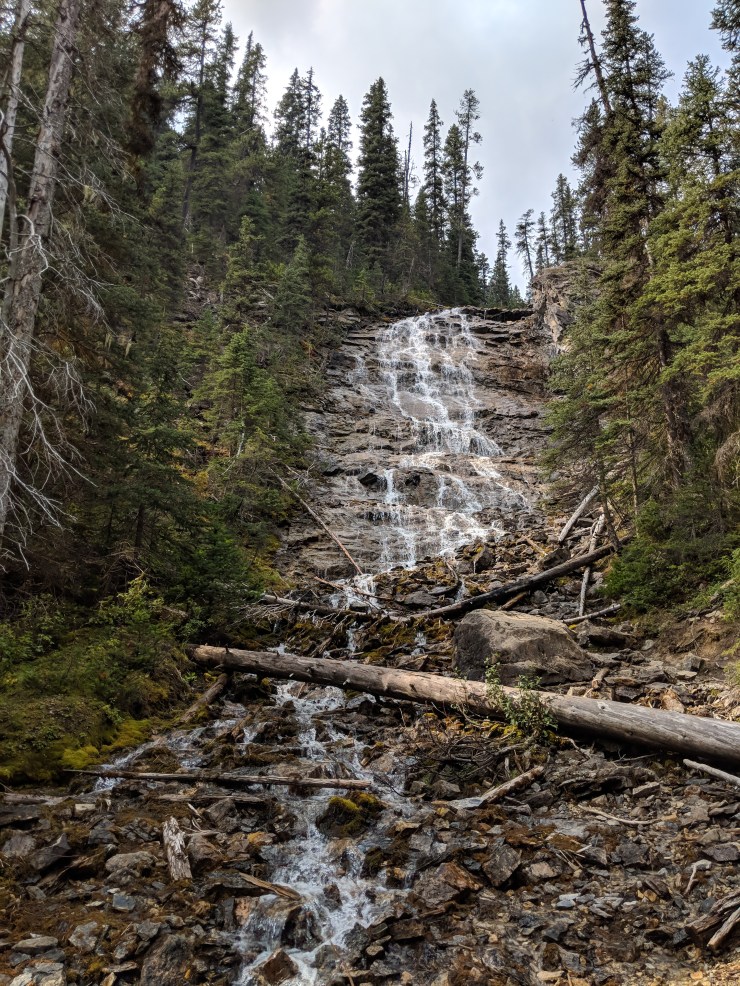
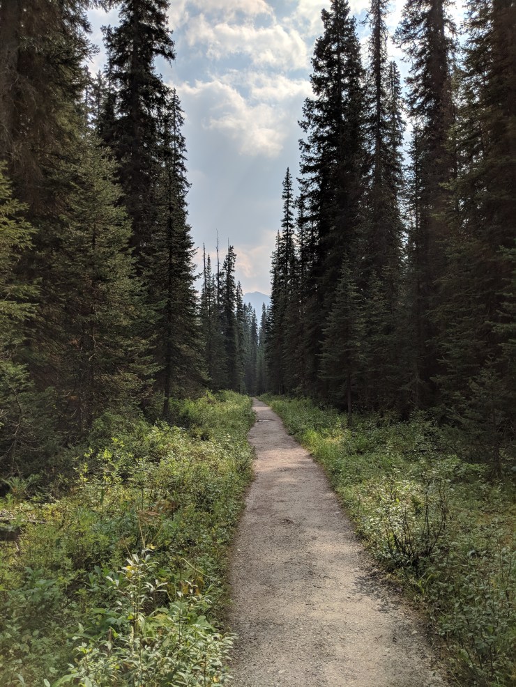
At the ~7 mile mark, you reach the Little Yoho River. After crossing the river you come upon an Alpine Club hut. At this point you begin hiking on the Little Yoho Valley Trail and follow the Little Yoho River through the forest. After roughly 3 miles descending, the trail meets up with Laughing Falls. You can take a short break to go check out the waterfall up close.

iceline-trail-little-yoho-river-looking-west
View at the shore of the Little Yoho River, looking west.
iceline-trail-little-yoho-river-looking-east
View at the shore of the Little Yoho River, looking east.
alpine-club-little-yoho-river
You come across one of the Alpine Clubs after you cross the Little Yoho River.
starting-hike-on-little-yoho-valley-trail
Hiking along the Little Yoho Valley Trail towards Laughing Falls.
little-yoho-valley-trail-avalanche
Avalanche area along the Little Yoho Valley Trail.
little-yoho-valley-trail-hiking-through-avalanche-area
Hiking through the avalanche area
little-yoho-valley-trail-whaleback-trail-junction
Around the 8-9 mile mark you reach a junction with the Whaleback Trail. Continue hiking towards Laughing Falls. Much of this section of the hike is deep in the forest, so the views are not spectacular.
view-of-yoho-river-from-little-yoho-valley-trail
As you continue you eventually begin to see the Yoho River in the distance. This means you are getting closer to Laughing Falls.
laughing-falls-iceline-trail
View of Laughing Falls near the Yoho River.

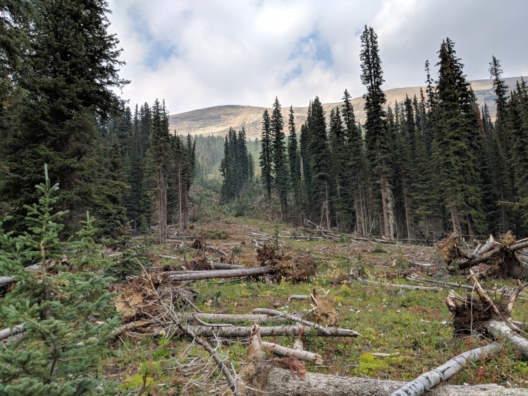
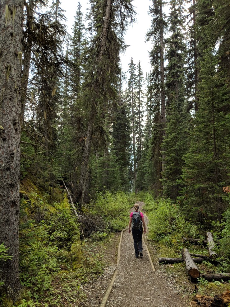
After Laughing Falls, you take the Yoho Valley Trail back towards Takakkaw Falls. Along the way you can make brief stops to see Angels Staircase Falls and Point Lace Falls. Both are very short side trips from the main trail. The hike back to the parking lot is roughly 3 miles from Laughing Falls.

hiking-yoho-valley-trail
Hiking along the Yoho Valley Trail through the forest. This section of the trail is a bit more popular because many hikers walk between Takakkaw Falls and Laughing Falls (pictured: prAna Halle Pants)
yoho-valley-trail-point-lace-falls
View of Point Lace Falls, which is a short side trip off of Yoho Valley Trail.
yoho-valley-trail-angels-staircase-falls
View of Angel’s Staircase Falls, which is another short trip from the trail. Unfortunately the water was not flowing down this falls at the beginning of September.
yoho-valley-trail-final-stretch
After the two falls, it is a relatively simple and flat hike back to the Takakkaw Falls area.
blue-yoho-river
View of the turquoise Yoho River from the trail.
yoho-valley-trail-approaching-campground
The Yoho Valley Trail goes in and out of the forest in a couple different areas. The views are quite nice when you leave the forest (pictured: Osprey women’s Tempest 20 day pack)
yoho-valley-trail-takakkaw-falls
View of Takakkaw Falls from the Yoho Valley Trail.

At this point, you continue hiking until your meet back up with the Takakkaw Falls parking lot. When you pass through the campground, you will know that you are close. Overall this is a great but challenging hike!


Here are some similar hikes:

Banff and Canmore Hiking – Plain of Six Glaciers Trail and Grassi Lakes

Grand Canyon Hiking – South Kaibab and Bright Angel Trails

5 Replies to “Iceline Trail and Takakkaw Falls – Yoho National Park (13 mile loop)”

  1. Thank you for that amazing review! We have 2 nights at Twin Falls campground so I’ve been trying to plan the best way to see it all! I’m so excited!

    Like

Leave a Reply