


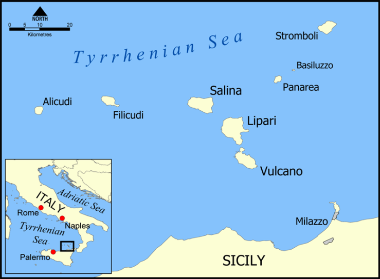
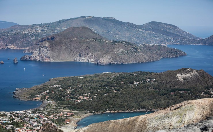
Trip overview: The Aeolian Islands are a volcanic archipelago in Italy just north of Sicily. The islands are a UNESCO Heritage site and are a popular tourist destination due to their unique geography and beauty. We visited the island of Salina during an eight day trip to Sicily. During our visit to Salina, we hiked to the summit of Monte dei Porri. The hike is roughly 4 miles round trip from the village of Valdichiesa or 8 miles round trip from Malfa. The trail climbs ~1,700 feet from Valdichiesa (2,500 feet from Malfa) and reaches a peak elevation of ~2,800 feet. Highlights include greats views of the Monte Fossa delle Felci volcano, sweeping views of the Salina island landscape, and views of several other Aeolian Islands in the distance. We completed this hike in September of 2017. We also describe several other popular hikes on different islands in the Aeolian archipelago.
In this report, I will both describe the hike we completed on Salina as well as describe various other hikes within the Aeolian Islands. My hope is that this post will be instructive for anyone looking for hikes on any of the popular island!
Links to skip to various islands:
- Jump to Salina hikes
- Jump to Stromboli hikes
- Jump to Vulcano hikes
- Jump to Panarea hikes
- Jump to Lipari hikes
Shop Sale & Clearance Items at REI.com (up to 50% off)!
General Information:
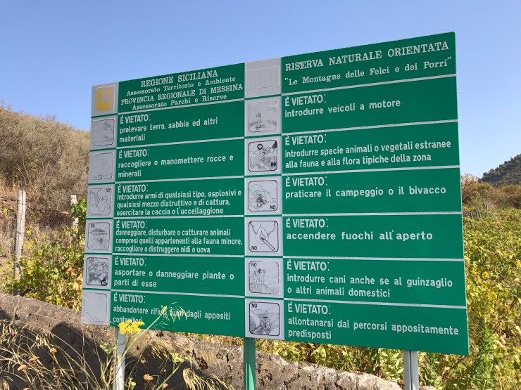
Permits: The only hike that requires any sort of permit or guide is the hike to the top of Stromboli. Since 2005 guides have been required to hike the all the way to the top of the volcanic crater here. Without a guide, you will be stopped ~400 meters from the top. All other hikes described in this post are free and do not require any guide or permit.
Getting to the Aeolian Islands: It is most common to reach the Aeolian Islands via a ferry or hydrofoil. You can reach the islands from the Milazzo, Messina, or Palermo ports in Sicily or from Naples or Reggio Calabria on mainland Italy. The boat schedules vary depending on the time of year, so be sure to check what routes are available at the time of year you plan to visit. Hydrofoil tickets typically cost between 20-50 Euro one-way depending on the exact route and time of year. The main hydrofoil operator is Liberty Lines and they allow you to book tickets online. Some ferry operators including NGI and Siremar are options. The hydrofoil is fastest and is typically the recommended method unless you need to bring a vehicle. If you have a lot of money to burn, you can also arrange a helicopter to transfer you to the Aeolian Islands…
To get to Sicily, most travelers fly into either the Palermo or Catania airports. From the airports, you can then take a regional train to whichever port you plan to leave from.
Supplies: Many of the trails listed here do not have water along the way, so a 2.5 liter camelback is good to bring along. Some trails are also very exposed to the sun, so sunscreen and a long sleeve shirt is highly advised. Beyond that, the equipment you need will depend on which specific hike you do. For hiking to the top of Stromboli, you likely want trekking poles and real hiking shoes. You also need a flashlight and helmet for the Stromboli hike, but these are likely provided by your guide or can be rented before your hike. For most of the other hikes, you likely can get away with just running or walking shoes. Lastly, the views along the hikes are spectacular, so be sure to bring your camera!
Difficulty: Most of the trails on the Aeolian Islands are of moderate length and are not too difficult. However, the exposed trails can be very hot during the summer, so you must prepare accordingly (bring water and sun protection). The hikes are all done as day hikes and no camping along the way is required. Some of the hikes do gain significant elevation though, so a good baseline level of fitness makes the experience more enjoyable!
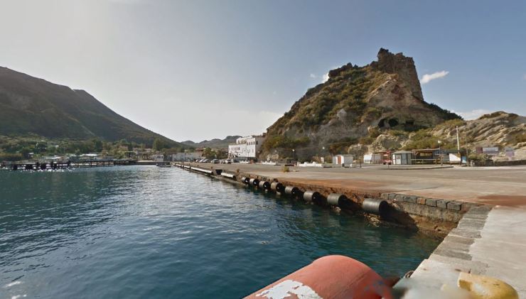
Island of Salina
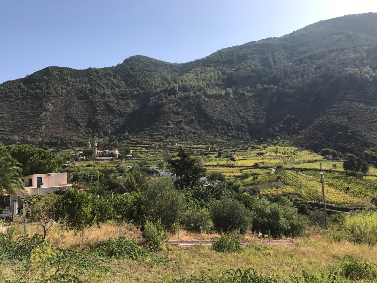
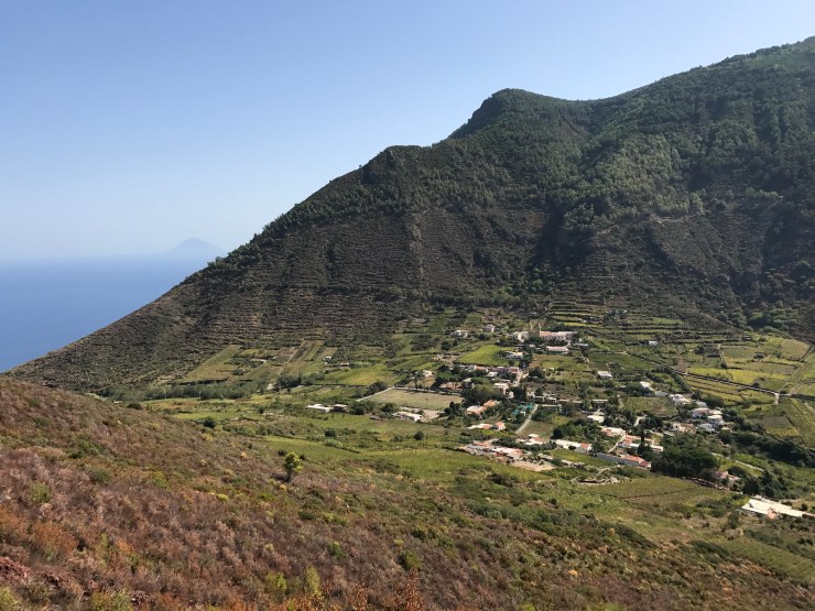
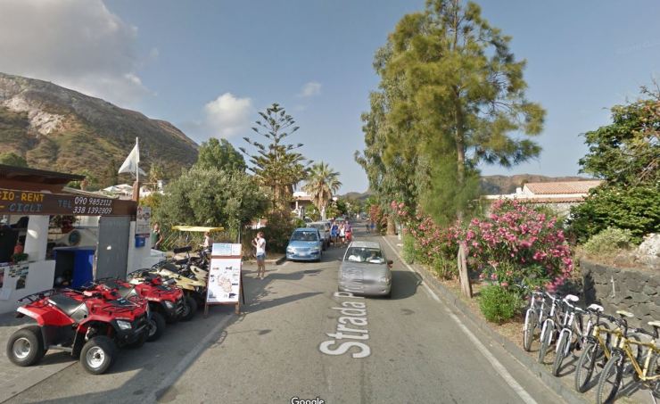
Salina is a very green island with lots of vegetation. The island has two twin volcanoes that both are great for hiking. To get to the various trailheads, you can either walk, take the bus, or rent a scooter. For both hikes listed here, we will list stats assuming the trailhead is in the town of Valdichiesa.
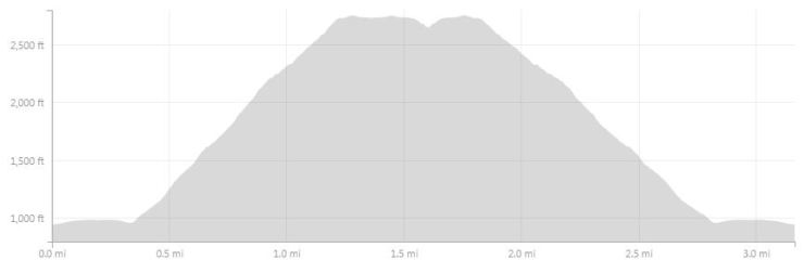
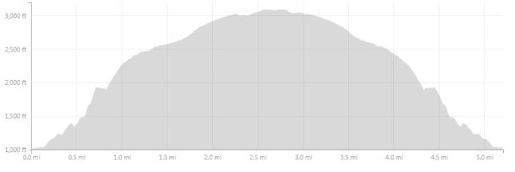
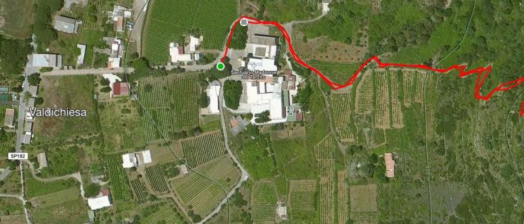
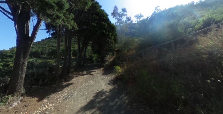
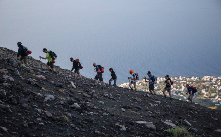
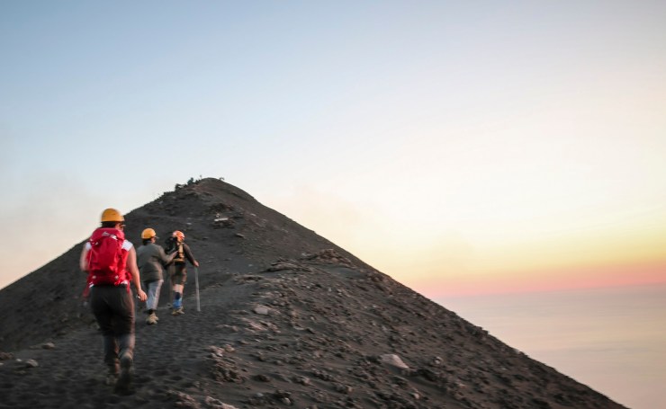
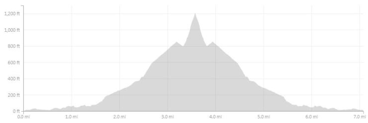
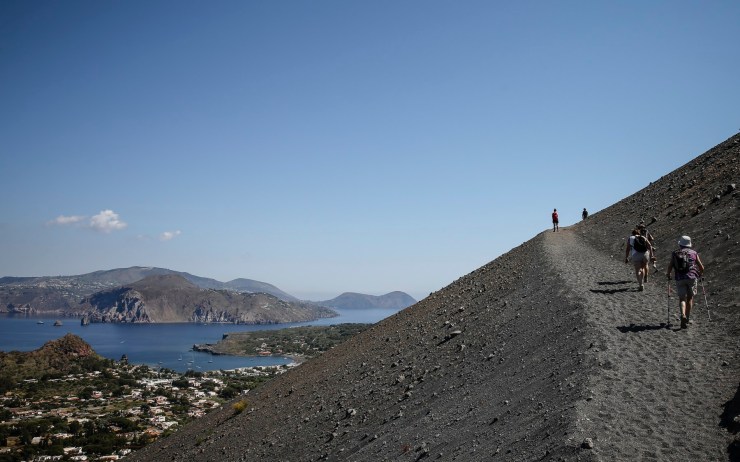
Hike to the summit of Monte dei Porri – 3.2 miles round trip; +/- 1,933 feet

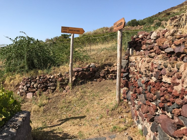
There are actually two trail leading to the summit of Monte dei Porri. The trail described in this report goes from Valdichiesa to the summit. On the other side of the volcano, there is another trail leading from the Belvedere Panoramico to the summit. Thus, the hike can be completed by starting/ending at the same trailhead or you could start in Valdichiesa and end near the beach in Pollara.
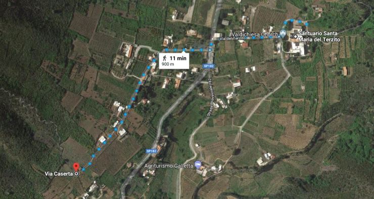
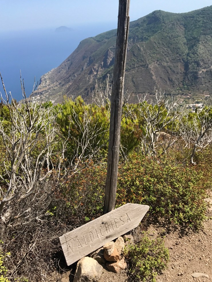
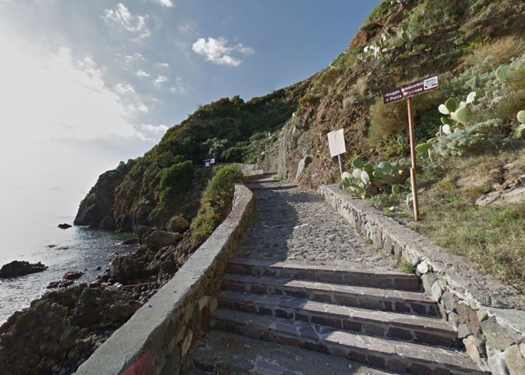
In Valdichiesa, you start by walking 900 meters from the main church to the trail. The route is not really marked, but there are not too many roads in the town so it is easily found if you briefly study a map beforehand.
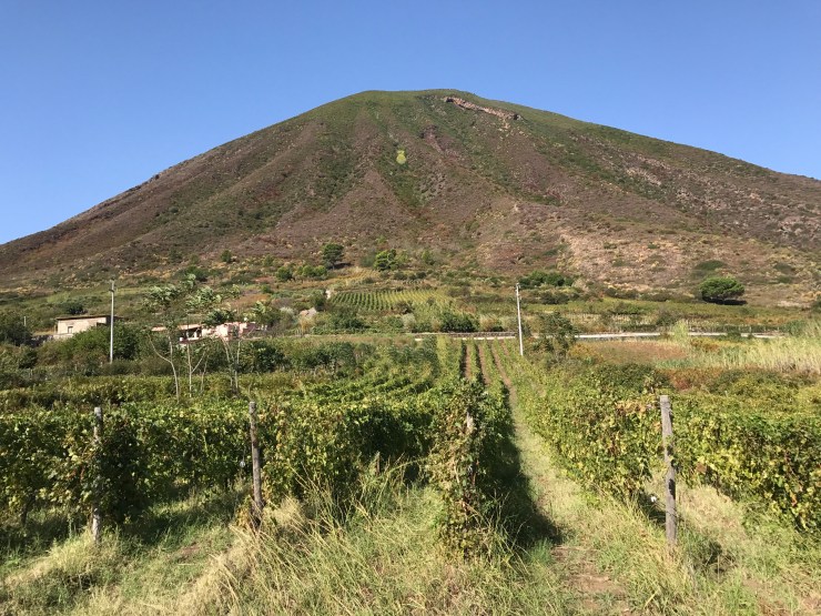
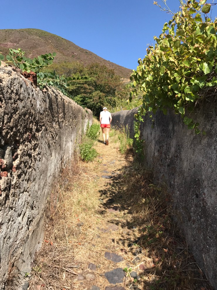
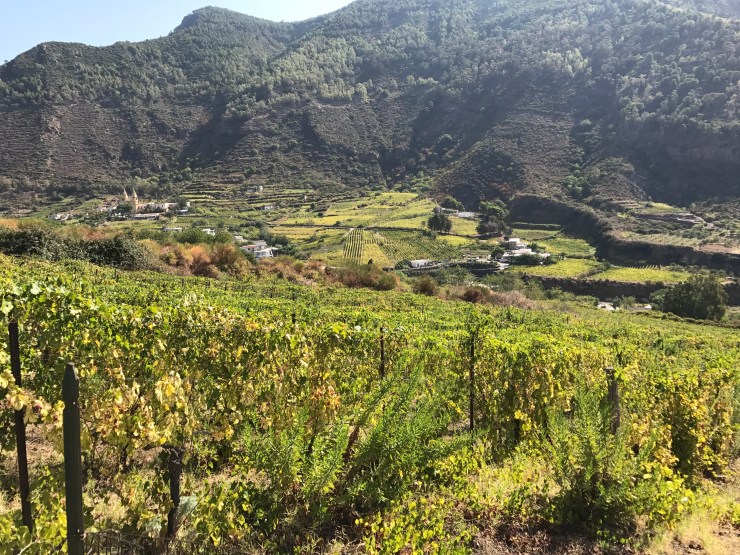
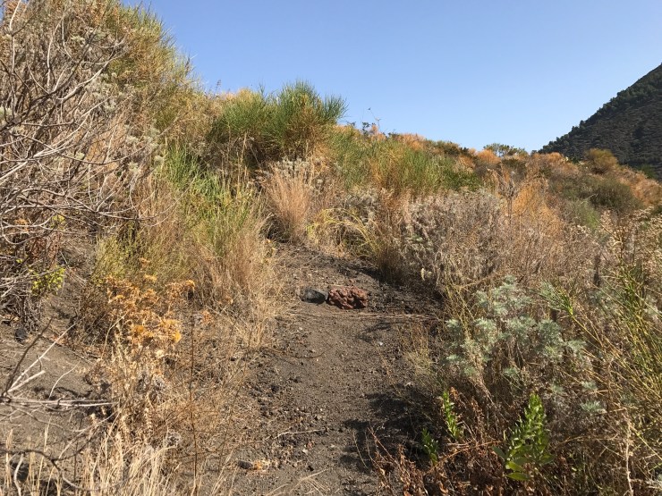
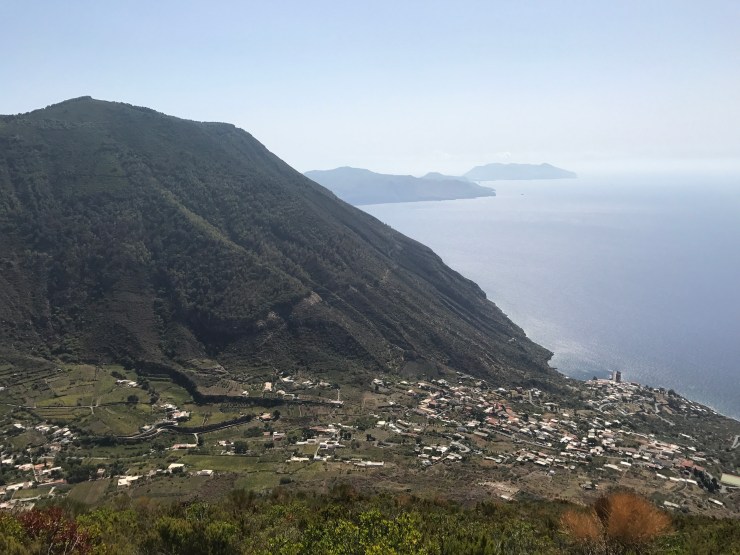
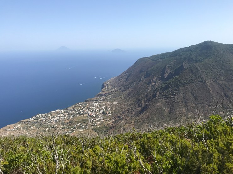
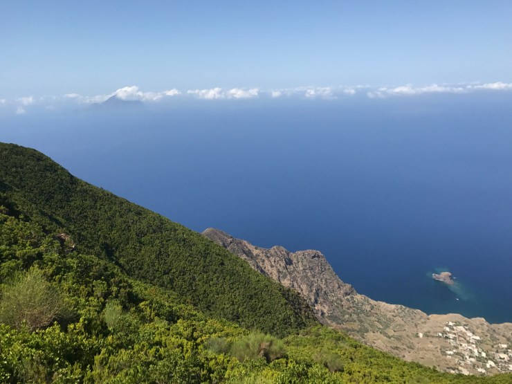
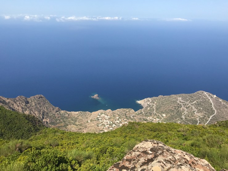
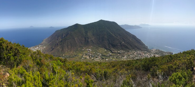
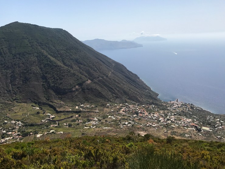
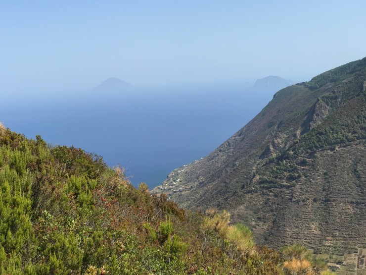
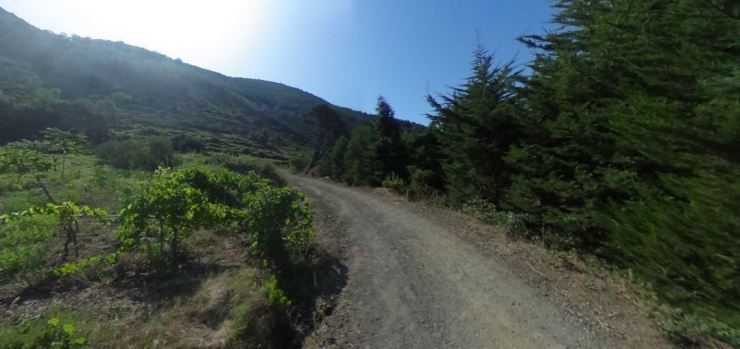
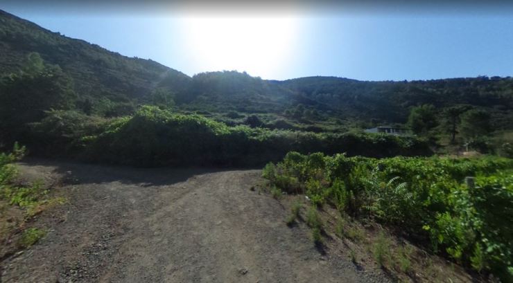
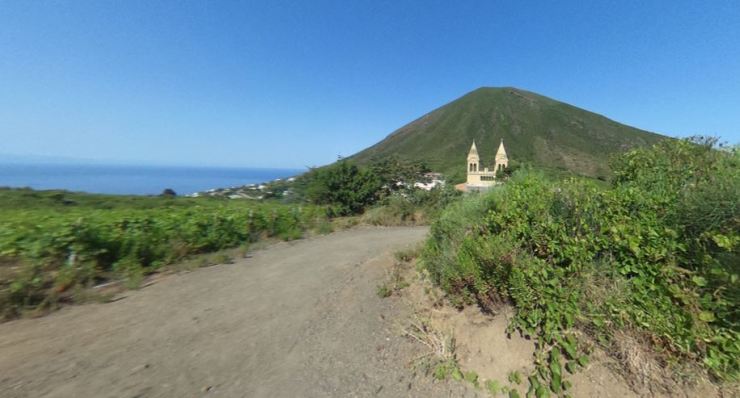
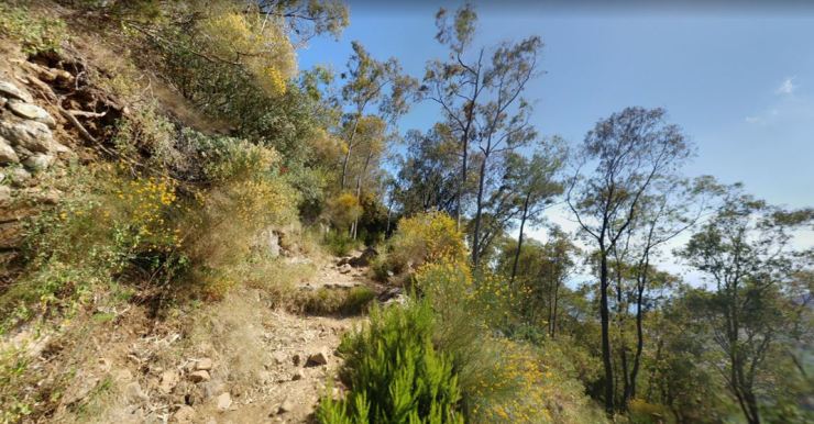
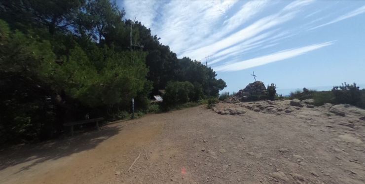
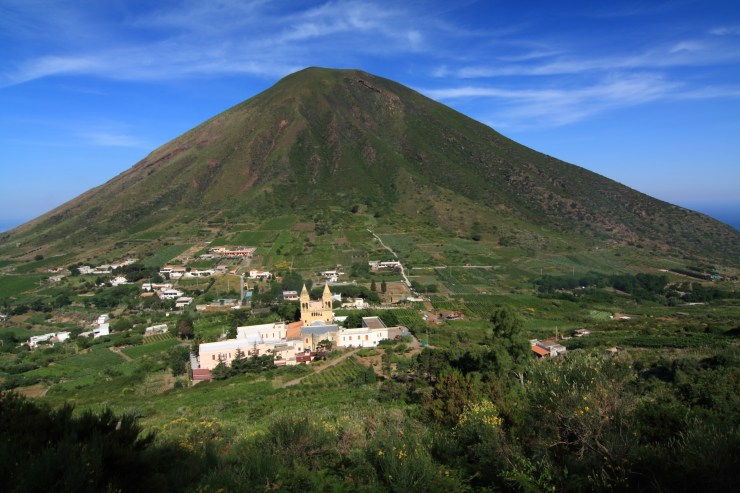
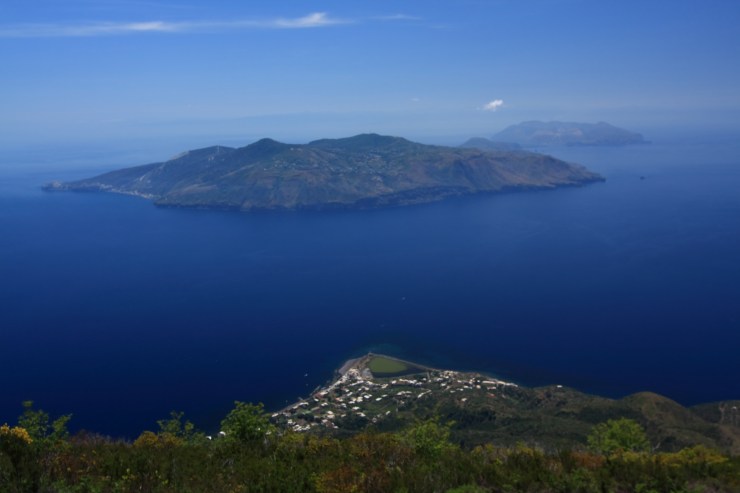
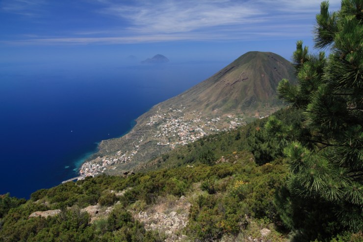
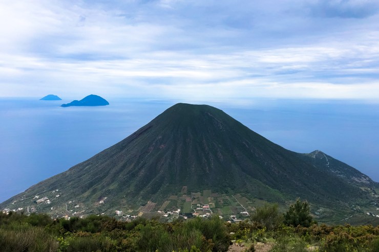
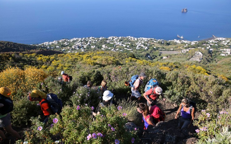
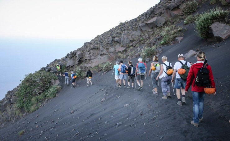
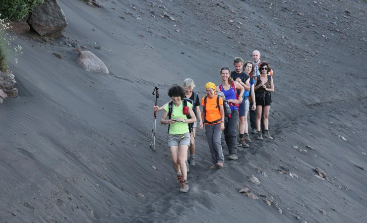
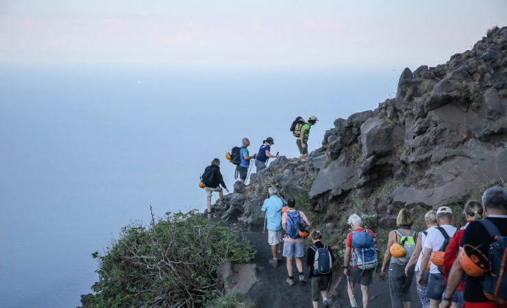
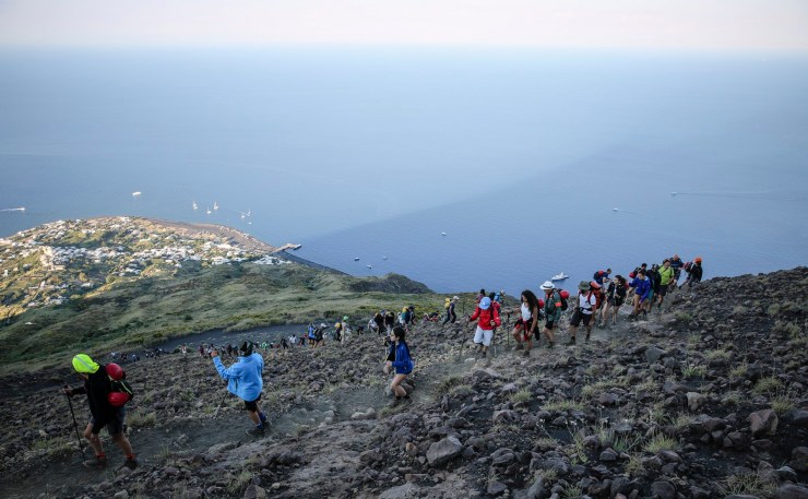
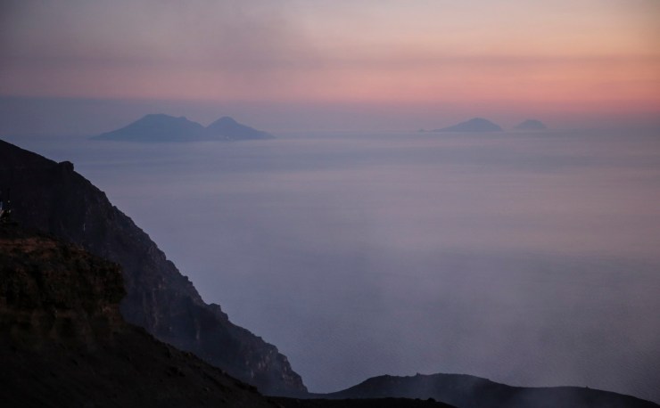
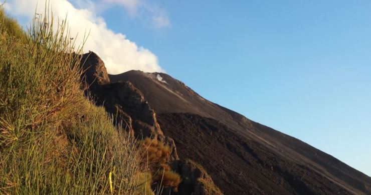
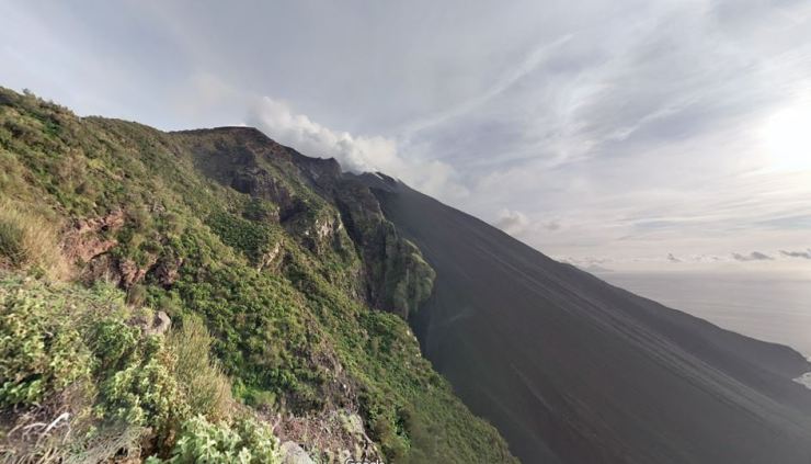
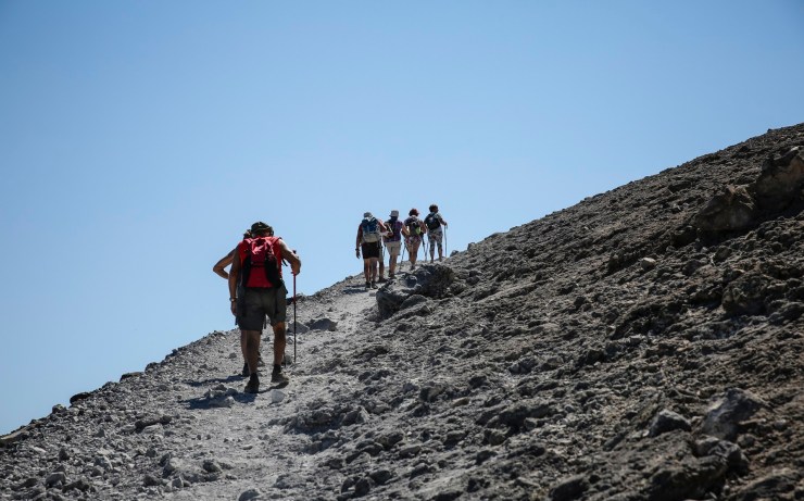
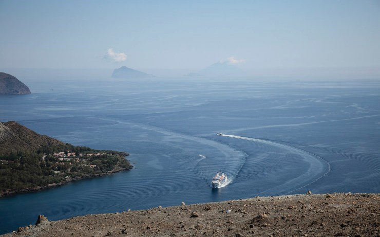
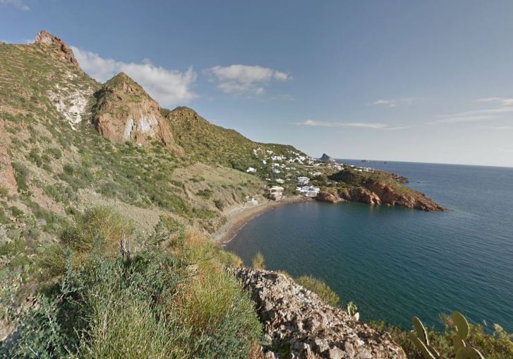
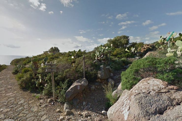
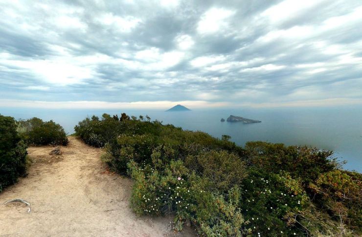
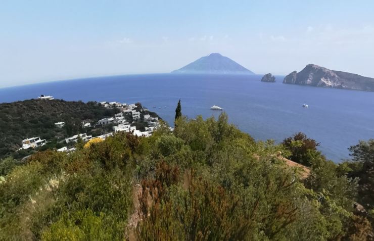
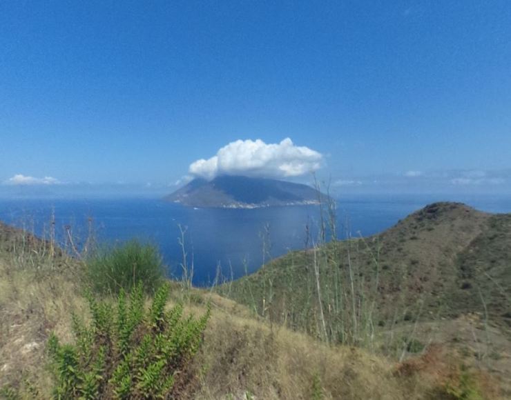
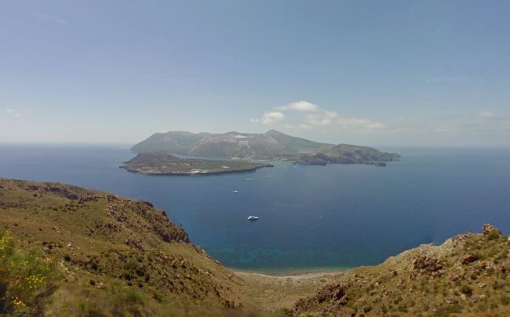
Eventually you will reach a sign marking the entrance to the preserve area and you will see the trail. The trail then begins to steeply climb up to the summit. This section of the trail is very exposed to the sun, so be prepared with water if you are hiking in the afternoon. The trail is fairly slippery and rocky in sections as well. As you climb up the trail, you will be treated to great views of Valdichiesa and Monte Fossa delle Felci to the east. You also have great views of Malfa and Rinella. As you get closer to the summit, you can see other Aeolian Islands in the distance including Lipari, Vulcano, Panarae, and Ginostra. Eventually you reach the summit and can take a quick break from climbing. If you continue along on the trail, you eventually reach some nice viewpoints looking west down at Pollara. It is also possible to see two more islands, Filicudi and Alicudi, from the summit.


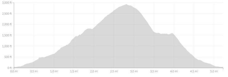
Hike to the summit of Monte Fossa delle Felci – 5.2 miles round trip; +/- 2,220 feet

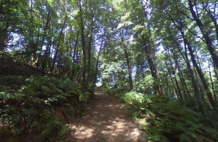
The primary route to the summit of Monte Fossa delle Felci begins just behind the main church in Valdichiesa (Santuario della Madonna del Terzito). You walk approximately 5 minutes behind the church and soon will reach a series of switchbacks that lead up to the summit. From there, the hike steeply climbs 2,000 feet over the course of 2 miles. There is also a dirt road that leads much of the way up the mountain, but the road is longer than the trail. In the beginning of the hike the trail leads through trees and there is a fair amount of cover from the sun. In the middle the trail goes in and out of the trees. At the summit the trail leaves the most of the trees behind and you will be able to see great views of the surrounding area. Overall, this trail has much more cover from the sun when compared to the hike up Monte dei Porri.
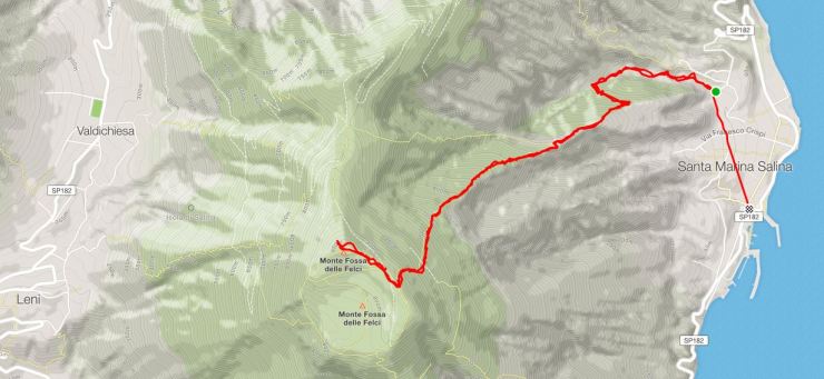
When you reach the summit you are treated to some amazing views of Salina, Monte dei Porri, and the surrounding Aeolian Islands. From the summit you can either return back to Valdichiesa or could hike down to Santa Marina

Here is the route to the summit of Monte Fossa delle Felci from Santa Marina Salina. The trail is roughly 5.5 miles round trip with +/- 2,950 feet of elevation change.
Island of Stromboli
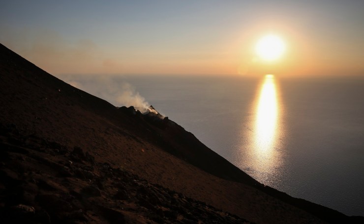
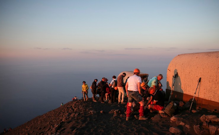
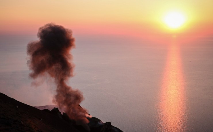
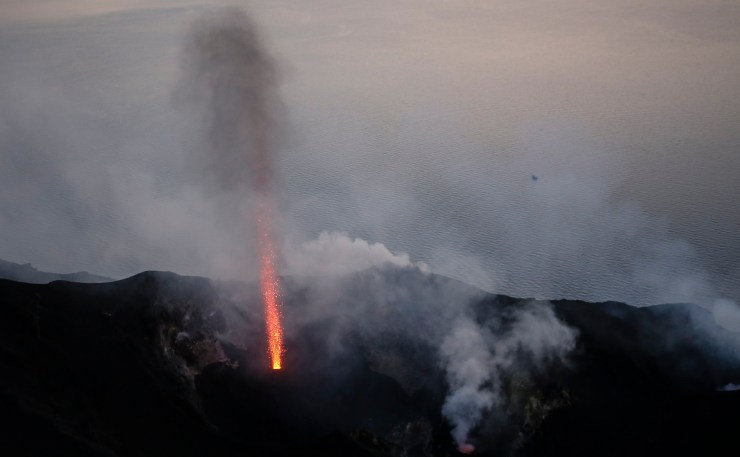
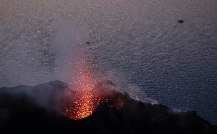
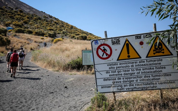
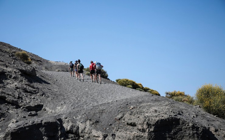
The island of Stromboli is named after the active volcano that makes up the island. As such, the most popular hike on the island goes up to the top of the Stromboli volcano. A guide is required to reach the summit and see the lava eruptions up close. Typical costs to join a non-private guided group are in the range of EUR 30-50. Taking a private tour will cost much more. The hike is usually started in the late afternoon so that you reach the summit when the sun is setting. This allows the hikers to get nice pictures of the lava eruptions at dusk.
For hiking to the top of Stromboli, you will want trekking poles and real hiking shoes. A headlamp is also needed when you descend the trail at night, but this can likely be rented from your guide company. You also will want to bring along a warm and light down jacket and a wind jacket because you can get cold sitting at the summit while you wait for an eruption. A bandana or scarf is another nice addition because it can be used to shield your nose and mouth from dust.
Most excursions leave from near Stromboli village on the Northeast side of the island. This is the route I will describe here. Other excursions are available that let you start from the Southwest side of the island in Ginostra and end in Stromboli village.
Hike to the summit of Stromboli (with a guide) – 5.2 miles; +/- 2,960 feet
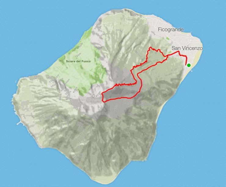

This trek follows the paths shown above in the counter-clockwise direction. You do not go down the same trail you hiked up because that trail going down is sandier and easier on the joints when going down. It is also better to not have hikers going both up and down on the same trail so that there are no right of way issues. Exactly where you start the hike will depend on your tour guide.


Unguided hike on Stromboli (cannot go to summit) – 7 miles; +/- 1,400 feet
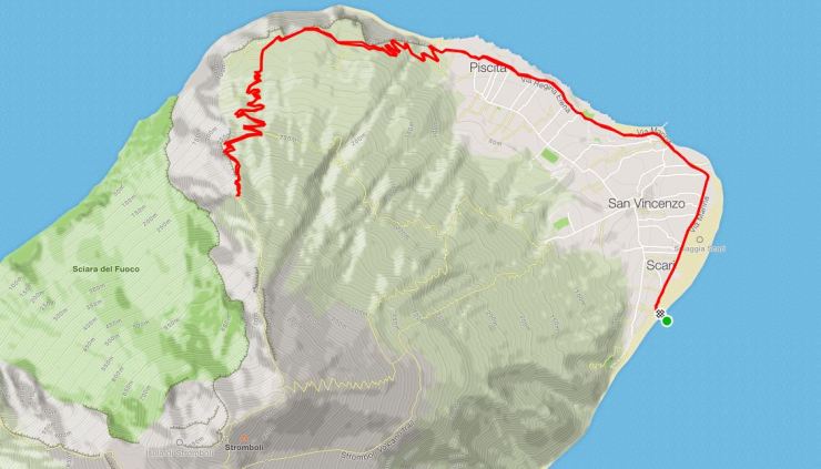
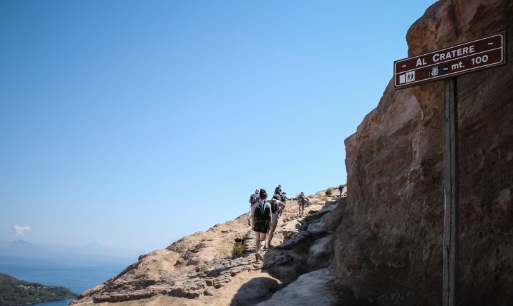
This hike will take you up the old climbing route towards the summit of Stromboli. However, you must stop at the 400 meter panoramic viewpoint unless you have a guide. This route is known as the Sciara del Fuoco route. As mapped above, you traverse near the shore of the island until you reach the beginning of the road Mulattiera Salvatore Di Losa. You follow this road for roughly 1 mile until you reach a restaurant. From there, you take the road Salita al Vulcano – Labronzo for another 1 mile until you reach the 290 meter panoramic viewpoint. Finally, you take a steep and rocky trail for the last 0.25 miles until you reach the 400 meter panoramic viewpoint. From here you can see some of the fumaroles of the active volcanic craters.
Island of Vulcano
Vulcano’s main attraction is the Fossa di Vulcano or the large volcanic crater located on the island. The crater is reach via the short hike described below. Many people visit Vulcano as a day trip and you can also take advantage of the mud baths during your visit.
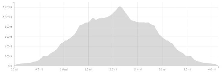
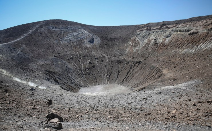
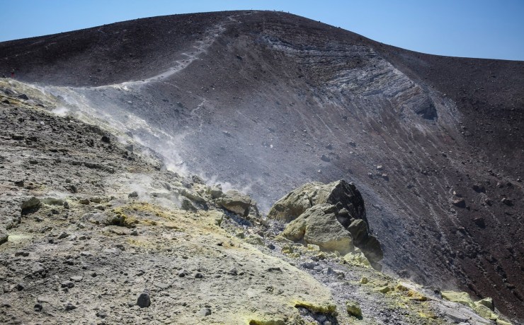
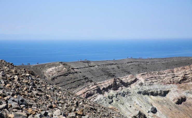
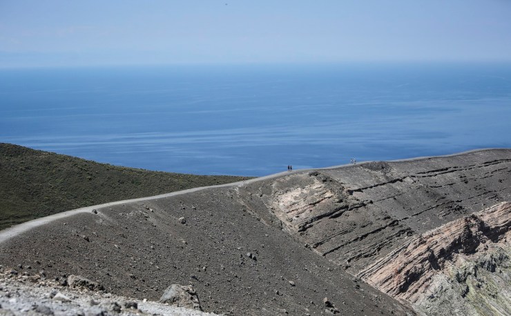
Hike to the Fossa di Vulcano (volcanic crater) – 4.2 miles; +/- 1,250 feet
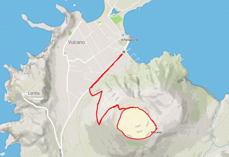
To reach the trail, head to the left along the water after you get off the boat at the Port of Vulcano. Soon you will reach Strada Provinciale 179. Follow this road for roughly 0.5 miles until you see a sign for Accesso al Cratere (access to the volcanic crater). From here, take the trail up all the way to the crater.
This hike is very exposed to the sun, so be prepared with water and sunscreen. From the top of the crater you will get great views of the island and of the crater itself. The overall hike is not too long, but you can circumnavigate the whole crater to get up to 4 miles as shown above.


Island of Panarea
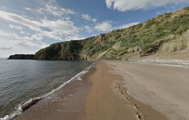
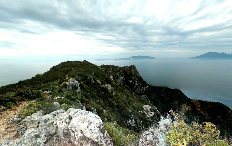
Panarea is one of the smaller Aeolian Islands. The island is known for being chic and tony but also has a large reserve and some hiking trails. Two routes are shown below. Both routes reach the island’s summit, Punta del Corvo. From the summit you get nice views of the coastline and of the other Aeolian Islands. Trails (old mule paths) are reasonably easy to follow, but there is elevation gain involved. For information about Panarea and some good directions on the quickest way up to the summit Punta del Corvo, this website is a good resource.
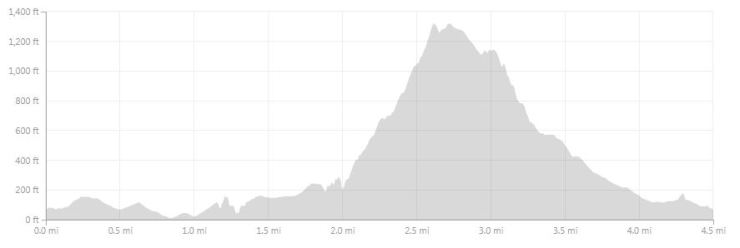
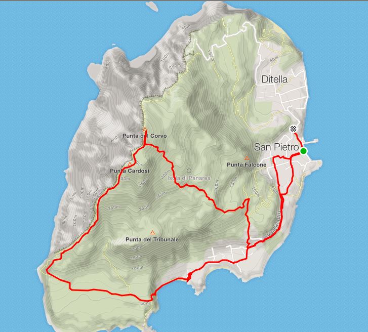
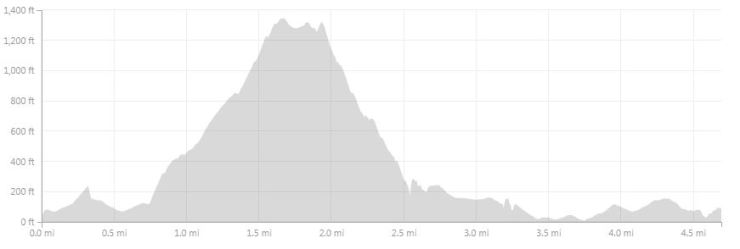
Hike around Panarea – 4.5 miles; +/- 1,750 feet
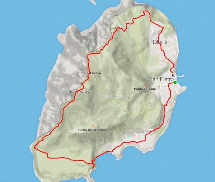

Head South from the port and follow Vetter Panarea to Via Drautto. Via Drautto will take you ~1 mile all the way South to the Ristorante Zimmari. From there, the road more or less ends and you will start hiking along a dirt trail/path.
From here, the trail tranverse 0.6 miles of moderate incline over to the Southwest coastline of the island. You then begin the steep 1 mile climb up to the top of Punta del Corvo.

As you continue north, the trail eventually widens and your can follow the wider trail to Via San Pietro. You can then follow this road back down to the port at San Pietro.
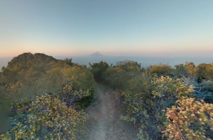
Panarea alternate hiking route – 4.7 miles; +/- 1,900 feet
For this hike, many of the views are the same as those shown above. Thus, I will only show two pictures from the trail leading from San Pietro across the island and up to Punta del Corvo.

Island of Lipari
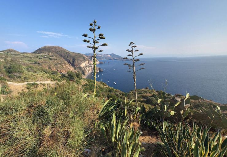
Lipari is the largest of the Aeolian Islands and is a very popular island to stay on since it acts as a gateway of sorts with many boats leaving from Lipari to other islands. There are many hiking trails on Lipari and you can find short trails near most of the towns on the island. Here I will describe a few longer routes, but most of these hikes can be broken up in two. Most hikes provide great views of the Lipari coastline and of the neighboring islands of Vulcano and Salina.
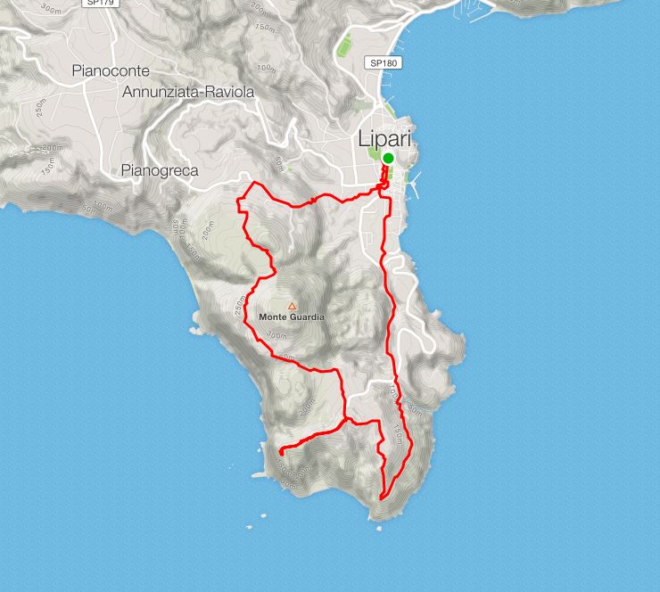
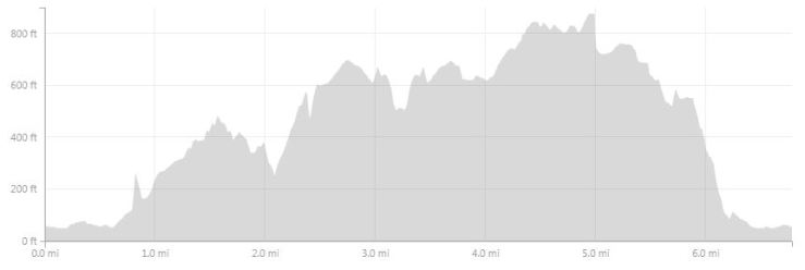
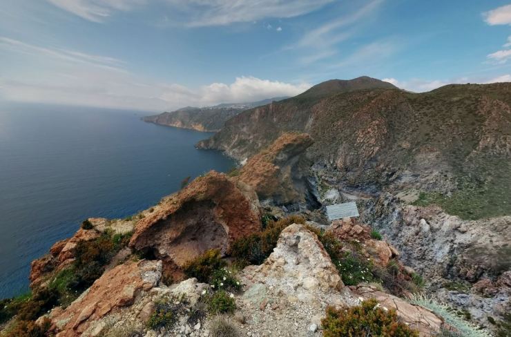
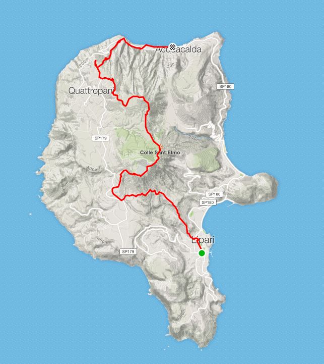
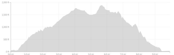
Hike from to Quattropani to Pianoconte to Lipari – 9 miles; +/- 1,960 feet (one way)
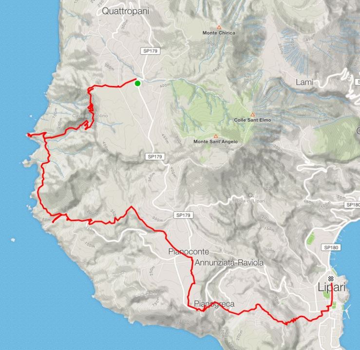
- Map of hike from to Quattropani to Pianoconte to Lipari
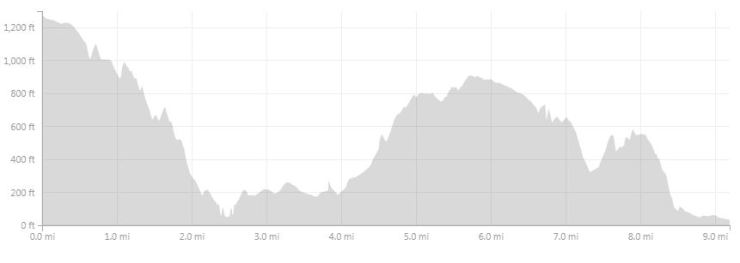
This trail follows along the west coast of Lipari and provides great views of the shoreline and of Salina, Vulcano, Filicudi and Alicudi. Since it is a one way hike, it is best to take a bus or taxi to the starting point.
Loop on the South of Lipari – 7 miles; +/- 1,800 feet
This trail is a compact loop on the south portion of the island of Lipari. The loop allows you to stop t the Observatory and weather station and catch great views of Vulcano and the coastline.

Across Lipari, summit of Mt. Angelo and Mt. Chirica – 10 miles; +/- 2,700 feet (one way)
This is a tough hike that traverse the whole island from south to north. Along the way, you summit Mt. Chirica, the highest point on the island of Lipari. Note that it is one-way hike and you will either need to take a bus to the starting point or take a bus home at the end of the hike.

Great pictures… do you have a favorite island and when did you go?
LikeLike
We visited Salina in September and it was great! I would definitely recommend Salina to anyone who wants to visit the Aeolian Islands and wants a good balance between scenery, cost, activities, and seclusion.
LikeLike
Thank you for putting this together. Nothing else online comes close to the maps and pictures you have in this hiking page!
LikeLike
Thank you. I’m visiting next month and delighted to have this info.
LikeLike
I hope you have a lovely trip!
LikeLike
Thanks for the detailed overview, this is VERY useful for planning my trip. Nothing else is as comprehensive and genuine. Now I am torn between Stromboli for a unique landscape, and Salina for a less taxing (physically and logistically) hike
LikeLike