


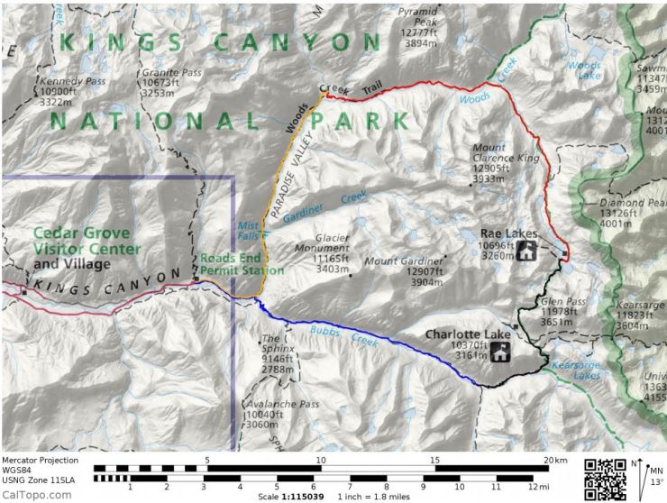
Trip Overview: ~41 mile backpacking loop from the Roads End Trailhead in Kings Canyon National Park. +/- 8,400 feet of elevation with a starting elevation of 5,050 feet and a peak elevation of 12,000 feet. Highlights include alpine lakes, expansive granite canyon views, and scenic lake-side campsites. We completed this trip over 4 days in July of 2016.
- High resolution USGS topographic map part 1 (pdf) and part 2 (pdf)
- Link to purchase topographic map on Amazon (here)
Jump to Day 1: Road’s End Trailhead to Junction Meadow
Jump to Day 2: Junction Meadow to Rae Lakes
Jump to Day 3: Rae Lakes to Woods Creek Crossing
Jump to Day 4: Woods Creek Crossing to Roads End Trailhead
Shop Sale & Clearance Items at REI.com (up to 50% off)!
Preparations:
Click here to read more about Permits
Permits: The Rae Lakes Loop is one of the most popular backpacking loops in the Sierra, so permits are required and the number of permits is limited. You likely want to secure a permit to do the hike in either July, August, or September. The rivers can be very high and impassable in May and June, and the Glen Pass can be snow covered into mid July. Basic information about the loop can be found on the NPS website.
You can apply for permits by e-mail or US mail starting at 12:01am on March 1st. On the permit you need to specify the trailheads you will enter/exit through and your party size (limited to 15 people). If you want to do the loop clockwise, you enter via Woods Creek and exit via Bubbs Creek. If you want to hike counter-clockwise, it’s the opposite. Information about the reservation process can be found here and the wilderness permit application is here. The cost per permit is $10 plus a $5 per person camping fee. You pay your fees online after you receive an e-mail confirming your permit is secured.
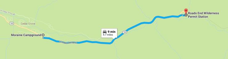
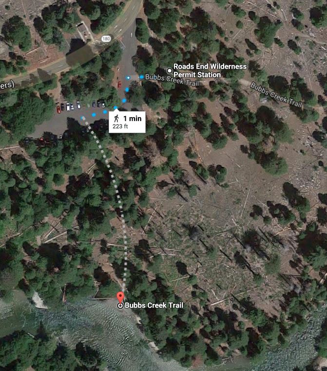
If you are able to reserve a permit and pay your fee, the next step is to pick up the permit from the Roads End Ranger Wilderness Permit Station (36.794690, -118.583116). You can get your permit after 1 pm the day before you hike or before 9 am the day of your hike. If you cannot get to the permit station before 9 am on the day of your hike, you must notify the Wilderness Office (559-565-3766) or they will cancel your permit and release it to walk-up hikers after 9 am.
Click here to read more about Logistics
Logistics: We decided to camp near the Roads End Permit Station the night before our trek. There are multiple campsites on Highway 180 including Sentinel, Canyon View, and Moraine Campgrounds. Sentinel and Canyon View allow reservations via recreation.gov and Moraine is 1st come, 1st served. Camping the night before allows you to acclimate a bit to the elevation and will allow you to easily get to the permit station before 9 am.
At the Roads End Wilderness Permit Station there are some bear vaults to store leftover food, and there is a potable water source to fill up your water bottles or camelbacks. The permit station is hard to miss and you can ask the ranger about current conditions. You can park your car near the permit station when you first get there, but may need to move your car to a nearby lot if you are parking for multiple days.
Click here to read more about Weather and Trail Conditions
Weather and Trail Conditions: It is important to check the trail conditions before taking off on this trek. You can find the conditions of the Woods Creek and Bubbs Creek Trails and the Glen Pass here. It is important to make sure the stream crossing are manageable and make sure the Glen Pass is not dangerous. Crossing a fast moving stream can be very dangerous, so listen to the rangers and take their advice. Beyond that, the trails are well maintained so it’s easy to find your way.
You will want to start this trek early because Kings Canyon gets very warm in the afternoon. The trailhead is only at 5,000 feet, so the first day of the trek is likely to be quite warm after ~11 am.
Click here to read more about Difficulty
Difficulty: If you are doing this loop is 4 or fewer days, expect a moderately tough hike. Each day will be close to 10 miles and 2 of the days will have serious climbs. Note that if you extend the hike to more than 4 days, many popular lakes on the trail have camping restrictions that limit visitors to 2 consecutive nights. You can build a rest day at Rae Lakes into your itinerary, but must leave after your second night.
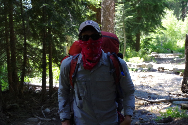
Supplies: There are black bears in the park, so you need to bring a bear canister. Bear spray is not allowed, so do not bother bringing that. When I spoke with the rangers at the park they discouraged hanging food because they said the bears have gotten smart enough to knock food out of trees. Your results may vary, but a bear canister is the safest option.
You likely will want bug spray because the mosquitoes can be out in force in certain areas of the trek. I prefer a picaridin based spray because it does not damage plastics and synthetic fibers like high concentration DEET sprays do. I also like to pre-treat my clothes and tent with permethrin spray repellent
. The permethrin treatment stays on your clothes for up to 7 washes, so it helps reduce the amount of spray you need to put on your skin.
Below is a list of the gear I brought on Rae Lakes Loop:
Hiking clothes
- a lightweight hiking rain jacket (North Face Venture 2 Jacket)
- fast drying synthetic hiking pants (prAna Zion Pants)
- a quick drying long sleeve hiking shirt (Columbia Silver Ridge L/S Shirt)
- wool outer socks (People Socks Moreno 4-pack)
- thin blister preventing base socks (WrightSock double layer Coolmesh)
- quick drying synthetic boxer briefs (ExOfficio Give-N-Go)
- Gore-tex hiking shoes (adidas Outdoor Terrex Fast R Gore-Tex Shoe)
Clothes for camp
- wool leggings (Minus33 Merino Wool Kancamagus Midweight Bottom)
- wool base layer shirt (Minus33 Merino Wool Chocorua Midweight Crew)
- warm wool overshirt (Pendleton Long Sleeve Classic-Fit Board Shirt)
- lightweight down jacket (Patagonia 800-fill Down Jacket)
- lightweight camp shoes (Xero Z-Trail lightweight sandal)
Hiking gear
- topographic map (Tom Harrison Kearsage Pass / Rae Lakes Map)
- trekking poles (Black Diamond Trail Ergo Cork Trekking Poles)
- 2 liter hydration bladder (Platypus Big Zip Water Reservoir)
- 65 liter backpack (Osprey Atmos 65 Liter pack)
- water filtration system (Platypus gravity filtration system)
Camp gear
- strong tent with rain-fly (Alps Mountaineering Chaos 2 Tent)
- inflatable sleeping pad (Therm-a-Rest Trail Pro Sleeping Pad)
- sleeping bag (REI Co-op Igneo 25 Sleeping Bag)
- inflatable camping pillow (Ultralight Inflating Pillow)
- lightweight backpacking chair (Helinox Chair Zero)
- lightweight lantern (MPOWERD Luci Outdoor 2.0)
- headlamp (Black Diamond Cosmo Headlamp)
- multi-tool with knife (Gerber MDime Mini Multi-Tool)
- Ursack (Ursack Major bear bag) or bear canister (BearVault BV500)
- lightweight stove (MSR PocketRocket 2)
- lighter (BIC plastic lighters)
- 2 liter pot (GSI Outdoors Halulite Boiler Pot)
- coffee cup (GSI Outdoors Glacier Stainless Cup)
- lightweight spork (Snow Peak Titanium Spork)
- small, quick drying towel (REI mutli towel mini)
Random
- wet wipes (Stall Mates individually wrapped wipes)
- mole skin for blisters (Blister medic kit)
- lightweight trowel (GSI Sanitation Trowel)
- small amount of duct tape for gear repairs
- chapstick and sun screen
Food and drink
- a variety of my favorite dehydrated meals
- electrolyte replacement (NUUN Hydration Tablets)
- quick snacks (Clif Shot Bloks and Clif energy bars)
- instant coffee (Starbucks VIA)
- small plastic water bottles filled with whisky 🙂
There are also plenty of lakes along the trail and some good trout fishing spots, so bringing fishing gear if you are into that!
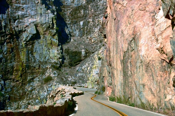
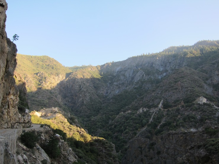
Day 0: To start the trip we made the long drive to Kings Canyon National Park the day before leaving on the trek. The drive along Highway 180 when you enter the park is very scenic and has great views if you get there before the sun goes down.
We ended up getting a campsite at Moraine Campground, which is the closest to the Roads End. The sites were nice and had potable water, so we had no complaints. We made dinner, had some drinks, and then got some rest before getting up early in the morning.
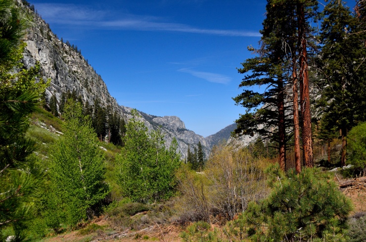
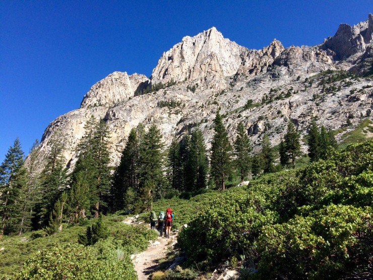
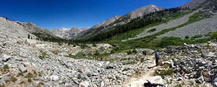
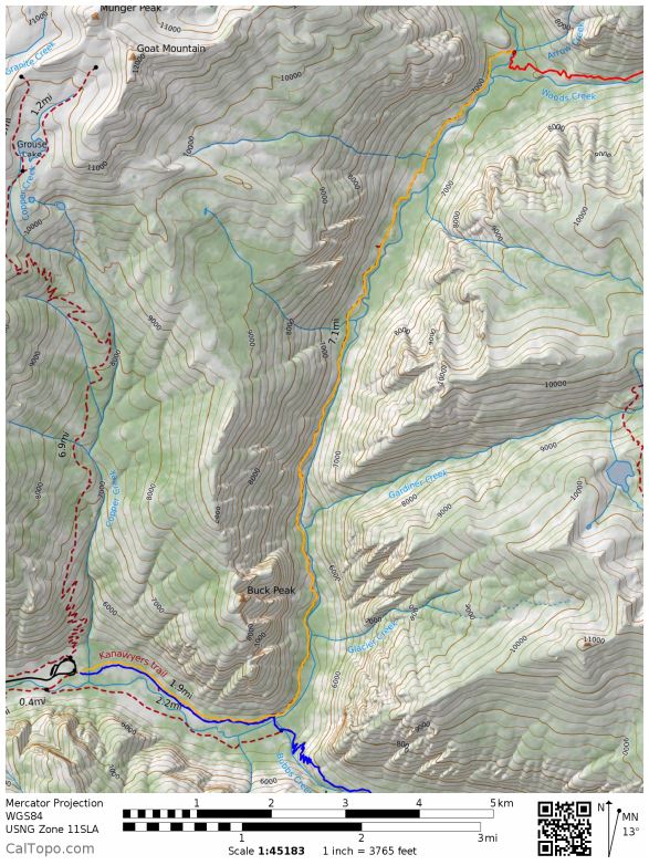
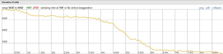
Day 1: 10.5 miles; +3,600 feet / -500 feet; Roads End Trailhead to Junction Meadow
Map of Rae Lakes Loop Day 1 Hike (pdf)

After making breakfast and packing up, we made it to the permit station at about 8:30am. We grabbed the permit and got a report on the conditions and rules from the ranger. We planned to leave at 9 am, but half our party showed up late. Unfortunately, we didn’t actually start hiking until about 10:45 am. I would advise starting before 9 am if possible because it was really warm in the afternoon.
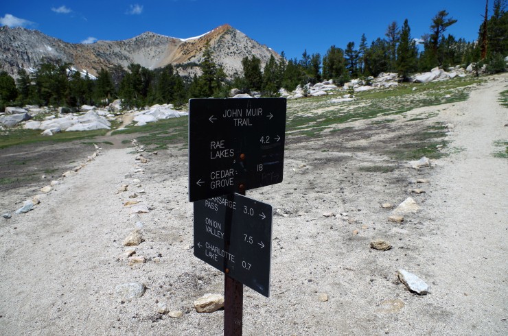
We initially thought our permit was for hiking the loop clockwise, but the ranger said we actually reserved a permit for a counter-clockwise trek. So, we did some quick planning and decided we would camp at Junction Meadow on the first night (~10.5 miles away). There is some debate about which direction is best. I have not hiked the clockwise direction, so I cannot directly compare. Our trek was great though and it was very rewarding to descend down Glen Pass on the way to Rae Lakes. We liked being able to see Rae Lakes in the distance and use it as motivation.
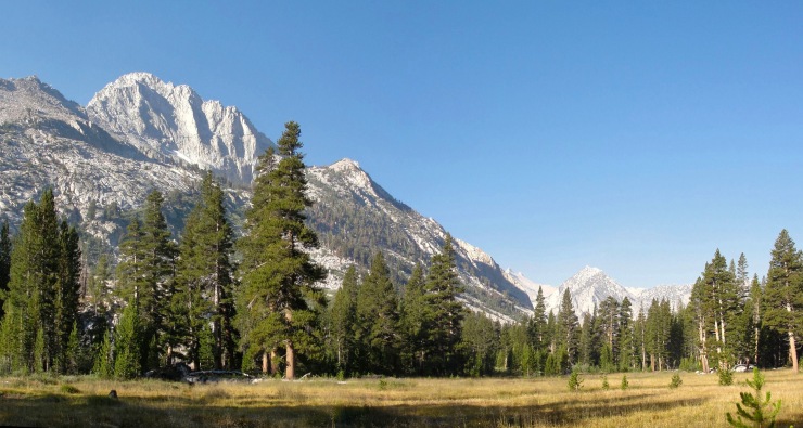
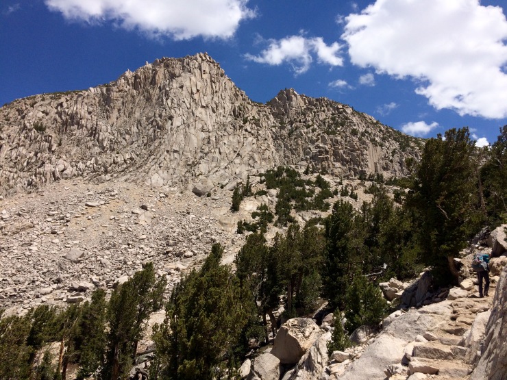
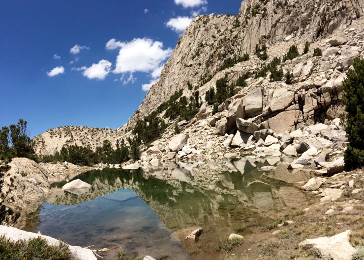
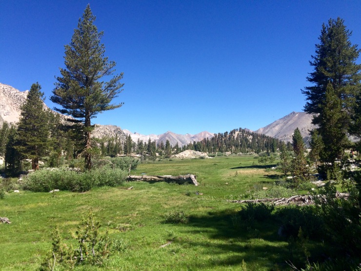
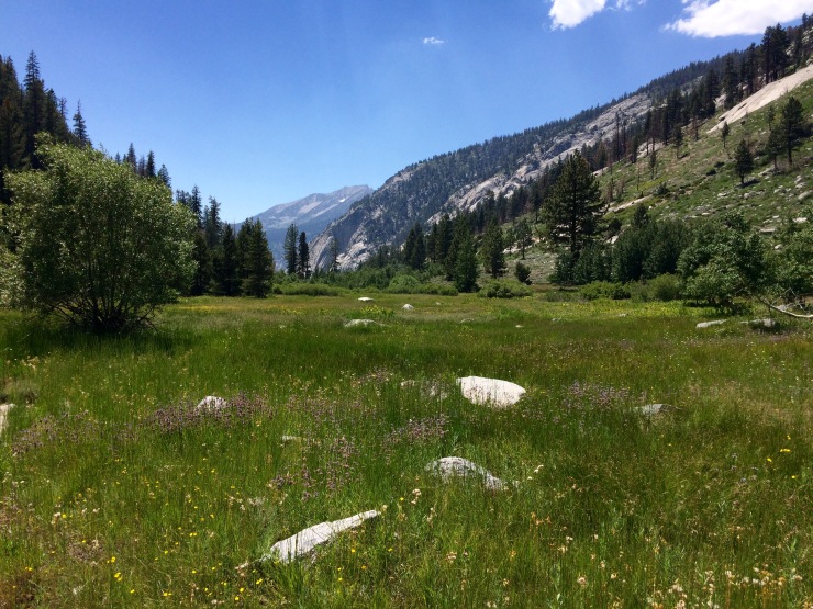
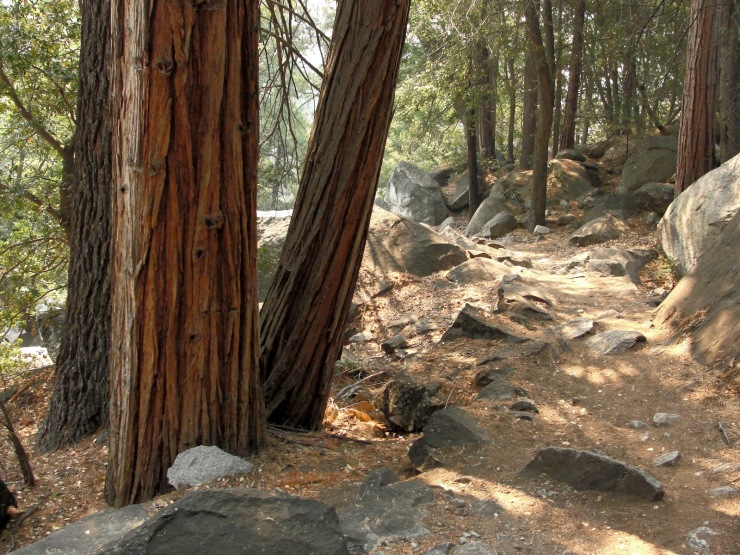
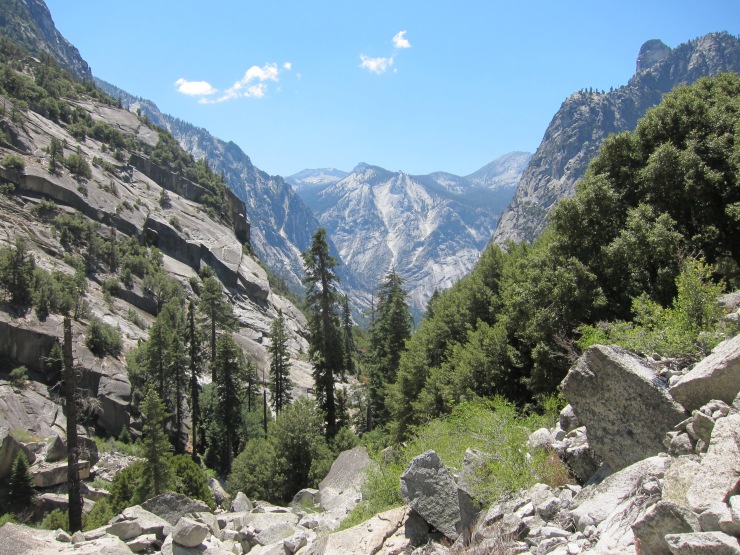
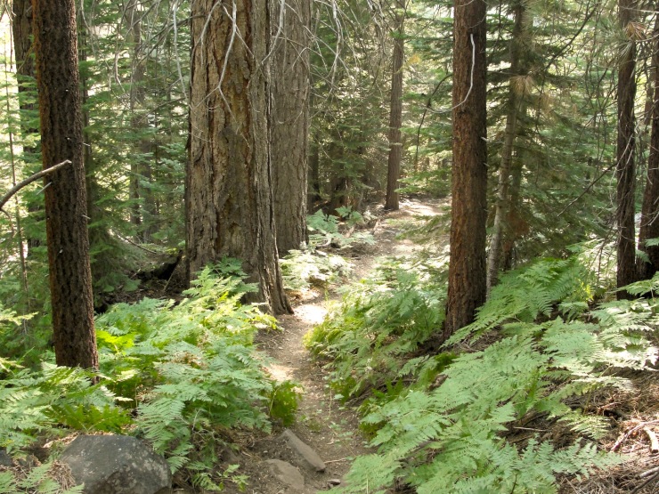
The trailhead is right next to the permit station. The first part of the trek is a ~2 mile hike along the Kanawyers Trail. This trail was super sandy and dusty, so the footing is tough. Eventually you reach a bridge and start on the Bubbs Creek Trail. The footing here is normal. Once you are on the Bubbs Creek Trail, it is about a 8 mile hike to get to Junction Meadow. The trail follows the Bubbs Creek through a canyon and provides some nice views. The views are nothing compared to what comes on the 2nd and 3rd days though.
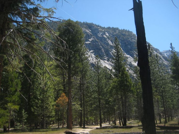
We camped in a developed campsite we found near Junction Meadow. The sites were nearby the junction of two streams and made for a pleasant spot to do some fishing. We caught one or two trout, but the fishing wasn’t super easy here. The bugs here were pretty annoying, so I’d suggest using repellent or bundling up. There were some deer in the area too, so it’s best not to hang salty clothes up overnight or they may get stolen.
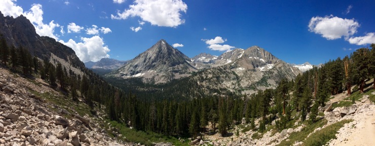
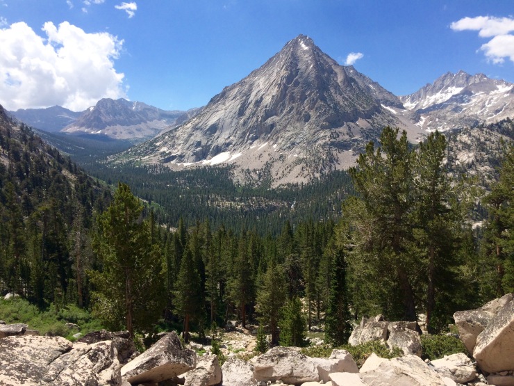
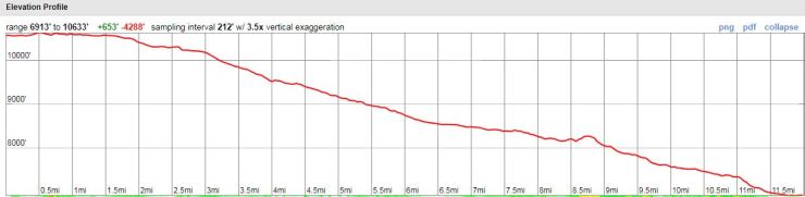
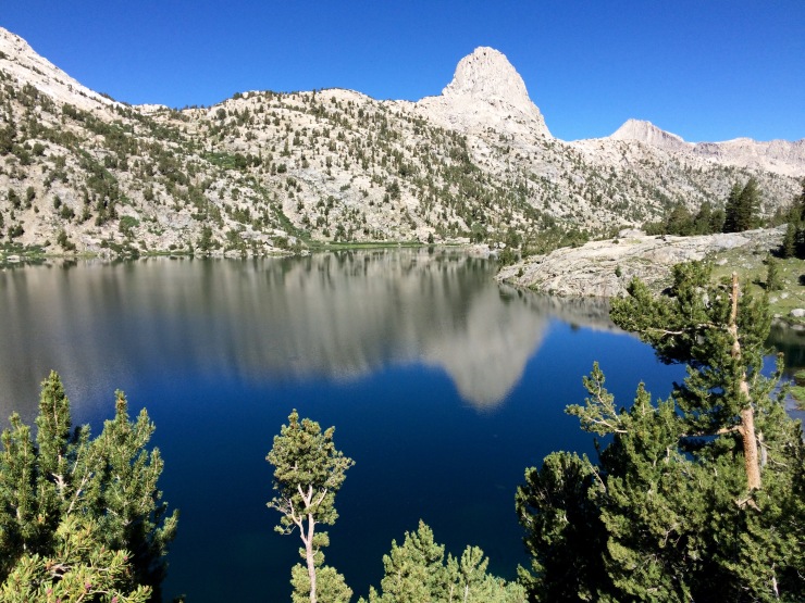
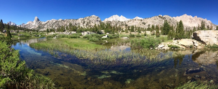
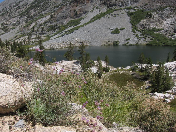
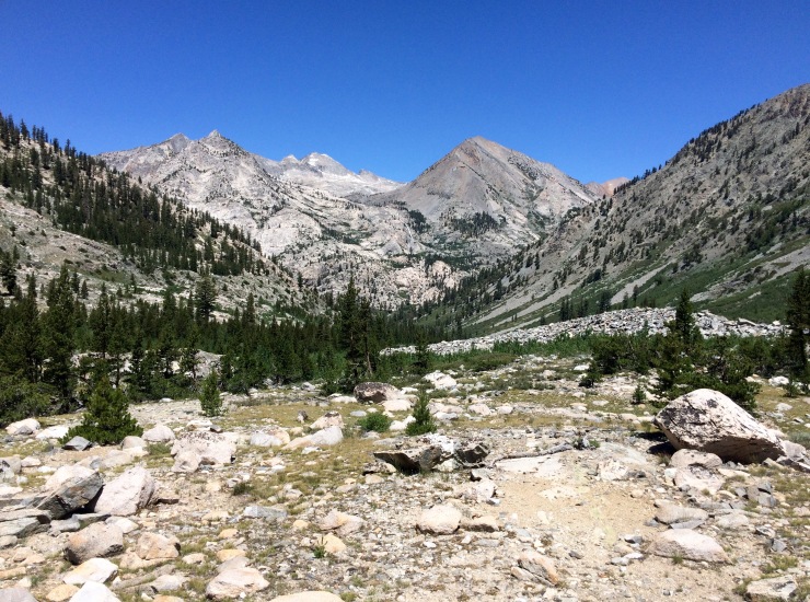
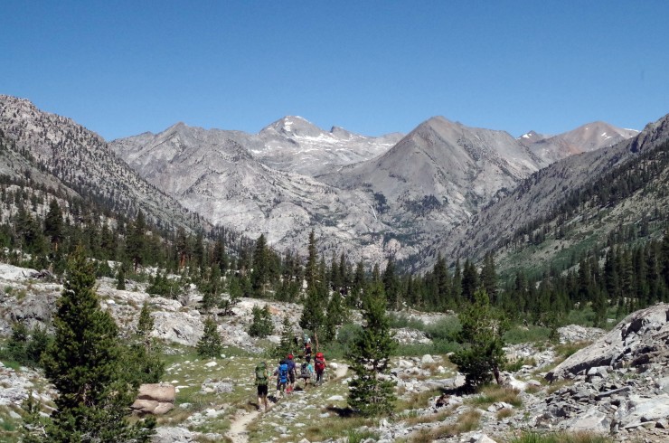
Day 2: 8.6 miles; +4,000 feet / -1,600 feet; Junction Meadow to Rae Lakes
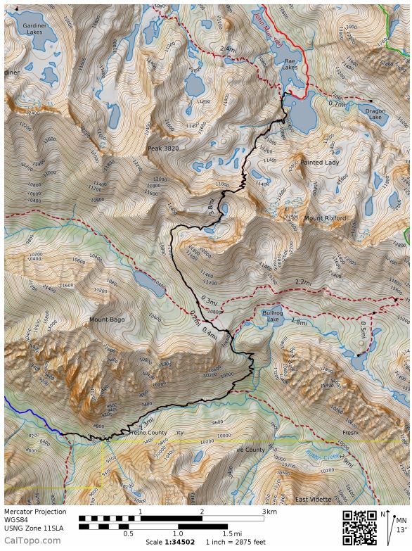
Map of Rae Lakes Loop Day 2 hike (pdf)

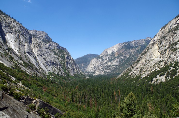
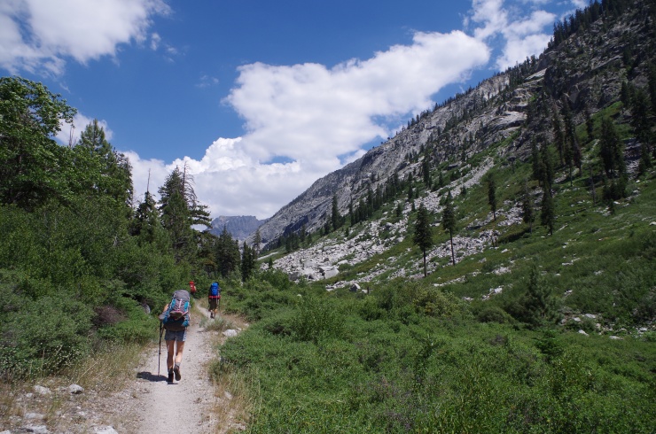
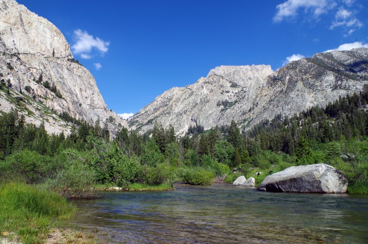
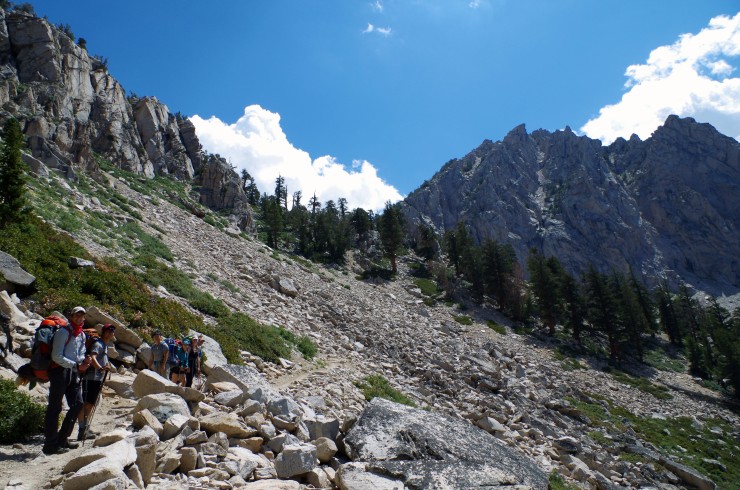
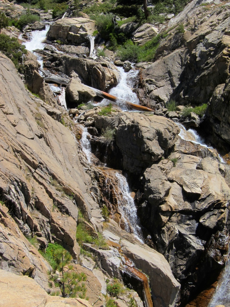
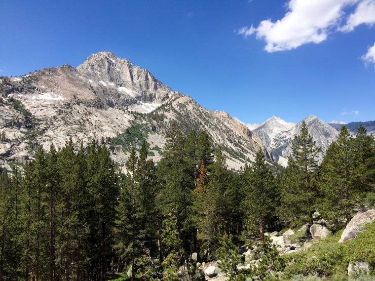
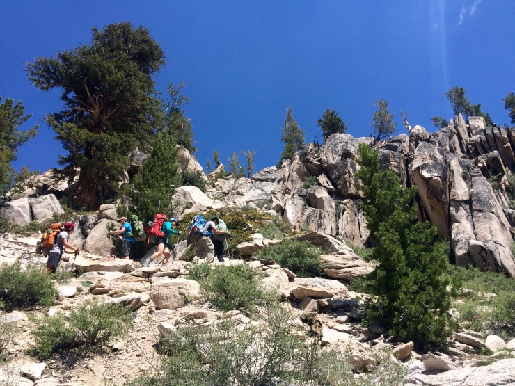
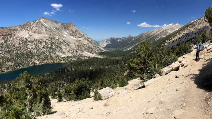
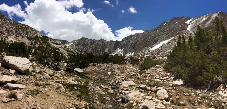
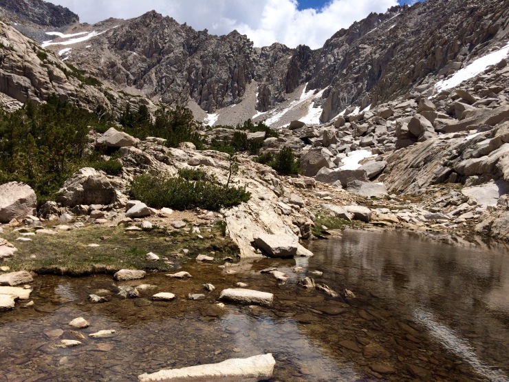
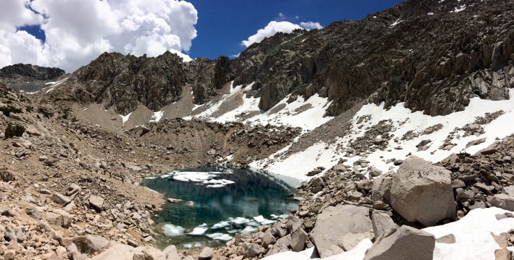
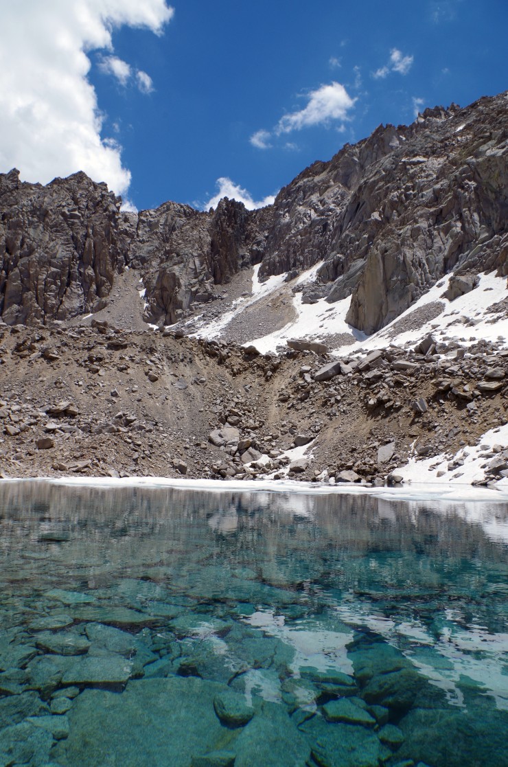
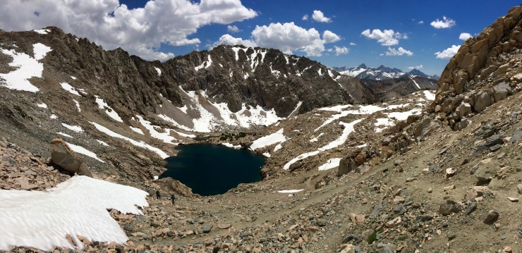
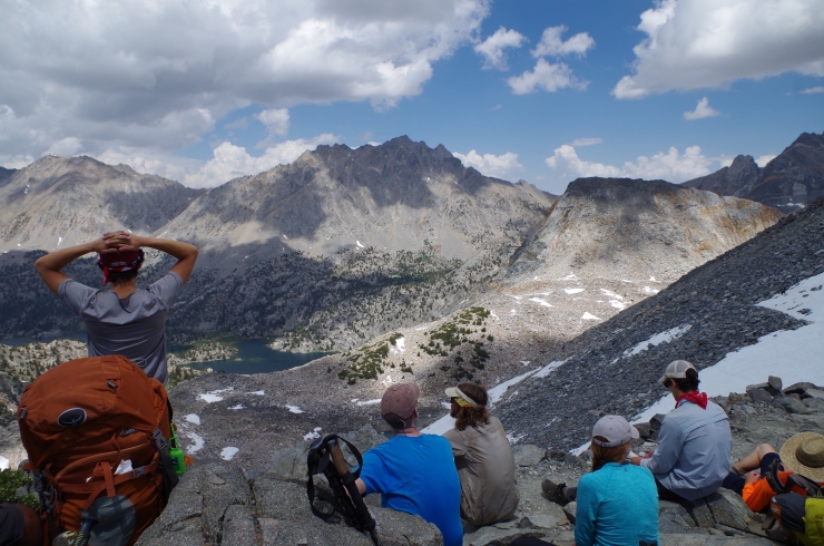
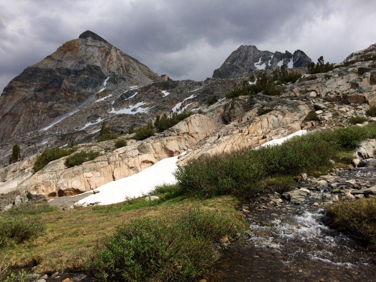
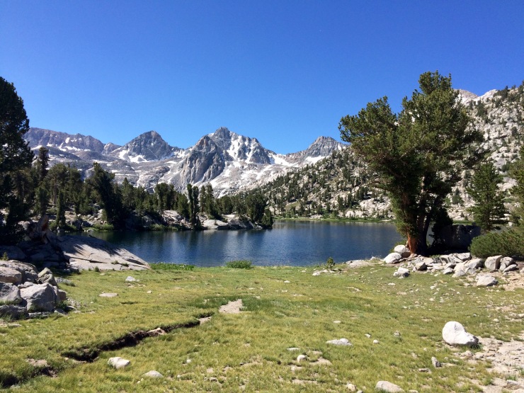
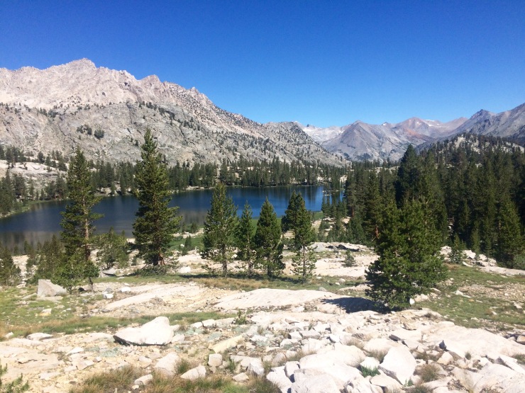
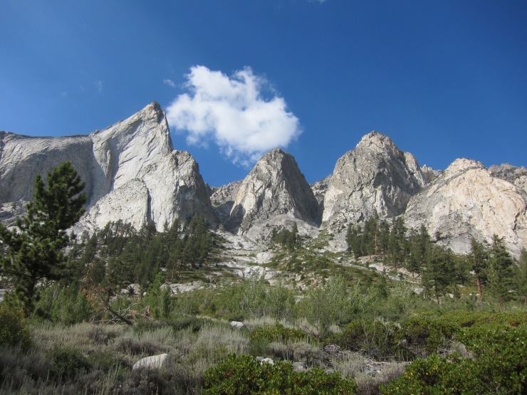
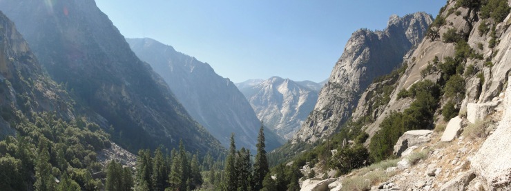
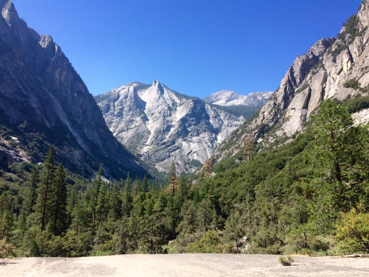
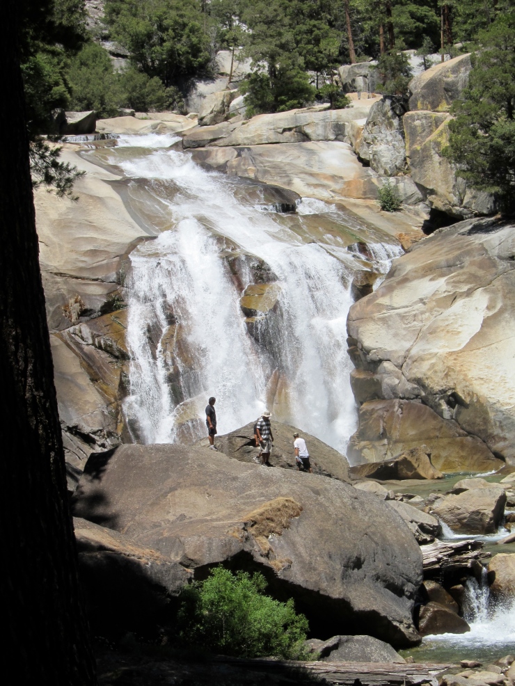
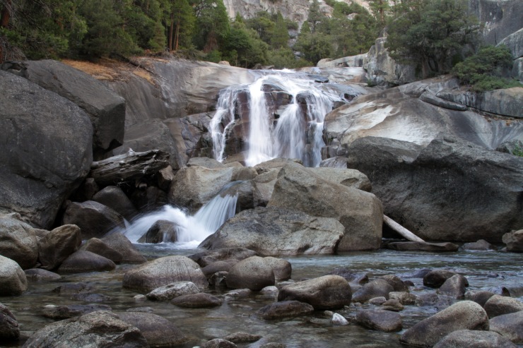
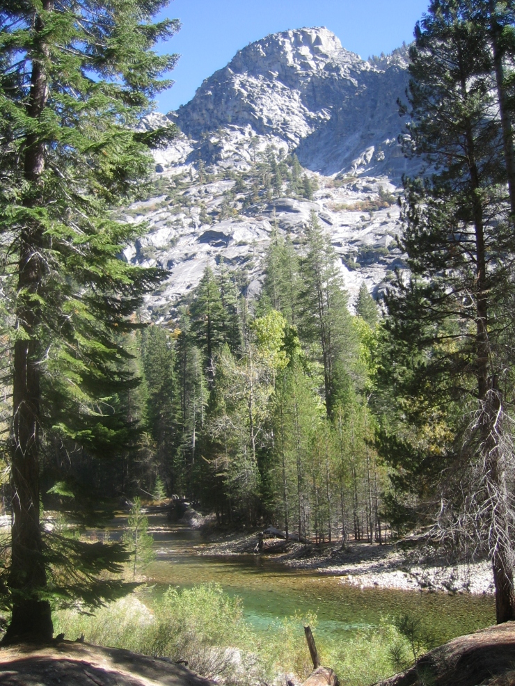
The day 2 hike was the most beautiful but also the most difficult. In the first ~6.5 miles, you climb up 4,000 feet and reach the top of Glen Pass. The views along the climb are spectacular, but be prepared for lots of dry, dusty switchbacks. During the first 3 miles, you hike alongside the Bubbs Creek and get to walk close to a waterfall. Eventually the trail leaves the creek and begins to climb towards Glen Pass. At this point you are hiking along the John Muir Trail and will run into some PCT through hikers.
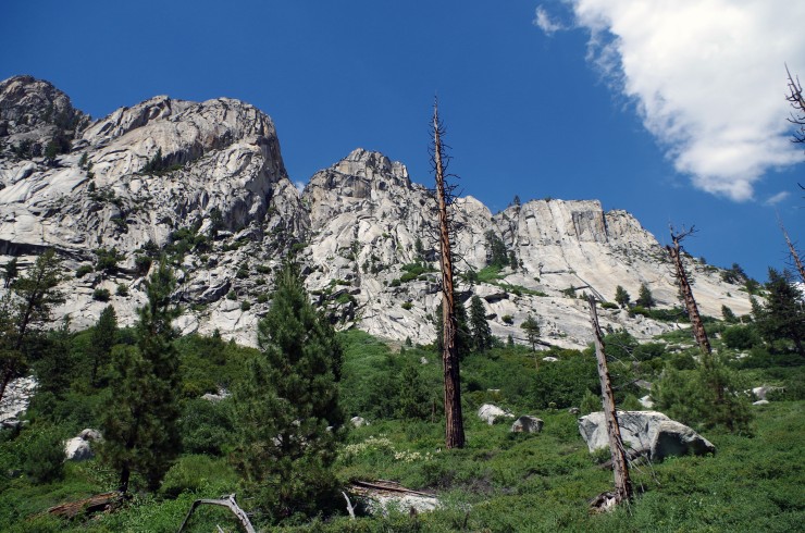
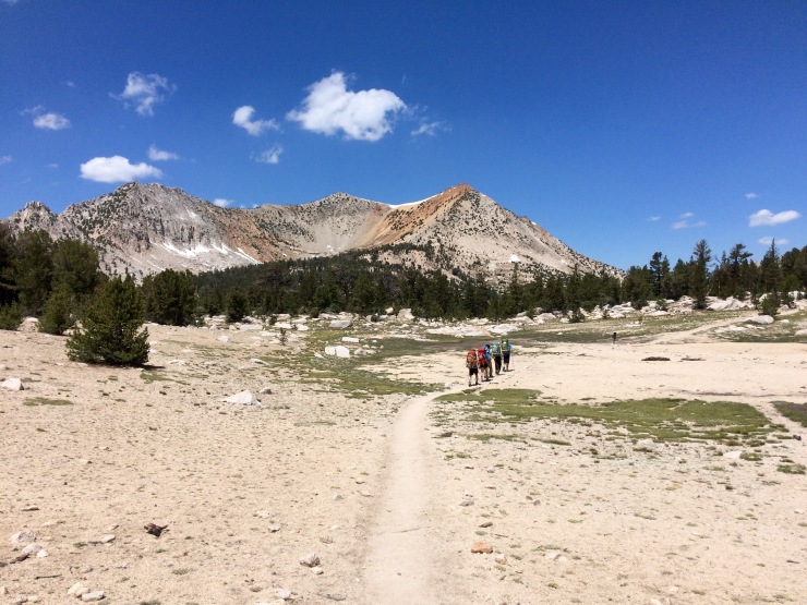
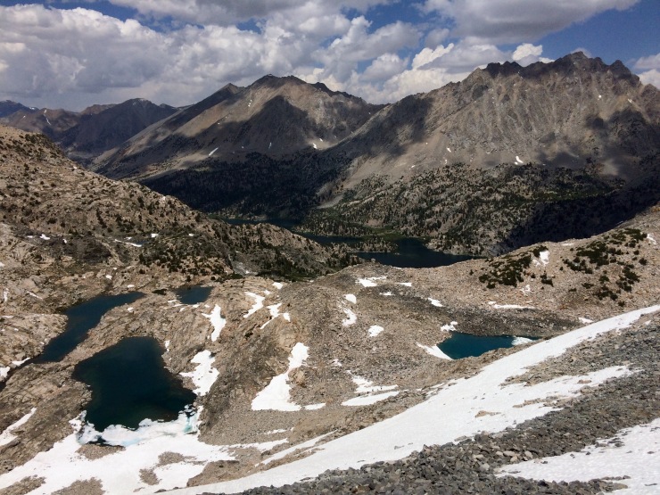
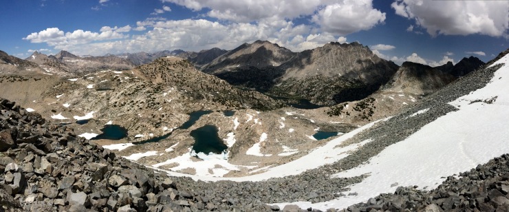
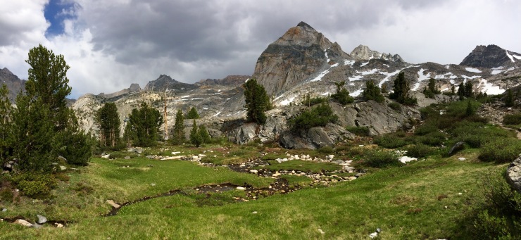
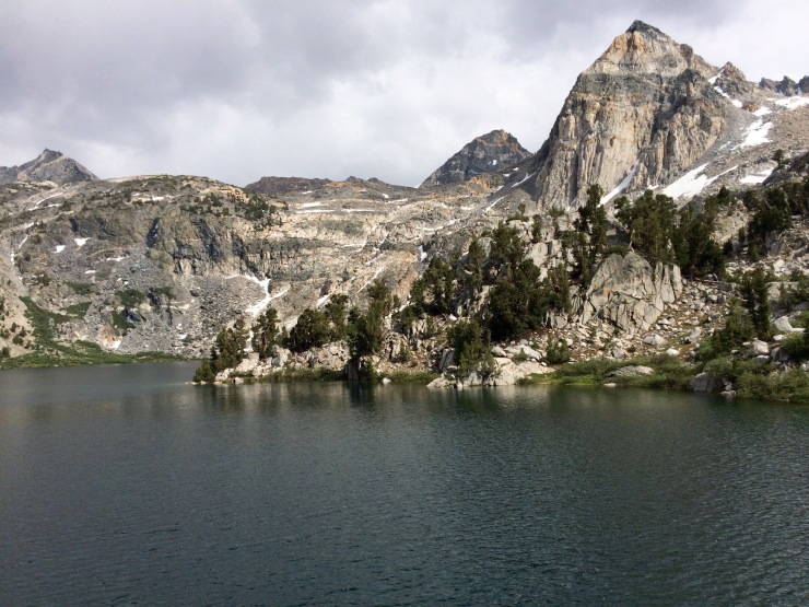
The trail ascending Glen Pass is really pretty with blue lakes surrounded by jagged mountain ridges. At the top of the pass you likely will see many people taking a break. Some members of our party were feeling a big sick from the altitude (12,000 feet), so be sure to take care of yourself. After taking some pictures and drinking water we started the descent. The north side of the pass still had some snow on it, so we had to carefully hike through snow on some of the switchbacks. Some people slid down the snowy slopes, but this technique is not a good idea unless you really know what you are doing.
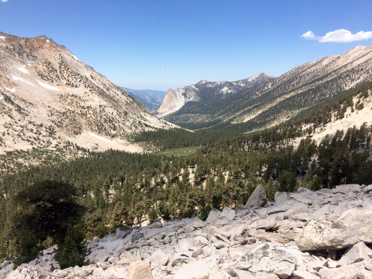
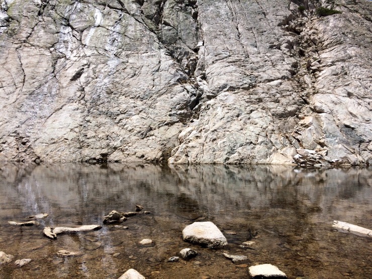
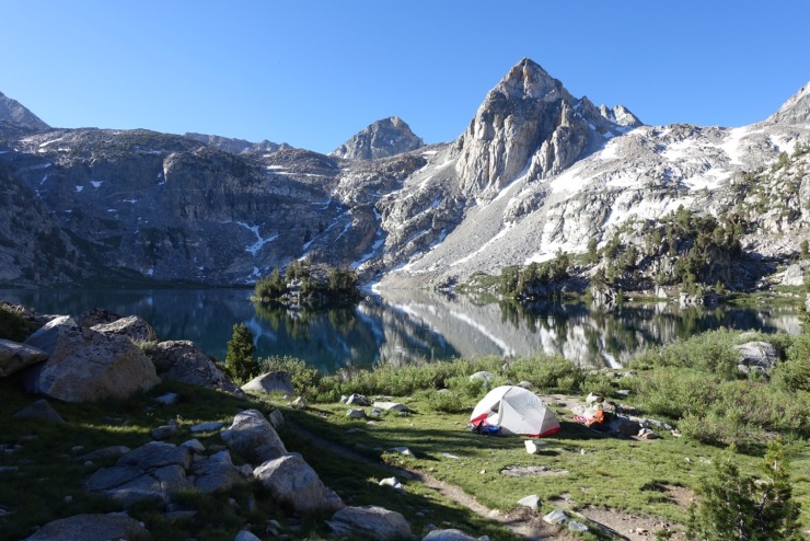
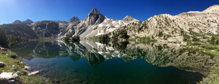
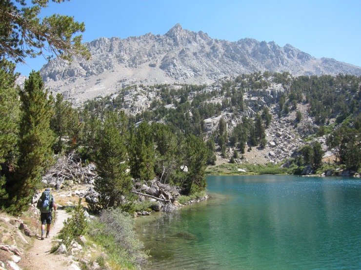
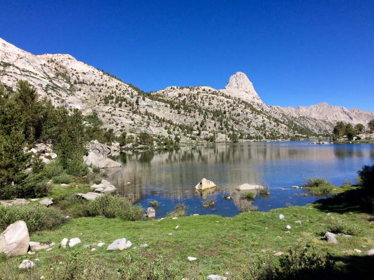
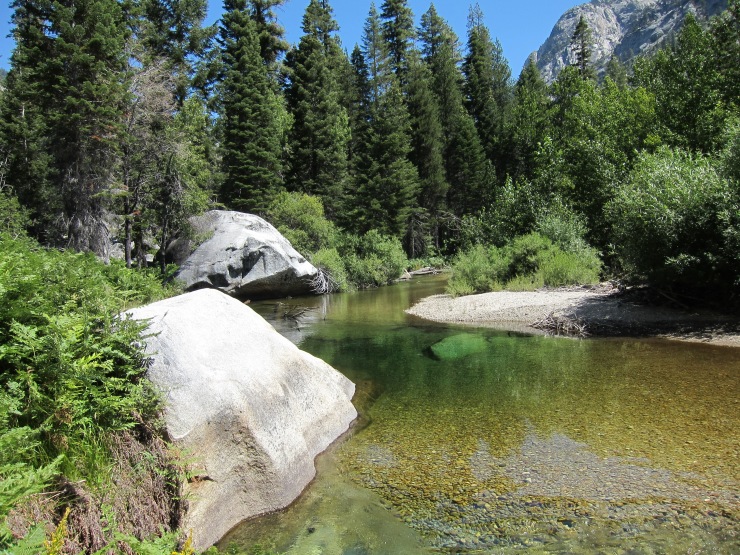
Along the descent you see several snow melt lakes. As you get closer to Rae Lakes, the trail switches from gravel and granite to a dirt and grass trail. We followed this trail to the isthmus between two of the lakes and found some nice campsites there.
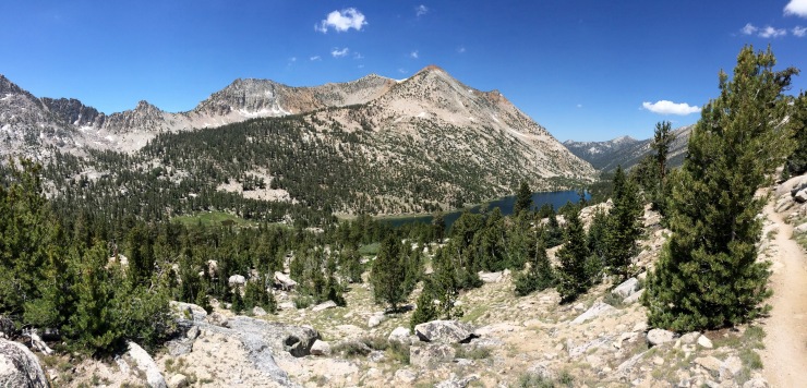
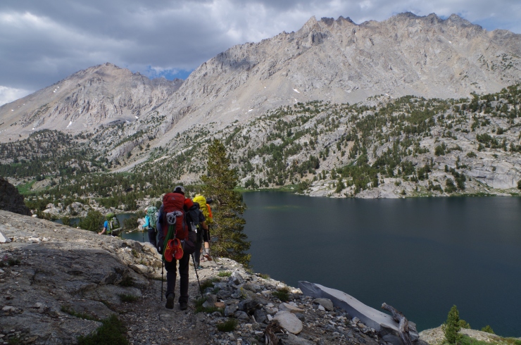
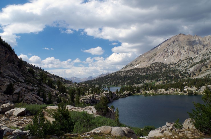
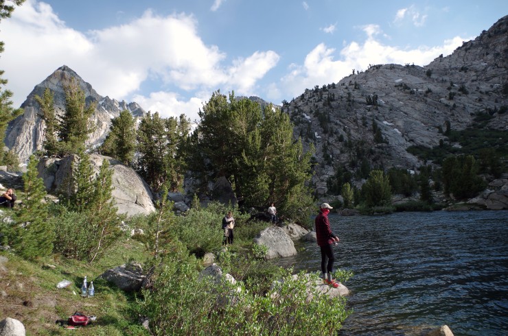
At the lakes we all pulled out our fishing gear and went after the trout. I caught about 8 small trout and we filleted and ate a handful of them. I had good luck with Panther Martin Spinners. For tackle, I used my 4 piece travel fishing rod
and a compact reel
. Some people were fly fishing and they also had good luck.
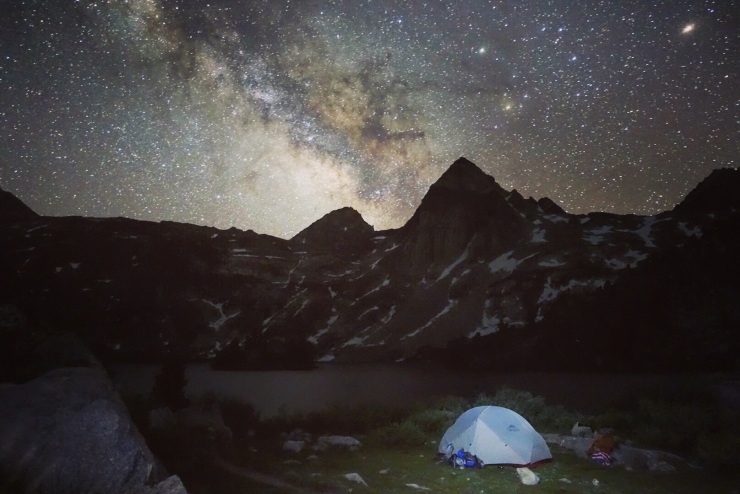
After fishing and dinner, we relaxed and hung out by the lakes at dawn. When the sun was totally down, the stars put on a great show.
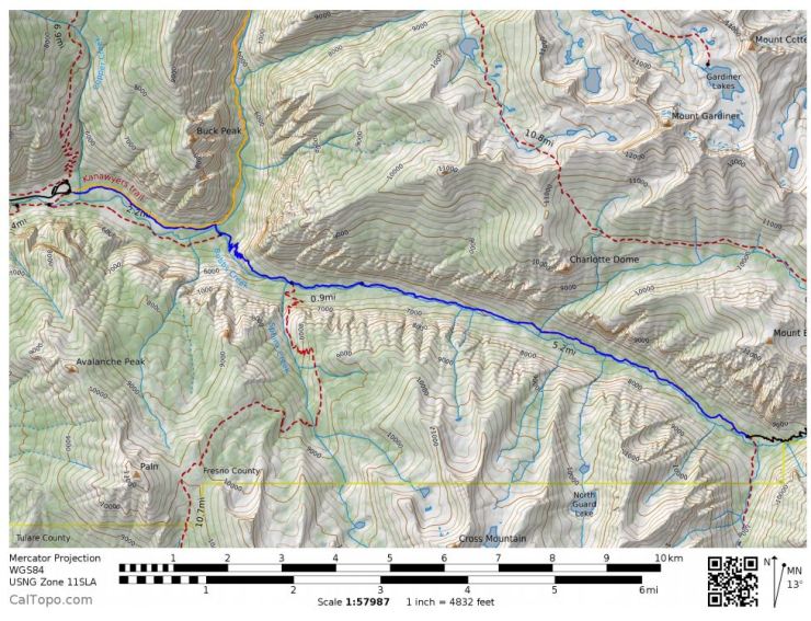
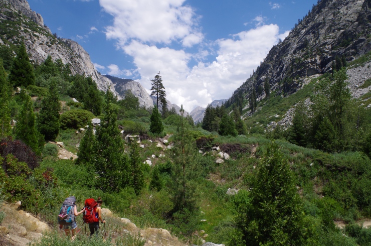
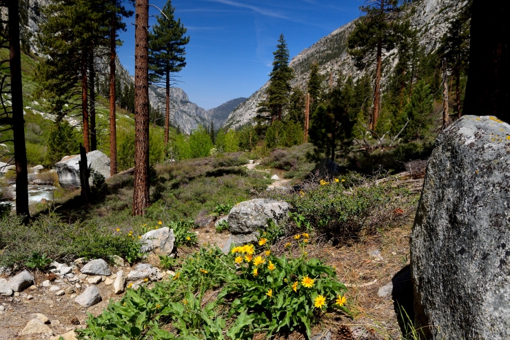
Day 3: 12.7 miles; +400 feet / -4,000 feet; Rae Lakes to Woods Creek Crossing
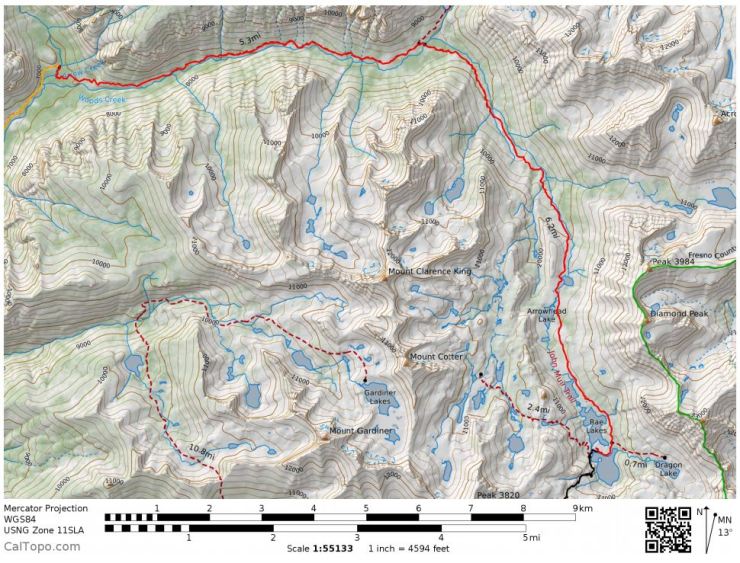
Map of the Rae Lakes Loop Day 3 Hike (pdf)
The hike on the 3rd day was the longest (~13 miles) but was mostly downhill. The main issue was that it got very hot near the end of the hike. Other than that, the hike was manageable.
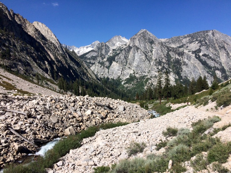
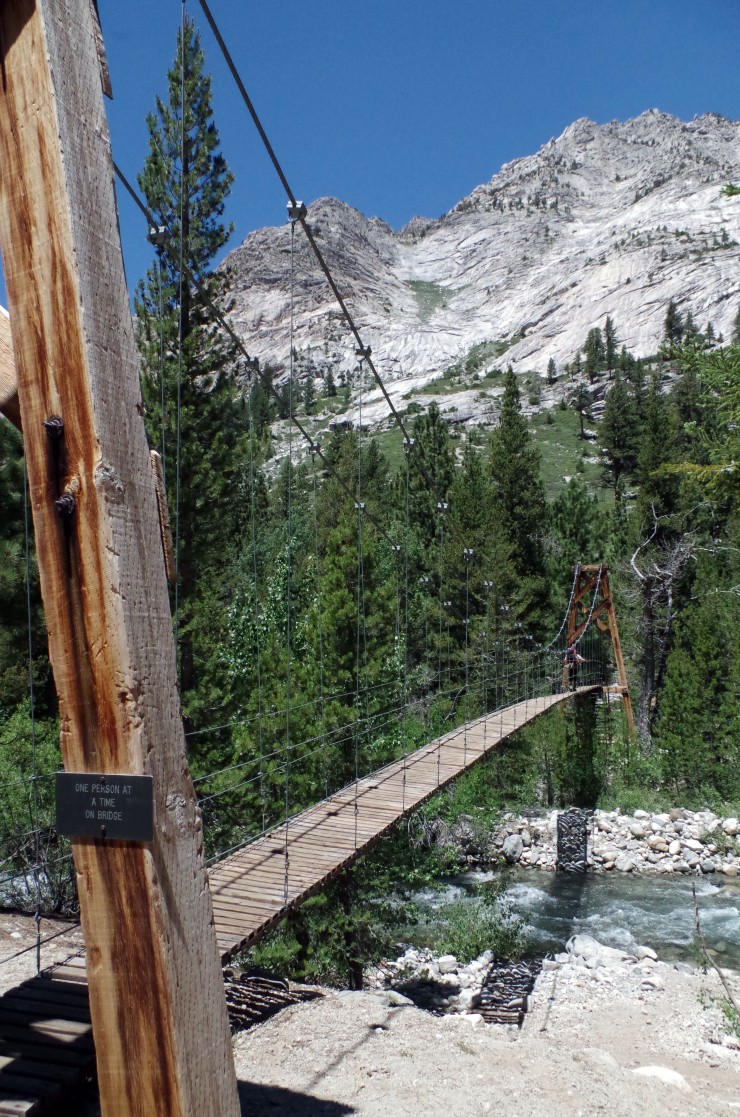
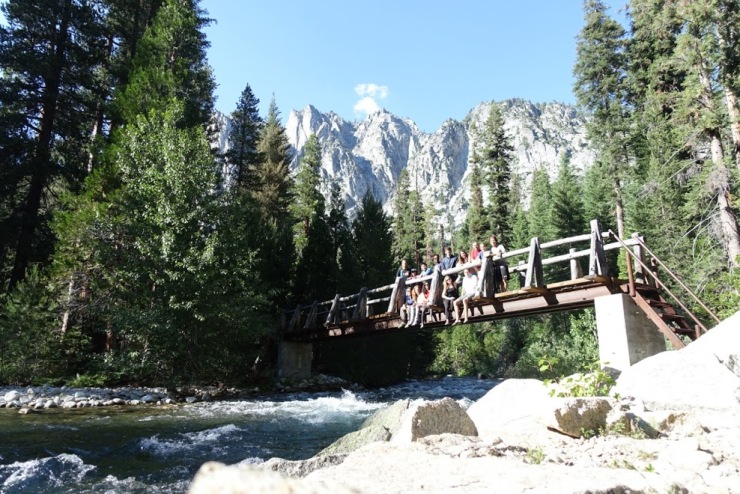
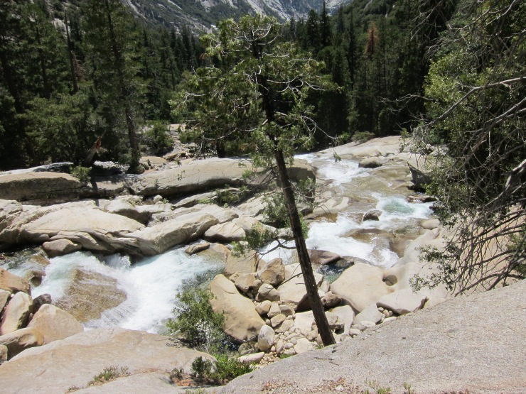
The hike begins with a ~7 mile trek out of the Rae Lakes Basin area before meeting up with Woods Creek. At Woods Creek you cross a suspension bridge, and then take the Woods Creek Trail the remaining ~6 miles until you reach the South Fork of the Kings River. We crossed the bridge (actually it’s damaged as of August 2017) over the Kings River and then made camp in the trees nearby the river. There is a nice area of the Kings river that pools near the bride and is great for taking a dip and rinsing off.
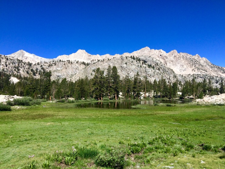
This hike was very scenic and had some great views. At the beginning you get to hike past several lakes in the Rae Lakes area. Then, as you follow the Woods Creek you get to see some very impressive rock structures.
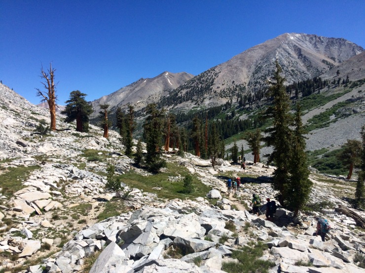
Day 4: 9.6 miles; +450 feet / -2,300 feet; Woods Creek to Roads End
Map of the Rae Lakes Loop Day 4 Hike (pdf)
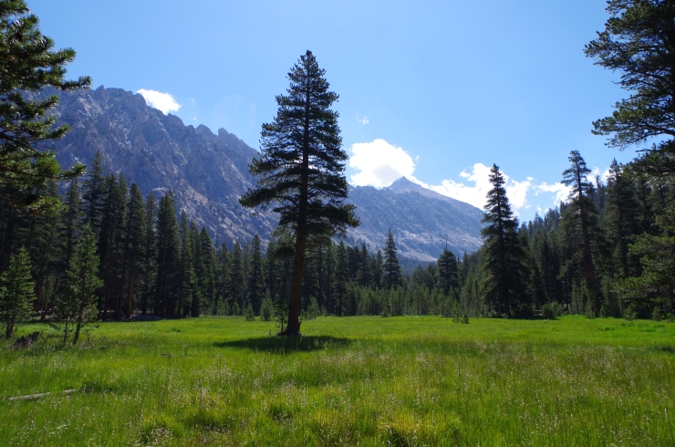
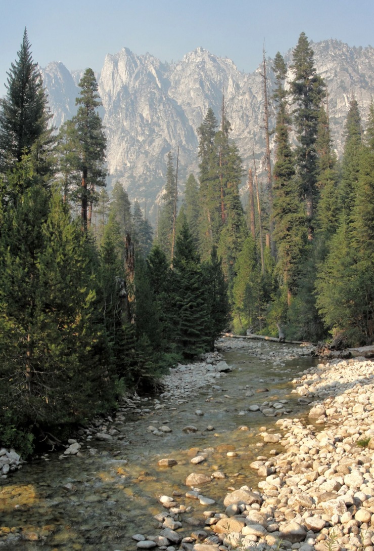
The last day’s hike is again mostly downhill along the Paradise Valley Trail. I didn’t take too many pictures on this hike because my battery was nearly dead. The trail meanders alongside the South Fork of the Kings River and goes in and out of the forest. Some of the forest areas were full of mosquitoes, so be sure to choose your lunch spots carefully.
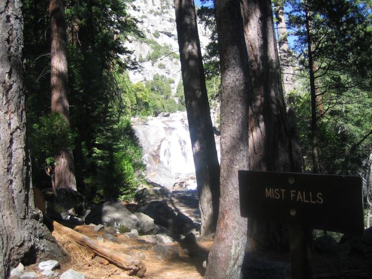
The highlight of the hike was stopping at Mist Falls, which is ~5.5 miles into the hike. Once you reach the falls, there is a very short scramble from the trail down to the base of the waterfall. At the base there are some nice rocks to sit on and have lunch. It makes for a great spot to take a break. The last 4 miles of the hike have some nice views of The Sphynx rock structure and of the Kings River. We encountered a rattle snake and a black bear in this area though, so be alert.
Eventually the Paradise Valley Trail meets up with the Kanawyers Trail. For the final 2 miles you must hike on this sandy and hot trail before reaching the Roads End station. The sandy footing was especially annoying with sore knees and hips after a 40 mile loop. Soon we reached the trailhead though and drank a bunch of water.
After we finished up the hike, we walked ~5 minutes to the Kings River right near the Roads End parking lot. There was a nice pebble beach here and we got in the river to cool down and rinse off. This felt great after finishing up the last hike of the loop.
All in all, this is a great backpacking loop. The scenery is great and the route is set up perfectly for a 40 mile loop. The only disadvantage in my mind is that the loop is so popular it can be difficult to find solitude.
Here are some similar trip reports!
Rocky Mountain National Park – Continental Divide National Scenic Trail
Sequoia National Park – Mineral King Area – Sawtooth Pass and High Sierra Trail
Yosemite Hiking – Clouds Rest and the Lembert Dome
Teton Crest Trail – Grand Teton National Park (48 mile loop)
Yosemite Highlights Loop – Yosemite National Park (40 mile loop)

That must of been an experience of a lifetime hiking these scenic views.
LikeLike
Thanks for the great write up. Best info on Rae’s Creek loop I have found so far. Plan on going in summer of 2018!
LikeLiked by 1 person
This is such a helpful resource. Thank you for putting it together! I’m hiking the Rae Lakes Loop counterclockwise in July and am so glad to find such an informative guide to this trip. Thanks again!
LikeLike
I hope you have a great trip in July! Just remember that the bridge at the South Fork Kings River is still out and you will need to ford the river to cross. The water levels may be down in July, but it’s always good to check with the rangers ahead of time!
LikeLike
Nice trip report! Thanks for putting in the time to provide such in depth info for the rest of us! =)
LikeLike
Thanks for the detailed account.
The Day 3 map is the same as the Day 4 map. I assume you just uploaded the wrong file.
LikeLike
Thanks for pointing that out. Will fix it soon!
LikeLike
Very good report with great photos. Just want to let people know that the snow around Rae Lakes has finally melted, but there is still a lot of snow around Glen Pass. Plan accordingly!
LikeLike
we’re supposed to do a CW loop in 2 weeks. watching the snow levels on Glen Pass and appreciate any info.
LikeLike
Hi John – here are the satellite images of the Rae Lakes area from 7/13/2019: https://caltopo.com/l/H8SK
That map will give you an idea of conditions this week. The satellite images are updated weekly, so you can get some info those! Snow is likely to linger on the north face of Glen Pass for a while, but it is typically fine to hike down if you are careful. When I hiked the loop a few years ago there was a switchback path worn into the snow that we followed. It is much safer to follow the path than to try to glissade.
Also, keep in mind that the South Fork Kings River Bridge is still out. It’s probably a good idea to give the rangers a call a few days before you leave to ask about that and other river crossings. Hope you have a good trip!
LikeLike
I hiked this loop back in 1980, when I was 15 years old, with my cousins and brothers. Trip of a lifetime! I learned so much. Thank you for the great pictures. You’ve inspired me to get in shape enough to do it again.
LikeLike
I hike the rae lakes loop this past weekend and it was great! Thank you for the helpful report 🙂
Mosquitoes were a little bad in spots but using deet helped. The pass had a bit of snow but I felt ok wearing normal hiking shoes! For the river crossing, we found a tree that was downed across the river. Hope that helps!
LikeLike
I hiked that trail back in 1973. It was beautiful! Glad that people are respecting it. My daughter and I are planning a trip in fall of 2021 to Rae Lakes. I’m much older now, battling high BP and some arthritis, but I want to do it before my time is up.
LikeLike
Ed, you may want to consider going in June or July so that you don’t run the risk of having your trip cancelled due to wild fires. That happened to us this past Sept, we were planning a trip to mineral king but the air quality was too bad as there was a fire raging not too far away.
LikeLike
Just keep in mind that in June and early July there can still be a good amount of snow in the high elevation sections of both the Rae Lakes Loop and the Mineral King area. If you plan to do the trip in June/July, keep an eye on the snow pack throughout the spring.
LikeLike
I know it’s been awhile since you did this trail, but do you remember what kind of exercises/training prep you did to prepare for this? There are a world of resources, but I’m just curious about your regimen. Also, are you still an advocate of the picardin and permethrin routine listed above or have you changed this since then?
Thanks for all the great information. =)
LikeLike
If I have the time, I still like to pretreat my clothing with permethrin. I like picardin because it doesn’t melt plastic, but sometimes use DEET instead (if I have it).
For training, I just try to hike as much as possible and occasionally do some squats/lunges!
LikeLike