Cirque of the Towers Loop – Wind River Range, WY (45 mile loop)
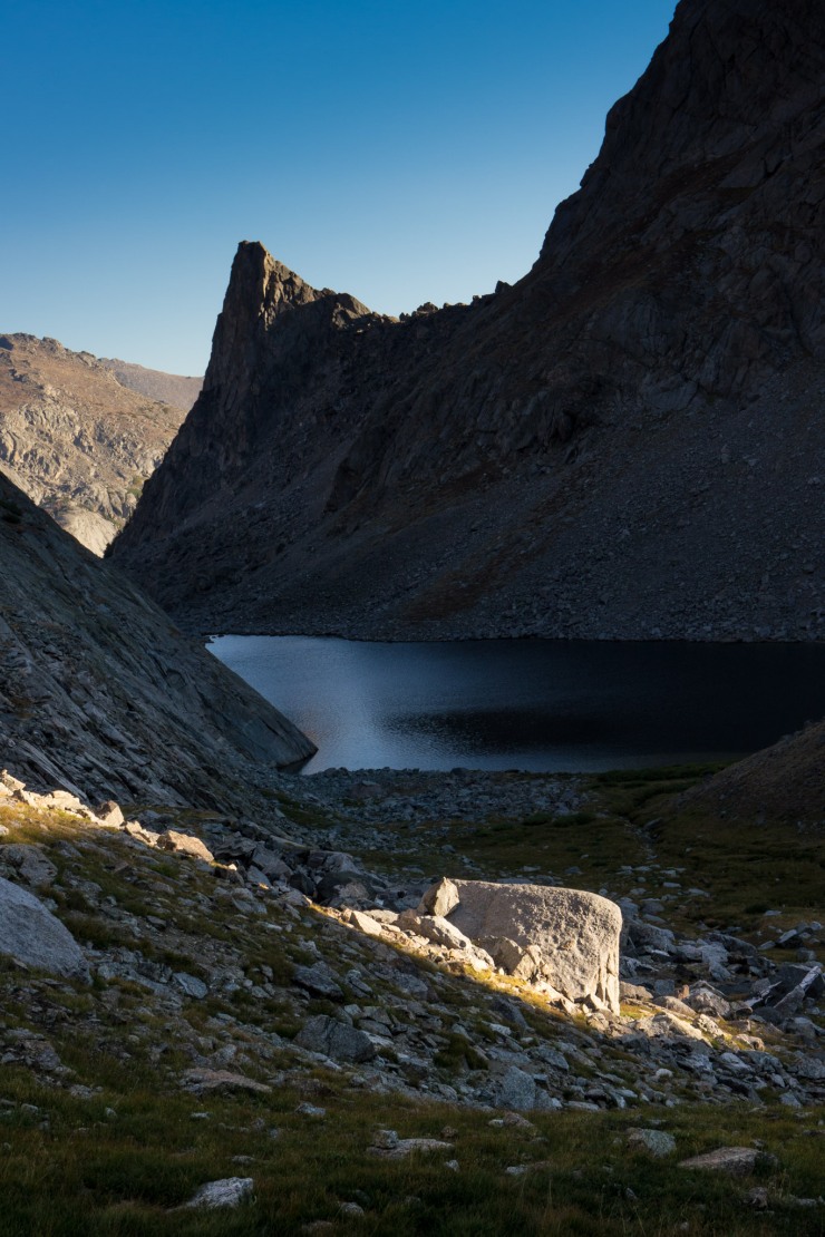
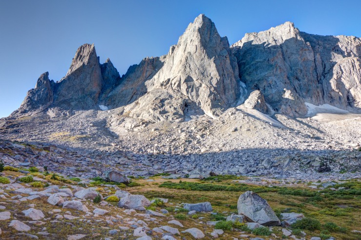
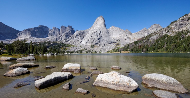
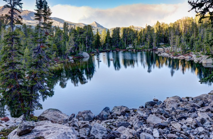
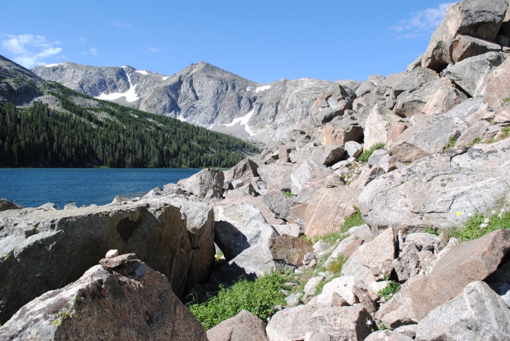
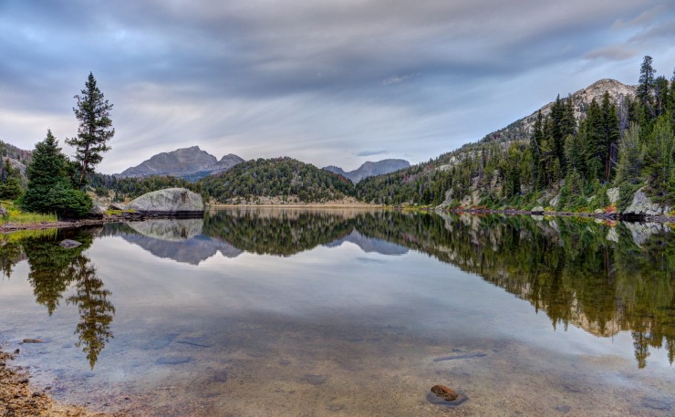
Cirque Lake is a modest scramble from the campsite. Here is the view from shore showing the prominent peaks of Overhang Tower, Sharks Nose, and Block Tower (credit: Mark Henn)
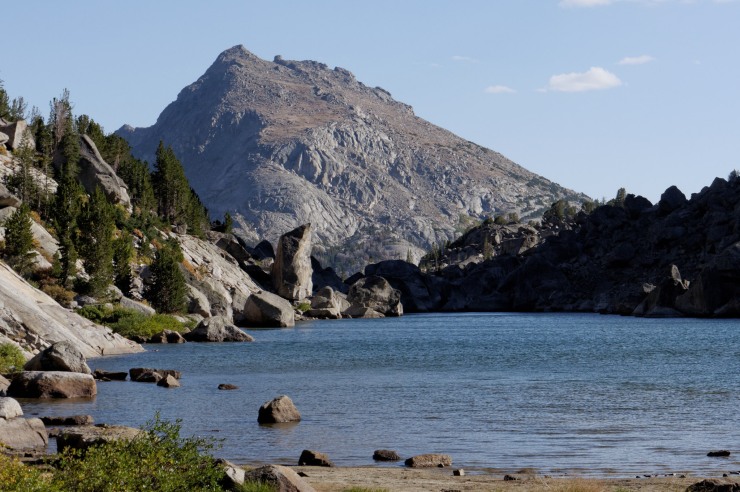
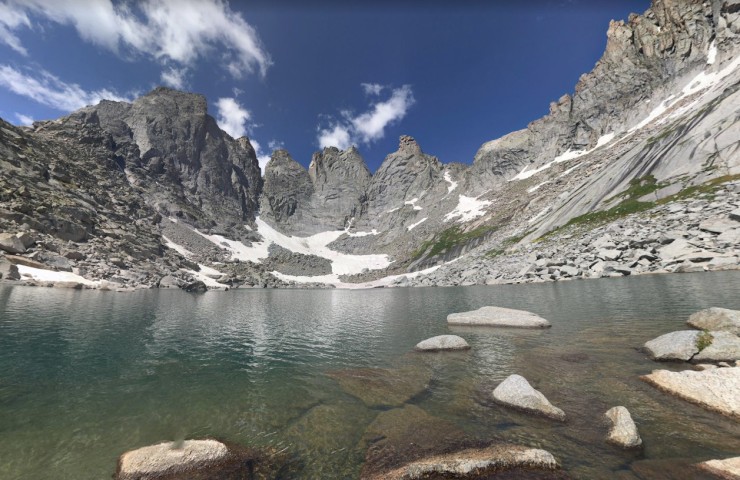
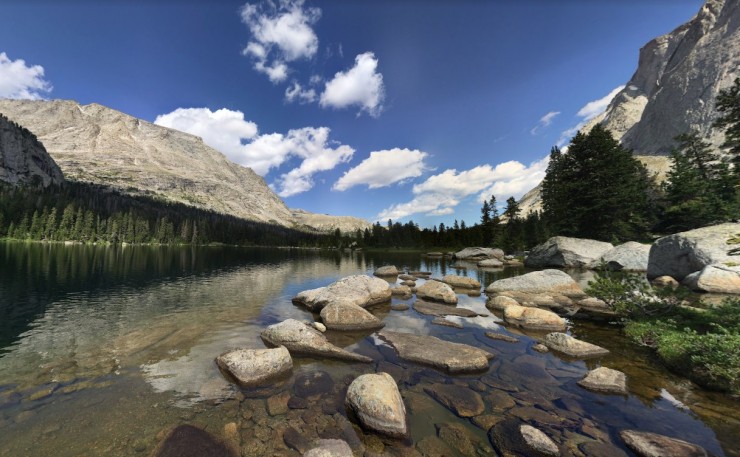
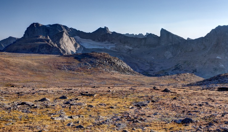
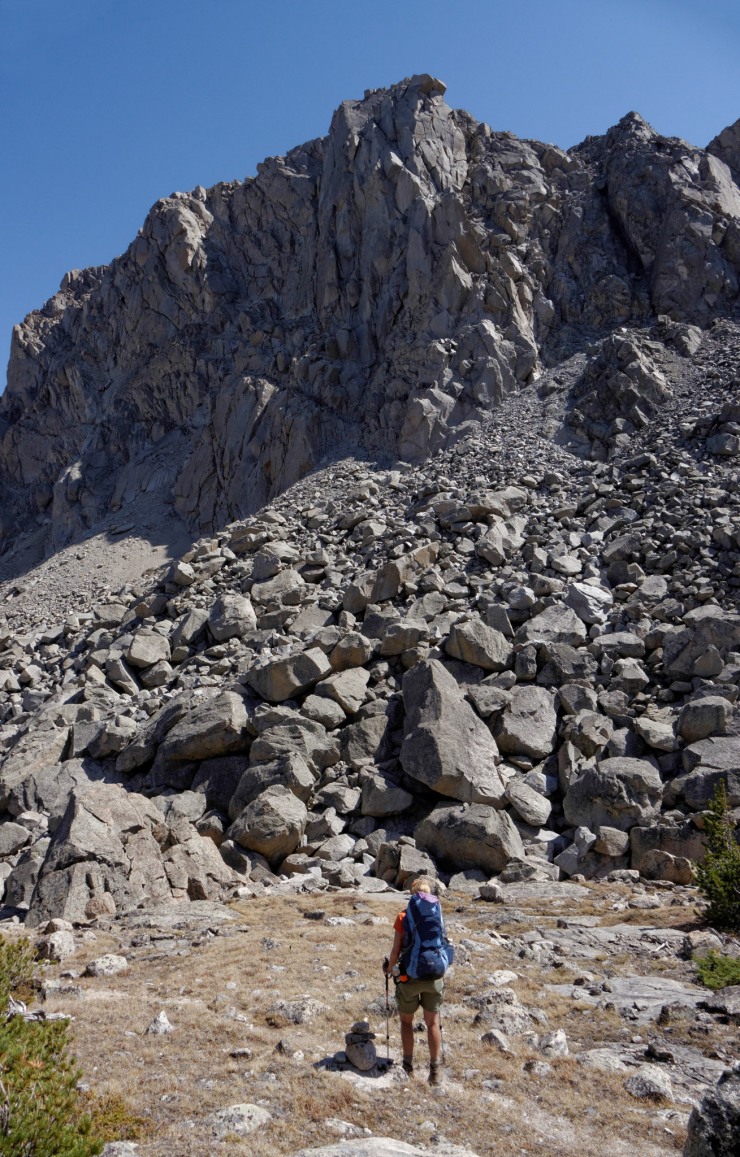
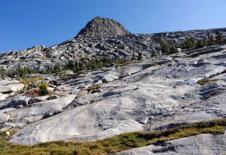
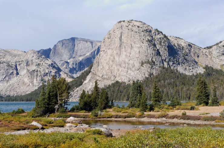
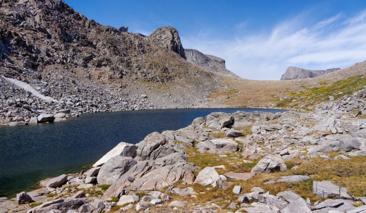
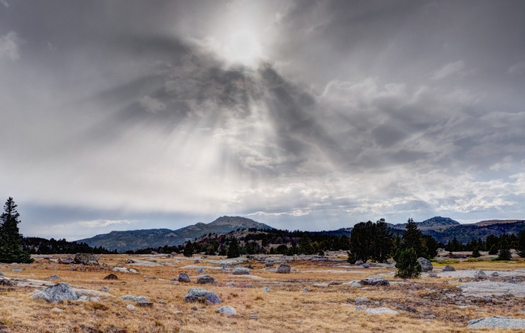
Zoomed in view of the Pilot Knob that frames the Northwest end of Grave Lake (credit: John Strother)
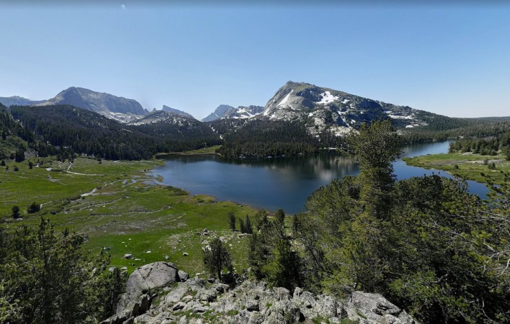
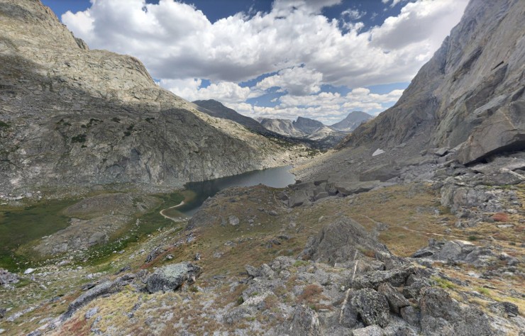
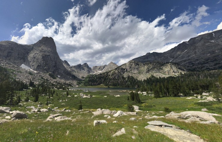
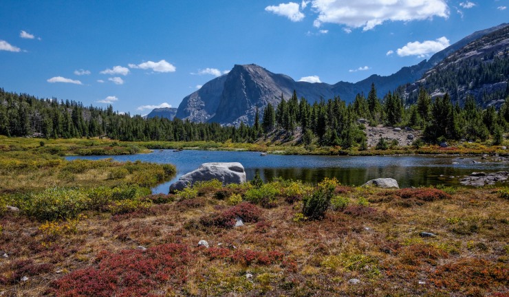
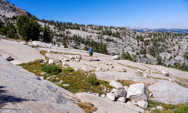
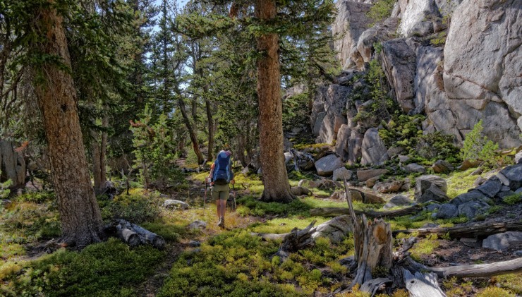
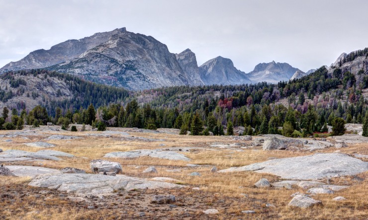
View of Skull Lake in the distance, which will be the campsite for night 4 (credit: John Strother)
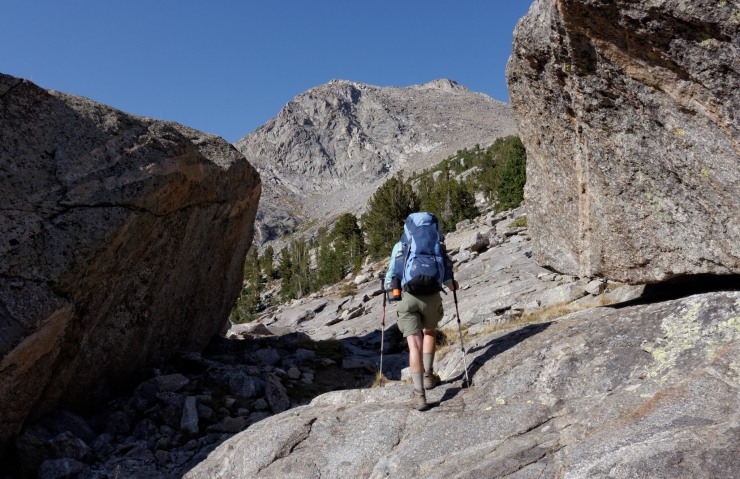
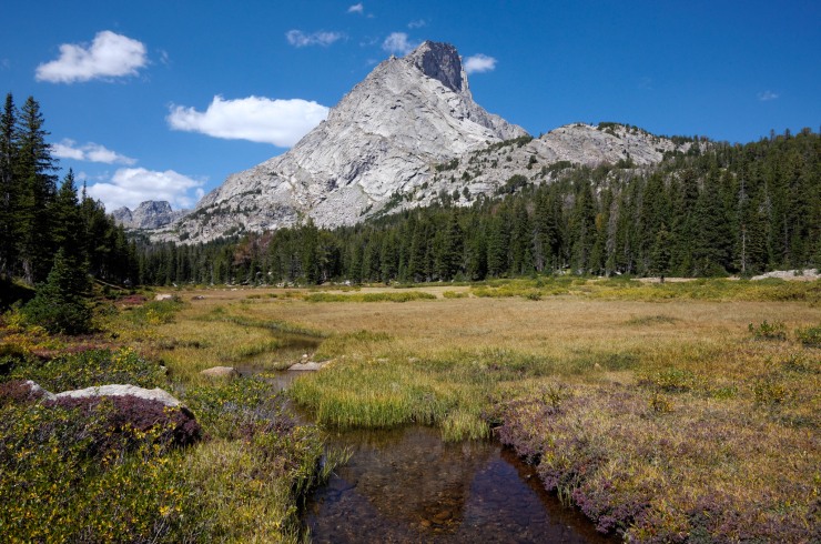
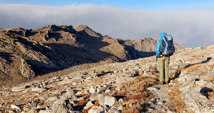
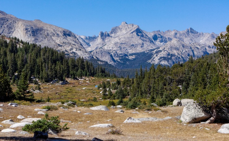
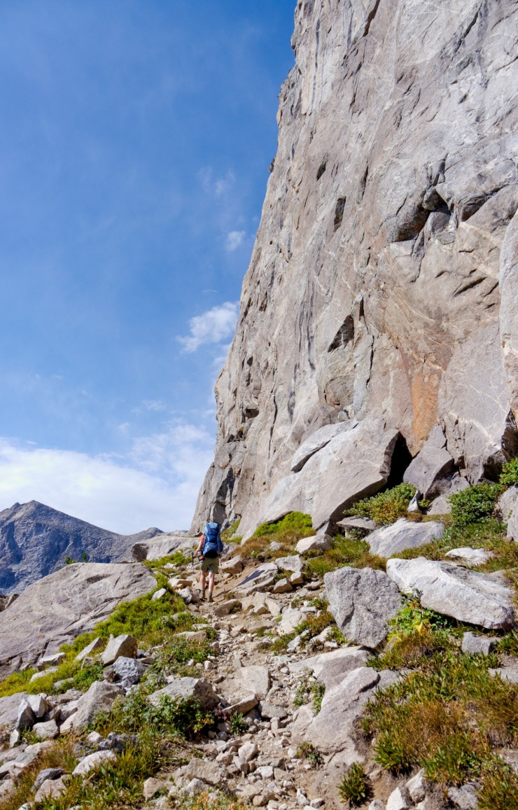
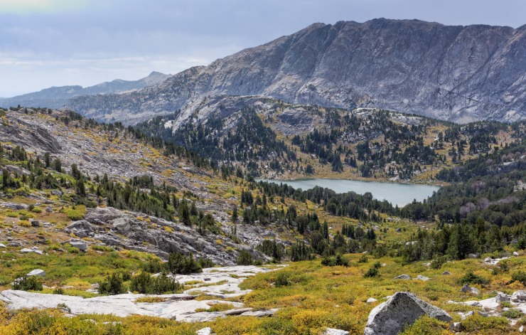
Looking northwest at Mount Hooker from the Hailey Pass Trail (credit: John Strother)
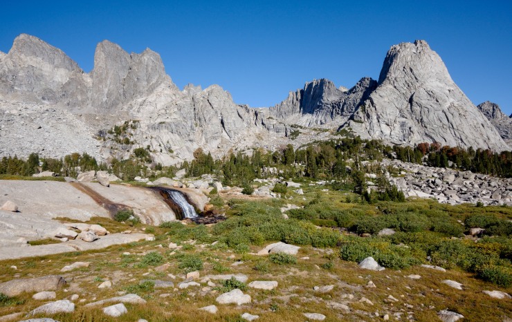
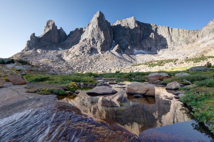
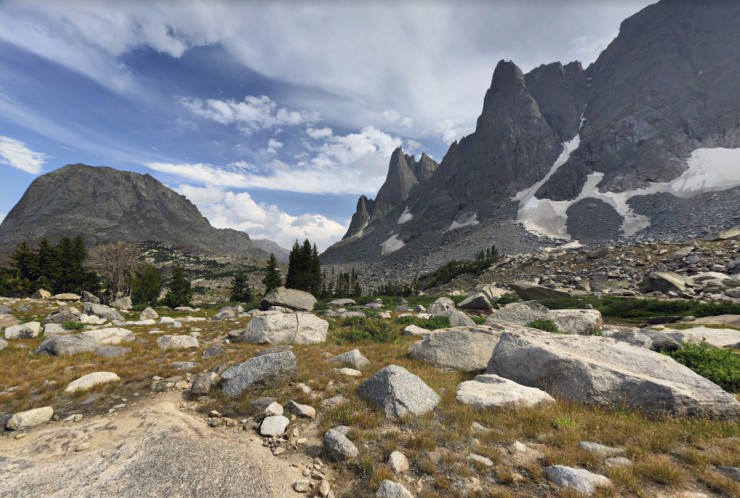
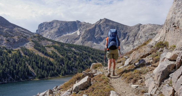
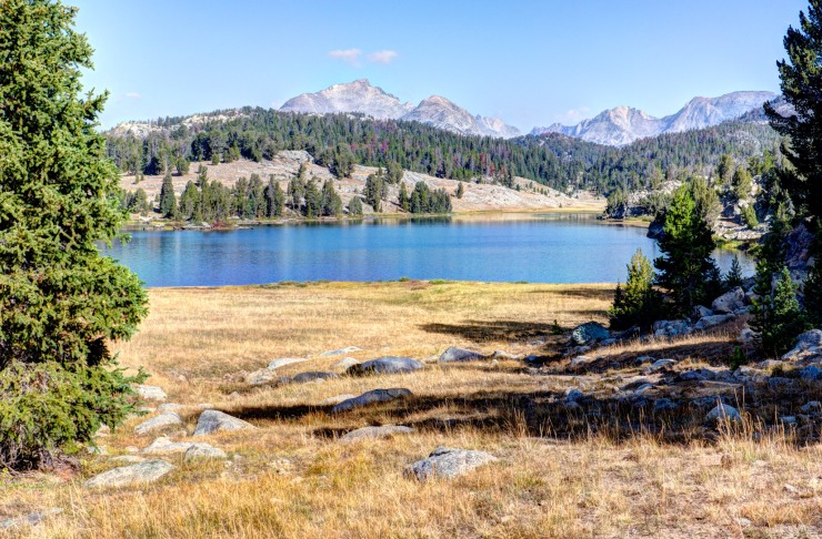
Pingora Peak and the Cirque of the Towers from the east shore of Lonesome Lake. From this point, you hike east on the Big Sandy Trail towards the Lizard Head Trail (credit: John Strother)
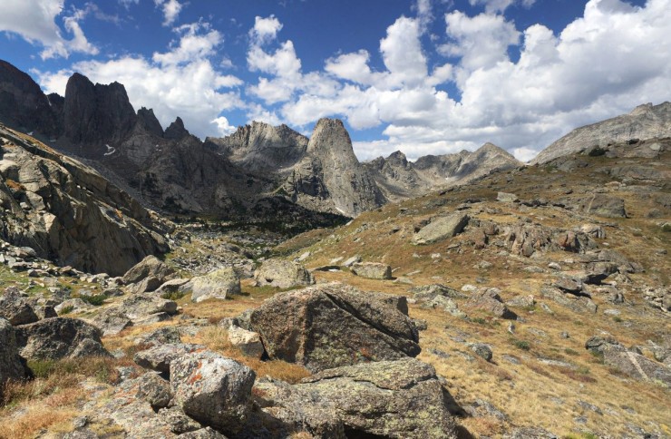
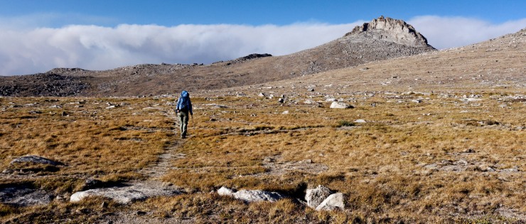
You then continue to climb upwards on Lizard Head Trail for the next 1.5 miles. Looking back you get nice views of the Cirque of the Towers and of Bear Lake (credit: John Strother)
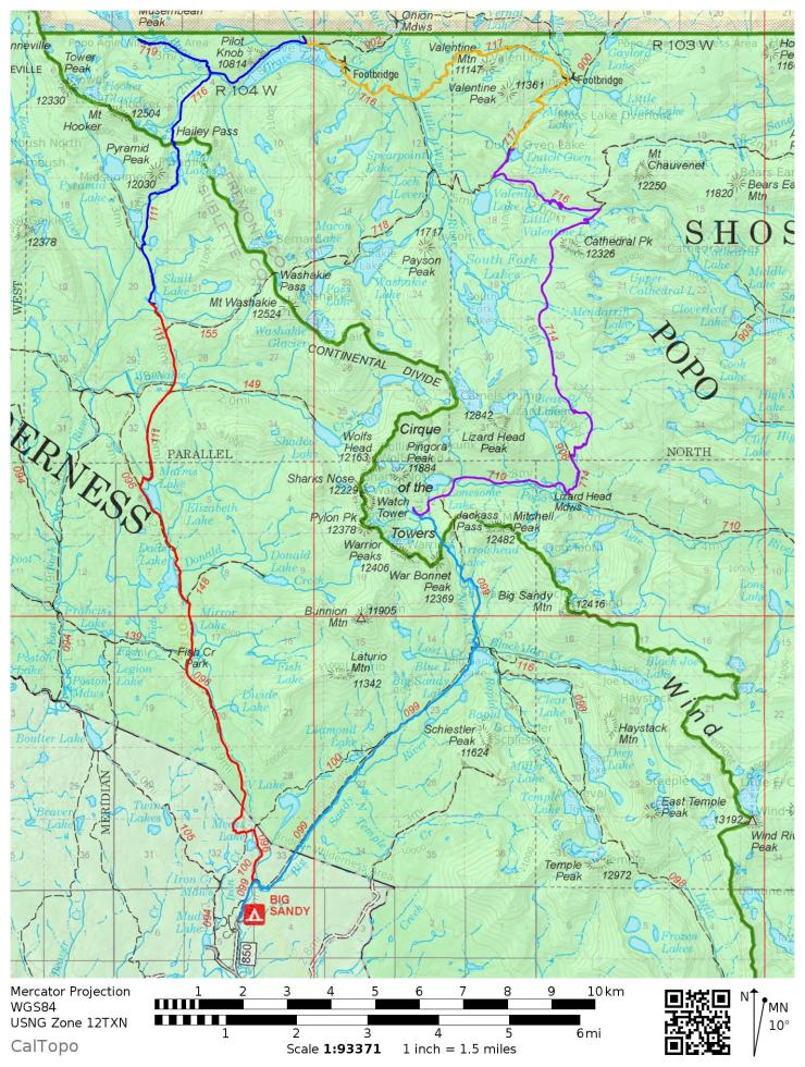
Trip Overview: The 45 mile Cirque of the Towers backpacking loop goes through the spectacular and popular Wind River Range of the Pop Agie and Bridger Wilderness areas of Wyoming. +/ -9,500 feet of elevation across the course of this trek with a peak elevation of 11,870 feet. Highlights include steep glacier cut valleys, glacial-fed alpine lakes, impressive granite peaks, and spectacular views. The beauty of this area makes it one of the more popular backpacking destinations in Wyoming, but the scenery makes up for any crowds you may encounter. Along this route you circumnavigate the iconic Cirque of the Towers mountain region, conveniently starting and ending at the same trailhead.
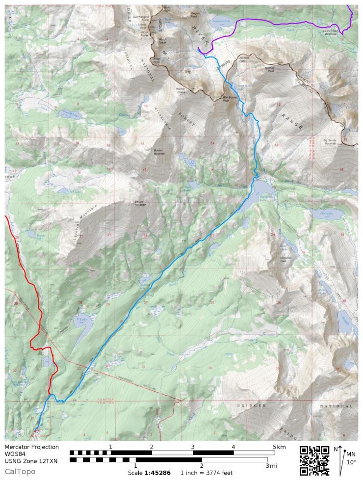
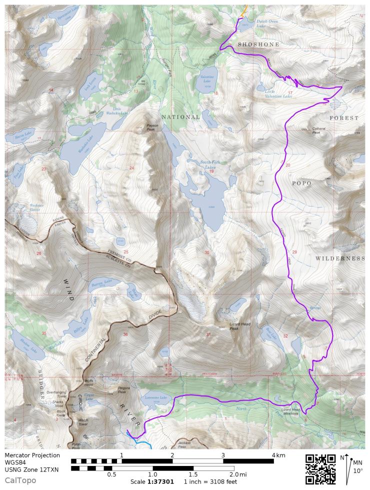
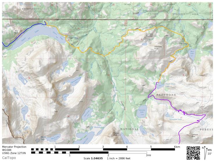
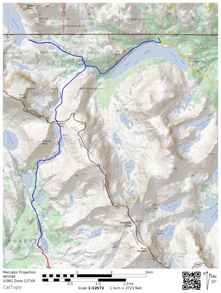
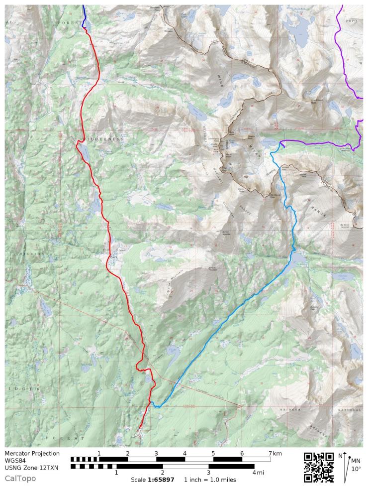
Overall map of the Cirque of the Towers Loop in the Wind River Range of Wyoming. The hike is divided across five days. Day 1 camp at Lonesome Lake (turquoise), Day 2 camp at Dutch Oven Lake (magenta), Day 3 camp at Grave Lake (yellow), Day 4 camp at Skull Lake (blue), and Day 5 hike out (red).
Higher resolution version of the overall map for Cirque of the Towers Loop (PDF)
Topographic map of Wind River Range for purchase (link)
Permits: No permits are needed to backpack in the Wind River Range. Both the Popo Agie and Bridger Wilderness areas allow groups under 15 people to backpack with no permits or fees. There are a few regulations that backpackers must follow in these areas though. There is no camping allowed within 200 feet of lake shores or within 100 feet of creeks or streams. Also, there is no camping or campfires are not allowed within 1/4 mile of Lonesome Lake near the Cirque of the Towers. In the Bridger Wilderness area, campfires are only allowed below the tree line and cutting or removing standing wood is not allowed. Beyond these regulation, you should follow other general rules such as staying on trail, packing out all trash, and properly storing food (either in a bear canister or by properly hanging).
Click here to read more about Logistics
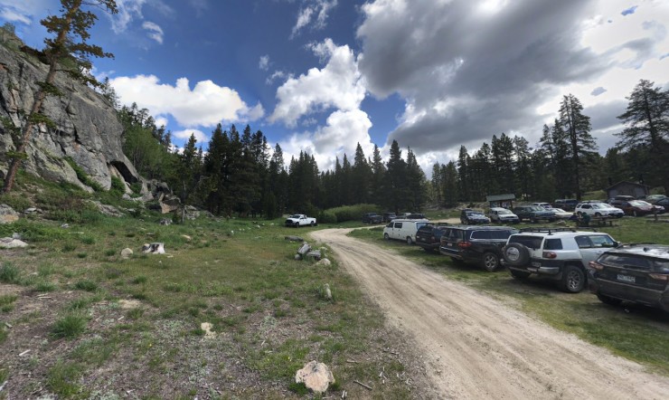
Logistics: The Cirque of the Towers Loop starts and end at the Big Sandy Trailhead. At the trailhead there are vault toilets and parking, but no potable water source (plan to arrive with a filled camelbak or filter water along the trail). You must drive to the trailhead or arrange for a private shuttle. The trailhead is about 3.5 hours drive from Jackson, Wyoming.
If you plan to camp the night before leaving on the trek (a good idea to help acclimate to the elevation), the Big Sandy Campground near the trailhead is a great option. Sites are available on a first-come, first-serve basis and it only costs $7 per night. There are vault toilets, but no potable water here (the Big Sandy River is close by). You are also required to pack out your own trash given the campsite is very primitive. Note that there are only 5 sites at the campground, so it’s possible the campground could be full and you may need to make friends and pitch your tent close to someone else.
Click here to read more about Difficulty
Trail Conditions and Difficulty: Many of the trails in the Wind River Range have a good amount of elevation change and traverse high elevation mountain passes. The Cirque of the Towers Loop is no exception and is a challenging route. This entire loop sits above 9,000 feet and much of the mileage on days 2-4 is above 10,000 feet. Backpackers should spend a day or two acclimating to the thin air, should be in good cardiovascular shape, and should know the signs for altitude sickness.
Given this route is quite popular, the trails are typically well marked. That said, backpackers should be prepared with a map and compass because storms can drop snow in the high elevation Wind River Range many months of the year. The best time of the year to backpack this route is typically mid-July to mid-September. During this time frame you are least likely to encounter snow on the trail. Note that the weather is unpredictable in the mountains and afternoon thunderstorms are common. Backpackers should be prepared for varying weather and should avoid hiking on high elevation exposed trails in the afternoon when storms are likely.
Supplies: In the Winds, you must be prepared for a variety of conditions depending on the time of year. Up until late July / early August, snow may remain in the high country and on mountain passes. If you are hiking the trail in June or July (before the snow fully melts) or in late September / October (when snow can begin to fall again), you will want to consider bringing microspikes/crampons and an ice ax. If the trail is clear of snow, then these are not needed.
Because of rapidly changing weather in the mountains, you will want to bring several layers so that you can easily adapt to the changing temperature and also so that you can stay dry. I also recommend having a set of wool clothes to change into at camp. Wool is great because it doesn’t pick up funky stenches as fast at cotton or synthetic clothes. It also dries out quickly so that you are able to stay warm even if all your gear gets soaked in a thunderstorm.
Other specific gear you will want for backpacking in the Cirque of the Towers is related to bear safety. This wilderness area is inhabited by both grizzly and black bears. Thus, it is important to store all food and scented items in either a bear canister or properly hung using a rope and ursack. It is also recommended to carry bear spray. Given the popularity of this route, an encounter with a grizzly is unlikely, but it is best to be prepared.
You may also want to pre-treat your clothes and tent with permethrin spray repellent. Mosquitoes can be an issue in late July and early August after the snow melts. The permethrin treatment stays on your clothes for up to 7 washes, so it helps reduce the amount of DEET spray you need to put on your skin.
Below is a list of the gear recommended for backpacking in the Wind River Range:
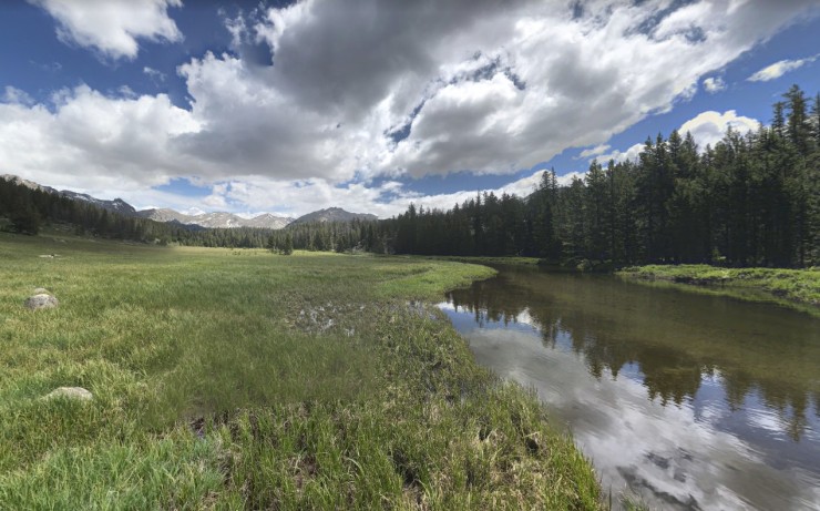
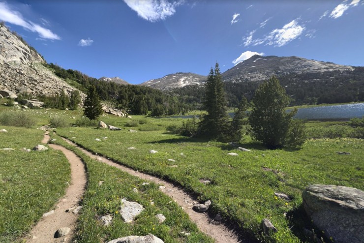
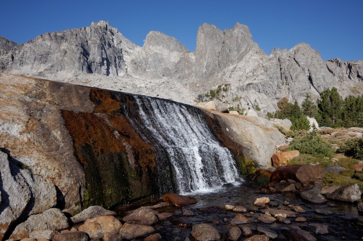
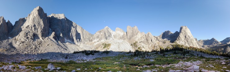
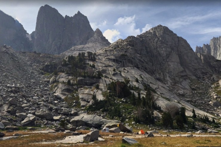
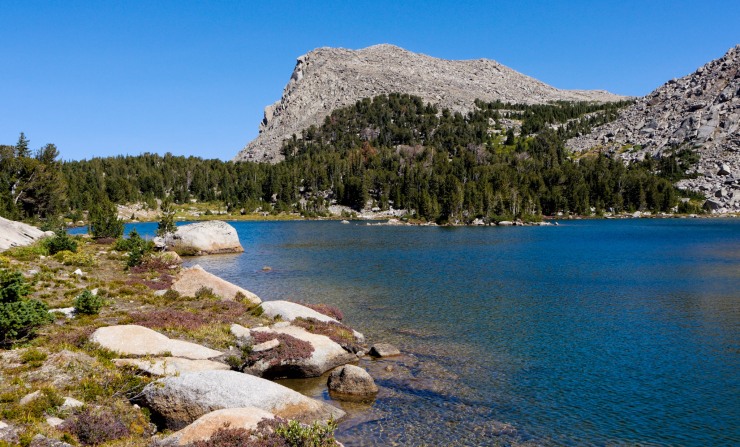
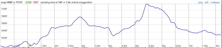
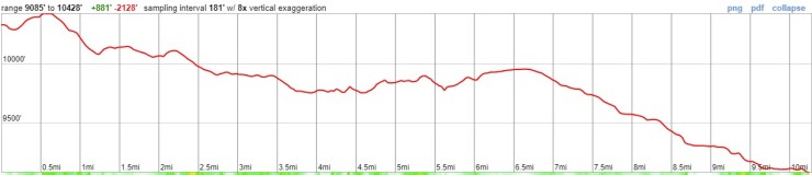
Elevation profile of the Day 1 (turquoise) hike along the Cirque of the Towers Loop in the Wind River Range from the Big Sandy Trailhead to Lonesome LakeView from the Big Sandy Trailhead where you start off on the Cirque of the Towers backpacking Loop in the Wind River Range (credit: Daniel Weber)The Big Sandy Trail starts off with a ~3 mile hike along the Big Sandy River. The trail gradually climbs in elevation (credit: Daniel Weber)At the ~5 mile mark, the trail approaches and then passes by Big Sandy Lake. At this point you have climbed ~650 feet (credit: Daniel Weber)View from along the Big Sandy Trail with Big Sandy Lake in the foreground and Big Sandy Mountain in the background (credit: John Strother)View from along the Big Sandy Trail with Big Sandy Lake in the foreground and Big Sandy Mountain in the background (credit: John Strother)View from along the Big Sandy Trail with Big Sandy Lake in the foreground and Haystack Mountain in the background (credit: John Strother)The Big Sandy Trail climbs ~500 feet up in the mile after Big Sandy Lake. This is the view looking back at Big Sandy Lake from around the 6 mile mark with Schestier Peak in the background (credit: Nathan Stelzer)After the 6 mile mark, the trail follows and then crosses North Creek (credit: Daniel Weber)View from along the Big Sandy Trail between Big Sandy Lake and North Lake (credit: John Strother)The Big Sandy Trail then goes through a large boulder field before reaching North Lake (credit: John Strother)View from the Big Sandy Trail with North Lake in the foreground and Mitchell Peak in the background (credit: John Strother)Looking back at Arrowhead Lake and War Bonnet Peak from near Jackass Pass. When you reach Arrowhead Lake, transition from the Big Sandy Trail to the climber trail that heads northwest between War Bonnet Peak and Jackass Pass. This climbers trail leads to the nice campsite region to the southwest of Lonesome Lake (credit: John Strother)View looking back down at Arrowhead Lake from the climber trail that leads to Hidden Lake and Cirque Lake, which are southwest of Lonesome Lake (credit: Shasta Braithwaite)View looking towards the Cirque of the Towers from the climbers trail. From here you continue straight towards Pingora Peak and will camp on the flat ridge between Cirque Lake and Hidden Lake (credit Shasta Braithwaite)View of Warrior Peaks and War Bonnet Peak along the climber trail (credit: John Strother)View looking towards Pingora Peak showing a cascade from one of the outlet streams from Hidden Lake. You cross the stream and continue forward to get to the campsite. These outlets are good water sources though (credit: John Strother)Cascade coming from Hidden Lake with some peaks from the Cirque in the background (credit: John Strother)View looking back towards Warrior Peaks and War Bonnet Peak (credit: John Strother)Panoramic view of the Cirque of the Towers (credit: John Strother)Looking east into the valley where Lonesome Lake sits with Pingora Peak on the left and Lizard Head Peak in the center. You cannot easily see Lonesome Lake from the ridge, but will get great views of it the next day when you hike east (credit: Dan E)There are several nice flat spots to set up a campsite between Pingora Peak and Warrior Peaks and east of Pylon Peak. There is not a view of Lonesome Lake here, but it is a very nice area to explore and there is flat ground for camping (credit: Daniel Chandler)Cirque of the Towers campsite with Pylon Peak rise in the background (credit: Daniel Chandler)View looking southeast from the campsite with Jackass Pass, Mitchell Peak, and War Bonnet Peak in the background (credit: Daniel Chandler)Cirque Lake is a modest scramble from the campsite. Here is the view from shore showing the prominent peaks of Overhang Tower, Sharks Nose, and Block Tower (credit: Mark Henn)
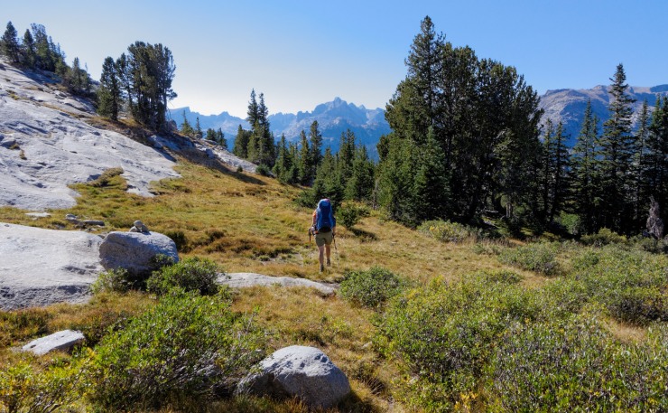
Elevation profile of the Day 2 (magenta) hike along the Cirque of the Towers Loop in the Wind River Range from Lonesome Lake to Dutch Oven LakeOn day 2 you hike down to Lonesome Lake and can meet up with the Big Sandy Trail to the south of the lake. This is the view of Lonesome Lake from above. From this point, you head to the shore of the lake and can explore around the lake for a bit (credit: Mark Henn)Pingora Peak and the Cirque of the Towers from the south shore of Lonesome Lake. From this point, you hike east on the Big Sandy Trail towards the Lizard Head Trail (credit: John Strother)View from the south shore of Lonesome Lake looking east with Lizard Head Peak on the left and Mitchell Peak on the right (credit: Mark Henn)View of Mitchell Peak from the Lizard Head Meadows area (credit: John Strother)View of a tributary of the North Popo Agie River with Lizard Head Peak in the background (credit: John Strother)North Popo Agie river with Lizard Head Peak and the Cirque of the Towers in the background (credit: John Strother)Shortly before the 3 mile mark on Day 2, you reach the junction a trail junction. Head north on the Lizard Head Trail. The is a significant climb over the next 3 miles (credit: Jonathan Stassen)Around the 3.5 mile mark you reach a short junction that leads to Bear Lake and the unnamed lake next to it. This is the view from the first lake with Lizard Head Peak in the background (credit: John Strother)You then continue to climb upwards on Lizard Head Trail for the next 1.5 miles. Looking back you get nice views of the Cirque of the Towers and of Bear Lake (credit: John Strother)After the 5 mile mark, the Lizard Head Trail flattens out and you hike along a expansive and exposed plateau (credit: John Strother)Hiking across the plateau along the Lizard Head Trail. You would not want to be caught up here during a thunderstorm (credit: John Strother)Mountain view from the Lizard Head Trail (credit: John Strother)View from along the Lizard Head Trail in the Wind River Range (credit: John Strother)Along the hike across the plateau you will cross a few streams, so it is possible to camp here and get water access. For the best camping, you should push forward in order to make it to Dutch Oven Lake or Valentine Lake (credit: John Strother)Expansive view from the Lizard Head Trail with Dutch Oven Lake in the distance on the right and Valentine Lake and the South Fork Lakes visible on the left (credit: John Strother)Zoomed view of the lakes to the northwest as seen from the Lizard Head Trail (credit: John Strother)At the ~10 mile mark, you reach a junction with the Moss Lake Trail. Take a right and head northeast to Dutch Oven Lake where you can set up camp for the second night. This is the view from the shore of Dutch Oven Lake (credit: John Strother).
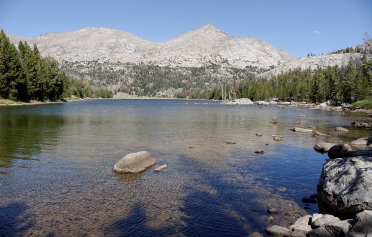
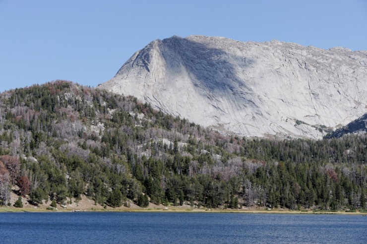
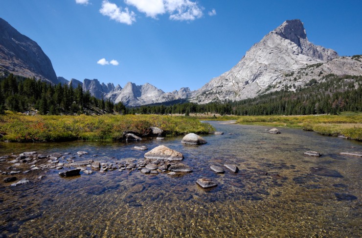
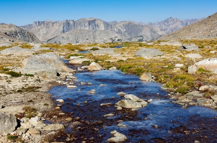
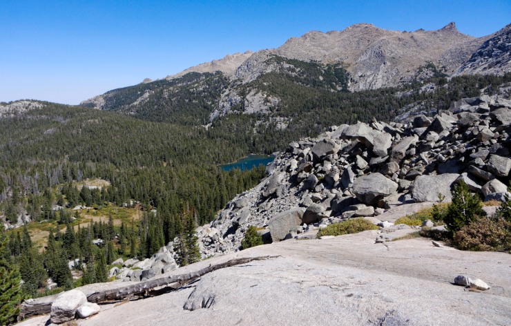
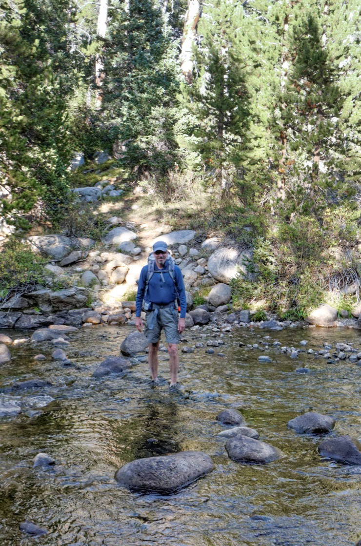
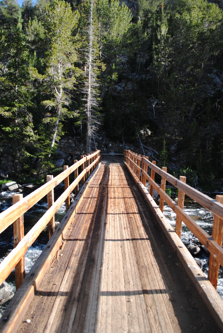
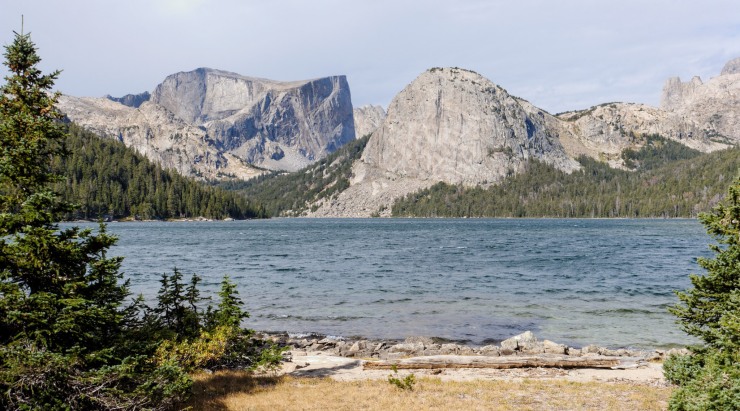
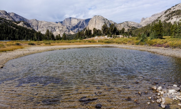
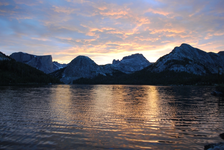
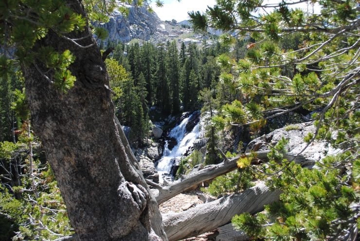
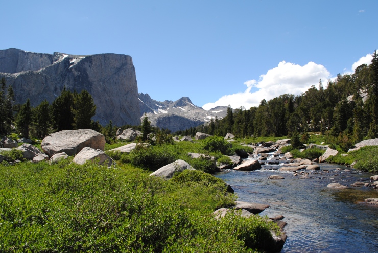
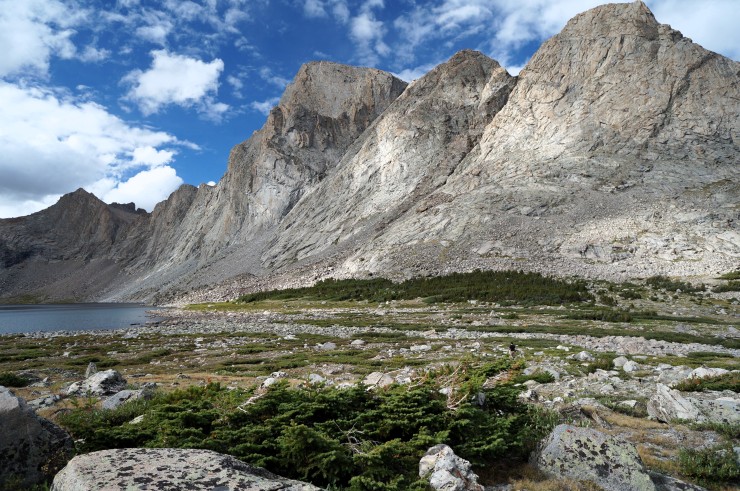
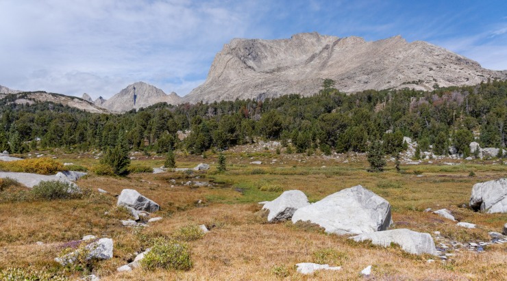
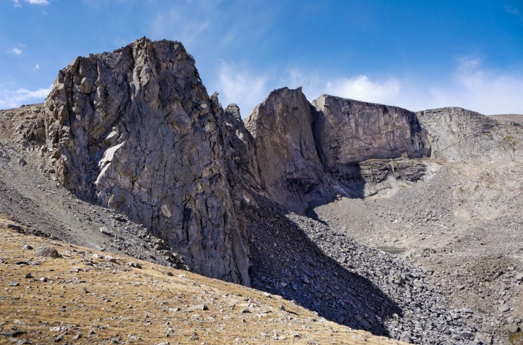
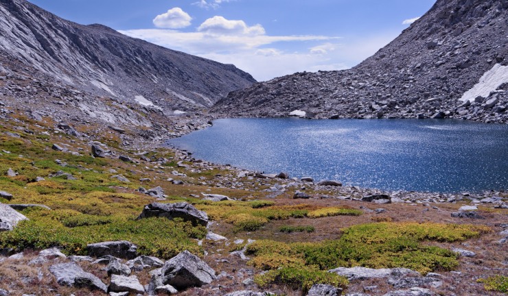
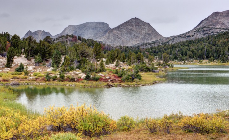
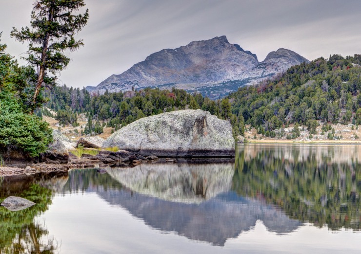
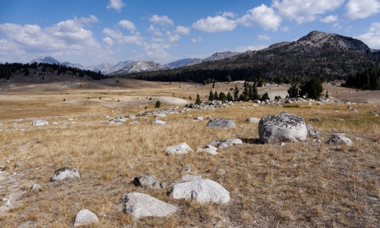
Elevation profile of the Day 3 (yellow) hike along the Cirque of the Towers Loop in the Wind River Range from Dutch Oven Lake to Grave LakeOn Day 3 you head northeast from Dutch Oven Lake and wrap around the backside of Valentine Peak and Mountain. There are some great views as you hike along the Moss Lake Trail (credit: John Strother)Heading towards Moss Lake on Day 3 of the Cirque of the Towers trek. Around the 0.5 mile mark you pass a peak and boulder field on the right (credit: John Strother)From mile 0.5 to 1, the trail then transitions to mostly granite and rock under your feet. Here you begin to descend down towards Moss Lake (credit: John Strother)View of Moss Lake below as you continue to descend along the Moss Lake Trail (credit: John Strother)You pass Moss Lake around the 1.75 mile mark and then the trail turns to the northwest and wraps around the north side of Valentine Peak. This is the view of Valentine Peak from the Moss Lake Trail (credit: John Strother)The trail steadily climbs ~650 feet from mile 2.2 to 3. As you climb the views of the “Chess Ridge” to the west really open up (credit: John Strother)Hiking west towards the Chess Ridge (credit: John Strother)View of Valentine Mountain from the Moss Lake Trail (credit: John Strother)After the ~3 mile mark, the Moss Lake Trail begins to descend and enters a forested area as it heads west to Grave Lake (credit: John Strother)After descending for a while, you reach the South Fork of the Wind River at the 4.75 mile mark. Here you ford the river to continue to Grave Lake (credit: John Strother)At the 5.5 mile you pass a pretty small pond that sits at 10,150 feet (credit: John Strother)Shortly after the 6 mile mark, you reach the east shore of Grave Lake. The views from the lake are very nice. You hike ~1 more mile along the north shore to make up some more mileage before setting up camp (Credit: John Strother)At the east end of Grave Lake, you cross a foot bridge that spans the Grave Creek outlet. From this point it is about 0.6 miles to the nice camping area before Grave Creek inlet crossing (credit: jm133)View from the shore of Grave Lake with the Pilot Knob and Mount Hooker in the background (credit: John Strother)View of Pilot Knob from shore of Grave Lake (credit: John Strother)Zoomed in view of the Pilot Knob that frames the Northwest end of Grave Lake (credit: John Strother)You can set up camp near where the trail crosses Grave Creek on the nothern shore of Grave Lake (credit: John Strother)Grave Lake sunset from near camp (credit: jm133)
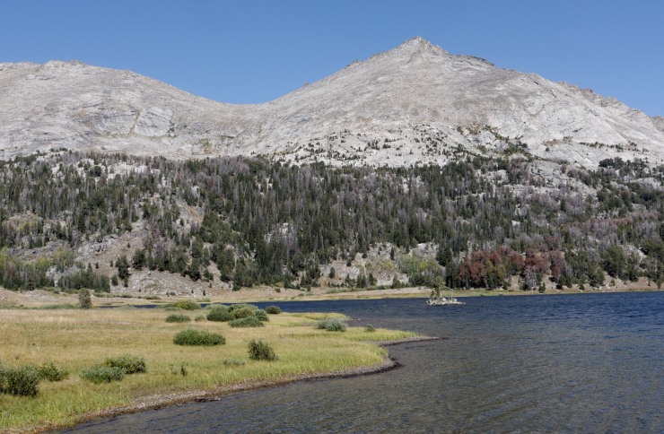
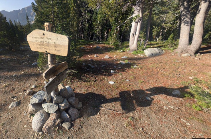
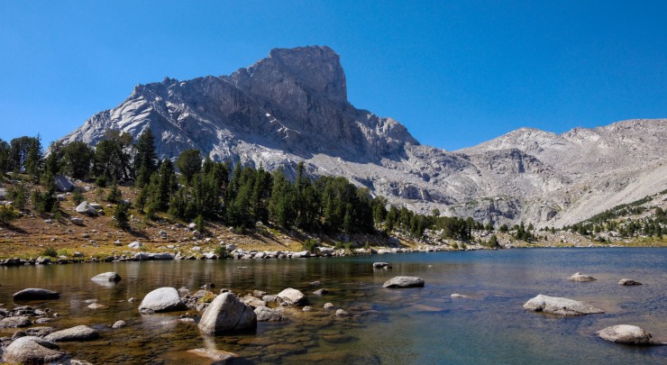
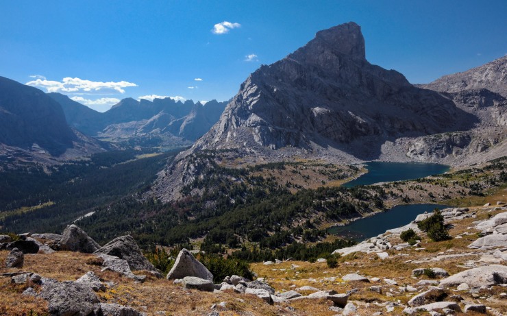
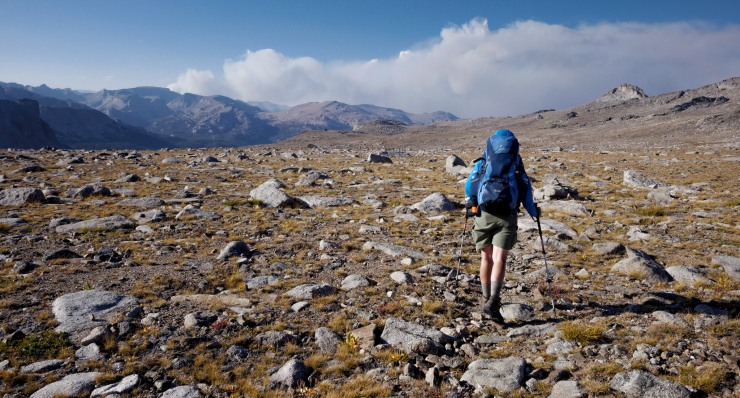
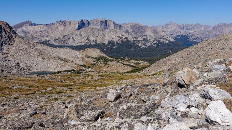
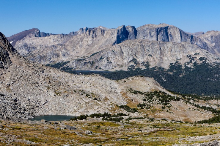
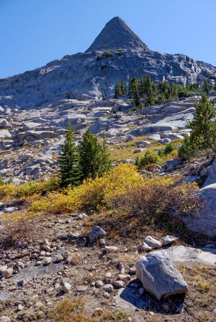
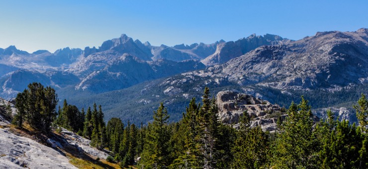
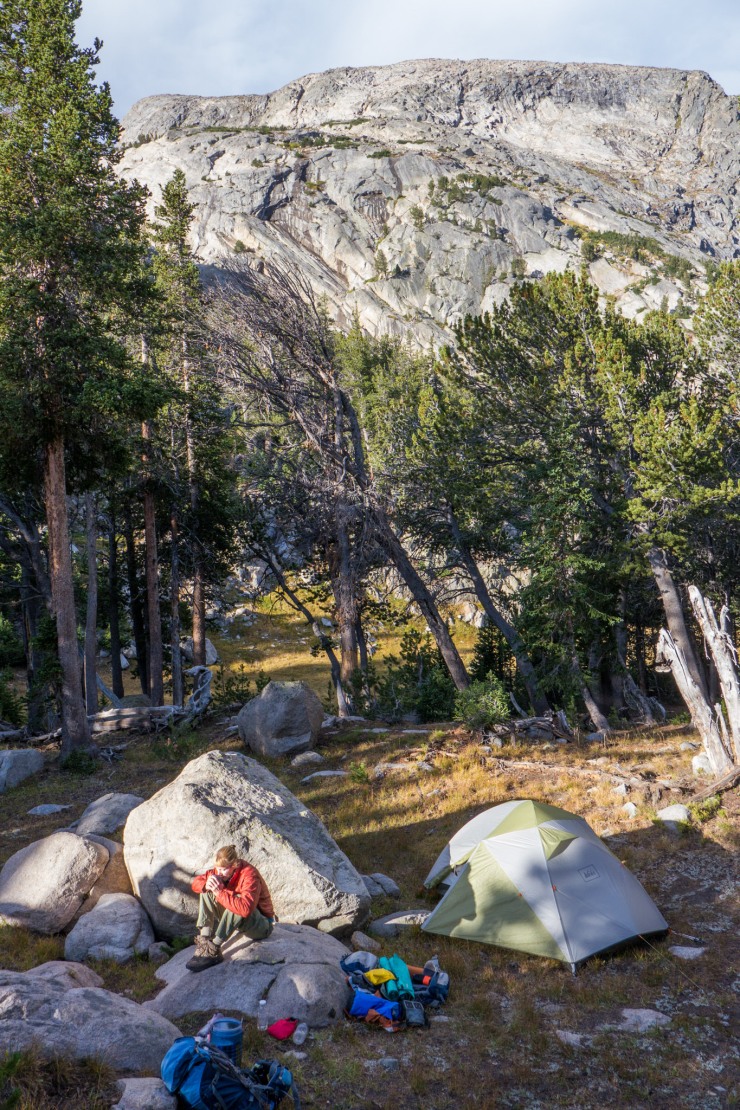
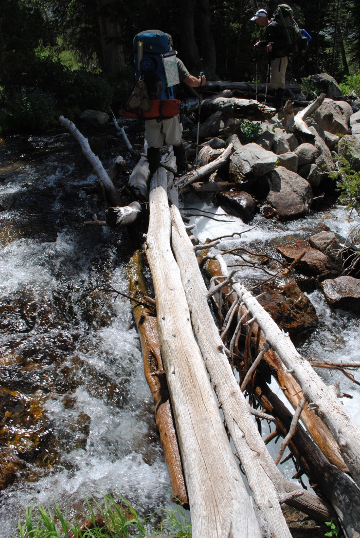
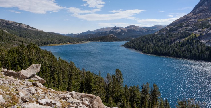
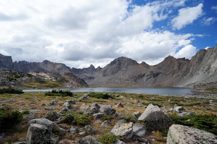
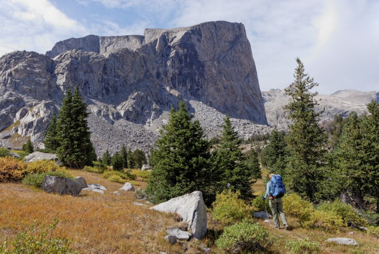
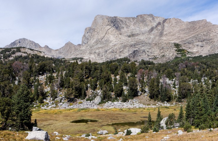
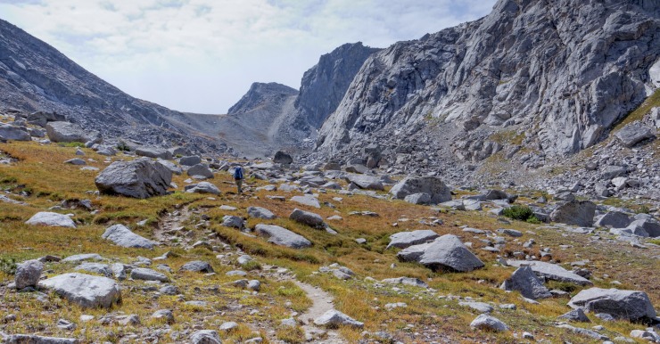
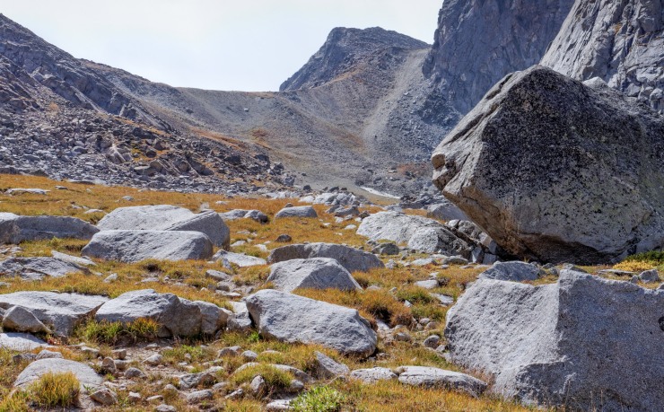
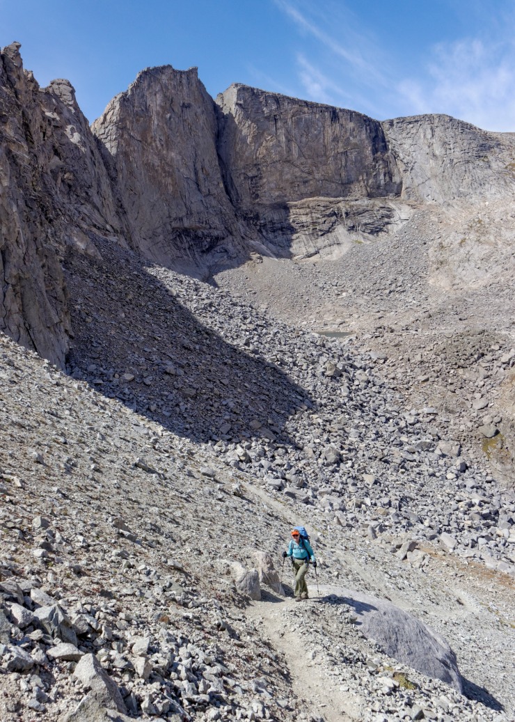
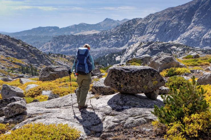
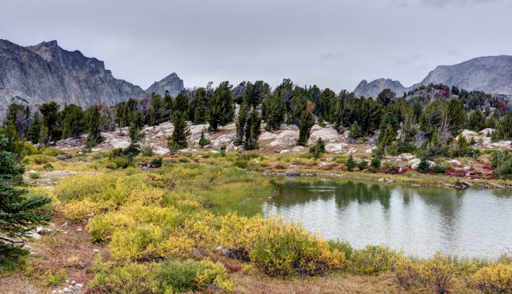
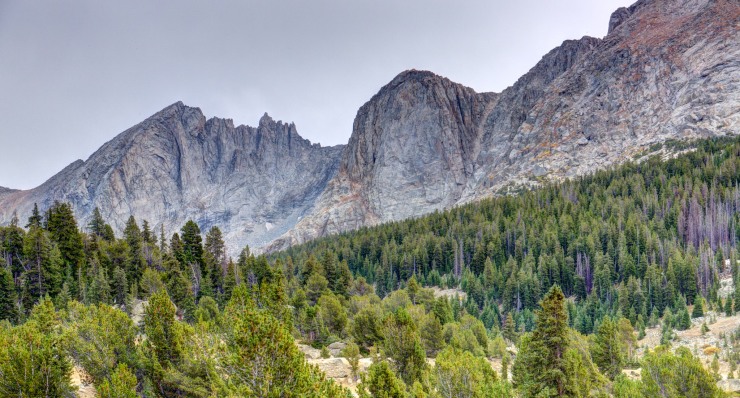
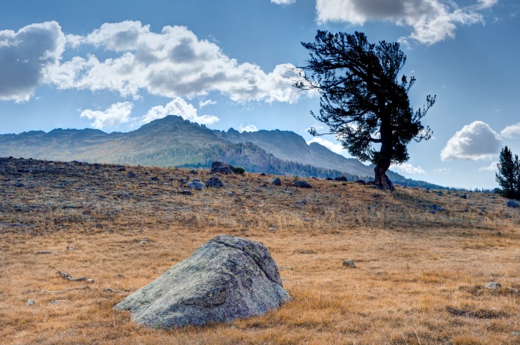
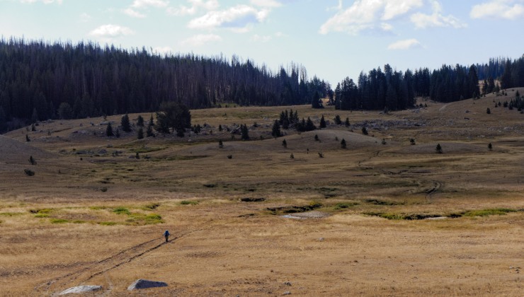
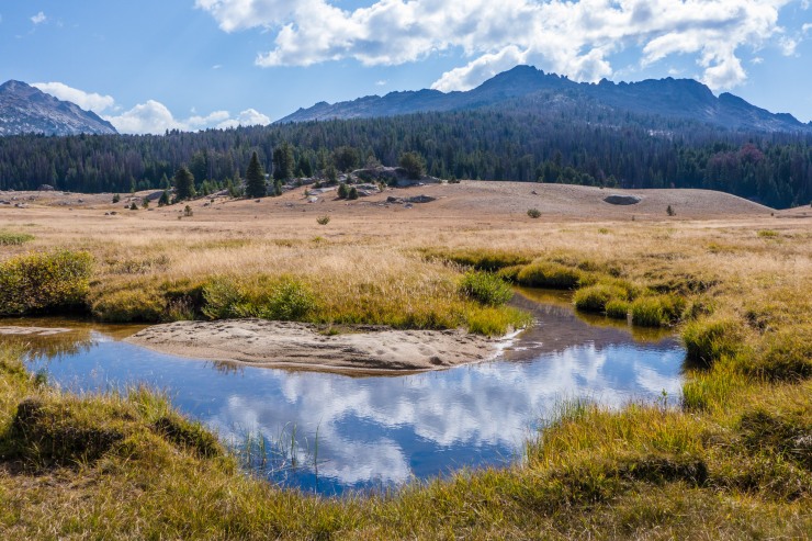
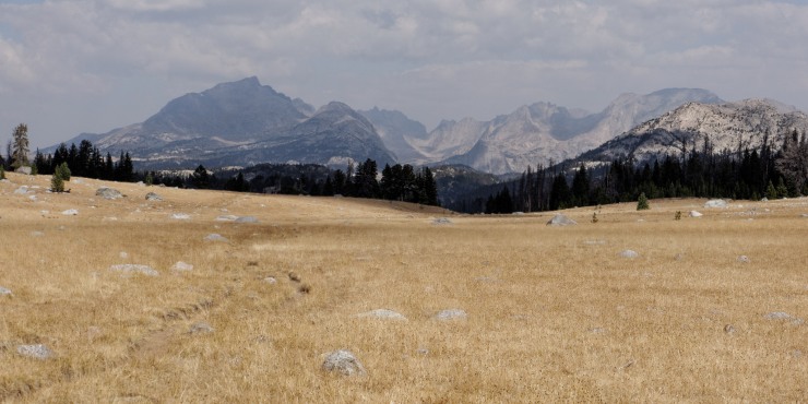
Elevation profile of the Day 4 (blue) hike along the Cirque of the Towers Loop in the Wind River Range from Grave Lake to Skull LakeThe first challenge on day 4 is finding a nice spot to cross the Grave Creek inlet that is just to the west of the campsite. After this, the trail follows along the north shore of Grave Lake for ~1.2 miles (credit: jm133)Section of the trail that requires some boulder scrambling as you head west towards Pilot Knob and Grave Lake (credit: jm133)Hiking along the trail that leads from Grave Lake towards the Baptiste Creek and Hailey Pass. Here the Pilot Knob is on the right (credit: John Strother)View looking back over Grave Lake from the trail near Pilot Knob (credit: John Strother)Continuing to the west with Pyramid Peak in the background (credit: John Strother)Around the 1.5 mile mark the trail begins follow the cascades of the Baptiste Creek (credit: jm133)Baptiste Creek with Mount Hooker in the background. In this area you will find the junction that leads northwest to Baptiste Lake. This is a worthy side trip to see the nice views at the shore of Baptiste Lake (credit: jm133)View of Mount Hooker from the sidetrail leading to Baptiste Lake (credit: Ray C)View of Baptiste Lake from the southern shore with Mount Lander in the background (credit: Ray C)Baptiste Lake with Musembeah Peak in the background. After taking in the views at Baptiste Lake, head back to the trail that leads up to Hailey Pass and continue along the Cirque of the Towers Loop (credit: Ray C)Meadow view as you get back on the Hailey Pass Trail and start hiking towards the pass (credit: John Strother)Along the Hailey Pass Trail with Mount Hooker in the background (credit: John Strother)Looking back to the north from the Hailey Pass Trail (credit: John Strother)The Hailey Pass Trail heads south and begins to climb after about the 4.5 mile mark on this hike (credit: John Strother)Looking northwest at Mount Hooker from the Hailey Pass Trail (credit: John Strother)View of Hailey Pass in the background (credit: John Strother)View looking back to the north where you just hiked from (credit: John Strother)The last ~0.5 miles up to Hailey Pass involve a steep climb up a series of switchbacks (credit: John Strother)View looking west along the Continental Divide from near the top of Hailey Pass (credit: John Strother)After you cross over Hailey Pass, you descend down to Upper Twin Lake (credit: John Strother)View from Twin Lakes with Hailey Pass in the background (credit: John Strother)The trail then descend another 2.5 miles into the valley below (credit: John Strother)View of Skull Lake in the distance, which will be the campsite for night 4 (credit: John Strother)View from the shore of Skull Lake, the campsite for night 4 (credit: John Strother)View from the shore of Skull Lake, the campsite for night 4 (credit: John Strother)
Elevation Profile of the Day 5 (red) hike along the Cirque of the Towers Loop in the Wind River Range from Skull Lake to the Big Sandy TrailheadOn the last day, continue to the south along the Hailey Pass Trail towards Marms Lake. There are nice mountain views along the trail (credit: John Strother)View from the Hailey Pass Trail on the way to Marms Lake (credit: John Strother)View from the Hailey Pass Trail on the way to Marms Lake (credit: John Strother)View from the shore of Marms Lake. At this lake you reach a junction with the Continental Divide – Freemont Trail. After enjoying the view at Marms Lake, take the Freemont Trail south (credit: John Strother)View from the shore of Marms Lake (credit: John Strother)View of Marms Lake as you start to hike south on the Freemont Trail (credit: John Strother)View from the Freemont Trail in the Wind River Range (credit: John Strother)View from the Freemont Trail in the Wind River Range (credit: John Strother)View from the Freemont Trail in the Wind River Range (credit: John Strother)View from the Freemont Trail in the Wind River Range (credit: John Strother)View from the Freemont Trail in the Wind River Range (credit: John Strother)
Near the 9.5 mile mark, the Freemont Trail reaches a junction with the Big Sandy Trail. Transition onto the Big Sandy Trail and hike the last 0.5 miles to the Big Sandy Trailhead. You have now finished the Cirque of the Towers Loop!
This is a classic route, but I usually go clockwise instead. Check out the nearby Titcomb Basin, arguably better scenery there. Thanks for sharing your images
Just completed this loop. We ended up squeezing the last three days of the itinerary into two (spent the third night at Mays Lake). Non-stop amazing views! The route as suggested in this blog is excellent. Graves Lake is spectacular and would have been a great place to spend night 3. By going counter-clockwise, we experienced very steep ascents and nice, steady descents, which everyone in our group preferred. Thanks for all the detailed information and photos!
I’m wondering if anyone can give intel on what conditions to expect on this route late Aug/ early Sept? I’d like to be out there on my bday, which is first week of Sept, but I know from previous trips to other locations that September can always be a dice roll. I don’t mind the cold too much but will not be equipped to deal with much snow or ice. Thanks for any input and thanks so much for this amazing guide!
Hi Amy – from I can see online, the snow pack in the Wind River Range is currently ~90-100% of the median year (not especially dry this winter). My guess is that mid June is going to be quite early and there will still be significant amounts of snow along the Cirque of the Towers route. The whole route is above 9,000 feet of elevation, so things would need to melt really fast. Certainly keep an eye on things through May and give the rangers a call in mid-to-late May to check though. That said, I suggest you start evaluating some backup itineraries at lower elevation.
Hi Matt – There a trees near each of the suggested campsites in this itinerary. That said, I am not much of a hammock user and did not pay much, if any, attention to whether the trees were well positioned for hammock use! My best guess is that you would be ok with a hammock. I would just scope out satellite images of the lakes on google maps to get an idea of which sides of the lakes have the higher density of trees. The specific campsite locations I recommend at definitely geared toward tent usage and may not be ideal for hammocks. Hopefully that helps you!
Is this specific trail marked well? Will these specific red trail numbers be easy to follow? I just want to make sure my group won’t stray from this path. Thanks!
Can anyone tell me what texas pass will be like around the 3rd of July. Will microspikes and treking poles be enough or do I need an ice axe? Hoping to do the run over the pass and south past clear lake, temple lake to little sandy lake and back to the CDT. Working on finishing the northern half of CDT this year in my mid 60’s and dont want too gnarly.
Good morning, I’m planning this trip in early September. Can you please give me more insight on the camping near Lonesome Lake? I understand camping is prohibited at the lake, but you can camp up on the shelf to the southwest. Is there water in that area? Did you have any difficulty finding a site? Any more recommendations? I’m mostly wondering about water availability and specific campsite location. Thanks.
I’m a fan of your trip guides. In fact, we did the Maroon Bells/Four Pass Loop and Continental Divide Trail last season. We just did the Grand Loop in the Olympics last week; are doing both of your Wind River Range routes in September; and doing both of your Desolation Wilderness routes later in September. I’m looking at your Yosemite routes for next summer. In other words, your website is one of my first stops when I begin planning a backpacking trip. Thanks!
Hi Jim – I’m happy to hear that the trip guides have been so useful. Your list of trips the past year is impressive!
Regarding Lonesome Lake, the area to the southwest of the lake has a couple streams that flow from Cirque Lake and Hidden Lake. These streams were still flowing nicely in early September (several years ago) when the photos in the guide were taken. I haven’t been there this year, so I can’t say anything about current water conditions up there. The streams made for a good running water source. If they are dry, you also could perhaps just walk down to Lonesome Lake to get water. Just be sure filter/sterilize all water since the area gets a lot of foot traffic.
My main advice is just to take the climbers trail northwest after Arrowhead Lake. This leads you straight over to the camping area. If you take the main trail over Jackass Pass and down to Lonesome Lake, you will need to backtrack up hill to get to the camping area. Hope that helps!
For camping, I would expect to meet some other campers in the area. It’s a popular spot since it’s ~9 miles from the trailhead (though crowds may smaller in September). You should be able to find a suitable space to camp, although I wouldn’t be surprised if you had a couple other tents within sight.
Thanks! Did you mean to say to take the climbers’ trail before Arrowhead Lake (not after)? From your PDF map it looks like you branch off northwest prior to Arrowhead Lake and pass to the west of it to head up to the shelf. I have two topo maps, but I’m studying your maps and report first. Thanks.
I’m still wondering how you made it from Dose Meadow to Grand Lake on the Grand Loop in one day. That had three extremely steep climbs. I’m duly impressed. We camped at Bear Camp and Upper Cameron Basin – say made your 2 days into 3 days. Maybe I could have done it when I was 42 and super fit, but at age 57 and not competitive running fit anymore, we have to plan extra hours for some of your longer segments. Elkhart Park to Island Lake will be a long day, for example.
Hi Jim – If I recall correctly there are two options. You can take the side trail at the start of Arrowhead Lake that skirts along the west side of Lake and there is a trail (after you pass Arrowhead Lake on the Big Sandy Trail) that cuts west before you make the climb up to Jackass Pass. Either one gets you over to the camping areas. I think we took the earlier trail that cuts over before you reach Arrowhead Lake because it was shorter.
I am looking at putting a trip together for my hiking club from Whitefish, Mt to do this next August when we are in “beast mode”. But we would prefer to hire an outfitter carry some of our stuff. Can you recommend any company?
Hi Reid, it will really depend on what time of year you visit the Wind River Range. In the peak season of August, you likely will encounter a fair number of other backpackers. On one hand, this area will not be as popular as Glacier or Grand Teton National Park. On the other hand, no permits are required so there are not any quotas limiting the number of backpackers. If you go a bit earlier (mid July) or later (early September), the crowds will be smaller.
Well, with posts like this, you can expect to see a LOT more people than there were just a few years ago. Thanks for making our quiet mountain range as crowded as it is. Appreciate people who can’t keep their mouth shut about special places.
I didn’t realize you own the mountain range. Your post is just as ignorant as someone who posted on the Wind River Range Facebook page that outsiders aren’t welcome. I live in Washington State. You aren’t welcome in our mountain ranges out here.
Wow, I hiked sections of this trail in 1989 and 1991 with a large-format camera. I always wondered about the amazing tree overlooking Skull Lake, whether it was still there. Your photo “View from the Freemont Trail in the Wind River Range (credit: John Strother)” confirms it’s continued existence. I spent a long rest under that tree, and it is great to see that it is still there. I had the Cirque to myself in 1991, and most of the Highline Trail to myself in 1989. I remember that tree!! Thanks
Thank you for your trip report. I’m planning to take my wife on the loop hike in August of 24. We will have a map and compass, but I was curious to know if the trails are marked with signage displaying the route, distances to lakes, camping passes, etc. Thank you for the information. We have hiked in Colorado and the Tetons but have never been to the Wind River Range. When hiking Teton Crest Trail last August I meet a lady and her husband who had just finished a backpacking trip in the Winds. They could not stop talking about how awesome it was! Thank you


If you don’t want to camp the night before or after the hike, check out Big Sandy Lodge. Near the trailhead and has great cabins and meals.
LikeLike
Lovely report. Wyomingites know the Winds well, we just hope not too many other people find them.. We want to keep them all to ourselves!
LikeLike
This is a classic route, but I usually go clockwise instead. Check out the nearby Titcomb Basin, arguably better scenery there. Thanks for sharing your images
LikeLike
Anyone have a GPX file of this route?
LikeLike
Just completed this loop. We ended up squeezing the last three days of the itinerary into two (spent the third night at Mays Lake). Non-stop amazing views! The route as suggested in this blog is excellent. Graves Lake is spectacular and would have been a great place to spend night 3. By going counter-clockwise, we experienced very steep ascents and nice, steady descents, which everyone in our group preferred. Thanks for all the detailed information and photos!
LikeLike
Awesome – glad you had a great trip!
LikeLike
I’m wondering if anyone can give intel on what conditions to expect on this route late Aug/ early Sept? I’d like to be out there on my bday, which is first week of Sept, but I know from previous trips to other locations that September can always be a dice roll. I don’t mind the cold too much but will not be equipped to deal with much snow or ice. Thanks for any input and thanks so much for this amazing guide!
LikeLike
Hi all – I am looking at this route for June 9-13, 2021. Anyone have a sense of how much snowcover there will be? Will the full route be open?
LikeLike
Hi Amy – from I can see online, the snow pack in the Wind River Range is currently ~90-100% of the median year (not especially dry this winter). My guess is that mid June is going to be quite early and there will still be significant amounts of snow along the Cirque of the Towers route. The whole route is above 9,000 feet of elevation, so things would need to melt really fast. Certainly keep an eye on things through May and give the rangers a call in mid-to-late May to check though. That said, I suggest you start evaluating some backup itineraries at lower elevation.
LikeLike
Can you do this trip with a 3 season hammock as shelter? Do the suggested campsites have trees to hang a Hennesy?
LikeLike
Hi Matt – There a trees near each of the suggested campsites in this itinerary. That said, I am not much of a hammock user and did not pay much, if any, attention to whether the trees were well positioned for hammock use! My best guess is that you would be ok with a hammock. I would just scope out satellite images of the lakes on google maps to get an idea of which sides of the lakes have the higher density of trees. The specific campsite locations I recommend at definitely geared toward tent usage and may not be ideal for hammocks. Hopefully that helps you!
LikeLike
Is this specific trail marked well? Will these specific red trail numbers be easy to follow? I just want to make sure my group won’t stray from this path. Thanks!
LikeLike
My group did not have trouble following the route, but I always recommend bringing a map and or GPS just in case!
LikeLike
Can anyone tell me what texas pass will be like around the 3rd of July. Will microspikes and treking poles be enough or do I need an ice axe? Hoping to do the run over the pass and south past clear lake, temple lake to little sandy lake and back to the CDT. Working on finishing the northern half of CDT this year in my mid 60’s and dont want too gnarly.
LikeLike
Good morning, I’m planning this trip in early September. Can you please give me more insight on the camping near Lonesome Lake? I understand camping is prohibited at the lake, but you can camp up on the shelf to the southwest. Is there water in that area? Did you have any difficulty finding a site? Any more recommendations? I’m mostly wondering about water availability and specific campsite location. Thanks.
I’m a fan of your trip guides. In fact, we did the Maroon Bells/Four Pass Loop and Continental Divide Trail last season. We just did the Grand Loop in the Olympics last week; are doing both of your Wind River Range routes in September; and doing both of your Desolation Wilderness routes later in September. I’m looking at your Yosemite routes for next summer. In other words, your website is one of my first stops when I begin planning a backpacking trip. Thanks!
LikeLike
Hi Jim – I’m happy to hear that the trip guides have been so useful. Your list of trips the past year is impressive!
Regarding Lonesome Lake, the area to the southwest of the lake has a couple streams that flow from Cirque Lake and Hidden Lake. These streams were still flowing nicely in early September (several years ago) when the photos in the guide were taken. I haven’t been there this year, so I can’t say anything about current water conditions up there. The streams made for a good running water source. If they are dry, you also could perhaps just walk down to Lonesome Lake to get water. Just be sure filter/sterilize all water since the area gets a lot of foot traffic.
My main advice is just to take the climbers trail northwest after Arrowhead Lake. This leads you straight over to the camping area. If you take the main trail over Jackass Pass and down to Lonesome Lake, you will need to backtrack up hill to get to the camping area. Hope that helps!
For camping, I would expect to meet some other campers in the area. It’s a popular spot since it’s ~9 miles from the trailhead (though crowds may smaller in September). You should be able to find a suitable space to camp, although I wouldn’t be surprised if you had a couple other tents within sight.
LikeLike
Thanks! Did you mean to say to take the climbers’ trail before Arrowhead Lake (not after)? From your PDF map it looks like you branch off northwest prior to Arrowhead Lake and pass to the west of it to head up to the shelf. I have two topo maps, but I’m studying your maps and report first. Thanks.
I’m still wondering how you made it from Dose Meadow to Grand Lake on the Grand Loop in one day. That had three extremely steep climbs. I’m duly impressed. We camped at Bear Camp and Upper Cameron Basin – say made your 2 days into 3 days. Maybe I could have done it when I was 42 and super fit, but at age 57 and not competitive running fit anymore, we have to plan extra hours for some of your longer segments. Elkhart Park to Island Lake will be a long day, for example.
LikeLike
Hi Jim – If I recall correctly there are two options. You can take the side trail at the start of Arrowhead Lake that skirts along the west side of Lake and there is a trail (after you pass Arrowhead Lake on the Big Sandy Trail) that cuts west before you make the climb up to Jackass Pass. Either one gets you over to the camping areas. I think we took the earlier trail that cuts over before you reach Arrowhead Lake because it was shorter.
LikeLike
I am looking at putting a trip together for my hiking club from Whitefish, Mt to do this next August when we are in “beast mode”. But we would prefer to hire an outfitter carry some of our stuff. Can you recommend any company?
LikeLike
How many people are we likely to see? Trying to estimate how busy it will be.
Thanks for pulling this together!!
LikeLike
Hi Reid, it will really depend on what time of year you visit the Wind River Range. In the peak season of August, you likely will encounter a fair number of other backpackers. On one hand, this area will not be as popular as Glacier or Grand Teton National Park. On the other hand, no permits are required so there are not any quotas limiting the number of backpackers. If you go a bit earlier (mid July) or later (early September), the crowds will be smaller.
LikeLike
Well, with posts like this, you can expect to see a LOT more people than there were just a few years ago. Thanks for making our quiet mountain range as crowded as it is. Appreciate people who can’t keep their mouth shut about special places.
LikeLike
I didn’t realize you own the mountain range. Your post is just as ignorant as someone who posted on the Wind River Range Facebook page that outsiders aren’t welcome. I live in Washington State. You aren’t welcome in our mountain ranges out here.
LikeLike
Wow, I hiked sections of this trail in 1989 and 1991 with a large-format camera. I always wondered about the amazing tree overlooking Skull Lake, whether it was still there. Your photo “View from the Freemont Trail in the Wind River Range (credit: John Strother)” confirms it’s continued existence. I spent a long rest under that tree, and it is great to see that it is still there. I had the Cirque to myself in 1991, and most of the Highline Trail to myself in 1989. I remember that tree!! Thanks
LikeLike
Thank you for your trip report. I’m planning to take my wife on the loop hike in August of 24. We will have a map and compass, but I was curious to know if the trails are marked with signage displaying the route, distances to lakes, camping passes, etc. Thank you for the information. We have hiked in Colorado and the Tetons but have never been to the Wind River Range. When hiking Teton Crest Trail last August I meet a lady and her husband who had just finished a backpacking trip in the Winds. They could not stop talking about how awesome it was! Thank you
LikeLike